Ni'iinlii Njik (Fishing Branch) Ecological Reserve ... · PDF fileNi'iinlii Njik (Fishing...
41
Ni'iinlii Njik (Fishing Branch) Ecological Reserve & Settlement Land R-5A & S-3A1 MANAGEMENT PLAN 2004 Updated 2010 Yukon Government / Dennis Kuch
Transcript of Ni'iinlii Njik (Fishing Branch) Ecological Reserve ... · PDF fileNi'iinlii Njik (Fishing...
Ni'iinlii Njik (Fishing Branch)
Ecological Reserve & Settlement Land R-5A & S-3A1 MANAGEMENT PLAN
2004 Updated 2010
Yukon Government / Dennis Kuch


UPDATED MANAGEMENT PLAN The original Management Plan for the Wilderness Preserve and Habitat Protection Area was approved in 2004 by the Vuntut Gwitchin First Nation, North Yukon Renewable Resources Council, and Yukon Government. This updated version of the plan was reviewed, edited and approved by the members of the Committee of Management Agencies, with representatives from Vuntut Gwitchin Government, North Yukon Renewable Resources Council, Yukon Government and Fisheries and Oceans Canada. The content of the plan has been updated, but no substantive changes were made during this review. A full review of the management plan will occur after five seasons of commercial bear viewing operations. As of September 2010, three seasons of operation are complete.

TABLE OF CONTENTS
THE STORY OF HOW THE RED STAINED ROCKS AND NEVER FREEZING AREA OF THE RIVER CAME TO BE AT A BLUFF CALLED "KUIHENJIK'S BLUFF". i ......................................i
1.0 INTRODUCTION ............................................................................................................................1 2.0 HISTORICAL SIGNIFICANCE .......................................................................................................2
2.1 Management Guidelines for Heritage Resources ............................................................ 4 3.0 ECOLOGICAL, PALAEONTOLOGICAL & ARCHAEOLOGICAL SIGNIFICANCE OF AREA ....4
3.1 Karst Ecosystemsxxii ....................................................................................................... 4 3.2 Caves xxiii ......................................................................................................................... 5 3.3 Diversity of Species ........................................................................................................ 6 3.4 Salmon xxvi....................................................................................................................... 7 3.5 Grizzly Bears .................................................................................................................. 8
4.0 LEGISLATION................................................................................................................................9
4.1 Vuntut Gwitchin First Nation Final Agreement & Self-Government Legislation ............... 9 4.2 Parks and Land Certainty Act 2002 ................................................................................. 9 4.3 VGFN Land and Resources Act....................................................................................... 9 4.4 Yukon Quartz Mining Act, Yukon Placer Mining Act & Canada Petroleum
Resources Act ................................................................................................................ 9 4.5 Yukon Wildlife Act .......................................................................................................... 9 4.6 VGFN Fish & Wildlife Act ................................................................................................ 9 4.7 Federal Fisheries Act ...................................................................................................... 9 4.8 Historic Resources Act & the Yukon Act......................................................................... 9 4.9 Wilderness Tourism Licensing Act ................................................................................. 9
5.0 MANAGEMENT PRINCIPLES AND OBJECTIVES SET OUT IN THE VGFNFA........................10
5.1 Management Principles for the Ecological Reserve ...................................................... 10 5.2 Management Objectives for any future Habitat Protection Area .................................... 10 5.3 Relationship of Management Plan to Management Principles & Objectives once a
HPA agreed to .............................................................................................................. 10 5.4 Principles & Objectives Take Precedence In Management of Area ................................ 10
6.0 FUTURE PROTECTED AREA AROUND THE ECOLOGICAL RESERVE .................................10 7.0 MANAGEMENT GUIDELINES .....................................................................................................11
7.1 Conditions of Access.................................................................................................... 12 7.1.1 Managing Access during the Fall Chum Salmon Run ..................................................13 7.1.2 Visitor Access - When Bears are Not Congregating 7.1.3 Access for Other Purposes (Research and Education) .................................................13 7.1.4 Helicopters ........................................................................................................................14 7.1.5 Off Road Vehicles .............................................................................................................14 7.1.6 Roads.................................................................................................................................14
7.2 Wildlife Viewing ............................................................................................................ 15 7.2.1 Status & Purpose of Wildlife Viewing .............................................................................15 7.2.2 Commercial Viewing Operations ....................................................................................15
7.3 Management Facilities & Infrastructure......................................................................... 16 7.3.1 Buildings ...........................................................................................................................16

7.3.2 Trails ..................................................................................................................................17 7.3.3 Signs ..................................................................................................................................17 7.3.4 Helicopter Landing Site ...................................................................................................17 7.3.5 Landing Strips ..................................................................................................................17
7.4 Management of Food & Garbage................................................................................... 17 7.5 Wildfire Management .................................................................................................... 17
7.5.1 Wildfire Management .......................................................................................................17 7.6 Woodcutting for On-Site Use ........................................................................................ 17
7.6.1 Replacing use of Wood with Oil ......................................................................................17 7.6.2 Guidelines for Woodcutting for On-Site Use .................................................................17
7.7 Industrial Development ................................................................................................ 18 7.7.1 Mining ................................................................................................................................18 7.7.2 Oil & Gas Development ....................................................................................................18 7.7.3 Commercial Logging ........................................................................................................18 7.7.4 Other Uses ........................................................................................................................18
7.8 Hunting, Trapping & Fishing ......................................................................................... 18 7.8.1 Hunting ..............................................................................................................................19 7.8.2 Trapping ............................................................................................................................19 7.8.3 Fishing ...............................................................................................................................19
7.9 Monitoring & Research ................................................................................................. 19 7.9.1 Monitoring .........................................................................................................................20 7.9.2 Research ...........................................................................................................................20
7.10 Weir & Salmon Management .......................................................................................... 20 7.10.1 Salmon Management........................................................................................................21 7.10.2 Weir Management .............................................................................................................21
7.11 On-Site Personnel......................................................................................................... 21 7.11.1 Purpose of Staff ................................................................................................................22
7.12 Wildlife Management .................................................................................................... 22 7.12.1 Wildlife Management Planning........................................................................................22 7.12.2 Wildlife Management Techniques ...................................................................................22
7.13 Defense of Life & Property ............................................................................................ 23 7.13.1 Personal Responsibility in Bear and Moose Country ...................................................23 7.13.2 Standard for defense of Human Life...............................................................................23 7.13.3 Standard for Defense of Property ...................................................................................23 7.13.4 Immediate Reporting ........................................................................................................23 7.13.5 Prohibition on Benefiting Materially ...............................................................................23 7.13.6 Management Response ...................................................................................................23 7.13.7 Respectful Treatment of Wildlife Remains.....................................................................23
7.14 Public Information & Education .................................................................................... 23 7.14.1 Public Information & Education Associated with Management of this Area ..............24 7.14.2 General Public Information & Education........................................................................24
8.0 PLAN REVIEW, EVALUATION & AMENDMENTS ....................................................................24
8.1. Plan Review .................................................................................................................. 24 8.2 Evaluation .................................................................................................................... 24 8.3 Amendments ................................................................................................................ 25
9.0 MANAGEMENT COMMITTEE OF MANAGING AGENCIES ......................................................25
9.1 Management Committee ............................................................................................... 25
10.0 FUNDING......................................................................................................................................25 10.1 Funding Responsibilities .............................................................................................. 25

MAPS MAP 1: Ecological Reserve and Settlement Lands - in context………………………………………………ii MAP 2: Ecological Reserve and Settlement Lands - showing site locations……………………………….iii ATTACHMENTS ATTACHMENT 1. Schedule B to Chapter 10, Vuntut Gwitchin Final Agreement – Fishing
Branch Ecological Reserve……………..……………………………………………..26 ATTACHMENT 2. Appendix A, Vuntut Gwitchin Final Agreement……………………………….……..28 ATTACHMENT 3. List of Participants…………………………………………………….........................29 ATTACHMENT 4. Endnotes………………………………………………………………………………...30 ATTACHMENT 5. Approved Management Plan Amendments & Editorial Adjustments – 2004……………………………………………………………….……31

_________________________________________________________________________________________________________________________________________________________________________________________________________________________________________________________________________________________________________________________________________________________________________________________________________________________________________________________________
Ni’inlii Njik (Fishing Branch) Ecological Reserve & Settlement Lands Management Plan – updated 2010 i
THE STORY OF HOW THE RED STAINED ROCKS AND NEVER FREEZING AREA OF THE RIVER CAME TO BE AT A BLUFF CALLED
"KUIHENJIK'S BLUFF". i Kuihenjik was a man who lived with his people, the Vuntut Gwitchin, in the region of Crow Flats. Kuihenjik was known amongst his people to be a "superman ", a man of enormous strength and stature and a great hunter.
Kuihenjik and his brother were hunting. Kuihenjik's brother killed a moose. While his brother remained behind to skin and butcher the moose, Kuihenjik went in search of more game. Soon he came across another moose which he killed and began to skin. Meanwhile, some of Kuihenjik's people, who were very hungry and also in search of game, came across his brother while he was butchering his moose. The people rushed upon Kuihenjik's brother, killed him, and stole his meat and ate it.
After satisfying their hunger, they buried Kuihenjik's brother and moved on only to meet Kuihenjik who had just finished butchering his moose.
Kuihenjik asked the people where his brother was, and the people replied that when they had passed his brother he was still butchering the moose. Kuihenjik knew that his brother was long overdue and began to grow suspicious. His suspicions became stronger when he saw blood on the hands of some of the men and women, and the children acted very nervous.
Suddenly, Kuihenjik, sensing what had happened to his brother, walked over to a young boy who was shaking with nervous fear and said sternly, "Why do you shake?" As he yelled this question he hit the boy a single but fatal blow with his arm. Then he took a jawbone from the moose he had butchered, and wielding it like a club he killed dozens of people. Only a few escaped.
Kuihenjik did not forget and his wrath grew. He lived through the winter with his sister and two nephews. In summer he learned that three "nations" or families of Vuntut Gwitchin were living at Klo-Kut [“Tl’oo K’at” in modern Gwich’in]. on the north shore of the Porcupine River opposite "First Island". Kuihenjik and his two nephews launched a surprise attack and destroyed almost all the people in the camp. Those who escaped carried word to the other Vuntut Gwitchin families who were living in the area.
A pact was made to kill Kuihenjik. Scouting parties were sent out to locate him. One day a scouting party was passing through the mountains when they saw several mountain sheep drinking water from a stream. Suddenly an enormous man stepped out of the bushes and killed sheep with a single blow of his club. The scouting party was too far away to be sure that this man was Kuihenjik, but when they saw him pick up the sheep's body and carry it away under one arm, they knew that it must be him.
A war party was formed and returned to the mountains where they saw Kuihenjik and his two nephews coming through a mountain pass. They planned an ambush.
In the battle, Kuihenjik killed dozens of the warriors with his club, and only after his two nephews had fallen did he flee, his body full of arrows. The warriors pursued him to a high bluff which he climbed. When he reached the summit, he looked down at his pursuers who waited below afraid to follow lest they be knocked off the cliff.
As they gazed up at him, Kuihenjik defiantly broke off the arrow shafts which still protruded from his body and built a small fire with them. Then he sat down to rest.
After a while, Kuihenjik slumped over and collapsed. Everyone thought that he had finally died from his arrow wounds, but they were still afraid to ascend the cliff, lest he not be dead. Finally, two brave young men climbed the mountain. When they reached the summit, Kuihenjik suddenly sprang up and grabbed the young warriors, one under each arm and jumped backwards off the cliff
On the way down the cliff face, a sharp rock ripped open Kuihenjik's body. He fell to the bottom of the cliff, broken, gnarled and bleeding beside the river with the mangled corpse of the young warriors in each arm. The warriors rushed towards him. In a last effort of supreme disdain, he reached down with his hand and disemboweled himself, and with his last dying strength, he heaved his guts into the river. Thereupon he died before his pursuers could reach him. Those blood stains on the face of the cliff and at the bottom remain there even today in the streaks of red rock, and to this day the river does not freeze over in that place where he threw his entrails.
_________________________________________________________________________________________________________________________________________________________________________________________________________________________________________________________________________________________________________________________________________________________________________________________________________________________________________________________________
Ni’inlii Njik (Fishing Branch) Ecological Reserve & Settlement Lands Management Plan – updated 2010 ii
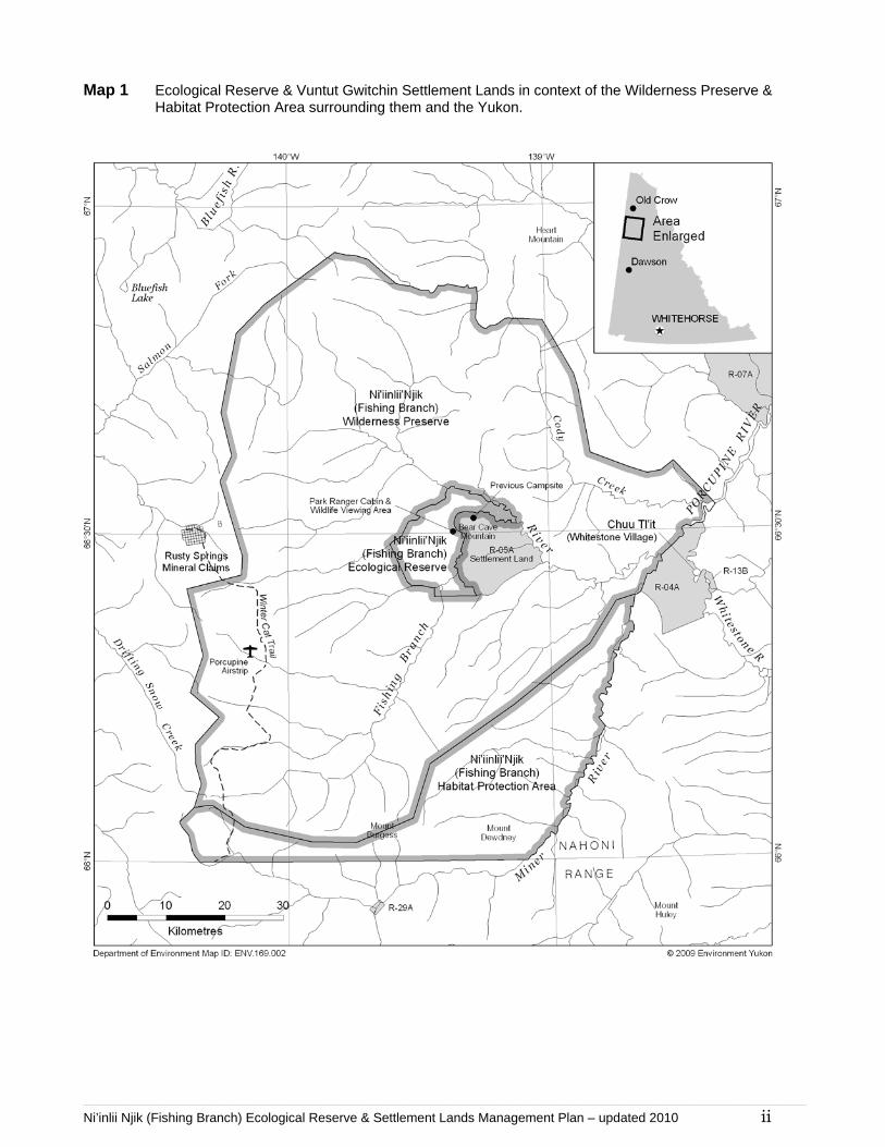
Map 1 Ecological Reserve & Vuntut Gwitchin Settlement Lands in context of the Wilderness Preserve & Habitat Protection Area surrounding them and the Yukon.
_________________________________________________________________________________________________________________________________________________________________________________________________________________________________________________________________________________________________________________________________________________________________________________________________________________________________________________________________
Ni’inlii Njik (Fishing Branch) Ecological Reserve & Settlement Lands Management Plan – updated 2010 iii
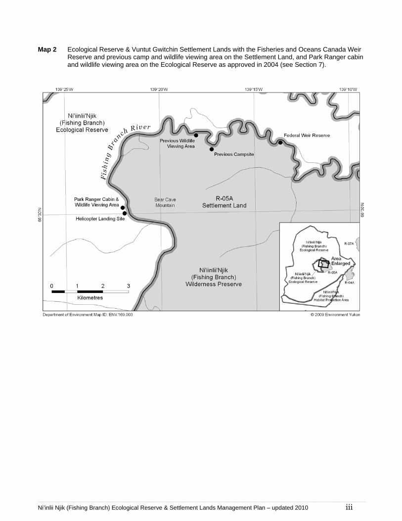
Map 2 Ecological Reserve & Vuntut Gwitchin Settlement Lands with the Fisheries and Oceans Canada Weir
Reserve and previous camp and wildlife viewing area on the Settlement Land, and Park Ranger cabin and wildlife viewing area on the Ecological Reserve as approved in 2004 (see Section 7).
Ni’inlii Njik (Fishing Branch Ecological Reserve & Settlement Lands Management Plan – updated 2010 1
1.0 INTRODUCTION The protection of the Fishing Branch is a priority for the Vuntut Gwitchin First Nation and for the Yukon Government given its important ecological and biological values. The Elders regard this area as a source of life where ecological interactions must not be disturbed. The governments of VGFN, Yukon and Canada all have management responsibilities in the area. The Vuntut Gwitchin First Nation, the North Yukon Renewable Resources Council and the Environment Yukon, with Fisheries and Oceans Canada, have worked together to develop this Management Plan for the Fishing Branch Ecological Reserve, R-5A, and S-3Al jointly, as set out in the Vuntut Gwitchin First Nation Final Agreement The purpose of this Management Plan is to: • implement the Management Principles for the Ecological Reserve, R-5A and S-3Al, as defined in the
Final Agreement; • provide the basis for effective management of the Fishing Branch Ecological Reserve and the
adjacent Settlement Lands as an ecological unit; and, • protect the cultural, historic and scientific significance of the area and the full diversity of its wildlife,
particularly salmon and grizzly bears of the region. This Management Plan will be implemented through the coordinated application of legislation of the governments of: • Yukon – for the management of the Ecological Reserve; • Vuntut Gwitchin First Nation – for the management of R-5A and S-3Al Settlement Lands and to
govern subsistence hunting, fishing and trapping activities of its citizens in the Ecological Reserve, Settlement Lands and the surrounding area, subject to the provisions and process in the Chapter 6 Access, Section 6.6 of the VGFN Final Agreement; and,
• Canada – for the management of sport and commercial and aboriginal salmon fisheries in the adjoining area.
Grizzly bears once had the widest distribution of any bears in the world, but due to increasing human populations, habitat loss and human/bear conflict, they have disappeared from most of their original habitats in Europe, Asia and much of North America. In western Canada only 25,000 remain.ii The 1990 status report on grizzlies by the Committee on the Status of Endangered Wildlife in Canada classified grizzly bears as "special concern" due to habitat loss, low reproduction and slow recovery rates. Significant numbers of grizzly bears now occur only in Alaska, British Columbia, the Northwest Territories and the Yukon. The Yukon is responsible for one third of the grizzly bears remaining in Canada and 25% of grizzlies in North America. The survival of grizzly bears in North America may be dependent to a considerable extent on our leadership on bear conservation in the North. Now we, like our neighbours. . .
“have the opportunity - and the global responsibility - to protect the remaining grizzly bears. We owe it to ourselves, to our descendants and to the grizzly bear . . .”.iii
Few areas have been effectively protected for grizzly bears - McNeil River in Alaska, the part of the Kamchatka Peninsula in Russia, Ivvavik National Park in the Yukon, and the Khutzeymateen in British Columbia. And few areas remain intact to be effectively protected - Fishing Branch is one. In order to further improve this protection, the Committee of Managing Agencies (CMA) has developed a bear-human risk management plan, the Ni'iinlii Njik Risk Management Plan.

_________________________________________________________________________________________________________________________________________________________________________________________________________________________________________________________________________________________________________________________________________________________________________________________________________________________________________________________________
Ni’inlii Njik (Fishing Branch) Ecological Reserve & Settlement Lands Management Plan – updated 2010 2
The Ni’iinlii Njik Wilderness Preserve, Ecological Reserve, Habitat Protection Area and Settlement Lands are within the planning area included in the Final Recommended North Yukon Land Use Plan (2009).
2.0 HISTORICAL SIGNIFICANCE Management Principle: To recognize and protect the traditional and current use of the Ecological Reserve by the Vuntut Gwitchin. The Gwitchin of northern Yukon, the Peel River area and interior Alaska have known of this special place for a very long time. They called the river The River Where Salmon Spawniv, or Kuihenjik's (Willow Man's) Creekv for the legendary figure who hid there, and whose blood is said to have made the limestone cliffs along the river red, and is said to be used “to paint snowshoes -- Indian Ink”vi. This diverse and exceptional area was well known to aboriginal people who depended on it for fish which were available there well into winter:
“The so called ‘Fishing Hole’ [was] well known to the Indians of this region [the Fishing Branch River] because when there is a shortage of food for man and dogs, fish can be caught here all winter long with grappling hooks of which we saw two on long handles. Red salmon came into this deep pond in late fall and even came under the ice. Fine Grayling fishing can be had here.” vii
Charlie Thomas, an elder now living in Old Crow, used to trap in the Fishing Branch area and remembers that prior to 1937 “Thomas [Njootli] and John [Moses] would travel with Constable May to Whitestone, Johnson Creek and Black River. This is where the people were trapping and lived with their families. We used a lot of meat such as caribou and moose. In 1937 we arrived in Old Crow...”.viii There may have been a well-traveled route from the Black River, west of Fishing Branch, to the Whitestone River, to the east. Joe Netro, who lived in the Black River area, is said to have made his start as a trader and store owner at the Whitestone village. Trappers located near the Alaska border were known to travel to Whitestone village to replenish their supplies. ix From the east, the “McPherson Indians” were said to have portaged from the Peel River to the Bell River and traveled down the Bell to the Porcupine to hunt.x In 1939, the Fairbanks Daily News Miner newspaper published a colourful account apparently told to two youthful travelers from New York by “the Peel River Kutchin, a seldom-visited Indian tribe living in the Canadian Arctic” about “the stone house of the bears...a large cave near the unmapped headwaters of the Porcupine River”: xi
“Thirty winters before a hunting party had seen a bear disappear into a hole high in a cliff and followed with improvised pine-shaving torches. By the "flickering, smoky light of the torches", they discerned objects "like square stone tables and chairs.... furniture, lamps, and utensils, all formed out of stone". They were also "much startled to find, just within the cave entrance the very old charred remain (sic.) of a fire."
John Nukon, a resident of Old Crow told Otto Geist, of the University of Alaska, that the cave at Bear Cave Mountain was indeed "discovered" in 1900 by the "McPherson Indians" when they followed bear tracks up the mountain through the snow and the tracks ended at the cave.xii This cave then was known, at least since 1900 and probably much longer if the account of the "charred remain[s] of a fire" is correct, as a food source in late winter if no other food was available; hibernating bears could be found and taken for food.xiii
_________________________________________________________________________________________________________________________________________________________________________________________________________________________________________________________________________________________________________________________________________________________________________________________________________________________________________________________________
Ni’inlii Njik (Fishing Branch) Ecological Reserve & Settlement Lands Management Plan – updated 2010 3
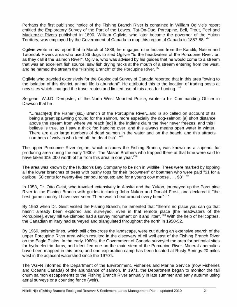
Perhaps the first published notice of the Fishing Branch River is contained in William Ogilvie's report entitled the Exploratory Survey of the Part of the Lewes, Tat-On-Duc, Porcupine, Bell, Trout, Peel and Mackenzie Rivers published in 1890. William Ogilvie, who later became the governor of the Yukon Territory, was employed by the Government of Canada to map this region of Canada in 1887-88. xiv Ogilvie wrote in his report that in March of 1888, he engaged nine Indians from the Kandik, Nation and Tatonduk Rivers area who used 36 dogs to sled Ogilvie "to the headwaters of the Porcupine River. or, as they call it the Salmon River". Ogilvie, who was advised by his guides that he would come to a stream that was an excellent fish source, saw fish drying racks at the mouth of a stream entering from the west, and he named the stream the "Fishing Branch" of the Porcupine River. xv Ogilvie who traveled extensively for the Geological Survey of Canada reported that in this area "owing to the isolation of this district, animal life is abundant". He attributed this to the location of trading posts at new sites which changed the travel routes and limited use of this area for hunting. xvi Sergeant W.J.D. Dempster, of the North West Mounted Police, wrote to his Commanding Officer in Dawson that he
"...reach[ed] the Fisher (sic.) Branch of the Porcupine River...and is so called on account of its being a great spawning ground for the salmon, more especially the dog-salmon; [a] short distance above the stream from where we reach [ed] it, the Indians claim the river never freezes, and this I believe is true, as I saw a thick fog hanging over, and this always means open water in winter. There are also large numbers of dead salmon in the water and on the beach, and this attracts numbers of wolves who feed off the dead fish". xvii
The upper Porcupine River region, which includes the Fishing Branch, was known as a superior fur producing area during the early 1900's. The Mason Brothers who trapped there at that time were said to have taken $16,000 worth of fur from this area in one year.xviii The area was known by the Hudson's Bay Company to be rich in wildlife. Trees were marked by lopping all the lower branches of trees with bushy tops for their "scowmen" or boatmen who were paid "$1 for a caribou, 50 cents for twenty-five caribou tongues; and for a young cow moose . . . $3". xix In 1953, Dr. Otto Geist, who traveled extensively in Alaska and the Yukon, journeyed up the Porcupine River to the Fishing Branch with guides including John Nukon and Donald Frost, and declared it "the best game country I have ever seen. There was a bear around every bend". xx By 1953 when Dr. Geist visited the Fishing Branch, he lamented that "there's no place you can go that hasn't already been explored and surveyed. Even in that remote place [the headwaters of the Porcupine], every hill we climbed had a survey monument on it and litter". xxi With the help of helicopters, the Canadian military had surveyed and triangulated throughout the north in 1950-52. By 1960, seismic lines, which still criss-cross the landscape, were cut during an extensive search of the upper Porcupine River area which resulted in the discovery of oil well east of the Fishing Branch River on the Eagle Plains. In the early 1960's, the Government of Canada surveyed the area for potential sites for hydroelectric dams, and identified one on the main stem of the Porcupine River. Mineral anomalies have been mapped in this area, and one exploration camp has been located at Rusty Springs 20 miles west in the adjacent watershed since the 1970's. The VGFN informed the Department of the Environment, Fisheries and Marine Service (now Fisheries and Oceans Canada) of the abundance of salmon. In 1971, the Department began to monitor the fall chum salmon escapements to the Fishing Branch River annually in late summer and early autumn using aerial surveys or a counting fence (weir).
_________________________________________________________________________________________________________________________________________________________________________________________________________________________________________________________________________________________________________________________________________________________________________________________________________________________________________________________________
Ni’inlii Njik (Fishing Branch) Ecological Reserve & Settlement Lands Management Plan – updated 2010 4
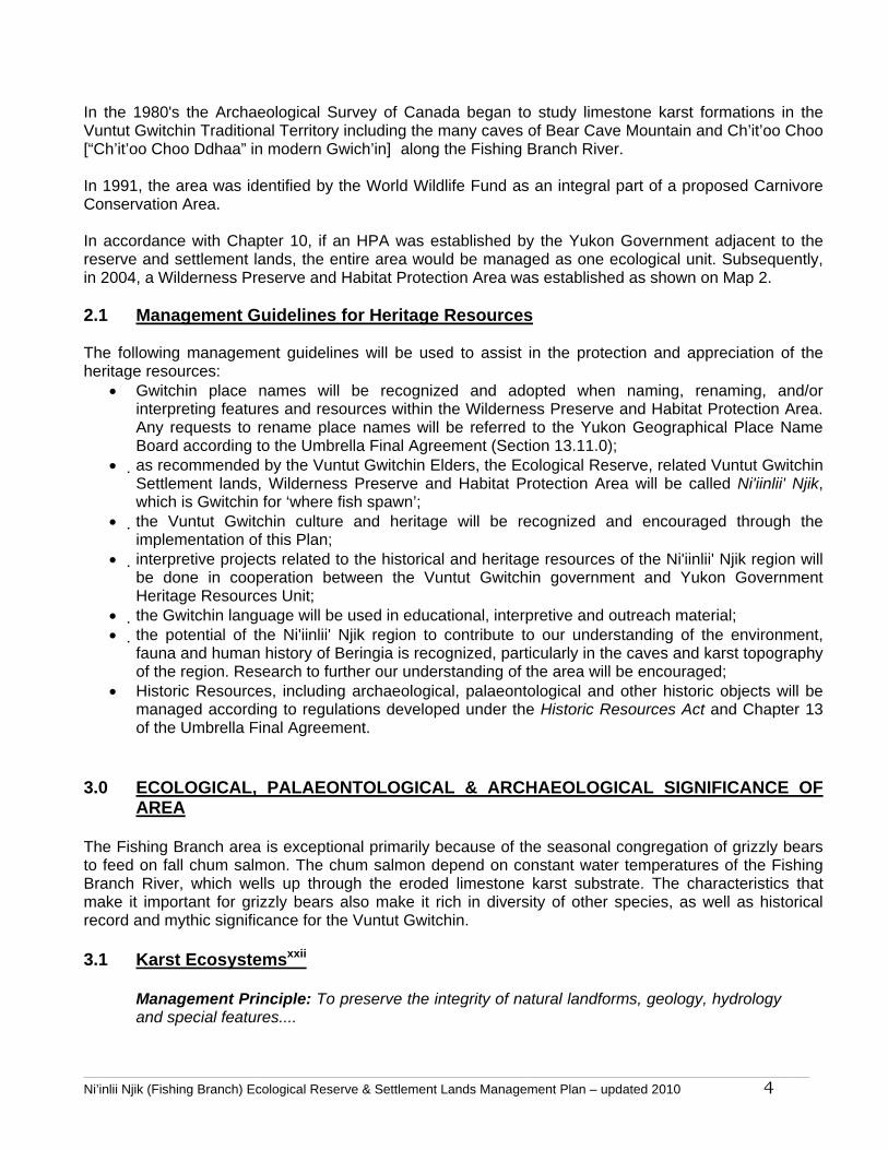
In the 1980's the Archaeological Survey of Canada began to study limestone karst formations in the Vuntut Gwitchin Traditional Territory including the many caves of Bear Cave Mountain and Ch’it’oo Choo [“Ch’it’oo Choo Ddhaa” in modern Gwich’in] along the Fishing Branch River. In 1991, the area was identified by the World Wildlife Fund as an integral part of a proposed Carnivore Conservation Area. In accordance with Chapter 10, if an HPA was established by the Yukon Government adjacent to the reserve and settlement lands, the entire area would be managed as one ecological unit. Subsequently, in 2004, a Wilderness Preserve and Habitat Protection Area was established as shown on Map 2. 2.1 Management Guidelines for Heritage Resources The following management guidelines will be used to assist in the protection and appreciation of the heritage resources:
• Gwitchin place names will be recognized and adopted when naming, renaming, and/or interpreting features and resources within the Wilderness Preserve and Habitat Protection Area. Any requests to rename place names will be referred to the Yukon Geographical Place Name Board according to the Umbrella Final Agreement (Section 13.11.0);
• as recommended by the Vuntut Gwitchin Elders, the Ecological Reserve, related Vuntut Gwitchin Settlement lands, Wilderness Preserve and Habitat Protection Area will be called Ni'iinlii' Njik, which is Gwitchin for ‘where fish spawn’;
• the Vuntut Gwitchin culture and heritage will be recognized and encouraged through the implementation of this Plan;
• interpretive projects related to the historical and heritage resources of the Ni'iinlii' Njik region will be done in cooperation between the Vuntut Gwitchin government and Yukon Government Heritage Resources Unit;
• the Gwitchin language will be used in educational, interpretive and outreach material; • the potential of the Ni'iinlii' Njik region to contribute to our understanding of the environment,
fauna and human history of Beringia is recognized, particularly in the caves and karst topography of the region. Research to further our understanding of the area will be encouraged;
• Historic Resources, including archaeological, palaeontological and other historic objects will be managed according to regulations developed under the Historic Resources Act and Chapter 13 of the Umbrella Final Agreement.
3.0 ECOLOGICAL, PALAEONTOLOGICAL & ARCHAEOLOGICAL SIGNIFICANCE OF
AREA The Fishing Branch area is exceptional primarily because of the seasonal congregation of grizzly bears to feed on fall chum salmon. The chum salmon depend on constant water temperatures of the Fishing Branch River, which wells up through the eroded limestone karst substrate. The characteristics that make it important for grizzly bears also make it rich in diversity of other species, as well as historical record and mythic significance for the Vuntut Gwitchin. 3.1 Karst Ecosystemsxxii
Management Principle: To preserve the integrity of natural landforms, geology, hydrology and special features....

_________________________________________________________________________________________________________________________________________________________________________________________________________________________________________________________________________________________________________________________________________________________________________________________________________________________________________________________________
Ni’inlii Njik (Fishing Branch) Ecological Reserve & Settlement Lands Management Plan – updated 2010 5
Karst ecosystems are more productive than ecosystems based on other substrates. Karst is formed by the dissolving action of water on bedrock (usually carbonates). This geological process occurs over thousands of years and results in unusual surface and subsurface features including sinkholes, vertical shafts, disappearing streams, springs, complex underground drainage systems and caves. The limestone in the Fishing Branch area has been exposed by the erosion for millions of years by ancient rivers and streams, likely ancestral to the Upper Porcupine River. The Fishing Branch River upstream of Bear Cave Mountain, periodically disappears into the gravels of the stream bed, only to re-emerge downstream. It is the numerous areas of upwelling water that makes the Fishing Branch River a prime spawning river for fall chum salmon. The stream is fed by a series of springs at Bear Cave Mountain. The numerous caves on the slopes of Bear Cave and Ch’it’oo Choo mountains and the surrounding hills are old karst features that developed at or close to ancient water tables as a result of stream action at a time when permafrost was absent from the area. Though on the Arctic Circle, upwelling groundwater keeps the river open throughout the year for approximately 15 kilometres near Bear Cave Mountain. Although not rare, this phenomenon seldom occurs in this volume at such northern latitudes. This phenomenon creates its own microclimate which affects vegetation, opportunities for habitat use and consequent biological diversity and abundance. As waterways, current or ancient, limestone substrates are interconnected. Disturbance or damage to one part of the substrate may have unforeseen implications on other parts. Preservation of the Ecological Reserve and the values for which it was protected will depend on avoiding disturbance to the surrounding substrate. 3.2 Caves xxiii
Management Principles: To recognize and protect the traditional use by the Vuntut Gwitchin, and to gain knowledge from, manage and protect the integrity of natural landforms, historic resources and special features.
Caves in the vicinity which have sheltered animals, and at times, people for millennia contain records of significant climatological change, and important palaeontological and archaeological resources relating to the Beringian region. As J. Cinq-Mars and R.E. Morlan have noted in Bluefish Caves and Old Crow Basin: A New Rapport, caves
"...can serve as windows to the distant past. Through them we will continue to decipher the complex environmental and cultural processes that led to the peopling of a truly New World." xxiv
In 1953, Dr. Otto Geist, of the University of Alaska, visited Fishing Branch in search of Bear Cave:
"I had been hearing from Indians stories about a wonderful cave up at one of the heads of the Porcupine River. I became very eager to investigate this region and find the cave, thinking that in such a place one might find fossil remains of animals of long ago which might have been in the habit of hibernating in or frequenting such a place. It seemed very possible that the exploration of this cave might yield information of interest to Science". xxv
On Bear Cave Mountain the principal caves are found along the foot of cliffs and in a few outlying tors. Twenty rock shelters plus Bear Cave itself have been discovered at elevations ranging from 800 - 950 m. a.s.l. Bear Cave is the largest cave in the Yukon. This cave is 200 metres deep and is comprised of three chambers:

_________________________________________________________________________________________________________________________________________________________________________________________________________________________________________________________________________________________________________________________________________________________________________________________________________________________________________________________________
Ni’inlii Njik (Fishing Branch) Ecological Reserve & Settlement Lands Management Plan – updated 2010 6
• The First Chamber, or Speleothem Cave, is characterized by flow stone where moisture flowing over rocks has deposited mineral matter;
• The Second Chamber has clear pillars of ice rising from the floor of the chamber, ice crystals coating the ceiling and walls which are, in places, so thick as to form drapes;
• The Third Chamber is cold and dry without appreciable ice formation. The cold, dry environment of the interior chambers is optimum for the preservation of palaeontological and archaeological remains such as wood and animal bones. Palaeoenvironmental information is preserved as well in the speleothem formations, dating back in some cases to the time of the formation of the caves, more than 2 million years ago. Caves and sinkholes are common features of Ch’it’oo Choo Mountain, north of Bear Cave Mountain. Ch’ii Ch’a’an Cave, located near the north end of the mountain, is 500 metres deep. Other caves investigated on this mountain include: La Grande Caverne, La Caverne Glacee 85, Le Porche du Nord, Bison Cave and La Grotte du Meandres. Like Bear Cave, Ch’ii Ch’a’an is of special interest for the presence of preserved evidence of human activity within the cave: A low drystone "wall" (30 cm.) of limestone across the mouth of the rear passage, behind which were cached five or six spruce trees. Wood from one of the spruce trees was radiocarbon dated to about 1300 AD. Just at the entrance of the rear chamber of the small cave system, a 10 cm.-long streak of red paint has been noted on one of the walls. In the ethnographic record, bears denning in caves were the object of occasional and hazardous hunts by young Gwitchin men in times when food was scarce. Before the introduction of firearms, the technique involved setting fires just inside the cave to smoke out the hibernating bear; a particularly courageous hunter would then wait for the bear at the cave mouth with his spear planted in the ground so that the bear would impale itself when it charged. The account of the Tetlit Gwitchin bear hunt at Bear Cave in 1900 provides the explanation for the presence of cut spruce trees concentrated in the passage between the chambers. The spruce trees, according to Geist's recounting of the tale, were used as "ladders" to access lower chambers of the cave and to assist in pulling the bear carcasses up from the lower levels. Whether all the wood remains in the cave are the result only of the 1900 hunt or are the accumulation of many hunts is unknown. A bison bone estimated to be 12,000 years old has been found in a cave on Bear Cave Mountain in the early 1990's. The palaeontological, archaeological and palaeoenvironmental evidence recovered in the Bluefish Caves located 90 km. NW of Bear Cave Mountain may provide an indication of what may be anticipated within the caves on Bear Cave and Ch’it’oo Choo Mountains. In the Bluefish Caves, located southwest of Old Crow in the Keele Range, an impressive array of late Ice Age fauna fossil animal bones, including mammoth, horse, bison, sheep, caribou, moose, wapiti, saiga antelope, musk-ox, lion, cougar, bear, wolf and a large variety of smaller mammals, birds and fish have been recovered. Altered caribou and mammoth bones have been dated to about 25,000 years and are proposed as the oldest evidence recovered to date of human occupation of the North America. 3.3 Diversity of Species
Management Principle: To protect the full diversity of wildlife....
A characteristic of karst ecosystems is increased productivity for plant and animal communities, including extremely productive aquatic communities. Most observations of the Fishing Branch area have

_________________________________________________________________________________________________________________________________________________________________________________________________________________________________________________________________________________________________________________________________________________________________________________________________________________________________________________________________
Ni’inlii Njik (Fishing Branch) Ecological Reserve & Settlement Lands Management Plan – updated 2010 7
occurred in the late summer and fall when the fall chum salmon are spawning. At the end of summer Chinook salmon are also observed, and the coho run begins in late October. The most visible wildlife that depends on the spawning salmon is the grizzly bear. But salmon and their roe are also key resources to Arctic grayling, owls, hawks, bald and golden eagles, wolves and ravens. Even ducks are part of the system; they appear to eat roe and also the invertebrates that are stirred up by fishing bears. Available food and the constant temperature of the open water appear to allow birds such as some ducks and the American Dipper to overwinter successfully. The microclimate caused by the constant water temperature and associated winter fog, as well as the good drainage and nutrient cycling associated with karst, influences plant growth. Karstland forage is thought to contain higher calcium levels, associated with the dissolved carbonates, allowing for better bone, muscle, and antler development. The unusually large riparian white spruce measuring up to one metre in diameter are notable for their size given the latitude. Red squirrels, marten, spruce grouse and a variety of songbirds inhabit these spruce forests. These trees and snags are frequented by birds of prey. Willows and poplar, associated with the main, as well as old, river channels provide food for beaver, which are common, and "giant" moose (Alces alces gigas). These moose have been observed in the same places, year after year. The forests adjacent to the river are also used as bedding and hiding areas for bears. The lower and mid-slopes of the mountains surrounding the river valleys are characterized by open spruce forests, paper birch forests, and shrublands. Many of these communities harbour a variety of berry producing shrubs, including blueberry, soapberry, crowberry, bearberry, kinnikinnick, rose, currant, highbush cranberry, low bush cranberry, cloudberry and red-osier dogwood. These are an important source of food in fall for grizzly bears, birds and other animals. In the winter, these areas are part of the range of the Porcupine Caribou Herd and they search out those vegetation types with abundant lichen. Although not apparently abundant, Dall sheep have been observed in some alpine areas, such as on Bear Cave Mountain. Interestingly, porcupines are known to use the caves; they can also be expected in the forests of the lower slopes and valley floor. 3.4 Salmon xxvi
Management Principle: To protect the full diversity of wildlife, particularly salmon.... The Fishing Branch supports spawning populations of fall chum, coho and Chinook salmon. Salmon, particularly fall chum, are a keystone species in this ecosystem upon which other species, including wildlife and humans, depend. Fishing Branch River fall chum salmon stocks are the mainstay of the aboriginal fishery located near Old Crow. They also contribute significantly to fisheries in the Alaskan portion of the Yukon River. The majority of fall chum salmon spawning within the Canadian section of the Porcupine River occurs in the Fishing Branch River. In 1975, Fisheries and Oceans Canada recorded a spawning escapement of 353,300 chum salmon to this river. Conservation concerns for the Fishing Branch River fall chum salmon run arose in the late 1990’s and were heightened in year 2000 when the count through the Fishing Branch River weir was only 5,053 fish, the lowest on record. However, run sizes improved somewhat within the 2001–2008 period when counts ranged from a low of 13,563 in 2002 to a high of 121,413 in 2005. The recent ten-year average (1999-2008) count is 30,905 fall chum salmon. Based on recent analyses, the Fishing Branch River fall chum salmon spawning escapement goal range has been decreased from a longstanding goal of 50,000-120,000 to a much lower range of 22,000- 49,000 fall chum salmon for the 2008-2010 period.
_________________________________________________________________________________________________________________________________________________________________________________________________________________________________________________________________________________________________________________________________________________________________________________________________________________________________________________________________
Ni’inlii Njik (Fishing Branch) Ecological Reserve & Settlement Lands Management Plan – updated 2010 8
Little is known about the distribution and abundance of Chinook and coho salmon within the Porcupine River drainage, although these species are known to spawn in the Fishing Branch River. A number of studies funded through the Yukon River Restoration and Enhancement Program suggest that the portion of the Miner River downstream of Fishing Creek is the primary spawning location for Chinook salmon in the Porcupine River drainage. Based on radio telemetry studies conducted in 2005 and 2007 the Fishing Branch watershed is the principal coho spawning location within the Porcupine River drainage. This watershed accounted for 72% and 79% of the tags applied in 2005 and 2007, respectively. The karst geology of the Fishing Branch River watershed results in water entering the river bed upstream of the principal spawning area during the summer. The water then discharges from the river bed into the spawning area. Heat is stored in the underground flow path of the water, and released throughout the winter. The high quality, relatively warm water contributes to almost ideal conditions for incubating salmon eggs. The “fall” race of Yukon River chum salmon spawn directly in groundwater discharges, and develop at roughly the same rate as populations located in southern areas.
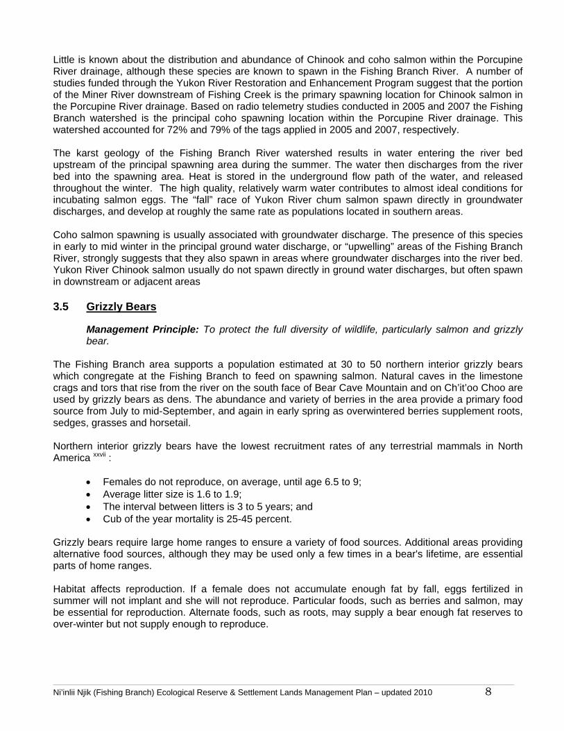
Coho salmon spawning is usually associated with groundwater discharge. The presence of this species in early to mid winter in the principal ground water discharge, or “upwelling” areas of the Fishing Branch River, strongly suggests that they also spawn in areas where groundwater discharges into the river bed. Yukon River Chinook salmon usually do not spawn directly in ground water discharges, but often spawn in downstream or adjacent areas 3.5 Grizzly Bears
Management Principle: To protect the full diversity of wildlife, particularly salmon and grizzly bear.
The Fishing Branch area supports a population estimated at 30 to 50 northern interior grizzly bears which congregate at the Fishing Branch to feed on spawning salmon. Natural caves in the limestone crags and tors that rise from the river on the south face of Bear Cave Mountain and on Ch’it’oo Choo are used by grizzly bears as dens. The abundance and variety of berries in the area provide a primary food source from July to mid-September, and again in early spring as overwintered berries supplement roots, sedges, grasses and horsetail. Northern interior grizzly bears have the lowest recruitment rates of any terrestrial mammals in North America xxvii :
• Females do not reproduce, on average, until age 6.5 to 9; • Average litter size is 1.6 to 1.9; • The interval between litters is 3 to 5 years; and • Cub of the year mortality is 25-45 percent.
Grizzly bears require large home ranges to ensure a variety of food sources. Additional areas providing alternative food sources, although they may be used only a few times in a bear's lifetime, are essential parts of home ranges. Habitat affects reproduction. If a female does not accumulate enough fat by fall, eggs fertilized in summer will not implant and she will not reproduce. Particular foods, such as berries and salmon, may be essential for reproduction. Alternate foods, such as roots, may supply a bear enough fat reserves to over-winter but not supply enough to reproduce.

_________________________________________________________________________________________________________________________________________________________________________________________________________________________________________________________________________________________________________________________________________________________________________________________________________________________________________________________________
Ni’inlii Njik (Fishing Branch) Ecological Reserve & Settlement Lands Management Plan – updated 2010 9
4.0 LEGISLATION Legislative protection for the Fishing Branch area was first enacted in 1972. A 4000 square km Game Preserve was established by Game Ordinance as a first step towards protecting the headwaters of the Fishing Branch River and surrounding area from activities which could damage the spawning beds and "in turn have a detrimental effect on the animal populations.... [and] lend weight to any instructions issued by other Departments if the area is withdrawn and placed outside exploration activities". xxviii When the Game Ordinance was replaced by the Wildlife Act in the early 1980's Game Preserves were discontinued.
In 1974, application was made to notate the area as a Recreational Reserve on behalf of the Yukon Tourism and Information Branch. The notation, delayed to await pending land claim negotiations, was approved by the Department of Indian and Northern Development in 1987 but subsequently dropped.
In 1984, settlement lands (R-5A, S-3Al), including Bear Cave Mountain, was interim protected by federal Order-in-Council.
In the early 1990's, the parties to the Vuntut Gwitchin First Nation Final Agreement agreed to establish the Ecological Reserve and ensure that Settlement Lands, including Bear Cave Mountain, and any future Habitat Protection Area would be managed as an ecological unit with the Ecological Reserve. The Final Agreement became law in 1995. 4.1 Vuntut Gwitchin First Nation
Final Agreement & Self-Government Legislation
The Vuntut Gwitchin First Nation, the Government of Canada, and the Government of Yukon agreed to establish the Fishing Branch Ecological Reserve pursuant to the Parks Act as set out in Schedule B, Chapter 10 of the VGFNFA [Appendix 1].
4.2 Parks and Land Certainty Act 2002
As set out in the Final Agreement, the Fishing Branch Ecological Reserve shall be established pursuant to, and managed in accordance with, the Parks and Land Certainty Act 2002. [Chapter 10, Schedule B, 1.2 & 5.1, pp. 132 & 134]
4.3 VGFN Land and Resources Act
The VGFN Land and Resources Act, as enabled by the VGFN Final and Self-government Agreements will provide for the management of R-5A & S-3Al lands when completed.
4.4 Yukon Quartz Mining Act, Yukon Placer Mining Act & Canada Petroleum Resources Act
The Ecological Reserve is withdrawn from locating, prospecting and mining under the Yukon Quartz Mining Act and Yukon Placer Mining Act, and from exploration and development under the Canada Petroleum Resources Act. [Chapter 10, Schedule B, Section 3.0, p. 132]
4.5 Yukon Wildlife Act Wildlife is managed pursuant to the Yukon Wildlife Act. 4.6 VGFN Fish & Wildlife Act The VGFN Fish and Wildlife Act will govern subsistence harvest of fish and
wildlife resources by VGFN citizens on crown land (including the Ecological Reserve), and management of certain wildlife on Settlement Lands in accordance with the VGFN Final Agreement.
4.7 Federal Fisheries Act Fish & fish habitats are managed under the federal Fisheries Act. Note: The Canada/U.S. Pacific Salmon Treaty (PST) 1985 and the Canada/U.S. Interim Yukon River Salmon Agreement (IYRSA) (1995) also affect the management of salmon and salmon habitat.
4.8 Historic Resources Act & the Yukon Act
Archaeological, palaeontological and palaeoenvironmental resources are managed pursuant to the Yukon Heritage Resources Act, Archaeological Sites Regulations under the Yukon Act and the VGFNFA and VGFN guidelines.
4.9 Wilderness Tourism Licensing Act
The Wilderness Tourism Licensing Act, proclaimed on May 1,1999, requires wilderness tourism operators to meet certain safety, insurance and

_________________________________________________________________________________________________________________________________________________________________________________________________________________________________________________________________________________________________________________________________________________________________________________________________________________________________________________________________
Ni’inlii Njik (Fishing Branch) Ecological Reserve & Settlement Lands Management Plan – updated 2010 10
skill requirements. The Act is also designed to protect and enhance wilderness tourism opportunities and to help sustain Yukon's wilderness.
5.0 MANAGEMENT PRINCIPLES AND OBJECTIVES SET OUT IN THE VGFNFA 5.1 Management Principles for
the Ecological Reserve The Final Agreement states that the management plan shall be consistent with the following management principles: • to manage the Ecological Reserve and R-5A, S-3A1 lands as an
ecological unit; • to recognize and protect the traditional and current use of the
Ecological Reserve by Vuntut Gwitchin; • to protect the full diversity of wildlife populations, particularly salmon
and grizzly bear; • to protect the habitat from activities which may reduce the capacity of
the Ecological Reserve to support Wildlife; and, • to preserve the integrity of the natural landforms, geology, hydrology
and special features of the Ecological Reserve. [Chapter 10, Schedule B, Section 4.2, pp.133]
5.2 Management Objectives for any future Habitat Protection Area
The Final Agreement sets the following management objectives for a future Habitat Protection Area if it is established: • to protect the Fishing Branch River; • to maintain the long term viability at natural population levels of grizzly
bear (Ursus arctos) which concentrate seasonally at Bear Cave Mountain; and,
• to manage the Ecological Reserve and the Habitat Protection Area as an ecological unit.
5.3 Relationship of
Management Plan to Management Principles & Objectives once a HPA agreed to
The Final Agreement states: • Yukon shall manage the Ecological Reserve in accordance with the
management principles for the Ecological Reserve and the Parks Act; • the Vuntut Gwitchin First Nation shall manage R-5A, S-3Al lands in a
manner consistent with 4.2 of Schedule B; and, • if a Habitat Protection Area were to be established, Government shall
manage the Habitat Protection Area, in accordance with the objectives set out in 8.3 of Schedule B of the VGFNFA.
[Chapter 10, Schedule B, 5.1,7.1 & 8.3, pp. 134 & 135]
5.4 Principles & Objectives Take Precedence In Management of Area
These Principles & Objectives as described in the VGFN Final Agreement will take precedence in management of the Ecological Reserve.
6.0 FUTURE PROTECTED AREA AROUND THE ECOLOGICAL RESERVE Effective implementation of the Ecological Reserve and R-5 depends, in part, on the ability to protect core parts of this ecosystem which are not within the Ecological Reserve or R-5A lands.
In 2004 the Yukon Government approved a protected area surrounding the Ecological Reserve, R-5A and S-3A1 as a Representative Area for the North Ogilvie Mountains ecoregion under the then Yukon Protected Areas Strategy (YPAS). Achievement of this commitment was considered to be an effective alternative to establishing this area as a Habitat Protection Area as contemplated in the VGFNFA. Management recommendations for the surrounding protected area were developed through the planning process established by YPAS, and carried out separately from this management plan. The management

_________________________________________________________________________________________________________________________________________________________________________________________________________________________________________________________________________________________________________________________________________________________________________________________________________________________________________________________________
Ni’inlii Njik (Fishing Branch) Ecological Reserve & Settlement Lands Management Plan – updated 2010 11
recommendations for the Ecological Reserve, R-5A and S-3A1 as outlined in this management plan, except those which form part of the VGFNFA, do not apply to the Wilderness Preserve and Habitat Protection Area.
The boundaries of the protected area surrounding the Ecological Reserve, R-5A and S-3A1 lands were identified in part through the consideration of the following values: 1. A significant portion of the interconnected karst system upon which the integrity of the Ecological
Reserve depends.xxix • The karstlands are as fragile as they are productive. The interactions between the sinking surface
waters and precipitation, the forest, the soils, and bedrock can be easily interrupted or changed. Minor changes to infiltration rates, water chemistry, and karst hydrology from human activity can have great effects on the function and biological health of the karst system.
2. The headwaters and watershed of the north and south forks of the Fishing Branch Riverxxx to ensure
protection of: • The water quality and hydrology essential for the upwelling, open water and spawning; • The spawning beds not included in the Ecological Reserve; • Very productive berry fields in the headwater mountains and floodplain habitats along all branches of
the river. 3. The Cody Creek watershedxxxi to ensure protection of: • Productive berry fields in the headwater mountains; • Floodplain habitats along the lower two thirds of the creek; • A diversity of side slope forests.
4. A significant portion of the grizzly bear habitat requirementsxxxii, including congregating areas which
are not within the Ecological Reserve and R-5A including • Floodplain habitats of all the major creeks and rivers in the area which are very high value for
grizzly bears for spring, summer, and early fall; • Lower elevation mountain ridges, particularly on southerly exposures, which provide an abundant
and diverse mix of shrubs that produce berries required by grizzly bears. These are very high value habitats for late summer, fall and, for the consumption of overwintered berries, in spring;
• The limestone mountains which are used as denning and birthing areas for grizzly bears. 5. Areas which contain caves or cultural sites of associated ecological, archaeological, palaeontological
and palaeoenvironmental significancexxxiii including • Ch’it’oo Choo Mountain: Ch’ii Ch’a’an , La Grande Caverne, La Caverne Glacee 85, Le Porche du
Nord, Bison Cave and La Grotte du Meandres; • Cody Creek Valley: which has numerous caves; • Fishing Branch Cave: located 3 km. SSW of Bear Cave Mountain; and, • Red Hill: a prominent landscape feature and alternative site with a red stain on the rock where, in
Gwitchin legend, the hero Kuihenjik may have thrown himself down the mountain. 7.0 MANAGEMENT GUIDELINES In order to achieve the purpose of this Management Plan, which is to ensure effective implementation of the Management Principles set out in the Vuntut Gwitchin First Nation Final Agreement, the following guidelines have been agreed upon by the: • Vuntut Gwitchin First Nation government; • North Yukon Renewable Resources Council; and, • Environment Yukon.

_________________________________________________________________________________________________________________________________________________________________________________________________________________________________________________________________________________________________________________________________________________________________________________________________________________________________________________________________
Ni’inlii Njik (Fishing Branch) Ecological Reserve & Settlement Lands Management Plan – updated 2010 12
7.1 Conditions of Access Managing access has been found to be one of the most important requirements of areas protected and managed for the long term survival of grizzly bears, for managing caves and the historic resources associated with them, and for monitoring use of the area. Heritage and historic resources may also be found exposed on elevated terrain such as bedrock, ridges, terraces and knolls, and are equally as vulnerable as those located in the caves. Management of these heritage and historic resources will be consistent with the Historic Resources Act and Chapter 13 of the Umbrella Final Agreement. General restrictions on access to R-5A and S-3A will be negotiated pursuant to the Final Agreement and put into effect by VGG legislation. It is important to note that entrance into or presence near caves located within Settlement Lands during the period of November 2008 to November 2013 is prohibited as per VGG Chief and Council direction. The purpose of this decision is directly related to incorporating the Precautionary Principle regarding bear denning activities. Access to the Ecological Reserve will be consistent with the Parks and Land Certainty Act. Specifically, effective access management is important to: • avoid disturbance of wildlife, particularly bears, their habitats and access to salmon and other food
sources; • avoid human/bear conflict which can result in injury or death to bears and humans; • provide opportunity for a positive wilderness and learning experience in bear country; • ensure proper food and garbage management; • limit requirements for visitor infrastructure; • protect fragile landforms, heritage resources, and historic resources such as the speleothems and
artifacts found in caves and the surrounding area; and, • maintaining the wilderness character of the area. Access management prescriptions are based on observation of the McNeil River State Game Sanctuary by Government of Yukon and the Vuntut Gwitchin staff. Although McNeil River is coastal, supports a higher density of grizzly bear and can accommodate more visitors than the Fishing Branch Ecological Reserve/R-5A, the model which has been successful there for 25 years is useful.xxxiv In 25 years no person has been harmed, no bear has been killed and, for many years, aversion techniques have been limited to speaking, banging on pots and clapping. While initially permitted in one lower elevation cave on Bear Cave Mountain opposite the viewing site, all access to the mountain and the caves is now prohibited for a 5-year period from 2009 to 2013. This moratorium was approved by the Vuntut Gwitchin Government in order to protect the bears and historic resources of the area. It is recognized that in many cases, road development can have a significant impact on grizzly bears. Roads can reduce grizzly bear survival by: • displacing them from optimum habitats and forcing them to use less productive habitat; • causing bears to flee which wastes the energy reserves bears must accumulate in the short summer
season to survive and reproduce; • increasing human access that concentrates and increases the number of bears killed; and, • increasing human use of back country areas leading to a significantly higher incidence of
human/bear conflict, food conditioning, and subsequent killing of bears. Consequently, the management guidelines contain specific restrictions related to road proposals in the Ecological Reserve and R-5A lands.

_________________________________________________________________________________________________________________________________________________________________________________________________________________________________________________________________________________________________________________________________________________________________________________________________________________________________________________________________
Ni’inlii Njik (Fishing Branch) Ecological Reserve & Settlement Lands Management Plan – updated 2010 13
The management guidelines are also consistent with the Grizzly Bear Management Principlesxxxv that outline the status of grizzly bears, biological limits to reproduction and recruitment, habitat requirements, adverse impacts on grizzly bears and prescriptions for managing viewing. Access 7.1.1 Managing Access during
the Fall Chum Salmon Run September & October
R-5A 2 & Ecological Reserve Commercial visitor access to R-5A or Ecological Reserve, which may include the camp area and viewing sites, is by permit only and will be limited to a maximum of five (5) visitors per day, including the guide. The maximum length of stay for any visitor will be one week (7 days) during the period between September 1 to October 31st in order to: • maintain the wilderness character of the Ecological Reserve; • avoid disturbance of the salmon and wildlife, particularly grizzly bear,
and their habitats; avoid disturbance to, caves, heritage resources and historic resources;
• encourage a high quality wilderness experience; • maintain public health and safety; • limit infrastructure requirements; and, • provide for good wildlife and salmon viewing opportunities. NOTE: Limiting access to five is based on: • a comparison with McNeil River where the limit is higher but accessible
areas are larger, the coastal vegetation is less fragile, and a higher density of bears may allow for more disturbance without significant loss to the bear population;
• observations at Fishing Branch that disturbance is incremental and is notable with more than five visitors;
• limited appropriate camping/accommodation options due to terrain and high density bear activity.
Access and bear-human interactions are governed by the Ni’iinlii Njik (Fishing Branch) Risk Management Plan
Visitor access to the Ecological Reserve by individuals other than weir staff or authorized Yukon Environment staff will not be allowed in order to: • avoid conflict with bears where encounters are likely to occur; • avoid displacement of bears from important habitat and access to
salmon; and, • maintain optimum viewing opportunities by not displacing bears.
7.1.2 Visitor Access - When Bears are Not Congregating November to August
Ecological Reserve, R-5A and S-3A lands By permit only, in order to: • protect caves and heritage and historic resources, including
archaeological and palaeontological resources; • avoid disturbance of wildlife and their habitats; • maintain wilderness quality; • provide opportunity for minimizing impacts and, particularly, for
coexisting with bears; and • facilitate monitoring of levels and type of visitor use.
7.1.3 Access for Other Purposes (Research and Education)
Special Permits/Approvals In addition to commercial visitor access permitted under Section 7.1.1., special permits allowing access to any part of the Ecological Reserve at any time of the year except the bear viewing period between September 1st and October 31st may be issued for activities such as research or the preparation of materials for public

_________________________________________________________________________________________________________________________________________________________________________________________________________________________________________________________________________________________________________________________________________________________________________________________________________________________________________________________________
Ni’inlii Njik (Fishing Branch) Ecological Reserve & Settlement Lands Management Plan – updated 2010 14
education if: • such activity is consistent with, and supports, the Management
Principles; • the applicant has received information about appropriate behavior
around bears; and, • the applicant has signed a waiver of liability as a condition of access as
per Section 7.14.1.; • applicants practice leave no trace camping skills; and • meets requirements under other relevant legislation Note: Vuntut Gwitchin Government Research permits are required to conduct research on Settlement Land. YG Scientists and Explorers permits are currently required to carry out research in the Yukon. Archaeological and palaeontological research requires a permit under the Yukon Archaeological Sites Regulations Permit (Yukon Act).
7.1.4 Helicopters Ecological Reserve, R-5A a) A Landing Permit is required in order to:
• manage visitor access; • avoid disturbance to wildlife, particularly grizzly bears, and their
habitats; and, • maintain wilderness quality.
b) A condition of the landing permit will be to avoid the disturbance of wildlife, particularly along the river and the den sites. c) Helicopter landing during September/October, except where specified for alternative permitted activities, is limited to:
• a designated site adjacent to the campsite and the weir (see Map 2); and,
• the designated drop off and pick up days, in order to avoid frequent disturbance of wildlife and visitor experience
d) Emergency landings must be reported to managing agencies as soon as practicable.
7.1.5 Off Road Vehicles
Ecological Reserve, R5-A Recreational use of Off Road Vehicles is prohibited in the Ecological Reserve and R-5A lands, except in unusual cases where a permit may be issued by the managing agency if the use of motorized vehicle is consistent with the goals and recommendations of this management plan and the Parks and Land Certainty Act and fulfills a demonstrable need where there is no feasible alternative.
7.1.6 Roads Ecological Reserve, R-5A The development of roads will not be permitted in order to: • ensure wilderness quality; • protect wildlife, particularly bears; and, • manage access to minimize displacing wildlife and to protect the caves
and their contents.
2Management Prescriptions for R-5A apply to S-3A.

_________________________________________________________________________________________________________________________________________________________________________________________________________________________________________________________________________________________________________________________________________________________________________________________________________________________________________________________________
Ni’inlii Njik (Fishing Branch) Ecological Reserve & Settlement Lands Management Plan – updated 2010 15
7.2 Wildlife Viewing The primary management consideration is to ensure protection of wildlife, particularly grizzly bears, and their habitats; viewing is secondary. Viewing bears poses special considerations. The presence of humans can create stress for bears and cause them to abandon a habitat. Viewers may also be at risk if they do not act appropriately. As such, viewing is governed by the Ni’iinlii Njik (Fishing Branch) Risk Management Plan. However, effectively managed viewing areas may: • increase public understanding and appreciation of bears and bear ecology; • increase public understanding of appropriate human behavior in bear habitat; and, • in controlled circumstances, increase tourism and provide economic benefit. 7.2.1 Status & Purpose of
Wildlife Viewing Ecological Reserve, R-5A The primary management consideration is to implement the Management Principles, including ensuring the protection of wildlife, particularly salmon & grizzly bears, and their habitats. Viewing is important but only if managed in support of, and consistent with the principles. The purpose of wildlife viewing will be to: • increase public understanding & appreciation of wildlife, particularly
bears, and their ecology; and • increase public understanding of appropriate human behavior in bear
habitat. NOTE: In addition, public appreciation for this special area will be encouraged through public information and education as set out in section 7.15.2 of this plan.
7.2.2 Commercial Viewing Operations
Ecological Reserve, R-5A Commercial viewing operations were not allowed to operate on the Ecological Reserve, R-5A or S-3A for five years after the effective date of this plan for the following reasons: • management agencies has to be fully familiar with the area, collect
baseline data and develop criteria to effectively assess the possible effects of commercial viewing;
• assess the possible effects of commercial viewing operations on implementing the Management Principles, particularly the protection of grizzly bears;
• assess the potential economic benefits in comparison with possible adverse effects of commercial operations;
• establish terms and conditions for commercial operations in accordance with the process set out for the management of R5A lands [Appendix A - VGFNFA, p. 391];
• complete a risk management plan; and • design a controlled pilot trial before committing to long-term commercial
access. When commercial operations were approved, the total number of
commercial visitors on site will not exceed the five persons per day prescribed under 7.1.1. of this Management Plan, including the guide. Commercial operations were not be allowed to operate on the Ecological Reserve; R-5A or S-3A until a bear risk management plan was completed and approved for the management area in 2006.

_________________________________________________________________________________________________________________________________________________________________________________________________________________________________________________________________________________________________________________________________________________________________________________________________________________________________________________________________
Ni’inlii Njik (Fishing Branch) Ecological Reserve & Settlement Lands Management Plan – updated 2010 16
7.3 Management Facilities & Infrastructure Consistent with the Management Principles and in keeping with the wilderness character of the area, the development of management facilities and infrastructure were kept to a minimum. The following considerations for human safety and the protection of grizzly bears were included in the design for the Ranger Facilities: • appropriate structures to provide safety in Arctic weather and relative comfort/security in bear habitat
for staff and visitors; • a cache which prevents grizzly bears from accessing human food & garbage and becoming food
conditioned and potentially dangerous; • an outhouse for the convenience of staff and visitors, and to prevent the degradation of the camp
area; and, • a sauna/washhouse for the convenience and comfort of staff and visitors, and to prevent potential
accidental bear/human meetings on the riverbank. 7.3.1 Buildings NOTE: See Maps 1 and 2 showing location of facilities.
R-5A, or the Ecological Reserve, and the Weir site Other than the permitted park-related facilities referred to below, there will be no buildings in the Ecological Reserve. At the Weir site, buildings will be limited to the following existing structures: • one sleeping building and one kitchen facility building; • one outhouse; • one fuel storage building; • one generator shed; and, • one sauna/washhouse The following ranger facilities were built between 2005 and 2007 at the designated campsite on R-5A or Ecological Reserve: • a maximum of four sleep cabins or tents, as the site can safely
accommodate; • one cook cabin or tent; • one cache; • one outhouse; • walkways; • viewing site at the back slough; • bear viewing platform and, • one sauna/washhouse These ranger facilities are available under lease to the licensed bear viewing operation. All buildings will be: • of minimum size necessary; . • as bear-proofed as possible; • of materials harmonious with the natural surroundings; and, • to a reasonable aesthetic standard. These buildings, and their contents, are to be used only by authorized staff, researchers, commercial bear viewing clients and guides.
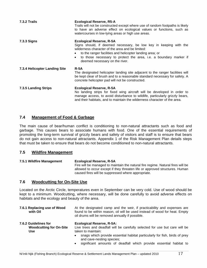
_________________________________________________________________________________________________________________________________________________________________________________________________________________________________________________________________________________________________________________________________________________________________________________________________________________________________________________________________
Ni’inlii Njik (Fishing Branch) Ecological Reserve & Settlement Lands Management Plan – updated 2010 17
7.3.2 Trails Ecological Reserve, R5-A Trails will not be constructed except where use of random footpaths is likely to have an adverse effect on ecological values or functions, such as watercourses in low-lying areas or high use areas.
7.3.3 Signs Ecological Reserve, R-5A Signs should, if deemed necessary, be low key in keeping with the wilderness character of the area and be limited: • to the ranger facilities and helicopter landing area; or • to those necessary to protect the area, i.e. a boundary marker if
deemed necessary on the river.
7.3.4 Helicopter Landing Site R-5A The designated helicopter landing site adjacent to the ranger facilities will be kept clear of brush and to a reasonable standard necessary for safety. A concrete helicopter pad will not be constructed.
7.3.5 Landing Strips Ecological Reserve, R-5A No landing strips for fixed wing aircraft will be developed in order to manage access, to avoid disturbance to wildlife, particularly grizzly bears, and their habitats, and to maintain the wilderness character of the area.
7.4 Management of Food & Garbage The main cause of bear/human conflict is conditioning to non-natural attractants such as food and garbage. This causes bears to associate humans with food. One of the essential requirements of promoting the long-term survival of grizzly bears and safety of visitors and staff is to ensure that bears do not gain access to non-natural attractants. Appendix 1 of the Risk Management Plan details steps that must be taken to ensure that bears do not become conditioned to non-natural attractants. 7.5 Wildfire Management 7.5.1 Wildfire Management Ecological Reserve, R-5A
Fire will be managed to maintain the natural fire regime. Natural fires will be allowed to occur except if they threaten life or approved structures. Human caused fires will be suppressed where appropriate.
7.6 Woodcutting for On-Site Use Located on the Arctic Circle, temperatures even in September can be very cold. Use of wood should be kept to a minimum. Woodcutting, where necessary, will be done carefully to avoid adverse effects on habitats and the ecology and beauty of the area. 7.6.1 Replacing use of Wood
with Oil At the designated camp and the weir, if practicability and expenses are found to be within reason, oil will be used instead of wood for heat. Empty oil drums will be removed annually if possible.
7.6.2 Guidelines for Woodcutting for On-Site Use
Ecological Reserve, R-5A: Live trees and deadfall will be carefully selected for use but care will be taken to maintain: • snags which provide essential habitat particularly for fish, birds of prey
and cave-nesting species; • significant amounts of deadfall which provide essential habitat to

_________________________________________________________________________________________________________________________________________________________________________________________________________________________________________________________________________________________________________________________________________________________________________________________________________________________________________________________________
Ni’inlii Njik (Fishing Branch) Ecological Reserve & Settlement Lands Management Plan – updated 2010 18
species, nutrients to the soil and are an essential component of the ecosystem;
• bear rubbing or culturally altered trees; and, • the large riparian trees
7.7 Industrial Development The Ecological Reserve and R-5A and S-3Al are not open for industrial activity, consistent with the Management Principles, particularly to: • manage the Ecological Reserve and Parcels R-5A and S-3Al as an ecological unit; • protect the full diversity of wildlife, particularly salmon and grizzly bear, • protect the habitat from activities which may reduce the capacity of the Ecological Reserve to
support wildlife; and, • preserve the integrity of the natural landforms, geology, hydrology and special features. 7.7.1 Mining Ecological Reserve, R-5A, S-3A1
In accordance with 3.1 of Schedule B [Appendix 3], the Government of Canada has withdrawn the mines and minerals within the Ecological Reserve from locating, prospecting and mining under the Yukon Quartz Mining Act, R.S.C. 2005, C. Y4 and the Yukon Placer Mining Act, R.S.C. 2005, c. Y -3. Consistent with the Management Principles, R-5A and S-3Al are not available for mining.
7.7.2 Oil & Gas Development Ecological Reserve: In accordance with 3.1 of Schedule B [Appendix 3], the Government of Canada has withdrawn the Ecological Reserve from exploration and development under the Canada Petroleum Resources Act, R.S.C. 1985 (2nd Supp.), c.36. R-5A, S-3A1 : Consistent with the Management Principles, R-5A and S-Al, oil & gas development will not be allowed.
7.7.3 Commercial Logging Ecological Reserve, R-5A Concessions for commercial harvesting will not be issued.
7.7.4 Other Uses Any activity that is not compatible with the Management Plan will not be allowed.
7.8 Hunting, Trapping & Fishing Hunting, trapping and fishing will be kept to a minimum in order to: • maintain the full diversity of wildlife, in particular those whose habitat is primarily within the protected
area; • maintain optimum genetic diversity by protecting individual animals; • avoid displacement of wildlife from their habitats or damage to habitat; • avoid conflict with grizzly bears associated with carcasses and gut piles; • avoid opportunities for bears to access human food and garbage; • minimize avoidance behavior associated with hunted wildlife; and, • maintain optimum wildlife viewing opportunities. The issue of a bear hunting closure will be further studied by the committee.

_________________________________________________________________________________________________________________________________________________________________________________________________________________________________________________________________________________________________________________________________________________________________________________________________________________________________________________________________
Ni’inlii Njik (Fishing Branch) Ecological Reserve & Settlement Lands Management Plan – updated 2010 19
7.8.1 Hunting Ecological Reserve, R-5A
Resident and Non-Resident Hunting: Game Management Subzone 1-39, in which the Ecological Reserve and R-5A are situated, is closed for the hunting of grizzly bear. This closure does not apply to other species, except that the hunting of mountain sheep is closed throughout Game Management Zone 1. This area is not within a big game outfitting concession. Aboriginal Hunting: The Vuntut Gwitchin have the right to harvest wildlife in the Ecological Reserve and R-5A, but have chosen to exercise their right to harvest big game as follows: • caribou, which migrate through seasonally, may be taken; and, • moose and grizzly bear will not be hunted in the area; Reciprocal Hunting Regulations: Any harvesting will be done in a manner which does not lead to human/bear conflicts, minimizes disturbance to other wildlife and wildlife habitat, and does not conflict directly with wildlife viewing. It is contemplated that Vuntut Gwitchin will adopt regulatory instruments to reinforce the above voluntary commitments. Yukon and Vuntut Gwitchin agree to coordinate their respective programs to ensure that hunting regulations are uniformly applied within the Ecological Area, R-5A, and S-3Al. The Management Committee established by this plan will be instrumental in the coordination of regulatory programs. The Committee will evaluate the efficacy of management actions, and it may recommend new regulations. Recommendations from the Committee would enter the established processes for the making of regulatory decisions.
7.8.2 Trapping Ecological Reserve, R-5A The Vuntut Gwitchin can trap in the Ecological Reserve and R-5A.
7.8.3 Fishing Ecological Reserve, R-5A Salmon and Arctic Grayling fishing is subject to the laws of general application. The catch limit for these species should be reduced to one fish per person per day. Changes to Grayling catch limits may be accomplished by way of a variation order through the Yukon Government, whereas changes to the current salmon catch limits must be addressed by Fisheries and Oceans Canada. In both cases the change to the catch limits will not require a regulatory change. Salmon populations will be monitored to ensure fishing pressure does not result in a population decline. Any fishing activity must be undertaken in a manner which limits the possibility of human/bear conflict and which does not displace bears from access to salmon. Drying racks, or storage of fish, which may attract and potentially cause conflict with bears are not allowed.
7.9 Monitoring & Research Monitoring is an essential part of assessing and evaluating whether the Management Principles are being effectively implemented, particularly to: • protect the full diversity of wildlife, particularly salmon and grizzly bears; • protect the habitat from activities which may reduce the capacity of the Ecological Reserve to
support wildlife;

_________________________________________________________________________________________________________________________________________________________________________________________________________________________________________________________________________________________________________________________________________________________________________________________________________________________________________________________________
Ni’inlii Njik (Fishing Branch) Ecological Reserve & Settlement Lands Management Plan – updated 2010 20
• preserve the integrity of the natural landforms, geology, hydrology and special features of the Ecological Reserve, including archaeological and palaeontological sites and deposits;
• protect the Fishing Branch River; • maintain the long term viability at natural population levels of grizzly bear which concentrate
seasonally at Bear Cave Mountain; and, • manage the Ecological Reserve and R-SA as an ecological unit. Research may be permitted in the Fishing Branch River area if it is respectful and consistent with the Management Principles. 7.9.1 Monitoring Based on the Management Principles, managing agencies have designed
and implemented simple and effective strategies to monitor: • Salmon populations; • behavioural change (i.e. avoidance); • disturbance to wildlife or their habitats; • disturbance to exceptional features, particularly the caves; and, • any disturbance to the area which could negatively affect this
exceptional ecosystem. Monitoring shall be conducted by the Yukon Government in accordance with section 7.11 and should: • be cost effective so that it can be long term; and, • not disturb or adversely affect wildlife, habitat, or natural or cultural
features.
7.9.2 Research Research in the area may be allowed by permit if it is consistent with the Management Principles and contributes to understanding of the cultural and natural values of the area, this Management Plan and the conditions of a permit, and does not: • adversely affect the wilderness quality of the area; • adversely affect the natural behavior patterns of the wildlife; involve the
taking or killing of wildlife; or, • disturb or adversely affect habitat, or natural or cultural features.
7.10 Weir & Salmon Management Fisheries and Oceans Canada is responsible for management of salmon stocks and protection of the aquatic environment. The Fishing Branch River supports spawning populations of fall chum, coho and Chinook salmon. The Fishing Branch River fall chum salmon run is one of the largest spawning populations identified within the Canadian portion of the Yukon River drainage. The fall chum escapements, which occur from late August to late October, have been monitored since 1971. Monitoring has involved aerial surveys and/or a counting fence, commonly referred to as a weir. The weir has been located on the south fork of the Fishing Branch River, east of Bear Cave Mountain reserve on Settlement Lands. It has operated annually from 1972-1975 and from 1985 to the present (excluding 1990). In years when the weir was not installed, aerial counts were used to estimate fall chum escapements. Fishing Branch River fall chum are harvested in numerous fisheries located throughout the Yukon River drainage. These fisheries include the Vuntut Gwitchin aboriginal fishery near Old Crow, as well as Alaskan commercial and subsistence fisheries in the Yukon River downstream of the confluence with the Porcupine River. In addition to Alaskan in-river harvests, catches of Yukon-origin fall chum salmon are believed to occur in U.S. fisheries along the Aleutian Islands chain.

_________________________________________________________________________________________________________________________________________________________________________________________________________________________________________________________________________________________________________________________________________________________________________________________________________________________________________________________________
Ni’inlii Njik (Fishing Branch) Ecological Reserve & Settlement Lands Management Plan – updated 2010 21
The average number of Fishing Branch chum fall salmon entering the Yukon River annually over the 1999-2008 period is estimated at 38,600 while the estimated number for the entire Porcupine River drainage in Canada for the same period is estimated at 48,300. • Fishing Branch spawning escapement estimates have ranged from a high of 353,000 in 1975 to a
low of 5,053 in 2000; the recent 4-year (2005-2008) escapement average is 51,500, although this average is influenced the strong spawning escapement of 121,413 observed in 2005;
• the Old Crow aboriginal fishery harvest averaged 3,600 fall chum salmon over the 1999-2008 period; and,
• the annual Alaskan harvest of Fishing Branch River fall chum salmon is estimated to have averaged 9,700 over the 1999-2008 period.
The Canada/U.S. Yukon River Salmon Agreement (YRSA) was signed on December 04, 2002. This international agreement, which is an annex of the Pacific Salmon Treaty, outlines a co-operative approach to the management of salmon stocks originating in the Yukon River in Canada. Key elements of the agreement include the formation of the international Yukon River Panel (YRP), the Yukon River Joint Technical Committee (JTC), and the establishment of an annual Yukon River Restoration and Enhancement Fund (REF). The REF has supported a number of programs which have advanced our knowledge of the three salmon species which spawn in the Porcupine River drainage. The JTC has recommended an Interim Management Escapement Goal (set a target interim spawning escapement goal) range of 22,000 to 49,000 fall chum salmon for the Fishing Branch River for the 2008-2010 period. The previous spawning escapement goal range was 50,000 to120,000. 7.10.1 Salmon Management Consistent with the recommendations of the Joint Technical Committee to
continue and improve assessment of Porcupine River fall chum salmon: • the Fishing Branch River weir program should be continued; • potential sonar sites on the Porcupine River in Alaska and Canada
were investigated in 2009; • genetic stock identification baselines and techniques which are
under development will be used when appropriate; and • when the Fishing Branch fall chum salmon spawning escapements
fall below target levels the Yukon River Panel shall consider the need to develop a rebuilding plan based on information and analyses prepared by the JTC.
7.10.2 Weir Management The weir will be managed in accordance with the Management Principles
and this Management Plan.
7.11 On-Site Personnel In addition to any visitors which may be permitted to access the area in accordance with Section 7.1.1., designated staff will be on site as needed. In particular, in order to collect monitoring data and have a management presence, Yukon Parks will have one staff on-site for 2 visitor periods within each operating season. Yukon Parks and the Operator will finalize arrangements in respect of these 2 visitor periods by August 1st of every year. The successful management of this area will depend on knowledgeable and experienced on-site personnel. If the job criteria are met, preference will be given to VGFN citizens for at least one of these positions.

_________________________________________________________________________________________________________________________________________________________________________________________________________________________________________________________________________________________________________________________________________________________________________________________________________________________________________________________________
Ni’inlii Njik (Fishing Branch) Ecological Reserve & Settlement Lands Management Plan – updated 2010 22
7.11.1 Purpose of Staff The purpose of on-site staff will, consistent with the Management Principles and the terms set out for R-5A in Settlement. Land Descriptions, include: • recognizing and protecting the traditional and current use of the area by
the Vuntut Gwitchin; • protecting the full diversity of wildlife (including genetic diversity of
individuals), particularly salmon & grizzly bears; • preserving integrity of ecosystem & features such as caves; • limiting the potential for harm to human health or safety; • monitoring health of ecosystem & assess disturbance; • promoting increased understanding and appreciation of wildlife and
ecology; • providing interpretation and education; • promoting increased understanding of appropriate human behaviour
around wildlife; and, • encouraging continuity and training successors as required.
7.12 Wildlife Management Wildlife management in the Fishing Branch River region must be respectful and consistent with: • the Management Principles particularly protecting the full diversity of wildlife including the genetic
diversity of bears; • this management plan; • the wilderness quality of the area; • the natural behavior patterns of the wildlife; and, • the wildlife viewing opportunities. 7.12.1 Wildlife Management
Planning Ecological Reserve, R-5A and surrounding area Agencies responsible for wildlife management should be notified of the provisions of the plan so that they can ensure their activities within the region are consistent with the requirements of the management plan. Canadian Wildlife Service shall be notified in respect of all issues concerning migratory birds.
7.12.2 Wildlife Management Techniques
Ecological Reserve, R-5A and surrounding area Intrusive wildlife management techniques will not be used, except in very exceptional circumstances and only if deemed to be essential to implementing the Management Principles. When evaluating the need to use intrusive wildlife management techniques such as collaring, the following should be considered: • whether or not the desired information could be obtained by using non-
intrusive methods; and • whether or not the net benefits of the management information to be
received from that particular study outweigh all associated cost, including to the natural behavior of the animals involved in consideration of viewing and other values associated with the unique characteristics of this area;

_________________________________________________________________________________________________________________________________________________________________________________________________________________________________________________________________________________________________________________________________________________________________________________________________________________________________________________________________
Ni’inlii Njik (Fishing Branch) Ecological Reserve & Settlement Lands Management Plan – updated 2010 23
7.13 Defense of Life & Property Persons who choose to access this area must be aware that this is bear country and take steps to avoid conflict with bears including not contributing to food conditioning of bears and to learn about bear behavior in order to ensure that bears are not killed. 7.13.1 Personal Responsibility
in Bear and Moose Country
Ecological Reserve, R-5A Anyone accessing the area must recognize that this is bear and moose country and take responsibility to be aware of, and practice, appropriate behavior around wildlife.
7.13.2 Standard for defense of Human Life
As a condition of access, staff and other persons must take responsibility to learn about wildlife, particularly bear behavior in order to reduce or avoid wildlife-human conflict occurrences. Killing of wildlife will only occur in defense of life where: (a) there is imminent or immediate threat of grievous bodily harm, and, (b) all other practical means of averting the threat of harm have been
exhausted. In the event of such an incident there will be a thorough investigation and reporting undertaken by the managing agencies as to the circumstances and the tests used by those involved to justify the killing of the wildlife Where a human-wildlife conflict occurs, resulting in a threat to human life, dispatching of the wildlife by staff will only be considered after all other feasible management options have been exercised to keep the individual in the population. In general, wildlife will not be dispatched where the conflict results because of inappropriate human behaviour.
7.13.3 Standard for Defense of Property
Wildlife will not be killed in defense of property unless the property is essential for human safety and other aversive techniques fail. The threat to life must be imminent, indicating that wildlife is charging, breaking into shelter, exhibiting predatory behaviour, or other similar behaviour and no other means of averting a conflict was available (e.g. leave the area, use bear spray or rubber slugs, or seek shelter).
7.13.4 Immediate Reporting Any wildlife killing must be reported as soon as practicable.
7.13.5 Prohibition on Benefiting Materially
No person shall benefit materially from the killing of any wildlife for defense of life or property.
7.13.6 Management Response If human access or activity has caused wildlife to be deemed to be a threat to life or property or to be killed due to conflict with humans • that activity may be suspended and reassessed; and, • all human access may be suspended by managing agencies.
7.13.7 Respectful Treatment of Wildlife Remains
If wildlife is killed, the remains shall be treated with respect.
7.14 Public Information & Education Good public information is essential to long-term effective protection of this area. It will be important to develop, and make available, information which clearly describes the values of this area and places these values in a local, regional and international context. Such information currently includes an informational exhibit at the John Tizya Visitor Reception Centre in Old Crow, and will be extended to
_________________________________________________________________________________________________________________________________________________________________________________________________________________________________________________________________________________________________________________________________________________________________________________________________________________________________________________________________
Ni’inlii Njik (Fishing Branch) Ecological Reserve & Settlement Lands Management Plan – updated 2010 24
include brochures, informational packages and informational panels regarding the cabin and pertinent academic, YG and VGG research, as well as public information displayed at the Tombstone Interpretive Centre and at the ranger cabin. A goal of this public information will be to encourage pride in, and support for, this exceptional Yukon ecosystem. The Fishing Branch also offers excellent opportunities for gathering diverse information, for a variety of media, for public information, education and enjoyment. 7.14.1 Public Information &
Education Associated with Management of this Area
Managing agencies will develop, within one year of the approval of this management plan, an information package to encourage public support for careful protection of this exceptional Yukon ecosystem. The information package will include: • the values of, and reasons for protecting, this area; • the boundaries of the respective sections which comprise the area; • the Management Principles; • the management prescriptions and rationale; • interpretation for appreciation and understanding the area.
7.14.2 General Public Information & Education
This area may play an important ongoing role in public information & education about: • the value of diverse, functioning of ecosystems; • the behavior of wildlife, including grizzly bears; • appropriate human behavior in bear habitat; • salmon adaptations, life histories/changes in abundance; • the value and management of karst; • the archaeology, palaeontology and palaeoecology of northern Yukon or
North America; • the value of wilderness; or, • other values of this area. Careful use of this protected area will be encouraged for the purpose of public information & education if the: • purpose of the work is consistent with the Management Principles; and, • work on-site does not contravene the Management Principles or the
Management Plan. 8.0 PLAN REVIEW, EVALUATION & AMENDMENTS The Vuntut Gwitchin First Nation Final Agreement sets out a minimum requirement for review of the Management Plan of not later than five years after it is initially approved and at least every 10 years thereafter. In order to ensure the Management Principles, it is important to evaluate the plan on an ongoing basis. If the plan does not provide for adequate implementation of the Management Principles, it should be amended. To this end, an administrative review of the Management Plan occurred in 2009, and a full public review shall be concluded by 2014. Thereafter, such reviews shall occur every 10 years. Criteria, based on ongoing observations and monitoring, will be developed to evaluate whether the Management Principles for the area are being met. 8.1. Plan Review This Plan should be reviewed and evaluated on an ongoing basis by the
managing agencies to ensure that the Management Principles are effectively implemented.
8.2 Evaluation Criteria should be developed to evaluate whether the Management Principles are being met, based on:

_________________________________________________________________________________________________________________________________________________________________________________________________________________________________________________________________________________________________________________________________________________________________________________________________________________________________________________________________
Ni’inlii Njik (Fishing Branch) Ecological Reserve & Settlement Lands Management Plan – updated 2010 25
• ongoing observation and monitoring; and, • the best current scientific & traditional knowledge available.
8.3 Amendments The Management Plan will be amended as necessary to ensure implementation of the Management Principles.
9.0 MANAGEMENT COMMITTEE OF MANAGING AGENCIES 9.1 Management Committee A Management Committee will be established, co-chaired by the Yukon
Government and the Vuntut Gwitchin government, with the participation of agencies responsible for management oversight of the ecological, archaeological, and cultural components of the Plan: • Vuntut Gwitchin Government, Department of Natural Resources; • North Yukon Renewable Resources Council; • Yukon Government, Department of Environment; • Yukon Government, Department of Tourism and Culture; • Fisheries and Oceans Canada; and • Such other persons or agencies as these members may agree. The Management Committee would meet at least once a year: • to be debriefed by the seasonal on-site staff; • to ensure the integrated and effective implementation of the
Management Principles and this Plan; • to consider amendments to the Plan; and • to debrief operational plan and budget Each member of the Management Committee will be responsible for their own costs.
10.0 FUNDING 10.1 Funding Responsibilities Funding responsibilities shall be apportioned among the Managing
Agencies as negotiated/agreed.

_________________________________________________________________________________________________________________________________________________________________________________________________________________________________________________________________________________________________________________________________________________________________________________________________________________________________________________________________
Ni’inlii Njik (Fishing Branch) Ecological Reserve & Settlement Lands Management Plan – updated 2010 26
ATTACHMENT 1
Schedule B to Chapter 10 of the Vuntut Gwitchin Final Agreement - Fishing Branch Ecological Reserve 1.0 Establishment 1.1 The boundaries of the Fishing Branch Ecological Reserve (the "Ecological Reserve") shall be as
set out on map "Fishing Branch Ecological Reserve, (FBER)" in Appendix B - Maps, which forms a separate volume to this Agreement.
1.2 Canada shall transfer to the Commissioner of the Yukon the administration and control of the land comprising the Ecological Reserve, excluding the mines and minerals and the right to work the mines and minerals, as soon as practicable following the Effective Date of this Agreement.
1.3 As soon as practicable following the transfer of land under 1.2, the Yukon shall establish the Ecological Reserve pursuant to the Parks Act, R.S.Y. 1986, c. 126.
1.4 No land forming part of the Ecological Reserve shall be removed from ecological reserve status under the Parks Act, R.S. Y. 1986, c: 126, without the consent of the Vuntut Gwitchin First Nation.
2.0 Fish and Wildlife 2.1 Vuntut Gwitchin shall have the right to harvest Fish and Wildlife in the Ecological Reserve in
accordance with their Harvesting rights pursuant to Chapter 16 - Fish and Wildlife. 3.0 Mines and Minerals 3.1 Government shall withdrawn the mines and minerals within the Ecological Reserve from locating,
prospecting and mining under the Yukon Quartz Mining Act, R.S.C. 1985, c. Y -4 and the Yukon Placer Mining Act, R.S.C. 1985, c Y -3, and from exploration and development under the Canada Petroleum Resources Act, R.S.C. 1985, (2nd Supp.), c. C-36.
4.0 Management Plan 4.1 Government and the Vuntut Gwitchin First Nation shall jointly prepare a management plan for the
Ecological Reserve and recommend it to the Minister within two years of the Effective Date of this Agreement.
4.2 The management plan shall be consistent with the following management principles: 4.2.1 to management the Ecological Reserve and Parcels R-5A and S-3Al as an ecological
unit; 4.2.2 to recognize and protect the traditional and current use of the Ecological Reserve by
Vuntut Gwitchin; 4.2.3 to protect the full diversity of Wildlife populations, particularly Salmon and grizzly bear; 4.2.4 to protect the habitat from activities which may reduce the capacity of the Ecological
Reserve to support Wildlife; and 4.2.5 to preserve the integrity of the natural landforms, geology, hydrology and special features
of the Ecological Reserve. 4.3 The management plan shall include recommendations respecting the regulation of land use in
the Ecological Reserve for the purpose of minimizing land use conflicts and negative environmental impacts of activities in the Ecological Reserve.
4.4 The development of the management plan shall include a process for public consultation. 4.5 If Government and the Vuntut Gwitchin First Nation are unable to agree on part or all of the
management plan, they shall recommend to the Minister that part of the management plan which has been prepared, if any, and, at the same time, jointly refer the outstanding matters to the Minister in writing.

_________________________________________________________________________________________________________________________________________________________________________________________________________________________________________________________________________________________________________________________________________________________________________________________________________________________________________________________________
Ni’inlii Njik (Fishing Branch) Ecological Reserve & Settlement Lands Management Plan – updated 2010 27
4.6 The Minister shall: 4.6.1 accept, vary or set aside the recommendations made pursuant to 4.1 or 4.5; and 4.6.2 consider and decide the outstanding matters referred pursuant to 4.5, within 60 days of
the receipt of the recommendation or referral. 4.7 The Minister may extend the time provided in 4.6 by 30 days. 4.8 The Minister shall forward his decision under 4.6 to the Vuntut Gwitchin First Nation in writing. 5.0 Implementation 5.1 The Yukon shall manage the Ecological Reserve in accordance with the Parks Act. R.S. Y. 1985,
c. 126, and the management plan for the Ecological Reserve approved by the Minister under 4.6. 6.0 Review of the Management Plan 6.1 The management plan shall be reviewed jointly by Government and the Vuntut Gwitchin First
Nation not later than five years after its initial approval and at least every 10 years thereafter. 7.0 Management of Adjacent Parcels 7.1 The Vuntut Gwitchin First Nation shall manage Parcels R-5A and S-3Al in a manner consistent
with the principles in 4.2. 8.0 Habitat Protection Area 8.1 If Government proposes the establishment of a habitat protection area pursuant to the Wildlife
Act. R.S. Y. 1986, c. 178, in the area surrounding the Ecological Reserve, the Vuntut Gwitchin First Nation shall consent to the establishment of the habitat protection area, provided that the habitat protection area is established in accordance with Chapter 10 - Special Management Areas.
8.2 Nothing in 8.1 is intended to allow Government to include Vuntut Gwitchin First Nation Settlement Land in a proposed habitat protection area or to allow Government to affect the rights under this Agreement of Vuntut Gwitchin or the Vuntut Gwitchin First Nation within the area proposed to be included in the habitat protection area except in accordance with 10.4.0.
8.3 If Government establishes a habitat protection area pursuant to 8.1, Government shall manage the habitat protection area in accordance with the following objectives: 8.3.1 to protect the Fishing Branch River; 8.3.2. to maintain the long term viability at natural population levels of grizzly bear (Ursus
arctos) which concentrate seasonally at Bear Cave Mountain; and 8.3.3 to manage the Ecological Reserve and the habitat protection area as an ecological unit.
It is of special interest to note that in accordance with the directives provided in Chapter 11 of the Vuntut Gwitchin First Nation Final Agreement, the North Yukon Regional Land Use Plan was officially approved in June 2009. The Plan provides management and land use direction for surrounding lands and references the Fishing Branch Management Plans for specific information within the Habitat Protection Area, Ecological Reserve and Settlement Lands. For more information on the North Yukon Regional Land Use Plan visit www.gov.yk.ca or www.vgfn.ca.

_________________________________________________________________________________________________________________________________________________________________________________________________________________________________________________________________________________________________________________________________________________________________________________________________________________________________________________________________
Ni’inlii Njik (Fishing Branch) Ecological Reserve & Settlement Lands Management Plan – updated 2010 28
ATTACHMENT 2
Appendix A of the Vuntut Gwitchin Final Agreement - Settlement Land Descriptions of the
Vuntut Gwitchin First Nation R-5A R-5A Category A, being the Parcel shown as R-5A on Territorial Resource Base Maps 1161/6 and
1161/11, dated Apri15, 1993, having as westerly and northerly boundaries the easterly and southerly banks, respectively, of the Fishing Branch River, subject to the following Special Conditions:
- any reservation established for the Department of Fisheries and Oceans as a result of Application 13521;
- from time to time, upon request by the Vuntut Gwitchin First Nation, Government shall review and provide written justification to the Vuntut Gwitchin First Nation for the continued requirement for any reservation which results from Application 13521 and if Government determines it no longer requires the reservation, Government shall cancel the reservation;
- the management of the Parcel by the Vuntut Gwitchin First Nation shall be consistent with the management principles in 4.2 of Schedule B - Fishing Branch Ecological Reserve attached to Chapter 10 - Special Management Areas;
- Grizzly Bear viewing: ( 1) Yukon shall have a right, without payment of any fee to the Vuntut Gwitchin First
Nation, to authorize Persons to enter and stay in limited camping and viewing areas of the Parcel, without payment of any fee or charge to the Vuntut Gwitchin First Nation, for the purposes of viewing grizzly bear during three weeks of the prime fall viewing period, which, unless the parties otherwise agree: (a) shall be, in the first year following the Effective Date of this Agreement,
September 13 to October 3, inclusive; (b) shall be, in the second year following the Effective Date of this Agreement,
October 4 to October 25, inclusive, and (c) shall alternate between September 13 to October 3 and October 4 to
October 25 in each subsequent year; (2) the Yukon shall negotiate with the Vuntut Gwitchin First Nation the terms and
conditions of access for Grizzly Bear viewing which shall include public health and safety considerations and the identification of the limited camping and viewing areas and, failing agreement, either party may refer the matter to the Surface Rights Board for resolution, having an area of approximately 143.12 square kilometres.
S-3A S-3A Proposed Site Specific Settlement Land, being the area shown as S-3A, at a tributary of the
Fishing Branch River, on Territorial Resource Base Map 1661/11, dated Apri15, 1993, out of which shall be selected a Parcel of Category 1 Settlement Land, to be known as S-3A1, subject to the following Special Condition:
- the management of the Parcel by the Vuntut Gwitchin First Nation shall be consistent with the management principles in 4.2 of Schedule B - Fishing Branch Ecological Reserve, attached to Chapter 10 - Special Management Areas, having an area of approximately 10.00 hectares.
_________________________________________________________________________________________________________________________________________________________________________________________________________________________________________________________________________________________________________________________________________________________________________________________________________________________________________________________________
Ni’inlii Njik (Fishing Branch) Ecological Reserve & Settlement Lands Management Plan – updated 2010 29
ATTACHMENT 3
LIST OF PARTICIPANTS The following organizations and individuals are acknowledged for their contribution to the development and updating of the Management Plan: Governments, Agencies and Organizations: • The Government of Yukon, the Vuntut Gwitchin First Nation and the Government of Canada; • The Alaska Department of Fish & Game; • The USDA Forest Service; • The Archaeological Survey of Canada and University of Ottawa; • North Yukon Renewable Resources Council (formerly "Vuntut Gwitchin Renewable Resources
Council"); • The World Wildlife Fund and Canadian Parks & Wilderness Association. Individuals: • Bruce Charlie, Hugh Monaghan, Joe Linklater, Stephen Mills, Mike Rispin, Shel Graupe, Megan
Williams, VGG; • Jude Henzler, Bering Sea Fisherman's Association; • Larry Aumiller, McNeil River & John Neary, Pack Creek; • Jim Baichtal, Tongass National Forest • Doug Urquhart, Quill Inc.; • Jacques Cinq-Mars, Archaeological Survey of Canada & Bernard Lauriol, University of Ottawa; • Katie Hayhurst, John Meikle, Jennifer Staniforth, Jillian Lynn-Lawson, Ruth Gotthardt, Jerome
Mclntyre, Valerie Loewen, Ramona Maraj, Grant Zazula, Erik Val, Brook Land-Murphy, Brian Johnston, Yukon Government;
• Grant MacHutchon; • Bill Klassen, Contractor for Vuntut Gwitchin/Development Assessment Commissioner; • Jill Pangman, Ecosummer/Sila Sojourns; • Juri Peepre, World Wildlife Fund & Canadian Parks & Wilderness Society; • lan Boyce, Sandy Johnson and Patrick Milligan, Fisheries and Oceans Canada; • Bruno Meili & Carl Scholz, Fireweed Helicopters; • Harvey Kassi, Isaac Thomas, Derek Abel & Peter Josie, Weir Staff; • Rae Moses, Robert Bruce, and Joel Peter, Nick Gray, Stanley G. Njootli (Stan, Jr.), North Yukon
Renewable Resources Council; • Greg Charlie & Heather Taylor, Vuntut Gwitchin Natural Resources; With Special Acknowledgement of: • Phil Timpany, Wildman Productions; • Roy Moses & Charlie Thomas, Elders, Vuntut Gwitchin.

_________________________________________________________________________________________________________________________________________________________________________________________________________________________________________________________________________________________________________________________________________________________________________________________________________________________________________________________________
Ni’inlii Njik (Fishing Branch) Ecological Reserve & Settlement Lands Management Plan – updated 2010 30
ATTACHMENT 4
ENDNOTES
i. Based on transcription by David Stothers (University of Toronto) as told by Lazarus Charlie, Tabeetha Peter and Bill Smith, summer 1970, with content amendment concerning the two warriors being taken over the cliff by Kuihenjik in retribution for the death of his two nephews, based on other, including Charlie Thomas and Joe Netro's, accounts. The spelling Kuihenjik is in the Archdeacon Macdonald orthography, the older writing system used by this story’s translator Roy Moses. In Modern Gwich’in, the name would be written ‘K’aiiheenjik.
ii. Conservation of Grizzly Bears in British Columbia: Background Report, Province of British Columbia, Ministry of the Environment, Lands and Parks, May 1995.
iii. A Future for the Grizzly: British Columbia Grizzly Bear Conservation Strategy, Province of British Columbia, Ministry of Environment, Lands and Parks, June 1995.
iv. Salmon, David, Chalkytsik Elder, pers. comm. to Jude Henzler, 1998. v. Thomas, Charlie, Vuntut Gwitchin Elder, Fishing Branch Video, Department of Renewable Resources, 1994. vi. Netro, Joe, A Book of Indian Legends and Stories from Old Crow, Yukon Territory, Undated. vii. Geist, Otto, Caption for Slide, Rasmussen Library, University of Alaska, Fairbanks, Alaska, 1953. viii. Thomas, Charlie, Vuntut Gwitchin Elder, Transcript of Interview with Charlie Thomas, Yukon Archives, SR 191 (15). ix. Henzler, Jude, pers. comm. from Fabian Carey, Amateur Historian of Trapping, Fairbanks, Alaska, 1973. x. Geist, Otto, Scientific Investigations in the Old Crow and Porcupine River Regions of Alaska and Territory 1952-1953, p. 79. xi. Fairbanks Daily News Miner, June 17,1939. xii. Geist, Otto, Scientific Investigations in the Old Crow and Porcupine River Regions of Alaska and Yukon Territory 1952-
1953, p.90. xiii. Henzler, Jude, pers. comm. RCMP Constable Jim Lambert, 1963. xiv. Ogilvie, William, Exploratory Survey of Part of the Lewes, Tat-On-Duc, Porcupine, Bell, Trout, Peel and Mackenzie Rivers,
Geological Survey of Canada, 1890. xv. Ogilvie, William, ibid., p. 52. xvi. Ogilvie, William, ibid., p. 58. xvii. Dempster, W .1 .D . Sergeant, RNWMP, Letter to Officer Commanding, February 11, 1917. xviii. Henzler, Jude, pers. comm. from Fabian Carey, Amateur Historian of Trapping, Fairbanks, Alaska, 1973. xix. Geist, Otto, Scientific Investigations in the Old Crow and Porcupine River Regions of Alaska and Yukon Territory 1952-
1953, p. 76-77. xx. Henzler, Jude, pers. comm. from Otto Geist, 1953. xxi. Henzler, Jude, pers. comm. from Otto Geist, 1953. xxii. Based in part on information provided by Jim Baichtal, Karst & Cave Resource Management Specialist, USDA Forest
Service. 1998. xxiii. Based on information provided by Ruth Gotthardt in The Fishing Branch Ecological Reserve and Proposed Habitat
Protection Area: A Preliminary Overview of Human History and Heritage V Heritage Branch, 1998. xxiv. Cinq-Mars, J. and R.E. Morlan. 1999. Bluefish Caves and Old Crow Basin: A new rapport. In: R. Bonnichsen and K.L.
Turnmire, eds. Ice Age People of North America: Environment, Origins and Adaptation. Oregon State University Press for the Center for the Study of the First Americans, Corvallis. pp. 200-212.
xxv. Geist, Otto, Scientific Investigations in the Old Crow and Porcupine River Region of Alaska and Yukon Territory 1853-1953, p. 66.
xxvi. Based on information provided by lan Boyce and Patrick Milligan, Fisheries and Oceans Canada Whitehorse, Yukon. xxvii. Based on information compiled by Brian Horejsi in Grizzly and Black Bears of the Yukon: Ecology and Conservation, Work
in Progress, 1998, Grizzly Bear Management Guidelines, Yukon Renewable Resources, July 1997 and Conservation of Grizzly Bears in British Columbia: Background Report, Ministry of Environment, Lands and Parks, Province of British Columbia, 1995.
xxviii. J.B. Fitzgerald, Director of Game, Yukon Territory, memorandum subject: Game Preserve - Fishing Branch River, January 5, 1972.
xxix. Baichtal, Jim, Karst & Cave Resource Management Specialist, USDA Forest Service, 1998. xxx. Timpany, Phil, Salmon Habitat Assessment Work done 1990-1997; and von Finster, AI, Fisheries and Oceans Canada,
pers. comm. 1998. xxxi. Thomas, Charlie, Vuntut Gwitchin Elder, pers.comm. 1992 and 1997. xxxii. MacHutchon, A. Grant, Wildlife Biologist, M.Sc., R.P .Bio., Grizzly Bear Habitat Assessment, Fishing Branch River Region,
Yukon for Habitat Management, Yukon Department of Renewable resources, Whitehorse, Yukon, January 1998. xxxiii. Gotthardt, Ruth, Fishing Branch Ecological Reserve and Habitat Protection Area: A Preliminary Overview of Human History
and Heritage Values, Heritage Branch, Government of Yukon, February 1998. (This report incorporates and overview of ongoing work by the Archaeological Survey of Canada and the University of Ottawa. )
xxxiv. McNeil River State Game Refuge and State Game Sanctuary Management Plan, Alaska Department of Fish and Game, June 1996, and McNeil River State Game Sanctuary and Refuge Operational management Plan, Alaska Department of Fish and Game, 1995.
xxxv. Grizzly Bear Management Guidelines, Yukon Renewable Resources, July 1997.
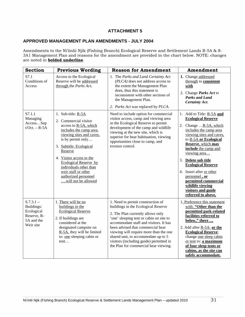
_________________________________________________________________________________________________________________________________________________________________________________________________________________________________________________________________________________________________________________________________________________________________________________________________________________________________________________________________
Ni’inlii Njik (Fishing Branch) Ecological Reserve & Settlement Lands Management Plan – updated 2010 31
ATTACHMENT 5
APPROVED MANAGEMENT PLAN AMENDMENTS - JULY 2004 Amendments to the Ni’iinlii Njik (Fishing Branch) Ecological Reserve and Settlement Lands R-5A & S-3A1 Management Plan and reasons for the amendment are provided in the chart below. NOTE: changes are noted in bolded underline. Section Previous Wording Reason for Amendment Amendment S7.1 Conditions of Access
Access to the Ecological Reserve will be addressed through the Parks Act.
1. The Parks and Land Certainty Act (PLCA) does not address access to the extent the Management Plan does, thus this statement is inconsistent with other sections of the Management Plan.
2. Parks Act was replaced by PLCA.
1. Change addressed through to consistent with
2. Change Parks Act to Parks and Land Certainty Act.
S7.1.1 Managing Access…Sept/Oct. – R-5A
1. Sub-title: R-5A
2. Commercial visitor access to R-5A, which includes the camp area, viewing sites and caves, is by permit only…
3. Subtitle: Ecological Reserve
4. Visitor access to the Ecological Reserve by individuals other than weir staff or other authorized personnel ….will not be allowed
Need to include option for commercial visitor access, camp and viewing area in the Ecological Reserve to permit development of the camp and wildlife viewing at the new site, which is superior for bear habituation, viewing opportunities close to camp, and erosion control.
1. Add to Title: R-5A and Ecological Reserve
2. Change …R-5A, which includes the camp area viewing sites and caves, to R-5A or Ecological Reserve, which may include the camp and viewing area…
3. Delete sub title Ecological Reserve
4. Insert after or other personnel , or permitted commercial wildlife viewing visitors and guide referred to above,
S.7.3.1 – Buildings: Ecological Reserve, R-5A and the Weir site
1. There will be no buildings in the Ecological Reserve.
2. If buildings are considered at the designated campsite on R-5A, they will be limited to: one sleeping cabin or tent…
1. Need to permit construction of buildings in the Ecological Reserve
2. The Plan currently allows only ‘one’ sleeping tent or cabin on site to accommodate staff and visitors. It has been advised that commercial bear viewing will require more than the one shared unit, to accommodate up to 5 visitors (including guide) permitted in the Plan for commercial bear viewing.
1. Preference this statement with: “Other than the permitted park-related facilities referred to below,” there …
2. Add after R-5A: or the Ecological Reserve; change one sleep cabin or tent to: a maximum of four sleep tents or cabins, as the site can safely accommodate.