to the Rampion Offshore Wind Farm public...
30
Thank you for coming along today. We aim to introduce you to all aspects of the Rampion Offshore Wind Farm proposal covering: • the offshore and onshore elements of the project • details about the proposed underground onshore cable route • the selection of the substation location • potential impacts during the construction and operation phases • how the offshore elements could look, shown from different viewpoints (photomontages) • the benefits of the project • an explanation of the consultation process and how we’ll consult with you. This is one of many opportunities to have your say on the project so why not: • talk to the project team directly • complete the community consultation questionnaire • view the photomontages. It’s important that you give us your feedback and comments before the consultation deadline of Sunday 6 May 2012, so we can consider them to help shape our proposal. to the Rampion Offshore Wind Farm public exhibition Welcome
Transcript of to the Rampion Offshore Wind Farm public...
1000MM X 700MM FOAMEX BOARD – ARTWORK SET TO 100%
Thank you for coming along today. We aim to introduce you to all
aspects of the Rampion Offshore Wind Farm proposal covering:
•the offshore and onshore elements of the project
•details about the proposed underground onshore cable route
•the selection of the substation location
•potential impacts during the construction and operation phases
•how the offshore elements could look, shown from different
viewpoints (photomontages)
•the benefits of the project
•an explanation of the consultation process and how we’ll
consult with you.
This is one of many opportunities to have your say on
the project so why not:
•talk to the project team directly
•complete the community consultation questionnaire
•view the photomontages.
It’s important that you give us your feedback and comments
before the consultation deadline of Sunday 6 May 2012, so we
can consider them to help shape our proposal.
totheRampionOffshoreWindFarmpublicexhibition
Welcome
1873_RAMPION EXHIB BOARDS_AW.indd 1 01/02/2012 12:53

1000MM X 700MM FOAMEX BOARD – ARTWORK SET TO 100%
About usWe’re one of the world’s largest power and gas companies.
Here in the UK, we supply energy to more than 5 million
customers, generate enough electricity for around 8 million
homes and employ 12,000 people.
We set up a global business in 2007 to develop, construct and
operate all of our renewable energy projects. We’re helping
to shape the energy industry of tomorrow and create secure,
sustainable energy supplies for future generations.
In the UK, we’re focusing on developing onshore and offshore
wind, biomass and marine energy technologies. At present, we
own and operate 18 onshore wind farms and 3 offshore wind
farms. Together, these have an installed capacity of more than
400 megawatts (MW).
Robin Rigg Offshore Wind Farm, Solway Firth. For illustrative purposes only.
1873_RAMPION EXHIB BOARDS_AW.indd 2 01/02/2012 12:53
1000MM X 700MM FOAMEX BOARD – ARTWORK SET TO 100%
Our offshore experienceWe were early pioneers in the UK’s offshore wind energy industry,
owning and operating the UK’s very first offshore wind farm at
Blyth in Northumberland.
We built and operate one of the country’s first commercial scale
projects, Scroby Sands in Great Yarmouth, which has 30 turbines
with an installed capacity of 60MW. Our third operational offshore
wind farm, the 180MW Robin Rigg project, was completed in 2010
and has 60 turbines. In February 2011, we received planning consent
to build the 219MW Humber Gateway Offshore Wind Farm off the
east coast of Yorkshire, which will be starting construction shortly.
Building the world’s largest offshore wind farmIn March 2011, we started laying the first of 177 foundations on
Phase One of London Array, an offshore wind farm project that
we’re undertaking with our partners DONG Energy and Masdar.
When fully complete, London Array will be the largest offshore
wind farm in the world.
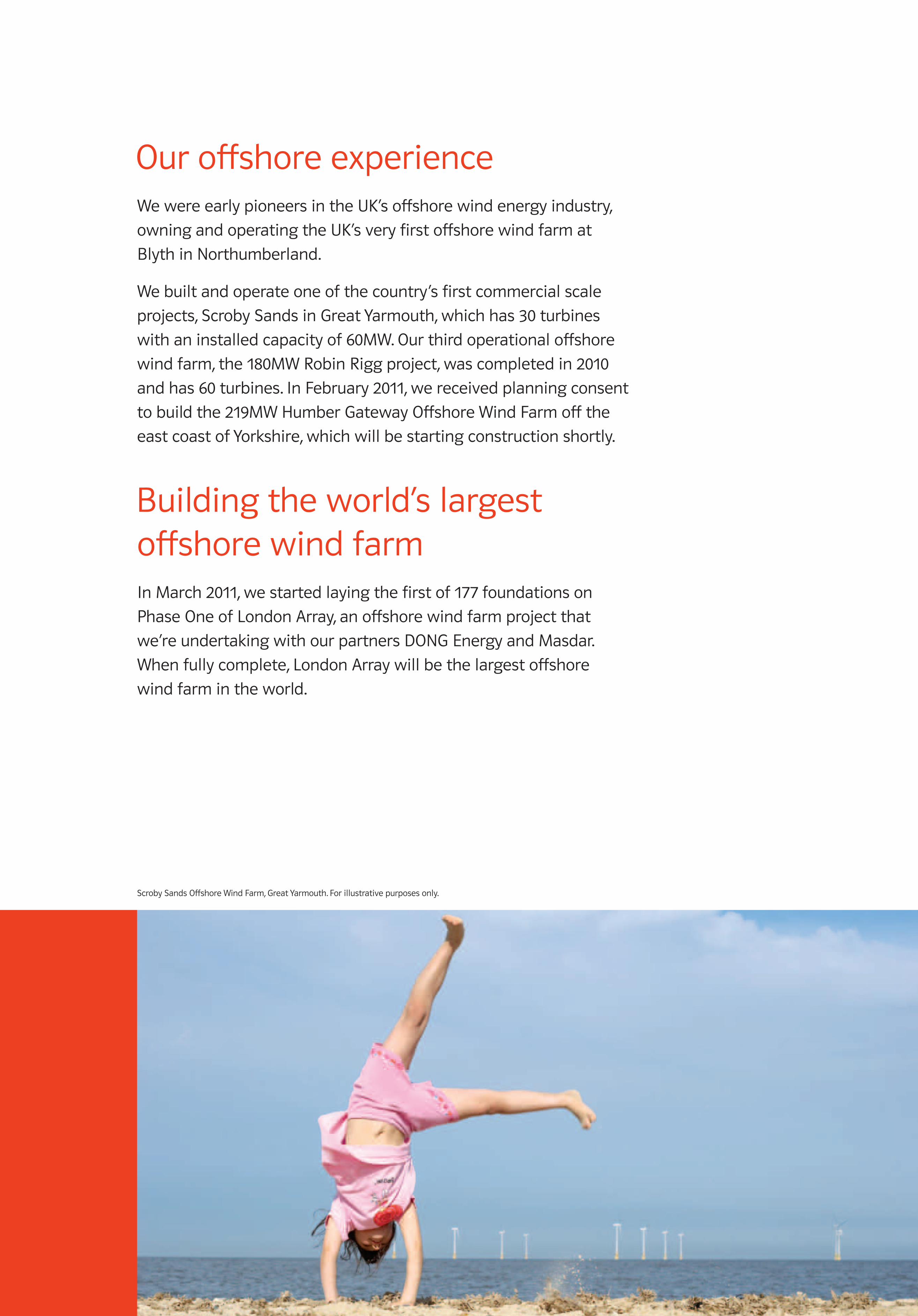
Scroby Sands Offshore Wind Farm, Great Yarmouth. For illustrative purposes only.
1873_RAMPION EXHIB BOARDS_AW.indd 3 01/02/2012 12:53
1000MM X 700MM FOAMEX BOARD – ARTWORK SET TO 100%
The UK’s energy gapFillingtheenergygap
Over the next 10 years, many of the older coal-fired and nuclear power stations
in the UK will close, resulting in a potential ‘energy gap’. We need to act now
to replace these power stations with cleaner, more effective solutions such
as renewable energy technologies. However, no single energy source holds the
answer on its own. That’s why we’re developing a range of generation methods,
with renewable energy sources such as wind, biomass, wave and tidal power.
Whyweneedoffshorewind
With its long coastlines and as one of Europe’s greatest wind resources, the
UK is uniquely placed to harvest offshore wind energy and lead the world in
offshore wind development.
Offshore wind is currently the only renewable energy technology which can
be built on a scale comparable to many conventional power stations, to achieve
the Government’s targets for producing renewable energy and reducing carbon
dioxide (CO2) emissions. It offers the additional benefits of higher than average
wind speeds and reduced turbulence, all leading to a greater energy yield.
Cleanerandbetterenergy
To help build a secure energy future, we need to change the way we think about
energy, from how we generate it, to how we use it in our homes and businesses.
As one of the UK’s leading electricity and gas companies we’re working hard to
make our operations cleaner and better. At the same time, we’re helping our
customers get ‘energy fit’ by giving them the tools they need to start saving
energy and money.
1873_RAMPION EXHIB BOARDS_AW.indd 4 01/02/2012 12:53
1000MM X 700MM FOAMEX BOARD – ARTWORK SET TO 100%
Background and historyThe Rampion site was identified following the Government’s
Offshore Energy Strategic Environmental Assessment (SEA),
which looked at the potential for new large-scale offshore
wind farms in UK waters. The SEA looked at a whole range
of environmental and technical criteria to establish the
area as suitable for wind farm development, including:
•wind speed
•water depth
•distance from shore
•major shipping lanes
•environmental designations
•other uses of seabed, eg aggregates extraction.
Nine zones were identified and The Crown Estate, which owns
the seabed around the UK, launched a tender process known
as ‘Round 3’, to award development rights. In January 2010, we
were awarded exclusive development rights in an area off the
Sussex coast, to seek to build and operate an offshore wind farm.
This was initially called Zone 6. A single offshore wind farm project
has now been defined within the zone. The Rampion site and its
associated offshore and onshore infrastructure form the basis
of this consultation.
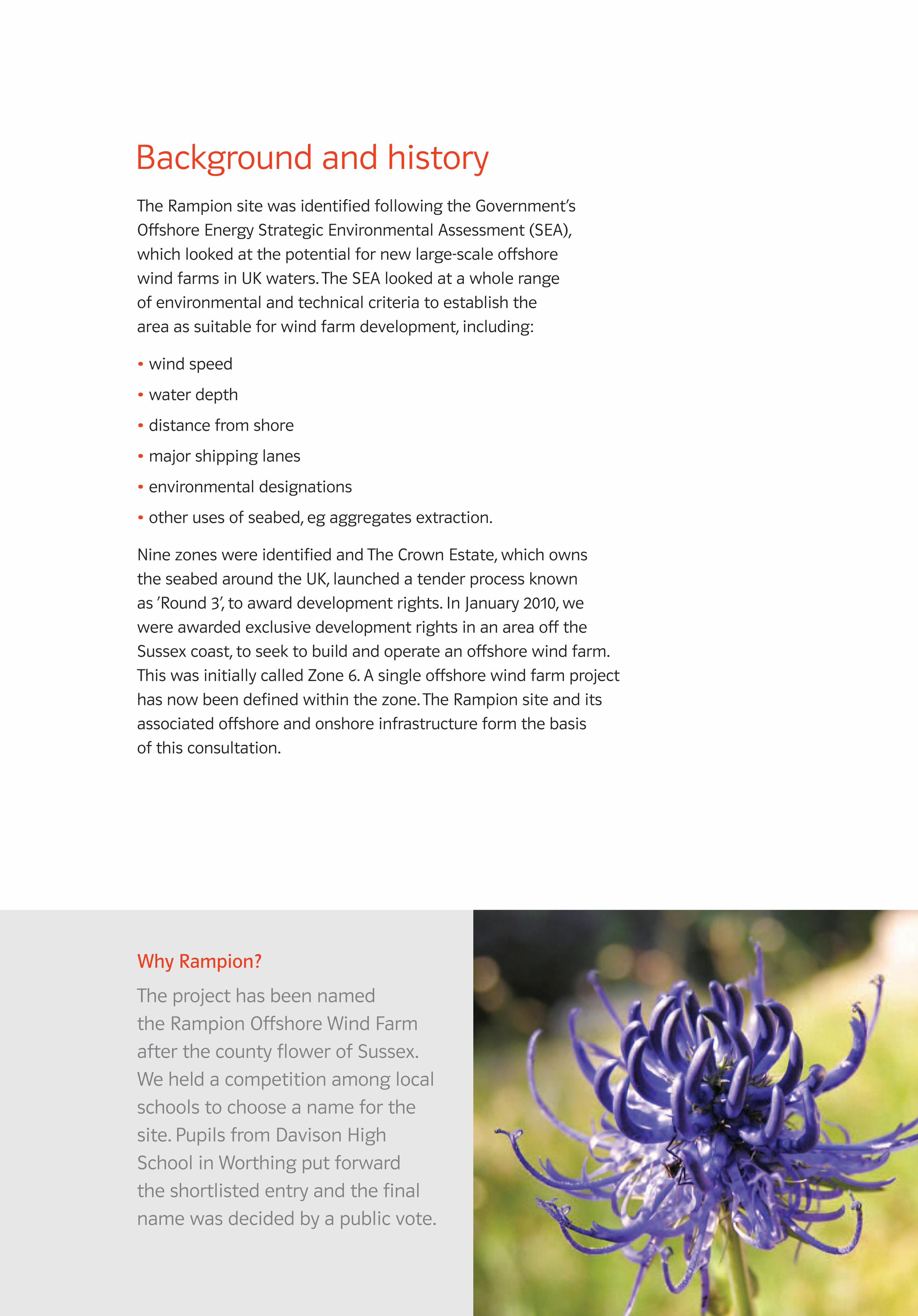
WhyRampion?
The project has been named
the Rampion Offshore Wind Farm
after the county flower of Sussex.
We held a competition among local
schools to choose a name for the
site. Pupils from Davison High
School in Worthing put forward
the shortlisted entry and the final
name was decided by a public vote.
1873_RAMPION EXHIB BOARDS_AW.indd 5 01/02/2012 12:53

1000MM X 700MM FOAMEX BOARD – ARTWORK SET TO 100%
What we’re proposingThe project has offshore and onshore elements:
Offshore
•turbines and foundations
•inter array cables
•two offshore substations
•offshore export cables.
Onshore
•cable ‘landfall’
•underground onshore cable route
•onshore substation.
Robin Rigg Offshore Wind Farm, Solway Firth. For illustrative purposes only.
1873_RAMPION EXHIB BOARDS_AW.indd 6 01/02/2012 12:53

1000MM X 700MM FOAMEX BOARD – ARTWORK SET TO 100%
Figure1–ProposeddevelopmentareaoftheRampionOffshoreWindFarm
The solid red line boundary defines the site location for the offshore wind turbines. However,
a potential additional development area (marked by a dashed red line) coincides with an area
over which The Crown Estate has granted an aggregates extraction option (shown as a yellow
hatched area), which is valid until 2013. For the purposes of this community consultation, and
in order that all issues can be addressed, consultees should therefore assume that a consent
application for turbines within the area bounded by the dashed red line, may be sought.
Onshorecableroute
Proposedoffshorewindfarmdevelopmentarea
Offshorecableroutesearcharea
Potentialadditionaldevelopmentarea
Onshoresubstationsearcharea
Aggregatesextractionoptionarea
Key
1 3
2
4
5
6
7
10
11
12
9
8
8a
Coordinate Longitude Latitude
1 -0.366 50.687
2 -0.229 50.707
3 -0.074 50.678
4 0.02 50.642
5 -0.144 50.612
6 -0.151 50.643
7 -0.262 50.619
8 -0.274 50.643
8a -0.388 50.601
9 -0.345 50.623
10 -0.349 50.809
11 -0.316 50.818
12 -0.209 50.775
CLIENT:
PROJECT:
TITLE:
File Reference:
Project No: Status/Rev:
Project No:
DESCRIPTIONREV BY DATE AUTHREV'WCHK'D
AUTHORISED:ORIGINATOR:
DATE:
REVIEWED:
DATE:
CHECKED:
DATE: DATE:
ORIGINAL SIZE:SCALE:
OFFICE:
Number:Discipline: Type:
Status/Rev:Number:
Discipline:Type:
Rampion Offshore Windfarm
3.6MW symmetric 7.6 x 7.6 spacingWTG Layout excl. Area 499195 Turbines, 2 Substations
1:150000A3
EPS
SWK
22-12-11
BF
22-12-11
BF
22-12-11
BF
22-12-11
5101821 SM 036 0SE
P:\GBBMA\Geospatial\Project\_Power\5099062 - EON Rampion Engineering Services\300 Project Data\310 Datasets\311 DWG
5101821-SE-SM-036-RevB0.dwg Allen, Kit 6/07/2012, 04:07 ISO full bleed A3 (420.00 x 297.00 MM)
_atkins half size.ctb
Atkins LimitedWoodcote GroveAshley RoadEpsom, SurreyKT18 5BWEngland
Telephone +44(0)1372 726 140Fax +44(0)1372 740 055
5101821-SE-SM-036-Rev05101821
0036
SMSE
© British Crown and SeaZone Solutions Limited. All rights reserved. Products Licence No. 042010.002.This product has been derived in part from material obtained from the UK Hydrographic Office with thepermission ofthe Controller of Her Majesty's Stationery Office and UK Hydrographic Office (www.ukho.gov.uk).“NOT TO BE USED FOR NAVIGATION”.
KEYProposed Development AreaPotential AdditionalDevelopment AreaCable Route AreaOffshore Substation AreaAggregates Option AreaMet Mast LocationLandfall LocationTurbine / Substation Locations
BFSK06-01-12KAClient Approved0BFSK06-01-12KAIssue to ClientB1BFKA22-12-11SKIssue to ClientBBFBF22-12-11SKInter Discipline ReviewA
BFBFBFBF
Notes:
Projected toWGS 1984 UTM Zone 30NTransverse MercatorFalse Easting: 500000.000000False Northing: 0.000000Central Meridian: -3.000000Scale Factor: 0.999600Latitude Of Origin: 0.000000
0 KILOMETRES1 5
© British Crown and SeaZone Solutions Limited. All rights reserved. Products Licence No. 042010.002. This product has been derived in part from material obtained from the UK Hydrographic Office with the permission of the Controller of Her Majesty’s Stationery Office and UK Hydrographic Office (ukho.gov.uk). NOT TO BE USED FOR NAVIGATION.
!!
!!
!!
!!
!!
!!
!!
!
!!
!!
!!
!
!!
!!
!!
!!
!!
!!
!!
!!!
!!
!!
!
Key
Onshore Cable Route
Proposed Development Area
Cable Route Area
!!
! ! ! !!!
!!!! Potential Additional Development Area
Onshore Substation Area of Search
Aggregates Option Area
´
Contains Ordnance Survey data © Crown copyright and database rights 2011.© British Crown and SeaZone Solutions Limited. All rights reserved. Products Licence No. 042010.002. This product has been derived in part from material obtained from the UK Hydrographic Office with the permission of the Controller of Her Majesty's Stationery Office and UK Hydrographic Office (www.ukho.gov.uk). “NOT TO BE USED FOR NAVIGATION”.
Status/Rev:Type:Discipline:
5107085 LY MP B1Project No: Number:
004
BY DATE CHK'D REV'W AUTH
KAKAKA
09-01-1205-01-1205-01-12
BFBFBF
SKSKSK
BFBFBF
REV DESCRIPTION
B1BA
For Client ReviewFor Client ReviewInter Discipline Review
File Reference:
5107085-LY-MP-004-RevB1
1 3
2
4
5
6
7
10
11
12
9
8
8a
Coordinate Longitude Latitude
1 -0.366 50.687
2 -0.229 50.707
3 -0.074 50.678
4 0.02 50.642
5 -0.144 50.612
6 -0.151 50.643
7 -0.262 50.619
8 -0.274 50.643
8a -0.388 50.601
9 -0.345 50.623
10 -0.349 50.809
11 -0.316 50.818
12 -0.209 50.775
CLIENT:
PROJECT:
TITLE:
File Reference:
Project No: Status/Rev:
Project No:
DESCRIPTIONREV BY DATE AUTHREV'WCHK'D
AUTHORISED:ORIGINATOR:
DATE:
REVIEWED:
DATE:
CHECKED:
DATE: DATE:
ORIGINAL SIZE:SCALE:
OFFICE:
Number:Discipline: Type:
Status/Rev:Number:
Discipline:Type:
Rampion Offshore Windfarm
3.6MW symmetric 7.6 x 7.6 spacingWTG Layout excl. Area 499195 Turbines, 2 Substations
1:150000A3
EPS
SWK
22-12-11
BF
22-12-11
BF
22-12-11
BF
22-12-11
5101821 SM 036 0SE
P:\GBBMA\Geospatial\Project\_Power\5099062 - EON Rampion Engineering Services\300 Project Data\310 Datasets\311 DWG
5101821-SE-SM-036-RevB0.dwg Allen, Kit 6/07/2012, 04:07 ISO full bleed A3 (420.00 x 297.00 MM)
_atkins half size.ctb
Atkins LimitedWoodcote GroveAshley RoadEpsom, SurreyKT18 5BWEngland
Telephone +44(0)1372 726 140Fax +44(0)1372 740 055
5101821-SE-SM-036-Rev05101821
0036
SMSE
© British Crown and SeaZone Solutions Limited. All rights reserved. Products Licence No. 042010.002.This product has been derived in part from material obtained from the UK Hydrographic Office with thepermission ofthe Controller of Her Majesty's Stationery Office and UK Hydrographic Office (www.ukho.gov.uk).“NOT TO BE USED FOR NAVIGATION”.
KEYProposed Development AreaPotential AdditionalDevelopment AreaCable Route AreaOffshore Substation AreaAggregates Option AreaMet Mast LocationLandfall LocationTurbine / Substation Locations
BFSK06-01-12KAClient Approved0BFSK06-01-12KAIssue to ClientB1BFKA22-12-11SKIssue to ClientBBFBF22-12-11SKInter Discipline ReviewA
BFBFBFBF
Notes:
Projected toWGS 1984 UTM Zone 30NTransverse MercatorFalse Easting: 500000.000000False Northing: 0.000000Central Meridian: -3.000000Scale Factor: 0.999600Latitude Of Origin: 0.000000
0 KILOMETRES1 5
1873_RAMPION EXHIB BOARDS_AW.indd 7 01/02/2012 12:53
1000MM X 700MM FOAMEX BOARD – ARTWORK SET TO 100%
Rampion project statisticsLocation – 13km to 23km off the Sussex coast
Site area – 167km2
Water depth – 19m to 50m
Installed electrical capacity – up to 700 megawatts (MW)
Turbine size – Turbines will have a generating capacity of between 3MW
and 7MW, with respective maximum height to tip of 180m and 210m.
Turbine numbers – Up to a maximum of 195 x 3MW or 3.6MW units.
For larger turbines, the number of units needed to generate 700MW
would vary.
Onshore works – A 27.8km underground cable route from the landfall
to the 400 kilovolts (kV) substation (owned by National Grid), around
2km south-west of Bolney village.
Power output – Based on our current expectations of the area’s wind
resource over the long-term, we estimate the site could generate more
than 2,100 gigawatt hours (GWh) of electricity each year*. In a typical
year, we estimate the project could generate enough electricity for the
domestic needs of the equivalent of around 450,000 homes#. That’s more
than two thirds of the homes in the whole of Sussex†, including the city
of Brighton and Hove.
* Based on wind speed data from our existing offshore wind farms in UK waters. This will be updated as Rampion site-specific data is gathered.
# Based on an average annual domestic household electricity consumption of 4,700kWh (DECC).
† Office of National Statistics census data.
Scroby Sands Offshore Wind Farm, Great Yarmouth. For illustrative purposes only.
1873_RAMPION EXHIB BOARDS_AW.indd 8 01/02/2012 12:53
1000MM X 700MM FOAMEX BOARD – ARTWORK SET TO 100%
1.Providingclean,renewableelectricityonalargescale
In a typical year, we estimate the Rampion Offshore Wind Farm
could generate enough electricity for the domestic needs of
the equivalent of around 450,000 homes# each year. This could
contribute to reducing the UK’s reliance on imported fuels,
help increase our security of supply and stabilise electricity
prices in the future.
2.ReducingCO2emissionsintheUK
We believe the Rampion project could avoid the emission of
over 920,000 tonnes† of CO2 each year, which would otherwise
have been released by conventional power stations.
3.Enhancingmarineecology
Environmental monitoring at operational wind farms has shown
that positive habitat changes in marine ecology can occur in and
around turbine foundations acting as a natural reef. We’re currently
monitoring the ecology at our Robin Rigg Offshore Wind Farm in
the Solway Firth, and a wide range of fish species are now being
found in the wind farm area.
# Based on an average annual domestic household electricity consumption of 4,700kWh (DECC).
† Every unit (kWh) of electricity produced by the wind displaces a unit of electricity, which would otherwise have been produced by a power station burning fossil fuel. This is a generally accepted fact used by many organisations including Government in their environmental calculations. Wind-generated electricity does not replace electricity from nuclear power stations because these operate at ‘base load’, that is they will be working for the whole time that they are available. The calculation is made using a static figure of 430g CO2/kWh representing the energy mix in the UK.
1873_RAMPION EXHIB BOARDS_AW.indd 9 01/02/2012 12:53

1000MM X 700MM FOAMEX BOARD – ARTWORK SET TO 100%
4.Boostingthelocaleconomy
The Rampion project will offer a boost to the local economy in a
number of ways. We will:
•create between 65 and 85 full-time, permanent jobs, mostly in the local area
•establish a permanent Operations and Maintenance (O&M) base at a local
port (we’re currently in discussions with Newhaven and Shoreham ports)
•use local companies to provide services, such as vessels, construction
activities and engineering consultancy
•create indirect benefits from our construction and operational activities,
such as increased revenue to hotels and local businesses
•raise awareness of the opportunities and timescales on which local
companies could tender for contracts on the project.
We’ll try to use local labour and services as much as possible during all phases
of the project. We currently employ a full-time member of staff in Brighton, and
use a number of local companies to provide vessels, consultancy services and
undertake ecological surveys to support the wind farm’s development.
5.Supportingtourism
Offshore wind farms may enhance tourism potential by providing a feature
of interest. Our Scroby Sands Offshore Wind Farm, off the coast of Great
Yarmouth in Norfolk, has operated a visitor centre on the promenade since
2004. In 2010, it attracted 40,000 visitors from both the local community and
holidaymakers visiting the area. Additionally, some local operators run boat
trips out to the wind farm.
Scroby Sands Offshore Wind Farm Visitor Centre, Great Yarmouth.
1873_RAMPION EXHIB BOARDS_AW.indd 10 01/02/2012 12:53
1000MM X 700MM FOAMEX BOARD – ARTWORK SET TO 100%
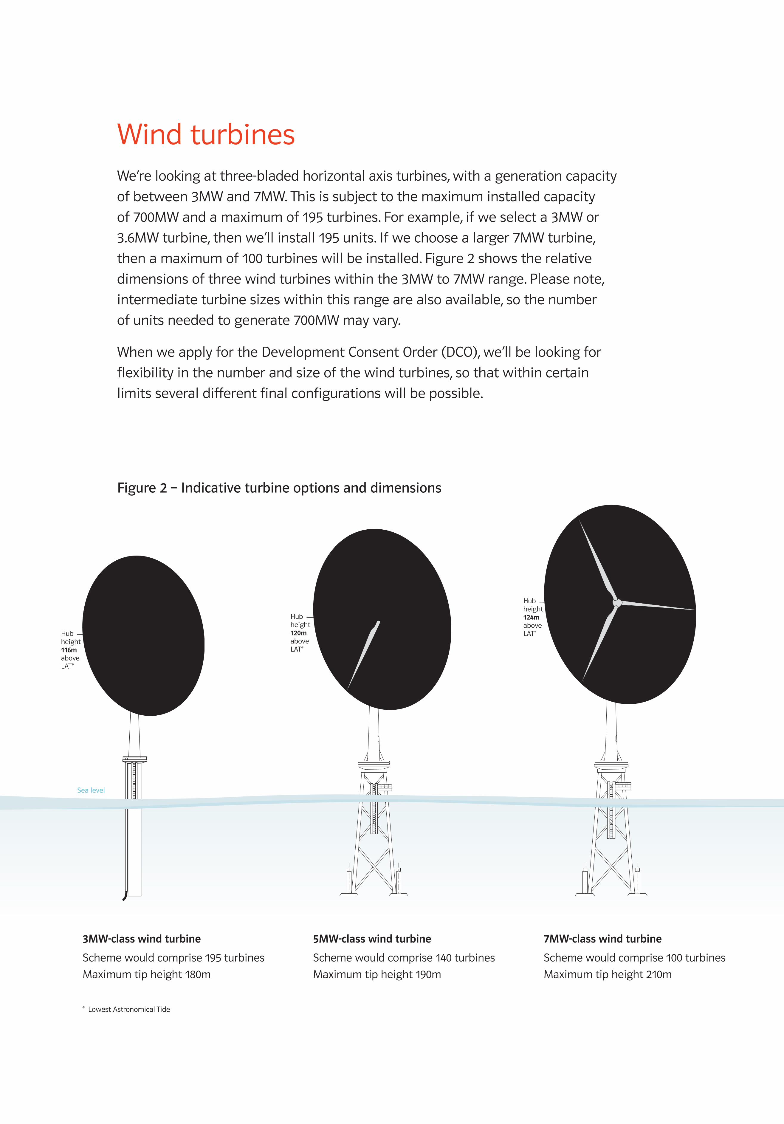
Wind turbinesWe’re looking at three-bladed horizontal axis turbines, with a generation capacity
of between 3MW and 7MW. This is subject to the maximum installed capacity
of 700MW and a maximum of 195 turbines. For example, if we select a 3MW or
3.6MW turbine, then we’ll install 195 units. If we choose a larger 7MW turbine,
then a maximum of 100 turbines will be installed. Figure 2 shows the relative
dimensions of three wind turbines within the 3MW to 7MW range. Please note,
intermediate turbine sizes within this range are also available, so the number
of units needed to generate 700MW may vary.
When we apply for the Development Consent Order (DCO), we’ll be looking for
flexibility in the number and size of the wind turbines, so that within certain
limits several different final configurations will be possible.
Maximum rotor diameter
172mMaximum rotor diameter
128mHub height116m aboveLAT*
Maximum rotor diameter
140mHub height120m aboveLAT*
Hub height124m aboveLAT*
Sea level
3MW-class wind turbine
Scheme would comprise 195 turbines
Maximum tip height 180m
5MW-class wind turbine
Scheme would comprise 140 turbines
Maximum tip height 190m
7MW-class wind turbine
Scheme would comprise 100 turbines
Maximum tip height 210m
Figure2–Indicativeturbineoptionsanddimensions
* Lowest Astronomical Tide
1873_RAMPION EXHIB BOARDS_AW.indd 11 01/02/2012 12:53
1000MM X 700MM FOAMEX BOARD – ARTWORK SET TO 100%
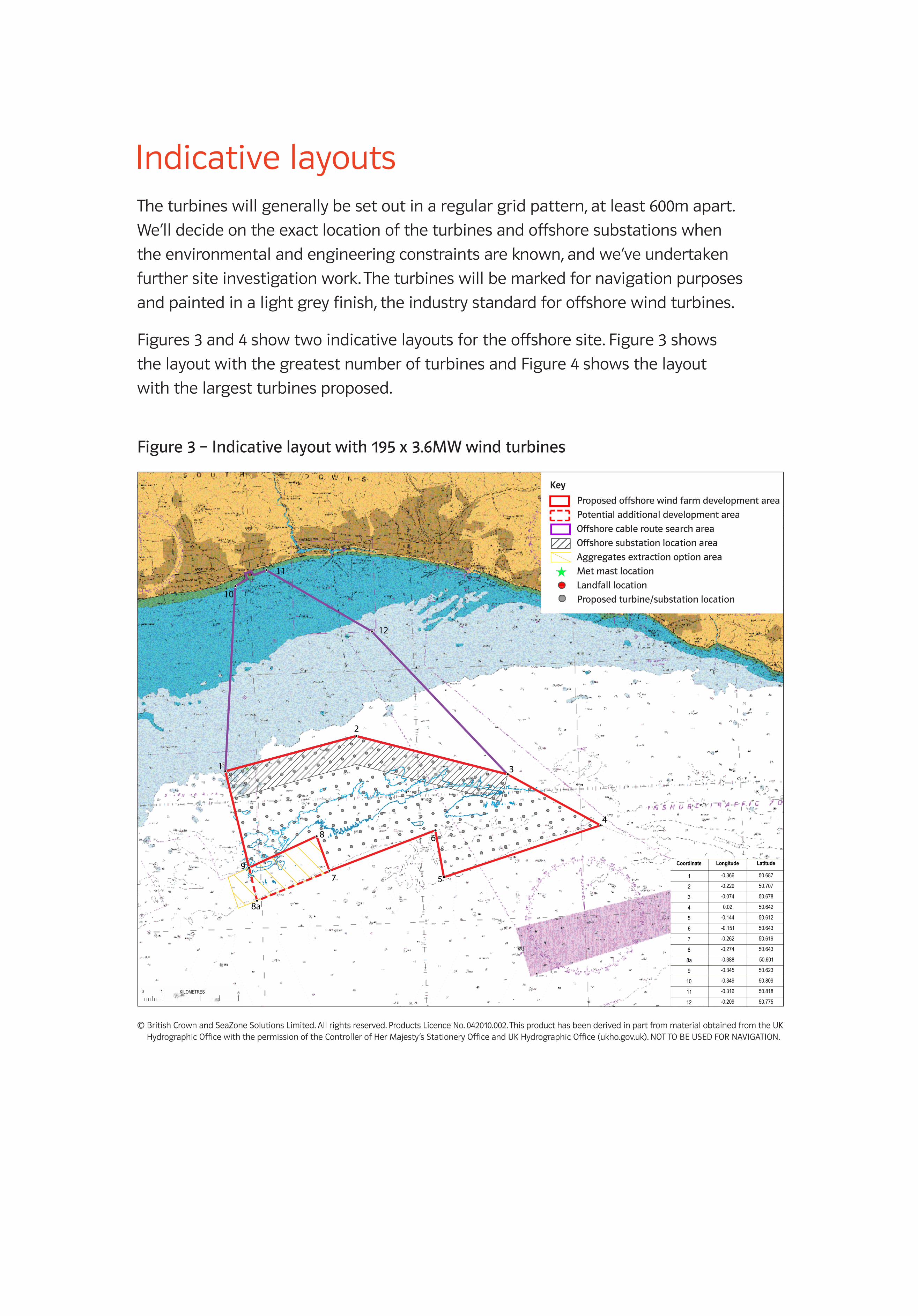
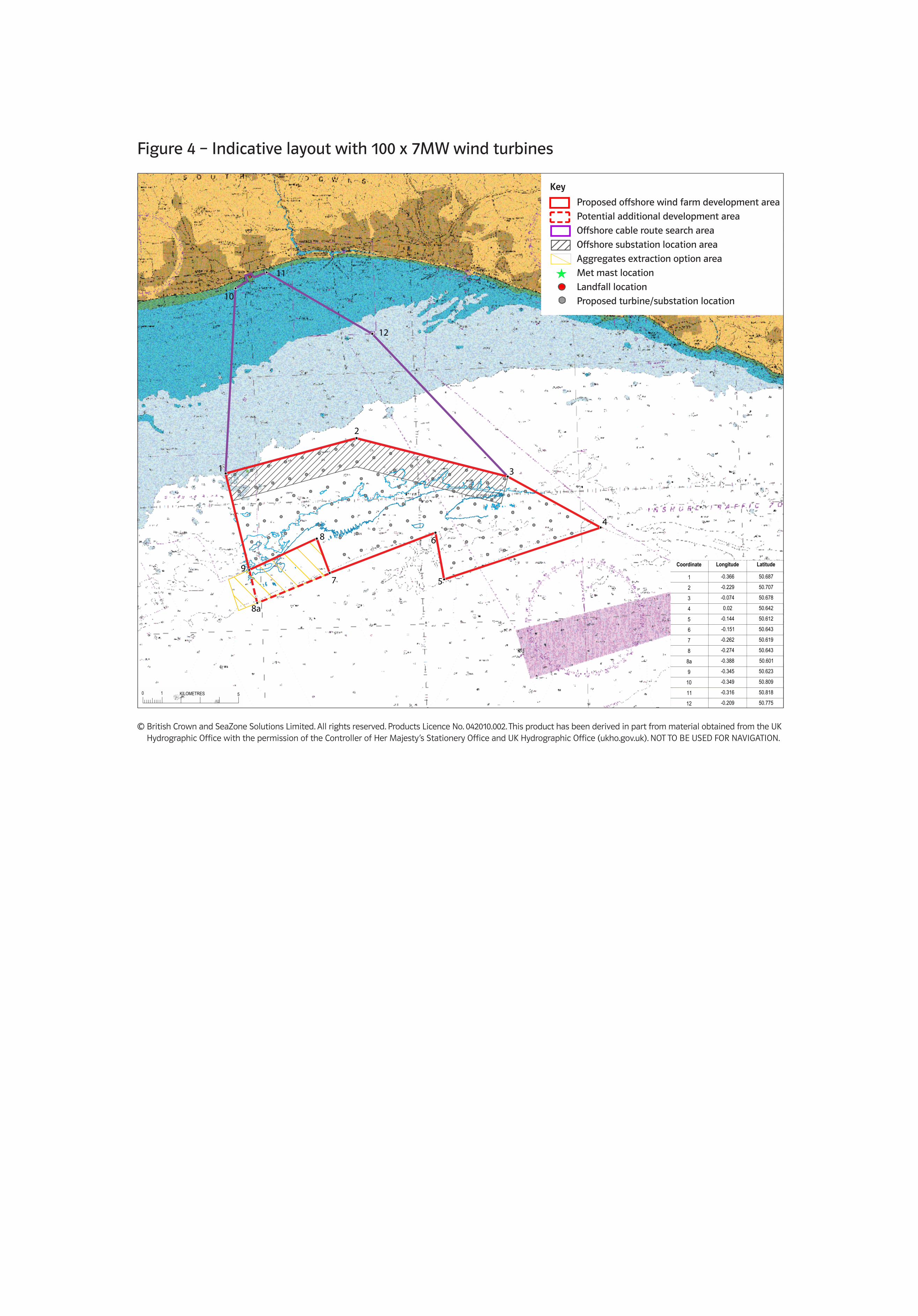
Indicative layoutsThe turbines will generally be set out in a regular grid pattern, at least 600m apart.
We’ll decide on the exact location of the turbines and offshore substations when
the environmental and engineering constraints are known, and we’ve undertaken
further site investigation work. The turbines will be marked for navigation purposes
and painted in a light grey finish, the industry standard for offshore wind turbines.
Figures 3 and 4 show two indicative layouts for the offshore site. Figure 3 shows
the layout with the greatest number of turbines and Figure 4 shows the layout
with the largest turbines proposed.
Figure3–Indicativelayoutwith195x3.6MWwindturbines
1 3
2
4
5
6
7
10
11
12
9
8
8a
Proposedoffshorewindfarmdevelopmentarea
Potentialadditionaldevelopmentarea
Offshorecableroutesearcharea
Offshoresubstationlocationarea
Aggregatesextractionoptionarea
Metmastlocation
Landfalllocation
Proposedturbine/substationlocation
Key
1 3
2
4
5
6
7
10
11
12
9
8
8a
Coordinate Longitude Latitude
1 -0.366 50.687
2 -0.229 50.707
3 -0.074 50.678
4 0.02 50.642
5 -0.144 50.612
6 -0.151 50.643
7 -0.262 50.619
8 -0.274 50.643
8a -0.388 50.601
9 -0.345 50.623
10 -0.349 50.809
11 -0.316 50.818
12 -0.209 50.775
CLIENT:
PROJECT:
TITLE:
File Reference:
Project No: Status/Rev:
Project No:
DESCRIPTIONREV BY DATE AUTHREV'WCHK'D
AUTHORISED:ORIGINATOR:
DATE:
REVIEWED:
DATE:
CHECKED:
DATE: DATE:
ORIGINAL SIZE:SCALE:
OFFICE:
Number:Discipline: Type:
Status/Rev:Number:
Discipline:Type:
Rampion Offshore Windfarm
3.6MW symmetric 7.6 x 7.6 spacingWTG Layout excl. Area 499195 Turbines, 2 Substations
1:150000A3
EPS
SWK
22-12-11
BF
22-12-11
BF
22-12-11
BF
22-12-11
5101821 SM 036 0SE
P:\GBBMA\Geospatial\Project\_Power\5099062 - EON Rampion Engineering Services\300 Project Data\310 Datasets\311 DWG
5101821-SE-SM-036-RevB0.dwg Allen, Kit 6/07/2012, 04:07 ISO full bleed A3 (420.00 x 297.00 MM)
_atkins half size.ctb
Atkins LimitedWoodcote GroveAshley RoadEpsom, SurreyKT18 5BWEngland
Telephone +44(0)1372 726 140Fax +44(0)1372 740 055
5101821-SE-SM-036-Rev05101821
0036
SMSE
© British Crown and SeaZone Solutions Limited. All rights reserved. Products Licence No. 042010.002.This product has been derived in part from material obtained from the UK Hydrographic Office with thepermission ofthe Controller of Her Majesty's Stationery Office and UK Hydrographic Office (www.ukho.gov.uk).“NOT TO BE USED FOR NAVIGATION”.
KEYProposed Development AreaPotential AdditionalDevelopment AreaCable Route AreaOffshore Substation AreaAggregates Option AreaMet Mast LocationLandfall LocationTurbine / Substation Locations
BFSK06-01-12KAClient Approved0BFSK06-01-12KAIssue to ClientB1BFKA22-12-11SKIssue to ClientBBFBF22-12-11SKInter Discipline ReviewA
BFBFBFBF
Notes:
Projected toWGS 1984 UTM Zone 30NTransverse MercatorFalse Easting: 500000.000000False Northing: 0.000000Central Meridian: -3.000000Scale Factor: 0.999600Latitude Of Origin: 0.000000
0 KILOMETRES1 5
© British Crown and SeaZone Solutions Limited. All rights reserved. Products Licence No. 042010.002. This product has been derived in part from material obtained from the UK Hydrographic Office with the permission of the Controller of Her Majesty’s Stationery Office and UK Hydrographic Office (ukho.gov.uk). NOT TO BE USED FOR NAVIGATION.
1 3
2
4
5
6
7
10
11
12
9
8
8a
Coordinate Longitude Latitude
1 -0.366 50.687
2 -0.229 50.707
3 -0.074 50.678
4 0.02 50.642
5 -0.144 50.612
6 -0.151 50.643
7 -0.262 50.619
8 -0.274 50.643
8a -0.388 50.601
9 -0.345 50.623
10 -0.349 50.809
11 -0.316 50.818
12 -0.209 50.775
CLIENT:
PROJECT:
TITLE:
File Reference:
Project No: Status/Rev:
Project No:
DESCRIPTIONREV BY DATE AUTHREV'WCHK'D
AUTHORISED:ORIGINATOR:
DATE:
REVIEWED:
DATE:
CHECKED:
DATE: DATE:
ORIGINAL SIZE:SCALE:
OFFICE:
Number:Discipline: Type:
Status/Rev:Number:
Discipline:Type:
Rampion Offshore Windfarm
3.6MW symmetric 7.6 x 7.6 spacingWTG Layout excl. Area 499195 Turbines, 2 Substations
1:150000A3
EPS
SWK
22-12-11
BF
22-12-11
BF
22-12-11
BF
22-12-11
5101821 SM 036 0SE
P:\GBBMA\Geospatial\Project\_Power\5099062 - EON Rampion Engineering Services\300 Project Data\310 Datasets\311 DWG
5101821-SE-SM-036-RevB0.dwg Allen, Kit 6/07/2012, 04:07 ISO full bleed A3 (420.00 x 297.00 MM)
_atkins half size.ctb
Atkins LimitedWoodcote GroveAshley RoadEpsom, SurreyKT18 5BWEngland
Telephone +44(0)1372 726 140Fax +44(0)1372 740 055
5101821-SE-SM-036-Rev05101821
0036
SMSE
© British Crown and SeaZone Solutions Limited. All rights reserved. Products Licence No. 042010.002.This product has been derived in part from material obtained from the UK Hydrographic Office with thepermission ofthe Controller of Her Majesty's Stationery Office and UK Hydrographic Office (www.ukho.gov.uk).“NOT TO BE USED FOR NAVIGATION”.
KEYProposed Development AreaPotential AdditionalDevelopment AreaCable Route AreaOffshore Substation AreaAggregates Option AreaMet Mast LocationLandfall LocationTurbine / Substation Locations
BFSK06-01-12KAClient Approved0BFSK06-01-12KAIssue to ClientB1BFKA22-12-11SKIssue to ClientBBFBF22-12-11SKInter Discipline ReviewA
BFBFBFBF
Notes:
Projected toWGS 1984 UTM Zone 30NTransverse MercatorFalse Easting: 500000.000000False Northing: 0.000000Central Meridian: -3.000000Scale Factor: 0.999600Latitude Of Origin: 0.000000
0 KILOMETRES1 5
1873_RAMPION EXHIB BOARDS_AW.indd 12 01/02/2012 12:53
1000MM X 700MM FOAMEX BOARD – ARTWORK SET TO 100%
Figure4–Indicativelayoutwith100x7MWwindturbines
1 3
2
4
5
6
7
10
11
12
9
8
8a
1 3
2
4
5
6
7
10
11
12
9
8
8a
Coordinate Longitude Latitude
1 -0.366 50.687
2 -0.229 50.707
3 -0.074 50.678
4 0.02 50.642
5 -0.144 50.612
6 -0.151 50.643
7 -0.262 50.619
8 -0.274 50.643
8a -0.388 50.601
9 -0.345 50.623
10 -0.349 50.809
11 -0.316 50.818
12 -0.209 50.775
CLIENT:
PROJECT:
TITLE:
File Reference:
Project No: Status/Rev:
Project No:
DESCRIPTIONREV BY DATE AUTHREV'WCHK'D
AUTHORISED:ORIGINATOR:
DATE:
REVIEWED:
DATE:
CHECKED:
DATE: DATE:
ORIGINAL SIZE:SCALE:
OFFICE:
Number:Discipline: Type:
Status/Rev:Number:
Discipline:Type:
Rampion Offshore Windfarm
3.6MW symmetric 7.6 x 7.6 spacingWTG Layout excl. Area 499195 Turbines, 2 Substations
1:150000A3
EPS
SWK
22-12-11
BF
22-12-11
BF
22-12-11
BF
22-12-11
5101821 SM 036 0SE
P:\GBBMA\Geospatial\Project\_Power\5099062 - EON Rampion Engineering Services\300 Project Data\310 Datasets\311 DWG
5101821-SE-SM-036-RevB0.dwg Allen, Kit 6/07/2012, 04:07 ISO full bleed A3 (420.00 x 297.00 MM)
_atkins half size.ctb
Atkins LimitedWoodcote GroveAshley RoadEpsom, SurreyKT18 5BWEngland
Telephone +44(0)1372 726 140Fax +44(0)1372 740 055
5101821-SE-SM-036-Rev05101821
0036
SMSE
© British Crown and SeaZone Solutions Limited. All rights reserved. Products Licence No. 042010.002.This product has been derived in part from material obtained from the UK Hydrographic Office with thepermission ofthe Controller of Her Majesty's Stationery Office and UK Hydrographic Office (www.ukho.gov.uk).“NOT TO BE USED FOR NAVIGATION”.
KEYProposed Development AreaPotential AdditionalDevelopment AreaCable Route AreaOffshore Substation AreaAggregates Option AreaMet Mast LocationLandfall LocationTurbine / Substation Locations
BFSK06-01-12KAClient Approved0BFSK06-01-12KAIssue to ClientB1BFKA22-12-11SKIssue to ClientBBFBF22-12-11SKInter Discipline ReviewA
BFBFBFBF
Notes:
Projected toWGS 1984 UTM Zone 30NTransverse MercatorFalse Easting: 500000.000000False Northing: 0.000000Central Meridian: -3.000000Scale Factor: 0.999600Latitude Of Origin: 0.000000
0 KILOMETRES1 5
© British Crown and SeaZone Solutions Limited. All rights reserved. Products Licence No. 042010.002. This product has been derived in part from material obtained from the UK Hydrographic Office with the permission of the Controller of Her Majesty’s Stationery Office and UK Hydrographic Office (ukho.gov.uk). NOT TO BE USED FOR NAVIGATION.
Proposedoffshorewindfarmdevelopmentarea
Potentialadditionaldevelopmentarea
Offshorecableroutesearcharea
Offshoresubstationlocationarea
Aggregatesextractionoptionarea
Metmastlocation
Landfalllocation
Proposedturbine/substationlocation
Key
1 3
2
4
5
6
7
10
11
12
9
8
8a
Coordinate Longitude Latitude
1 -0.366 50.687
2 -0.229 50.707
3 -0.074 50.678
4 0.02 50.642
5 -0.144 50.612
6 -0.151 50.643
7 -0.262 50.619
8 -0.274 50.643
8a -0.388 50.601
9 -0.345 50.623
10 -0.349 50.809
11 -0.316 50.818
12 -0.209 50.775
CLIENT:
PROJECT:
TITLE:
File Reference:
Project No: Status/Rev:
Project No:
DESCRIPTIONREV BY DATE AUTHREV'WCHK'D
AUTHORISED:ORIGINATOR:
DATE:
REVIEWED:
DATE:
CHECKED:
DATE: DATE:
ORIGINAL SIZE:SCALE:
OFFICE:
Number:Discipline: Type:
Status/Rev:Number:
Discipline:Type:
Rampion Offshore Windfarm
3.6MW symmetric 7.6 x 7.6 spacingWTG Layout excl. Area 499195 Turbines, 2 Substations
1:150000A3
EPS
SWK
22-12-11
BF
22-12-11
BF
22-12-11
BF
22-12-11
5101821 SM 036 0SE
P:\GBBMA\Geospatial\Project\_Power\5099062 - EON Rampion Engineering Services\300 Project Data\310 Datasets\311 DWG
5101821-SE-SM-036-RevB0.dwg Allen, Kit 6/07/2012, 04:07 ISO full bleed A3 (420.00 x 297.00 MM)
_atkins half size.ctb
Atkins LimitedWoodcote GroveAshley RoadEpsom, SurreyKT18 5BWEngland
Telephone +44(0)1372 726 140Fax +44(0)1372 740 055
5101821-SE-SM-036-Rev05101821
0036
SMSE
© British Crown and SeaZone Solutions Limited. All rights reserved. Products Licence No. 042010.002.This product has been derived in part from material obtained from the UK Hydrographic Office with thepermission ofthe Controller of Her Majesty's Stationery Office and UK Hydrographic Office (www.ukho.gov.uk).“NOT TO BE USED FOR NAVIGATION”.
KEYProposed Development AreaPotential AdditionalDevelopment AreaCable Route AreaOffshore Substation AreaAggregates Option AreaMet Mast LocationLandfall LocationTurbine / Substation Locations
BFSK06-01-12KAClient Approved0BFSK06-01-12KAIssue to ClientB1BFKA22-12-11SKIssue to ClientBBFBF22-12-11SKInter Discipline ReviewA
BFBFBFBF
Notes:
Projected toWGS 1984 UTM Zone 30NTransverse MercatorFalse Easting: 500000.000000False Northing: 0.000000Central Meridian: -3.000000Scale Factor: 0.999600Latitude Of Origin: 0.000000
0 KILOMETRES1 5
1 3
2
4
5
6
7
10
11
12
9
8
8a
Coordinate Longitude Latitude
1 -0.366 50.687
2 -0.229 50.707
3 -0.074 50.678
4 0.02 50.642
5 -0.144 50.612
6 -0.151 50.643
7 -0.262 50.619
8 -0.274 50.643
8a -0.388 50.601
9 -0.345 50.623
10 -0.349 50.809
11 -0.316 50.818
12 -0.209 50.775
CLIENT:
PROJECT:
TITLE:
File Reference:
Project No: Status/Rev:
Project No:
DESCRIPTIONREV BY DATE AUTHREV'WCHK'D
AUTHORISED:ORIGINATOR:
DATE:
REVIEWED:
DATE:
CHECKED:
DATE: DATE:
ORIGINAL SIZE:SCALE:
OFFICE:
Number:Discipline: Type:
Status/Rev:Number:
Discipline:Type:
Rampion Offshore Windfarm
3.6MW symmetric 7.6 x 7.6 spacingWTG Layout excl. Area 499195 Turbines, 2 Substations
1:150000A3
EPS
SWK
22-12-11
BF
22-12-11
BF
22-12-11
BF
22-12-11
5101821 SM 036 0SE
P:\GBBMA\Geospatial\Project\_Power\5099062 - EON Rampion Engineering Services\300 Project Data\310 Datasets\311 DWG
5101821-SE-SM-036-RevB0.dwg Allen, Kit 6/07/2012, 04:07 ISO full bleed A3 (420.00 x 297.00 MM)
_atkins half size.ctb
Atkins LimitedWoodcote GroveAshley RoadEpsom, SurreyKT18 5BWEngland
Telephone +44(0)1372 726 140Fax +44(0)1372 740 055
5101821-SE-SM-036-Rev05101821
0036
SMSE
© British Crown and SeaZone Solutions Limited. All rights reserved. Products Licence No. 042010.002.This product has been derived in part from material obtained from the UK Hydrographic Office with thepermission ofthe Controller of Her Majesty's Stationery Office and UK Hydrographic Office (www.ukho.gov.uk).“NOT TO BE USED FOR NAVIGATION”.
KEYProposed Development AreaPotential AdditionalDevelopment AreaCable Route AreaOffshore Substation AreaAggregates Option AreaMet Mast LocationLandfall LocationTurbine / Substation Locations
BFSK06-01-12KAClient Approved0BFSK06-01-12KAIssue to ClientB1BFKA22-12-11SKIssue to ClientBBFBF22-12-11SKInter Discipline ReviewA
BFBFBFBF
Notes:
Projected toWGS 1984 UTM Zone 30NTransverse MercatorFalse Easting: 500000.000000False Northing: 0.000000Central Meridian: -3.000000Scale Factor: 0.999600Latitude Of Origin: 0.000000
0 KILOMETRES1 5
1 3
2
4
5
6
7
10
11
12
9
8
8a
Coordinate Longitude Latitude
1 -0.366 50.687
2 -0.229 50.707
3 -0.074 50.678
4 0.02 50.642
5 -0.144 50.612
6 -0.151 50.643
7 -0.262 50.619
8 -0.274 50.643
8a -0.388 50.601
9 -0.345 50.623
10 -0.349 50.809
11 -0.316 50.818
12 -0.209 50.775
CLIENT:
PROJECT:
TITLE:
File Reference:
Project No: Status/Rev:
Project No:
DESCRIPTIONREV BY DATE AUTHREV'WCHK'D
AUTHORISED:ORIGINATOR:
DATE:
REVIEWED:
DATE:
CHECKED:
DATE: DATE:
ORIGINAL SIZE:SCALE:
OFFICE:
Number:Discipline: Type:
Status/Rev:Number:
Discipline:Type:
Rampion Offshore Windfarm
7.0MW symmetric 7.75 x7.75 spacingWTG Layout excl. Area 499100 Turbines, 2 Substations
1:150000A3
EPS
SWK
22-12-11
BF
22-12-11
BF
22-12-11
BF
22-12-11
5101821 SM 037 0VE
P:\GBBMA\Geospatial\Project\_Power\5099062 - EON Rampion Engineering Services\300 Project Data\310 Datasets\311 DWG
5101821-VE-SM-037-Rev0.dwg Allen, Kit 6/03/2012, 04:03 ISO full bleed A3 (420.00 x 297.00 MM)
_atkins half size.ctb
Atkins LimitedWoodcote GroveAshley RoadEpsom, SurreyKT18 5BWEngland
Telephone +44(0)1372 726 140Fax +44(0)1372 740 055
5101821-VE-SM-037-Rev05101821
0037
SMVE
© British Crown and SeaZone Solutions Limited. All rights reserved. Products Licence No. 042010.002.This product has been derived in part from material obtained from the UK Hydrographic Office with thepermission ofthe Controller of Her Majesty's Stationery Office and UK Hydrographic Office (www.ukho.gov.uk).“NOT TO BE USED FOR NAVIGATION”.
BFSK06-01-12KAClient Approved0BFSK06-01-12KAIssue to ClientB1BFKA22-12-11SKIssue to ClientBBFBF22-12-11SKInter Discipline ReviewA
BFBFBFBF
Notes:
Projected toWGS 1984 UTM Zone 30NTransverse MercatorFalse Easting: 500000.000000False Northing: 0.000000Central Meridian: -3.000000Scale Factor: 0.999600Latitude Of Origin: 0.000000
0 KILOMETRES1 5
KEYProposed Development AreaPotential AdditionalDevelopment AreaCable Route AreaOffshore Substation AreaAggregates Option AreaMet Mast LocationLandfall LocationTurbine / Substation Locations
1873_RAMPION EXHIB BOARDS_AW.indd 13 01/02/2012 12:53
1000MM X 700MM FOAMEX BOARD – ARTWORK SET TO 100%
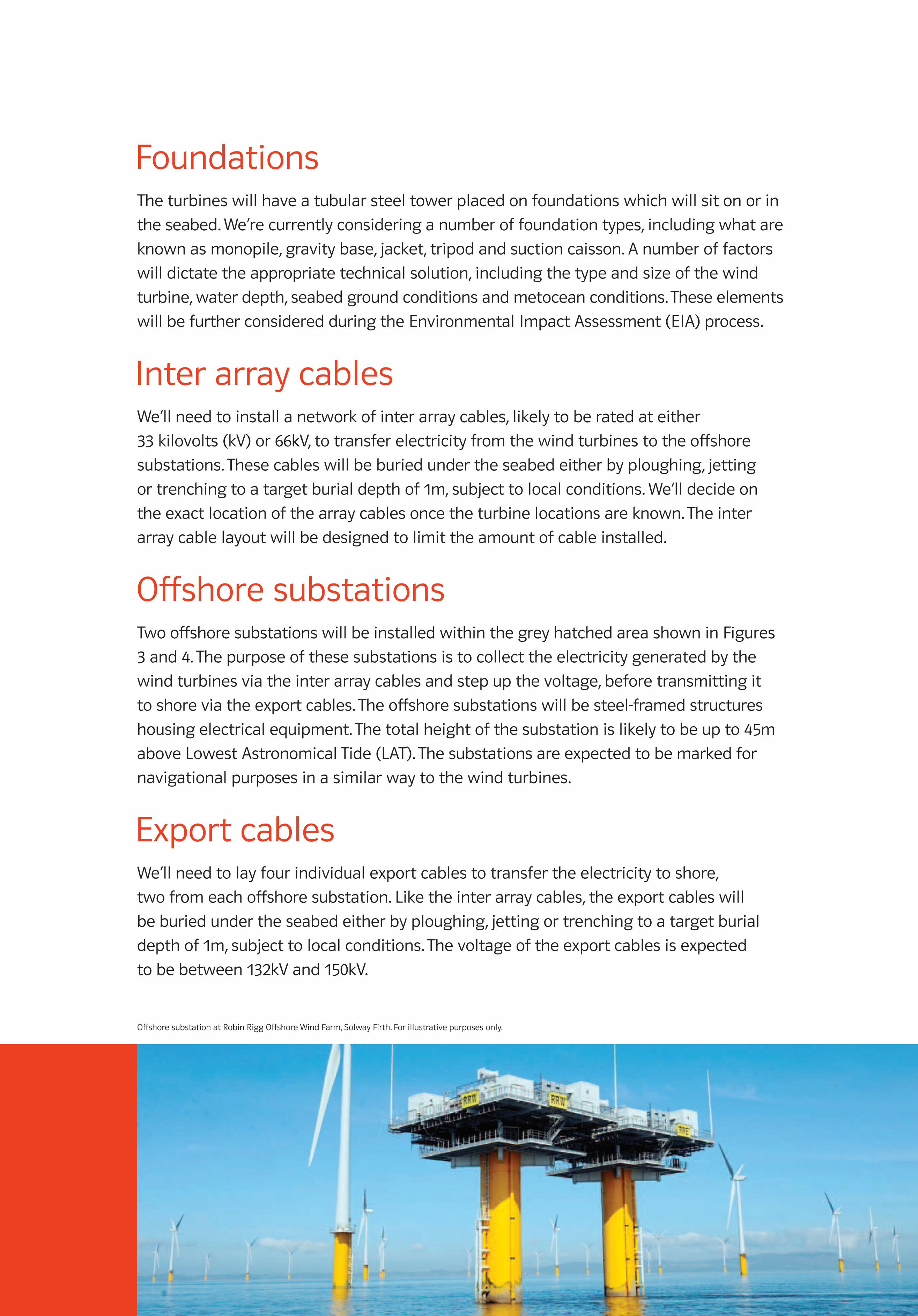
FoundationsThe turbines will have a tubular steel tower placed on foundations which will sit on or in
the seabed. We’re currently considering a number of foundation types, including what are
known as monopile, gravity base, jacket, tripod and suction caisson. A number of factors
will dictate the appropriate technical solution, including the type and size of the wind
turbine, water depth, seabed ground conditions and metocean conditions. These elements
will be further considered during the Environmental Impact Assessment (EIA) process.
Inter array cablesWe’ll need to install a network of inter array cables, likely to be rated at either
33 kilovolts (kV) or 66kV, to transfer electricity from the wind turbines to the offshore
substations. These cables will be buried under the seabed either by ploughing, jetting
or trenching to a target burial depth of 1m, subject to local conditions. We’ll decide on
the exact location of the array cables once the turbine locations are known. The inter
array cable layout will be designed to limit the amount of cable installed.
Offshore substationsTwo offshore substations will be installed within the grey hatched area shown in Figures
3 and 4. The purpose of these substations is to collect the electricity generated by the
wind turbines via the inter array cables and step up the voltage, before transmitting it
to shore via the export cables. The offshore substations will be steel-framed structures
housing electrical equipment. The total height of the substation is likely to be up to 45m
above Lowest Astronomical Tide (LAT). The substations are expected to be marked for
navigational purposes in a similar way to the wind turbines.
Export cablesWe’ll need to lay four individual export cables to transfer the electricity to shore,
two from each offshore substation. Like the inter array cables, the export cables will
be buried under the seabed either by ploughing, jetting or trenching to a target burial
depth of 1m, subject to local conditions. The voltage of the export cables is expected
to be between 132kV and 150kV.
Offshore substation at Robin Rigg Offshore Wind Farm, Solway Firth. For illustrative purposes only.
1873_RAMPION EXHIB BOARDS_AW.indd 14 01/02/2012 12:53

Construction of the offshore elementsDue to the scale of the project, it’s likely that offshore construction would be spread
over a period of two to three years from the initial works to full commercial operation.
A large jack-up barge would typically be used to install the foundations of the turbines
and offshore substations, whilst another barge would transport turbine components
to be lifted by crane and installed on to the foundations. We’re likely to carry out both
these activities, along with the offshore cabling works, at the same time. Figure 5
shows an installation sequence used at Scroby Sands Offshore Wind Farm based
on monopile foundations.
Decommissioning the wind farmIf the project is approved, a seabed lease would be granted for 50 years. The design
life of current wind turbine technology is typically 20-25 years, so at the end of this
period a decision would need to be made whether to refurbish the scheme, replace it
with newer turbine technology, or decommission the project. Any new turbines would
require a fresh consent application and supporting Environmental Impact Assessment.
Figure 5 – Construction technique previously used at
Scroby Sands Offshore Wind Farm, Great Yarmouth
Bottom tower
Monopile
Top tower
Hub
Turbine blade
Nacelle
Jack-up barge
1000MM X 700MM FOAMEX BOARD – ARTWORK SET TO 100%
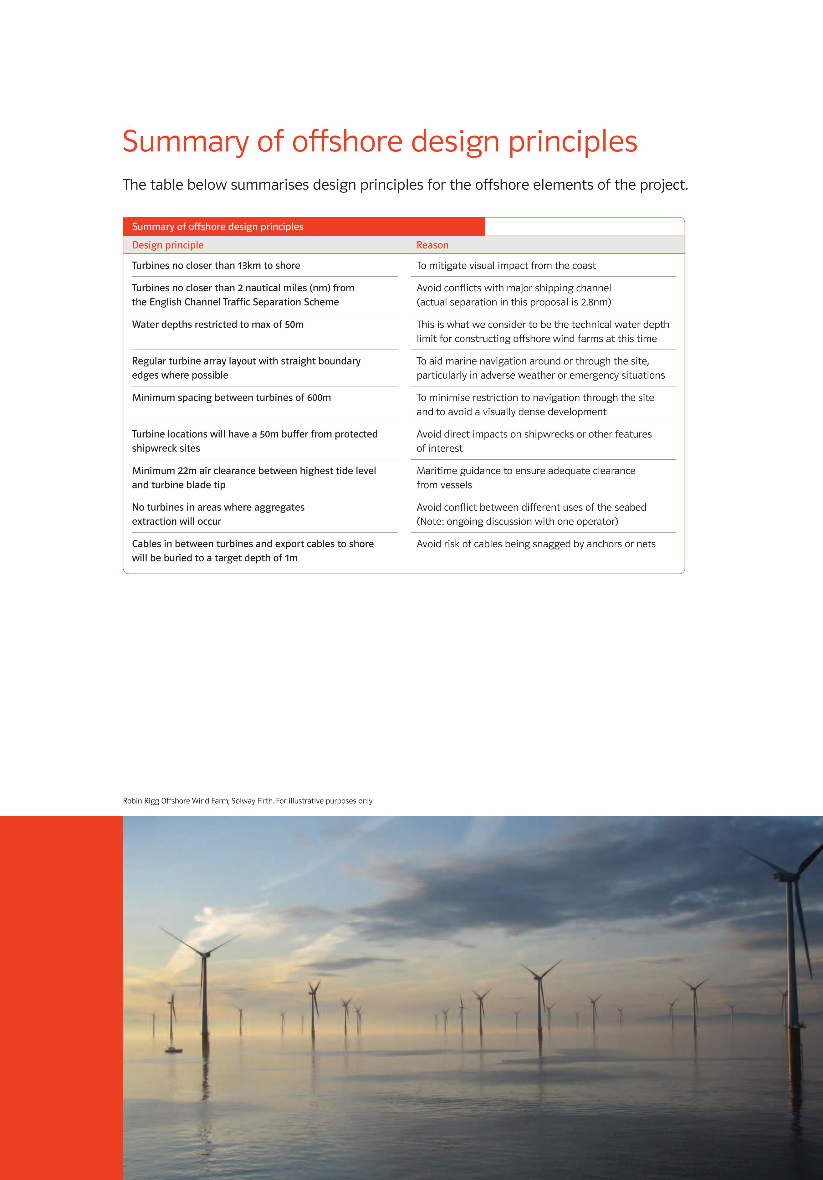
Summary of offshore design principlesThe table below summarises design principles for the offshore elements of the project.
Robin Rigg Offshore Wind Farm, Solway Firth. For illustrative purposes only.
Designprinciple Reason
Summaryofoffshoredesignprinciples
Turbinesnocloserthan13kmtoshore
Turbinesnocloserthan2nauticalmiles(nm)fromtheEnglishChannelTrafficSeparationScheme
Waterdepthsrestrictedtomaxof50m
Regularturbinearraylayoutwithstraightboundaryedgeswherepossible
Minimumspacingbetweenturbinesof600m
Turbinelocationswillhavea50mbufferfromprotectedshipwrecksites
Minimum22mairclearancebetweenhighesttidelevelandturbinebladetip
Noturbinesinareaswhereaggregatesextractionwilloccur
Cablesinbetweenturbinesandexportcablestoshorewillbeburiedtoatargetdepthof1m
To mitigate visual impact from the coast
Avoid conflicts with major shipping channel (actual separation in this proposal is 2.8nm)
This is what we consider to be the technical water depth limit for constructing offshore wind farms at this time
To aid marine navigation around or through the site, particularly in adverse weather or emergency situations
To minimise restriction to navigation through the site and to avoid a visually dense development
Avoid direct impacts on shipwrecks or other features of interest
Maritime guidance to ensure adequate clearance from vessels
Avoid conflict between different uses of the seabed (Note: ongoing discussion with one operator)
Avoid risk of cables being snagged by anchors or nets
1873_RAMPION EXHIB BOARDS_AW.indd 16 01/02/2012 12:53
1000MM X 700MM FOAMEX BOARD – ARTWORK SET TO 100%
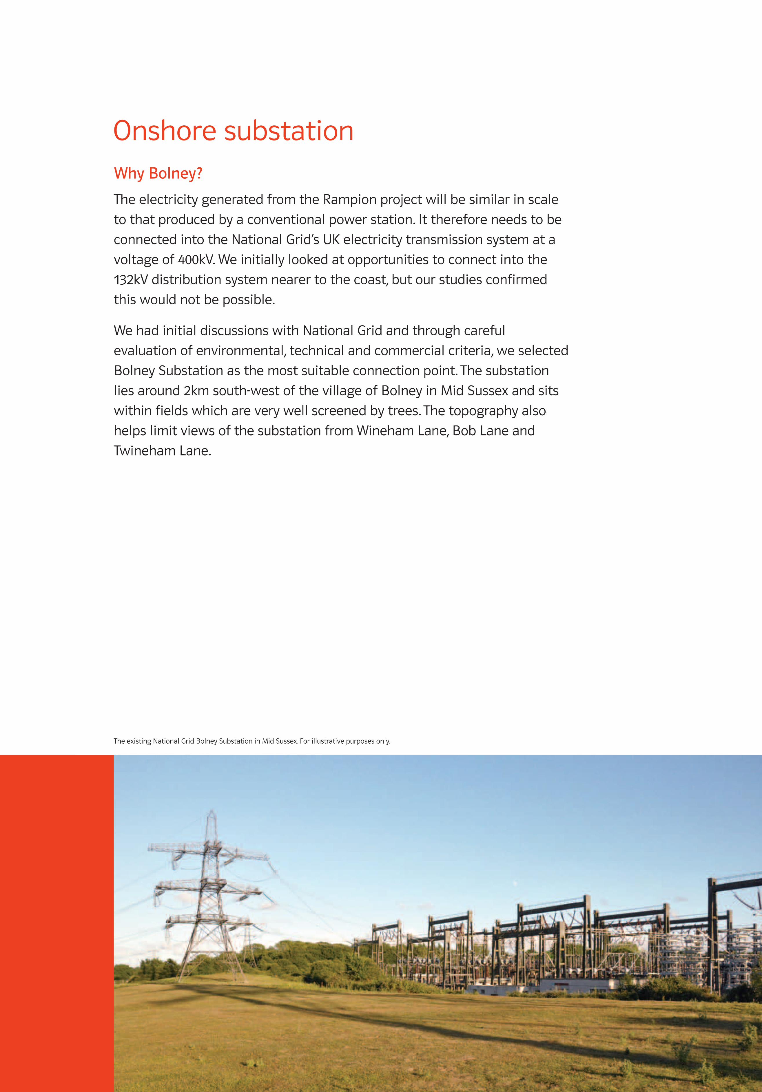
Onshore substationWhyBolney?
The electricity generated from the Rampion project will be similar in scale
to that produced by a conventional power station. It therefore needs to be
connected into the National Grid’s UK electricity transmission system at a
voltage of 400kV. We initially looked at opportunities to connect into the
132kV distribution system nearer to the coast, but our studies confirmed
this would not be possible.
We had initial discussions with National Grid and through careful
evaluation of environmental, technical and commercial criteria, we selected
Bolney Substation as the most suitable connection point. The substation
lies around 2km south-west of the village of Bolney in Mid Sussex and sits
within fields which are very well screened by trees. The topography also
helps limit views of the substation from Wineham Lane, Bob Lane and
Twineham Lane.
The existing National Grid Bolney Substation in Mid Sussex. For illustrative purposes only.
1873_RAMPION EXHIB BOARDS_AW.indd 17 01/02/2012 12:53
1000MM X 700MM FOAMEX BOARD – ARTWORK SET TO 100%
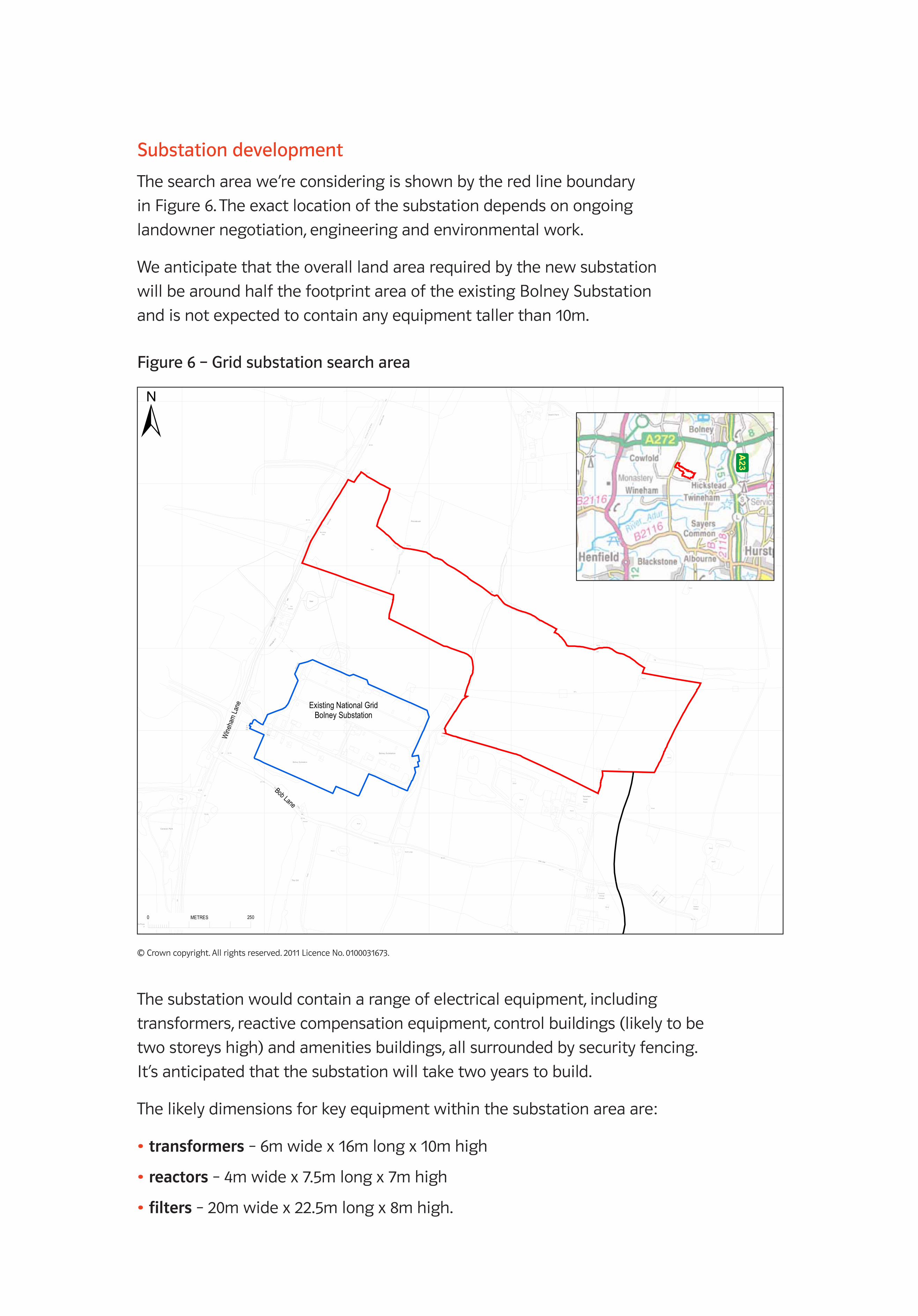
Substationdevelopment
The search area we’re considering is shown by the red line boundary
in Figure 6. The exact location of the substation depends on ongoing
landowner negotiation, engineering and environmental work.
We anticipate that the overall land area required by the new substation
will be around half the footprint area of the existing Bolney Substation
and is not expected to contain any equipment taller than 10m.
© Crown copyright. All rights reserved. 2011 Licence No. 0100031673.
Pond
BOB LANE
Tanks
Pond
BOB LANE
WIN
EH
AM L
ANE
Pond
Def
Pond
Downs
view
Woo
dpec
kers
ETL
Pond
Drain
FB
20.7m
Issues
Trac
k
The Gill
Twineham
FarmCourt
ETL
North Lodge
26.2m
Pond
26.1m
Grange
Tw ineham
Cottages
Pond
Pond
6
3
Twineham
Farm
Twineham Grange
Bolney Substation
Pond
29.0m
27.7m
Bolney Substation
Drain
Pond
Pond
SwallowCottage
20.1m
Pond
Pond
Pond
Night ingales
Old
Doctors
Pond
ETL
Pond
The Royal Oak(PH)
Drain
Path
(um
)
El
StaSub
GP
Ponds
Def
GP 33.5m
30.2m
Pond
Caravan Park
CR
WIN
EH
AM L
ANE
CS
CS
CP & E
D B
dy
Def
Co Const,
Track
Toll Copse
0.91
m R
H
BoundaryPos t
28.3m
Pond
Def
0.91m RHDef
Priorsbush
Issues
Pond
WIN
EH
AM L
ANE
29.6m
Co
Con
st, C
P &
ED
Bdy
Pond
Dawe's Farm
Dra
in
Pond
Pond
Pond
Sw imm ing Pool
HouseCoombe
CS
Drain
Ponds
Little Farm
The Bungalow
HouseLittle Combe Sw imm ing Pool
0.91
m R
H
Def
Existing National GridBolney Substation
Bob Lane
Wine
ham
Lane
523,600 523,800 524,000 524,200 524,400 524,600 524,800 525,000
120,
600
120,
800
121,
000
121,
200
121,
400
121,
600
121,
800
© Crown copyright, All rights reserved. 2011 License number 0100031673
±
PROJECTED TO:
British National GridProjection: Transverse_MercatorFalse_Easting: 400000.00000000False_Northing: -100000.00000000Central_Meridian: -2.00000000Scale_Factor: 0.99960127Latitude_Of_Origin: 49.00000000
ORIGINAL SIZE: ORIGINATOR: CHECKED: REVIEWED: AUTHORISED:SCALE:
OFFICE: DATE: DATE: DATE: DATE:
Status/Rev:Type:Discipline:Project No:
File Reference:
5099062 LY MP
A3
GBBMA
TITLE:
PROJECT:
CLIENT:
5099062-LY-MP-002-RevB
RAMPION OFFSHORE WINDFARM
SUBSTATION CONSULTATION BOUNDARY
1:5,000
REV DESCRIPTION BY DATE CHK'D REV'W AUTH
Atkins LimitedWoodcote GroveAshley RoadEpsom, SurreyKT18 5BWEngland
Telephone +44(0)1372 726 140Fax +44(0)1372 740 055
NOTES
1. DO NOT SCALE FROM THIS DRAWING.
Project No:Discipline:
Number:
Status/Rev:
5099062LY
MP
KEYProposed Cable RouteSubstation Area of SearchExisitng National Grid Substation
B2
B2
BF BFSKKA
21-12-11 21-12-11 21-12-11 21-12-11
Type:
002
Number:
002
B2B1BA
For Client ReviewFor Client ReviewFor Client ReviewInter Discipline Review
SKKAKAKA
18-01-1206-01-1205-01-1221-12-11
KASKSKSK
BFBFBFBF
BFBFBFBF
P:\GBBMA\Geospatial\Project\_Power\5099062 - EON Rampion Engineering Services\300 Project Data\310 Datasets\314 MXD\5099062-LY-MP-002_RevB2.mxd
0 250METRES
A23
Pond
BOB LANE
Tanks
Pond
BOB LANE
WIN
EH
AM L
ANE
Pond
Def
Pond
Downs
view
Woo
dpec
kers
ETL
Pond
Drain
FB
20.7m
Issues
Trac
k
The Gill
Twineham
FarmCourt
ETL
North Lodge
26.2m
Pond
26.1m
Grange
Tw ineham
Cottages
Pond
Pond
6
3
Twineham
Farm
Twineham Grange
Bolney Substation
Pond
29.0m
27.7m
Bolney Substation
Drain
Pond
Pond
SwallowCottage
20.1m
Pond
Pond
Pond
Night ingales
Old
Doctors
Pond
ETL
Pond
The Royal Oak(PH)
Drain
Path
(um
)
El
StaSub
GP
Ponds
Def
GP 33.5m
30.2m
Pond
Caravan Park
CR
WIN
EH
AM L
ANE
CS
CS
CP & E
D B
dy
Def
Co Const,
Track
Toll Copse
0.91
m R
H
BoundaryPos t
28.3m
Pond
Def
0.91m RHDef
Priorsbush
Issues
Pond
WIN
EH
AM L
ANE
29.6m
Co
Con
st, C
P &
ED
Bdy
Pond
Dawe's Farm
Dra
in
Pond
Pond
Pond
Sw imm ing Pool
HouseCoombe
CS
Drain
Ponds
Little Farm
The Bungalow
HouseLittle Combe Sw imm ing Pool
0.91
m R
H
Def
Existing National GridBolney Substation
Bob Lane
Wine
ham
Lane
523,600 523,800 524,000 524,200 524,400 524,600 524,800 525,000
120,
600
120,
800
121,
000
121,
200
121,
400
121,
600
121,
800
© Crown copyright, All rights reserved. 2011 License number 0100031673
±
PROJECTED TO:
British National GridProjection: Transverse_MercatorFalse_Easting: 400000.00000000False_Northing: -100000.00000000Central_Meridian: -2.00000000Scale_Factor: 0.99960127Latitude_Of_Origin: 49.00000000
ORIGINAL SIZE: ORIGINATOR: CHECKED: REVIEWED: AUTHORISED:SCALE:
OFFICE: DATE: DATE: DATE: DATE:
Status/Rev:Type:Discipline:Project No:
File Reference:
5099062 LY MP
A3
GBBMA
TITLE:
PROJECT:
CLIENT:
5099062-LY-MP-002-RevB
RAMPION OFFSHORE WINDFARM
SUBSTATION CONSULTATION BOUNDARY
1:5,000
REV DESCRIPTION BY DATE CHK'D REV'W AUTH
Atkins LimitedWoodcote GroveAshley RoadEpsom, SurreyKT18 5BWEngland
Telephone +44(0)1372 726 140Fax +44(0)1372 740 055
NOTES
1. DO NOT SCALE FROM THIS DRAWING.
Project No:Discipline:
Number:
Status/Rev:
5099062LY
MP
KEYProposed Cable RouteSubstation Area of SearchExisitng National Grid Substation
B2
B2
BF BFSKKA
21-12-11 21-12-11 21-12-11 21-12-11
Type:
002
Number:
002
B2B1BA
For Client ReviewFor Client ReviewFor Client ReviewInter Discipline Review
SKKAKAKA
18-01-1206-01-1205-01-1221-12-11
KASKSKSK
BFBFBFBF
BFBFBFBF
P:\GBBMA\Geospatial\Project\_Power\5099062 - EON Rampion Engineering Services\300 Project Data\310 Datasets\314 MXD\5099062-LY-MP-002_RevB2.mxd
0 250METRES
A23
Figure6–Gridsubstationsearcharea
The substation would contain a range of electrical equipment, including
transformers, reactive compensation equipment, control buildings (likely to be
two storeys high) and amenities buildings, all surrounded by security fencing.
It’s anticipated that the substation will take two years to build.
The likely dimensions for key equipment within the substation area are:
•transformers – 6m wide x 16m long x 10m high
•reactors – 4m wide x 7.5m long x 7m high
•filters – 20m wide x 22.5m long x 8m high.
1873_RAMPION EXHIB BOARDS_AW.indd 18 01/02/2012 12:53
700MM x 1000MM FOAMEX BOARD – ARTWORK SET TO 100%
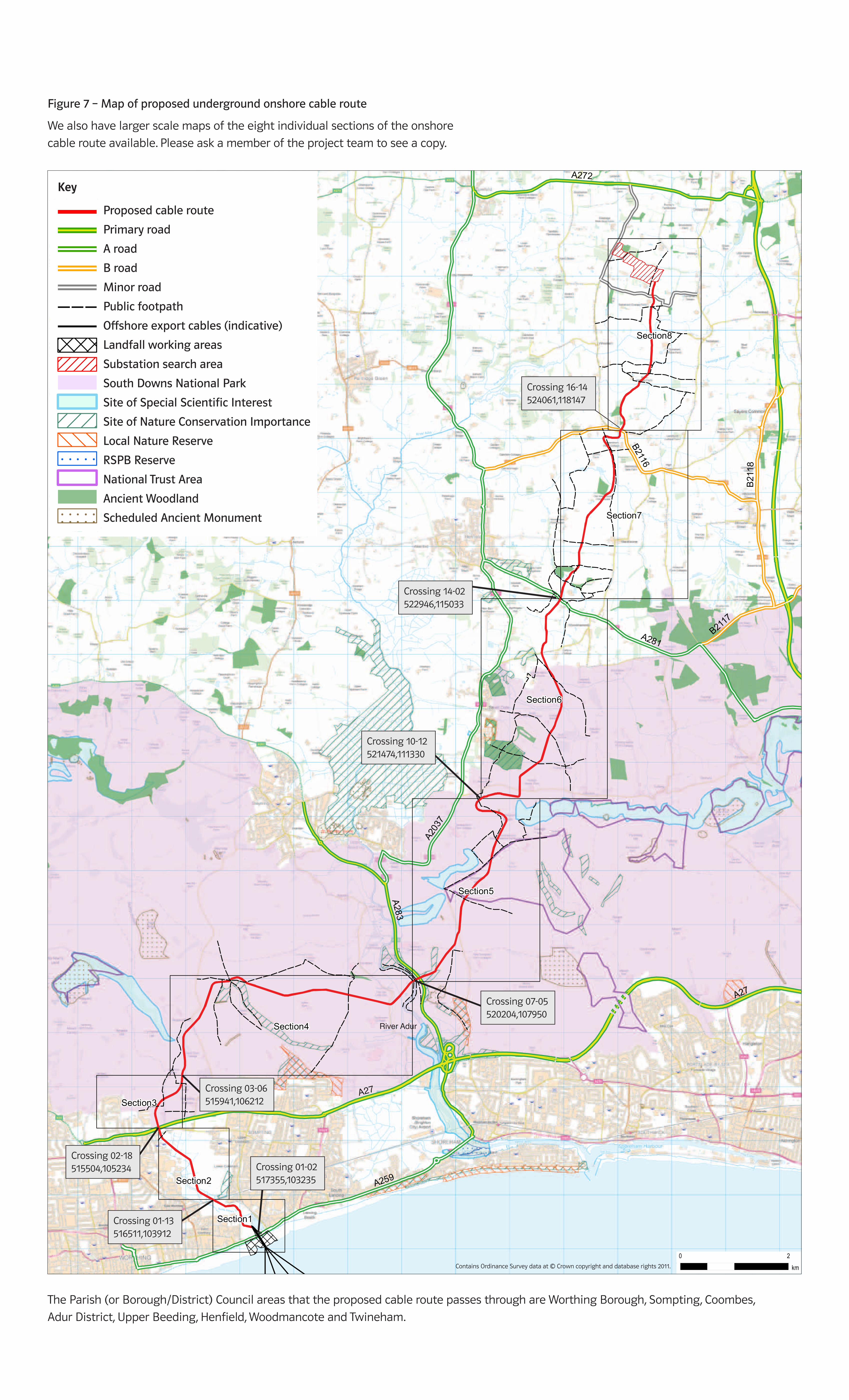
Onshore cable routeFigure 7 shows the proposed cable route, which is 27.8km long. We would lay the
cable underground for the whole route, to avoid the long-term visual impacts from
an overhead connection.
Section 1
At the preferred landfall location, the proposed cable would be drilled under the beach,
the sea defences and underneath the A259 between East Worthing and Lancing, before
continuing under parts of the Brooklands Pleasure Park, Pitch and Putt, and Par 3 Golf
Course. The route passes close to the Southern Water works before crossing into open
space. It generally runs alongside the route of the new cycle path, until it passes under
an overgrown former landfill site.
Sections 2, 3 and 4
From here, the cable would be drilled under the railway and head north through open
land towards the A27 Sompting Bypass where another drilled section will be installed
under this major road. At this point, the cable route enters the South Downs National
Park and then heads generally north-east, avoiding the Site of Special Scientific Interest
(SSSI) at Steep Down. It then heads directly east to cross the River Adur, south of the
disused cement works.
Section 5
The route gradually ascends towards Beeding Hill. Beyond this point is the most
constrained part of the route, particularly at Tottington Mount where the route crosses
the hilltop, before taking a U-shaped course to maintain workable slope inclines. There
is a Scheduled Ancient Monument (SAM) here, a Bronze Age Cross Dyke, which the cable
can’t avoid due to slopes on either side. We held a meeting on site with English Heritage
to discuss a suitable methodology to limit the impact and agree further investigations to
understand more about this feature. The route then descends from the South Downs into
the open plain to the north and towards the Low Weald.
Sections 6 and 7
The route passes through generally open farmland, avoiding a Site of Nature Conservation
Importance (SNCI) and ancient woodland near Small Dole. The proposed route crosses
the A281 at a point between Henfield to the west and Woodmancote to the east. It then
heads north, passing to the west of Blackstone before reaching the B2116.
Section 8
The cable route then heads directly north, keeping around the same distance from
Wineham in the west and Twineham to the east, before crossing under Bob Lane and
then reaching land next to Bolney Substation. At that point, it will connect into a new
dedicated Rampion substation for connection to the National Grid.
900MM X 1485MM FOAMEX BOARD – ARTWORK SET TO 100%
Figure 7 – Map of proposed underground onshore cable route
We also have larger scale maps of the eight individual sections of the onshore
cable route available. Please ask a member of the project team to see a copy.
The Parish (or Borough/District) Council areas that the proposed cable route passes through are Worthing Borough, Sompting, Coombes,
Adur District, Upper Beeding, Henfield, Woodmancote and Twineham.
A281
A272
A2037
B2116
A27
A283
A259
A23
B2117
B2118
Section6
Section4
Section5
Section7
Section8
Section2
Section3
Section1
A27
River Adur
Crossing 16-14524061,118147
Crossing 14-02522946,115033
Crossing 10-12521474,111330
Crossing 07-05520204,107950
Crossing 03-06515941,106212
Crossing 02-18515504,105234
Crossing 01-13516511,103912
Crossing 01-02517355,103235
A281
A272
A203
7
B2116
A27
A283
A259
A23
B2117
B21
18
Section6
Section4
Section5
Section7
Section8
Section2
Section3
Section1
520000
1100
00
1100
00
1200
00
1200
00
Contains Ordnance Survey data © Crown copyright and database rights 2011.
0 2
km
ORIGINAL SIZE: ORIGINATOR: CHECKED: REVIEWED: AUTHORISED:SCALE:
OFFICE: DATE: DATE: DATE: DATE:
Status/Rev:Type:Discipline:
5107085 GS DG
A3
GBBMA1:60,000
1
BF BFSKKA
20-12-11 20-12-11 20-12-11 20-12-11
File Reference:
5107085-GS-DG-002-Rev1
MILLIMETRES0 10 50Atkins LimitedWoodcote GroveAshley RoadEpsom, SurreyKT18 5BWEngland
Telephone +44(0)1372 726 140Fax +44(0)1372 740 055
PROJECT:
RAMPION OFFSHORE WINDFARMTITLE:
ONSHORE CABLE ROUTETRANSPORT ACCESS ANDCONSTRAINTS
CLIENT:
Project No:
BY DATE CHK'D REV'W AUTHREV DESCRIPTION
±
Number:
001
NOTES
1. DO NOT SCALE FROM THIS DRAWING.
PROJECTED TO:
British_National_GridProjection: Transverse_MercatorFalse_Easting: 400000.000000False_Northing: -100000.000000Central_Meridian: -2.000000Scale_Factor: 0.999601Latitude_Of_Origin: 49.000000
KEYProposed Cable RoutePrimary RoadA RoadB RoadMinor RoadPublic FootpathExport Cables (Indicative)Landfall Working AreasSubstation Area of SearchSouth Downs National ParkSSSISNCILocal Nature Reserve
! ! ! ! ! !
! ! ! ! ! !
! ! ! ! ! !
RSPB ReserveNational Trust AreaAncient Woodland
! ! ! ! ! !
! ! ! ! ! !
! ! ! ! ! ! Scheduled Monument
10BA
Client ApprovedClient ApprovedFor Client ReviewInter Discipline Review
KAKAKAKA
09-01-1222-12-1120-12-1120-12-11
BFBFBFBF
SKSKSKSK
P:\GBBMA\Geospatial\Project\_Power\5099062 - EON Rampion Engineering Services\300 Project Data\310 Datasets\314 MXD\5107085-GS-DG-002-Rev1.mxd
BFBFBFBF
Key
Crossing 16-14524061,118147
Crossing 14-02522946,115033
Crossing 10-12521474,111330
Crossing 07-05520204,107950
Crossing 03-06515941,106212
Crossing 02-18515504,105234
Crossing 01-13516511,103912
Crossing 01-02517355,103235
A281
A272
A203
7
B2116
A27
A283
A259
A23
B2117
B21
18
Section6
Section4
Section5
Section7
Section8
Section2
Section3
Section1
520000
1100
00
1100
00
1200
00
1200
00
Contains Ordnance Survey data © Crown copyright and database rights 2011.
0 2
km
ORIGINAL SIZE: ORIGINATOR: CHECKED: REVIEWED: AUTHORISED:SCALE:
OFFICE: DATE: DATE: DATE: DATE:
Status/Rev:Type:Discipline:
5107085 GS DG
A3
GBBMA1:60,000
1
BF BFSKKA
20-12-11 20-12-11 20-12-11 20-12-11
File Reference:
5107085-GS-DG-002-Rev1
MILLIMETRES0 10 50Atkins LimitedWoodcote GroveAshley RoadEpsom, SurreyKT18 5BWEngland
Telephone +44(0)1372 726 140Fax +44(0)1372 740 055
PROJECT:
RAMPION OFFSHORE WINDFARMTITLE:
ONSHORE CABLE ROUTETRANSPORT ACCESS ANDCONSTRAINTS
CLIENT:
Project No:
BY DATE CHK'D REV'W AUTHREV DESCRIPTION
±
Number:
001
NOTES
1. DO NOT SCALE FROM THIS DRAWING.
PROJECTED TO:
British_National_GridProjection: Transverse_MercatorFalse_Easting: 400000.000000False_Northing: -100000.000000Central_Meridian: -2.000000Scale_Factor: 0.999601Latitude_Of_Origin: 49.000000
KEYProposed Cable RoutePrimary RoadA RoadB RoadMinor RoadPublic FootpathExport Cables (Indicative)Landfall Working AreasSubstation Area of SearchSouth Downs National ParkSSSISNCILocal Nature Reserve
! ! ! ! ! !
! ! ! ! ! !
! ! ! ! ! !
RSPB ReserveNational Trust AreaAncient Woodland
! ! ! ! ! !
! ! ! ! ! !
! ! ! ! ! ! Scheduled Monument
10BA
Client ApprovedClient ApprovedFor Client ReviewInter Discipline Review
KAKAKAKA
09-01-1222-12-1120-12-1120-12-11
BFBFBFBF
SKSKSKSK
P:\GBBMA\Geospatial\Project\_Power\5099062 - EON Rampion Engineering Services\300 Project Data\310 Datasets\314 MXD\5107085-GS-DG-002-Rev1.mxd
BFBFBFBF
Proposed cable route
Primary road
A road
B road
Minor road
Public footpath
Offshore export cables (indicative)
Landfall working areas
Substation search area
South Downs National Park
Site of Special Scientific Interest
Site of Nature Conservation Importance
Local Nature Reserve
RSPB Reserve
National Trust Area
Ancient Woodland
Scheduled Ancient Monument
Crossing 16-14 524061,118147
Crossing 14-02 522946,115033
Crossing 10-12521474,111330
Crossing 07-05520204,107950
Crossing 03-06515941,106212
Crossing 02-18515504,105234
Crossing 01-13516511,103912
Crossing 01-02517355,103235
Contains Ordinance Survey data at © Crown copyright and database rights 2011.

1000MM X 700MM FOAMEX BOARD – ARTWORK SET TO 100%
Cable landfall With the grid connection point defined as Bolney Substation, we then started a
process to identify the preferred route for underground cabling from the wind farm
to reach this location. It was important to carefully select the landfall location, where
the marine cables would be brought ashore.
The degree of urbanisation along the Sussex coastline meant that potential landfall
locations were extremely limited. Cliffs and environmental designations ruled out a
route to the east of Brighton, and taking a route west of Worthing would have resulted
in unnecessarily long offshore and onshore cable routes with associated environmental
impacts. So we defined a search area in between Worthing and Shoreham, and three
possible cable landfalls were identified within this area:
•between East Worthing and Lancing, through Brooklands Pleasure Park
•eastern end of Widewater Lagoon in Shoreham-by-Sea and through the beach
•west of Norfolk Bridge, Shoreham-by-Sea.
Following a number of studies, we decided that the most suitable option would be
between East Worthing and Lancing, through Brooklands Pleasure Park. The Widewater
Lagoon option would have required demolition of at least two existing houses, so was
immediately discounted. The cable landfall near Norfolk Bridge would have impacted
on a Local Nature Reserve and the cable would also have been routed through a Site
of Special Scientific Interest (SSSI). Furthermore, this option would have impacted on
residents of house boats on the River Adur, owners of beach huts, and required closure
of a children’s outdoor play area.
1873_RAMPION EXHIB BOARDS_AW.indd 19 01/02/2012 12:53
1000MM X 700MM FOAMEX BOARD – ARTWORK SET TO 100%
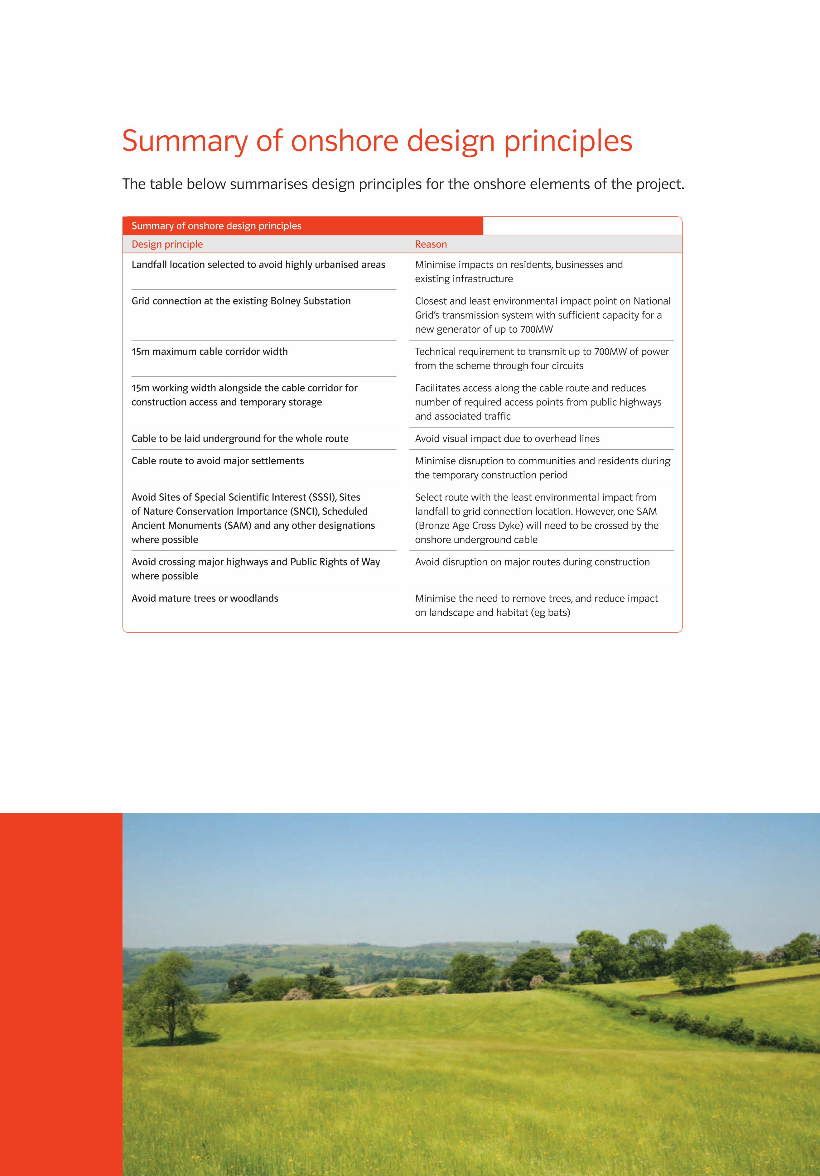
Summary of onshore design principlesThe table below summarises design principles for the onshore elements of the project.
Designprinciple Reason
Summaryofonshoredesignprinciples
Landfalllocationselectedtoavoidhighlyurbanisedareas
GridconnectionattheexistingBolneySubstation
15mmaximumcablecorridorwidth
15mworkingwidthalongsidethecablecorridorforconstructionaccessandtemporarystorage
Cabletobelaidundergroundforthewholeroute
Cableroutetoavoidmajorsettlements
AvoidSitesofSpecialScientificInterest(SSSI),SitesofNatureConservationImportance(SNCI),ScheduledAncientMonuments(SAM)andanyotherdesignationswherepossible
AvoidcrossingmajorhighwaysandPublicRightsofWaywherepossible
Avoidmaturetreesorwoodlands
Minimise impacts on residents, businesses and existing infrastructure
Closest and least environmental impact point on National Grid’s transmission system with sufficient capacity for a new generator of up to 700MW
Technical requirement to transmit up to 700MW of power from the scheme through four circuits
Facilitates access along the cable route and reduces number of required access points from public highways and associated traffic
Avoid visual impact due to overhead lines
Minimise disruption to communities and residents during the temporary construction period
Select route with the least environmental impact from landfall to grid connection location. However, one SAM (Bronze Age Cross Dyke) will need to be crossed by the onshore underground cable
Avoid disruption on major routes during construction
Minimise the need to remove trees, and reduce impact on landscape and habitat (eg bats)
1873_RAMPION EXHIB BOARDS_AW.indd 22 01/02/2012 12:53
1000MM X 700MM FOAMEX BOARD – ARTWORK SET TO 100%
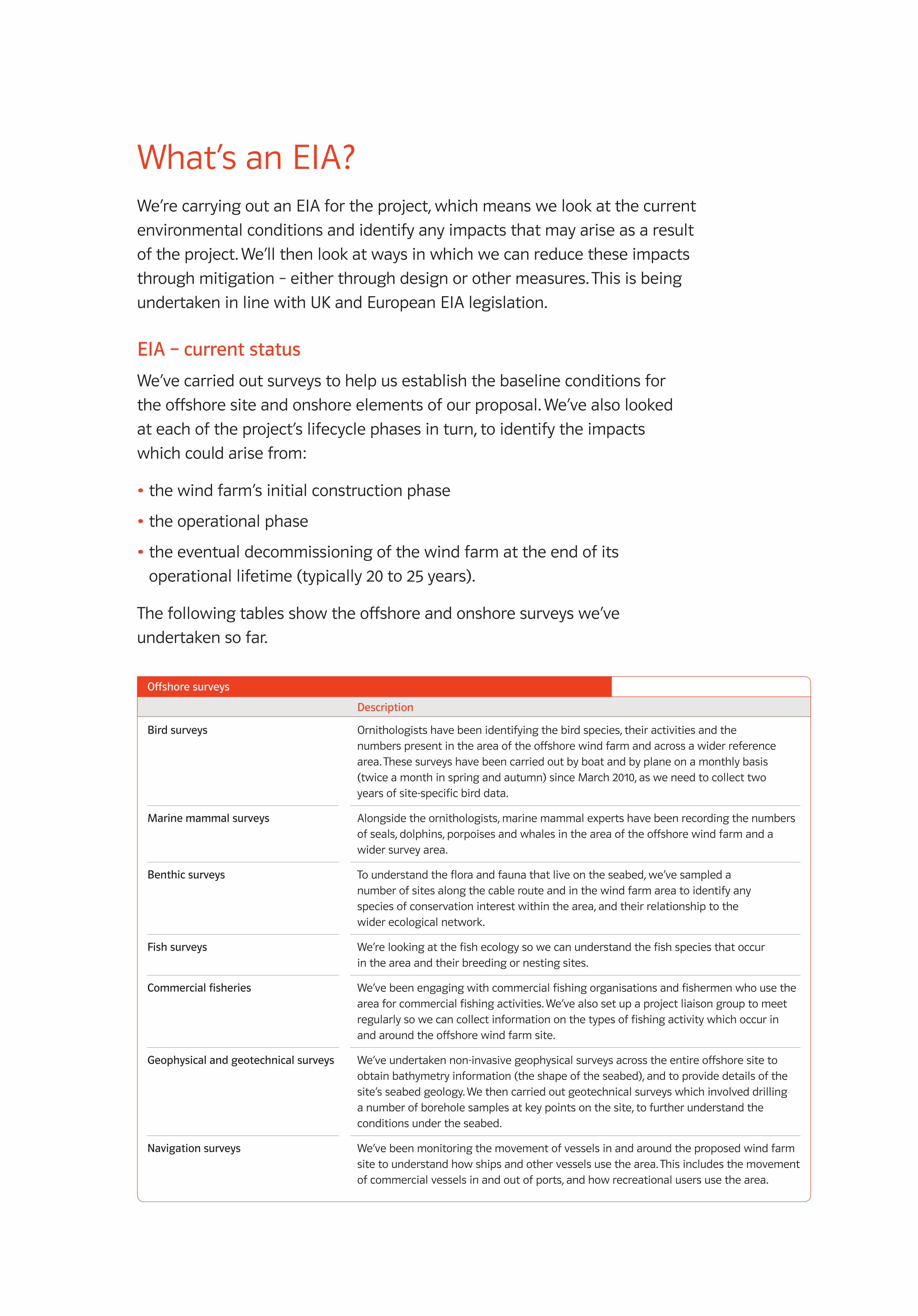
What’s an EIA?We’re carrying out an EIA for the project, which means we look at the current
environmental conditions and identify any impacts that may arise as a result
of the project. We’ll then look at ways in which we can reduce these impacts
through mitigation – either through design or other measures. This is being
undertaken in line with UK and European EIA legislation.
EIA–currentstatus
We’ve carried out surveys to help us establish the baseline conditions for
the offshore site and onshore elements of our proposal. We’ve also looked
at each of the project’s lifecycle phases in turn, to identify the impacts
which could arise from:
•the wind farm’s initial construction phase
•the operational phase
•the eventual decommissioning of the wind farm at the end of its
operational lifetime (typically 20 to 25 years).
The following tables show the offshore and onshore surveys we’ve
undertaken so far.
Description
Offshoresurveys
Birdsurveys
Marinemammalsurveys
Benthicsurveys
Fishsurveys
Commercialfisheries
Geophysicalandgeotechnicalsurveys
Navigationsurveys
Ornithologists have been identifying the bird species, their activities and the numbers present in the area of the offshore wind farm and across a wider reference area. These surveys have been carried out by boat and by plane on a monthly basis (twice a month in spring and autumn) since March 2010, as we need to collect two years of site-specific bird data.
Alongside the ornithologists, marine mammal experts have been recording the numbers of seals, dolphins, porpoises and whales in the area of the offshore wind farm and a wider survey area.
To understand the flora and fauna that live on the seabed, we’ve sampled a number of sites along the cable route and in the wind farm area to identify any species of conservation interest within the area, and their relationship to the wider ecological network.
We’re looking at the fish ecology so we can understand the fish species that occur in the area and their breeding or nesting sites.
We’ve been engaging with commercial fishing organisations and fishermen who use the area for commercial fishing activities. We’ve also set up a project liaison group to meet regularly so we can collect information on the types of fishing activity which occur in and around the offshore wind farm site.
We’ve undertaken non-invasive geophysical surveys across the entire offshore site to obtain bathymetry information (the shape of the seabed), and to provide details of the site’s seabed geology. We then carried out geotechnical surveys which involved drilling a number of borehole samples at key points on the site, to further understand the conditions under the seabed.
We’ve been monitoring the movement of vessels in and around the proposed wind farm site to understand how ships and other vessels use the area. This includes the movement of commercial vessels in and out of ports, and how recreational users use the area.
1873_RAMPION EXHIB BOARDS_AW.indd 23 01/02/2012 12:53
1000MM X 700MM FOAMEX BOARD – ARTWORK SET TO 100%
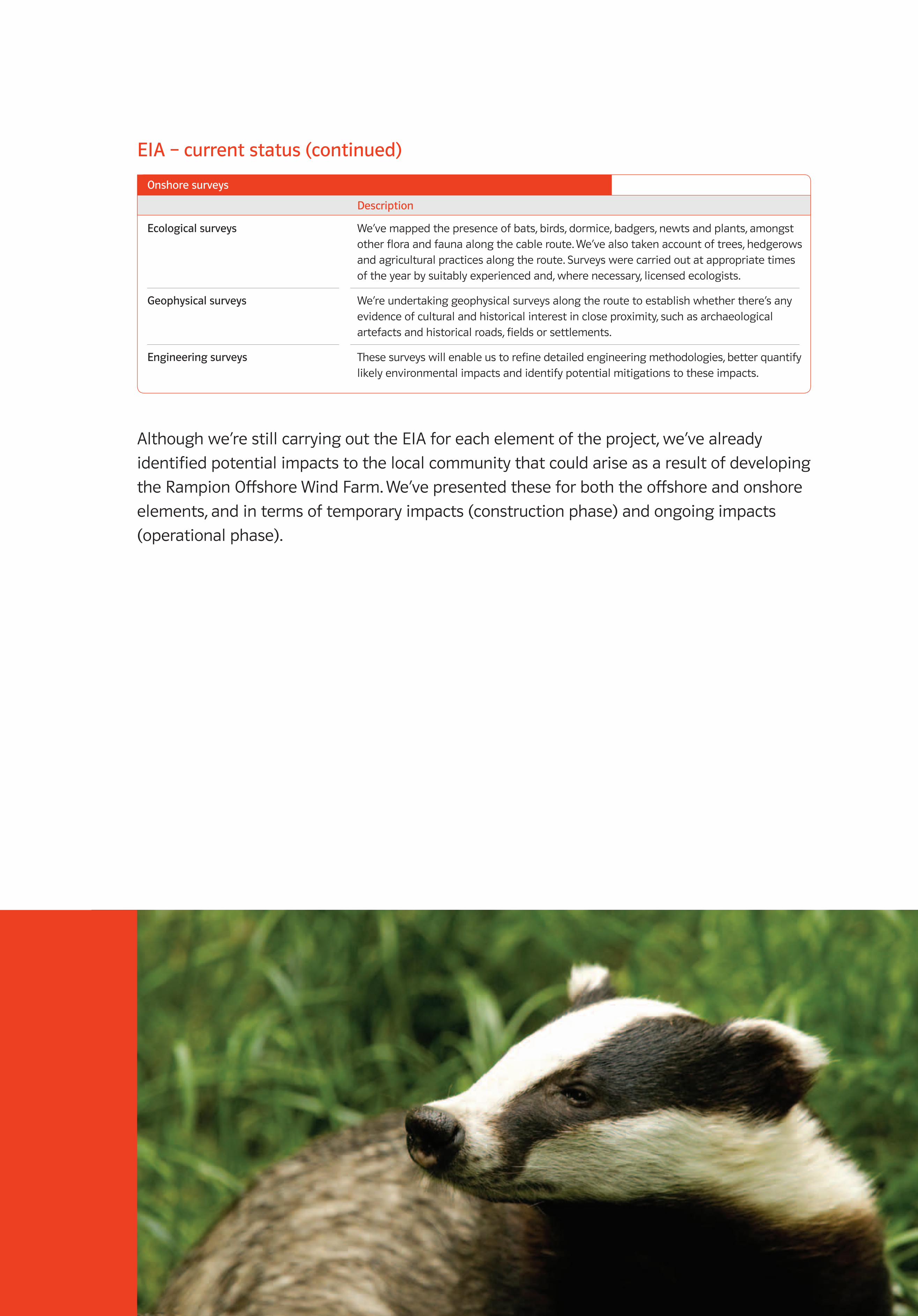
EIA–currentstatus(continued)
Although we’re still carrying out the EIA for each element of the project, we’ve already
identified potential impacts to the local community that could arise as a result of developing
the Rampion Offshore Wind Farm. We’ve presented these for both the offshore and onshore
elements, and in terms of temporary impacts (construction phase) and ongoing impacts
(operational phase).
Description
Onshoresurveys
Ecologicalsurveys
Geophysicalsurveys
Engineeringsurveys
We’ve mapped the presence of bats, birds, dormice, badgers, newts and plants, amongst other flora and fauna along the cable route. We’ve also taken account of trees, hedgerows and agricultural practices along the route. Surveys were carried out at appropriate times of the year by suitably experienced and, where necessary, licensed ecologists.
We’re undertaking geophysical surveys along the route to establish whether there’s any evidence of cultural and historical interest in close proximity, such as archaeological artefacts and historical roads, fields or settlements.
These surveys will enable us to refine detailed engineering methodologies, better quantify likely environmental impacts and identify potential mitigations to these impacts.
1873_RAMPION EXHIB BOARDS_AW.indd 24 01/02/2012 12:53
1000MM X 700MM FOAMEX BOARD – ARTWORK SET TO 100%
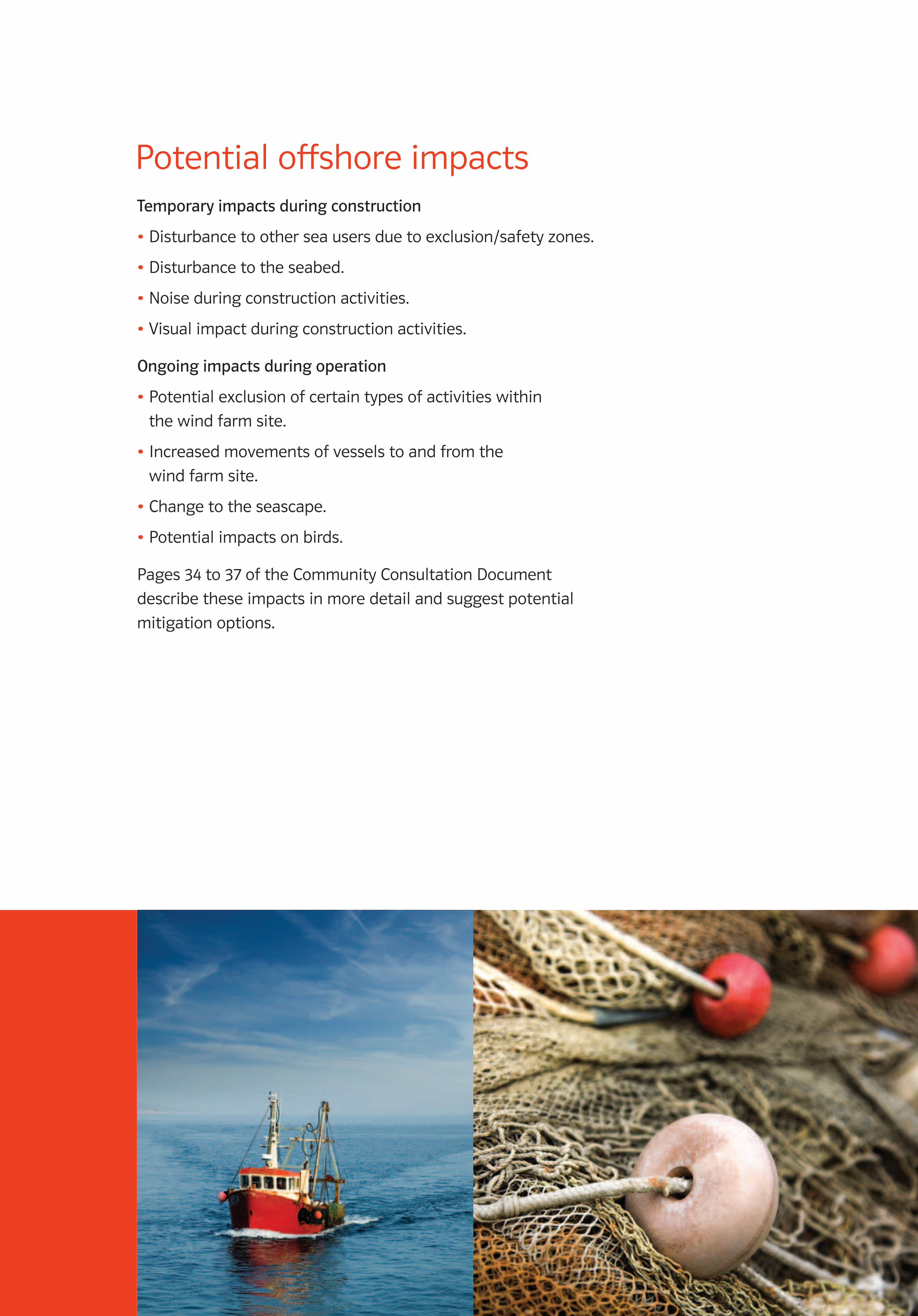
Potential offshore impactsTemporaryimpactsduringconstruction
•Disturbance to other sea users due to exclusion/safety zones.
•Disturbance to the seabed.
•Noise during construction activities.
•Visual impact during construction activities.
Ongoingimpactsduringoperation
•Potential exclusion of certain types of activities within
the wind farm site.
•Increased movements of vessels to and from the
wind farm site.
•Change to the seascape.
•Potential impacts on birds.
Pages 34 to 37 of the Community Consultation Document
describe these impacts in more detail and suggest potential
mitigation options.
1873_RAMPION EXHIB BOARDS_AW.indd 25 01/02/2012 12:54
1000MM X 700MM FOAMEX BOARD – ARTWORK SET TO 100%
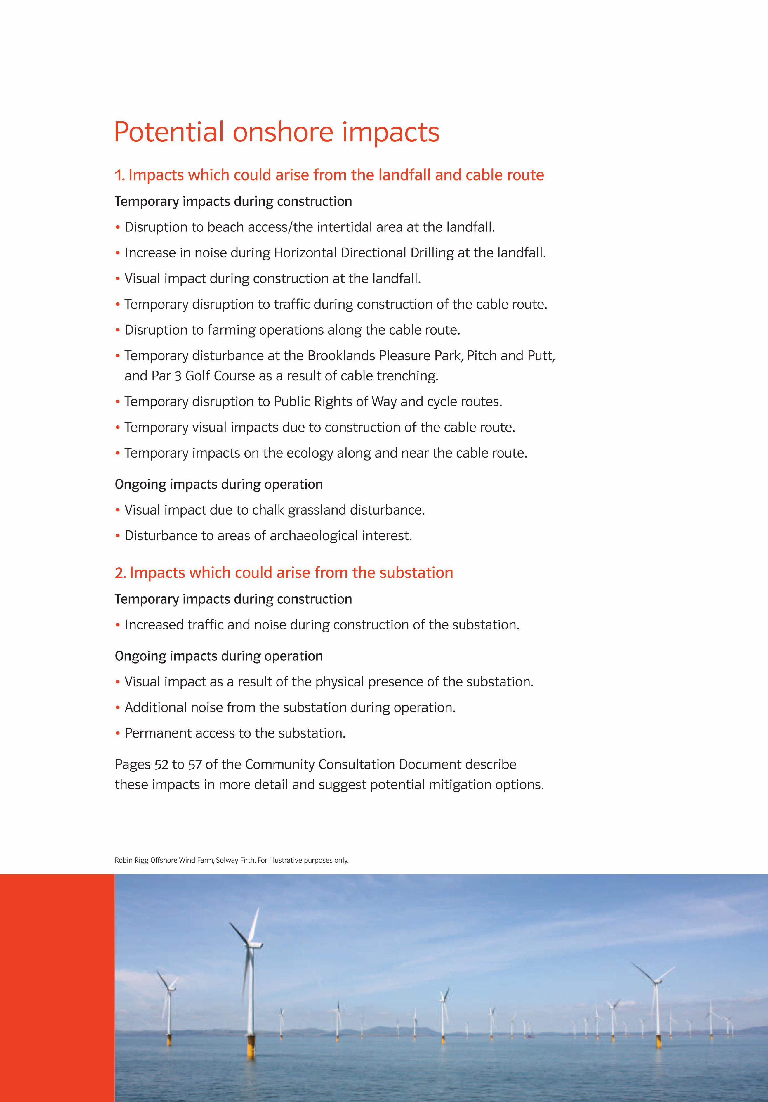
Potential onshore impacts1.Impactswhichcouldarisefromthelandfallandcableroute
Temporaryimpactsduringconstruction
•Disruption to beach access/the intertidal area at the landfall.
•Increase in noise during Horizontal Directional Drilling at the landfall.
•Visual impact during construction at the landfall.
•Temporary disruption to traffic during construction of the cable route.
•Disruption to farming operations along the cable route.
•Temporary disturbance at the Brooklands Pleasure Park, Pitch and Putt,
and Par 3 Golf Course as a result of cable trenching.
•Temporary disruption to Public Rights of Way and cycle routes.
•Temporary visual impacts due to construction of the cable route.
•Temporary impacts on the ecology along and near the cable route.
Ongoingimpactsduringoperation
•Visual impact due to chalk grassland disturbance.
•Disturbance to areas of archaeological interest.
2.Impactswhichcouldarisefromthesubstation
Temporaryimpactsduringconstruction
•Increased traffic and noise during construction of the substation.
Ongoingimpactsduringoperation
•Visual impact as a result of the physical presence of the substation.
•Additional noise from the substation during operation.
•Permanent access to the substation.
Pages 52 to 57 of the Community Consultation Document describe
these impacts in more detail and suggest potential mitigation options.
Robin Rigg Offshore Wind Farm, Solway Firth. For illustrative purposes only.
1873_RAMPION EXHIB BOARDS_AW.indd 26 01/02/2012 12:54

1000MM X 700MM FOAMEX BOARD – ARTWORK SET TO 100%
What are photomontages?Photomontages are photographic illustration tools which give an indication
of the potential scale and extent of the proposed development. They’re used
to gain an appreciation of how the proposed development may appear within
any given view and are intended for guidance only.
How should I view the images to give the best representation?The relative viewing distance needs to be correctly understood, eg if an image
is viewed too far from the eye then the elements will appear too small, whilst
if an image is viewed too closely, elements will appear disproportionately large.
The photomontages displayed today are printed to a width of 150cm and present
a 120° field of view. To view these images at the scale that best represents what
you would see in real life, you’re advised to view them at a distance of 72cm.
Which turbine layouts have you used to generate the images?For the purpose of this community consultation, we’ve produced photomontages
based on 195 x 3.6MW turbines (‘worst case scenario’) for each of the viewpoints,
and an additional indicative photomontage for 100 x 7MW turbines from Brighton
Seafront Promenade (Viewpoint 02), for comparison purposes.
Our Environmental Impact Assessment (EIA) work to date indicates that a greater
number of the smaller turbines (195 x 3.6MW) would have a more significant impact
on the seascape than fewer larger turbines (100 x 7MW), as they look more densely
packed on the horizon and the height difference in the turbines is difficult for the
eye to make out from a distance of 13km.
Scroby Sands Offshore Wind Farm, Great Yarmouth. For illustrative purposes only.
1873_RAMPION EXHIB BOARDS_AW.indd 27 01/02/2012 12:54
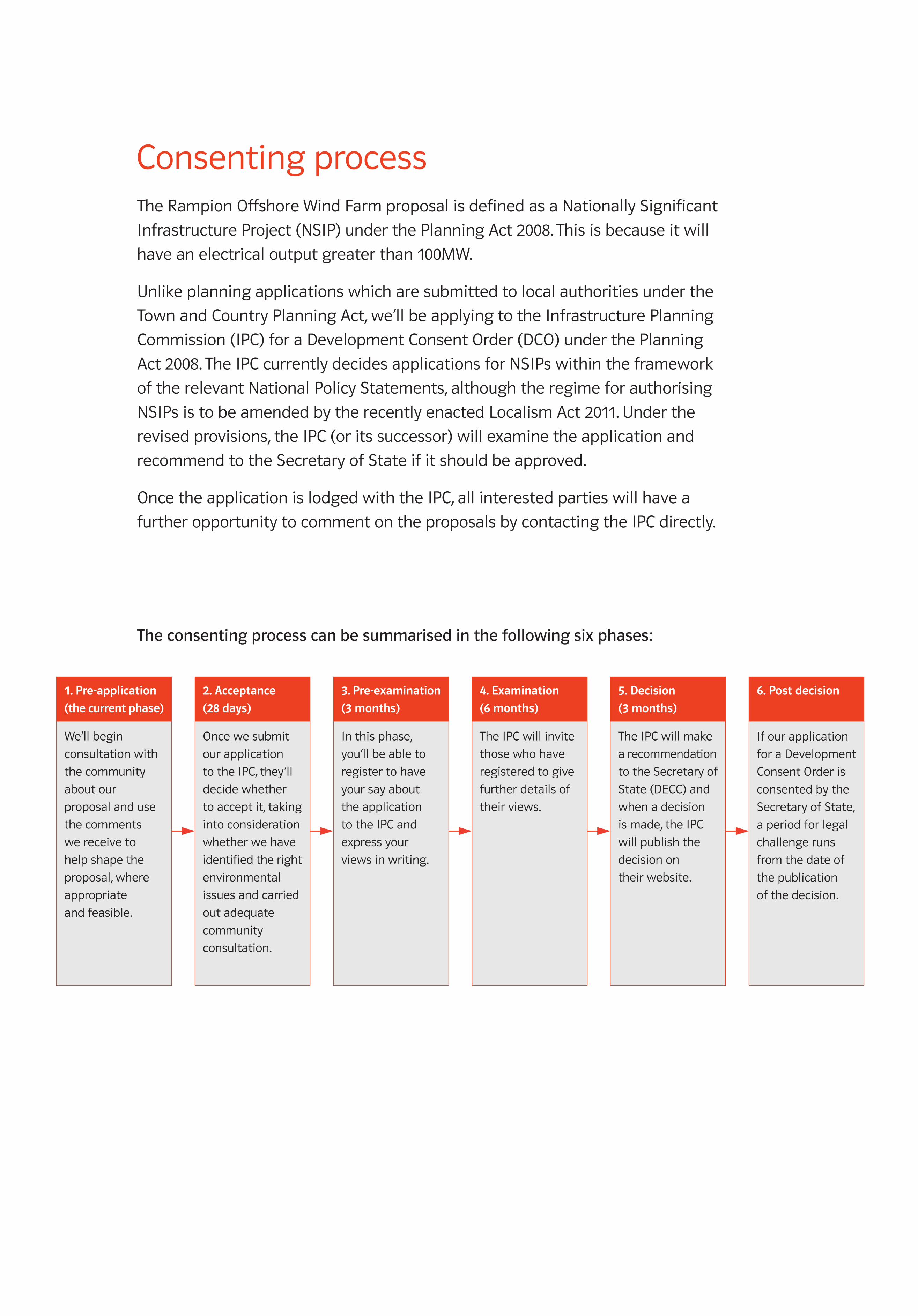
1000MM X 700MM FOAMEX BOARD – ARTWORK SET TO 100%
Consenting processThe Rampion Offshore Wind Farm proposal is defined as a Nationally Significant
Infrastructure Project (NSIP) under the Planning Act 2008. This is because it will
have an electrical output greater than 100MW.
Unlike planning applications which are submitted to local authorities under the
Town and Country Planning Act, we’ll be applying to the Infrastructure Planning
Commission (IPC) for a Development Consent Order (DCO) under the Planning
Act 2008. The IPC currently decides applications for NSIPs within the framework
of the relevant National Policy Statements, although the regime for authorising
NSIPs is to be amended by the recently enacted Localism Act 2011. Under the
revised provisions, the IPC (or its successor) will examine the application and
recommend to the Secretary of State if it should be approved.
Once the application is lodged with the IPC, all interested parties will have a
further opportunity to comment on the proposals by contacting the IPC directly.
Theconsentingprocesscanbesummarisedinthefollowingsixphases:
1. Pre-application
(the current phase)
We’ll begin
consultation with
the community
about our
proposal and use
the comments
we receive to
help shape the
proposal, where
appropriate
and feasible.
2. Acceptance
(28 days)
Once we submit
our application
to the IPC, they’ll
decide whether
to accept it, taking
into consideration
whether we have
identified the right
environmental
issues and carried
out adequate
community
consultation.
3. Pre-examination
(3 months)
In this phase,
you’ll be able to
register to have
your say about
the application
to the IPC and
express your
views in writing.
4. Examination
(6 months)
The IPC will invite
those who have
registered to give
further details of
their views.
5. Decision
(3 months)
The IPC will make
a recommendation
to the Secretary of
State (DECC) and
when a decision
is made, the IPC
will publish the
decision on
their website.
6. Post decision
If our application
for a Development
Consent Order is
consented by the
Secretary of State,
a period for legal
challenge runs
from the date of
the publication
of the decision.
1873_RAMPION EXHIB BOARDS_AW.indd 28 01/02/2012 12:54
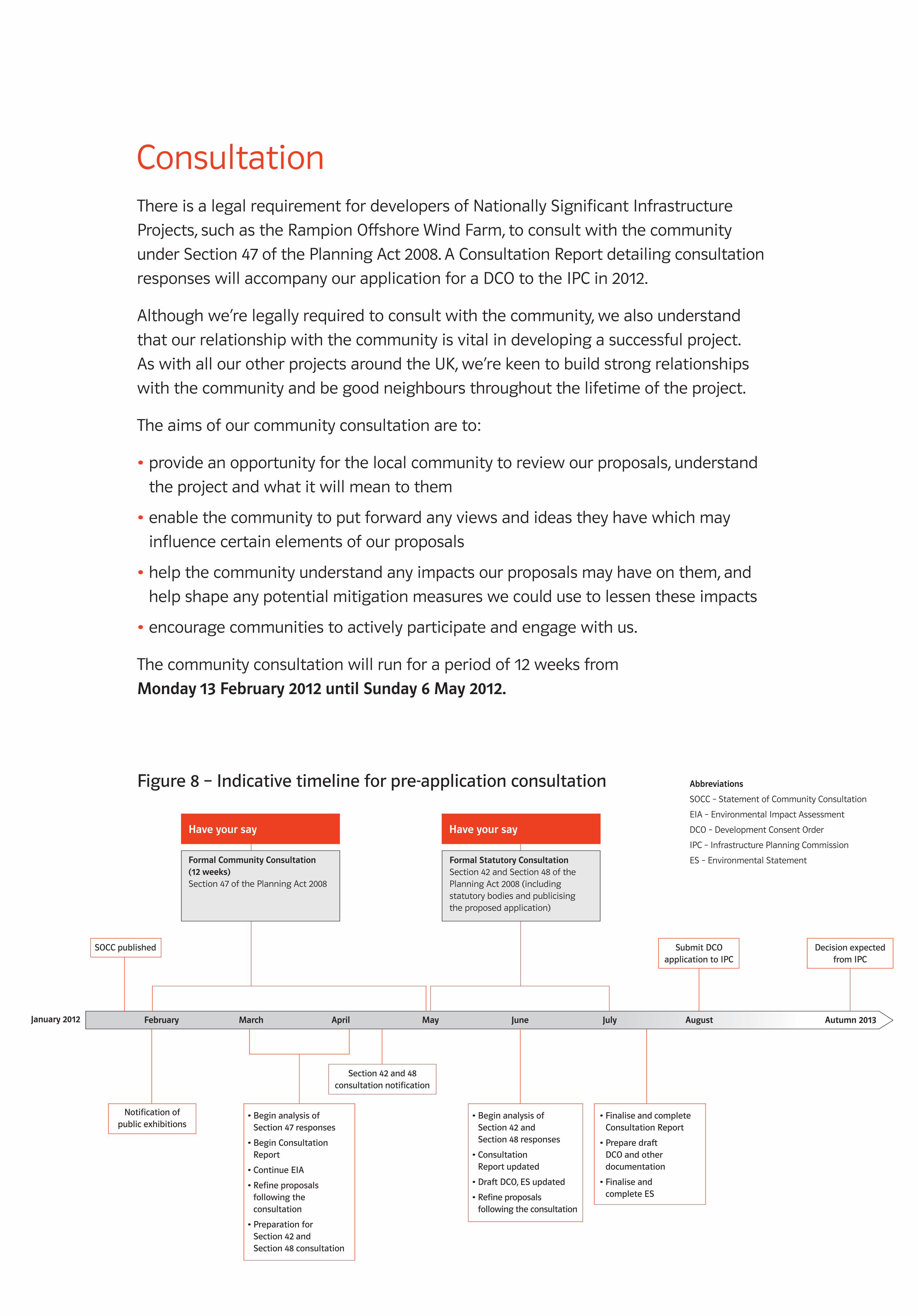
1000MM X 700MM FOAMEX BOARD – ARTWORK SET TO 100%
ConsultationThere is a legal requirement for developers of Nationally Significant Infrastructure
Projects, such as the Rampion Offshore Wind Farm, to consult with the community
under Section 47 of the Planning Act 2008. A Consultation Report detailing consultation
responses will accompany our application for a DCO to the IPC in 2012.
Although we’re legally required to consult with the community, we also understand
that our relationship with the community is vital in developing a successful project.
As with all our other projects around the UK, we’re keen to build strong relationships
with the community and be good neighbours throughout the lifetime of the project.
The aims of our community consultation are to:
•provide an opportunity for the local community to review our proposals, understand
the project and what it will mean to them
•enable the community to put forward any views and ideas they have which may
influence certain elements of our proposals
•help the community understand any impacts our proposals may have on them, and
help shape any potential mitigation measures we could use to lessen these impacts
•encourage communities to actively participate and engage with us.
The community consultation will run for a period of 12 weeks from
Monday 13 February 2012 until Sunday 6 May 2012.
Notificationofpublicexhibitions
•BeginanalysisofSection47responses
•BeginConsultationReport
•ContinueEIA
•Refineproposalsfollowingtheconsultation
•PreparationforSection42andSection48consultation
•BeginanalysisofSection42andSection48responses
•ConsultationReportupdated
•DraftDCO,ESupdated
•Refineproposalsfollowingtheconsultation
•FinaliseandcompleteConsultationReport
•PreparedraftDCOandotherdocumentation
•FinaliseandcompleteES
Formal Community Consultation (12 weeks) Section 47 of the Planning Act 2008
Have your say
January 2012
Abbreviations
SOCC – Statement of Community Consultation
EIA – Environmental Impact Assessment
DCO – Development Consent Order
IPC – Infrastructure Planning Commission
ES – Environmental Statement
SubmitDCOapplicationtoIPC
JulyJuneMayAprilMarchFebruary
Formal Statutory ConsultationSection 42 and Section 48 of the Planning Act 2008 (including statutory bodies and publicising the proposed application)
Have your say
DecisionexpectedfromIPC
Section42and48consultationnotification
August
SOCCpublished
Autumn 2013
Figure8–Indicativetimelineforpre-applicationconsultation
1873_RAMPION EXHIB BOARDS_AW.indd 29 01/02/2012 12:54
1000MM X 700MM FOAMEX BOARD – ARTWORK SET TO 100%
Take part in the consultationWe’ve prepared a Community Consultation Document which includes a description of
the project elements, information about the Environmental Impact Assessment which
constitutes Preliminary Environmental Information, and details of how the community
can respond to the consultation.
Pick up a copy today and use it to complete the community consultation questionnaire.
You can hand your questionnaire in to a member of the project team or post it to
FREEPOST RAMPION OFFSHORE WIND FARM (no stamp required). You can also go
online to eon-uk.com/rampion to fill it in.
Contact usYou can also respond to the consultation or contact us in one of the following ways:
•Email us at [email protected]
•Write to our freepost address: FREEPOST RAMPION OFFSHORE WIND FARM
(no stamp required).
•Call our consultation line: 01273 694 876 (9am to 5pm, Monday to Friday).
All the consultation documents are available to download from eon-uk.com/rampion
or call 01273 694 876 if you would like us to send you a printed or CD copy.
The closing date for responses is Sunday 6 May 2012
It’s important that you submit your feedback and comments to us before
the closing date so we can consider them to help shape our proposals.
E.ONClimate&RenewablesUKRampionOffshoreWindLimitedRegistered Office: Westwood Way Westwood Business Park Coventry CV4 8LG Registered in England and Wales No. 7199847 eon-uk.com/rampion
1873_RAMPION EXHIB BOARDS_AW.indd 30 01/02/2012 12:54