Third IOC/WESTPAC Training Course on NEAR-GOOS … · 3.2 OUTLINE OF THE COURSE PROGRAMME 2 ......
41
Intergovernmental Oceanographic Commission Training Course Report 58 Third IOC/WESTPAC Training Course on NEAR-GOOS Data Management Japan Oceanographic Data Centre Hydrographic Department Maritime Safety Agency Tokyo, Japan 24 January - 4 February 2000 GOOS Report No. 89 UNESCO
Transcript of Third IOC/WESTPAC Training Course on NEAR-GOOS … · 3.2 OUTLINE OF THE COURSE PROGRAMME 2 ......
Intergovernmental Oceanographic Commission
Training Course Report 58
Third IOC/WESTPAC Training Course on NEAR-GOOS Data Management Japan Oceanographic Data Centre Hydrographic Department Maritime Safety Agency Tokyo, Japan 24 January - 4 February 2000
GOOS Report No. 89 UNESCO
Intergovernmental Oceanographic Commission
Training Course Report 58
Third IOC/WESTPAC Training Course on NEAR-GOOS Data Management Japan Oceanographic Data Centre Hydrographic Department Maritime Safety Agency Tokyo, Japan 24 January - 4 February 2000
GOOS Report No. 89 UNESCO
IOC Training Course Report No.58
Paris, June 2000 English only
Abstract This report presents a summary of the Third IOC/WESTPAC Training Course on NEAR-GOOS Data Management, which was organized by the Japan Oceanographic Data Center (JODC) under the auspices of IOC from 24 January to 4 February 2000 at the JODC, Tokyo, Japan. Five participants from China, Indonesia, the Republic of Korea, the Russian Federation and Vietnam were selected by the IOC and the JODC, and many lectures were given on the following: the concept of NEAR-GOOS and its function in the WESTPAC region; The framework of the International Oceanographic Data and Information Exchange (IODE) programme; Processing and management on various marine data and information, etc., and also country reports were presented by the five participants regarding the data management and the state-of-the-art in the field of marine observation in their countries.
SC-2000/WS/53
IOC Training Course Report No.58 Page (i)
TABLE OF CONTENTS
Page
1. INTRODUCTION 1
2. PARTICIPANTS 1
3. TRAINING COURSE 1
3.1 OPENING 1 3.2 OUTLINE OF THE COURSE PROGRAMME 2
3.2.1 Activities of the Hydrographic Department 2 3.2.2 Activities of JODC 2 3.2.3 International Oceanographic Data and Information Exchange (IODE) System and Data
Exchange in the WESTPAC Region 2 3.2.4 NEAR-GOOS and Regional Real-time data exchange 3 3.2.5 Data Management 3 3.2.6 Information Management 3 3.2.7 Practical Training 4
3.3 STUDY VISIT 4 3.3.1 MIRC 4 3.3.2 JMA 4 3.3.3 JAMSTEC 5
3.4 COUNTRY REPORTS 5 3.5 CLOSURE 5
4. COURSE EVALUATION 6
4.1 LOCAL ARRANGEMENTS 6 4.2 PERIOD OF COURSE AND MATERIALS 6 4.3 LECTURES 6 4.4 STUDY VISIT 6 4.5 EXPECTATION AND SATISFACTION 6 4.6 OPINIONS TO IMPROVE THE COURSE 6 4.7 CONCLUSIONS 7
ANNEXES I. COURSE PROGRAMME II. LIST OF PARTICIPANTS III. COUNTRY REPORTS (China, Indonesia, Republic of Korea, Russian Federation, Vietnam) IV. LIST OF PARTICIPATING COUNTRIES IN TRAINING COUSES FROM 1982 TO 1999
IOC Training Course Report No.58
1. INTRODUCTION “The Training Course on the Oceanographic Data Management for WESTPAC” has been organized every year since 1982 at the Japan Oceanographic Data Centre (JODC), in support of the activities of the IOC Sub-Commission for the Western Pacific (WESTPAC). The activities of NEAR-GOOS started in 1996. And the training course on Oceanographic Data Management added to these activities from 1997. That is why the name of the course changed from “ The Training Course on Oceanographic Data Management for WESTPAC” to “IOC/WESTPAC Training Course on NEAR-GOOS Data Management”. The Third IOC/WESTPAC Training Course on NEAR-GOOS Data Management was organized by the JODC under the auspices of the IOC and with financial support from the Japanese Government, from 24 January to 4 February 2000 at the JODC, Hydrographic Department, Maritime Safety Agency, Tokyo, Japan. The objectives of the training course were to disseminate concepts of NEAR-GOOS and its functions in the WESTPAC region and to allow participants to become acquainted with acquisition, processing and exchange of oceanographic data in accordance with principles used within the framework of the International Oceanographic Data and Information Exchange (IODE) programme. 2. PARTICIPANTS The IOC announced the training course through its Circular Letter No. 1617 dated 23 July 1999 to all Member States of the WESTPAC. The application requirements were that applicants should possess adequate background knowledge in the field of oceanographic data management, preferably with responsibility in collection, archiving and exchange of oceanographic data and management in the national organizations which are interested in NEAR-GOOS, and that they should have a good command of the English language. Eighteen applications were received from nine Member States of the WESTPAC in response to the IOC Circular Letter. In consultation with the authorities concerned, five participants from China, Indonesia, the Republic of Korea, the Russian Federation and Vietnam were selected by the JODC and the IOC (see Annex II). 3. TRAINING COURSE 3.1 OPENING The training course was officially opened on 24 January 2000 by Mr. Toshio NAGAI, Director of Japan Oceanographic Data Centre, Hydrographic Department (JHD), Maritime Safety Agency, Tokyo, Japan. In his opening remarks, Mr. NAGAI reminded the participants and the lecturers that the aims of this training course were to improve levels of oceanographic data management, both in real time and non-real time, to facilitate mutual data exchange in North East Asian Regional countries, and thus to contribute to the Global Ocean Observing System. To achieve these aims, JODC invited three lecturers in addition to the staff members of Hydrographic Department and JODC: Prof. Dr. K. TAIRA, Director of Ocean Research Institute of Tokyo University, Mr. N. HASEGAWA, Japan Meteorological Agency and Dr. Y. NAGATA, Director of Marine Information Research Centre, Japan Hydrographic Association. Furthermore, he stressed that since oceanographic data exchange was one of the most efficient and important aspects of international cooperation, the participants' role, not only in their own countries but also in the international oceanographic community, would become more important. Finally he expressed that mutual friendship and understanding between participants and related organizations was one of the important factors for efficient data and information exchange.

IOC Training Course Report No.58 Page 2
3.2 OUTLINE OF THE COURSE PROGRAMME The programme covered various subjects such as NEAR-GOOS, Regional Real Time Data Base and Regional Delayed Mode Data Base, outline of the activities of JODC and Hydrographic Department, the IOC/IODE system, oceanographic data management at the JODC, study visits, and practical training in the usage of personal computers (PCs) and workstations in data management (see Annex I). During the course, a workstation was provided for on-line database training including Internet. Course materials distributed to the participants are as follows: (i) NEAR-GOOS (operational manual V2.0, Revised Edition 1998) (brochure) (ii) Manual on International Oceanographic Data Exchange (IOC Manual and Guide 9, Revised Edition, 1991) (iii) Activities of Hydrographic Department (brochure) (iv) Activities of JODC (brochure) (v) Oceanographic Data Management Text Book prepared by JODC (vi) Activities of MIRC (brochure) (vii) Activities of JMA (brochure) (viii) Activities of JAMSTEC (brochure) 3.2.1 Activities of the Hydrographic Department The participants went to the divisions in JHD and were introduced to officers of JHD. The brochure Striving for revealing oceans scientifically and safe navigation at sea was distributed to the participants for their reference. The outline of the activities of the Hydrographic Department was introduced during the tour in the exhibition room. A demonstration on the Electronic Chart Display and Information System (ECDIS) was given by using the Electronic Navigational Chart (ENC) of Tokyo Bay. Its useful navigational information with the nautical chart information from ENC was explained at the Cartography Office. 3.2.2 Activities of JODC The organization of the JODC, the reception of oceanographic data and information from the originator, data processing flow, and data files were explained. The role of the JODC as the Responsible National Oceanographic Data Centre (RNODC) for the WESTPAC was also explained. During the explanation, the Activities of JODC (brochure) and JODC Data Online Service System (J-DOSS) (brochure) were used. 3.2.3 International Oceanographic Data and Information Exchange (IODE) System and Data Exchange in the
WESTPAC Region A lecture was given on the history, structure and function of the IODE system of the IOC, preceded by the outline of the IOC's activities. It included the basic idea, organizational structure and history of the IODE followed by explanations of data flow from observing stations to World Data Centres (WDCs) through National Oceanographic Data Centres (NODCs) and Responsible National Oceanographic Data Centres (RNODCs). Lectures were given on data exchange in the WESTPAC region, explaining the activities of the JODC as the RNODC for the WESTPAC. It was noted that the JODC was also acting as the RNODC for the Integrated Global Ocean Services System programmes (IGOSS), the RNODC for the IOC Marine Pollution Monitoring programme (MARPOLMON) for the WESTPAC

IOC Training Course Report No.58 Page 3
region, and the RNODC for Acoustic Doppler Current Profiler (ADCP). The lectures outlined the tasks of the RNODC for the WESTPAC including procedures for forwarding and disseminating oceanographic information, procedures for forwarding data and data announcement, and retrieval of data and information in the WESTPAC programme. 3.2.4 NEAR-GOOS and Regional Real-time data exchange A lecture was given on the aims of WESTPAC/NEAR-GOOS, the circumstance concerning its inauguration, the structure of its organization and the content of the enterprise. It included the trend of recent oceanographic research concerning environmental issues and the actual use of that data. Lectures were given on the importance of exchanging real-time data, IGOSS and GOOS, especially NEAR-GOOS, which are under operation now, and the framework of data exchange in detail. The lectures outlined, as a successful example of real-time data exchange, the oceanographic data system of the Meteorological Agency, which was used for the early detection of the El Niño event. 3.2.5 Data Management 3.2.5.1 Oceanography One of the main topics in this session was quality control of the data. Position check, speed check of vessel, spike check for temperature and salinity, limitation check for various parameters including meteorological parameters, check of hourly height of sea level, check of tidal current were introduced. ADCP and CTD (Conductivity Temperature and Depth profiler system) were introduced in detail. Additionally, animation on the comparative images of the published tidal current chart and the new digital tidal current chart, plus animation of the predicting system for drifting materials and sea water exchange were introduced. 3.2.5.2 Marine Geophysics As the participants had no experience of oceanographic survey or geophysics research, preliminary explanations of soundings on charts, basic maps of the sea, and the GEBCO (General Bathymetric Chart of the Oceans) were given. Then the data management systems, J-BIRD (JODC Bathymetry Integrated Random Data Set) and MGD77 (Marine Geophysical Data Format), for geophysical/geological data were outlined. Formats and data contents of the JODC's geological / geophysical master files were then shown. The Geophysical Data Management System (GEODAS), which has been developed by U.S. NGDC, was explained. GEODAS is an advanced management system for data which is formatted with MGD77. In addition, GEBCO was introduced as an example of international cooperation in the field of geology/geophysics. 3.2.6 Information Management The lecture stressed the purpose, necessity, and importance of observed data management and observation information such as the Cruise Summary Report (CSR). The database management for CSRs at JODC was shown on a workstation. It was noted that JODC annually published CSRs and distributed them to IOC Member States through the RNODC Activity Report. At the same time, submission of CSRs to JODC was requested to the participants because JODC was the RNODC in WESTPAC.
IOC Training Course Report No.58 Page 4
Brief information on GODAR project (Global Oceanographic Data Archaeology and Rescue Project) was also provided. 3.2.7 Practical Training 3.2.7.1 External Data Base (J-DOSS) JODC developed an oceanographic data management system in the related database called J-DOSS (JODC Data On-line Service System) in 1995, which provides users with the JODC's holding data through the Internet. It provides information on newly received data, and the JODC’s holding data as well as other WWW home pages. In particular, a lecturer stressed that users could search data inventory and download actual data to their workstation through FTP. Any data could be extracted in a short time through the Internet, by inputting keys such as country code, ship code, institution code, observation date, and observation area (latitude, longitude). The participants were impressed very much by the JODC's WWW homepage because participants had not experienced such a homepage with data downloading function. The address of JODC home Page is: http://www.jodc.jhd.go.jp 3.3 STUDY VISIT 3.3.1 MIRC A study visit to the Marine Information Research Centre (MIRC) was conducted on the afternoon of 28 January to provide the participants with an opportunity to be aware of one of the functions of the Japan Hydrographic Association. The MIRC was established in May 1997 in the Japan Hydrographic Association. MIRC will conduct high-grade quality control on the oceanic data compiled by JODC, and produce useful data products for users of various fields. Speedy distribution of necessary data sets and data products is also the task of MIRC. MIRC keeps experts and technical staff, and computer and communication facilities to the conduct this business. MIRC also promotes popularisation of ocean knowledge for the general publics using its data products. To serve studies on the global environment and climate prediction research, MIRC cooperates with international data exchange systems in order to produce the necessary high quality global data sets. 3.3.2 JMA
On 26 January 2000, the participants visited the Japan Meteorological Agency (JMA), and received a lecture on the NEAR-GOOS Real Time Data Base in the morning. In the afternoon, a study tour to informative sections was carried out as follows: (i) Oceanographical Division - JMA’s data collection/processing activities for physical oceanographic services were explained. The hardware for the NEAR-GOOS Real Time Data Base was also shown, and some of the capabilities of the database were demonstrated.
(ii) El Niño Monitoring and Prediction Centre - The Ocean Data Assimilation System for El Niño monitoring was explained. It was shown that the system gave useful information for the early detection of the El Niño event of 1997-98.
(iii) Wave Forecasting Service/Marine Meteorological Division - The JMA’s wave analysis and forecast activities were demonstrated. The numerical ocean wave prediction models calculate evolution of wave conditions based upon the equations of wave dynamics using the surface wind data given by numerical weather prediction models of JMA.
(iv) Sea Ice Monitoring Service/Maritime Meteorological Division - The JMA’s activities related to the sea ice monitoring were shown. The remote sensing from GMS-5 is a useful tool for sea ice monitoring.
IOC Training Course Report No.58 Page 5
(v) Pollutants Chemical Analysis Oceanographic/Oceanographic Division - The Centre's activities were described with emphasis on systematic measurements of the carbon dioxide flux through the sea surface.
(vi) Numerical Prediction Division - The operational global and limited area numerical weather prediction models were explained. Some output from the numerical models and data assimilation systems were demonstrated.
(vii) Forecast Division - The weather forecast services at JMA were briefly introduced. In 1956 the JMA established a variety of facilities throughout the country to provide integrated meteorological services. The JMA is responsible as the national meteorological service for contributing to the improvement of public welfare including prevention and mitigation of natural disasters, safety of transportation, prosperity of industries, and international cooperation activities. The major services are to issue weather forecasts for short-range, one-week, and long-range; the warning/advisories against typhoon and heavy rainfall/snowfall; the warning/forecast against tsunami; storm surge, ocean waves and floods; and information on earthquake and volcanic activities.
3.3.3 JAMSTEC On 3 February 2000, a study visit to the Japan Marine Science and Technology Centre (JAMSTEC) was organized to give a chance for the participants to see underwater observation technology. At the beginning of the visit, the outline of the JAMSTEC was introduced by video to the participants. Then several studies on ocean research regarding global change, especially the surface moored buoy network named TRITON (TRIangle Trans-Ocean Buoy Network) Project for observing oceanic and atmospheric variability in the Pacific Ocean and its adjacent seas, were introduced. Lastly, the participants visited the submersible Research Vessel " Shinkai 6500". JAMSTEC was founded in 1971 through the cooperative efforts of government, academia and the private sector. The centre was expected to promote marine sciences and technology in Japan in response to the social needs of the people, and today plays a highly important role in those activities. 3.4 COUNTRY REPORTS Country Reports were presented by the five participants. This session provided useful information to the JODC staff and participants with regard to the oceanographic data management and the state-of-the-art in the field of marine observation in the region. The Country Reports are shown in the Annex III. 3.5 CLOSURE The training course was completed on 4 February 2000. Mr. Toshio NAGAI, Director of the JODC, congratulated the participants for their fruitful completion of the course, which had been run with the assistance of IOC and the Ministry of Education, Science, Sports and Culture of Japan, and other related organizations. He mentioned believes that this course could provide the participants with knowledge of basic oceanographic data management, both in real time and non real time as well as information on the JODC activities. He pointed out that this course would enable good human relations among the participants and between the participants and the JODC staff, and that the participants were very welcome to contact the JODC for further information and technical assistance. On behalf of the participants, Dr. Jung Kyu Kui thanked the JODC for organizing the course and the IOC for providing them with an opportunity to take part in this training course. Each of five participants was awarded a certificate signed by the Executive Secretary of the IOC and the Director of the JODC, indicating that they had successfully completed the training course.
IOC Training Course Report No.58 Page 6
4. COURSE EVALUATION
On 4 February 2000, evaluation reports on the training course were submitted by all the participants. A summary of the evaluation is given below.
4.1 LOCAL ARRANGEMENTS Accommodation, lecture conditions including facilities and classroom, and assistance of JODC staff members were evaluated as excellent. 4.2 PERIOD OF COURSE AND MATERIALS These were evaluated as good in general. However, the participant from Indonesia comments that the course period is too short to practice on PC. 4.3 LECTURES All lectures were quite useful for their office work. Especially, Real Time Data Base, Serial Station Data Management, Tidal Current Data Management, Ocean Current Data Management, and Practice of Data Management by using PC were very instructive. 4.4 STUDY VISIT The study visits to Japan Meteorological Agency (JMA), Marine Information Research Centre (MIRC), and Japan Marine Science and Technology Centre (JAMSTEC) were very informative and interesting. 4.5 EXPECTATION AND SATISFACTION All of the participants were satisfied with the course arrangement and specified as follows:
(i) The participant from China was aware of the importance of existing data and the database.
(ii) The participant from Indonesia expected to improve her professional skill in data management including data quality control.
(iii) The participant from the Republic of Korea planned to introduce JODC methods of data collection, management, and distribution to his organization.
(iv) The participant from Vietnam enriched knowledge and management skill of oceanographic data.
(v) The participant from the Russian Federation expected to use modern oceanographic data management of all kinds of database and practical training communication.
4.6 OPINIONS TO IMPROVE THE COURSE The participant from China expressed his opinion that the balance of time-sharing of the lecture should be considered to give more priorities to Data Management and Quality Control than Data Acquisition. And also the participant from the Republic of Korea mentioned that much more practice and study visit to related institutions should be increased to familiarize the participants with its studies and scientific discussions.
IOC Training Course Report No.58 Page 7
4.7 CONCLUSIONS The course was successfully conducted in line with the purpose of WESTPAC/NEAR-GOOS. However, the course should be reconsidered taking into account the comments of the participants in order to optimise the maximum benefit of this training course in the future. In conclusion, it is expected that the training course will continue to play an important role in promoting activities of NODCs or equivalent organizations in each country, to facilitate data exchange in the region, and to strengthen, on a global scale, the IODE system and the operation of NEAR-GOOS.

IOC Training Course Report No.58 Annex I
ANNEX I
COURSE PROGRAMME
Monday, 24 January 2000 10:00-12:00 Opening Ceremony and Course Orientation 13:30-16:00 Lecture on Outline about WESTPAC (Containing NEAR-GOOS) ( Dr. K. TAIRA ) Tuesday, 25 January 2000 10:00-12:00 Lecture on Research for Ocean and Utilization and Management of Oceanographic Data (Dr. Y. NAGATA ) 13:30-16:00 Country Report Wednesday, 26 January 2000 10:00-12:00 Lecture on Real Time Data Base ( Mr. N. HASEGAWA ) 13:30-16:00 Study Visit to: Japan Meteorological Agency Thursday, 27 January 2000 10:00-12:00 Lecture on Serial Station Data Management (Mr. T. IMOTO ) 13:30-16:00 Lecture on Tidal Data Management (Mr. K. AIURA ) Friday, 28 January 2000 10:00-12:00 Lecture on Tidal Current Data Management (Mr. S. SATO ) 13:30-1600 Study Visit to: Hydrographic Department, Maritime Safety Agency Marine Information Research Centre (MIRC) Monday, 31 January 2000 10:00-12:00 Lecture on IODE (containing CSR and GODAR) (Mr. K. AIURA ) 13:30-16:00 Lecture on Ocean Current Data Management ( Dr. Y. MICHIDA ) Tusesday,1 February 2000 10:00-12:00 Training and Explanation of J-DOSS ( Mr. N. YOZA ) 13:30-16:00 Lecture on Geographic Data Management J-BIRD , MGD-77 and Software GEODAS ( Mr. N. NODA ) Wendnesday,2 February 2000 All Day Lecture on Practice of Data Management by using PC ( Mr. T. MIYAKE ) Thursday, 3 February 2000 All Day Study Visit to: Japan Marine Science and Technology Centre (JAMSTEC) Friday,4 February 2000 10:00-12:00 Course Evaluations and Closing Ceremony 13:30-16:00 Customized Special Study

IOC Training Course Report No.58 Annex II
ANNEX II
LIST OF PARTICIPANTS 1. INVITED TRAINEES Mr. LAN Youchang Senior Engineer, Operation Division National Marine Environment Forecasting Centre No.8 Dahuisi Road, Haidian District Beijing 100081 CHINA Tel : 86-10-62173598 Fax: 86-10-62173620 E-mail: [email protected] Ms. SWASTI Priti Chief, Section of Documentation & Information (Puslitbang Oseanologi - LIPI ) Research and Development Centre for Oceanology JI, Pasir Putih 1, Ancol Timur P.O. Box 4801/JKTF Jakarta 11048 INDONESIA Tel : 62-21-683850 Fax: 62-21-681948 E-mail: [email protected] Dr. JUNG Kyu Kui Researcher Korea Oceanographic Data Centre (KODC) National Fisheries Research and Development Institute 408-1 Shirangri, Kijang, Pusan city 619-900 REPUBLIC OF KOREA Tel : 82-51-720-2231 Fax: 82-51-720-2225 E-mail: [email protected]
Ms. Elena DMITRIEVA Manager, POI Oceanographic Database Pacific Oceanological Institute (POI) Far Eastern Branch, Russian Academy of Sciences 43, Baltiyskaya Street Vladivostok 690041 RUSSIAN FEDERATION Tel : 7-4232-311-420 Fax : 7-4232-312-573 E-mail: [email protected]
Ms. TRAN Thi Tho Head, Section of Oceanographic Database National Centre for Natural Science Technology of Vietnam Hoang Quoc Viet Road, CauGiay, Hanoi VIETNAM Tel: 84-4-7-564373 Fax: 84-4-8352483 E-mail: [email protected]
2. INSTRUCTORS Mr. Toshio NAGAI Director, Japan Oceanographic Data Centre (JODC) Oceanographic Data and Information Division Hydrographic Department Japan Maritime Safety Agency Mr. Satoshi SATO Deputy Director, JODC Mr. Keiji AIURA Principle Research Officer, JODC Mr. Naoki NODA Senior Research Officer, JODC Mr. Takeharu MIYAKE Research Officer, JODC Mr. Naohisa YOZA Research Officer, JODC Dr. Yutaka MICHIDA Deputy Director, Planning Division Hydrographic Department Japan Maritime Safety Agency Mr. Taiji IMOTO Principal Officer, Ocean Research Laboratory Planning Division Hydrographic Department Japan Maritime Safety Agency
IOC Training Course Report No.58 Annex II - Page 2
Prof. Dr. Keisuke TAIRA Director, Ocean Research Institute University of Tokyo Mr. Naoyuki HASEGAWA El NIño Monitoring and Prediction Centre Japan Meteorological Agency Dr. Yutaka NAGATA Director, Marine Information Research Centre 3. SECRETARIAT Mr. Toshihiro TAKASHIBA Senior Research Officer, JODC Mr. Mamoru UEDA Officer in charge of International Affairs, JODC Ms. Masako SAITO Assistant of International Affairs, JODC

IOC Training Course Report No.58 Annex III
ANNEX III
COUNTRY REPORTS
A – CHINA National Report on Activities of Oceanographic Data Base
Youchang Lan
National Marine Environment Forecasting Centre, SOA 1. Observing and Monitoring Network China’s marine environment observing and monitoring network is composed of coastal stations, research vessels, voluntary observing ships, data buoys, airplanes and ground stations for receiving satellite data. China's marine environment forecasting network consists of a national centre, three regional centres and several local stations. The national centre is National Marine Environment forecasting centre, which is located in Beijing and designed to provide forecasting services on a national basis and to serve operators in oceans throughout the world and provide technical guidance for regional forecasting centres. The three regional centres are located in Qingdao, Shanghai and Guangzhou respectively, and are designed to provide services for operators and clients in the Bohai Sea/the Yellow Sea area, the East China Sea area and the South China Sea area respectively. The local stations are designed to serve the users in the local areas where they are situated. It is the structure of the observing, monitoring and forecasting network that defines the National Marine Environmental Forecasting Centre responsible for managing, maintaining the National Oceanographic Real Time Data Base, and inter-exchanging with regional and international Real Time Data Centres. The Chinese Government pays great attention to the development of marine environment observing and monitoring network. In 1998, the equipment in the three regional centres (Qingdao, Shanghai, Guangzhou) for receiving and transmitting data was mostly renewed, and the communicating rate and communicating quality are much improved. 2. National RTDB and DMDB A National Real-Time Data Base (RTDB) and a Delayed Mode Data Base (DMDB) have been established in the National Marine Environment Forecasting Centre (NMEFC, Beijing) and the National Marine Data and Information Service (NMDIS, Tianjin) respectively. Both of the databases are in operation and provide relevant oceanographic and meteorological data and information which are in agreed standards for users. At present, the databases include oceanographic and meteorological data (from coastal observing stations, ships report, and buoys) and GTS data (composed of surface meteorological data and ship meteorological data.) Wave data and sea temperature data included in the databases are collected at the following fourteen coastal observing stations: Xiaochangshang, Laohutan, Zhifudao, Xiaomaidao, Lianyungang, Lvsi, Shengshan, Zhenhai, Dachen, Nanlu, Beishuang, Xiamen, Dongshan and Zhelang at 00:00, 06:00 and 12:00 every day. One buoy collects wave data and sea temperature at determined times every day. In the future, data of two other more buoys are expected to be included into the databases. Ships over the oceanic area 15N−42N, 105E−130E also obtain wave data and sea surface temperature at prescribed times everyday. These data (and others) are then submitted to NMEFC via VSAT, where they are validated, analysed, and quality controlled, and at last, final data and data products are generated and archived. The data, data products (such as storm surge forecasting and warning) and analyses (such as wave and sea temperature analyses) are accessible through the Internet. The three regional forecasting centres also get data they need via dedicated line-VSAT.
IOC Training Course Report No.58 Annex III - Page 2
3. Activities and Users All the activities of data and information management are to serve users. If there are no users, there is no reason for the database to exist. Our emphasis is on increasing public awareness of ocean, reduction and mitigation of marine hazards, and improvement of scientific and technical research. Users for the databases are divided mainly into three types: (1) scientific researchers and engineers; (2) operational agencies issuing forecasts and warnings, etc.; and (3) managers of data collection and information dissemination programmes and decision-makers. The scientific researchers and engineers have higher requirements for accuracy and completeness of the data sets for their work. The operational agencies take on responsibilities to produce predictions and issue storm warnings, thus timeliness is more important for them. Managers and decision-makers pay more attention to information than data itself for evaluation and ensuring the success of the programme and making decision. The users of the China National RTDB are mainly those who are engaged in marine forecast(s), marine /coastal management, offshore oil exploration and exploitation, and other production activities at sea (for instance, ocean transportation companies, etc.). Users of China NEAR-GOOS DMDB are mostly research scientists from research organizations and Universities. Some users outside China, especially within the NEAR-GOOS region have also visited the web sites and downloaded files needed. One who is to be a user of the National DMDB is just requested to provide information such as the name of the organization, it's name, e-mail address, telephone number and purpose for using the database. After having registered, he/she can obtain data just through the e-mail address. 4. Future Plans Data sharing and open exchange is one of the basic principles of NEAR-GOOS. Many scientists, managers and operational agencies are benefiting from the National databases. And providing better service for more and more users is always our goal to complete. In order to attract more users to the databases, China plans to hold a domestic user workshop this year. The State Oceanic Administration (SOA) of China will publish a brochure describing the system to be distributed at the workshop. In addition, the China NEAR-GOOS Committee plans to hold a NEAR-GOOS Regional Symposium to exchange experience on marine monitoring, jointly with a National Key Project entitled “Study of Marine Monitoring Technology” which is financially supported by the Ministry of Science and Technology (MST). Scientists and engineers from China and abroad (especially from NEAR-GOOS Region) will be welcomed to the symposium. In order to include more real-time data in the China NEAR-GOOS RTDB, we will try our best to get government’s permission to load more data into the database. The development of metadata has begun on DMDB at NMDIS. However, there is a large amount of historical data to be processed. The plan is to be endorsed by MST to provide financial assistance for the development of the sub-dataset during the National Tenth Five-Year Plan so that users can understand and use the data effectively. −−−−−−−−−−−−−−−−−−−−−−−−−−−−−−−−−−−−−−−−−−−−−−−−−−−−−−−− Though great achievements have been made in the National NEAR-GOOS data and information management, there is still much work to be done. One of the most important actions is to attract much more financial support from the national and local governments to improve the facilities of the existing observing stations, and enhance capability of communication networks, thus it is possible to add more available data to the databases and provide data to users on request. An important component of the ocean environmental system is the biological and chemical variables that are not included in the databases because of inadequate source of data. Therefore measures should be taken to encourage contributions for the databases.
IOC Training Course Report No.58 Annex III - Page 3
B. - INDONESIA 1
Status of Oceanographic Data Management at the Research and Development Center for Oceanology
Priti Swasti R&D for Oceanology Development, Indonesian Institute of Sciences, Indonesia
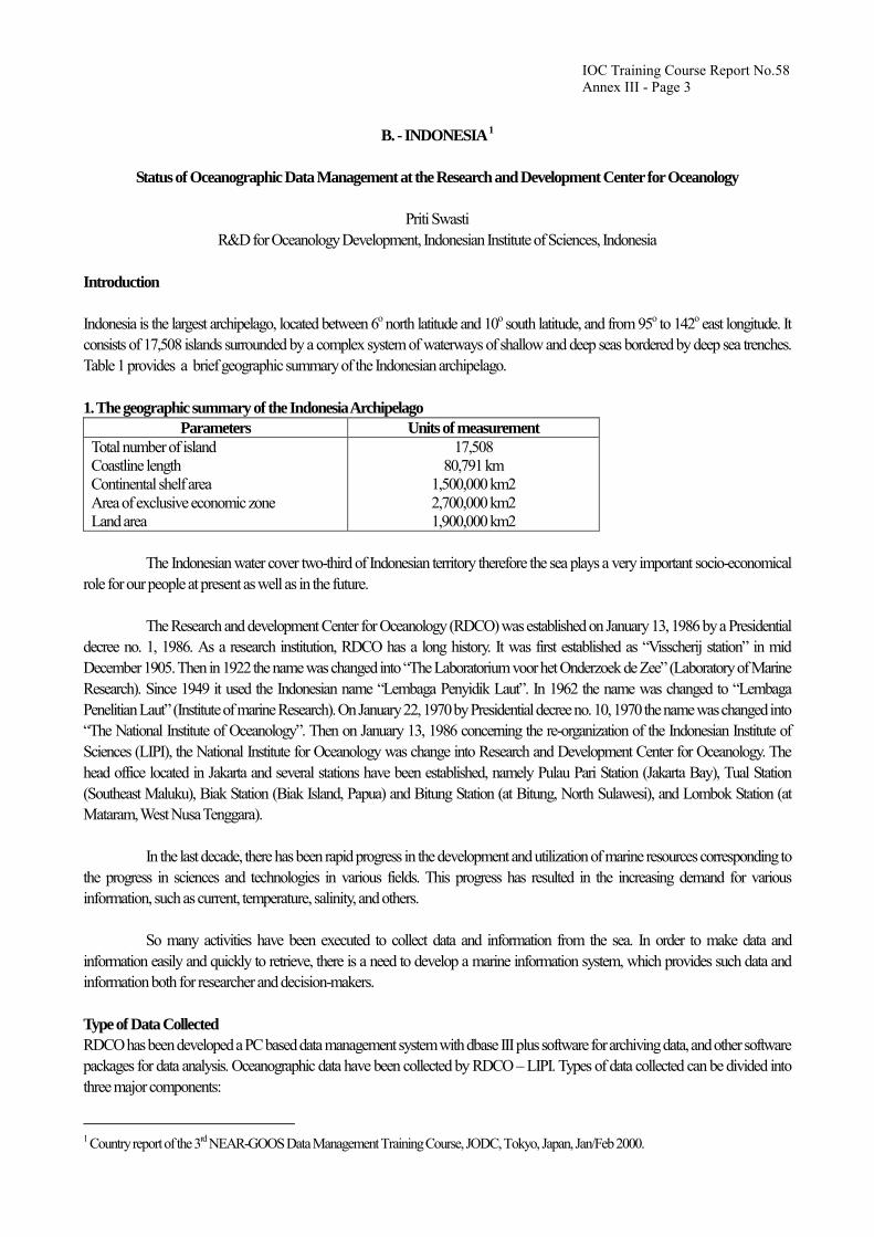
Introduction Indonesia is the largest archipelago, located between 6o north latitude and 10o south latitude, and from 95o to 142o east longitude. It consists of 17,508 islands surrounded by a complex system of waterways of shallow and deep seas bordered by deep sea trenches. Table 1 provides a brief geographic summary of the Indonesian archipelago. 1. The geographic summary of the Indonesia Archipelago
Parameters Units of measurement Total number of island Coastline length Continental shelf area Area of exclusive economic zone Land area
17,508 80,791 km
1,500,000 km2 2,700,000 km2 1,900,000 km2
The Indonesian water cover two-third of Indonesian territory therefore the sea plays a very important socio-economical role for our people at present as well as in the future. The Research and development Center for Oceanology (RDCO) was established on January 13, 1986 by a Presidential decree no. 1, 1986. As a research institution, RDCO has a long history. It was first established as “Visscherij station” in mid December 1905. Then in 1922 the name was changed into “The Laboratorium voor het Onderzoek de Zee” (Laboratory of Marine Research). Since 1949 it used the Indonesian name “Lembaga Penyidik Laut”. In 1962 the name was changed to “Lembaga Penelitian Laut” (Institute of marine Research). On January 22, 1970 by Presidential decree no. 10, 1970 the name was changed into “The National Institute of Oceanology”. Then on January 13, 1986 concerning the re-organization of the Indonesian Institute of Sciences (LIPI), the National Institute for Oceanology was change into Research and Development Center for Oceanology. The head office located in Jakarta and several stations have been established, namely Pulau Pari Station (Jakarta Bay), Tual Station (Southeast Maluku), Biak Station (Biak Island, Papua) and Bitung Station (at Bitung, North Sulawesi), and Lombok Station (at Mataram, West Nusa Tenggara). In the last decade, there has been rapid progress in the development and utilization of marine resources corresponding to the progress in sciences and technologies in various fields. This progress has resulted in the increasing demand for various information, such as current, temperature, salinity, and others. So many activities have been executed to collect data and information from the sea. In order to make data and information easily and quickly to retrieve, there is a need to develop a marine information system, which provides such data and information both for researcher and decision-makers. Type of Data Collected RDCO has been developed a PC based data management system with dbase III plus software for archiving data, and other software packages for data analysis. Oceanographic data have been collected by RDCO – LIPI. Types of data collected can be divided into three major components:
1 Country report of the 3rd NEAR-GOOS Data Management Training Course, JODC, Tokyo, Japan, Jan/Feb 2000.

IOC Training Course Report No.58 Annex III - Page 4
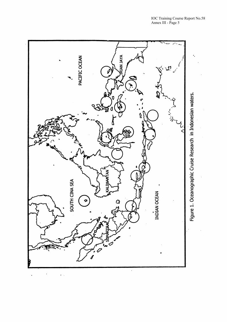
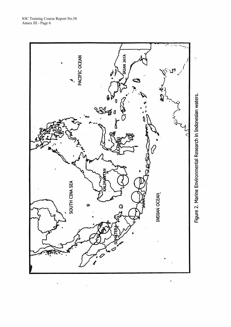
1) Oceanographic Cruise Data 2) Marine Biological Cruise Data 3) Marine Pollution Oceanographic Cruise Data This data is collected from about 1720 stations in Indonesian waters, and consists of marine meteorological, physical, chemical and biological data. To support research activities, a new research vessel Baruna Jaya VIII was launched in 1998. Figure 1 shows oceanographic cruise research location in Indonesian waters. Marine Biological Data This data is the results of biosystematic study of marine flora and fauna on Indonesian waters. A standard database system for coastal living resources has been developed by RDCO. The database was developed under the ASEAN-Australia Co-operative Project on Marine Science. This data consists of four components: 1. Coral reef ecosystem data 2. Mangrove ecosystem data 3. Seagrass ecosystem data 4. Softbottom community data The Indonesian coastal living resources data has been collected since 1987 from three areas: Seribu Island (a coral reef archipelago of Jakarta Bay), Ujung Kulon at West Java, and Grajagan at East Java. Marine Pollution Data Marine pollution data was collected in order to monitor the environmental condition of Indonesian waters, especially in the coastal areas. The pollution is generally caused by land-based human cativities. The parameters of marine pollution monitored can be categorized into physical, chemical and microbiological. All of the data are stored in floppy disk. Figure 2 shows marine environmental research location in Indonesian waters. Publications The RDCO issues a number of publications: 1. Oceanographic Cruise Report (OCR): a compilation of oceanographic data of the recent cruises. Issued irregularly in English. 2. Marine Research in Indonesia (MRI): a scientific journal dealing with marine sciences in general. Issued irregularly in English. 3. Oseanologi dan Limnologi di indonesia (OLDI): a scientific journal dealing with the results of the research in Indonesian
waters. Issued irregularly in Indonesian and or English (bilingual journal). 4. Oseana: a quarterly newsletter in Indonesian. 5. Special Publication: a publication dealing with important subject matters, written in Indonesian and English (bilingual
publication). Acknowledgements I especially thank IOC and JODC for providing me with financial support to attend the training course at JODC. I would like to express my sincere hope that the knowledge provided by the course will be applied successfully to accomplish my task at RDCO.
IOC Training Course Report No.58 Annex III - Page 5
IOC Training Course Report No.58 Annex III - Page 6
IOC Training Course Report No.58 Annex III - Page 7
C - REPUBLIC OF KOREA
Oceanographic Observation and Data Management in Korea
Kyu Kui Jung Korea Oceanographic Data Centre, Oceanography Division, National Fisheries Research and Development Institute
In Korea, oceanographic observation including environmental monitoring has been carried out by several organizations: National Fisheries Research and Development Institute (NFRDI), National Oceanographic Research Institute (NORI), Korea Ocean Research and Development Institute (KORDI), National Maritime Police Administration (NMPA) and Korea Institute of Geology, Mining and Materials (KIGAM). Among those, NFRDI is responsible for the time series oceanographic observation and operation of the national network on marine environment monitoring. Korea Oceanographic Data Centre (KODC) operated by NFRDI is in charge of the Delayed Mode Data Base (DMDB), and KORDI is in charge of Real Time Data Base (RTDB). Serial oceanographic observations Since the foundation of Fisheries Experiment Station (the predecessor of NFRDI) in 1921, the serial oceanographic observations have been carried out in Korea (Tab. 1). The present 175 stations from 22 observation lines, except for one line, were established in 1961. The Korea-Japan Cooperative Line (K-line) in the southern sea of Korea, was added in the Korean oceanographic observation system in 1968. The serial oceanographic observations have been carried out bimonthly and seawater samples were collected at the depth layers of 0 m, 10 m, 20 m, 30 m, 50 m, 75 m, 100 m, 125 m, 150 m, 200 m, 250 m, 300 m, 400 m and 500 m. Beside the
network of serial oceanographic observations, the 315 and 316 observation lines surveyed in the period of CSK (1965 1970) were
specially observed again from 1995. These lines of the northern part of the East China Sea have been observed four times a year. The monitoring variables are water temperature, salinity, dissolved oxygen, nutrients, zooplankton biomass and meteorological factors. On Ullungdo-Yamato Bank Line (line-500) CTD data has been collected since 1993. This monitoring is carried out once a year in August. Environmental monitoring The Korean network for marine pollution monitoring was reorganized in 1997 and NFRDI is responsible for operating the network. The marine pollution monitoring is carried out four times a year at the 240 coastal stations and once a year at the 40 offshore stations (Tab. 2). General variables, like as pH, DO, COD, suspended solids, oil, nutrient (PO4-P, NO2-N,NO3-N, NH3-N) and coliforms, are analysed from all 280 monitoring stations. Particular variables, like heavy metals and CN, are analysed from 66 stations of the 280 stations.

IOC Training Course Report No.58 Annex III - Page 8
The endocrine disrupters (e.g., PCB, TBT, PAHs, heavy metals, dioxins, chlorinated pesticides and radioactivity) will be reinforced in the monitoring network from 2000. Since 1915, the sea surface temperature and meteorological factors in the coastal stations around Korea have been observed daily. The present-day 40 fixed coastal stations were established in 1967. Real time sea surface temperature (SST) data is obtained directly from the advanced very high-resolution radiometer (AVHRR) on the U. S. National Oceanic and Atmospheric Administration (NOAA) polar orbiting satellites. The SST data from the satellite and the daily observation of 40 coastal stations are analysed and used in the prediction and warning of near shore upwelling cold water. In the summer, monitoring for low-saline water and harmful algal blooms (HABs) is extensively implemented in the coastal area through the ship and buoy observations. Oceanographic data management Oceanographic data and information, obtained from NOAA satellite MCSST estimates, ship, drifting buoys, CTD and seawater samples, make it possible to forecast the oceanographic condition and fisheries environment in the seas around Korea. Korea Oceanographic Data Centre (KODC), operated by NFRDI, nowcasts and forecasts the oceanographic conditions in the seas around Korea for the fisheries industries, via facsimile and a webpage of KODC. The forecasting programmes of the oceanographic condition are as follows: Oceanographic Data and News (daily), Weekly Oceanographic Information, Monthly Oceanographic Information and HAB News (for the information of harmful algal bloom, daily in summer). Korea Oceanographic Data Centre devotes itself to collect the oceanographic data produced by several organizations in Korea, and efforts in improving the system for the oceanographic data management and flow. The oceanographic data file, prepared by KODC, has been expanded and a large amount of hydrographic data has been accumulated. KODC will establish the national NEAR-GOOS Delayed Mode Data Base.
Table 1. Time series oceanographic observations in Korea
Area around Korea East China Sea from Ullungdo to Yamato Bank
Frequency Bimonthly Four times a year
Once a year (August)
Line Station
22 Lines 175 Sts.
2 Lines 26 Sts.
1 Line 17 Sts.
Data
Water temperature Salinity
Dissolved oxygen Nutrients (NO2-N, NO3-N,
PO4-P, SiO2-Si) Zooplankton Chlorophyll-a
Meteorological factors
CTD Meteorological
factors
Beginning 1961 (1921 )
1995 (1965 1970) 1993

IOC Training Course Report No.58 Annex III - Page 9
Table 2. Variables for marine pollution monitoring in Korea
Classification Monitoring variables Sample
General var. (280 sts.)
pH, DO, COD, SS, Oil, Nutrients(PO4-P, NO2-N, NO3-N),
E. coli seawater
Particular var. (66 sts.)
Cr+6, As, Cd, Pb, Cu, Zn, Total Hg, CN seawater Coastal and
offshore areas (280 sts.)
Particular var. (20 sts.)
Endocrine disruptors (PCB, TBT, PAHs, Heavy metals, Dioxins,
Chlorinated pesticides, Radioactivity)
seawater sediments organism
D - RUSSIAN FEDERATION
Country Report on Oceanographic Data Management under the WESTPAC/NEAR-GOOS in Russia
Elena Dmitrieva, Igor Rostov V.I. Il’ichev Pacific Oceanological Institute (POI), Far Eastern Branch, Russian Academy of Sciences (FEBRAS)
Introduction The Far-eastern Seas and the adjacent areas of the Pacific Ocean have a determinant effect on formation of the hydrological regime, weather conditions and climate in the Asian-Pacific Region. Here, as well, the richest biological and mineral resources are concentrated, sea routes, fishery and navy activity are developed. All those conditions require up to date studies on the state of nature environment, and the accumulation and effective use of the data resources. Data support of these studies will provide a due participation of Russia in the recent global and regional ecological programmes, qualified management by resources exploration and protection of proper national interests, without carrying out any additional and money-consuming cruises. On the other hand, possibilities of the operative access of users to the national and foreign information resources are dictated by the state of the infrastructure of the created databases and telecommunications from the point of view of the data sets completeness, optimal organization of data and the adequate technical methods and software. For many years those conditions were not realized in the Far-east of Russia, and the access to the data sets of primary oceanographic data on the Far- eastern Seas (National, Foreign and Branch Archives) was regulated. Japan, the People's Republic of China, the Republic of Korea and Russia have good traditions for science and technical collaboration. Last year the scientists of these countries conducted cooperative research for the Sea of Japan, which included investigations of climate variations, living marine resources, coastal management, health of the sea and sea services. Participation of these countries in the NEAR-GOOS International Project under the aegis of IOC/UNESCO, creates a new stage of cooperation in the sphere of accumulation and exchange of data on the marine environment in the region.
IOC Training Course Report No.58 Annex III - Page 10
1. NEAR-GOOS Area Data Originators and Data Users in Russia The basis of information resources on the state of the ocean, and the coastal environment of the Far-eastern Region of Russia is composed of various data covering many years of expeditions, and stationary, regular and voluntary observations:
•= standard oceanographic data characterizing distribution of hydrographical parameters and processes taking place in oceans and seas;
•= hydrometeorological data, including coastal – on the stations and posts network;
•= hydrochemical and hydrobiological data;
•= specialized data connected with tackling ecological problems and application of special research methods (remote sensing, radiological, etc.).
Proceeding from economic and production requirements and depending on the nature of the problems tackled, the collected information is used for various purposes - general oceanology, hydrometeorological observations, fisheries, ecology, hydrography and in coping with a wide scope of applied problems. Below is a list of main sea-study organizations in the Russian Far-east that own and supply the above types of information on the Far-eastern seas (including coastal zones), and adjacent regions of the North-western Pacific:
•= Far-eastern Regional Hydrometeorological Research Institute, Roshydromet (FERHRI, Vladivostok);
•= Pacific Research Institute of Fisheries and Oceanography (TINRO, Vladivostok);
•= V.I. Il’ichev Pacific Oceanological Institute, FEBRAS (POI, Vladivostok);
•= Institute of Marine Biology, FEBRAS (IMB, Vladivostok);
•= Pacific Institute of Geography, FEBRAS (PIG, Vladivostok);
•= Institute of Automatics and Control Processes, FEBRAS (IACP, Vladivostok);
•= Primorye Regional Department on Hydrometeorology and Monitoring of the Natural Environment (PRDHMN, Roshydromet), uniting 10 presently operated coastal stations and posts;
•= Hydrographical Service of the Russian Pacific Fleet (HS RPF);
•= Sakhalin Department on Hydrometeorology and Monitoring of the Natural Environment (SDHMNE, Roshydromet) - 30 stations and posts;
•= Sakhalin Branch of Pacific Research Institute of Fisheries and Oceanography (SakhNIRO). The most complete scope of hydrological-hydrochemical observations (temperature, salinity and chemical composition of waters, marine currents, water pollution, radiochemistry, etc.) was carried out by R/Vs of FERHRI, Roshydromet and POI. Data provided by TINRO and HS RPF contain a few observations on hydrochemical elements and practically no observations on seawater pollution. For dozens of years the territorial hydrometeorological departments have undertaken regular observations using networks of coastal stations, as well as on the neighbouring marine water areas. The measured parameters include the temperature of water and air, water salinity, sea level, waves, ice characteristics, meteorological parameters and others. Many of these organizations do not usually have problem-oriented databases, and information is stored on outdated carriers. Practically all data are passed to RusODC (All Russian Research Institute of Hydrometeorological Information – WDC"B", Obninsk) where they are transferred to modern technical carriers. IMB, PIG and IACP of FEBRAS also have their own information resources on the state of the natural environment of the land, coastal water areas as well as satellite information.

IOC Training Course Report No.58 Annex III - Page 11
Officially, the sea-related organizations of the Far-eastern region can participate in the system of the international data exchange (IODE) through the RusODC (Obninsk) only, or in the bounds of special agreements (GODAR Project, joint cruises and studies, etc.) Such situation contradicts the obligations accepted by Russia according to GOOS/NEAR-GOOS Project, and restricts the development of programmes mutually beneficial for the regional cooperation. This problem should be solved in the nearest future. At present, in the bounds of the Federal Target Programme «The World Ocean» the work for the creation of a Unified System of Information on the World Ocean State has started. It is aimed at coordinating the work of different departments and organizations of Russia in this field (see Supplement 1). 2. Oceanographic Investigations of Russia in the NEAR-GOOS Area in 1996-1999 Starting from the formal beginning of studies under the Project in 1996, the POI, FERHRI, IMB and TINRO have conducted more than 30 oceanographic cruises in the area of Project studies. During the cruises about 1600 oceanographic stations were carried out. The last expedition of POI in the Sea of Japan was finished at the end of last year. The next one, with the participation of SIO (USA), POI and FERHRI, will start in February 2000. Cruises are conducted both in the bounds of the announced national programmes, and with support of the international organizations (Japan, People's Republic of China, Republic of Korea, USA) on the basis of the corresponding agreements. Such programmes include investigation of physical, geochemical and biochemical processes, as well as the control for water quality in the Sea of Japan. 3. Creation of Data Bases on the Far-eastern Seas and the Adjacent Areas of the Pacific Ocean At the initial stage of the activity under the Project "Creating a Unified System of Information on the World Ocean State" in 1999, we're undertaken at the POI, FERHRI and TINRO, an inventory of available oceanographic data was compiled. At present, this information is being located on Web sites of these institutes where information on data bases created by these organizations are also presented.
•= POI : < http://www.pacific.marine.su >
•= FERHRI: < http://www.hydromet.com >
•= TINRO: < http://www.marine.su/TINRO >
•= Other Sites: < http://www.meteo.ru > ; <http://www.fegi.ru/primorye/ At the POI all available archive data sets on observations have been transferred to technical carriers on IBM PC (Supplement 2- oral presentation). Using the relational database management system “PARADOX for WINDOWS” two electronic data bases of oceanographic data (DB) have been established and are being replenished. They mainly contain the data sets on the Northern Pacific and marginal seas.
•= Data Base “OCEAN-1” comprises the archive materials of hydrographic observations (temperature and salinity) from national and foreign expeditions carried out for the period from 1900 to the present time, compiled from all available sources (NODC of Russia, USA, Japan, People's Republic of China, Republic of Korea etc.).
•= Data Base “OCEAN-2” comprises the materials of the cruise studies that have been performed by the POI for a 26 -year period in various areas of the World Ocean on board the research vessels of the FEBRAS and other Institutions, including joint studies of Russian and foreign organizations.
As far as the completeness of the data sets, their organization and possible operative access are concerned this development, at present, has no analogues in the Far-eastern Region of Russia (Supplement 3- oral presentation).
IOC Training Course Report No.58 Annex III - Page 12
New version of integrated databases on separate regions are being developed step by step for the Sea of Japan, Sea of Okhotsk, Bering Sea, South-China Sea and the whole Northern Pacific. For instance, in 1999, while using such technology, the POI created the archive database on the Sea of Japan, Yellow Sea, and the East-China Sea (NEAR-GOOS Area). It involves the observation data from 271,924 Stations (temperature and salinity) for the period of 1925-1999. The POI users’ have been provided access to all data being stored. Quality control, editing, and selective processing of data are carried out. It started by attaching the POI Data Bases to the opto-fibre channel of the integrated network of data transference in FEBRAS (Supplement 4- oral presentation). At the FERHRI and TINRO the analogous work is being carried out in the bounds of priority of their own research programmes. 4. Development of NEAR-GOOS Data Bases in Russia In spite of difficulties in technical maintenance, absence of targeted financing and insufficient coordination of this activity of the official level, the first versions of the following databases have been created and are being developed in two organizations of the Far-eastern Region of Russia:
•= Real Time Data Base (RTDB of FERHRI) < http://www.hydromet.com/neargoos.html >
•= Delayed Mode Data Base (DMDB of POI) <http://www.pacific.marine.su/cdsdb/ngpdb/ngpdbd.html > RTDB of FERHRI is to provide the collection, accumulation and transmission through the Internet of the operative information on marine medium, which is supplied by a network of coastal stations (PRDHMN, SDHMNE, Roshydromet), as well as data of on-the-way and other operative observations carried out on board vessels and buoys. At present, this RTDB is functioning in the mode of collecting and transmitting the operative reports from the marine vessels (surface marine data). This information is passed on a regular basis to the Regional DMDB (Japan). DMDB of POI is to provide the collection, accumulation and transmission through the Internet of both the above data supplied by the RTDB of FERHRI, and all data obtained during the oceanographic cruises of Russian vessels (they are received with delay). At present, the accumulation of such data is carried out at POI as they are received, and only metadata are placed at the correspondent site in the Internet (information about the cruises being carried out, the data sets being accumulated, maps of stations location). In the near future the graphical information on the vertical sections of the observed parameters are meant to be presented on this site. The organizational problems encountered when direct access to the observation data sets to all participants of the Project prompt us to settle additional agreement or to create solutions at the official level. This concerns in the first place the data of cruises performed on a commercial basis or in the bounds of bilateral agreements, as well as the data on the near-coastal water areas of Russia. 5. Further development, creation of information products
POI plans to begin activities on the new project in 2000.
•= Project Title Information Retrieval System on the Marine Environment and Resources of the Far-eastern Seas «FES-Atlas».
•= Specific Goals For the first time an interactive system on CD will be created for rapid access to a multi-disciplinary reference information on the state of marine environment in the Russian Far East. The Project is aiming at the development and creation of the information retrieval system on PC involving both the software and the generalized data presented in tables, schemes and text materials, which contain all modern data on physical and geographical characteristics and resources of the Sea of Japan, the Sea of Okhotsk, and the Bering Sea in the following fields: 1) climate and oceanography; 2) nature environment; 3) biological resources and fishery; 4) oil, mineral resources and their exploration; 5) bibliography. The system will provide data on the state of marine environment in the region (CD-ROM, Internet) by way of generalizing and visualizing the data collected over many years, which , as they are now, are not yet available for free distribution and wide usage.

IOC Training Course Report No.58 Annex III - Page 13
It will allow an operative and complex evaluation of natural and geographic peculiarities and potential of the studied region from the point of view of specific scientific, economic and industrial needs without carrying out supplementary studies and other expenditures. The information retrieval system is being developed for the operational system Windows 9x and Windows NT. The technology of development is based on using freely distributed mini- web-server, hyper-text medium and links linking to the related data bases.
•= Background and Significance For the first time, as far as the Asian-Pacific Region of Russia is concerned, a complex interactive information retrieval system on hydro-meteorological regime, ecology and nature resources of the Far-eastern Seas is found. It presents on compact disks the software and the generalized data on long-term observations performed in the Sea of Japan, the Sea of Okhotsk and the Bering Sea, as well as the results of completed research studies scattered in numerous special scientific transactions and the archives. This information retrieval system can be used as the base of knowledge and the expert system on the given region. It will be helpful at solving the fundamental research problems in the field of studying the World Ocean nature; it can also be used by industrial organizations, the education system and the administrative bodies, which activities are related to the usage of data on the nature environment state, resources and economy of the region, including the cases of emergency, nature and anthropogenic disasters. Conceptually, the system developed is an independent regional segment of a national telecommunication system of information on the World Ocean environment (ESIMO- Russian Federal Programme «Integrated System of Marine Information on the World Ocean»), which is now being created in Russia. Its separate elements can be integrated in a structure providing information for the international projects being carried out by Russia under the aegis of UNESCO/IOC (NEAR-GOOS, NOWPAP/UNEP), PICES, etc., which aim at the marine resources exploration and the environment protection of the Region.
•= Contemporary Condition Similar computer systems are created and successfully used in global practice in the various spheres of human activity, nevertheless the theme and geographical referencing of the proposed system are unique: the most important results of the fundamental and applied studies performed in the area of the Far-eastern Seas in the bounds of international, national and regional programmes are preserved in the archives and special scientific literatures available to a narrow range of specialists. Up to now, the Pacific Oceanological Institute has developed a series of techniques for the collection, accumulation and processing of data, which are arranged in two specialized data bases. The catalogues and data sets are formed for the long-term observations in the Pacific Ocean and the Far-eastern Seas, including the materials of foreign databases. Publications and necessary primary materials representing more than 120,000 references have been collected in order to carry out the work. A group of experts consisting of oceanographers and programmers who possess great experience in the field of creating and exploiting oceanographic data bases for the Pacific Ocean have at their disposal computers, CD-ROM, systems for pre-print materials processing and software.
•= Research Stages At present, we try to find any supplementary sources for financing the fulfilment of this work. This will condition the actual duration of our work. At the first stage (2000) the following has been fulfilled: the coordination of the executors’ work, the technical requirements and the structure of the system are developed; the software has been created and adapted; archive data on the Sea of Japan are collected, processed and generalized. At the next stage (2001) the objective is to create a data base on the Sea of Okhotsk and Bering Sea and to prepare and print the exploitation documents. The information retrieval system will be recorded on CD-ROM together with the programme of installation prepared as a manual. The programme will be distributed freely on the web server. The subprogramme “ Creating a Unified System of Information on the World Ocean State “ represents an important part of the Federal target programme “ The World Ocean”. The governmental customer programme: the coordinator of the Ministry of Economy of the Russian Federation: Roshydromet,. the main developers of the subprogramme are: the Hydrometeorological
IOC Training Course Report No.58 Annex III - Page 14
Centre, Research Institute of Hydrometeorological Information-World Data Centre ( RIHMI-WDC ) and the State Oceanographic Institute (SOI). Subprogramme implementation dates:1998-2007. Executors: 23 ministries and departments of the Russian Federation. The objective of the subprogramme is to create a Unified system of information on the World Ocean state (hereinafter referred to as “ System”) which is based on existing agency systems and intends to provide information support for various marine activities. Major objectives are: ּ creating a unified regulatory - methodical, organizational, metrological and technological basis for maintaining information
resources for the World Ocean state in the Russian Federation; ּ creating and maintaining governmental information funds of data on the state of the World Ocean and coastal areas; ּ developing and standardizing monitoring technologies for the state and pollution of the World Ocean and coastal areas in
on-line and delayed modes; ּ integrating agency information systems and providing access to the whole set of governmental information resources for the
World Ocean; ּ establishing exchange with similar systems within international cooperation and participating in international programmes.
Major actions are: ּ constructing basic elements of the Unified system of information on the World Ocean state, its maintenance and development
on a regular basis; ּ developing and introducing methods, means and technologies of observations of the state and pollution of the World Ocean
and coastal areas; ּ providing users with on-line data on the World Ocean state in real time; ּ providing users with summarized and specialized data on the state of the World Ocean and coastal areas; ּ integrating, maintaining and disseminating information resources on the World Ocean state and providing telecommunication
interaction between the System’s elements and users; ּ developing special and regional components of the System.
The implementation of the subprogramme will make it possible to create a single information space of the country concerning
marine environmental problems and to improve the efficiency of information in support of making decisions in the field of economic, military and research activity in the World Ocean, Russian seas and coastal areas.
E - VIETNAM Oceanographic data management in Vietnam
Tran Thi Tho
Institute of Scientific Information, NCST Vietnam
I. MARINE RESEARCH ACTIVITIES IN VIETNAM Vietnam has a large sea area, with a shoreline spanning more than 3200 km, by mean 1km coastline/100km2 land surface. Along the coastline, there are more than 110 river mouths, many bays, lagoons and more than 2500 islands in the coastal zone. In the North, there is Bak Bo Gulf, to which opens the Red River system and in the South, the Gulf of Thailand, influenced by the Mekong River system.

IOC Training Course Report No.58 Annex III - Page 15
Marine research activities in Vietnam began in the late 20’s with the establishment of the Institute of Oceanography (IO) in Nha Trang in 1930 - the first and unique marine research institution in Indochina region at that time. Due to the war in the Indochina region, from 1945 to 1954, marine research in Vietnam was interrupted and continued only after 1954, separately in North Vietnam and South Vietnam, conforming to the political context at that time. The present period of marine research activities in Vietnam began in 1975, after the end of the long war and the reunification of the country, with a 3200 km coastline and a large sea area with more than 3000 coastal and offshore islands. From that time, corresponding to every State quinquennial Plan of socio-economic development, a National Marine Research Programme was organised with the participation of different marine scientific institutions of the country implementing the main tasks of marine research determined by the Government through the Ministry of Science and Technology. At the same time, there were many projects of research on different aspects of marine science and technology such as hydrometeorology and weather forecasting, coastal and offshore engineering, marine communication and transports, all conducted in different Ministries in response to the requirement of the development of different economic branches. Furthermore, due to renewed favourable national and international relation conditions, the scientific cooperation in marine research with regional countries and international organizations has been developed. Many long-term bilateral cooperative research programmes were established and conducted in the Vietnam sea area. Above all is the active participation of Vietnam in many regional and international Projects of IOC and WESTPAC/IOC, such as GLOSS, IODE, Coral Reef Monitoring, IBCWP, Harmful Algae, Gulf of Thailand, Remote sensing for ICAM, etc. This cooperation has now strengthened and enlarged the scientific research relations of Vietnam with international collective. It accounts for the development of marine sciences in Vietnam and the participation of the country in the development of marine sciences and technology of the region and the world. II. OCEANOGRAPHIC DATA MANAGEMENT IN VIETNAM 1. Oceanographic data holding in Vietnam Oceanographic data in Vietnam originates mainly from 2 sources: 1.1 Long-term series data by coastal and island stations Vietnam counts 18 regular coastal and island oceanographic stations. Established in the last 30 years, they are under the authority of the General Department of Meteorology and Hydrology. Among them the Qui Nhon Station (No73, 13o45’N-109o13’E) participates in the GLOSS system. These stations make observations on meteorological elements, such as air pressure, wind, temperature and others. Oceanographic observations usually include: sea level, waves, water temperature and salinity among others. Following the Action Plan of the National Programme for Environmental Protection, 16 monitoring stations have been established along the coast of Vietnam since 1996, mainly for observing marine environmental factors.
Tab. 1. Size of observation data by regular coastal and island stations
Element Wind Wave Sea level Water temperature Salinity Total
Number of observations 461.760 329.320 1.007.520 453.120 427.200 2.678.920

IOC Training Course Report No.58 Annex III - Page 16
1.2 Oceanographic cruise data Oceanographic cruise data is an important data holding in Vietnam. As presented in the above paragraphs, since 1930 the establishment of the Oceanographic Institute in NhaTrang, a great number of cruises have been conducted in coastal and offshore waters of the Vietnam sea and adjacent waters by Vietnamese and foreign institutions. A great quantity of data on natural conditions (meteorological, hydrological, chemical, geolo-geophysic, biological and environmental factors) and on natural marine resources (living and non-living) were collected. The total number of cruise stations until 1998 are presented in Tab. 2.
Tab. 2. Preliminary inventory of cruises and observation stations conducted in Vietnam and adjacent waters
Cruises Total
observation Stations
Oceanographic factors
observation Stations
Period of investigation (number of
cruises)
Remarks
Total 4.400 Vietnamese 600
Foreign 3.800
Soviet Union, Japan, China, Taiwan,
Thailand, Australia, Indonesia,
Philippines, USA... Short time obs. > 100.000
Long time obs. (1-7 days/nights) 587
Meteorological 600 Temperature 90.000
Salinity 20.000 Diluted oxygen 8.500 Nutrient comp. 3.000
Pollutants 1.300 Hydrobionts 4.000
Fishing trailing 2.928 Bottom sediment 8.700
Geophysics 45.000 Before 1955 211 War time in VN 1955-1975 2.578 War time in VN 1975-1998 1.611 Post war time
2. Present status of oceanographic data management As a result of marine research activities undertaken over 60 years, Vietnam has a great oceanographic data holding, which was effectively utilized in the economical development of the country in the past time. However, because of the long war time and other reasons, the oceanographic data management in Vietnam at present is not considered as well organized, and faces many difficulties in its inventory, conservation and utilisation. The most important points are as follows:
2.1. The oceanographic data holding is now extremely dispersed in different oceanographic research institutions in the country. Every institution manages its own data holding without any organization and technical relations. A national organization of Oceanographic data management is only now in preparation to be established.
2.2. Technical level of the data management is still not appropriate. Data are mostly in manuscript form computerization being only at the beginning. Every institution is now lacking of special managing workmanship and necessary technological capability. The budget granted by the government for oceanographic data management is very limited.

IOC Training Course Report No.58 Annex III - Page 17
2.3. International oceanographic data exchange is still insufficiently developed. Over the wartime there was almost no international relations in the field of oceanographic data management. Only after the war, Vietnam began to participate in IOC Programme such as IODE, GODAR, etc.., attending diverse regional workshops, training courses, establishing international contacts and exchange relationship with different countries in the region.
It is clear that the present status of the oceanographic data management in Vietnam is not yet responding effectively to the nowadays needs of implementing marine research activities and developing the marine resource exploitation and protection of the marine environment of the country. The establishment of a national oceanographic database with a national management plan and qualified staff with necessary capacity building, and international relationship is now an urgent need in Vietnam. LITERATURE 1. Hoang Xuan Nhuan et al. 1993. The present status and problems of the Oceanographic Data Management in Vietnam.
Summary Report Workshop. Tokyo 1992. 2. Dang Ngoc Thanh - 1998. Marine research activities in Vietnam. 1998. 3. Vo Van Lanh - 1998. Project Report: Establishment of the national Oceanographic database in Vietnam. (in Vietnamese)

IOC Training Course Report No.58 Annex IV
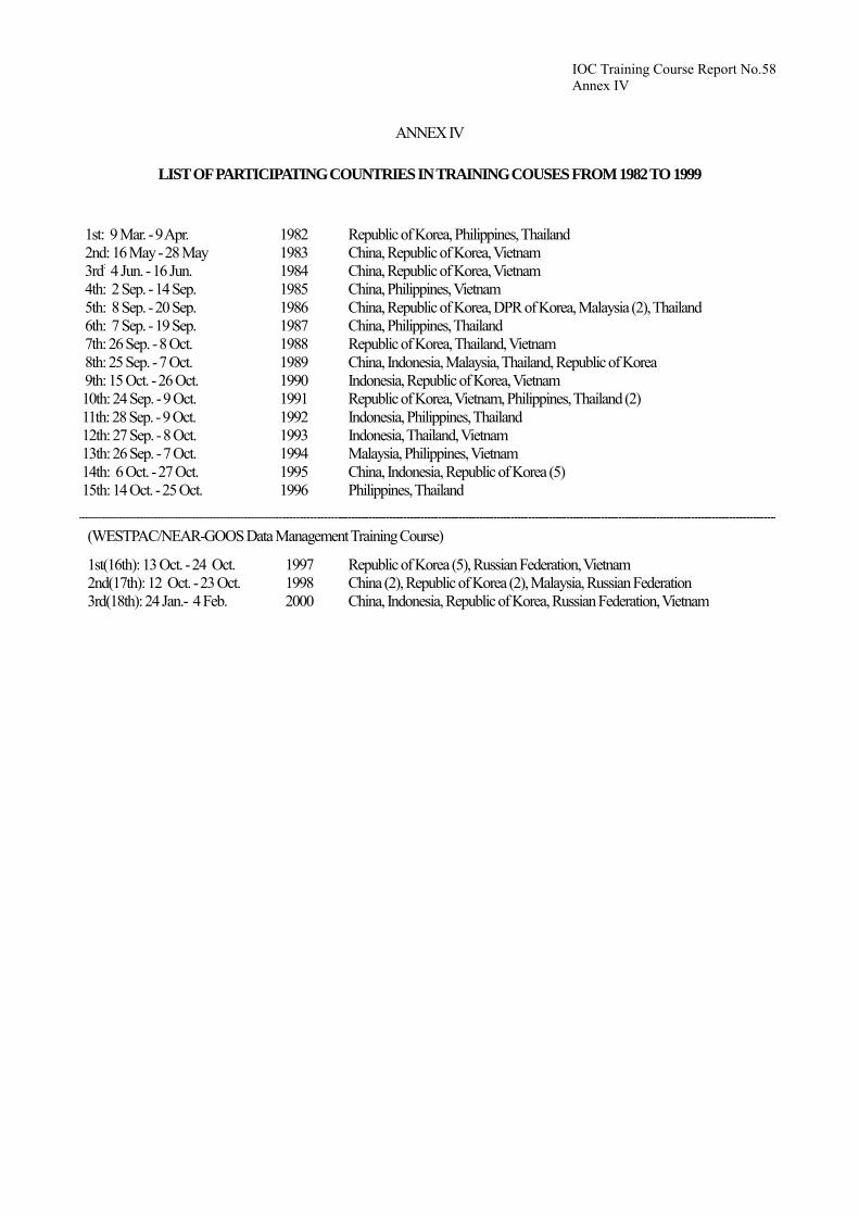
ANNEX IV
LIST OF PARTICIPATING COUNTRIES IN TRAINING COUSES FROM 1982 TO 1999 1st: 9 Mar. - 9 Apr. 2nd: 16 May - 28 May 3rd: 4 Jun. - 16 Jun. 4th: 2 Sep. - 14 Sep. 5th: 8 Sep. - 20 Sep. 6th: 7 Sep. - 19 Sep. 7th: 26 Sep. - 8 Oct. 8th: 25 Sep. - 7 Oct. 9th: 15 Oct. - 26 Oct. 10th: 24 Sep. - 9 Oct. 11th: 28 Sep. - 9 Oct. 12th: 27 Sep. - 8 Oct. 13th: 26 Sep. - 7 Oct. 14th: 6 Oct. - 27 Oct. 15th: 14 Oct. - 25 Oct.
1982 1983 1984 1985 1986 1987 1988 1989 1990 1991 1992 1993 1994 1995 1996
Republic of Korea, Philippines, Thailand China, Republic of Korea, Vietnam China, Republic of Korea, Vietnam China, Philippines, Vietnam China, Republic of Korea, DPR of Korea, Malaysia (2), Thailand China, Philippines, Thailand Republic of Korea, Thailand, Vietnam China, Indonesia, Malaysia, Thailand, Republic of Korea Indonesia, Republic of Korea, Vietnam Republic of Korea, Vietnam, Philippines, Thailand (2) Indonesia, Philippines, Thailand Indonesia, Thailand, Vietnam Malaysia, Philippines, Vietnam China, Indonesia, Republic of Korea (5) Philippines, Thailand
(WESTPAC/NEAR-GOOS Data Management Training Course)
1st(16th): 13 Oct. - 24 Oct. 2nd(17th): 12 Oct. - 23 Oct. 3rd(18th): 24 Jan.- 4 Feb.
1997 1998 2000
Republic of Korea (5), Russian Federation, Vietnam China (2), Republic of Korea (2), Malaysia, Russian Federation China, Indonesia, Republic of Korea, Russian Federation, Vietnam

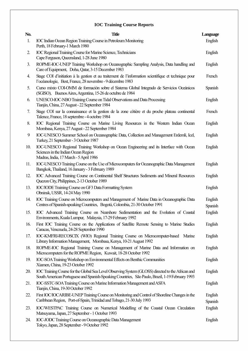
IOC Training Course Reports
No. Title Language 1. IOC Indian Ocean Region Training Course in Petroleum Monitoring
Perth, 18 February-1 March 1980 English
2. IOC Regional Training Course for Marine Science, Technicians Cape Ferguson, Queensland, 1-28 June 1980
English
3. ROPME-IOC-UNEP Training Workshop on Oceanographic Sampling Analysis, Data handling and Care of Equipment, Doha, Qatar, 3-15 December 1983
English
4. Stage COI d’initiation à la gestion et au traitement de l’information scientifique et technique pour l’océanologie, Best, France, 28 novembre - 9 décembre 1983
French
5. Curso mixto COI-OMM de formación sobre el Sistema Global Integrado de Servicios Oceánicos (SGISO), Buenos Aires, Argentina, 15-26 de octubre de 1984
Spanish
6. UNESCO-IOC-NBO Training Course on Tidal Observations and Data Processing Tianjin, China, 27 August - 22 September 1984
English
7. Stage COI sur la connaissance et la gestion de la zone côtière et du proche plateau continental Talence, France, 18 septembre - 4 octobre 1984
French
8. IOC Regional Training Course on Marine Living Resources in the Western Indian Ocean Mombasa, Kenya, 27 August - 22 September 1984
English
9 IOC-UNESCO Summer School on Oceanographic Data, Collection and Management Erdemli, Icel, Turkey, 21 September - 3 October 1987
English
10. IOC-UNESCO Regional Training Workshop on Ocean Engineering and its Interface with Ocean Sciences in the Indian Ocean Region Madras, India, 17 March - 5 April 1986
English
11. IOC-UNESCO Training Course on the Use of Microcomputers for Oceanographic Data Management Bangkok, Thailand, 16 January - 3 February 1989
English
12. IOC Advanced Training Course on Continental Shelf Structures Sediments and Mineral Resources Quezon City, Philippines, 2-13 October 1989
English
13. IOC/IODE Training Course on GF3 Data Formatting System Obninsk, USSR, 14-24 May 1990
English
14. IOC Training Course on Microcomputers and Management of Marine Data in Oceanographic Data Centres of Spanish-speaking Countries, Bogotá, Colombia, 21-30 October 1991
English Spanish
15. IOC Advanced Training Course on Nearshore Sedimentation and the Evolution of Coastal Environments, Kuala Lumpur, Malaysia, 17-29 February 1992
English
16. First IOC Training Course on the Applications of Satellite Remote Sensing to Marine Studies Caracas, Venezuela, 24-28 September 1990
English
17. IOC-KMFRI-RECOSCIX (WIO) Regional Training Course on Microcomputer-based Marine Library Information Management, Mombasa, Kenya, 10-21 August 1992
English
18. ROPME-IOC Regional Training Course on Management of Marine Data and Information on Microcomputers for the ROPME Region, Kuwait, 18-28 October 1992
English
19. IOC-SOA Training Workshop on Environmental Effects on Benthic Communities Xiamen, China, 19-23 October 1992
English
20. IOC Training Course for the Global Sea Level Observing System (GLOSS) directed to the African and South American Portuguese and Spanish-Speaking Countries, São Paulo, Brazil, 1-19 February 1993
English
21. IOC-SSTC-SOA Training Course on Marine Information Management and ASFA Tianjin, China, 19-30 October 1992
English
22. First IOC/IOCARIBE-UNEP Training Course on Monitoring and Control of Shoreline Changes in the Caribbean Region, Port-of-Spain, Trinidad and Tobago, 21-30 July 1993
English Spanish
23. IOC/WESTPAC Training Course on Numerical Modelling of the Coastal Ocean Circulation Matsuyama, Japan, 27 September - 1 October 1993
English
24. IOC-JODC Training Course on Oceanographic Data Management Tokyo, Japan, 28 September - 9 October 1992
English
No. Title Language 25. IOC-JODC Training Course on Oceanographic Data Management
Tokyo, Japan, 27 September - 8 October 1993 English
26. IOC Training Course on Ocean Flux Monitoring in the Indian Ocean. Organized with the support of the Government of Germany , Mombasa, Kenya, 15-27 November 1993
English
27. IOC-UNEP-SPREP Training Course on Coral Reef Monitoring and Assessment Rarotonga, Cook Islands, 23 February - 13 March 1994
English
28. IOC-JODC Training Course on Oceanographic Data Management Tokyo, Japan, 26 September - 7 October 1994
English
29. IOC-UNEP-WHO-FAO Training Course on Qualitative and Quantitative Determination of Algal Toxins , Jena, Germany, 18-28 October 1994
English
30. IOC Training Course on Oceanographic Data Management for Black Sea Countries Obninsk, Russian Federation, 1-12 August 1994
English
31. COI-CEADO Curso Regional de Capacitación en Gestión de Datos e Información Oceanográficos Buenos Aires, Argentina, 17-28 de octubre de 1994
Spanish
32. IOC-UNEP-FAO Training Course on Nutrient Analysis and Water Quality Monitoring Zanzibar, Tanzania, 21-26 November 1994
English
33. IOC-IOMAC Advanced Training Course on Marine Geology and Geophysics off Pakistan. Pakistan, 12-26 November 1994
English
34. Training Course on Management of Marine Data and Information for the Mediterranean Region Valletta, Malta, 10-21 April 1995
English
35. IOC-UNEP-WHO-FAO Training Course on Toxin Chemistry and Toxicology related to Harmful Algal Blooms, Trieste, Italy, 3-12 September 1995
English
36. MAST-IOC Advanced Phytoplankton Course on Taxonomy and Systematics Naples, Italy, 24 September - 14 October 1995
English
37. IOC-JODC Training Course on Oceanographic Data Management Tokyo, Japan, 16-27 October 1995
English
38. IOC/IODE Training Course on Marine Geological and Geophysical Data Management Gelendzhik, Russian Federation, 13-29 September 1995
English
39. IOC/GLOSS-GOOS Training Workshop on Sea-Level Data Analysis, Geodetic & Research Branch Survey of India, Dehra Dun, India, 21 November- 1 December 1995
English
40. IOC-DANIDA Training Course on the Taxonomy and Biology of Harmful Marine Microalgæ; University of Copenhagen, Denmark, 31 July-11 August 1995; IOC-SAREC-DANIDA Training Course on the Taxonomy and Biology of Harmful Marine Microalgæ; University of Mauritius, Republic of Mauritius, 5-14 February 1996; and Annual Report 1995, IOC Science and Communication Centre on Harmful Algæ, DANIDA, University of Copenhagen, Danish Fisheries Research Institute, Danish National Environmental Research Institute
English
41. IOC-Germany Advanced Training Course on Bathymetric Charting in the Western Indian Ocean METEOR, 15-29 December 1995
English
42. COI-SHOA-CICESE Curso Sobre Modelación Numérica de Tsunamis Valparaiso, Chile, 11 de Marzo - 11 de Mayo de 1996
Spanish
43. Seminario/Taller de la COI/GLOSS-SHN sobre Observación y Análisis del Nivel del Mar para países de habla hispano-portuguesa de Latinoamérica Servicio de Hidrografía Naval (SHN), Buenos Aires, Argentina, 19-27 de noviembre de 1996
Spanish
44. IOC-INCO-ROPME Training Course on Oceanographic Data and Information Management, Tehran, Iran, 19-30 October 1997
English
44. IOC-ICSU-IAEA-EU Training Course on Marine Geological and Geophysical Data Management for the Countries of the Black and Caspian Seas Regions, Gelendzhik, Russian Federation, 8-19 September 1997
English
45. IOC-ICSU-IAEA-EU Training Course on Marine Geological and Geophysical Data Management for the Countries of the Black and Caspian Seas Regions, Gelendzhik, Russian Federation, 8-19 September 1997
English
No. Title Language 46. Training Course on Management of Marine Data and Information for the IOCINCWIO Region
Mombasa, Kenya, 1-11 December 1997 English
47. IOC/WESTPAC-SIDA-SAREC-SEAPOL Training Workshop on Operational Data and Information System for the Gulf of Thailand, Bangkok, Thailand, 18-21 November 1997
English
48. SZN-IOC Advanced Phytoplankton Course on Taxonomy and Systematics Vico Equense, Naples, Italy, 10-30 May 1998
English
49. First IOC/WESTPAC Training Course on Monitoring of PSP Plankton and Shellfish Toxicity, Japan, July 1995 Second IOC/WESTPAC Training Course on Species Identification of Harmful Microalgæ, Japan, February 1997 Third IOC/WESTPAC Training Course on Species Identification of Harmful Microalgæ, Japan, August 1997
English
50. IOC/IODE-NIO Training Course on Oceanographic Data and Information Management Goa, India, 17–27 October 1998
English
51. IOC/GLOSS-GOOS Training Workshop on Sea-Level Data Analysis South Africa, 16–27 November 1998
English
52 Under preparation 53 Under preparation 54 IOC/GLOSS-GOOS Training Workshop on Sea-Level Measurements, Tidal Analysis, GPS and
Gravity Measurements, Satellite Altimetry and Numerical Modelling Sao Paulo, Brazil, 30 August-25 September 1999
English
55 IODE Training on Oceanographic Data and Information Management for the Spanish-Speaking Countries of Central and South America / Curso de Formación del Iode sobre la gestión de datos e información oceanográficos para los países de habla hispana de América Central y del Sur Rio Grande, Brazil, 20-29 September 1999
English/Spanish
57 under preparation 58 Third IOC/WESTPAC Training Course on NEAR-GOOS Data Management
Tokyo, Japan, 24 January-4 February 2000 English


![IOC-SOPAC Regional Workshop on Coastal Global Ocean ... · 3.3 COASTAL GLOBAL OCEAN OBSERVING SYSTEM [Coastal GOOS] The recently completedStrategic Design Plan for the Coastal Component](https://static.fdocuments.in/doc/165x107/5f3f00a1d7baf434065b667f/ioc-sopac-regional-workshop-on-coastal-global-ocean-33-coastal-global-ocean.jpg)