
Park Profile - Venezuela El Guache National Park Profile - Venezuela El Guache National Park ......
19
Park Profile - Venezuela El Guache National Park Date of most recent on-site evaluation: January 2004 Publication date: March 2004 Location: Andes Range in the States of Lara and Portuguesa Year created: 1992 Área: 12.500 ha. Ecoregion: Montane forests of the Andes Habitats: Premontane humid forests and lowland montane humid forests Summary Description Located in the foothills of the Andes Range, between the states of Lara and Portuguesa, El Guache National Park’s many rivers drain into the Portuguesa River basin and thus benefit regional agriculture. Forests cover the park’s high mountains. Along with Yacambú and Terepaima National Parks, El Guache is part of a suite of ecologically connected protected areas that are prone to be linked as a legally protected corridor. The Park was created in 1992 with the purpose of protecting the high basins of the Ospino, Guache, Morador, Toco, and Are Rivers, as well as endangered fauna species (especially spectacled bear and helmeted currasow). The park, however, suffers from several problems that might hinder the achievement of its goals. Biodiversity The Park’s flora and fauna have not been sufficiently studied, but it is assumed that populations of spectacled bear (Tremarctos ornatus) and helmeted currasow (Pauxi pauxi) thrive in the park as well as other animal and plant species that also abound in Yacambú National Park. Threats Human intervention, agricultural plots and the lack of institutional presence, surveillance and infrastructure have depleted more than 60% of the original forest. These actions critically endanger the biological integrity of El Guache National Park. 1 www.parkswatch.org
Transcript of Park Profile - Venezuela El Guache National Park Profile - Venezuela El Guache National Park ......

Park Profile - Venezuela El Guache National Park
Date of most recent on-site evaluation: January 2004 Publication date: March 2004 Location: Andes Range in the States of Lara and Portuguesa Year created: 1992 Área: 12.500 ha. Ecoregion: Montane forests of the Andes Habitats: Premontane humid forests and lowland montane humid forests Summary
Description Located in the foothills of the Andes Range, between the states of Lara and Portuguesa, El Guache National Park’s many rivers drain into the Portuguesa River basin and thus benefit regional agriculture. Forests cover the park’s high mountains. Along with Yacambú and Terepaima National Parks, El Guache is part of a suite of ecologically connected protected areas that are prone to be linked as a legally protected corridor. The Park was created in 1992 with the purpose of protecting the high basins of the Ospino, Guache, Morador, Toco, and Are Rivers, as well as endangered fauna species (especially spectacled bear and helmeted currasow). The park, however, suffers from several problems that might hinder the achievement of its goals. Biodiversity The Park’s flora and fauna have not been sufficiently studied, but it is assumed that populations of spectacled bear (Tremarctos ornatus) and helmeted currasow (Pauxi pauxi) thrive in the park as well as other animal and plant species that also abound in Yacambú National Park. Threats Human intervention, agricultural plots and the lack of institutional presence, surveillance and infrastructure have depleted more than 60% of the original forest. These actions critically endanger the biological integrity of El Guache National Park.
1 www.parkswatch.org
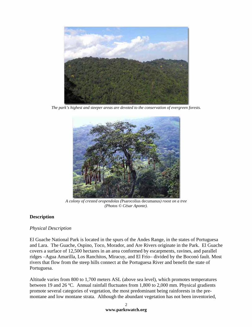
The park’s highest and steeper areas are devoted to the conservation of evergreen forests.
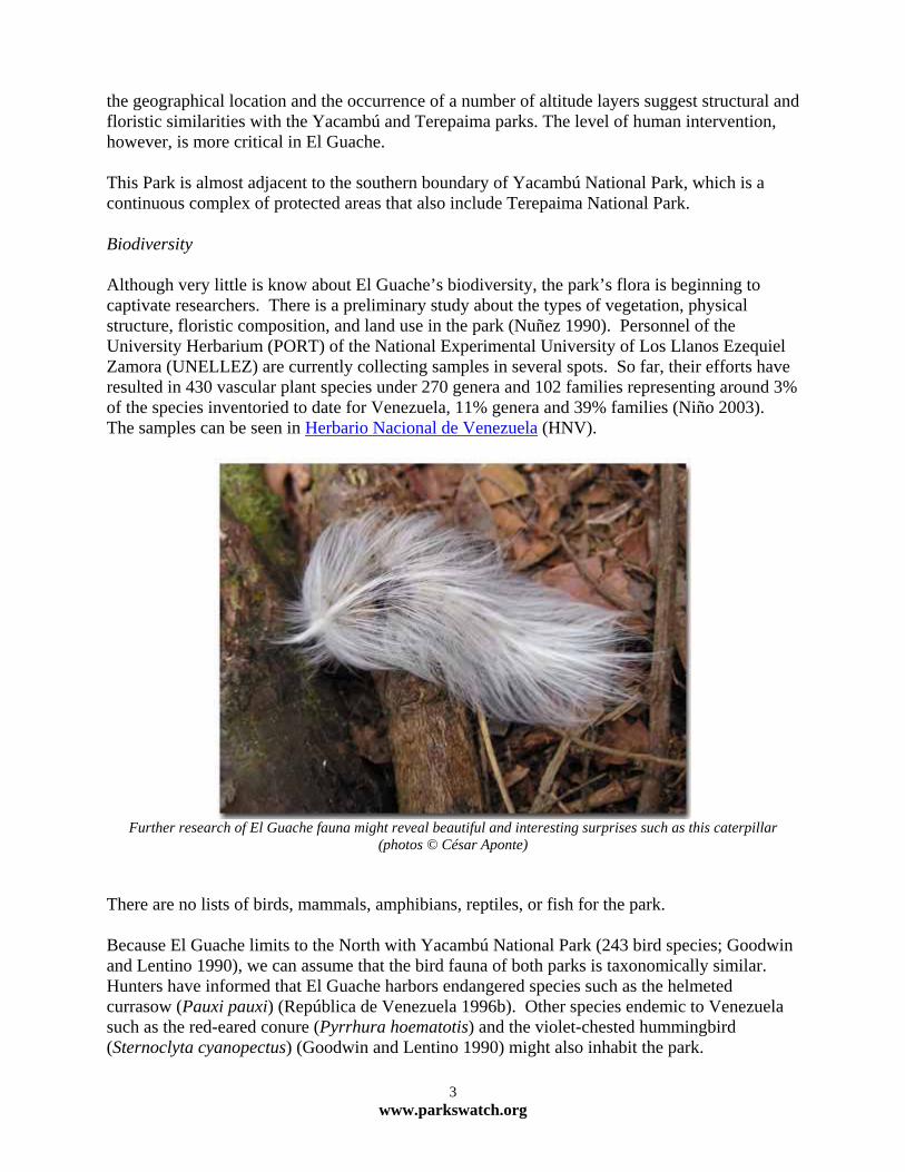
A colony of crested oropendolas (Psarocolius decumanus) roost on a tree
(Photos © César Aponte). Description Physical Description El Guache National Park is located in the spurs of the Andes Range, in the states of Portuguesa and Lara. The Guache, Ospino, Toco, Morador, and Are Rivers originate in the Park. El Guache covers a surface of 12,500 hectares in an area conformed by escarpments, ravines, and parallel ridges –Agua Amarilla, Los Ranchitos, Miracuy, and El Frío– divided by the Boconó fault. Most rivers that flow from the steep hills connect at the Portuguesa River and benefit the state of Portuguesa. Altitude varies from 800 to 1,700 meters ASL (above sea level), which promotes temperatures between 19 and 26 ºC. Annual rainfall fluctuates from 1,800 to 2,000 mm. Physical gradients promote several categories of vegetation, the most predominant being rainforests in the pre-montane and low montane strata. Although the abundant vegetation has not been inventoried,
2 www.parkswatch.org
the geographical location and the occurrence of a number of altitude layers suggest structural and floristic similarities with the Yacambú and Terepaima parks. The level of human intervention, however, is more critical in El Guache. This Park is almost adjacent to the southern boundary of Yacambú National Park, which is a continuous complex of protected areas that also include Terepaima National Park. Biodiversity Although very little is know about El Guache’s biodiversity, the park’s flora is beginning to captivate researchers. There is a preliminary study about the types of vegetation, physical structure, floristic composition, and land use in the park (Nuñez 1990). Personnel of the University Herbarium (PORT) of the National Experimental University of Los Llanos Ezequiel Zamora (UNELLEZ) are currently collecting samples in several spots. So far, their efforts have resulted in 430 vascular plant species under 270 genera and 102 families representing around 3% of the species inventoried to date for Venezuela, 11% genera and 39% families (Niño 2003). The samples can be seen in Herbario Nacional de Venezuela (HNV).
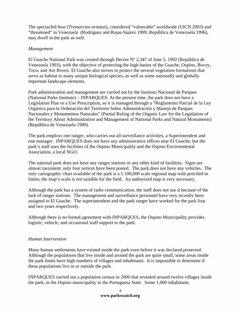
Further research of El Guache fauna might reveal beautiful and interesting surprises such as this caterpillar
(photos © César Aponte) There are no lists of birds, mammals, amphibians, reptiles, or fish for the park. Because El Guache limits to the North with Yacambú National Park (243 bird species; Goodwin and Lentino 1990), we can assume that the bird fauna of both parks is taxonomically similar. Hunters have informed that El Guache harbors endangered species such as the helmeted currasow (Pauxi pauxi) (República de Venezuela 1996b). Other species endemic to Venezuela such as the red-eared conure (Pyrrhura hoematotis) and the violet-chested hummingbird (Sternoclyta cyanopectus) (Goodwin and Lentino 1990) might also inhabit the park.
3 www.parkswatch.org
The spectacled bear (Tremarctos ornatus), considered “vulnerable” worldwide (UICN 2003) and “threatened“ in Venezuela (Rodríguez and Rojas-Suárez 1999; República de Venezuela 1996), may dwell in the park as well. Management El Guache National Park was created through Decree Nº 2,347 of June 5, 1992 (República de Venezuela 1993), with the objective of protecting the high basins of the Guache, Ospino, Bocoy, Toco, and Are Rivers. El Guache also strives to protect the several vegetation formations that serve as habitat to many unique biological species, as well as some nationally and globally important landscape elements. Park administration and management are carried out by the Instituto Nacional de Parques (National Parks Institute) – INPARQUES. At the present time, the park does not have a Legislation Plan or a Use Prescription, so it is managed through a “Reglamento Parcial de la Ley Orgánica para la Ordenación del Territorio Sobre Administración y Manejo de Parques Nacionales y Monumentos Naturales” (Partial Ruling of the Organic Law for the Legislation of the Territory About Administration and Management of National Parks and Natural Monuments) (República de Venezuela 1989). The park employs one ranger, who carries out all surveillance activities, a Superintendent and one manager. INPARQUES does not have any administrative offices near El Guache, but the park’s staff uses the facilities of the Ospino Municipality and the Ospino Environmental Association, a local NGO. The national park does not have any ranger stations or any other kind of facilities. Signs are almost inexistent; only four notices have been posted. The park does not have any vehicles. The only cartographic chart available of the park is a 1:100,000 scale regional map with penciled-in limits; the map’s scale is not suitable for the field. An authorized map is very necessary. Although the park has a system of radio communication, the staff does not use it because of the lack of ranger stations. The management and surveillance personnel have very recently been assigned to El Guache. The superintendent and the park ranger have worked for the park four and two years respectively. Although there is no formal agreement with INPARQUES, the Ospino Municipality provides logistic, vehicle, and occasional staff support to the park. Human Intervention
Many human settlements have existed inside the park even before it was declared protected. Although the populations that live inside and around the park are quite small, some areas inside the park limits have high numbers of villages and inhabitants. It is impossible to determine if these populations live in or outside the park. INPARQUES carried out a population census in 2000 that revealed around twelve villages inside the park, in the Ospino municipality in the Portuguesa State. Some 1,000 inhabitants
4 www.parkswatch.org
(INPARQUES 2000) live in the villages, although the figure is certainly higher today. The most populated areas are Sanarito (56 families, around 336 inhabitants), El Cielito (126 inhabitants), and Jobillal (102 inhabitants), each with several schools, religious facilities, electric power, and numerous agricultural plots.
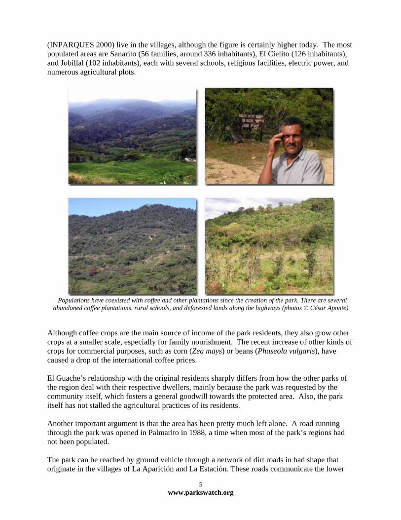
Populations have coexisted with coffee and other plantations since the creation of the park. There are several abandoned coffee plantations, rural schools, and deforested lands along the highways (photos © César Aponte)
Although coffee crops are the main source of income of the park residents, they also grow other crops at a smaller scale, especially for family nourishment. The recent increase of other kinds of crops for commercial purposes, such as corn (Zea mays) or beans (Phaseola vulgaris), have caused a drop of the international coffee prices. El Guache’s relationship with the original residents sharply differs from how the other parks of the region deal with their respective dwellers, mainly because the park was requested by the community itself, which fosters a general goodwill towards the protected area. Also, the park itself has not stalled the agricultural practices of its residents. Another important argument is that the area has been pretty much left alone. A road running through the park was opened in Palmarito in 1988, a time when most of the park’s regions had not been populated. The park can be reached by ground vehicle through a network of dirt roads in bad shape that originate in the villages of La Aparición and La Estación. These roads communicate the lower
5 www.parkswatch.org

areas of the Ospino municipality with the rural hamlets of Moroturo, Santa Rosa de Guache, Hacha, Santa Ana, Sanarito, La Laguna, San Bartolo, Santa Bárbara, Palmarito, Jobillal and Guache de Garabote, all located inside the park. The roads run through the park and end in the hamlets of El Rechazo, Platanal, Bucaritas, Miracuy, Fila Rica and Nuezalito de Guache, in the State of Lara (INPARQUES 2001). The complex network of roads requires 4 x 4 vehicles, although some segments are practically useless during the rainy season. The road, in very poor condition and perilous, is almost exclusively used by the residents, thus protecting the park from new settlements or invasions. Tourism Although El Guache is wealthy in tourist attractions such as beautiful cascades and wells, visitors seldom come to the park. A handful of seasonal visitors come to El Chorro de San Miguel, which is outside the park’s boundaries.
Wells of Palmarito River (photo © César Aponte)
6 www.parkswatch.org
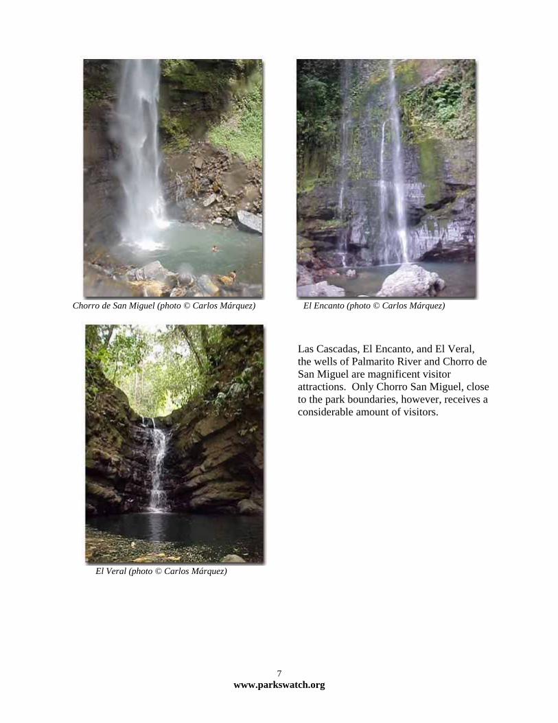
Chorro de San Miguel (photo © Carlos Márquez) El Encanto (photo © Carlos Márquez)
El Veral (photo © Carlos Márquez)
7 www.parkswa
Las Cascadas, El Encanto, and El Veral, the wells of Palmarito River and Chorro de San Miguel are magnificent visitor attractions. Only Chorro San Miguel, closeto the park boundaries, however, receives a considerable amount of visitors.
tch.org
Conservation and Research Very little research has been done in El Guache National Park. Only one preliminary characterization that includes the flower structure and composition of the park’s vegetation has been done (Núñez 1990). There is hardly any data about the fauna residing inside the park. Lists of land and aquatic vertebrates must be developed. Although there is no evidence of field sightings of spectacled bear (Tremarctos ornatus), Goldstein (1993) believes that individuals of the species make occasional visits to the park, per reports of local inhabitants, who have described how the species is hunted and tell stories about how the bear has ravaged their cattle. A project led by Lic. Shaenandhoa García is being carried out. The project’s objectives include an evaluation of the distribution, habitat selection and landscape use by spectacled bear in the parks of the Portuguesa Range. Click here for a description of the project. In 1994, Rivera (1994) did an evaluation of the biotic integrity of the Guache River, using fish as indicators. The study does not determine where in the river the samples were collected, so it is not clear if the study covered areas outside the park. Beginning in 2001, with support from WWF-USA, FUDENA began a project for the legal protection of an ecological corridor between the national parks of the Portuguesa Range (Yacambú, Terepaima, Dinira, El Guache, and Guaramacal). As part of the project, students from the Simón Bolívar University carried out an exercise using the environmental impact evaluation methodology to determine the positive or negative potential impacts of the link between El Guache and Yacambú National Parks. The Fundación Tierra Viva is currently developing the project “Sustainable Development of the Ospino Municipality,” that strives to develop an integrated model for the sustainable development of the highest areas of the municipality. The project will also try to educate producers that grow coffee inside the park, to promulgate environmentally friendly methods among them.
8 www.parkswatch.org
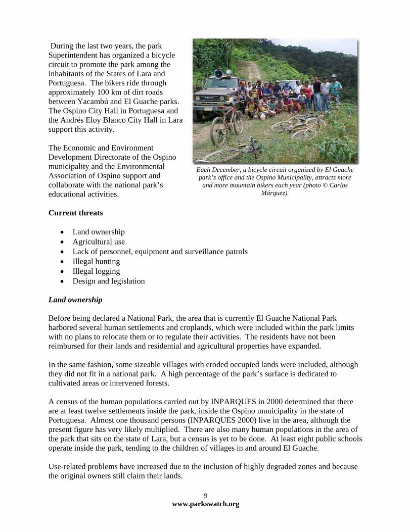
During the last two years, the park Superintendent has organized a bicycle circuit to promote the park among the inhabitants of the States of Lara and Portuguesa. The bikers ride through approximately 100 km of dirt roads between Yacambú and El Guache parks. The Ospino City Hall in Portuguesa and the Andrés Eloy Blanco City Hall in Lara support this activity. The Economic and Environment Development Directorate of the Ospino municipality and the Environmental Association of Ospino support and collaborate with the national park’s educational activities.
Each December, a bicycle circuit organized by El Guache park’s office and the Ospino Municipality, attracts more
and more mountain bikers each year (photo © Carlos Márquez).
Current threats
• Land ownership • Agricultural use • Lack of personnel, equipment and surveillance patrols • Illegal hunting • Illegal logging • Design and legislation
Land ownership Before being declared a National Park, the area that is currently El Guache National Park harbored several human settlements and croplands, which were included within the park limits with no plans to relocate them or to regulate their activities. The residents have not been reimbursed for their lands and residential and agricultural properties have expanded. In the same fashion, some sizeable villages with eroded occupied lands were included, although they did not fit in a national park. A high percentage of the park’s surface is dedicated to cultivated areas or intervened forests. A census of the human populations carried out by INPARQUES in 2000 determined that there are at least twelve settlements inside the park, inside the Ospino municipality in the state of Portuguesa. Almost one thousand persons (INPARQUES 2000) live in the area, although the present figure has very likely multiplied. There are also many human populations in the area of the park that sits on the state of Lara, but a census is yet to be done. At least eight public schools operate inside the park, tending to the children of villages in and around El Guache. Use-related problems have increased due to the inclusion of highly degraded zones and because the original owners still claim their lands.
9 www.parkswatch.org
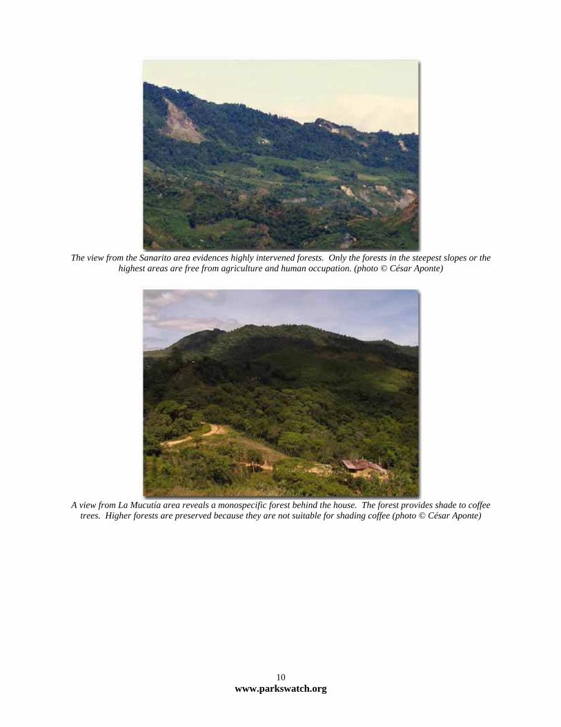
The view from the Sanarito area evidences highly intervened forests. Only the forests in the steepest slopes or the
highest areas are free from agriculture and human occupation. (photo © César Aponte)
A view from La Mucutía area reveals a monospecific forest behind the house. The forest provides shade to coffee
trees. Higher forests are preserved because they are not suitable for shading coffee (photo © César Aponte)
10 www.parkswatch.org
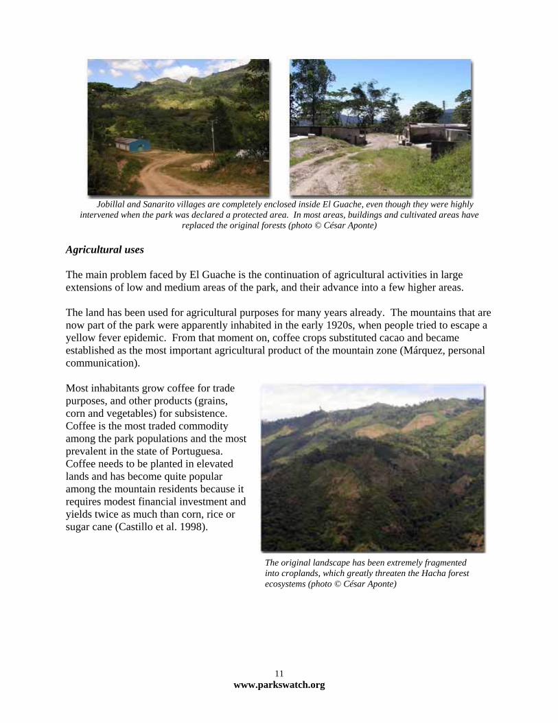
Jobillal and Sanarito villages are completely enclosed inside El Guache, even though they were highly
intervened when the park was declared a protected area. In most areas, buildings and cultivated areas have replaced the original forests (photo © César Aponte)
Agricultural uses The main problem faced by El Guache is the continuation of agricultural activities in large extensions of low and medium areas of the park, and their advance into a few higher areas. The land has been used for agricultural purposes for many years already. The mountains that are now part of the park were apparently inhabited in the early 1920s, when people tried to escape a yellow fever epidemic. From that moment on, coffee crops substituted cacao and became established as the most important agricultural product of the mountain zone (Márquez, personal communication). Most inhabitants grow coffee for trade purposes, and other products (grains, corn and vegetables) for subsistence. Coffee is the most traded commodity among the park populations and the most prevalent in the state of Portuguesa. Coffee needs to be planted in elevated lands and has become quite popular among the mountain residents because it requires modest financial investment and yields twice as much than corn, rice or sugar cane (Castillo et al. 1998).
The original landscape has been extremely fragmented into croplands, which greatly threaten the Hacha forest ecosystems (photo © César Aponte)
11 www.parkswatch.org
The advance of the agricultural frontier threatens even the highest forests, which are usually in better conditions.
Hacha area (photo © César Aponte)
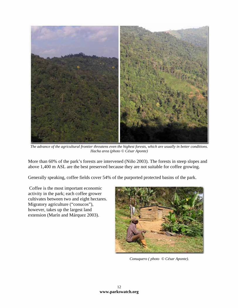
More than 60% of the park’s forests are intervened (Niño 2003). The forests in steep slopes and above 1,400 m ASL are the best preserved because they are not suitable for coffee growing. Generally speaking, coffee fields cover 54% of the purported protected basins of the park. Coffee is the most important economic activity in the park; each coffee grower cultivates between two and eight hectares. Migratory agriculture (“conucos”), however, takes up the largest land extension (Marín and Márquez 2003).
Conuquero ( photo © César Aponte).
12 www.parkswatch.org

The park’s superintendent inspects four hectares illegally planted with corn, sugar cane, blackberry and plantain.
Some other five hectares are sown with beans, blackberry, coffee, tomato and other vegetables and are also used as cattle grazing sites. Blackberry farming has recently been adopted as a substitute for coffee, due to the alarmingly
drop of prices (photos © César Aponte)
Agricultural activities imply deforestation and agrochemical contamination of soils and water. This is prevalent in Jobillal and Sanarito, where forest areas only remain in the highest and steepest areas, where growing crops is not possible. Farmers use fertilizers, but INPARQUES believes that they are scantily and seldom used and therefore do not impact the areas in a negative fashion. There are no studies about how agrochemicals have damaged El Guache’s soils and water. The lands of Palmarito, almost exclusively used for planting and therefore very disturbed, have given rise to conflicts between park residents and authorities. A few months before the park was declared as protected, a family that migrated from another region planted six hectares of onions. The rights to the yield of the land were sold to a couple of foreign families and the present owners do not recognize INPARQUES’ authority. The sale of land rights is illegal. Agricultural activities inside the park cannot be controlled because a regulation plan is not in place. INPARQUES opted for advising and educating the farmers and has tried to establish agreements regarding the size of croplands and razing. The farmers of the area have never acknowledged such agreements and have continued to clear the forest to make space for their crops. Since the coffee prices started to drop, most farmers began planting corn and beans instead of coffee.
13 www.parkswatch.org
Agriculture in Palmarito (Photos © César Aponte)
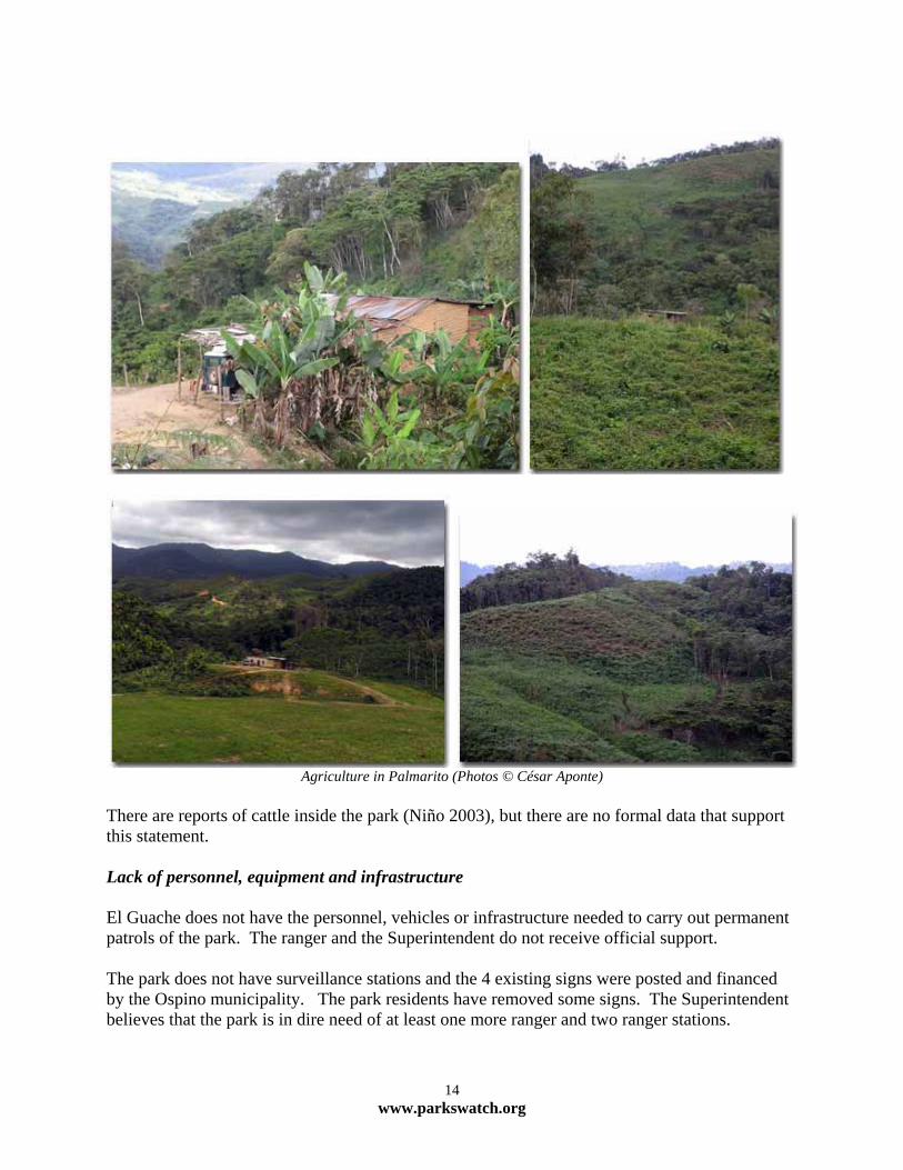
There are reports of cattle inside the park (Niño 2003), but there are no formal data that support this statement. Lack of personnel, equipment and infrastructure El Guache does not have the personnel, vehicles or infrastructure needed to carry out permanent patrols of the park. The ranger and the Superintendent do not receive official support. The park does not have surveillance stations and the 4 existing signs were posted and financed by the Ospino municipality. The park residents have removed some signs. The Superintendent believes that the park is in dire need of at least one more ranger and two ranger stations.
14 www.parkswatch.org
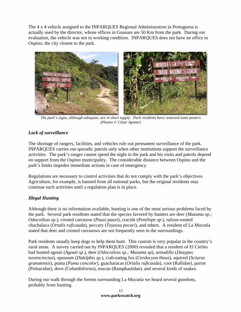
The 4 x 4 vehicle assigned to the INPARQUES Regional Administration in Portuguesa is actually used by the director, whose offices in Guanare are 50 Km from the park. During our evaluation, the vehicle was not in working condition. INPARQUES does not have an office in Ospino, the city closest to the park.
The park’s signs, although adequate, are in short supply. Park residents have removed some posters
(Photos © César Aponte) Lack of surveillance The shortage of rangers, facilities, and vehicles rule out permanent surveillance of the park. INPARQUES carries out sporadic patrols only when other institutions support the surveillance activities. The park’s ranger cannot spend the night in the park and his visits and patrols depend on support from the Ospino municipality. The considerable distance between Ospino and the park’s limits impedes immediate actions in case of emergency. Regulations are necessary to control activities that do not comply with the park’s objectives. Agriculture, for example, is banned from all national parks, but the original residents may continue such activities until a regulation plan is in place. Illegal Hunting Although there is no information available, hunting is one of the most serious problems faced by the park. Several park residents stated that the species favored by hunters are deer (Mazama sp.; Odocoileus sp.), crested currasow (Pauxi pauxi), cracids (Penélope sp.), rufous-vented chachalaca (Ortalis ruficauda), peccary (Tayassu pecari), and others. A resident of La Mucutía stated that deer and crested currasows are not frequently seen in the surroundings. Park residents usually keep dogs to help them hunt. This custom is very popular in the country’s rural areas. A survey carried out by INPARQUES (2000) revealed that a resident of El Cielito had hunted agouti (Agouti sp.), deer (Odocoileus sp.; Mazama sp), armadillo (Dasypus novencinctus), opossum (Didelphis sp.), crab-eating fox (Cerdocyon thous), squirrel (Sciurus granatensis), puma (Puma concolor), guacharacas (Ortalis ruficauda), coot (Rallidae), parrot (Psittacidae), dove (Columbiforms), toucan (Ramphastidae), and several kinds of snakes. During our walk through the forests surrounding La Mucutía we heard several gunshots, probably from hunting.
15 www.parkswatch.org

Rufous-vented chachalaca (Ortalis ruficauda). Residents of the park and surrounding areas usually keep wild
animals as pets (Photo © César Aponte) Illegal logging Cedars (Cedrella montana) are very abundant in the lower areas of the park (800 m ASL). In 2000, a joint study between INPARQUES and the National Guard revealed that an organized band of criminals was illegally extracting and trading cedar in Jobillal and Santana. The band operated under the wings of corrupt officers of the National Guard, who were detained and prosecuted. Since then, it appears that that illegal logging has not resumed inside the park. The problem, however, must be monitored. During our evaluation, we observed traces of recent timber extraction in a road in the forest surrounding La Mucutía. Due to the characteristics of the road, the logs extracted must have been medium and small, of the kind that is used for building houses inside the park. Joint operations between INPARQUES, the National Guard,
and the Ospino municipality successfully put a stop to illegal logging from Santa Ana del Palmar, near the park (Photo ©
Carlos Márquez)
16 www.parkswatch.org
Other wood species are also used extensively. An evaluation done by the Ospino municipality revealed that over 70% of the residents of the park use wood as the main source of energy for cooking and building. Design and regulation Some experts believe that, at the time of being declared a protected area, El Guache did not comply with all the requirements to become a National Park. Most of today’s threats are carry-overs from the past. The park became a declared area when the community requested legal protection to prevent further decay of the very degraded forest area. It seems that old political criteria prevailed over technical criteria, and the park was declared protected despite the many ecological problems of the area. Although the park has not stopped the advance of the agricultural frontier, it has functioned as a tool for decreasing it. The park does not operate, however, as an instrument to protect the ecosystem or its physical and ecological properties. El Guache might not be able to fulfill its two objectives: to protect the high river basins and the endangered species, such as crested currasow and spectacled bear. The legal document that supported the creation of the park instructs the Ministry of Environment and INPARQUES to “define and place demarcation signposts on all limits of the national park” (República de Venezuela 1992) two years after publication of the decree. The document also requests that a legislation plan for the park be developed before one year. Twelve years after, these two instructions have not been honored. A management plan is needed as an instrument to regulate all activities that do not respond to the objectives of the park and to prevent future threats. Recommendations Ownership and agricultural use of the land A relocation program such as the one implemented in Guatopo National Park would not be suitable in El Guache, because the lands inside the latter are large and have been populated for a long time. Residents would lose all rights to the land, which would result in acrimony towards the park and INPARQUES, and the extremely intervened terrains would not suit the park’s objectives. The total elimination of coffee cultivation within El Guache National Park is unthinkable. The crop is extremely important for the economy of park residents and the state of Portuguesa, and INPARQUES’ dire budget constraints, limiting the economic alternatives that could be offered to coffee growers in the park. Nevertheless, the degradation of the ecologically- and financially-important high river basins must be curtailed and emergency improvement actions undertaken. Perhaps the only long-term solution would be the development of an extensive plan for sustainable development that would include, among others, a time-suspended education program for coffee growers and schools, to promote environmentally friendly agricultural methods. The
17 www.parkswatch.org
plan could also include a financial subsidy program for coffee growers who adopt environmentally friendly criteria. Farmers should commit to growing coffee exclusively and to gradually stop planting at certain elevations to allow forest recovery. All of this would necessarily imply a government guarantee of keeping coffee prices stable and purchasing the yield. One such program is at present being promoted by Fundación Tierra Viva, with the support of a committee conformed by several local organizations and institutions. Click here for more details about the program and its outreach. Lack of personnel, equipment and facilities; poor surveillance. Regarding the lack of surveillance, it is necessary to increase the park staff and infrastructure. The latter will be easily accomplished without financial contribution of INPARQUES because of the excellent working relationship with the Ospino municipality and the park. The Fondo Intergubernamental para la Descentralización (FIDES) could contribute funds to build ranger stations. This government agency supports civil infrastructure improvement projects through the municipalities, as long as these projects are requested by civil society organizations. Current relations with the Ospino municipality are excelent, in particular with the agency in charge of economic and environmental development, where support to El Guache National Park is considered part of its responsibility. Perhaps it would be wise that INPARQUES took advantage of the municipality’s support and promoted a legal collaboration agreement to guarantee continued support for the coming years. Regardign staff, at least two more park rangers are needed. Although INPARQUES cannot pay full salaries at this time, the rangers may be hired temporarily through the Unified Command Against Forest Fires, a support program. INPARQUES is a member of the command, which has funds available to contract support personnel during the fire season. Park residents or neighbors and community leaders may be contracted to carry out surveillance and fire prevention activities. Personnel hired in this fashion might be incorporated into a voluntary brigade in order to collaborate with surveillance. Conclusions El Guache National Park faces countless serious problems, most of which originated before the park was created. The area, located in a highly important agricultural zone that is under heavy human intervention, apparently did not comply with all the requirements to become a National Park. If the park is to operate as an effective tool to stop the advance of the agricultural frontier and to protect hydrographic basins, it is necessary to implement a Management Plan and Use Regulations, which do not exist yet. Perhaps El Guache represents an opportunity to test alternative models for the management of protected natural areas based on the paradigms of the relationship between humans and the
18 www.parkswatch.org
environment. For this purpose, a sustainable development strategy such as the one being tested by the Fundación Tierra Viva might be of great benefit in the future. If the present conditions persist, however, El Guache will not meet the objectives for which it was created. El Guache is considered critically threatened. Bibliografía Castillo J., L. Colmenares, J. Najul, y O. Ron. 1998. Análisis Estratégico de la Caficultura en el Estado Portuguesa. Fundación para el Desarrollo de la Región Centro Occidental de Venezuela.
obernación del Estado Portuguesa. G FUDENA. 2001. Establecimiento de un corredor ecológico para La Sierra de Portuguesa.
ttp://www.fudena.org.ve/proyectos2.htmh . Consultado el 14 de Noviembre de 2003. GOLDSTEIN, I. 1993. Distribución, presencia y conservación del Oso Frontino en Venezuela.
iollania 9:171-181. B GOODWIN, M. L y LENTINO, M. 1990. Lista de las aves. Parque Nacional Yacambú, Estado Lara,
enezuela. Sociedad Conservacionista Audubon de Venezuela. 24 pp. V INPARQUES 2000. Primer censo de poblaciones humanas dentro del Parque Nacional El Guache, Sector 4, Estado Portuguesa. Dirección Regional del Instituto Nacional de Parques, Estado Portuguesa. IUCN 2003. 2003 IUCN RED LIST OF THREATENED SPECIES. <WWW.REDLIST.ORG>.
ONSULTADO EL 20 DE FEBRERO DE 2004. C MARÍN A. y C. MÁRQUEZ. 2003. Proyecto para el desarrollo de actividades agro ecológicas en las comunidades asentadas en las cuencas altas de los ríos y en el área asociada al Parque
acional El Guache. Junta Ambientalista de Ospino. N NUÑEZ, Q. O. 1990. Levantamiento de información básica en materia de vegetación. Fase II. Sector Portuguesa – Guache. Estado Portuguesa. MARNR. Serie Informes Técnicos, Zona 8/IT/318. 89 pp. NIÑO, M. 2003. Diversidad Vegetal del Parque Nacional El Guache, estado Portugesa –
enezuela. XV Congreso Venezolano de Botánica, Mérida. Libro de Resumenes: 73. V REPÚBLICA DE VENEZUELA. 1989. Decreto Nº 276. Reglamento Parcial de la Ley Orgánica para la Ordenación del Territorio sobre Administración y Manejo de los Parques Nacionales y Monumentos Naturales. Gaceta Oficial Nº 4,106; 7 de junio de 1989. REPÚBLICA DE VENEZUELA. 1993. Decreto Nº 2.345. Declaratoria del Parque Nacional El
uache. Gaceta Oficial Nº 4.548 Extraordinario; 26 de marzo de 1993. G REPÚBLICA DE VENEZUELA. 1996b. Decreto Nº 1.486. Especies en Peligro de Extinción. Gaceta oficial Nº 36,062; 10 de octubre de 1996. RIVERA, G. M. A. 1994. Utilización de la ictiofauna como indicadora de la integridad biótica de los ríos Guache y Guanare, Estado Portuguesa, Venezuela. Tesis de Grado. Universidad Experimental de los Llanos Ezequiel Zamora (UNELLEZ), 125 pp.
19 www.parkswatch.org
RODRÍGUEZ, J. -. y ROJAS-SUÁREZ, F. 1999. Libro Rojo de la Fauna Venezolana. PROVITA y Fundación Polar, Caracas, 472 pp.