Measuring Success of Targeted BMP Implementation, and Getting Smarter about Ephemeral Gully Sediment...
19
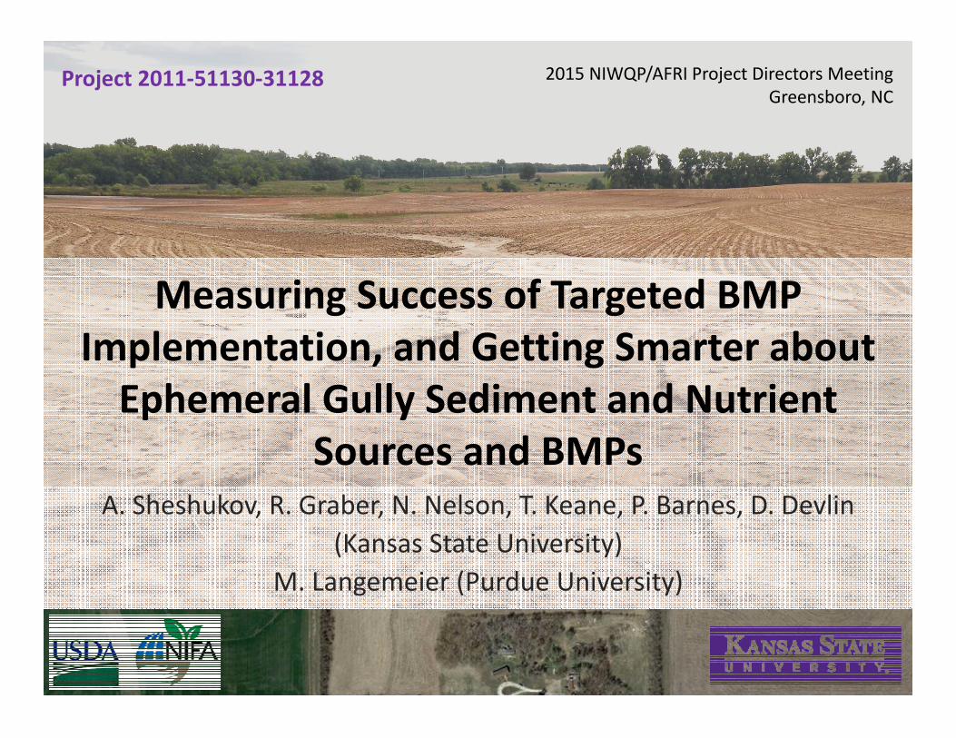
Measuring Success of Targeted BMP Implementation, and Getting Smarter about Ephemeral Gully Sediment and Nutrient Sources and BMPs A. Sheshukov, R. Graber, N. Nelson, T. Keane, P. Barnes, D. Devlin (Kansas State University) M. Langemeier (Purdue University) 2015 NIWQP/AFRI Project Directors Meeting Greensboro, NC Project 2011‐51130‐31128
-
Upload
national-institute-of-food-and-agriculture -
Category
Environment
-
view
288 -
download
0
Transcript of Measuring Success of Targeted BMP Implementation, and Getting Smarter about Ephemeral Gully Sediment...
Measuring Success of Targeted BMP Implementation, and Getting Smarter about Ephemeral Gully Sediment and Nutrient
Sources and BMPsA. Sheshukov, R. Graber, N. Nelson, T. Keane, P. Barnes, D. Devlin
(Kansas State University) M. Langemeier (Purdue University)
2015 NIWQP/AFRI Project Directors MeetingGreensboro, NC
Project 2011‐51130‐31128
2
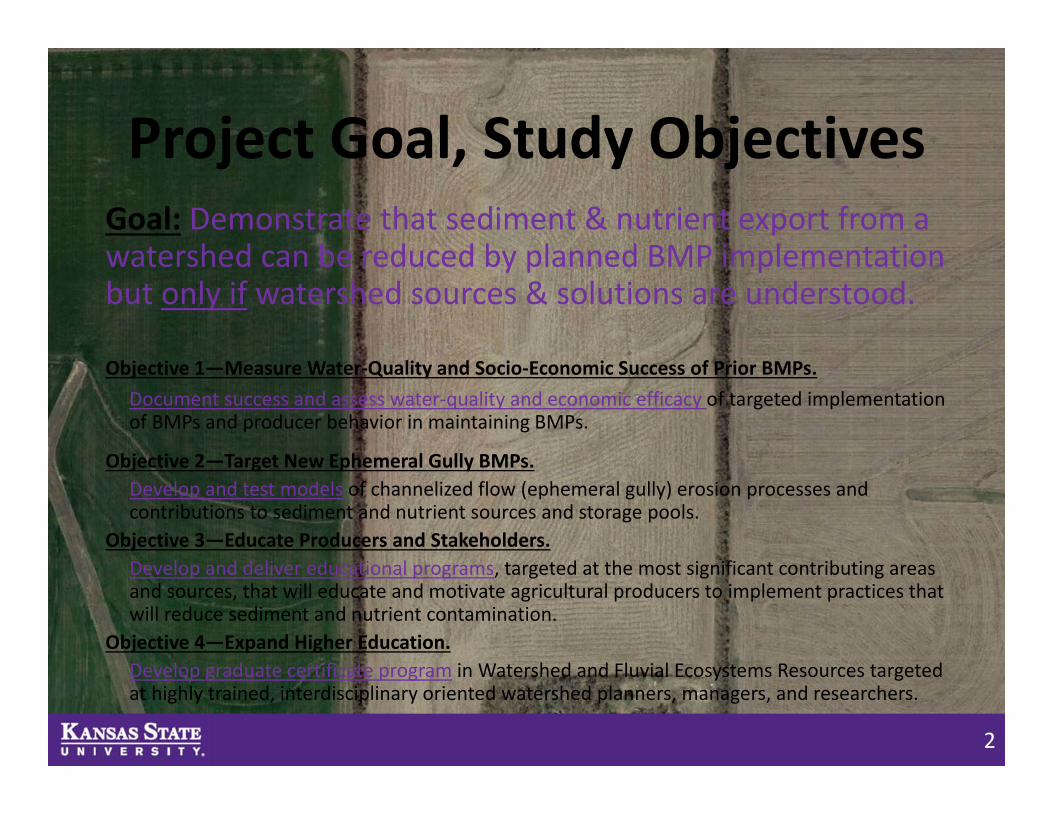
Project Goal, Study ObjectivesGoal: Demonstrate that sediment & nutrient export from a watershed can be reduced by planned BMP implementation but only if watershed sources & solutions are understood.
Objective 1—Measure Water‐Quality and Socio‐Economic Success of Prior BMPs. Document success and assess water‐quality and economic efficacy of targeted implementation of BMPs and producer behavior in maintaining BMPs.
Objective 2—Target New Ephemeral Gully BMPs. Develop and test models of channelized flow (ephemeral gully) erosion processes and contributions to sediment and nutrient sources and storage pools.
Objective 3—Educate Producers and Stakeholders.Develop and deliver educational programs, targeted at the most significant contributing areas and sources, that will educate and motivate agricultural producers to implement practices that will reduce sediment and nutrient contamination.
Objective 4—Expand Higher Education.Develop graduate certificate program in Watershed and Fluvial Ecosystems Resources targeted at highly trained, interdisciplinary oriented watershed planners, managers, and researchers.
3
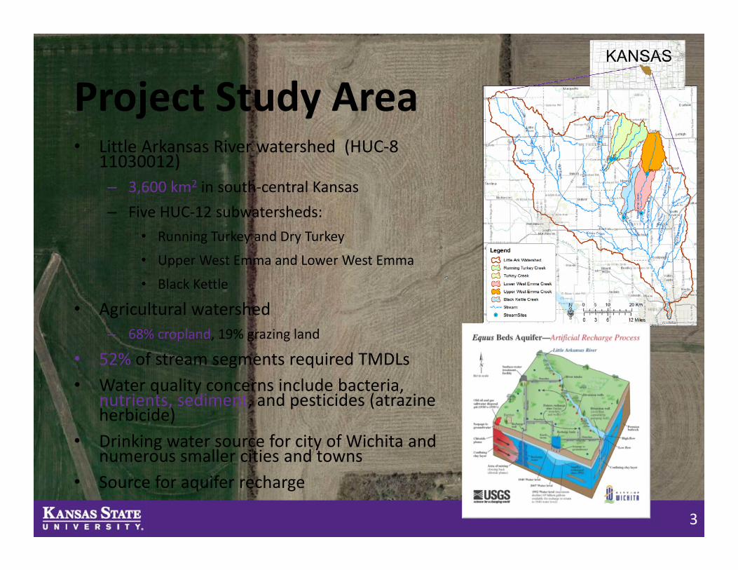
Project Study Area• Little Arkansas River watershed (HUC‐8
11030012) – 3,600 km2 in south‐central Kansas– Five HUC‐12 subwatersheds:
• Running Turkey and Dry Turkey
• Upper West Emma and Lower West Emma
• Black Kettle
• Agricultural watershed– 68% cropland, 19% grazing land
• 52% of stream segments required TMDLs• Water quality concerns include bacteria,
nutrients, sediment, and pesticides (atrazine herbicide)
• Drinking water source for city of Wichita and numerous smaller cities and towns
• Source for aquifer recharge
4
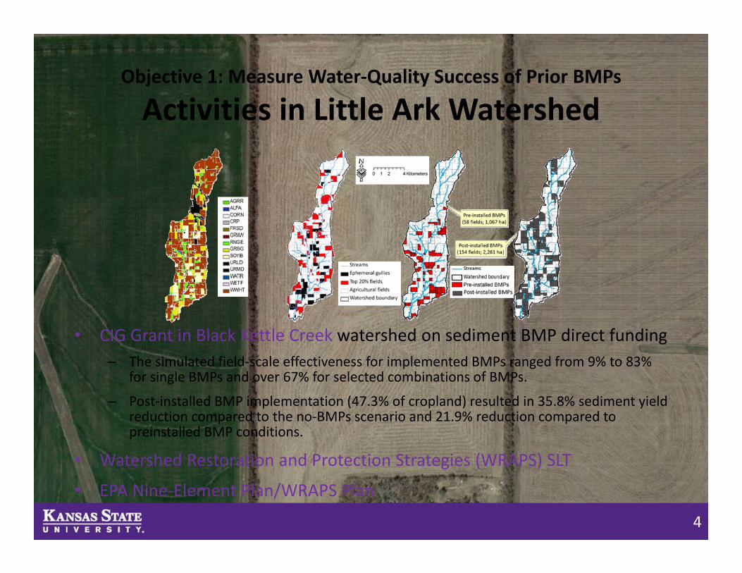
Objective 1: Measure Water‐Quality Success of Prior BMPs
Activities in Little Ark Watershed
• CIG Grant in Black Kettle Creek watershed on sediment BMP direct funding– The simulated field‐scale effectiveness for implemented BMPs ranged from 9% to 83%
for single BMPs and over 67% for selected combinations of BMPs.
– Post‐installed BMP implementation (47.3% of cropland) resulted in 35.8% sediment yield reduction compared to the no‐BMPs scenario and 21.9% reduction compared to preinstalled BMP conditions.
• Watershed Restoration and Protection Strategies (WRAPS) SLT
• EPA Nine‐Element Plan/WRAPS Plan
5
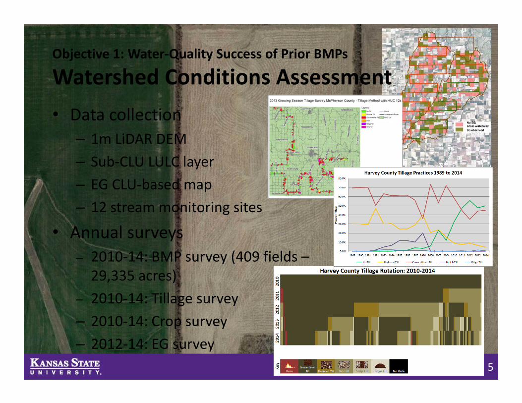
• Data collection– 1m LiDAR DEM– Sub‐CLU LULC layer– EG CLU‐based map– 12 stream monitoring sites
• Annual surveys– 2010‐14: BMP survey (409 fields –29,335 acres)
– 2010‐14: Tillage survey– 2010‐14: Crop survey– 2012‐14: EG survey
No EG; Grass waterwayEG observed
Objective 1: Water‐Quality Success of Prior BMPs
Watershed Conditions Assessment
6
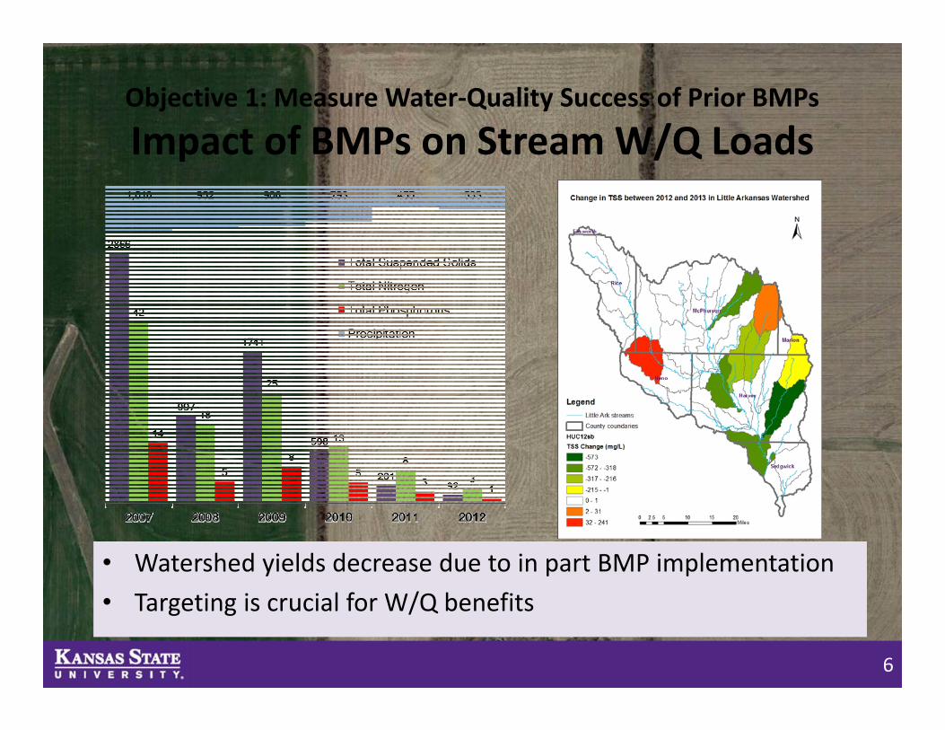
Objective 1: Measure Water‐Quality Success of Prior BMPs
Impact of BMPs on Stream W/Q Loads
• Watershed yields decrease due to in part BMP implementation • Targeting is crucial for W/Q benefits
7
Objective 2: Target New Ephemeral Gully BMPs
Watershed and Ephemeral Gully Modeling
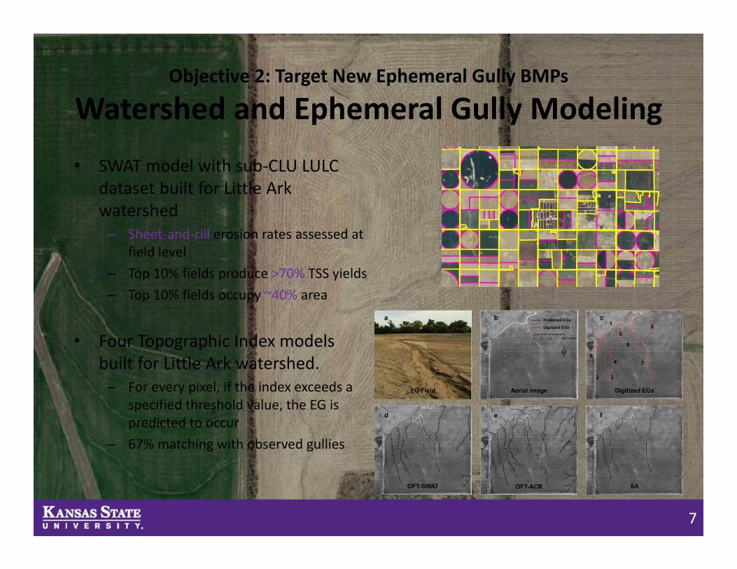
• SWAT model with sub‐CLU LULC dataset built for Little Ark watershed – Sheet‐and‐rill erosion rates assessed at
field level– Top 10% fields produce >70% TSS yields– Top 10% fields occupy ~40% area
• Four Topographic Index models built for Little Ark watershed. – For every pixel, if the index exceeds a
specified threshold value, the EG is predicted to occur
– 67% matching with observed gullies
8
Objective 2: Target New Ephemeral Gully BMPs
Location and Length of Ephemeral Gullies
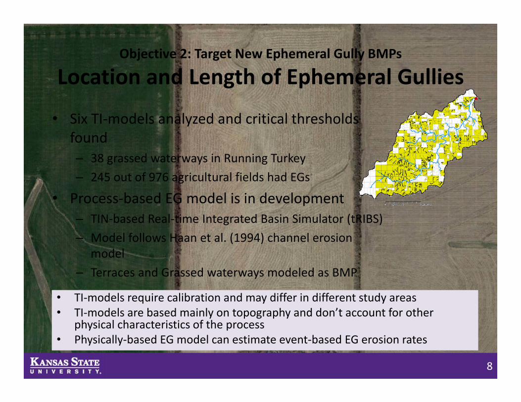
• Six TI‐models analyzed and critical thresholds found– 38 grassed waterways in Running Turkey– 245 out of 976 agricultural fields had EGs
• Process‐based EG model is in development– TIN‐based Real‐time Integrated Basin Simulator (tRIBS)– Model follows Haan et al. (1994) channel erosion
model– Terraces and Grassed waterways modeled as BMP
• TI‐models require calibration and may differ in different study areas • TI‐models are based mainly on topography and don’t account for other
physical characteristics of the process• Physically‐based EG model can estimate event‐based EG erosion rates
9
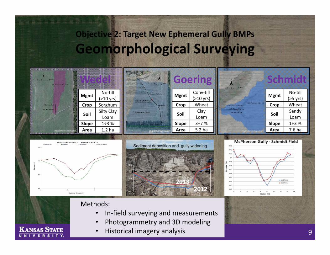
Objective 2: Target New Ephemeral Gully BMPs
Geomorphological Surveying
Mgmt No‐till (>10 yrs)
Crop Sorghum
Soil Silty Clay Loam
Slope 1÷3 %Area 1.2 ha
WedelMgmt Conv‐till
(>10 yrs)Crop Wheat
Soil Clay Loam
Slope 3÷7 %Area 5.2 ha
GoeringMgmt No‐till
(>5 yrs)Crop Wheat
Soil Sandy Loam
Slope 1÷3 %Area 7.6 ha
Schmidt
20122013
Sediment deposition and gully widening
Methods:• In‐field surveying and measurements• Photogrammetry and 3D modeling • Historical imagery analysis

10
Objective 2: Target New Ephemeral Gully BMPs
Geomorphological Surveying
• Antecedent soil moisture and vegetative cover play a large role in gully erosion rates
• Detachment and deposition cycles play significant role in gully dynamics• The gullies have been a part of the drainage network for decades• BMPs will be most successful when they allow runoff to utilize natural
drainage channels
USGS 1969
Google Earth 2014

11
Objective 2: Target New Ephemeral Gully BMPs
Field Monitoring Study of EG Erosion
• Catchment of 3.2 acres in Running Turkey Creek– No‐till last 10 years– Wheat‐corn‐sorghum rotation– Crete silt loam soil, 1‐3% slope
• Instrumentation– Pin‐frame built at KSU– Soil moisture sensors– Rain gage– ISCO sediment and flow sampler
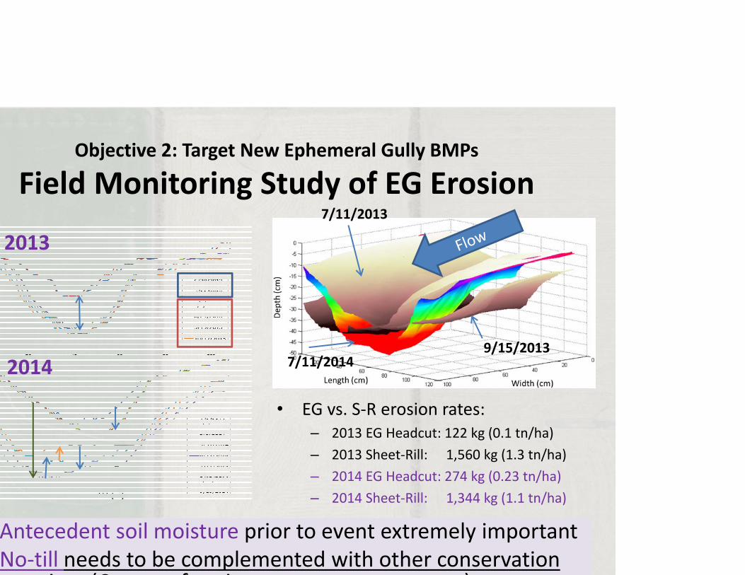
Objective 2: Target New Ephemeral Gully BMPs
Field Monitoring Study of EG Erosion7/11/2013
7/11/20149/15/2013
• EG vs. S‐R erosion rates:– 2013 EG Headcut: 122 kg (0.1 tn/ha)– 2013 Sheet‐Rill: 1,560 kg (1.3 tn/ha)– 2014 EG Headcut: 274 kg (0.23 tn/ha)– 2014 Sheet‐Rill: 1,344 kg (1.1 tn/ha)
2013
2014
Antecedent soil moisture prior to event extremely importantNo‐till needs to be complemented with other conservation
ti (C t f i t )
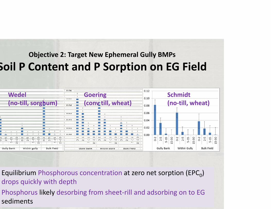
Objective 2: Target New Ephemeral Gully BMPs
Soil P Content and P Sorption on EG Field
Wedel(no‐till, sorghum)
Goering(conv till, wheat)
Schmidt(no‐till, wheat)
Equilibrium Phosphorous concentration at zero net sorption (EPC0) drops quickly with depthPhosphorus likely desorbing from sheet‐rill and adsorbing on to EG sediments
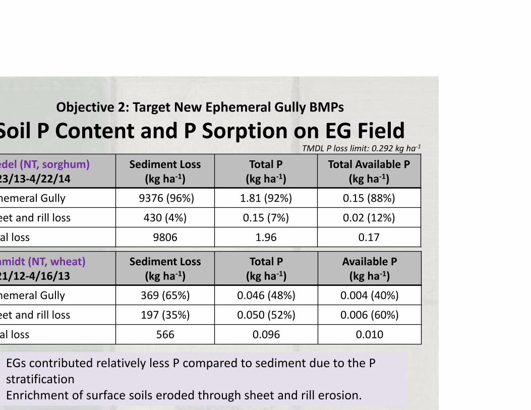
Objective 2: Target New Ephemeral Gully BMPs
Soil P Content and P Sorption on EG Fieldedel (NT, sorghum)23/13‐4/22/14
Sediment Loss(kg ha‐1)
Total P(kg ha‐1)
Total Available P(kg ha‐1)
hemeral Gully 9376 (96%) 1.81 (92%) 0.15 (88%)
eet and rill loss 430 (4%) 0.15 (7%) 0.02 (12%)
al loss 9806 1.96 0.17
hmidt (NT, wheat)21/12‐4/16/13
Sediment Loss(kg ha‐1)
Total P(kg ha‐1)
Available P(kg ha‐1)
hemeral Gully 369 (65%) 0.046 (48%) 0.004 (40%)
eet and rill loss 197 (35%) 0.050 (52%) 0.006 (60%)
al loss 566 0.096 0.010
EGs contributed relatively less P compared to sediment due to the P stratificationEnrichment of surface soils eroded through sheet and rill erosion.
TMDL P loss limit: 0.292 kg ha‐1
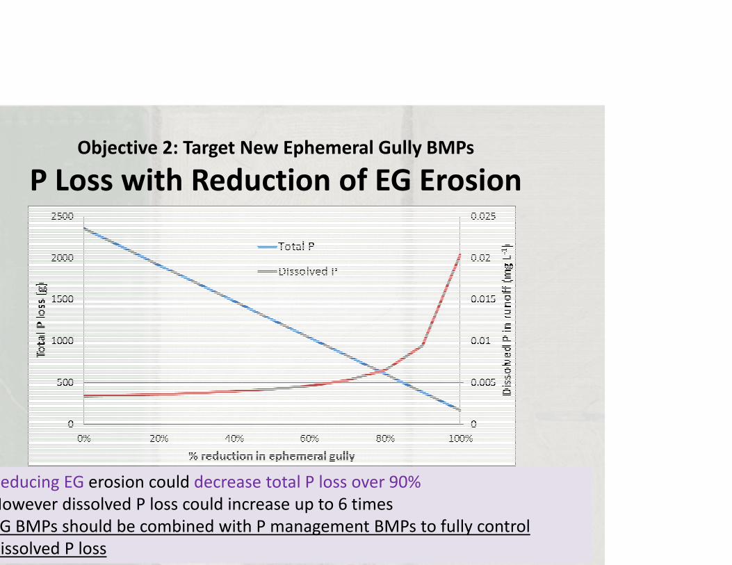
Objective 2: Target New Ephemeral Gully BMPs
P Loss with Reduction of EG Erosion
Reducing EG erosion could decrease total P loss over 90%However dissolved P loss could increase up to 6 timesG BMPs should be combined with P management BMPs to fully control issolved P loss
16
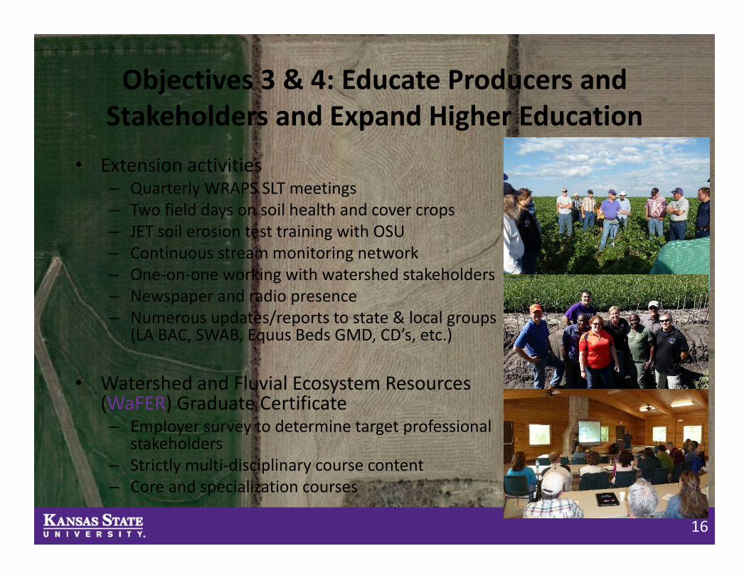
Objectives 3 & 4: Educate Producers and Stakeholders and Expand Higher Education
• Extension activities– Quarterly WRAPS SLT meetings – Two field days on soil health and cover crops – JET soil erosion test training with OSU– Continuous stream monitoring network – One‐on‐one working with watershed stakeholders– Newspaper and radio presence– Numerous updates/reports to state & local groups
(LA BAC, SWAB, Equus Beds GMD, CD’s, etc.)
• Watershed and Fluvial Ecosystem Resources (WaFER) Graduate Certificate– Employer survey to determine target professional
stakeholders– Strictly multi‐disciplinary course content– Core and specialization courses
17
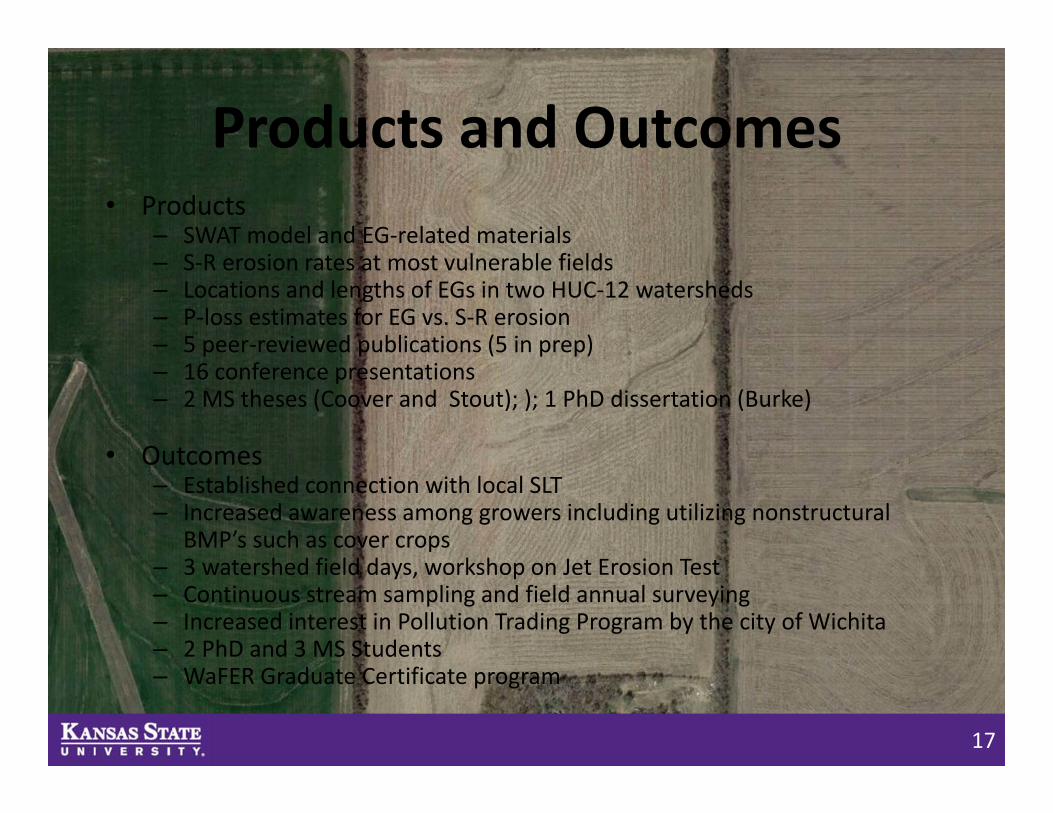
Products and Outcomes• Products
– SWAT model and EG‐related materials– S‐R erosion rates at most vulnerable fields– Locations and lengths of EGs in two HUC‐12 watersheds– P‐loss estimates for EG vs. S‐R erosion– 5 peer‐reviewed publications (5 in prep)– 16 conference presentations – 2 MS theses (Coover and Stout); ); 1 PhD dissertation (Burke)
• Outcomes– Established connection with local SLT– Increased awareness among growers including utilizing nonstructural
BMP’s such as cover crops– 3 watershed field days, workshop on Jet Erosion Test– Continuous stream sampling and field annual surveying– Increased interest in Pollution Trading Program by the city of Wichita– 2 PhD and 3 MS Students– WaFER Graduate Certificate program
18
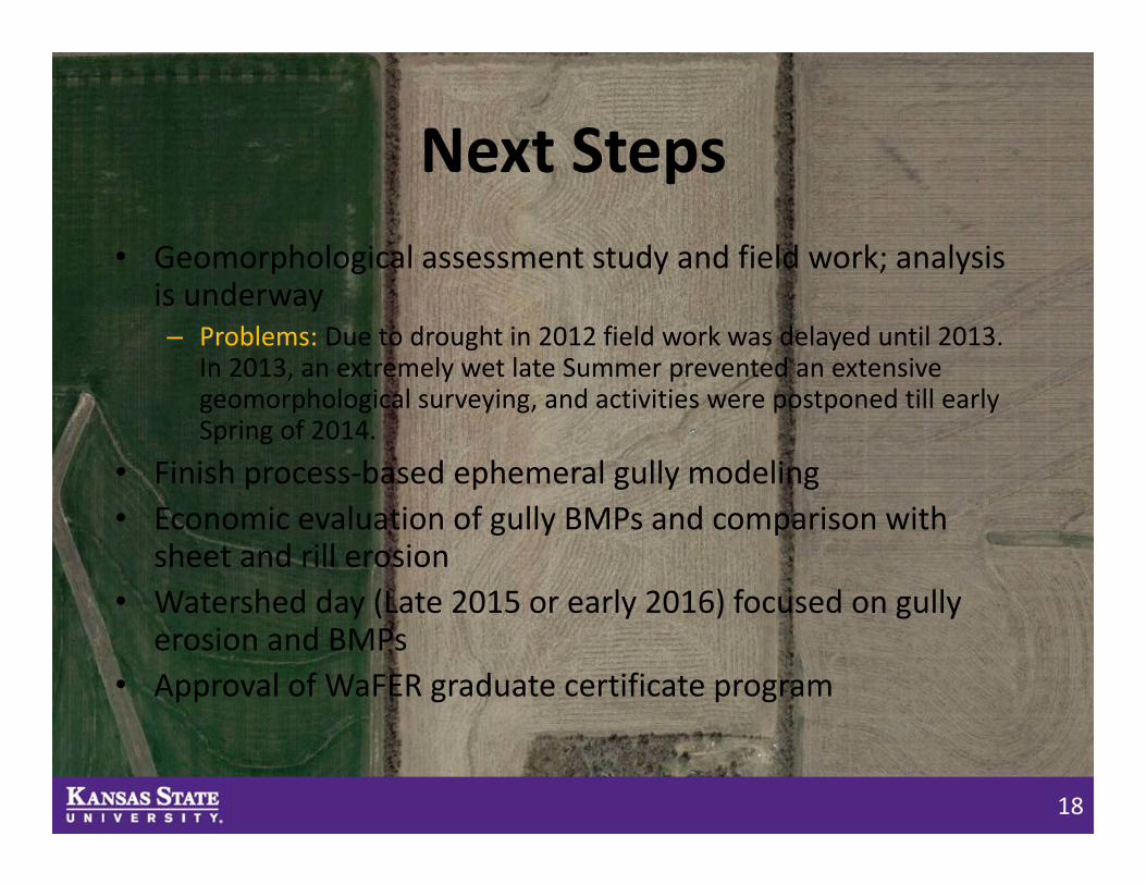
Next Steps• Geomorphological assessment study and field work; analysis
is underway– Problems: Due to drought in 2012 field work was delayed until 2013.
In 2013, an extremely wet late Summer prevented an extensive geomorphological surveying, and activities were postponed till early Spring of 2014.
• Finish process‐based ephemeral gully modeling• Economic evaluation of gully BMPs and comparison with
sheet and rill erosion• Watershed day (Late 2015 or early 2016) focused on gully
erosion and BMPs• Approval of WaFER graduate certificate program
19
Thank You!
• Acknowledgements– Graduate students: V. Karimov, K. Burke, J. Coover, L. Sekaluvu, B. Stout
–Watershed stakeholders and Rick Schlender– Owners of four crop fields– USDA‐NIFA NIWQP Grant– Additional funding provided by the city of Wichita, KDHE, EPA 319, KWA, NRCS
Aleksey [email protected], (785) 532‐5418
Biological & Agricultural Engineering