
Targeting Critical Ephemeral Gully Erosion Sites in a Watershed - Buman
40
Revolutionizing Conservation Delivery
-
Upload
soil-and-water-conservation-society -
Category
Environment
-
view
12 -
download
0
Transcript of Targeting Critical Ephemeral Gully Erosion Sites in a Watershed - Buman
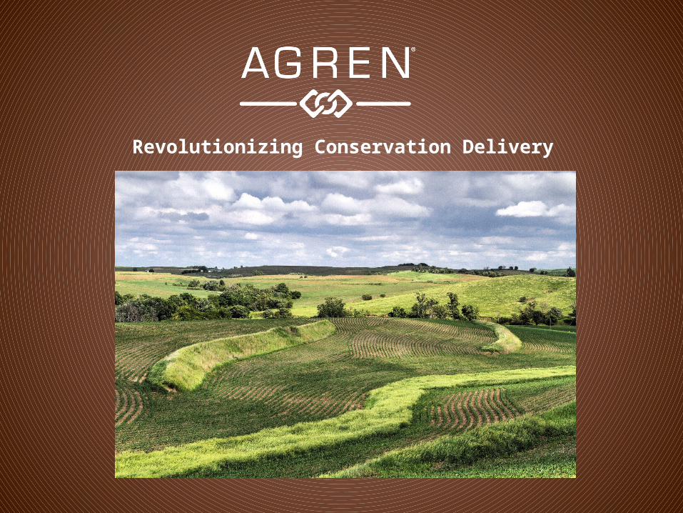
Revolutionizing Conservation Delivery
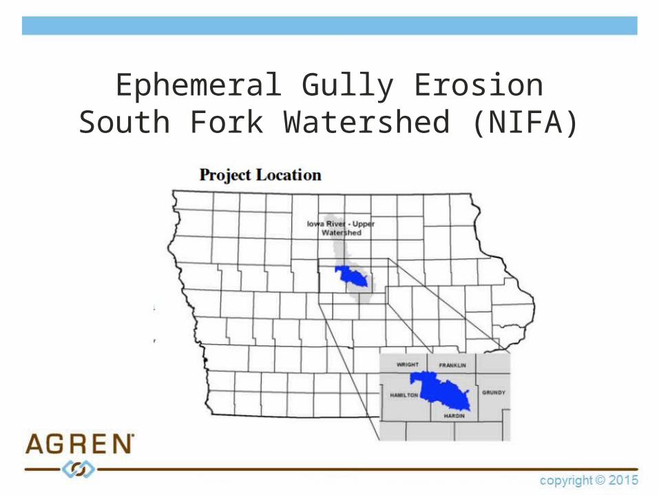
Ephemeral Gully ErosionSouth Fork Watershed (NIFA)
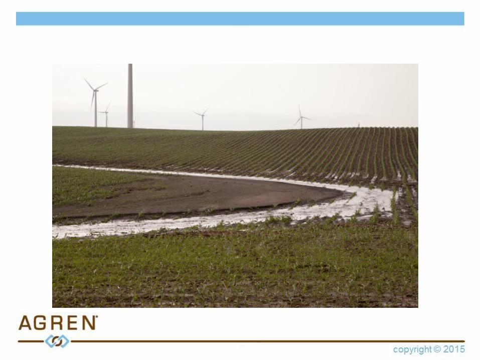
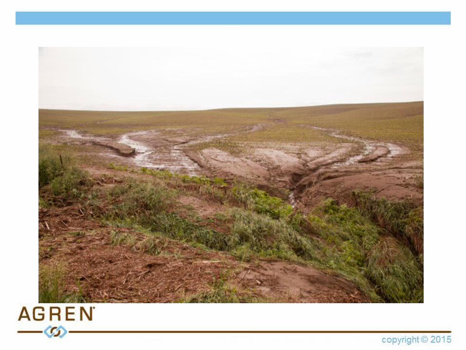
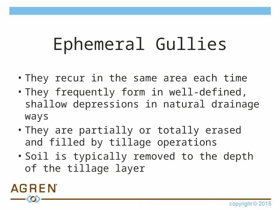
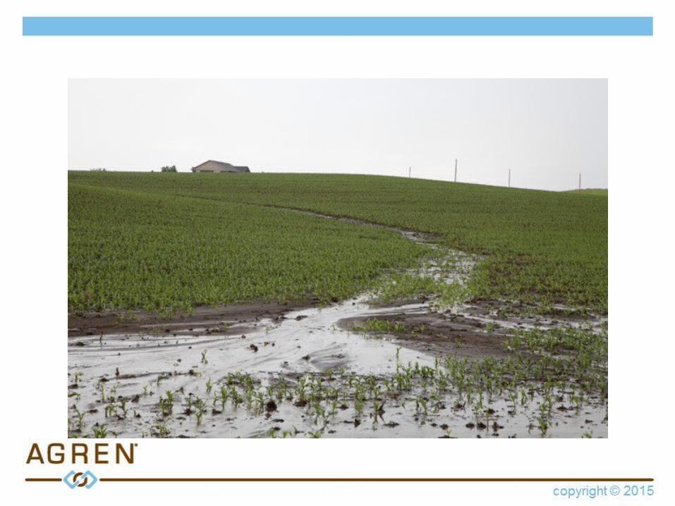
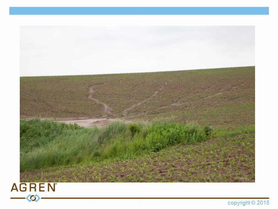
Ephemeral Gullies
• They recur in the same area each time
Ephemeral Gullies
• They recur in the same area each time • They frequently form in well-defined,
shallow depressions in natural drainage ways

Ephemeral Gullies
• They recur in the same area each time • They frequently form in well-defined,
shallow depressions in natural drainage ways
• They are partially or totally erased and filled by tillage operations
Ephemeral Gullies
• They recur in the same area each time • They frequently form in well-defined, shallow
depressions in natural drainage ways • They are partially or totally erased and filled
by tillage operations• Soil is typically removed to the depth of the
tillage layer
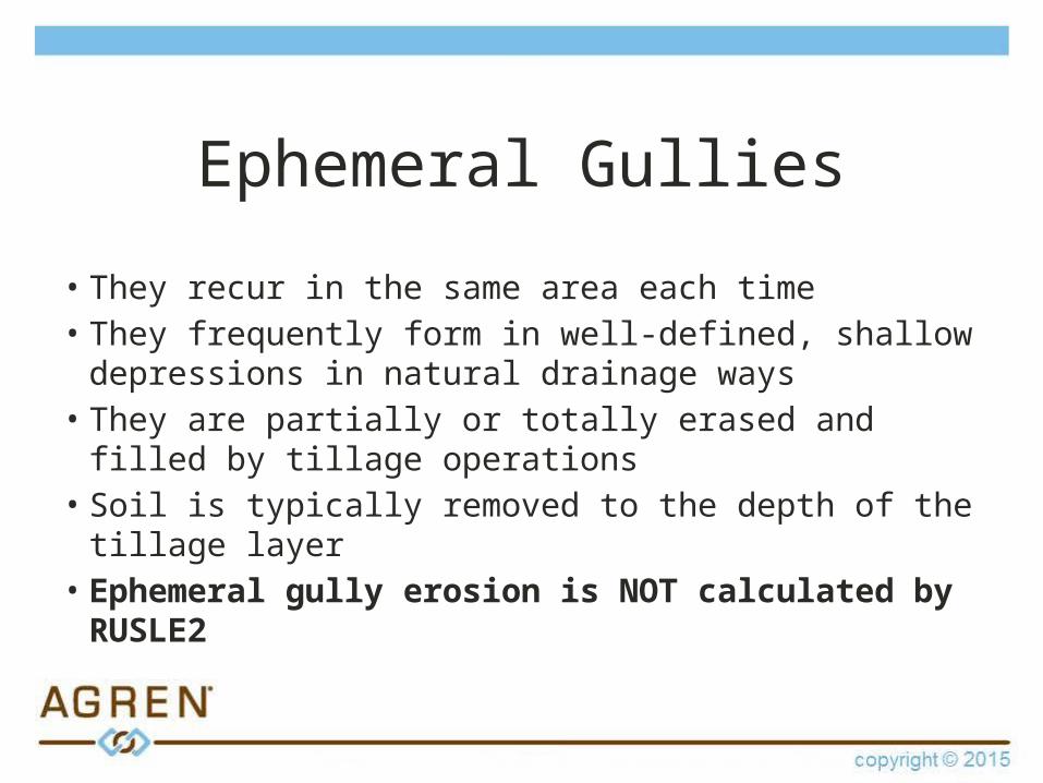
Ephemeral Gullies
• They recur in the same area each time • They frequently form in well-defined, shallow
depressions in natural drainage ways • They are partially or totally erased and filled by tillage
operations• Soil is typically removed to the depth of the tillage layer• Ephemeral gully erosion is NOT calculated by
RUSLE2

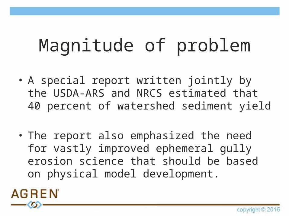
Magnitude of problem
Dr. Rick CruseIowa State University
Magnitude of problem
• A special report written jointly by the USDA-ARS and NRCS estimated that 40 percent of watershed sediment yield
• The report also emphasized the need for vastly improved ephemeral gully erosion science that should be based on physical model development.

Developing the model
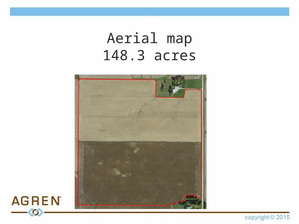
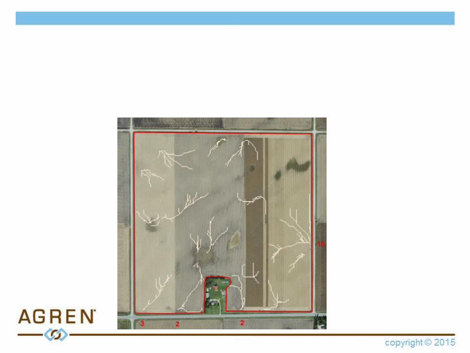
Aerial map148.3 acres
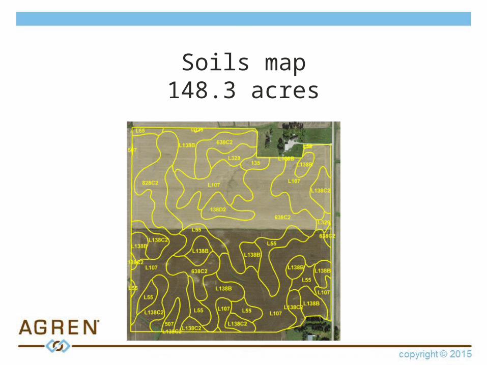
Soils map148.3 acres
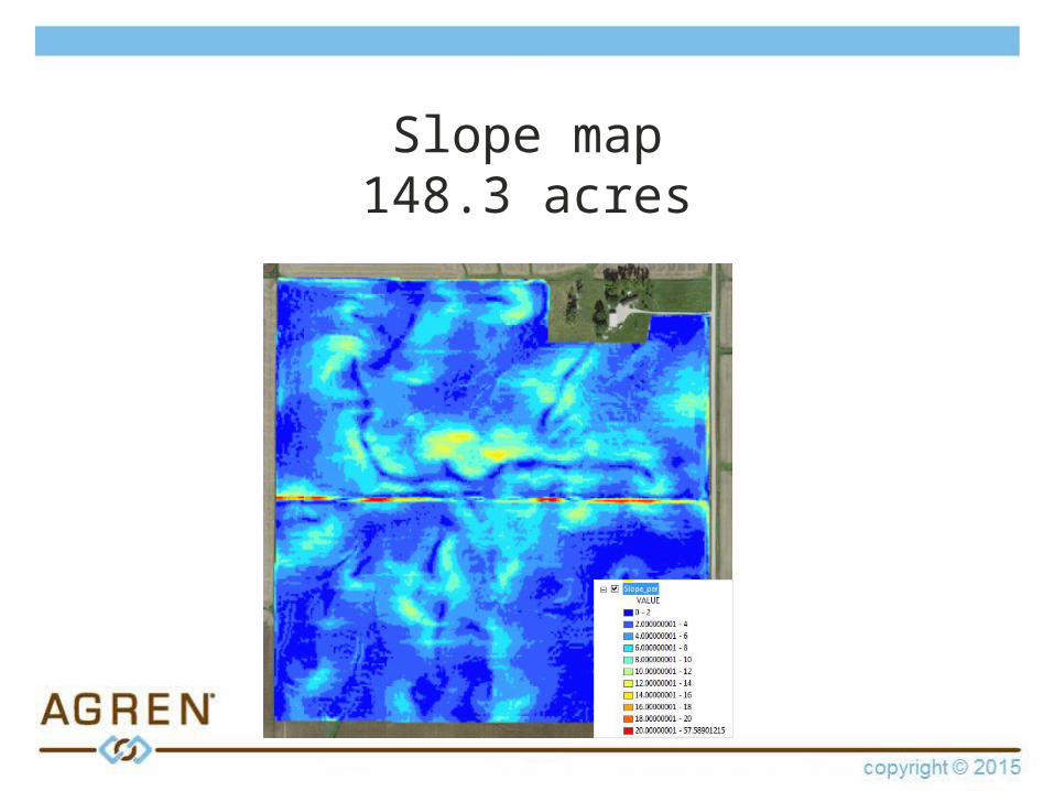
Slope map148.3 acres
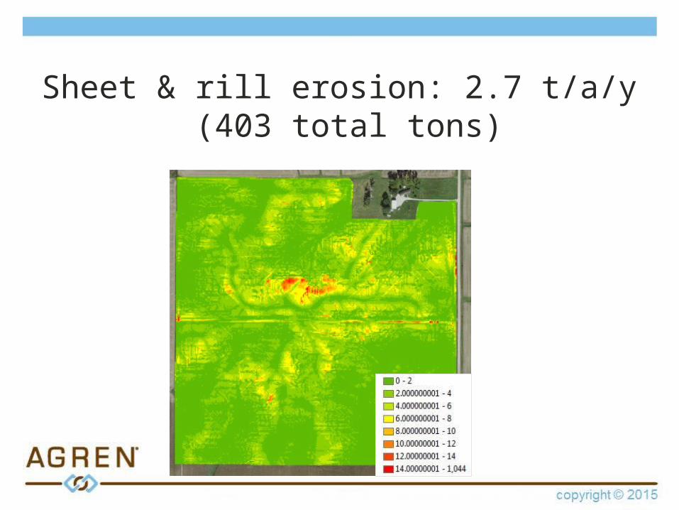
Sheet & rill erosion: 2.7 t/a/y (403 total tons)
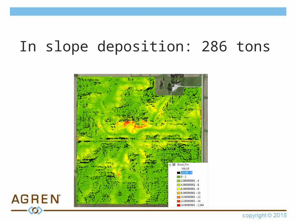
In slope deposition: 286 tons
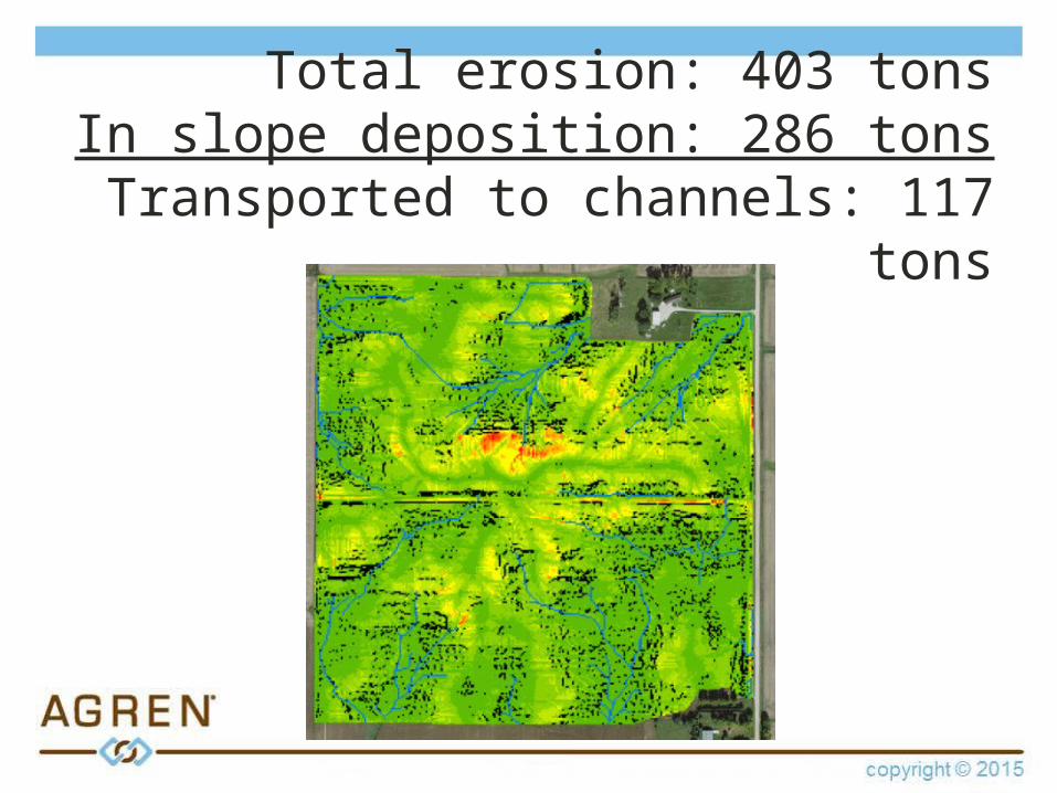
Total erosion: 403 tonsIn slope deposition: 286 tons
Transported to channels: 117 tons
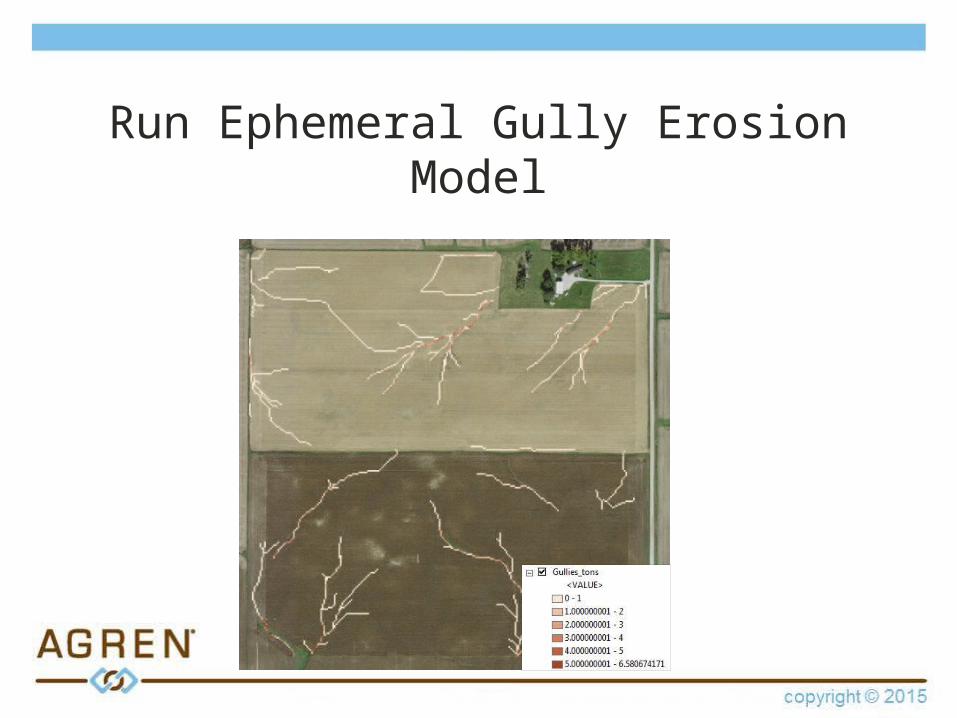
Run Ephemeral Gully Erosion Model
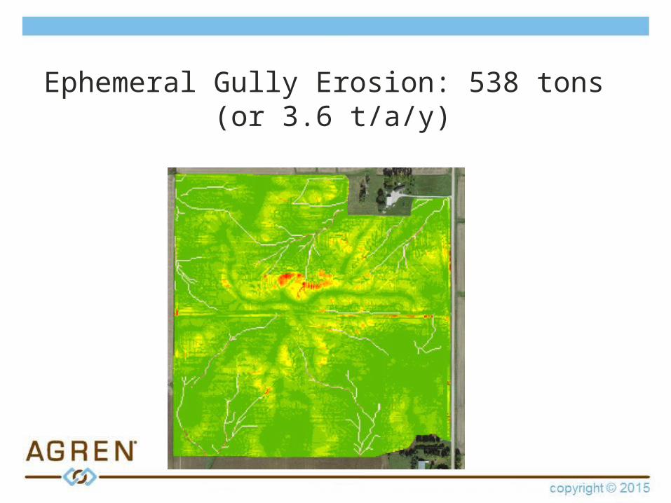
Ephemeral Gully Erosion: 538 tons (or 3.6 t/a/y)
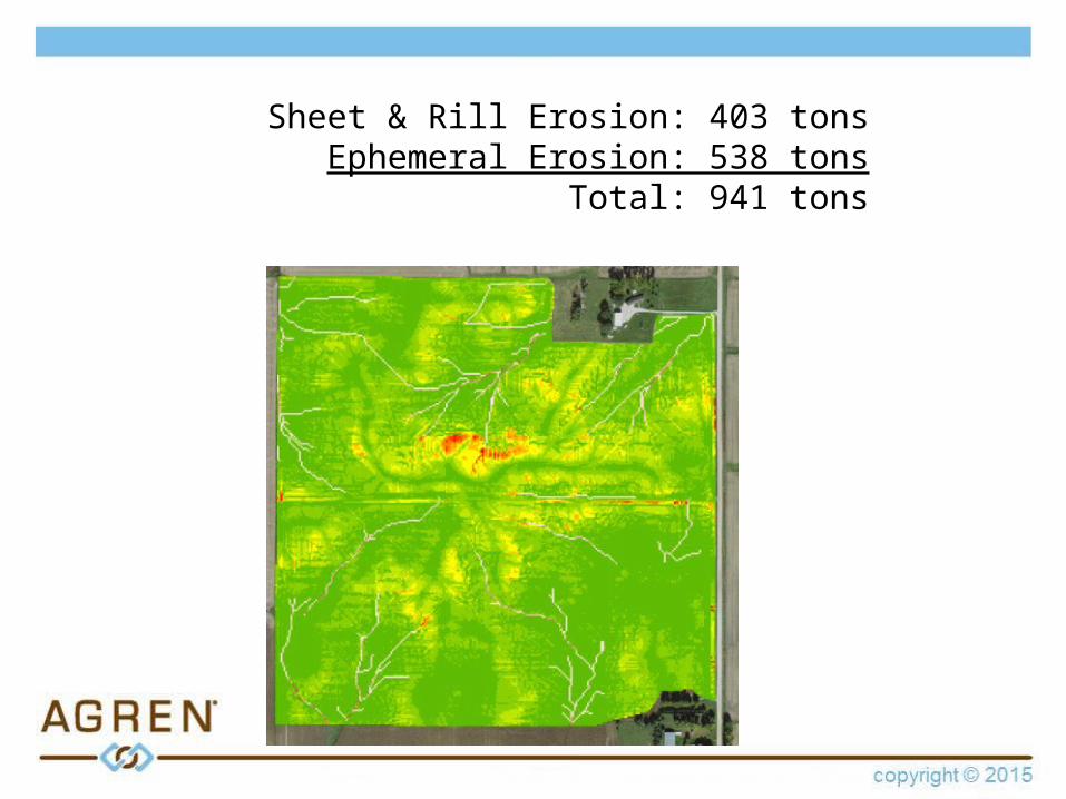
Sheet & Rill Erosion: 403 tonsEphemeral Erosion: 538 tons
Total: 941 tons
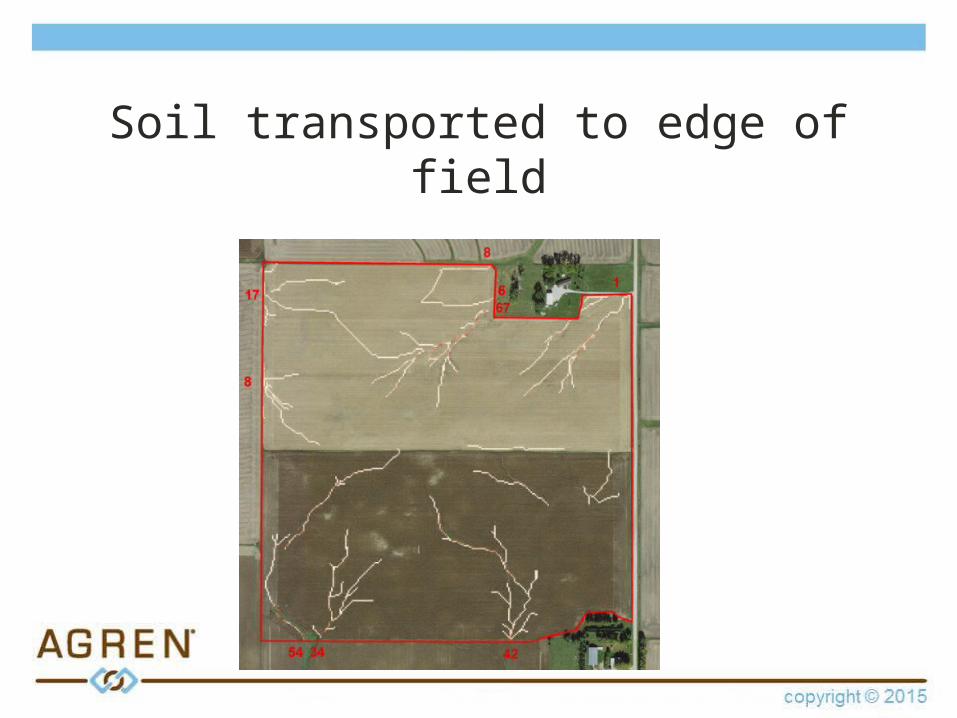
Soil transported to edge of field
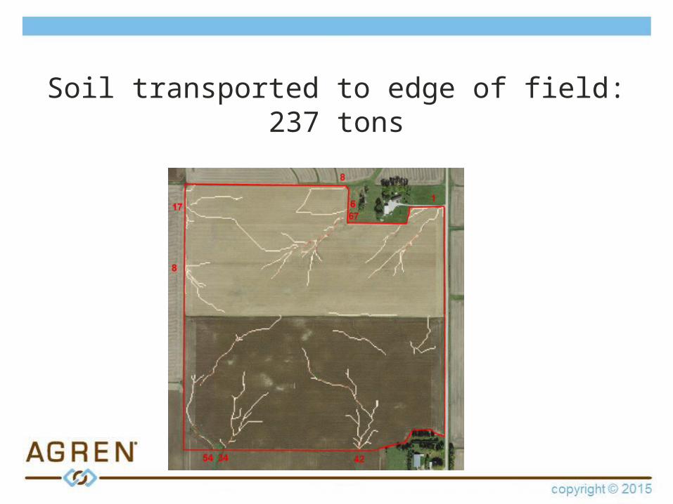
Soil transported to edge of field:237 tons
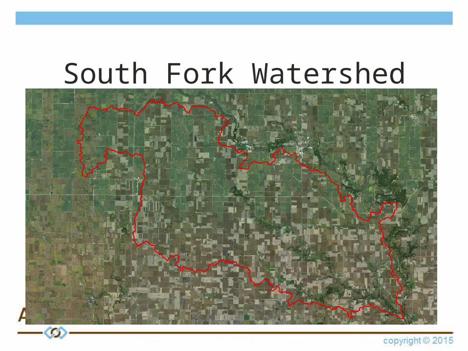
South Fork Watershed
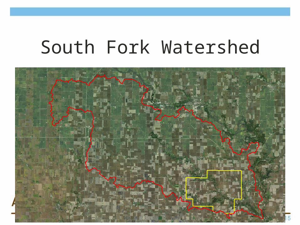
South Fork Watershed
Landowner outreach
• Outreach to 811 landowners • List narrowed to 50
– Receive map of ephemeral erosion– Offer for grassed waterway design– Follow up with landowner advocate– Provide waterway design
• Survey results
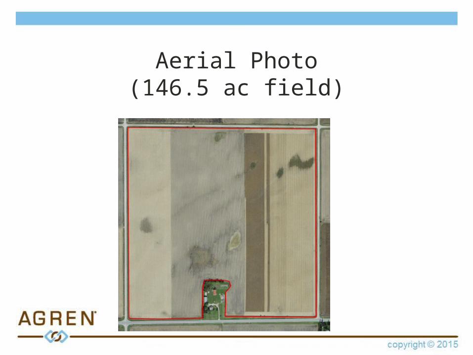
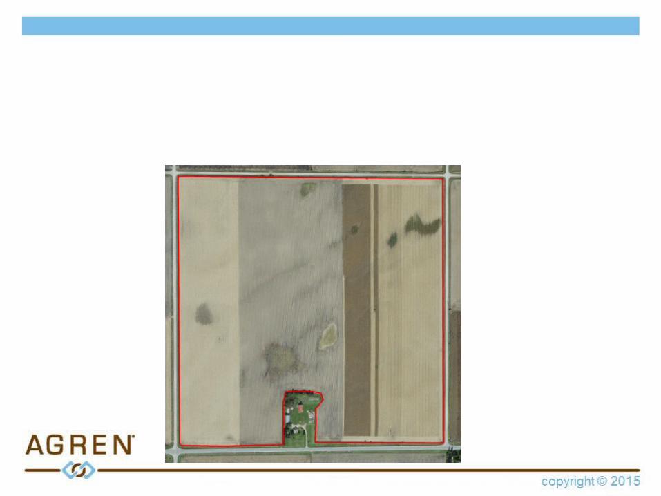
Aerial Photo(146.5 ac field)

Soils Map(146.5 ac field)
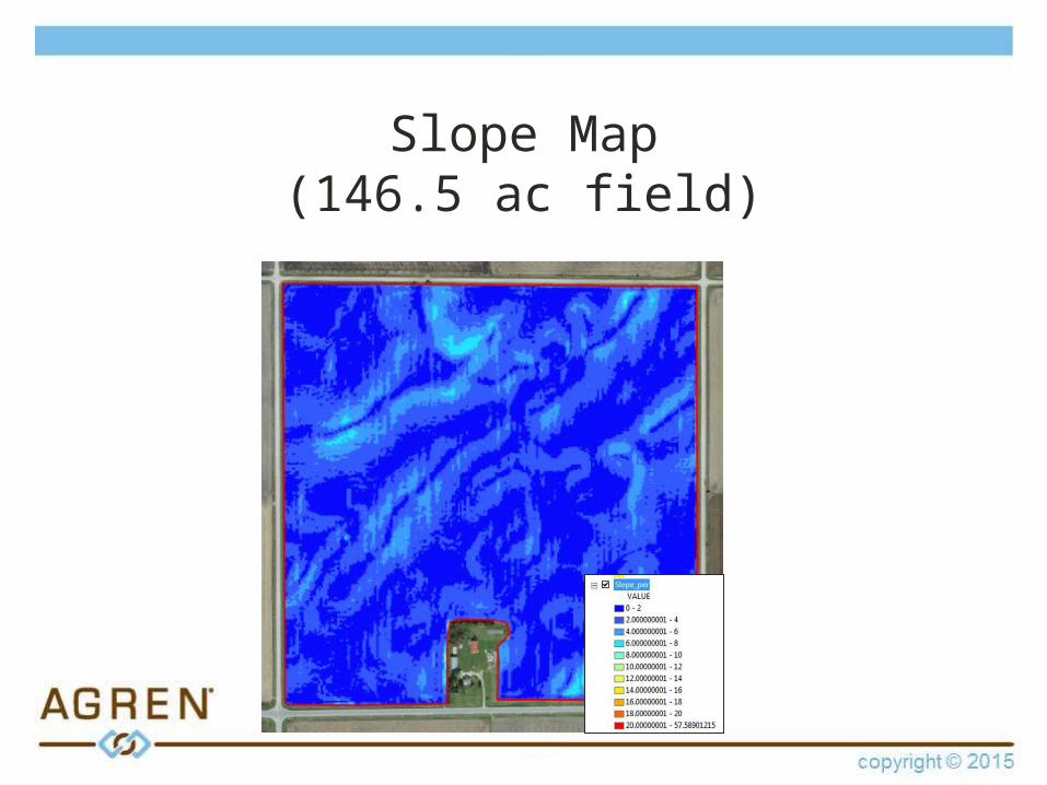
Slope Map(146.5 ac field)
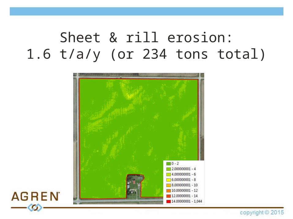
Sheet & rill erosion:1.6 t/a/y (or 234 tons total)
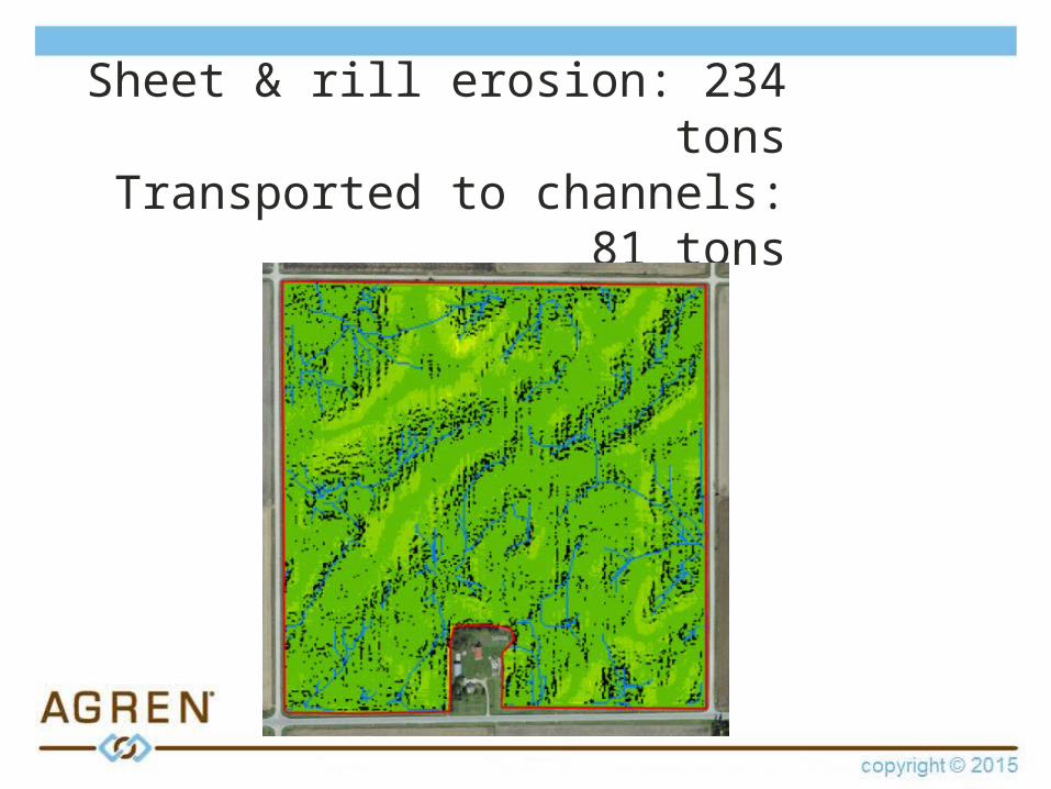
Sheet & rill erosion: 234 tonsTransported to channels: 81
tons

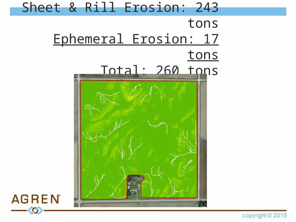
Sheet & Rill Erosion: 243 tonsEphemeral Erosion: 17 tons
Total: 260 tons
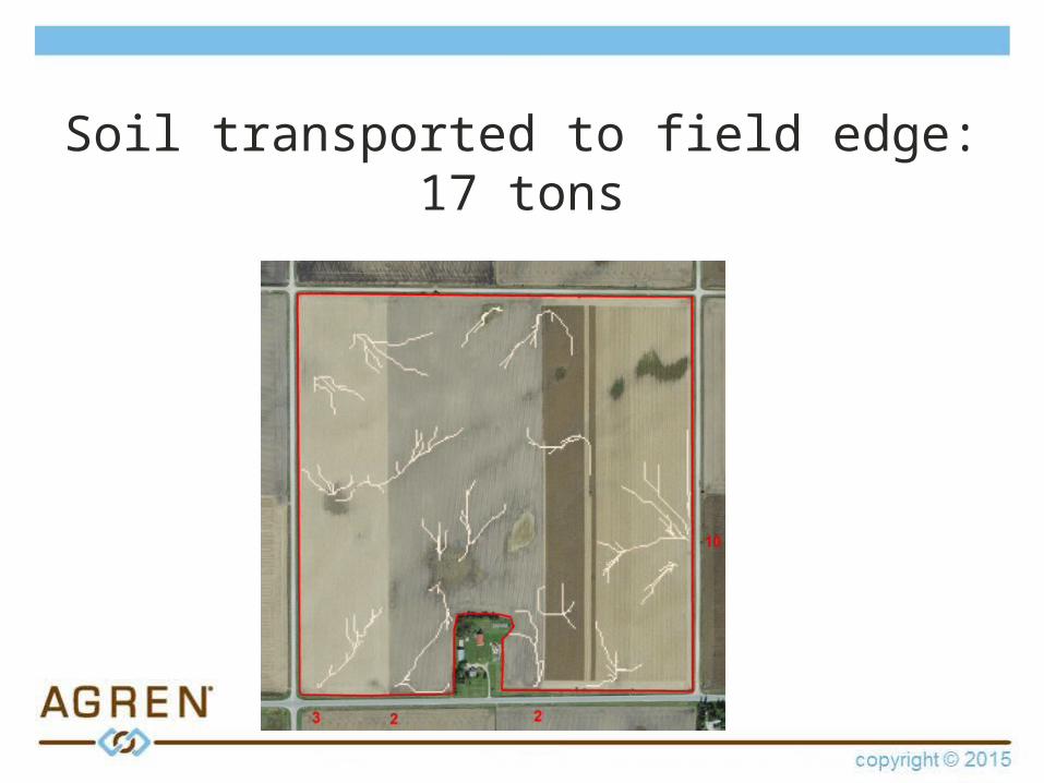
Soil transported to field edge:17 tons