KING THE CORPORATION OF THE TOWNSHIP OF … THE CORPORATION OF THE TOWNSHIP OF KING ... ^Quinte...
10
KING THE CORPORATION OF THE TOWNSHIP OF KING REPORT TO THE COMMITTEE OF THE WHOLE DATE: July 7'^ 2014 FROM: Administration SUBJECT: Administration Report No. ED-2014-05 - Greenbelt Cycling Route 1. RECOMMENDATIONS Administration respectfully submits the following recommendations: a) THAT Administration Report No. ED-2014-05 be received; b) AND THAT Council endorses the Greenbelt Cycling Route through King Township as identified in Attachment 2 to this report. 2. PURPOSE This report recommends the endorsement by Council of the Greenbelt Route through King Township using existing regional and municipal roads. 3. BACKGROUND AND ANALYSIS 3.1 Background The Greenbelt Route will create a 460 kilometre provincial cycling route connecting Northumberland County to Niagara Region The Route will showcase communities en route and provide links to urban centers along the Greenbelt. It will also have several north-south connections to the 1,400 kilometre Waterfront Trail, including York Region's proposed future Lake to Lake Route. Together, the connected trails will form a regional loop that encompasses a significant part of Lake Ontario and its watershed. Waterfront Regeneration Trust (WRT) is the project lead on the Greenbelt Route initiative. The proposed Greenbelt Route from Niagara to Northumberland County is shown in Attachment 1. The new route will take advantage of the rapidly growing interest in cycling tourism In 2010, two million Canadian visitors went cycling while traveling in Ontario and spent $391 million. According to the League of American Cyclists, American cyclists spend $47 billion annually while cycle touring. Quebec vacationing cyclists spend $134 million annually. Building on this trend, the Greenbelt cycling route is intended to encourage Ontarians and visitors to connect to the communities in the Greenbelt by touring and exploring on a bicycle.
Transcript of KING THE CORPORATION OF THE TOWNSHIP OF … THE CORPORATION OF THE TOWNSHIP OF KING ... ^Quinte...

KING THE CORPORATION OF THE TOWNSHIP OF KINGREPORT TO THE COMMITTEE OF THE WHOLE
DATE: July 7'^ 2014
FROM: Administration
SUBJECT: Administration Report No. ED-2014-05 - Greenbelt Cycling Route
1. RECOMMENDATIONS
Administration respectfully submits the following recommendations:
a) THAT Administration Report No. ED-2014-05 be received;
b) AND THAT Council endorses the Greenbelt Cycling Route through KingTownship as identified in Attachment 2 to this report.
2. PURPOSE
This report recommends the endorsement by Council of the Greenbelt Route throughKing Township using existing regional and municipal roads.
3. BACKGROUND AND ANALYSIS
3.1 Background
The Greenbelt Route will create a 460 kilometre provincial cycling routeconnecting Northumberland County to Niagara Region
The Route will showcase communities en route and provide links to urban centers alongthe Greenbelt. It will also have several north-south connections to the 1,400 kilometreWaterfront Trail, including York Region's proposed future Lake to Lake Route. Together,the connected trails will form a regional loop that encompasses a significant part of LakeOntario and its watershed. Waterfront Regeneration Trust (WRT) is the project lead onthe Greenbelt Route initiative. The proposed Greenbelt Route from Niagara toNorthumberland County is shown in Attachment 1.
The new route will take advantage of the rapidly growing interest in cyclingtourism
In 2010, two million Canadian visitors went cycling while traveling in Ontario and spent$391 million. According to the League of American Cyclists, American cyclists spend$47 billion annually while cycle touring. Quebec vacationing cyclists spend $134 millionannually. Building on this trend, the Greenbelt cycling route is intended to encourageOntarians and visitors to connect to the communities in the Greenbelt by touring andexploring on a bicycle.

Administration Report No. ED-2014-05 Page 2 of 5Re; Greenbelt Cycling Route
It is anticipated that The Greenbelt Route will be launched with a fully supportedrecreational bike tour of the entire route in the Summer of 2015
Since the Fall of 2012, the Waterfront Regeneration Trust has worked closely withRegional and local municipal staff to determine the preferred Greenbelt Routealignment.
The York Region segment of the Greenbelt Route passes through King Township andthe Towns of Newmarket, Aurora, and Whitchurch-Stouffville. The preferred route waspresented at a mapping workshop in the Fall of 2013 that was attended by staff fromacross the Greenbelt communities.
WRT Mobile Workshops were held between May 5 and May 10, 2014 for staff andexperts to assess readiness and test the draft maps through a combination of expertpresentations, facilitated discussion, and actual cycling.
The Waterfront Regeneration Trust has been working with Regional staff fromTransportation and Community Planning, as well as staff from local communities, toidentify an alignment for the proposed Greenbelt Route.
The Regional Committee of the Whole recently passed the endorsement of the routeand it is expected that approval will be received from Regional Council as well. TheAurora Trails Committee has also approved the Aurora Trails section.
3.2 Analysis
The signed Greenbelt Route is anticipated to create a new tourist destination and drawnew visitors to York Region. It will help to promote awareness of cycle touring andprovide local Greenbelt communities and businesses with access to the economicbenefits of catering to the growing cycle tourism market.
The 27-kilometre segment through King Township starts at the York Region border withPeel Region at Caledon King Townline. The Route follows 19th Sideroad through thehistoric communities of Lloydtown and Schomberg. It continues along Lloydtown-AuroraRoad on paved shoulders, passing through the communities of Pottageville andKettleby before heading north on Keele st. and then continuing east on 19*^ Sideroadinto Newmarket. Detailed mapping of the proposed Greenbelt Route through KingTownship is included in this report as Attachment 2.
Waterfront Regeneration Trust (WRT) is seeking local and regional approvals for thepreferred route in order to move forward with their work plan, which will include:
Spring/Summer 2014
• Wayfinding Workshop: The WRT will lead a session to develop a consistentwa^^nding strategy for directional signage along the route and its connections.
Administration Report No. ED -2014-05 Page 3 of 5Re: Greenbelt Cycling Route
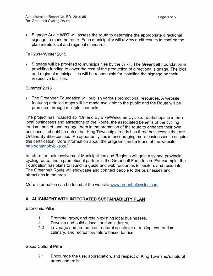
• Signage Audit: WRT will assess the route to determine the appropriate directionalsignage to mark the route. Each municipality will review audit results to confirm theplan meets local and regional standards.
Fall 2014/Winter2015
• Signage will be provided to municipalities by the WRT. The Greenbelt Foundation isproviding funding to cover the cost of the production of directional signage. The localand regional municipalities will be responsible for installing the signage on theirrespective facilities.
Summer 2015
• The Greenbelt Foundation will publish various promotional resources. A websitefeaturing detailed maps will be made available to the public and the Route will bepromoted through multiple channels.
The project has included six "Ontario By Bike/Welcome Cyclists" workshops to informlocal businesses and attractions of the Route, the associated benefits of the cyclingtourism market, and engage them in the promotion of the route to enhance their ownbusiness. It should be noted that King Township already has three businesses that areOntario By Bike certified. An opportunity lies in encouraging more businesses to acquirethis certification. More information about the program can be found at the websitehttp://ontariobvbike.ca/.
In retum for their involvement Municipalities and Regions will gain a signed provincialcycling route, and a promotional partner in the Greenbelt Foundation. For example, theFoundation has plans to launch a guide and web resources for visitors and residents.The Greenbelt Route will showcase and connect people to the businesses andattractions in the area.
More information can be found at the website wvw.greenbeltcvcles.com
4. ALIGNMENT WITH INTEGRATED SUSTAINABILITY PLAN
Economic Pillar
1.1 Promote, grow, and retain existing local businesses.4.1 Develop and build a local tourism industry.4.2 Leverage and promote our natural assets for attracting eco-tourism,
culinary, and recreation/nature based tourism.
Socio-Cultural Pillar
2.1 Encourage the use, appreciation, and respect of King Township's naturalareas and trails.

Administration Report No. ED -2014-05 Page 4 of 5Re: Greenbelt Cycling Route
2.2 Promote the use of King Township's parks and trails more widely.5.2 Encourage and support an active lifestyle.
5. ALIGNMENT WITH THREE YEAR COMMUNITY TOURISM PLAN
Page 19 of the Community Tourism Plan identifies that infrastructure with respect toroad cycling is lacking in King Township. There is, however, great potential to make theTownship more cyclist friendly, attracting cycling tourists and encouraging active,sustainable transportation in doing so. Supporting the Greenbelt Cycling Route is a stepin the right direction as it will better connect King with current road cycling infrastructure,standards, and best practices that are being implemented throughout the rest of YorkRegion and Ontario.
6. FINANCIAL IMPLICATIONS
The estimated cost of sign installations within the local municipal jurisdictions is $7,000.The cost of signage should be considered in the Township's budget and work plan for2015.
7. CONCLUSION
The Greenbelt Route will be launched following the Pan Am/Parapan Am Games inAugust 2015 with a fully supported recreational bike tour of the entire route. TheWaterfront Regeneration Trust requests municipality endorsements for the prefen-edalignment of the Greenbelt Route by the summer of 2014 as support for plans toimplement the route in time for a 2015 launch. King Township continues to work with theGreenbelt Route partners to assess the route and determine if updates are needed.Staff recommends that Council endorse King's participation in the proposed routethrough King.
8. ATTACHMENTS:
Appendix 1 - Map of Greenbelt Trail from Niagara to Northumberland County
Appendix 2 - Detailed map of Greenbelt Trail as it runs through King Township

Administration Report No. ED -2014-05Re: Greenbelt Cycling Route
Prepared by:
Evin Demirli
Economic Development Assistant
Submitted by:
lamie SmythEconomic Development Officer
Recommended by:
>usan Plamondon
Chief Administrative Officer
Page 5 of 5

BiufeMinesingo
InnisfijTNew ^ ^Keswick
Tecumseth Jo Bradford _ ^
East
Attachment 1
Kawartha\ Lakes
iriWOmemee
> OraiH evitie
^ HUl
. .. . V ipshawa •ClaringtdMarkharpv N--i oIney ® '°fjax '
o o ScarboroughNorth Yorkj
Waterloo
jjj oKitchener"o
Guelph ^i^ssaugao TorontooOakville
9 W
o i Turlington.Cambridge • o
Paris JT Q« I° Rrant' v^nijtt^!^^^ac,St.vCatharines LockportDdstOCk O -*Brantford ^
Caledonia
j Wei ana o w X^getaUonsVPtojeclsJCoimd^egor^aj^nachiiientsVCounci^a^Bagunenl^OIAlO^^un^OUJGf^^
ando^ath O \Road
Greenbelt Cycling RouteFull Route from Niagara Region to Northumberland County
June 26, 2014
produced by:Tranic Managment & ITSTransportation and Community PlanningO Copyright Tlie Regional Municfpality of York. May. 2014O Copyright. First 9ase Solutions Inc.. 20t 1 OrthophotographyG Queen's Printe/ for Ontario 2003-2013
'vi •.
V---—
Falls/ V ^
N
/
LJ
Stirjing
^Quinte West^.'-(i^
Trenton^^ '̂%?Brighton^ ^^̂
i^ourg ^
Lake Ontario
^ / _°lrondequoitRochesterP. '
^ ' "Bnghton/ Henrietta'cL.. : _ ^
fSgjJf
Legend
Greenbelt Route
YorkRegion yorkmaps

Attachment 2
Greenbelt Route Map 15 of 26 - King To^Tiship
i
omberg
"'iSSHiraS
GravelRoute en gravier
Schombefp
.1 MRI
Legend/LegendeGreenbelt Route
(5^ Greenbelt RouteOu-road / Sur la route
Ou-road - extra caution required/Sur la route - redouble! de vigilance
•2 of 2km Distance MsAxs/Distance (km)Points of Interest
Conservation Area / Zone de protection de la nature
xhombefy
Pottagevule
Map 15 Trail Length; 24 km
wwtt-.ereenbelt.ca
Map L'pdatedApril. 2014^ Museum/3/KJ^e[H] Shcfp^vsx%C^tti/Centre commercial^ Winer>'/ Vigfioble
Land Use
Buitt-up / Secteur bdtiPark, Natural Area//*(3n:, Espace namrelGreenbelt
Thornton
Area
Green be t Route
unit ofApplied ^Milibiry History 110
0«'Farms Gydart ^.mtt .Winery
og^1MaiOan4
320
'300
:8o
Elevation ^60Above Sea Level (m) 240

The Corporation of the Township of King
Council/COW Memo
TO: Mayor & Council CC: CAO & Clerk FROM: Jamie Smyth RE: Amendment to Appendix 2. Map of Greenbelt Route through King
Administration Report No ED – 2014-05 Greenbelt Cycling Route DATE: July 7th, 2014 Please be advised it is proposed that the Greenbelt Route as illustrated in
Attachment 2 of the report will be revised to eliminate an unpaved (gravel) portion of the 19th Sideroad in King and the Halls Lake Side Rd. in Caledon west of the 11th Concession. This will also add an approximate 7km to the overall route.
The proposed new route travels from the Caledon Trailway Path south on to Mt
Wolfe Road east on the 17th Sideroad to the 11th Concession then north on the 11th Concession to the 19th Sideroad and east into Schomberg. (see attached Map).


Ammended Attachement 2. Greenbelt Route Map 15 of 26 King Township
19th Sideroad replaced with 17th Sideroad and 11th Concession Route