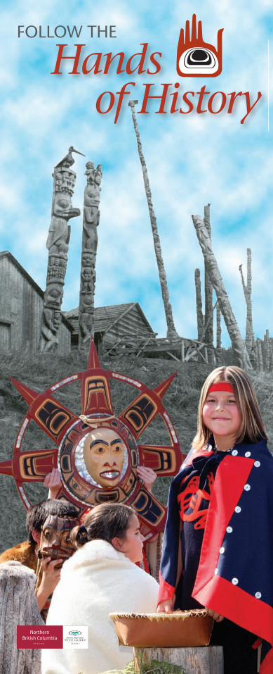
Hands of History
20
Hands of History FOLLOW THE
Transcript of Hands of History
Hands of History
FOLLOW THE
Seeley LakeProvincial Park
GITWANGAK
KITWANGA Kitwanga FortNational Historic Site
Skeena River
GITSEGUKLA
GITANMAAX
HAGWILGET
KISPIOX
Seve
ntee
n M
ile R
oad
(Dea
n Ro
ad)
Muldoe Road(Muldoon Rd)
Kispiox Rodeo Grounds
Swan Lake Rd
TWO MILE
Six Mile Lake
Ross Lake Provincial Park
To Moricetown and Smithers
16
37
Kisp
iox
Valle
y Rd
GITANYOW(Kitwancool)
Skeena Crossing
Braucher Rd
Skeena Crossing Rd
(Kitseguecla)
16
Date CreekForest Service Rd
Gitanyow Road
To Terrace
Hazelton-Kitwanga Backroad (Road ends here) Ross Lake Rd
N
Skeena River
Kispiox River
Bulkey River
Bulkey River
Kitw
anga
Rive
r
- Hand of History Sign location- Tour part 1- Tour part 2- Tourism feature
HAZELTON
NEWHAZELTON
Ksan
GLEN VOWELL
KITWANGA
SOUTH HAZELTON
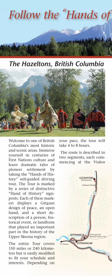
Welcome to one of British Columbia’s most historic and scenic areas. Immerse yourself in centuries of First Nations culture and learn dramatic tales of pioneer settlement by taking the “Hands of His-tory” self-guided driving tour. The Tour is marked by a series of distinctive “Hand of History” sign-posts. Each of these mark-ers displays a Gitxsan design of peace, an open hand, and a short de-scription of a person, his-torical event, or landform that played an important part in the history of the Upper Skeena region.
The entire Tour covers 150 miles or 240 kilome-tres but is easily modifi ed to fi t your schedule and interests. Depending on
your pace, the tour will take 4 to 8 hours.
The route is described in two segments, each com-mencing at the Visitor
Follow the “Hands of History”…
The Hazeltons, British Columbia
Seeley LakeProvincial Park
GITWANGAK
KITWANGA Kitwanga FortNational Historic Site
Skeena River
GITSEGUKLA
GITANMAAX
HAGWILGET
KISPIOX
Seve
ntee
n M
ile R
oad
(Dea
n Ro
ad)
Muldoe Road(Muldoon Rd)
Kispiox Rodeo Grounds
Swan Lake Rd
TWO MILE
Six Mile Lake
Ross Lake Provincial Park
To Moricetown and Smithers
16
37
Kisp
iox
Valle
y Rd
GITANYOW(Kitwancool)
Skeena Crossing
Braucher Rd
Skeena Crossing Rd
(Kitseguecla)
16
Date CreekForest Service Rd
Gitanyow Road
To Terrace
Hazelton-Kitwanga Backroad (Road ends here) Ross Lake Rd
N
Skeena River
Kispiox River
Bulkey River
Bulkey River
Kitw
anga
Rive
r
- Hand of History Sign location- Tour part 1- Tour part 2- Tourism feature
HAZELTON
NEWHAZELTON
Ksan
GLEN VOWELL
SOUTH HAZELTON
Follow the “Hands of History”…
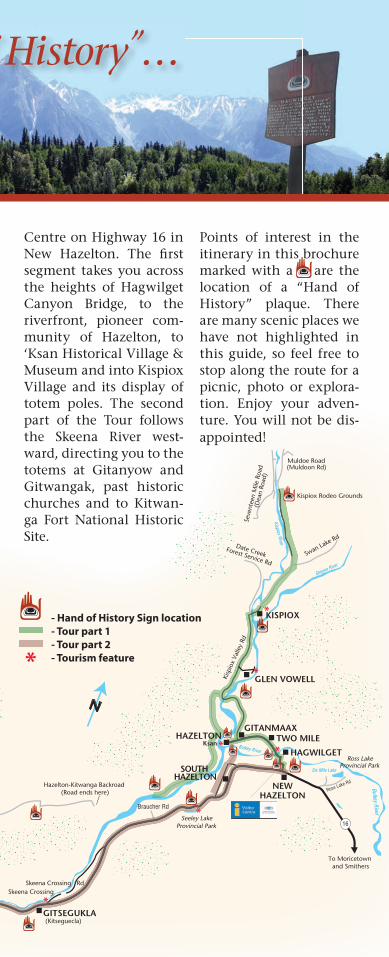
The Hazeltons, British ColumbiaCentre on Highway 16 in New Hazelton. The fi rst segment takes you across the heights of Hagwilget Canyon Bridge, to the riverfront, pioneer com-munity of Hazelton, to ‘Ksan Historical Village & Museum and into Kispiox Village and its display of totem poles. The second part of the Tour follows the Skeena River west-ward, directing you to the totems at Gitanyow and Gitwangak, past historic churches and to Kitwan-ga Fort National Historic Site.
Points of interest in the itinerary in this brochure marked with a are the location of a “Hand of History” plaque. There are many scenic places we have not highlighted in this guide, so feel free to stop along the route for a picnic, photo or explora-tion. Enjoy your adven-ture. You will not be dis-appointed!
K
1. Hazeltons Visitor Centre/ public washrooms 2. Royal Bank/bank machine 3. Hagwilget Church 4. Hagwilget Canyon Bridge 5. Greyhound bus depot 6. gas station/bank machine 7. Canada Post 8. Bulkley Valley Credit Union/ bank machine 9. tennis court 10. New Hazelton Elementary School 11. RCM Police 12. District of New Hazelton Office 13. hiking trails start 14. Allen Municipal Park 15. Via Rail
10th Ave.
Chu
rchi
ll
Pugs
ley
St.
Fiel
ding
St.
Bow
ser
St.
McL
eod
St.
Kelly
St.
Tem
ple
man
St.
Laur
ier
St
McB
ride
St
Tem
plem
an
McB
ride
Oliv
er S
t
Canad
ian N
ation
al Ra
ilway
NEW HAZELTON
HAGWILGET
14th
15th
13th
12th
11th
12th Ave.
6th
7th Ave.
8th Ave.9th Ave.9th Ave.1
9
12
1011
13
15
7
Pioneer Rd
Church Rd
8
2
elly
3
5
Eagle Down Trail
614
Wetland Trail
Outlook Trail
4
16
62
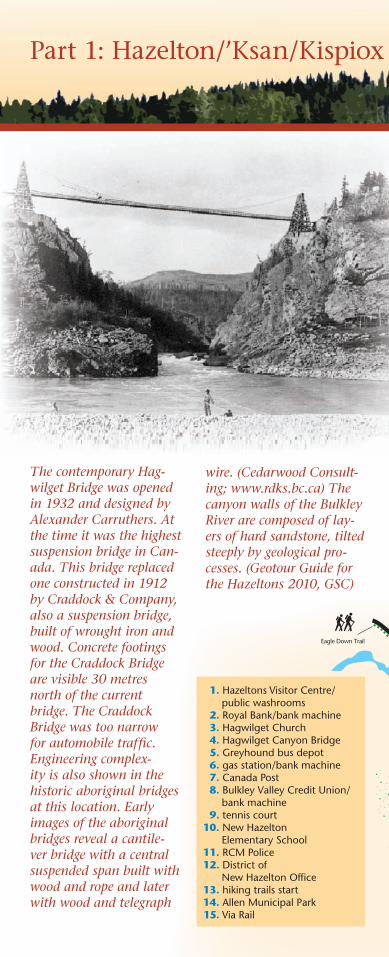
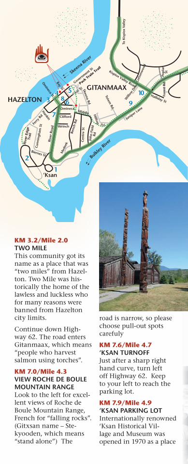
Part 1: Hazelton/’Ksan/Kispiox Valley
The contemporary Hag-wilget Bridge was opened in 1932 and designed by Alexander Carruthers. At the time it was the highest suspension bridge in Can-ada. This bridge replaced one constructed in 1912 by Craddock & Company, also a suspension bridge, built of wrought iron and wood. Concrete footings for the Craddock Bridge are visible 30 metres north of the current bridge. The Craddock Bridge was too narrow for automobile traffi c. Engineering complex-ity is also shown in the historic aboriginal bridges at this location. Early images of the aboriginal bridges reveal a cantile-ver bridge with a central suspended span built with wood and rope and later with wood and telegraph
wire. (Cedarwood Consult-ing; www.rdks.bc.ca) The canyon walls of the Bulkley River are composed of lay-ers of hard sandstone, tilted steeply by geological pro-cesses. (Geotour Guide for the Hazeltons 2010, GSC)
K
1. Hazeltons Visitor Centre/ public washrooms 2. Royal Bank/bank machine 3. Hagwilget Church 4. Hagwilget Canyon Bridge 5. Greyhound bus depot 6. gas station/bank machine 7. Canada Post 8. Bulkley Valley Credit Union/ bank machine 9. tennis court 10. New Hazelton Elementary School 11. RCM Police 12. District of New Hazelton Office 13. hiking trails start 14. Allen Municipal Park 15. Via Rail
10th Ave.
Chu
rchi
ll
Pugs
ley
St.
Fiel
ding
St.
Bow
ser
St.
McL
eod
St.
Kelly
St.
Tem
ple
man
St.
Laur
ier
St
McB
ride
St
Tem
plem
an
McB
ride
Oliv
er S
t
Canad
ian N
ation
al Ra
ilway
NEW HAZELTON
HAGWILGET
14th
15th
13th
12th
11th
12th Ave.
6th
7th Ave.
8th Ave.9th Ave.9th Ave.1
9
12
1011
13
15
7
Pioneer Rd
Church Rd
8
2
elly
3
5
Eagle Down Trail
614
Wetland Trail
Outlook Trail
4
16
Chu
rchi
ll
4
62
KM 0/Mile 0HAZELTONS VISITOR CENTRE Start in New Hazelton at the distinctive log build-ing that serves as our regional Travel Infocen-tre. Statues of a Miner, Horse Packer and Logger are marked with brass plaques which explain the importance of these fi gures in local history. When inside the Infor-mation Centre have a look at the upstairs “mini museum” that intro-duces the region’s history through the use of photo displays and artifacts.
From the Visitor Centre, turn left onto Highway 62.
KM 1.5/Mile .9HAGWILGET BRIDGE TURNOUTPark in the paved area before crossing the
bridge. Hagwilget Can-yon has been crossed since antiquity with a number of bridges. The current span was built in 1932 and soars 80 metres (260 feet) above the Bulkley River. A short distance uphill from the turnout is the begin-ning of a trail that will take you down to the river’s edge. Hagwilget, a Wet’suwet’en communi-ty, means “gentle or quiet people”.
KM 1.8/Mile 1.1HAGWILGET VIEWPOINT Turn left into the small parking area just across the bridge. Note: this area may be too small for large motorhomes. Trails descend here from the parking area to the downstream side of the bridge. Across the street another trail can be taken for spectacular views of Hagwilget Peak and the Bridge.
Part 1: Hazelton/’Ksan/Kispiox Valley
KM 3.2/Mile 2.0TWO MILEThis community got its name as a place that was “two miles” from Hazel-ton. Two Mile was his-torically the home of the lawless and luckless who for many reasons were banned from Hazelton city limits.
Continue down High-way 62. The road enters Gitanmaax, which means “people who harvest salmon using torches”.
KM 7.0/Mile 4.3VIEW ROCHE DE BOULE MOUNTAIN RANGELook to the left for excel-lent views of Roche de Boule Mountain Range, French for “falling rocks”. (Gitxsan name – Ste-kyooden, which means “stand alone”) The
Kispiox Valley Road
Bulkley
Rive
r
Skeen
a Rive
r
Om
ineca St
Govern
ment St
Field St
Omineca
Clifford
Wrinch
Hankin
Ferry
Rd
Rive
r Ro
ad
HAZELTON
Benc
h Rd
Cen
tre
St
Skeena Rd
Hilltop
Rd
Joh
n F
ield
Rd
Totem Rd
Juniper Lane
GITANMAAX
Will
ow D
rive
Halliday St
Fore
st R
d
Swan
nel
l Dr.
Wiggins W
ay
HAZELTON
Pop
lar
St
Cot
tonw
ood
To K
isp
iox
Valle
y
8 5
7
6 3
2
1’Ksan
9
11
13
12
Cun
nin
gh
am S
t
10 Hazelton/Gitanmaax
Med
eek
Biernes St
Bay St
Middle
Eagle Down Trail
Rive
r Edg
eTr
ail
Pack Tra
in Tra
il
1.’Ksan Historic Village & Museum 2.‘Ksan Campground 3. Hazelton Library/Museum 4. Bastion Park/public washroom 5. Saint Peter’s Anglican Church 6. Village of Hazelton Office 7. Gitanmaax Band Office 8. Canada Post 9. Gitanmaax Hall 10. gas station/bank machine 11. Wrinch Memorial Hospital 12. Hazelton Secondary School 13. Skeena Ice Arena
4
Stra
ther
n R
d
Omineca
Joh
n F
ield
Will
ow D
rive
Will
ow D
rive
Cot
tonw
ood
7
4 ore
st R
do
rest
Rd
62
road is narrow, so please choose pull-out spots carefuly
KM 7.6/Mile 4.7‘KSAN TURNOFF Just after a sharp right hand curve, turn left off Highway 62. Keep to your left to reach the parking lot.
KM 7.9/Mile 4.9‘KSAN PARKING LOT Internationally renowned ‘Ksan Historical Vil-lage and Museum was opened in 1970 as a place
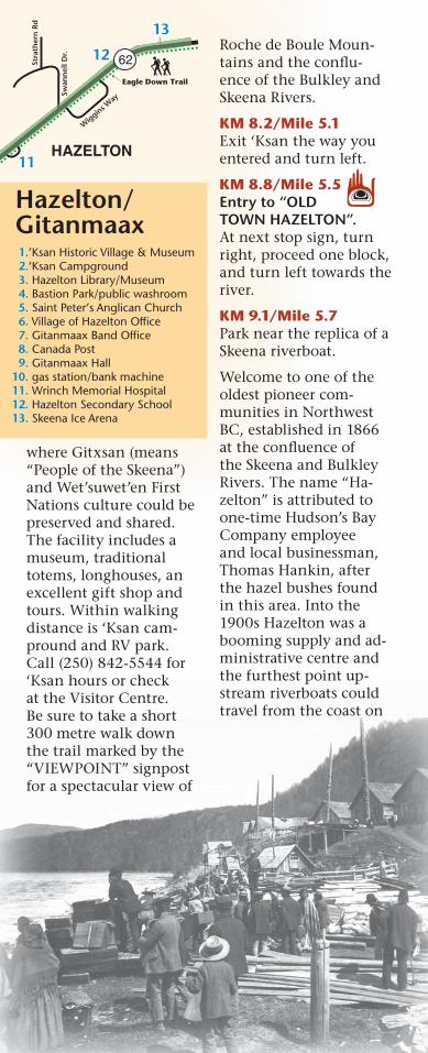
where Gitxsan (means “People of the Skeena”) and Wet’suwet’en First Nations culture could be preserved and shared. The facility includes a museum, traditional totems, longhouses, an excellent gift shop and tours. Within walking distance is ‘Ksan cam-pround and RV park. Call (250) 842-5544 for ‘Ksan hours or check at the Visitor Centre. Be sure to take a short 300 metre walk down the trail marked by the “VIEWPOINT” signpost for a spectacular view of
Kispiox Valley Road
Bulkley
Rive
r
Skeen
a Rive
r
Om
ineca St
Govern
ment St
Field St
Omineca
Clifford
Wrinch
Hankin
Ferry
Rd
Rive
r Ro
ad
HAZELTON
Benc
h Rd
Cen
tre
St
Skeena Rd
Hilltop
Rd
Joh
n F
ield
Rd
Totem Rd
Juniper Lane
GITANMAAX
Will
ow D
rive
Halliday St
Fore
st R
d
Swan
nel
l Dr.
Wiggins W
ay
HAZELTON
Pop
lar
St
Cot
tonw
ood
To K
isp
iox
Valle
y
8 5
7
6 3
2
1’Ksan
9
11
13
12
Cun
nin
gh
am S
t
10 Hazelton/Gitanmaax
Med
eek
Biernes St
Bay St
Middle
Eagle Down Trail
Rive
r Edg
eTr
ail
Pack Tra
in Tra
il
1.’Ksan Historic Village & Museum 2.‘Ksan Campground 3. Hazelton Library/Museum 4. Bastion Park/public washroom 5. Saint Peter’s Anglican Church 6. Village of Hazelton Office 7. Gitanmaax Band Office 8. Canada Post 9. Gitanmaax Hall 10. gas station/bank machine 11. Wrinch Memorial Hospital 12. Hazelton Secondary School 13. Skeena Ice Arena
4
Stra
ther
n R
d
62Roche de Boule Moun-tains and the confl u-ence of the Bulkley and Skeena Rivers.
KM 8.2/Mile 5.1Exit ‘Ksan the way you entered and turn left.
KM 8.8/Mile 5.5Entry to “OLD TOWN HAZELTON”. At next stop sign, turn right, proceed one block, and turn left towards the river.
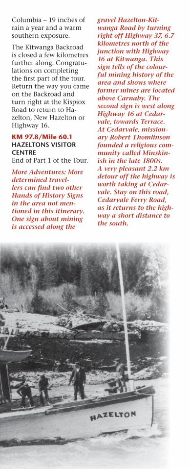
KM 9.1/Mile 5.7Park near the replica of a Skeena riverboat.
Welcome to one of the oldest pioneer com-munities in Northwest BC, established in 1866 at the confl uence of the Skeena and Bulkley Rivers. The name “Ha-zelton” is attributed to one-time Hudson’s Bay Company employee and local businessman, Thomas Hankin, after the hazel bushes found in this area. Into the 1900s Hazelton was a booming supply and ad-ministrative centre and the furthest point up-stream riverboats could travel from the coast on
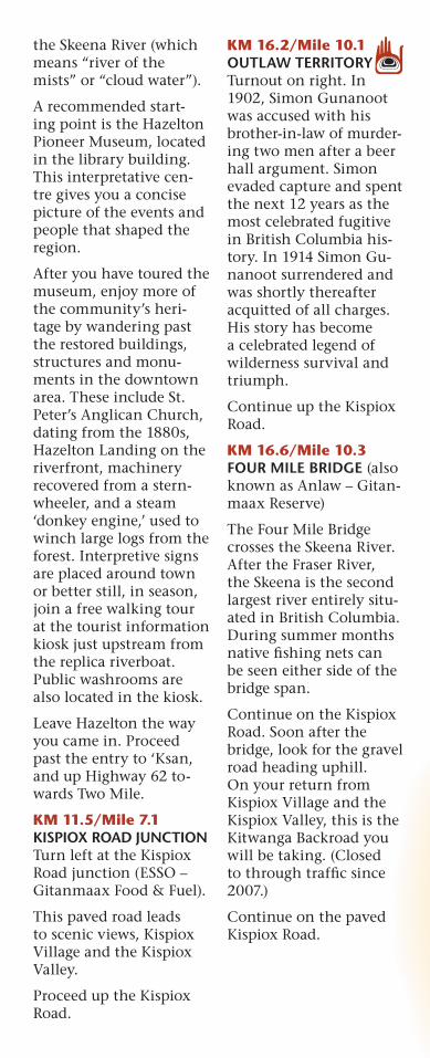
the Skeena River (which means “river of the mists” or “cloud water”).
A recommended start-ing point is the Hazelton Pioneer Museum, located in the library building. This interpretative cen-tre gives you a concise picture of the events and people that shaped the region.
After you have toured the museum, enjoy more of the community’s heri-tage by wandering past the restored buildings, structures and monu-ments in the downtown area. These include St. Peter’s Anglican Church, dating from the 1880s, Hazelton Landing on the riverfront, machinery recovered from a stern-wheeler, and a steam ‘donkey engine,’ used to winch large logs from the forest. Interpretive signs are placed around town or better still, in season, join a free walking tour at the tourist information kiosk just upstream from the replica riverboat. Public washrooms are also located in the kiosk.
Leave Hazelton the way you came in. Proceed past the entry to ‘Ksan, and up Highway 62 to-wards Two Mile.
KM 11.5/Mile 7.1KISPIOX ROAD JUNCTION Turn left at the Kispiox Road junction (ESSO – Gitanmaax Food & Fuel).
This paved road leads to scenic views, Kispiox Village and the Kispiox Valley.
Proceed up the Kispiox Road.
KM 16.2/Mile 10.1OUTLAW TERRITORY Turnout on right. In 1902, Simon Gunanoot was accused with his brother-in-law of murder-ing two men after a beer hall argument. Simon evaded capture and spent the next 12 years as the most celebrated fugitive in British Columbia his-tory. In 1914 Simon Gu-nanoot surrendered and was shortly thereafter acquitted of all charges. His story has become a celebrated legend of wilderness survival and triumph.
Continue up the Kispiox Road.
KM 16.6/Mile 10.3FOUR MILE BRIDGE (also known as Anlaw – Gitan-maax Reserve)
The Four Mile Bridge crosses the Skeena River. After the Fraser River, the Skeena is the second largest river entirely situ-ated in British Columbia. During summer months native fi shing nets can be seen either side of the bridge span.
Continue on the Kispiox Road. Soon after the bridge, look for the gravel road heading uphill. On your return from Kispiox Village and the Kispiox Valley, this is the Kitwanga Backroad you will be taking. (Closed to through traffi c since 2007.)
Continue on the paved Kispiox Road.
James WoodsPlace
Kispiox River
Kisp
iox
Valle
y Ro
ad
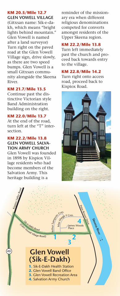
Glen Vowell(Sik-E-Dakh)
1 23
4
Skeena River
49
Sik-e-dakh Road
Art
hur
S am
ps
on
Cres.
Max
Mag
a-Y Cres.
(Glen Vowell Village Road)
Peter Brown D
rive
1 2
A
1. Sik-E-Dakh Health Station 2. Glen Vowell Band Office 3. Glen Vowell Recreation Area 4. Salvation Army Church
KM 20.5/Mile 12.7GLEN VOWELL VILLAGE (Gitxsan name: Sik-e-da-kh, which means “bright lights behind mountain.” Glen Vowell is named after a land surveyor) Turn right on the paved road at the Glen Vowell Village sign, drive slowly, as there are two speed bumps. Glen Vowell is a small Gitxsan commu-nity alongside the Skeena River.
KM 21.7/Mile 13.5Continue past the dis-tinctive Victorian style Band Administration building on the right.
KM 22.0/Mile 13.7At the end of the road, turn left at the “T” inter-section.
KM 22.2/Mile 13.8GLEN VOWELL SALVA-TION ARMY CHURCH Glen Vowell was founded in 1898 by Kispiox Vil-lage residents who had become members of the Salvation Army. This heritage building is a
reminder of the mission-ary era when different religious denominations competed for converts amongst residents of the Upper Skeena region.
KM 22.2/Mile 13.8Turn left immediately past the church and pro-ceed back towards entry to the village.
KM 22.8/Mile 14.2Turn right onto access road, proceed back to Kispiox Road.
KM 23.8/Mile 14.8KISPIOX ROAD. Turn right onto Kispiox Road.
KM 25.6/Mile 15.9FARLEIGH’S MARKET GARDENDuring the summer months the Farleigh family operates the best vegetable farm in North-western B.C. Feel free to stop and stock up on fresh produce.
KM 28.1/Mile 17.5KISPIOX RIVER BRIDGECross this wooden bridge over the famed Kispiox River. This river has a worldwide reputation for its very large Steelhead Trout.
KM 28.4/Mile 17.6KISPIOX VILLAGE (Anspayaxw which means “People of the Hiding Place”)Turn right at the fi rst road past the distinctive Kispiox Band Adminis-tration building on the right. Proceed down the gravel road.
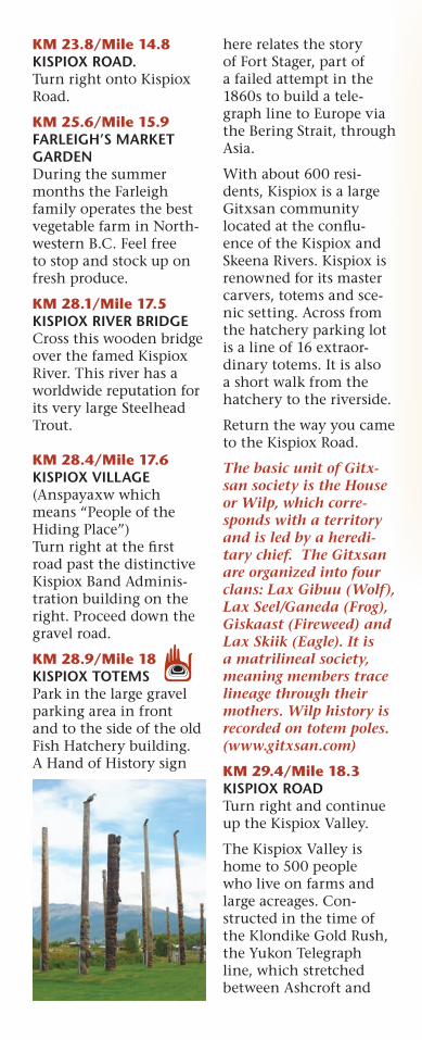
KM 28.9/Mile 18KISPIOX TOTEMSPark in the large gravel parking area in front and to the side of the old Fish Hatchery building. A Hand of History sign
here relates the story of Fort Stager, part of a failed attempt in the 1860s to build a tele-graph line to Europe via the Bering Strait, through Asia.
With about 600 resi-dents, Kispiox is a large Gitxsan community located at the confl u-ence of the Kispiox and Skeena Rivers. Kispiox is renowned for its master carvers, totems and sce-nic setting. Across from the hatchery parking lot is a line of 16 extraor-dinary totems. It is also a short walk from the hatchery to the riverside.
Return the way you came to the Kispiox Road.
The basic unit of Gitx-san society is the House or Wilp, which corre-sponds with a territory and is led by a heredi-tary chief. The Gitxsan are organized into four clans: Lax Gibuu (Wolf), Lax Seel/Ganeda (Frog), Giskaast (Fireweed) and Lax Skiik (Eagle). It is a matrilineal society, meaning members trace lineage through their mothers. Wilp history is recorded on totem poles. (www.gitxsan.com)
KM 29.4/Mile 18.3KISPIOX ROADTurn right and continue up the Kispiox Valley.
The Kispiox Valley is home to 500 people who live on farms and large acreages. Con-structed in the time of the Klondike Gold Rush, the Yukon Telegraph line, which stretched between Ashcroft and
Totem Drive
Giskaast St
Gun
anoo
t Av
enue
Lax Gibuu Street
Pier
ce A
ve
Lax See’l St
Sim
Gii
Gya
t Ave
.
An-
gol D
rive
Fritz
Ave
Sham
an A
ve
Comm
ercial
Drive
Fost
er A
ve
Toomitts St
Pine Ave
Birch Ave
Poplar St
Willow
AveJohn Crosby Drive
Kispiox Village
Kispiox V
alley R
oad
Kisp
iox
Rive
r
Spru
ce St
1
2
4
3 5
6
8
7Frontage St
Skeena River
Eagl
e Driv
e
Mary Blackwater DriveSi
gidi
m H
aa Nakx Drive
Barnes Cres.
Lax
Guu
Tikw
Way
Drop In Way
Sim
Gii
Gya
t
Kispi x V
alley R
oad
8
7Frontage Strontage St
1. Kispiox Band Office 2. Kispiox Salmon Hatchery 3. totem poles 4. camping area 5. Pierce Memorial United Church 6. Kispiox Community Centre 7. gas bar 8. fire hall 49
49
Return back down the Kispiox Road the way you came towards Hazelton. At this point you can either return to Hazelton and/or High-way 16, or continue with the “Hands of History” adventure.
For those who wish to complete the entire tour, proceed down the Kispiox Road to the inter-section at the Kitwanga Backroad (Hazelton-Kit-wanga Road).
KM 60.9/Mile 37.8KITWANGA BACKROAD Turn a sharp right and drive uphill along the scenic back road towards Kitwanga. (This turn may not be feasible for large motorhomes.) The Kitwanga Backroad is a gravel road but main-tained to high standards.
Atlin, extended north-ward through the Kispiox Valley. The line operated from 1900 to 1936, and provided employment for local ranchers and pack-ers who supplied isolated telegraph operators. The Kispiox Valley is now known for its pleasant rural lifestyle.
KM 41.6/Mile 25.9KISPIOX RODEO GROUNDS/COMMUNITY HALL Perhaps take a walk on the grounds and to the river. It is here where the annual KISPIOX VALLEY RODEO is held the fi rst weekend in June and the annual KISPIOX VALLEY MUSIC FESTIVAL, the last weekend in July.
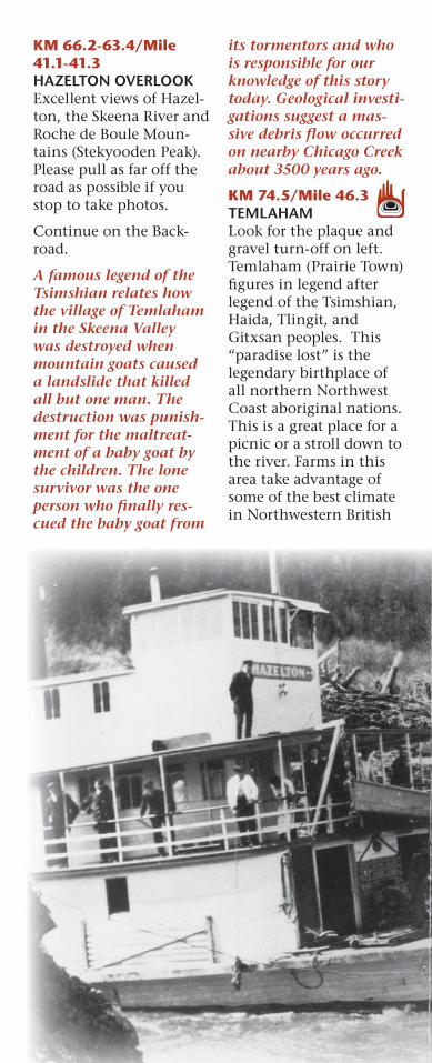
KM 66.2-63.4/Mile 41.1-41.3HAZELTON OVERLOOK Excellent views of Hazel-ton, the Skeena River and Roche de Boule Moun-tains (Stekyooden Peak). Please pull as far off the road as possible if you stop to take photos.
Continue on the Back-road.
A famous legend of the Tsimshian relates how the village of Temlaham in the Skeena Valley was destroyed when mountain goats caused a landslide that killed all but one man. The destruction was punish-ment for the maltreat-ment of a baby goat by the children. The lone survivor was the one person who fi nally res-cued the baby goat from
its tormentors and who is responsible for our knowledge of this story today. Geological investi-gations suggest a mas-sive debris fl ow occurred on nearby Chicago Creek about 3500 years ago.
KM 74.5/Mile 46.3TEMLAHAMLook for the plaque and gravel turn-off on left. Temlaham (Prairie Town) fi gures in legend after legend of the Tsimshian, Haida, Tlingit, and Gitxsan peoples. This “paradise lost” is the legendary birthplace of all northern Northwest Coast aboriginal nations. This is a great place for a picnic or a stroll down to the river. Farms in this area take advantage of some of the best climate in Northwestern British
Columbia – 19 inches of rain a year and a warm southern exposure.
The Kitwanga Backroad is closed a few kilometres further along. Congratu-lations on completing the fi rst part of the tour. Return the way you came on the Backroad and turn right at the Kispiox Road to return to Ha-zelton, New Hazelton or Highway 16.
KM 97.8/Mile 60.1HAZELTONS VISITOR CENTREEnd of Part 1 of the Tour.
More Adventures: More determined travel-lers can fi nd two other Hands of History Signs in the area not men-tioned in this itinerary. One sign about mining is accessed along the
gravel Hazelton-Kit-wanga Road by turning right off Highway 37, 6.7 kilometres north of the junction with Highway 16 at Kitwanga. This sign tells of the colour-ful mining history of the area and shows where former mines are located above Carnaby. The second sign is west along Highway 16 at Cedar-vale, towards Terrace. At Cedarvale, mission-ary Robert Thomlinson founded a religious com-munity called Minskin-ish in the late 1800s. A very pleasant 2.2 km detour off the highway is worth taking at Cedar-vale. Stay on this road, Cedarvale Ferry Road, as it returns to the high-way a short distance to the south.
KM 0/Mile 0HAZELTONS VISITOR CENTREStarting at the Visitor Centre in New Hazelton, this segment of the tour heads westward follow-ing the Skeena River and CN rail line and north
on a 15 minute drive along the Stewart Cassiar Highway 37 to Gitanyow (Kitwancool). The Hands of History stops of inter-est are described from Gitanyow back towards our starting point in New Hazelton.
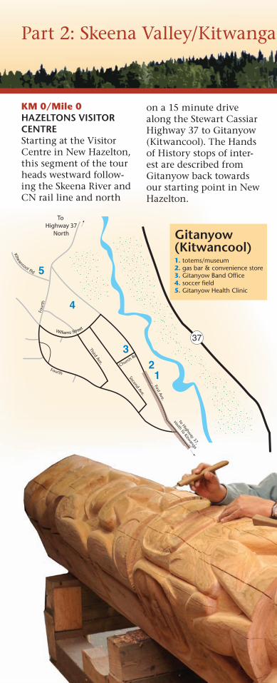
Part 2: Skeena Valley/Kitwanga Fort/Gitanyow
Gitanyow(Kitwancool)
37
First Ave.
Second Ave.
Third Ave.
to Highway 37,
south to Kitwanga
4
5
3 2
1Fourth
Four
th
Williams Street
Kitwancool Rd
Church Rd
1. totems/museum 2. gas bar & convenience store 3. Gitanyow Band Office 4. soccer field 5. Gitanyow Health Clinic
To Highway 37
North
From the Visitor Centre, exit the parking area and turn right onto Highway 16 (towards Kitwanga and Terrace).
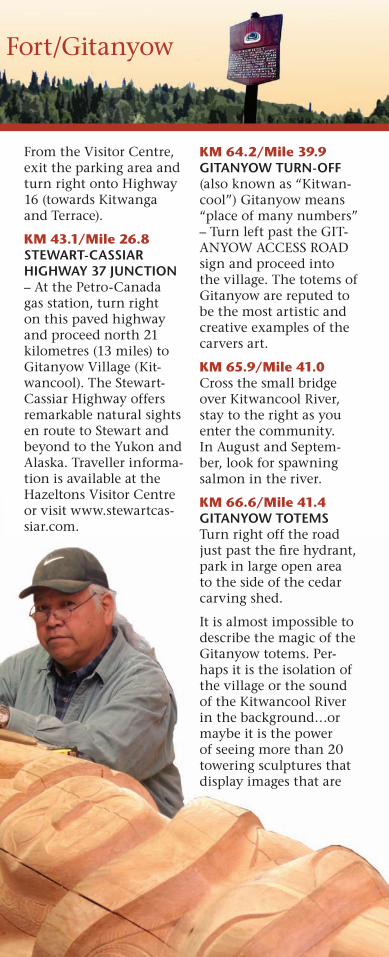
KM 43.1/Mile 26.8STEWART-CASSIAR HIGHWAY 37 JUNCTION – At the Petro-Canada gas station, turn right on this paved highway and proceed north 21 kilometres (13 miles) to Gitanyow Village (Kit-wancool). The Stewart-Cassiar Highway offers remarkable natural sights en route to Stewart and beyond to the Yukon and Alaska. Traveller informa-tion is available at the Hazeltons Visitor Centre or visit www.stewartcas-siar.com.
KM 64.2/Mile 39.9GITANYOW TURN-OFF(also known as “Kitwan-cool”) Gitanyow means “place of many numbers” – Turn left past the GIT-ANYOW ACCESS ROAD sign and proceed into the village. The totems of Gitanyow are reputed to be the most artistic and creative examples of the carvers art.
KM 65.9/Mile 41.0Cross the small bridge over Kitwancool River, stay to the right as you enter the community. In August and Septem-ber, look for spawning salmon in the river.
KM 66.6/Mile 41.4GITANYOW TOTEMS Turn right off the road just past the fi re hydrant, park in large open area to the side of the cedar carving shed.
It is almost impossible to describe the magic of the Gitanyow totems. Per-haps it is the isolation of the village or the sound of the Kitwancool River in the background…or maybe it is the power of seeing more than 20 towering sculptures that display images that are
Part 2: Skeena Valley/Kitwanga Fort/Gitanyow
truly of another world. It is worth taking time to wander amongst these timeless sentinels of Northwest Coast culture.
Return to the highway the way you came.
KM 69.0/Mile 42.9STEWART-CASSIAR HIGHWAY JUNCTION Turn right and proceed back down the way you came (approx. 14.5 kilo-metres).
KM 83.5/Mile 51.9KITWANGA JUNCTION Turn right at signs mark-ing the exit to Kitwanga.
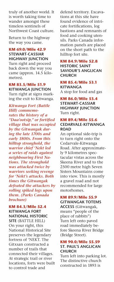
Kitwanga Fort (Battle Hill) commemo-rates the history of a “Daa’ootsip,” or fortifi ed village that was occupied by the Gitwangak dur-ing the late 1700s and early 1800s. From this hilltop stronghold, the warrior chief ‘Nekt led a series of raids against neighbouring First Na-tions. The stronghold was attacked twice by warriors seeking revenge for ‘Nekt’s attacks. Both times the Gitwangak defeated the attackers by rolling spiked logs upon them. (Parks Canada brochure)
KM 84.3/Mile 52.4KITWANGA FORT NATIONAL HISTORIC SITE (BATTLE HILL)On your right, this National Historical Site preserves the legendary fortress of ‘NEKT. The Gitxsan constructed a number of trails that connected their villages. At strategic trail or river locations, forts were built to control trade and
defend territory. Excava-tions at this site have found evidence of intri-cate fortifi cations, log bastions and remnants of food and cooking uten-sils. Parks Canada infor-mation panels are placed on the short path to the hilltop fort site.
KM 84.9/Mile 52.8HISTORIC SAINT SAVIOUR’S ANGLICAN CHURCH
KM 85.4/Mile 53.1KITWANGAA stop for food and gas
KM 86.0/Mile 53.4STEWART-CASSIAR HIGHWAY JUNCTION Turn right.
KM 89.4/Mile 55.6CEDARVALE-KITWANGA ROADAn optional side-trip is to turn right onto the Cedarvale-Kitwanga Road. After approximate-ly 9 kilometres spec-tacular vistas across the Skeena River and to the 2500 metre high Seven Sisters Mountains come into view. This is mostly a gravel road and not recommended for large motorhomes.
KM 89.9/Mile 55.9GITWANGAK TOTEMS ACCESS (Gitwangak, means “people of the place of rabbits”)Turn left onto paved road immediately be-fore Skeena River Bridge (Bridge Street).
KM 90.0/Mile 55.59ST. PAUL’S ANGLICAN CHURCHTurn left into parking lot. The distinctive church constructed in 1893 is
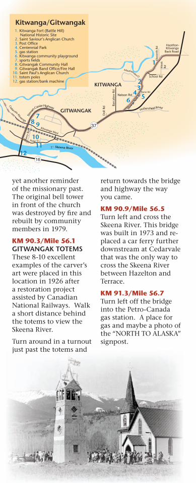
yet another reminder of the missionary past. The original bell tower in front of the church was destroyed by fi re and rebuilt by community members in 1979.
KM 90.3/Mile 56.1GITWANGAK TOTEMS These 8-10 excellent examples of the carver’s art were placed in this location in 1926 after a restoration project assisted by Canadian National Railways. Walk a short distance behind the totems to view the Skeena River.
Turn around in a turnout just past the totems and
return towards the bridge and highway the way you came.
KM 90.9/Mile 56.5Turn left and cross the Skeena River. This bridge was built in 1973 and re-placed a car ferry further downstream at Cedarvale that was the only way to cross the Skeena River between Hazelton and Terrace.
KM 91.3/Mile 56.7Turn left off the bridge into the Petro-Canada gas station. A place for gas and maybe a photo of the “NORTH TO ALASKA” signpost.
Kitwanga/Gitwangak
Elsw
orth
Rd Hazelton-
KitwangaBack Road
Mee
k Rd
School Rd
Kitw
anga
Nor
th R
dNelson RdHome Rd
Dol
l Rd Ba
rcal
ow R
dGITWANGAK
Skeena River
16
KITWANGA
10 11
8 9 7
2
1
34
6
Cedarvale-Kitwanga
Kitwanga West
Stew
art-Cassiar Highway
Hobenshield Road
Mountainview D
12
5
El
Kitw
anga
Nor
th R
d
Home Rd
23
4
8 8 7 7
g yy
1. Kitwanga Fort (Battle Hill) National Historic Site 2. Saint Saviour’s Anglican Church 3. Post Office 4. Centennial Park 5. gas station 6. Kitwanga community playground 7. sports fields 8. Gitwangak Community Hall 9. Gitwangak Band Office/Fire Hall 10. Saint Paul’s Anglican Church 11. totem poles 12. gas station/bank machine
37
Ferr
y Rd
Bridge St.
KM 91.14/Mile 56.8Turn left out of gas sta-tion parking lot onto Yel-lowhead Highway 16.
KM 108.1/Mile 67.1SKEENA CROSSING Large pull-put on right, just before entering the community of Kitseguk-la. This Hand of History plaque commemorates construction of the Grand Trunk Pacific Railway (now the Cana-dian National Railway) and specifically the 1912 completion of a railway bridge crossing just up-river from this location. Ironically sternwheelers on the Skeena River sup-ported this construction project but soon met their demise as rail travel became the preferred method of transporta-tion.
Continue down Highway 16.
KM 108.4/Mile 67.3ENTERING KITSEGUKLA Also called Gitsegukla, which means “people of the sharp pointed moun-tain” is a Gitxsan village located near river can-yons that provide excel-lent opportunities to net some of the 5 million salmon that migrate up the Skeena River annu-ally.
Continue down Highway 16.
KM 115.3/Mile 71.6CARNABY SAWMILL SITE – this sawmill was once one of the largest employers in the area before closing down in 2001. Forestry has been a mainstay of the re-gion’s economy, starting
with supplying wood to fuel the sternwheelers, to cutting railway ties and mining timbers, to producing lumber in high production mills for overseas markets.
KM 124.7/Mile 77.5SEELEY LAKE Turn right off Highway 16 at Seeley Lake Pro-vincial Park. A “Hand of History” sign commemo-rates the mythic grizzly bear that inhabited the lake in centuries past. Good fishing, swimming and camping.
Turn right from the parking area to return to Highway 16. Continue down Highway 16 until you see the signs for South Hazelton.
KM 127.3/Mile 79.1SOUTH HAZELTON ENTRANCETurn left off the high-way and proceed along Aldous Street into South Hazelton. At approxi-mately 3 km the road will turn right (Omineca Avenue).
South Hazelton and New Hazelton were born of the railway—both origi-nating with the railway construction starting around 1909. Great futures were predicted and grand plans drawn; South Hazelton was pro-moted as “The Chicago of the North.”
KM 130.4/Mile 81.0HAZELTON STATION ROADTurning left at Hazelton Station Road takes one on a 2 kilometre descent along a gravel road to Anderson Flats, along
the Bulkey River opposite ‘Ksan and Gitanmaax. Due to some steepness and sharp corners, larger motorhomes are advised to use caution.
KM 132.5/Mile 82.3MISSION POINT Anderson Flats has played an important role in the history of the region. It has been the location of native trad-ing, explorer’s camps, a Methodist mission, a Hudson’s Bay outpost, a slaughter yard, and a golf course. The site is now a provincial park, favourite local picnic ground and fi shing hole.
Return the way to you came, to the top of the hill
KM 134.7/Mile 83.7ALDOUS STREETAfter crossing the railway tracks again, turn left at the top of the hill.
KM 135.4/Mile 84.1HIGHWAY 16 JUNCTION Turn left and continue down Highway 16,
past the Visitor Centre, through New Hazelton to the “Welcome to the Ha-zeltons” sign at the paved turnout on the left.
KM 140.3/Mile 87.2BANK ROBBERIES Near this location the last “Wild West” bank robbery and shootout in Western Canada took place. Russian anar-chists met a gruesome fate when they came up against the sharp-shoot-ing townsfolk of New Hazelton.
KM 141.82/Mile 87.7HAZELTONS VISITOR CENTREA short return through New Hazelton brings you back to the Visitor Centre and completion of the tour. We trust the experi-ence was rewarding and thank you for visiting the Hazeltons: The Historic Heartland of Northwest British Columbia.
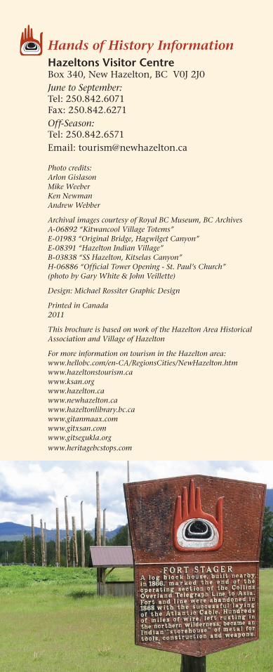
Hands of History InformationHazeltons Visitor CentreBox 340, New Hazelton, BC V0J 2J0June to September:Tel: 250.842.6071Fax: 250.842.6271Off-Season:Tel: 250.842.6571Email: [email protected]
Photo credits: Arlon GislasonMike WeeberKen NewmanAndrew Webber
Archival images courtesy of Royal BC Museum, BC ArchivesA-06892 “Kitwancool Village Totems”E-01983 “Original Bridge, Hagwilget Canyon”E-08391 “Hazelton Indian Village”B-03838 “SS Hazelton, Kitselas Canyon”H-06886 “Official Tower Opening - St. Paul’s Church” (photo by Gary White & John Veillette)
Design: Michael Rossiter Graphic Design
Printed in Canada2011
This brochure is based on work of the Hazelton Area Historical Association and Village of Hazelton
For more information on tourism in the Hazelton area:www.hellobc.com/en-CA/RegionsCities/NewHazelton.htmwww.hazeltonstourism.cawww.ksan.orgwww.hazelton.cawww.newhazelton.cawww.hazeltonlibrary.bc.cawww.gitanmaax.comwww.gitxsan.comwww.gitsegukla.orgwww.heritagebcstops.com