3.6 Geography
39
3.6 Geography 3.6 Geography We will have 9 lessons with SOL 3.6 We will have 9 lessons with SOL 3.6 3.6 The student will 3.6 The student will interpret geographic interpret geographic information from maps, information from maps, tables, graphs, and charts. tables, graphs, and charts.
-
Upload
dexter-rios -
Category
Documents
-
view
60 -
download
2
description
3.6 Geography. We will have 9 lessons with SOL 3.6. 3.6 The student will interpret geographic information from maps, tables, graphs, and charts. - PowerPoint PPT Presentation
Transcript of 3.6 Geography

3.6 Geography3.6 GeographyWe will have 9 lessons with SOL 3.6We will have 9 lessons with SOL 3.6
3.6 The student will interpret geographic 3.6 The student will interpret geographic information from maps, tables, graphs, information from maps, tables, graphs, and charts.and charts.
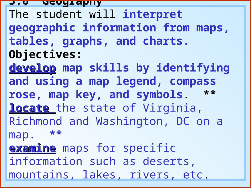
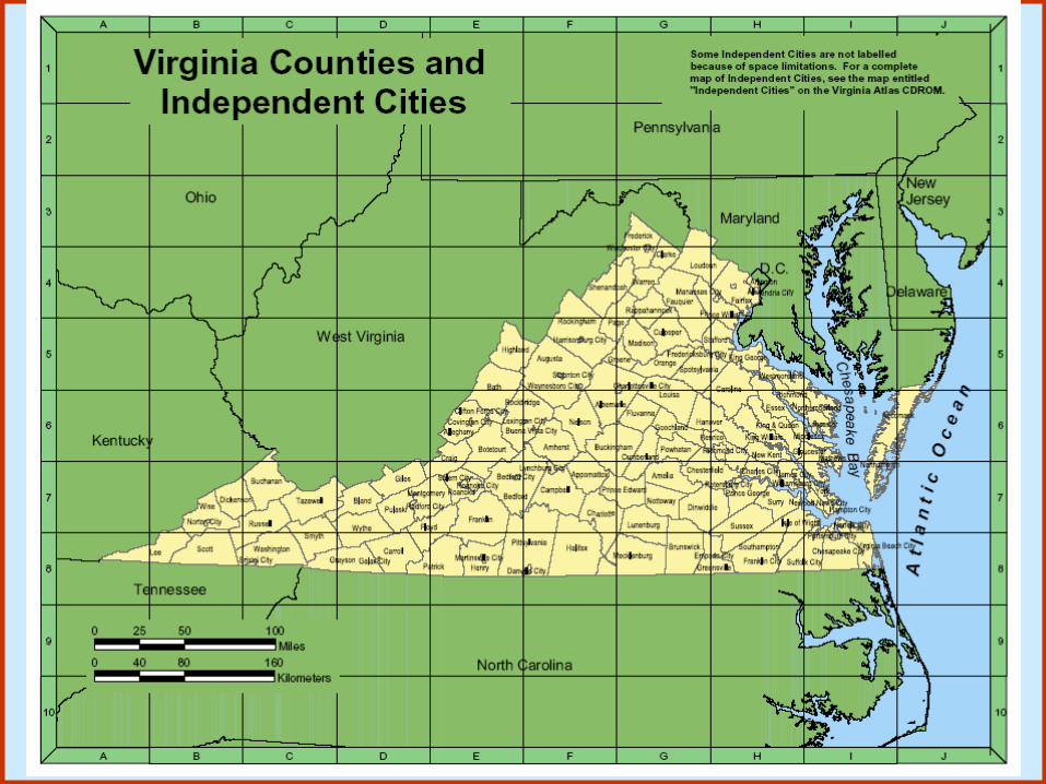
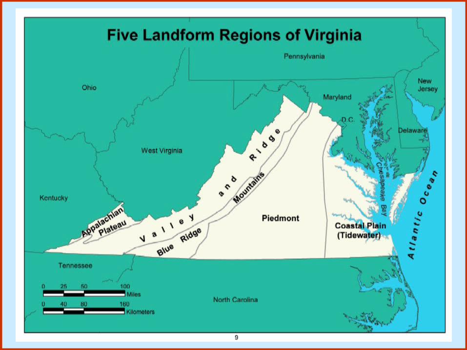
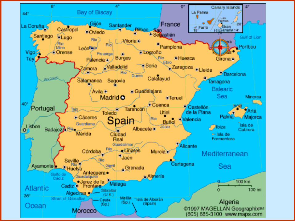
3.6 Geography The student will interpret geographic information from maps, tables, graphs, and charts.Objectives:developdevelop map skills by identifying and using a map legend, compass rose, map key, and symbols. **locate locate the state of Virginia, Richmond and Washington, DC on a map. **examineexamine maps for specific information such as deserts, mountains, lakes, rivers, etc.

Understanding HemispheresSocial Studies Textbook Page 222-223, 227 (9-11)Social Studies Textbook Page 222-223, 227 (9-11)

http://www.enchantedlearning.com/geography/printouts/compassrose.shtml
A compass rose is a design on a map that showsdirections. It shows north, south, east, west,northeast, northwest, southeast, and southwest.
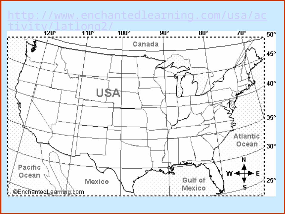
http://www.enchantedlearning.com/usa/activity/latlong2/


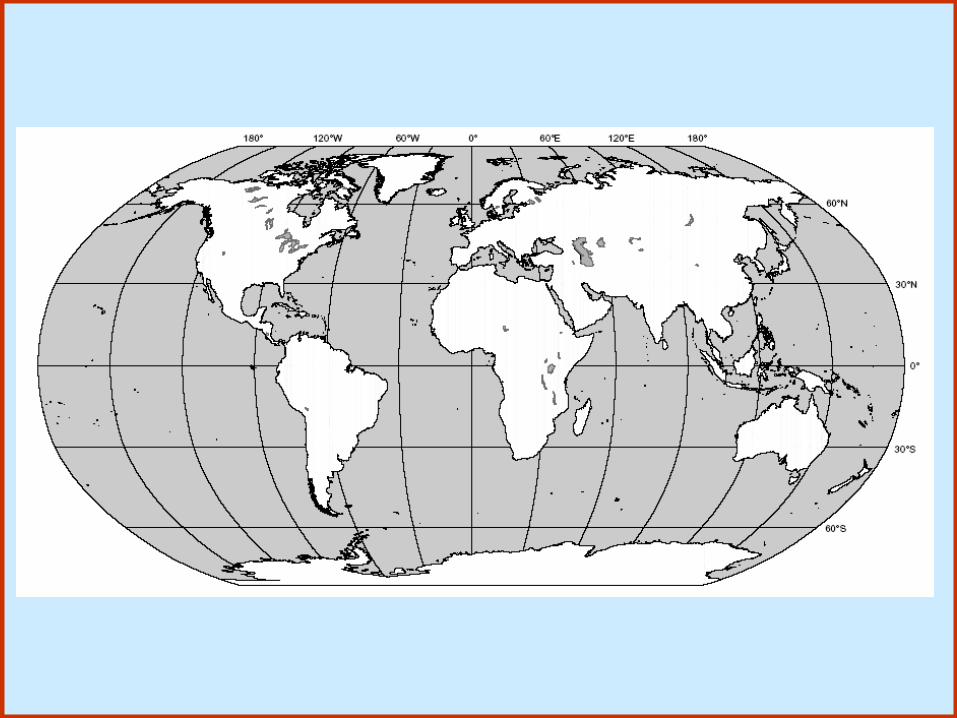


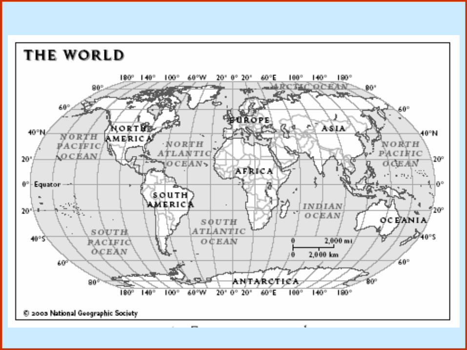

90º N45º N0º Latitude45º S90º S
180º W135º W90º W45º W0º Longitude
45º E90º E135º E180º E

90º N - the North Pole.45º N - a line of latitude that runs through the northern USA, central Europe, and central Asia.0º Latitude - the equator, a line of latitude that runs through northern South America and central Africa.45º S - a line of latitude that runs through the southern tip of South America and southern New Zealand.90º S - the South Pole.

180º W - a line of longitude that runs through the Midway Islands, half-way around the globe from the Prime Meridian. 180º W is the same as 180º W135º W - a line of longitude that runs through the far west of Canada.90º W - a line of longitude that runs through Canada and the USA (near the Mississippi River) and Guatemala (in Central America).45º W - a line of longitude that runs through Greenland and eastern Brazil.0º Longitude - a line of longitude that runs through Greenwich, England, western France, eastern Spain, Algeria, and other west African countries. Also known as the Prime Meridian.

45º E - a line of longitude that runs through western Russia, Saudi Arabia, and the Horn of Africa.90º E - a line of longitude that runs through central Russia, western China, and eastern India.135º E - a line of longitude that runs through eastern Russia, Japan, and Australia.180º E - a line of longitude that runs through the Midway Islands, half-waf around the globe from the Prime Meridian. 180º E is the same as 180º W.

Longitude and Latitudehttp://www.hammondmap.com/sites/hammond/geography/latlong1.html
Latitude and Longitude Look-uphttp://www.jyotisha.00it.com/Latitude.htm


90º N45º N0º Latitude45º S90º S
180º W135º W90º W45º W0º Longitude
45º E90º E135º E180º E