Welcome April 21, 2010 Capital Design Advisory … 21, 2010 Capital Design Advisory Presentation:...
21
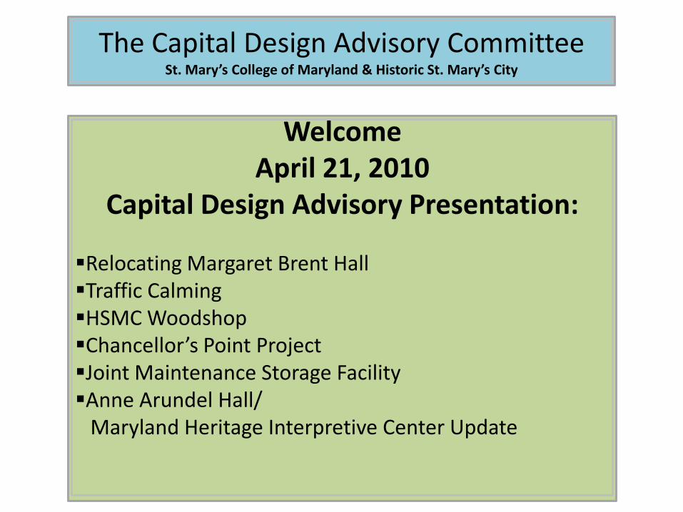
The Capital Design Advisory Committee St. Mary’s College of Maryland & Historic St. Mary’s City Welcome April 21, 2010 Capital Design Advisory Presentation: Relocating Margaret Brent Hall Traffic Calming HSMC Woodshop Chancellor’s Point Project Joint Maintenance Storage Facility Anne Arundel Hall/ Maryland Heritage Interpretive Center Update
Transcript of Welcome April 21, 2010 Capital Design Advisory … 21, 2010 Capital Design Advisory Presentation:...
The Capital Design Advisory CommitteeSt. Mary’s College of Maryland & Historic St. Mary’s City
WelcomeApril 21, 2010
Capital Design Advisory Presentation:
Relocating Margaret Brent HallTraffic CalmingHSMC WoodshopChancellor’s Point ProjectJoint Maintenance Storage FacilityAnne Arundel Hall/
Maryland Heritage Interpretive Center Update
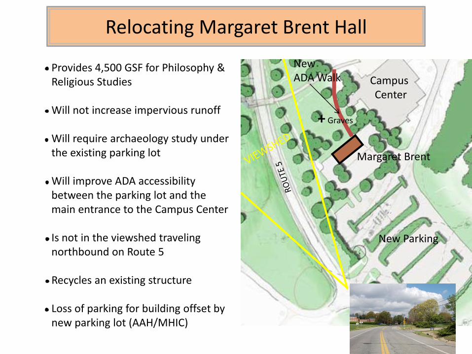
Relocating Margaret Brent Hall
Campus Center
Margaret Brent
Provides 4,500 GSF for Philosophy & Religious Studies
Will not increase impervious runoff
Will require archaeology study under the existing parking lot
Will improve ADA accessibility between the parking lot and the main entrance to the Campus Center
Is not in the viewshed traveling northbound on Route 5
Recycles an existing structure
Loss of parking for building offset by new parking lot (AAH/MHIC)
New Parking
NewADA Walk
+ Graves
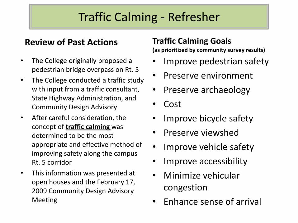
Traffic Calming - Refresher
• The College originally proposed a pedestrian bridge overpass on Rt. 5
• The College conducted a traffic study with input from a traffic consultant, State Highway Administration, and Community Design Advisory
• After careful consideration, the concept of traffic calming was determined to be the most appropriate and effective method of improving safety along the campus Rt. 5 corridor
• This information was presented at open houses and the February 17, 2009 Community Design Advisory Meeting
Traffic Calming Goals(as prioritized by community survey results)
• Improve pedestrian safety
• Preserve environment
• Preserve archaeology
• Cost
• Improve bicycle safety
• Preserve viewshed
• Improve vehicle safety
• Improve accessibility
• Minimize vehicular congestion
• Enhance sense of arrival
Review of Past Actions
Traffic Calming – Conceptual Ideas
• Narrowed traffic lanes from 11ft-12ft to 10ft-11ft
• Median islands
• Enhanced crosswalks with colored/textured pavement and improved pavement markings
• Bicycle lanes in road shoulders
• Sidewalks with curbs for pedestrians
• Landscaping to alert motorists that they have entered a more urban area
• Street lighting at crosswalks and along sidewalks
• Improved intersection at Route 5 and Trinity Church Rd.
• Sidewalks leading to the North Field
• Landscaped medians to serve as gateways with signage welcoming travelers to St. Mary’s City and the College
• Realigning Mill Field Drive with State House Road
• Traffic circles at intersections
• Improved access to the post office parking lot
Traffic Calming May Include:Traffic Calming Project Limits

• Hire Traffic Engineer - Summer 2010
• Hold 1st public meeting to discuss the full palette of traffic calming options – Fall 2010
• Develop 3 option packages considering general feedback from 1st public meeting - Fall 2010
• Present option packages at 2nd public meeting – Winter 2011
• Develop a final schematic design considering feedback from 2nd public meeting - Winter 2011
• Present schematic design at 3rd public meeting – Winter 2011
• Develop design and present at 4th public meeting – Spring 2011
• Complete construction documents – Summer 2011
• Bid project for construction – Fall 2011
• Construction project – Spring/Summer 2012
Traffic Calming – Upcoming Process
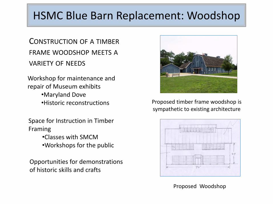
HSMC Blue Barn Replacement: Woodshop
Workshop for maintenance and repair of Museum exhibits
•Maryland Dove•Historic reconstructions
Space for Instruction in Timber Framing
•Classes with SMCM•Workshops for the public
CONSTRUCTION OF A TIMBER
FRAME WOODSHOP MEETS A
VARIETY OF NEEDS
Opportunities for demonstrations of historic skills and crafts
Proposed timber frame woodshop is sympathetic to existing architecture
Proposed Woodshop

Chancellor’s Point: Historic St. Mary’s City
Part of Historic St. Mary’s City Commission 66 acre site on St. Mary’s River
Special features of the property
•Nature Center building
•Archaeology•Possibilities for
water access•Mostly wooded•Views across the Bay•Accessible on HSMC
trail system
St. Mary’s College
Route 5

• Once the site of HSMC Nature Center
and the Woodland Indian Hamlet
• Now being rehabilitated for use as an environmental field station and to support study of:
• Water quality
• Shoreline
• Flora
• Art
• Literature
• Perma-culture/Sustainable farming
• Astronomy
• Leave No Trace (human impact)
Chancellor’s Point Project
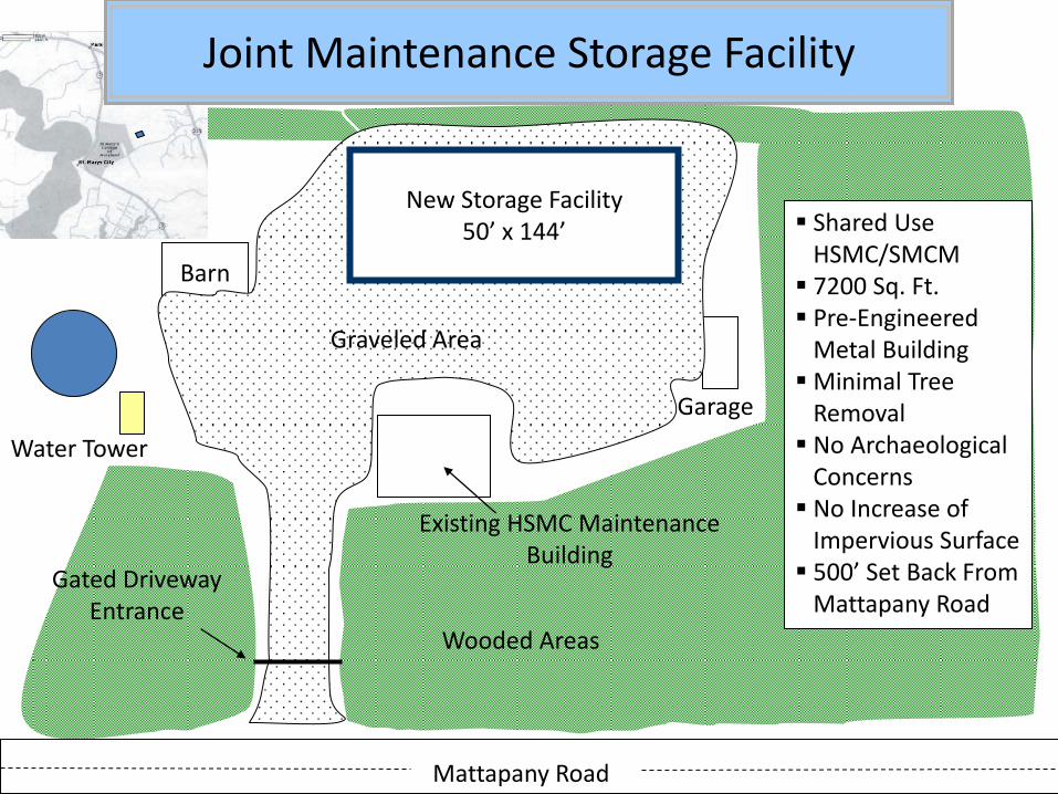
Mattapany Road
Water Tower
Barn
Garage
Wooded Areas
Shared UseHSMC/SMCM 7200 Sq. Ft. Pre-Engineered
Metal BuildingMinimal Tree
Removal No Archaeological
Concerns No Increase of
Impervious Surface 500’ Set Back From
Mattapany Road
New Storage Facility50’ x 144’
Gated DrivewayEntrance
Graveled Area
Existing HSMC Maintenance Building
Joint Maintenance Storage Facility
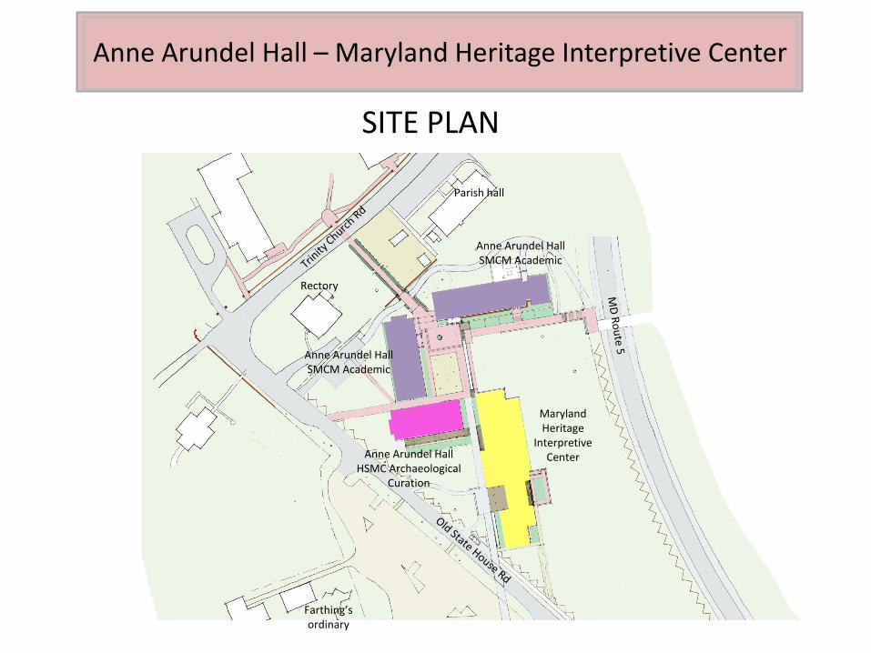
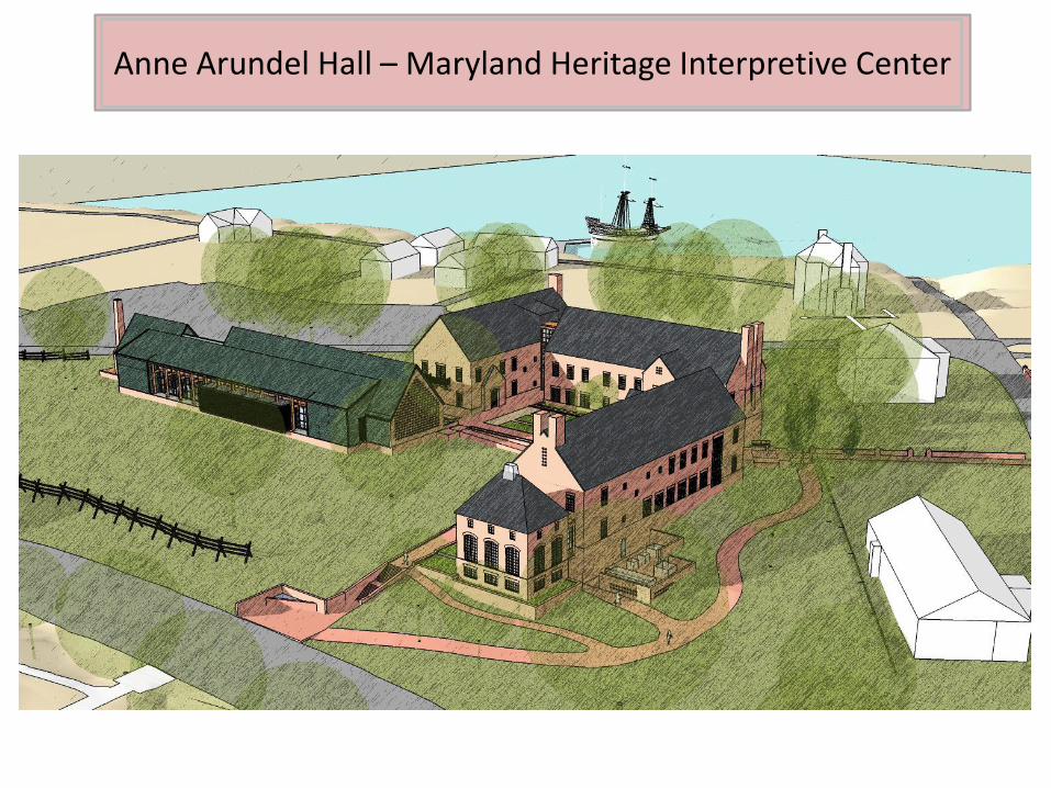
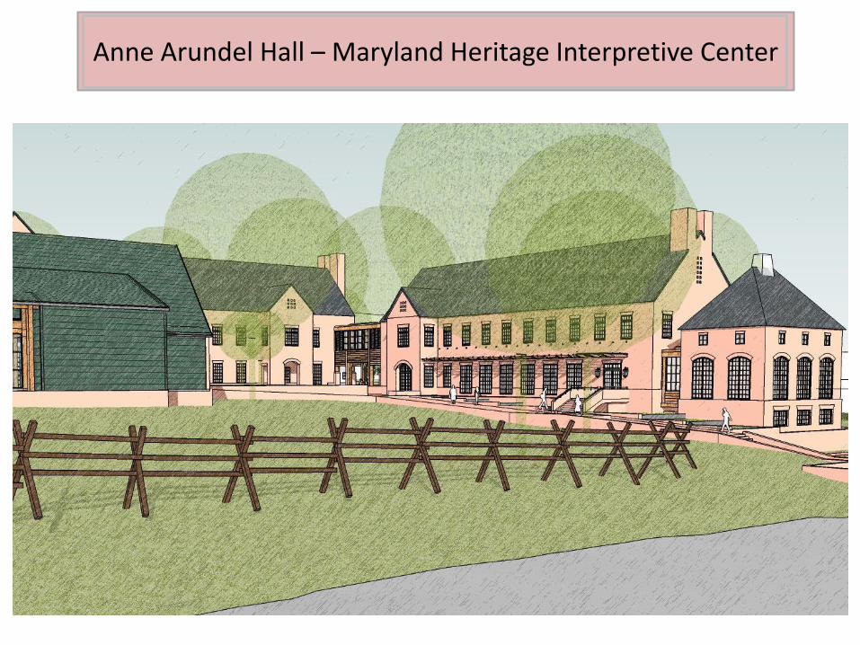
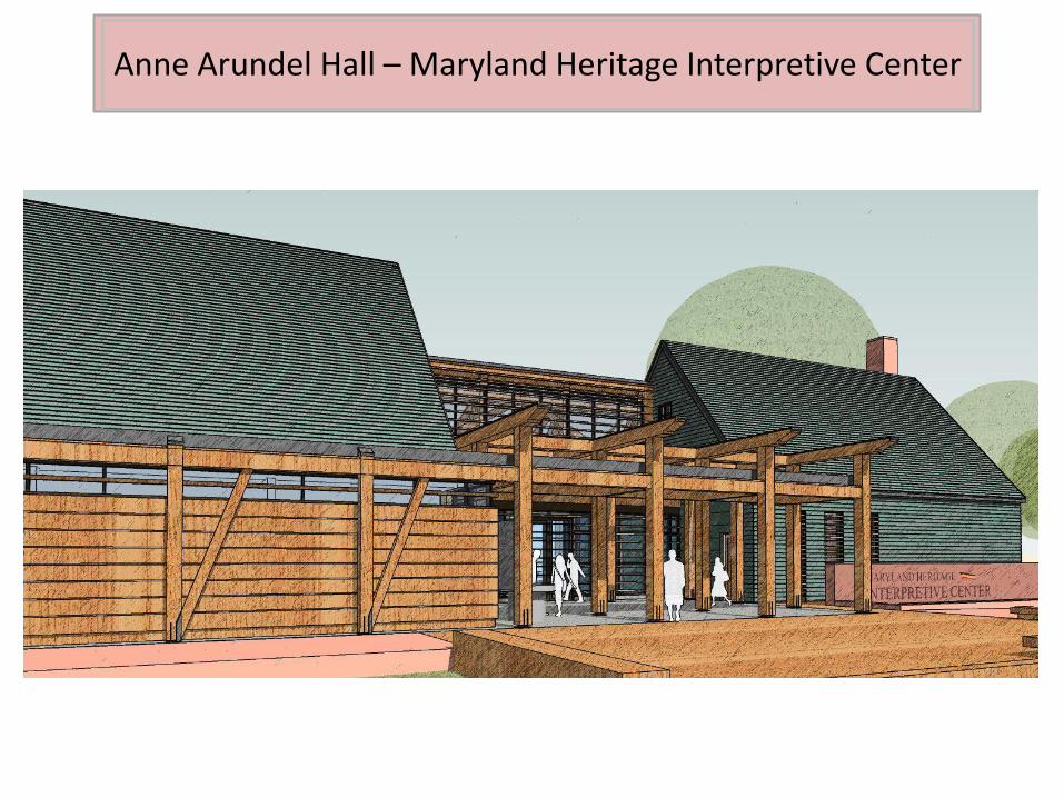
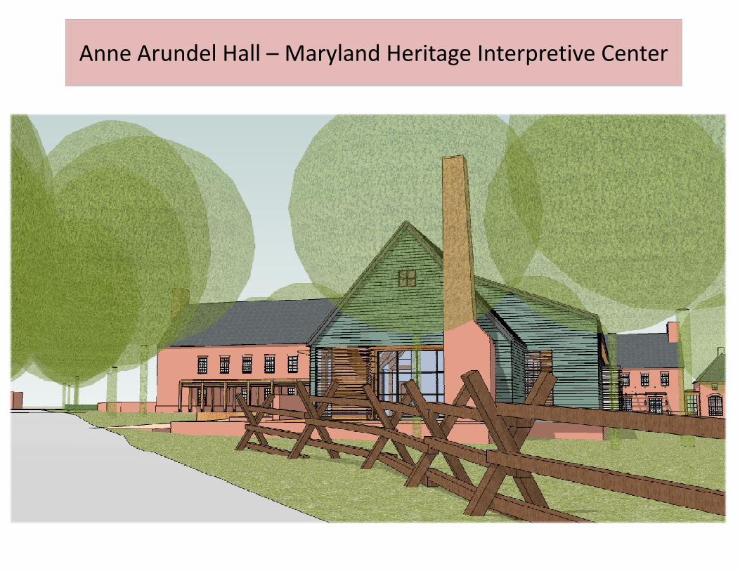
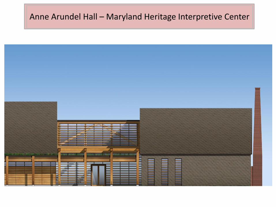
Anne Arundel Hall – Maryland Heritage Interpretive Center
Maryland Heritage
Interpretive Center
Anne Arundel HallSMCM Academic
Anne Arundel HallSMCM Academic
Anne Arundel HallHSMC Archaeological
Curation
Rectory
Parish hall
SITE PLAN
Farthing’s ordinary
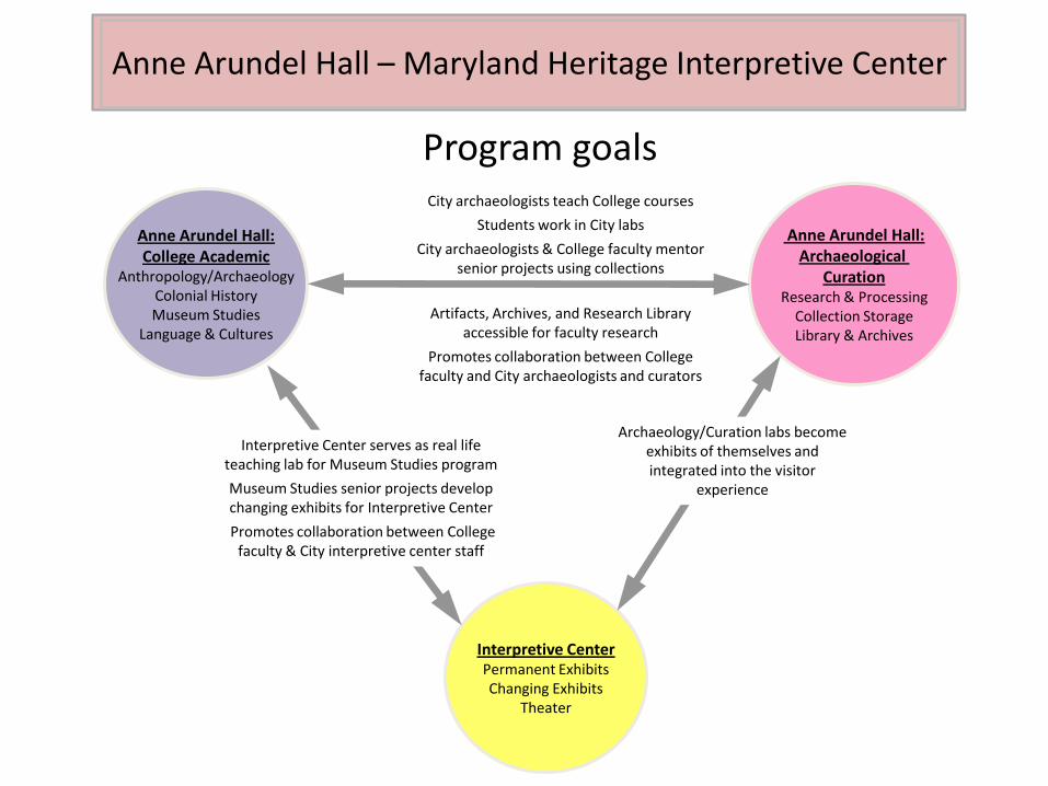
Anne Arundel Hall – Maryland Heritage Interpretive Center
Anne Arundel Hall:College Academic
Anthropology/ArchaeologyColonial HistoryMuseum Studies
Language & Cultures
Anne Arundel Hall:Archaeological
CurationResearch & Processing
Collection StorageLibrary & Archives
Interpretive CenterPermanent ExhibitsChanging Exhibits
Theater
Archaeology/Curation labs become exhibits of themselves and integrated into the visitor
experience
Interpretive Center serves as real life teaching lab for Museum Studies program
Museum Studies senior projects develop changing exhibits for Interpretive Center
Promotes collaboration between College faculty & City interpretive center staff
City archaeologists teach College courses
Students work in City labs
City archaeologists & College faculty mentor senior projects using collections
Artifacts, Archives, and Research Library accessible for faculty research
Promotes collaboration between College faculty and City archaeologists and curators
Program goals

Anne Arundel Hall – Maryland Heritage Interpretive Center
Project goal: Avoid areas of high archaeological significance
Archaeology for construction:A practiced process
In accordance with State and Federal requirements:
Step 1- Survey the site, identify archaeology and its significance
Step 2- Develop building plans that preserve/avoid archaeology to the extent possible
Step 3- Develop an archaeological mitigation plan to be approved and permitted by the Maryland Historic Trust
Step 4- Complete the excavations, then begin construction
State House
KentHall
CalvertHall
Anne ArundelHall
Interpretive Center
Legend
Area of high archaeological significance
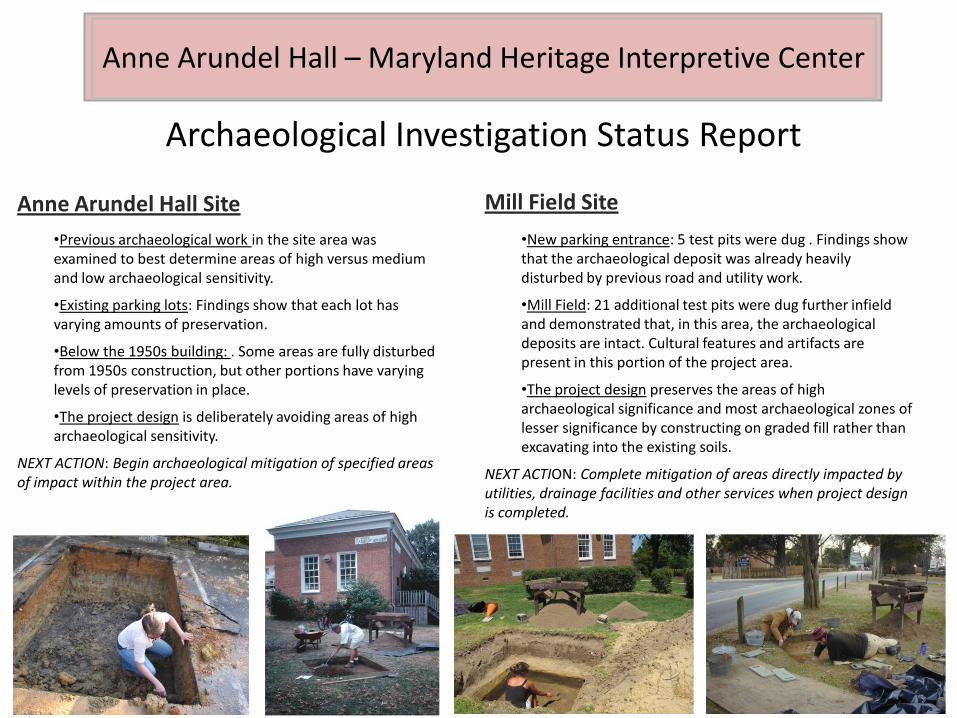
Anne Arundel Hall – Maryland Heritage Interpretive Center
Archaeological Investigation Status Report
Anne Arundel Hall Site
•Previous archaeological work in the site area was examined to best determine areas of high versus medium and low archaeological sensitivity.
•Existing parking lots: Findings show that each lot has varying amounts of preservation.
•Below the 1950s building: . Some areas are fully disturbed from 1950s construction, but other portions have varying levels of preservation in place.
•The project design is deliberately avoiding areas of high archaeological sensitivity.
NEXT ACTION: Begin archaeological mitigation of specified areas of impact within the project area.
Mill Field Site
•New parking entrance: 5 test pits were dug . Findings show that the archaeological deposit was already heavily disturbed by previous road and utility work.
•Mill Field: 21 additional test pits were dug further infield and demonstrated that, in this area, the archaeological deposits are intact. Cultural features and artifacts are present in this portion of the project area.
•The project design preserves the areas of high archaeological significance and most archaeological zones of lesser significance by constructing on graded fill rather than excavating into the existing soils.
NEXT ACTION: Complete mitigation of areas directly impacted by utilities, drainage facilities and other services when project design is completed.
Anne Arundel Hall – Maryland Heritage Interpretive Center
Anne Arundel Hall – Maryland Heritage Interpretive Center

Anne Arundel Hall – Maryland Heritage Interpretive Center

Anne Arundel Hall – Maryland Heritage Interpretive Center

Anne Arundel Hall – Maryland Heritage Interpretive Center
Anne Arundel Hall – Maryland Heritage Interpretive Center
Anne Arundel Hall – Maryland Heritage Interpretive Center
Anne Arundel Hall – Maryland Heritage Interpretive Center