University Curriculum Development for Decentralized ... · University Curriculum Development for...
19
University Curriculum Development for Decentralized Wastewater Management Site Evaluation Trotta, et.al. Page i University Curriculum Development for Decentralized Wastewater Management Site Evaluation Module Text Paul Trotta, P.E., Ph.D. Justin Ramsey, P.E. and Chad Cooper Northern Arizona University David Lindbo, Ph.D. NC State University September 2004
Transcript of University Curriculum Development for Decentralized ... · University Curriculum Development for...
University Curriculum Development for Decentralized Wastewater Management Site Evaluation
Trotta, et.al. Page i
University Curriculum Development for Decentralized
Wastewater Management
Site Evaluation
Module Text
Paul Trotta, P.E., Ph.D. Justin Ramsey, P.E.
and Chad Cooper
Northern Arizona University
David Lindbo, Ph.D. NC State University
September 2004
University Curriculum Development for Decentralized Wastewater Management Site Evaluation
Trotta, et.al. Page ii
NDWRCDP Disclaimer This work was supported by the National Decentralized Water Resources Capacity Development Project (NDWRCDP) with funding provided by the U.S. Environmental Protection Agency through a Cooperative Agreement (EPA No. CR827881-01-0) with Washington University in St. Louis. These materials have not been reviewed by the U.S. Environmental Protection Agency. These materials have been reviewed by representatives of the NDWRCDP. The contents of these materials do not necessarily reflect the views and policies of the NDWRCDP, Washington University, or the U.S. Environmental Protection Agency, nor does the mention of trade names or commercial products constitute their endorsement or recommendation for use.
CIDWT/University Disclaimer These materials are the collective effort of individuals from academic, regulatory, and private sectors of the onsite/decentralized wastewater industry. These materials have been peer-reviewed and represent the current state of knowledge/science in this field. They were developed through a series of writing and review meetings with the goal of formulating a consensus on the materials presented. These materials do not necessarily reflect the views and policies of University of Arkansas, and/or the Consortium of Institutes for Decentralized Wastewater Treatment (CIDWT). The mention of trade names or commercial products does not constitute an endorsement or recommendation for use from these individuals or entities, nor does it constitute criticism for similar ones not mentioned.
University Curriculum Development for Decentralized Wastewater Management Site Evaluation
Trotta, et.al. Page iii
Citation This document should be cited as follows: Trotta, P.D., D.L. Lindbo and J.O. Ramsey. 2005. Site and Soil Evaluation Text. in (M.A. Gross and N.E. Deal, eds.) University Curriculum Development for Decentralized Wastewater Management. National Decentralized Water Resources Capacity Development Project. University of Arkansas, Fayetteville, AR.

University Curriculum Development for Decentralized Wastewater Management Site Evaluation
Trotta, et.al. Page 1
Site Evaluation
I. Conducting a Site Investigation A. Overview The object of an on-site system is to treat and dispose of wastewater generated on-site in a way that will protect public health and minimize environmental impacts. To accomplish these goals a site investigation must determine the suitability of a location for a system and the type of system that may be installed. A site investigation has both a background research component as well as a field investigation. B. Background Site Investigation A background site investigation includes information about: 1. Easements along property lines and across the property 2. Regional soil evaluations 3. Location of neighboring water wells and waste water disposal fields that may not be
The investigation should also uncover clues to help designers and regulators understand the localized soil morphology and hydrology of the site. This information will help predict wastewater flow through the soil and into subsurface materials. This allows us to predict how and if a system will function and the probable flow paths of water from the site and the treatment received by the wastewater. C. Field Investigation A complete field investigation includes information about:
1. Surface Topography 2. Property Boundaries & Corners 3. Limiting Surface Features 4. Vegetation 5. Water Wells 6. Buried or Overhead Utilities
University Curriculum Development for Decentralized Wastewater Management Site Evaluation
Trotta, et.al. Page 2
II. Preliminary Investigation
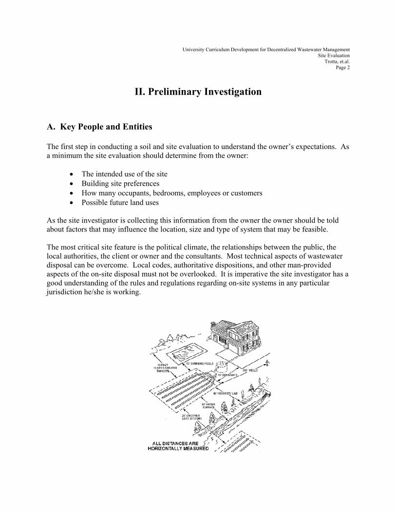
A. Key People and Entities The first step in conducting a soil and site evaluation to understand the owner’s expectations. As a minimum the site evaluation should determine from the owner:
• The intended use of the site • Building site preferences • How many occupants, bedrooms, employees or customers • Possible future land uses
As the site investigator is collecting this information from the owner the owner should be told about factors that may influence the location, size and type of system that may be feasible. The most critical site feature is the political climate, the relationships between the public, the local authorities, the client or owner and the consultants. Most technical aspects of wastewater disposal can be overcome. Local codes, authoritative dispositions, and other man-provided aspects of the on-site disposal must not be overlooked. It is imperative the site investigator has a good understanding of the rules and regulations regarding on-site systems in any particular jurisdiction he/she is working.
University Curriculum Development for Decentralized Wastewater Management Site Evaluation
Trotta, et.al. Page 3
Figure 1: Example of Setbacks for Onsite System
Figure 2: Example of Regulatory Agencies
B. Background Documentation After speaking with the owner it is a good idea to get as much site information available before making a trip to the actual site. There are many materials available from many different sources. The following are valuable sources of information regarding the site. Not all listed items will be needed or available for each site. Nor are the following items the only materials available to the site investigator. It will rest upon the investigator to determine what materials will be required to conduct a thorough and complete investigation. 1. Subdivision Requirements It is also important that the investigator understands requirements set fourth by homeowners associations, subdivision requirements and Codes, Covenants and Restrictions (CC&R’s). Utility companies also have codes and restrictions regarding their utility easements especially when it comes to setback requirements. 2. City & County Government Regulations
County Assessors Maps, which are available at the County Assessor Office, can give an accurate plan view of the site, as well as adjacent properties and can sometimes be used as an aid to locating the property. If the property is located in an approved subdivision the final plat can be used to get very accurate dimensions of the lot and adjacent properties. Typically the cover page of the final plat will have a vicinity map showing how to get to the subdivision. The County Recorders Office has copies of all recorded subdivision plats. The assessor’s map or final plat will not have contour information. If available preliminary plats for subdivisions is the most
University Curriculum Development for Decentralized Wastewater Management Site Evaluation
Trotta, et.al. Page 4
accurate means of acquiring topography prior to the site visit. Preliminary plats can usually be found at the County Planning and Zoning office or if the site is within the corporate boundaries of a city they can be found at the City Engineers Office. If these offices do not have them the design engineer will probably have the preliminary plat on file at his/her office. 3. USGS Maps
USGS Topographical Maps will have topography information at and around the site, however the contours are typically at such a large scale (40 foot contours are typical on 7-1/2 minute maps) they will provide little relevant information to the site investigator. However they can be used to locate the property.
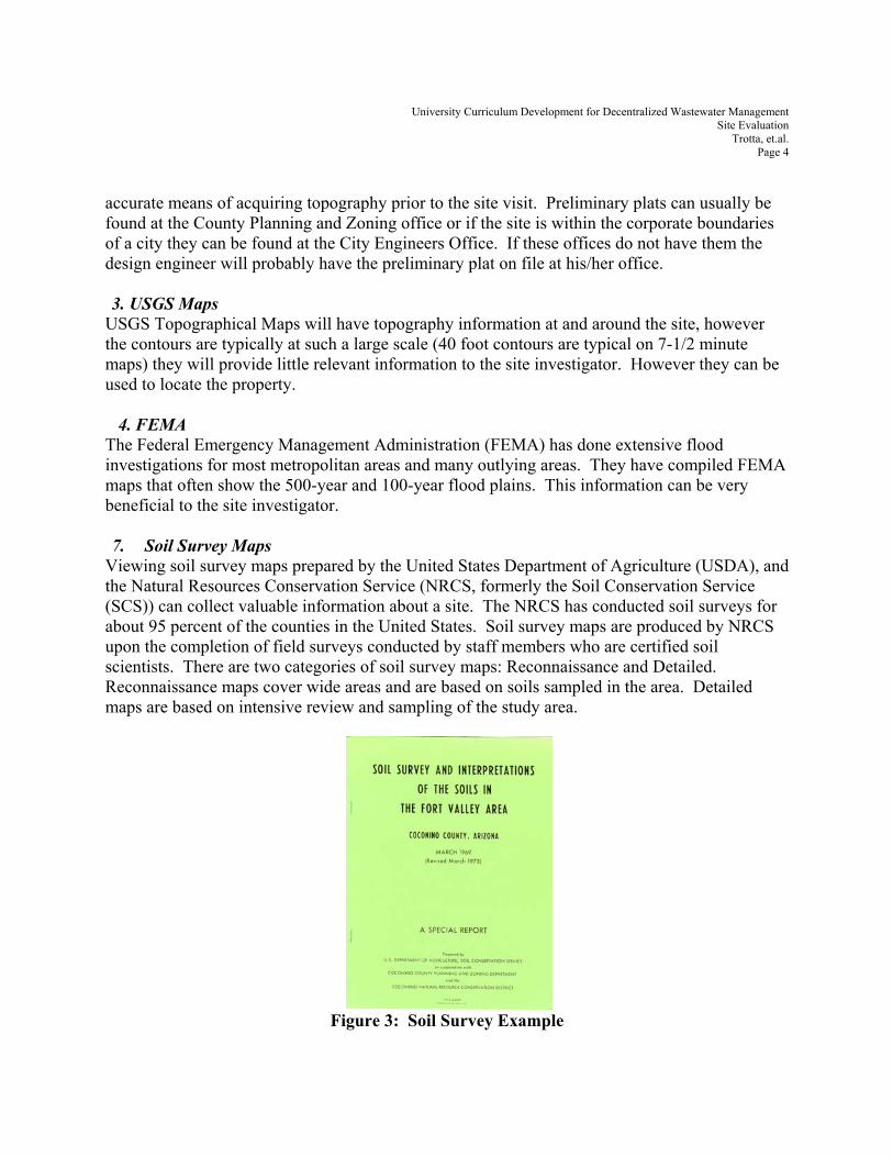
4. FEMA The Federal Emergency Management Administration (FEMA) has done extensive flood investigations for most metropolitan areas and many outlying areas. They have compiled FEMA maps that often show the 500-year and 100-year flood plains. This information can be very beneficial to the site investigator. 7. Soil Survey Maps
Viewing soil survey maps prepared by the United States Department of Agriculture (USDA), and the Natural Resources Conservation Service (NRCS, formerly the Soil Conservation Service (SCS)) can collect valuable information about a site. The NRCS has conducted soil surveys for about 95 percent of the counties in the United States. Soil survey maps are produced by NRCS upon the completion of field surveys conducted by staff members who are certified soil scientists. There are two categories of soil survey maps: Reconnaissance and Detailed. Reconnaissance maps cover wide areas and are based on soils sampled in the area. Detailed maps are based on intensive review and sampling of the study area.
Figure 3: Soil Survey Example
University Curriculum Development for Decentralized Wastewater Management Site Evaluation
Trotta, et.al. Page 5
Although soil survey maps may provide preliminary information they do have limitations. Many surveys were conducted many years ago and do not reflect current conventions and practice. They may not identify inclusions, which are soils of different types that appear in localized areas of another dominant soil type. Transitional zones may not be marked well.
III. Equipment
After collecting the above information and having a good understanding of the owner’s intentions and expectations as well as the regulatory environment the evaluator is ready to go to the site. Prior to going to the site the evaluator should sketch a plot plan. The plan should identify property corners and all significant features such as roads, structures, water features etc. The second step is to assemble appropriate tools and equipment. Tools and equipment should include, but are not limited to:
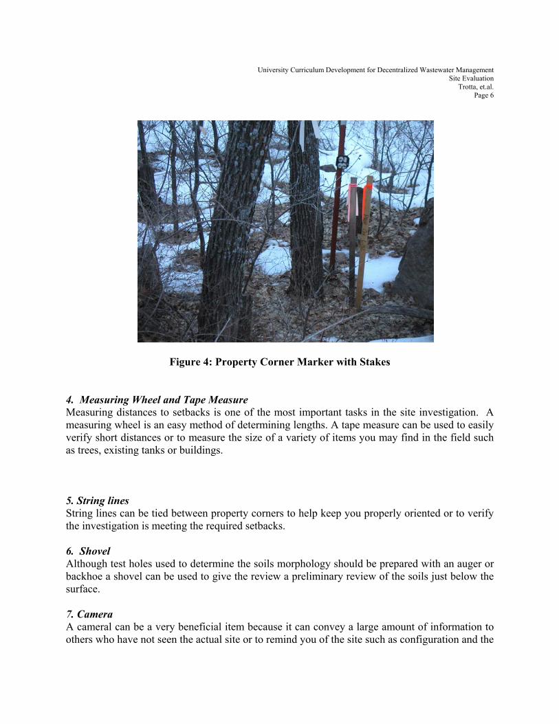
A. Recording, Marking and Measuring Equipment 1. Clipboard Having a clipboard in the field serves two purposes, first it provides a surface to write on as you move around the site, and secondly, while in the field you must be prepared for inclement weather conditions such as wind and rain. A weatherproof clipboard can protect your documents from being blown away or getting wet and illegible. 2. Compass A compass can be used to orient yourself once you get to a specific lot. 3. Flagging and Stakes Flagging is invaluable by marking areas such as property corners, wells, section corners or other items of interest and allowing the location to be seen from a distance. Stakes can be used similarly as flagging and in conjunction with flagging. If an above grade object is not available near the area you wish to mark a stake can be driven into the ground and flagging can be tied around it. The stake can also be written on to provide information to contractors of other site investigators.
University Curriculum Development for Decentralized Wastewater Management Site Evaluation
Trotta, et.al. Page 6
Figure 4: Property Corner Marker with Stakes
4. Measuring Wheel and Tape Measure Measuring distances to setbacks is one of the most important tasks in the site investigation. A measuring wheel is an easy method of determining lengths. A tape measure can be used to easily verify short distances or to measure the size of a variety of items you may find in the field such as trees, existing tanks or buildings. 5. String lines String lines can be tied between property corners to help keep you properly oriented or to verify the investigation is meeting the required setbacks. 6. Shovel Although test holes used to determine the soils morphology should be prepared with an auger or backhoe a shovel can be used to give the review a preliminary review of the soils just below the surface. 7. Camera A cameral can be a very beneficial item because it can convey a large amount of information to others who have not seen the actual site or to remind you of the site such as configuration and the

University Curriculum Development for Decentralized Wastewater Management Site Evaluation
Trotta, et.al. Page 7
location of items. Digital cameras tend to work exceptionally well because the files can be stored on a computer and easily reprinted and sent via-email or a storage device to all interested parties. B. Devices to Determine Grade There is a wide variation of tools that can be used to determine the grade of a site. These range from the extravagant to the simple. The investigator should use equipment that he/she feels comfortable using as well as can determine the topography of the site to a suitable degree of accuracy. Below is a list of some of the items available as well as the pros and cons of these devices. 1. Hand Level A hand level is a simple devise that looks like a telescope. The operator looks through the eyepiece and lines the cross hairs on an object. A bubble level can be seen through the eyepiece so the operator can level the instrument. The best way to use a hand level is by having a second person hold a surveys rod. The person looking through the hand level reads off various measurements as the rodman places the rod at all slope breaks. The difference in readings is the change in elevation. Just one person can use the hand level by sighting in on various vertical objects on the site. However this can be time consuming and there is a lot of room for human error. The cost of a hand level is as little as $10.00 up to $150.00.
Figure 5 Hand Level

University Curriculum Development for Decentralized Wastewater Management Site Evaluation
Trotta, et.al. Page 8
2. Clinometer A clinometer is a hand held device used to measure angles of elevation or inclination. It is used by holding the instrument to your eye and with both eyes open looking simultaneously through the lens and alongside the housing. A horizontal sighting line will appear. Raise or lower the clinometer (by tilting your head) to place the sighting line at eye level on an object that is upslope of down slope. Read the number closest to the sighting line. A clinometer is lightweight and can be used quickly and easily by one person, although just like the hand level a second person holding a surveyors rod is much more accurate. The cost ranges from $100.00 to over $250.00. Although a clinometer is more accurate than a hand level it is hard to determine accurate grades on lots that have undulating topography.
Figure 6: Clinometer
University Curriculum Development for Decentralized Wastewater Management Site Evaluation
Trotta, et.al. Page 9
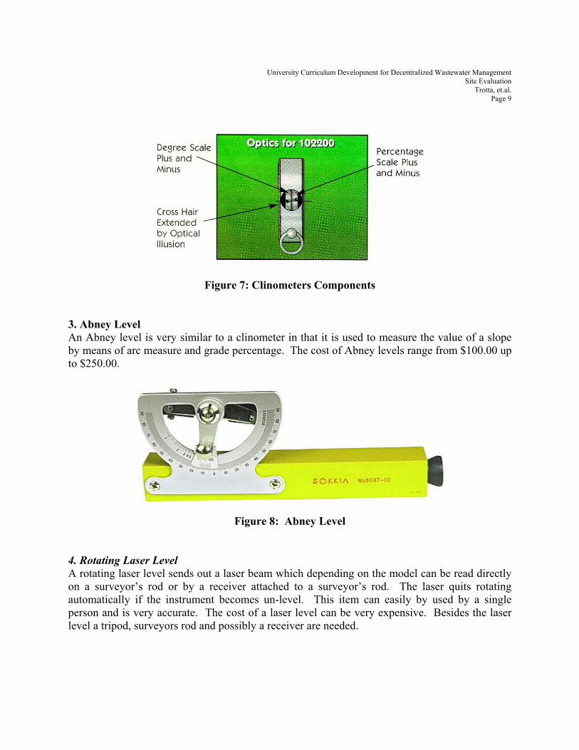
Figure 7: Clinometers Components 3. Abney Level An Abney level is very similar to a clinometer in that it is used to measure the value of a slope by means of arc measure and grade percentage. The cost of Abney levels range from $100.00 up to $250.00.
Figure 8: Abney Level
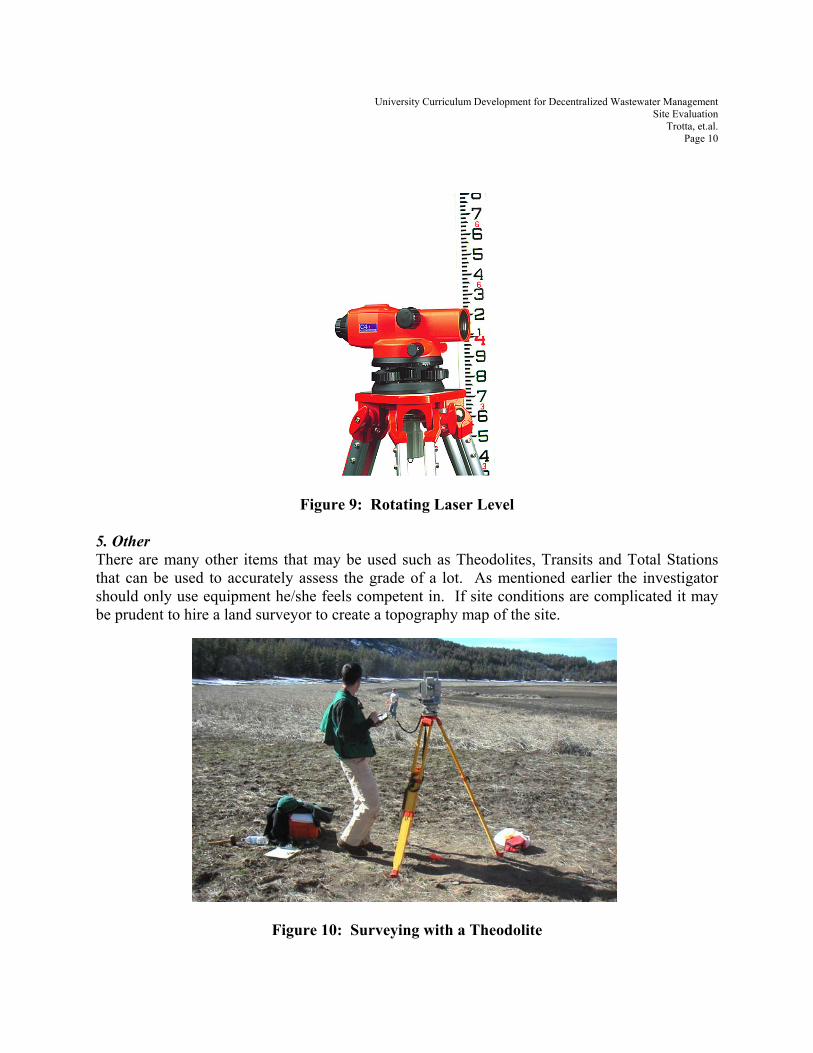
4. Rotating Laser Level A rotating laser level sends out a laser beam which depending on the model can be read directly on a surveyor’s rod or by a receiver attached to a surveyor’s rod. The laser quits rotating automatically if the instrument becomes un-level. This item can easily by used by a single person and is very accurate. The cost of a laser level can be very expensive. Besides the laser level a tripod, surveyors rod and possibly a receiver are needed.
University Curriculum Development for Decentralized Wastewater Management Site Evaluation
Trotta, et.al. Page 10
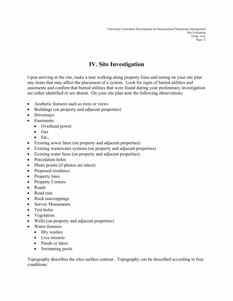
Figure 9: Rotating Laser Level 5. Other There are many other items that may be used such as Theodolites, Transits and Total Stations that can be used to accurately assess the grade of a lot. As mentioned earlier the investigator should only use equipment he/she feels competent in. If site conditions are complicated it may be prudent to hire a land surveyor to create a topography map of the site.
Figure 10: Surveying with a Theodolite
University Curriculum Development for Decentralized Wastewater Management Site Evaluation
Trotta, et.al. Page 11
IV. Site Investigation
Upon arriving at the site, make a tour walking along property lines and noting on your site plan any items that may affect the placement of a system. Look for signs of buried utilities and easements and confirm that buried utilities that were found during your preliminary investigation are either identified or are absent. On your site plan note the following observations: • Aesthetic features such as trees or views • Buildings (on property and adjacent properties) • Driveways • Easements
• Overhead power • Gas • Etc.,
• Existing sewer lines (on property and adjacent properties) • Existing wastewater systems (on property and adjacent properties) • Existing water lines (on property and adjacent properties) • Percolation holes • Photo points (if photos are taken) • Proposed residence • Property lines • Property Corners • Roads • Road cuts • Rock outcroppings • Survey Monuments • Test holes • Vegetation • Wells (on property and adjacent properties) • Water-features
• Dry washes • Live streams • Ponds or lakes • Swimming pools
Topography describes the sites surface contour. Topography can be described according to four conditions:
University Curriculum Development for Decentralized Wastewater Management Site Evaluation
Trotta, et.al. Page 12
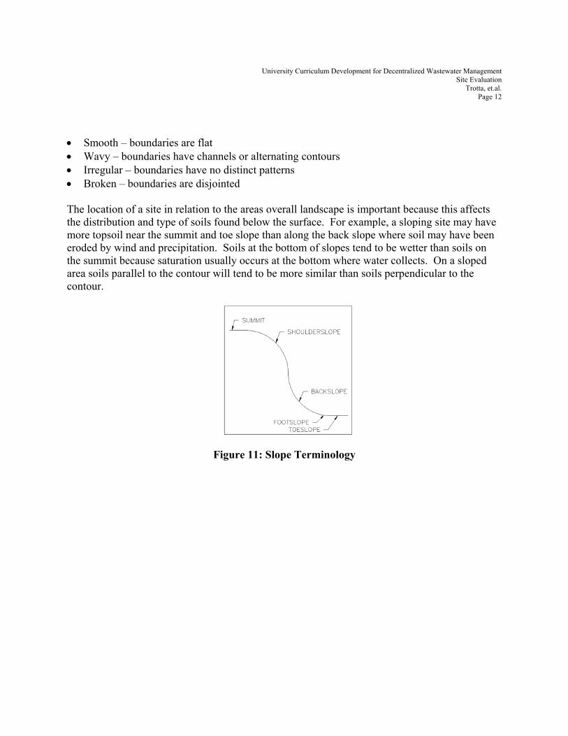
• Smooth – boundaries are flat • Wavy – boundaries have channels or alternating contours • Irregular – boundaries have no distinct patterns • Broken – boundaries are disjointed The location of a site in relation to the areas overall landscape is important because this affects the distribution and type of soils found below the surface. For example, a sloping site may have more topsoil near the summit and toe slope than along the back slope where soil may have been eroded by wind and precipitation. Soils at the bottom of slopes tend to be wetter than soils on the summit because saturation usually occurs at the bottom where water collects. On a sloped area soils parallel to the contour will tend to be more similar than soils perpendicular to the contour.
Figure 11: Slope Terminology
University Curriculum Development for Decentralized Wastewater Management Site Evaluation
Trotta, et.al. Page 13
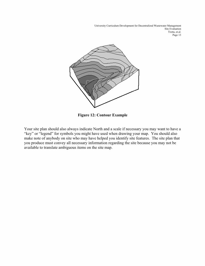
Figure 12: Contour Example Your site plan should also always indicate North and a scale if necessary you may want to have a “key” or “legend” for symbols you might have used when drawing your map. You should also make note of anybody on site who may have helped you identify site features. The site plan that you produce must convey all necessary information regarding the site because you may not be available to translate ambiguous items on the site map.
University Curriculum Development for Decentralized Wastewater Management Site Evaluation
Trotta, et.al. Page 14
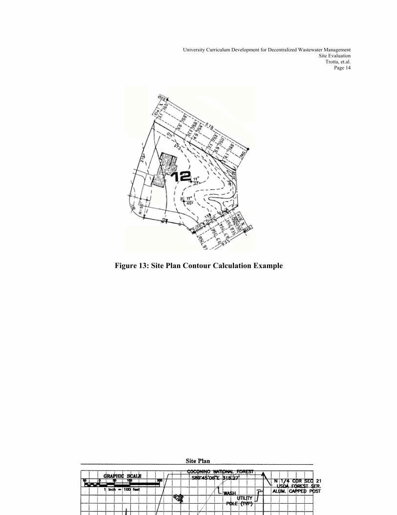
Figure 13: Site Plan Contour Calculation Example
University Curriculum Development for Decentralized Wastewater Management Site Evaluation
Trotta, et.al. Page 15
Figure 14: Completed Site Plan Example
University Curriculum Development for Decentralized Wastewater Management Site Evaluation
Trotta, et.al. Page 16
RREEFFEERREENNCCEESS Burks, B; Minnis, M. Onsite Wastewater Treatment Systems Hogarth House, LTD. Madison, WI, 1994 Crites, R.; Tchobangolous, G. Small and Decentralized Wastewater Management Systems. McGraw-Hill, New York, NY 1998 Hammer, M. Water & Wastewater Technology. J. Wiley & Sons, Inc. New York, NY, 1997 Tyler J. “Soil and Site Evaluation for Onsite Wastewater Treatment Systems Winneberger, T. Septic Tank Systems “A Consultants Toolkit”. New York, NY Butterworth Publishing. 1984