Town of Grantham ZONING ORDINANCE8E4EE0D6-AAA5-4E63-B5FA-19873AF96E35...Grantham, by securing safety...
81
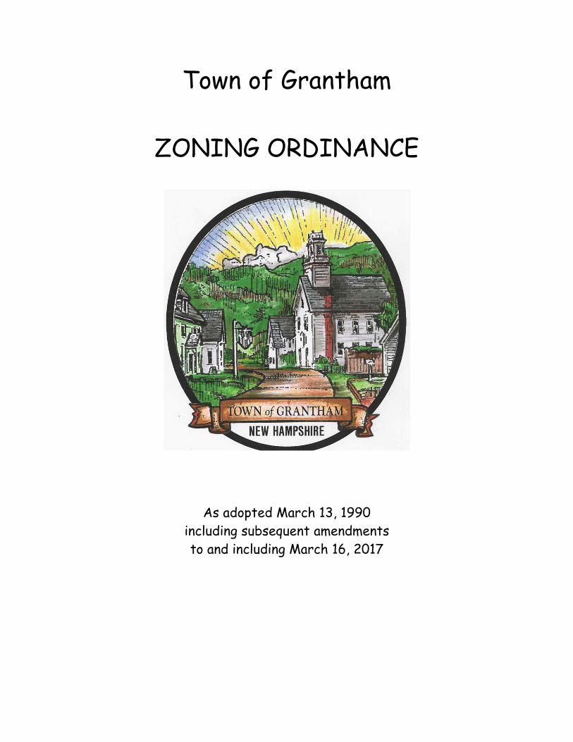
Town of Grantham ZONING ORDINANCE As adopted March 13, 1990 including subsequent amendments to and including March 16, 2017
Transcript of Town of Grantham ZONING ORDINANCE8E4EE0D6-AAA5-4E63-B5FA-19873AF96E35...Grantham, by securing safety...
Town of Grantham
ZONING ORDINANCE
As adopted March 13, 1990 including subsequent amendments to and including March 16, 2017
Page 2 of 81
TOWN OF GRANTHAM – ZONING ORDINANCE
INDEX Article I Title ............................................................................................................. 4 Article II Authority and Purpose ............................................................................ 4 Article III Zoning Districts and Map ........................................................................ 5 Article IV-A Business District (BD) ............................................................................... 7 Article IV-B Business Light Industrial District (BLD) .............................................. 10 Article IV-C Manufactured Housing Parks .............................................................. 13 Article V-A Rural Residential One (RRI) ................................................................. 14 Article V-B Rural Residential Two (RR2) ................................................................ 17 Article V-C Rural Residential Three (RR3) .............................................................. 19 Article V-D Central Village Residential District (CVRD) ....................................... 21 Article VI Cluster Residential Development ...........................................................23 Article VII Affordable Housing ................................................................................. 29 Article VIII Accessory Dwelling Units ....................................................................... 32 Article IX Home Business..........................................................................................34 Article X Recreation Camping Parks .................................................................... 36 Article XI-A Flood Plain Conservation Overlay District .......................................... 37 Article XI-B Forest Lands Conservation Districts ..................................................... 39 Article XI-C Shoreland and River Overlay District .................................................. 41 Article XII Telecommunications Overlay District ................................................... 42 Article XIII General Provisions .................................................................................. 45 Article XIV Signs ......................................................................................................... 47 Article XV Nonconforming Lots, Structures and Uses ............................................ 50 Article XVI Zoning Board of Adjustment .................................................................. 52
A. Creation and Appointment ................................................................................ 52 B. Organization ........................................................................................................ 52 C. Meetings ............................................................................................................... 52 D. Officers ................................................................................................................. 53 E. Powers .................................................................................................................. 53 F. Appeals to the Zoning Board of Adjustment ....................................................53 G. Public Notice Requirement ................................................................................ 54 H. Conditions to be Met
1. Administrative Appeal ....................................................................... 54 2. Special Exception ................................................................................ 55
Page 3 of 81
3. Variance .............................................................................................. 56 4. Equitable Waiver of Dimensional Requirements ............................ 57
Article XVII Administration and Enforcement ..................................................... 59
A. Administration .............................................................................................. 59 B. Issuing Permit ................................................................................................ 59 C. Enforcement .................................................................................................. 59 D. Consultant Fees ............................................................................................. 60 E. Impact Fees .................................................................................................... 60
Article XVIII Miscellaneous Provisions .................................................................. 62 Article XIX Definitions ............................................................................................. 63 Appendices ................................................................................................................ 72
A. Zoning District Boundaries ......................................................................... 72 B. Chronological List of Revisions to Original Ordinance ........................... 78
Page 4 of 81
ARTICLE I: TITLE
This Ordinance shall be known and may be cited as the “Zoning Ordinance of the Town of Grantham, New Hampshire”.
ARTICLE II: AUTHORITY AND PURPOSE
1. Authority Pursuant to the authority conferred by Chapters 672 through 677, New Hampshire Revised Statutes Annotated, as amended and in general conformity with the Master Plan of the Town of Grantham, New Hampshire and as may be amended from time to time at subsequent Town Meetings. 2. Purpose The purpose is to protect the health, safety, prosperity and general welfare of the residents of Grantham, by securing safety from fire and other dangers, providing adequate areas between buildings and rights-of-way, promoting efficiency, economy, and good civic design in development, protecting the value of homes and lands, and preserving the Towns character and environment, ensuring wise and efficient expenditure of public funds, and providing for adequate public utilities and other public requirements. This Ordinance was enacted by the voters of the Town of Grantham, New Hampshire, in official Town Meeting on March 13, 1990 and may be amended from time to time at subsequent Town Meetings.
Page 5 of 81
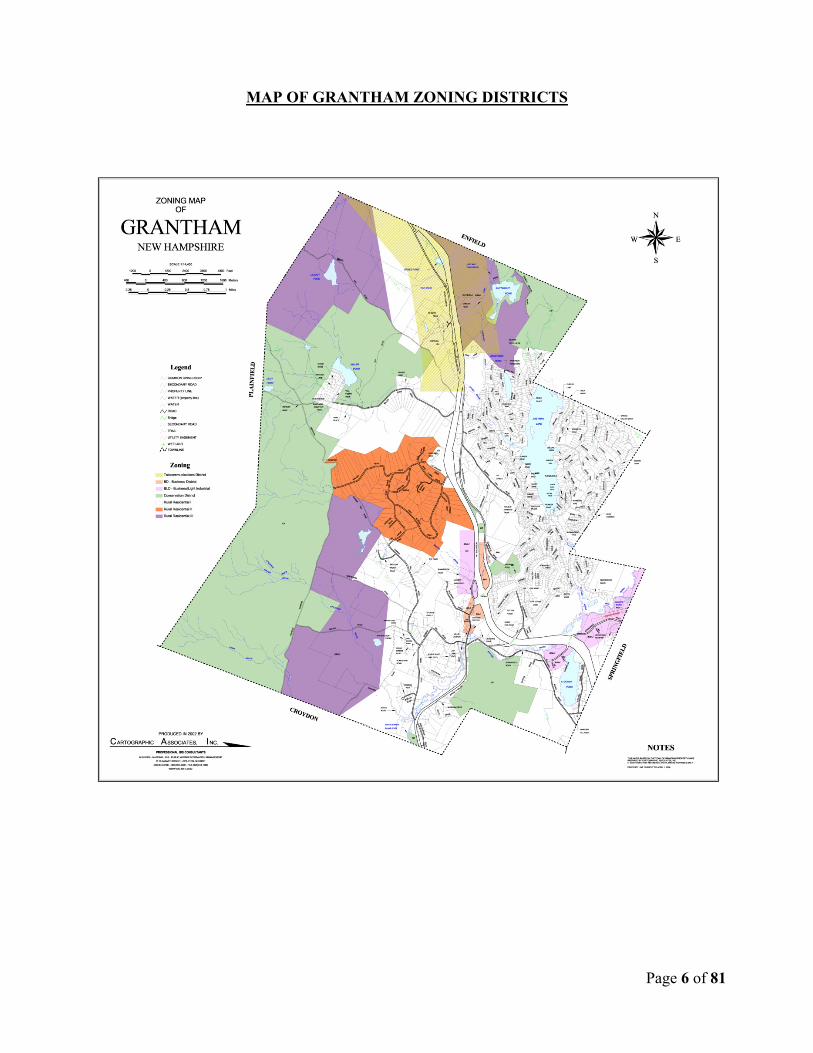
ARTICLE III: ZONING DISTRICTS AND MAP
The Town of Grantham, New Hampshire is divided into the following districts:
(Please refer to Appendices for boundaries) * BD Business District (1-4) * BLD Business Light Industrial District (1-5) * RR 1 Rural Residential One * RR 2 Rural Residential Two * RR 3 Rural Residential Three * CVRD Central Village Residential District * TC Telecommunications Overlay * FPC Flood Plain Conservation Overlay * FLC Forest Lands Conservation * SL Shoreland Overlay Where the boundary line of a Zoning District (excluding Floodplain, Conservation Overlay and Forest Land Conservation Districts) divides a lot in single ownership at the time of passage of this Zoning Ordinance, the owner may extend the permitted use in the less restricted District into the more restricted portion (but not into the Floodplain Conservation Overlay and Forest Land Conservation Districts) of the lot for not more than seventy-five (75) feet. All proposed commercial use(s) and permitted Special Exception usage shall be subject to the Site Plan Review process conducted by the Planning Board. Any changes in the current use(s) of commercial property and Special Exceptions shall, also, seek input from the Planning Board for Site Plan Review purposes.
Page 6 of 81
MAP OF GRANTHAM ZONING DISTRICTS
Page 7 of 81
ARTICLE IV-A: BUSINESS DISTRICT (BD)
The purpose of this District is to provide for medium-density residential, business and professional enterprises in areas that have good access both to existing principal town and state roads, and interstate highways, and to police and fire protection. a. Permitted Uses
1. One and two-family dwelling units, to be limited to one such building per lot 2. Multiple dwelling units of up to five (5) units in any one given building, limited to one
such building per lot
3. Offices or Home Businesses
4. Retail merchandising enterprises of up to fifteen thousand (15,000) square feet of floor area, including warehousing and merchandise storage space, in any given building
5. Service businesses; such as hair care, shoe repair, clothing alteration, appliance repair,
banks, art galleries, and small (less than 100 seats) theaters for live performances
6. Emergency health care facilities
7. Indoor and outdoor sports facilities including soccer, basketball, hockey, baseball, golf, hiking trails for foot traffic only and racquet sports. All accessory buildings to such facilities shall require Special Exception(s)
8. Indoor health and fitness centers
9. Public utility storage yards, substations and/or transmission operations
10. Manufactured Housing Parks
11. Agricultural uses and Forestry uses
12. Cluster Residential Developments
13. Child-Care Facilities (Day-Care)
14. Excavations to the extent that these conform to the Town of Grantham Regulation Excavations, dated October 12, 1983, as amended, and to pertinent New Hampshire RSAs
15. Miniature Golf Courses
16. Rental Storage Units
Page 8 of 81
17. Bed & Breakfast Facility
18. Private and Public Educational Facilities
19. Inns
20. In addition, the uses listed below SHALL be permitted by the Zoning Board of Adjustment by Special Exception, if the requirements for such Exception are met.
a. Elderly Housing
b. Nursing Homes
c. Privately-owned Recreational Camping Parks
d. Churches
e. Restaurant, excepting that drive-in, drive-through, and take-out restaurants are prohibited. However, take-out food services are permitted so long as they are subordinate and incidental to another business, and housed in a structure associated with that business.
f. Auto Service Stations
g. Farm and Craft stands
h. Telecommunications/Communications Facilities subject to the conditions in Article XI-H
b. Lot and Frontage Requirements
1. Lot Size: The minimum area of any lot shall be one (1) acre in size. No water bodies or wetland soils and no portion of slope areas of an incline greater than twenty (20) percent may be included in the minimum lot size.
2. Lot Coverage: The building coverage on any lot, including parking and driveway areas,
shall not exceed fifty (50) percent of any lot, with the open area to be devoted to landscaping or natural growth.
3. Frontage: The minimum lot frontage on any street shall be one hundred fifty (150) feet.
c. Front, Side and Rear Yard Setbacks
1. There shall be minimum distances between any structure and the boundary of any lot and public highway, street, or roadway right-of-way of thirty-five (35) feet at the frontage of the lot, and ten (10) feet at the sides and rear of the lot. Lots which front on two (2) highways, streets, or roadway rights-of-way (i.e. corner lots) shall be set back a minimum of thirty-five (35) feet from both such rights-of-way. The setback requirements apply with respect to any road, public or private, Town maintained (Class V) or Class VI. Business

Page 9 of 81
Signs, as a special type of structure, shall be at least ten (10) feet from the front boundary of a lot. Residential signs which indicate only the name of the resident (s) and address of the property or name of the residence or site, and which are no larger than one and one half (1-1/2) square feet, may be placed adjacent to the front property line.
2. No structure other than a dam, dock, bridge, or a separate non-habitable accessory structure,
which is deemed by the Board of Selectmen or the Building Inspector not to be a pollution risk to a water course or water body, shall be any closer than seventy-five (75) feet to a water course or water body.
3. No well water supply shall be located within ten (10) feet of any boundary of the lot on which it is located.
4. No septic system or part thereof shall be located within seventy-five (75) feet of any water body or wetland, unless approved by the New Hampshire Water Supply & Pollution Control Division.
d. Height Limitations No building or structure, or part thereof, shall exceed thirty-five (35) feet in height as measured from the high point thereof to the average natural or graded permanent ground level at the wall of the structure nearest to and below said high point; however, this limitation shall not include residential television and radio antennas, telecommunications structures including cell towers, lightning rods, cupolas, steeples, common chimneys, or utility poles provided that the foregoing appurtenances do not present a hazard to public safety.
Page 10 of 81
ARTICLE IV-B: BUSINESS LIGHT INDUSTRIAL DISTRICTS (BLD)
The purpose of this District is to provide for medium-density residential, business, professional, and light industrial enterprises in areas which have good access both to existing principal town and state roads and interstate highways and to police and fire protection. a. Permitted Uses
1. One and two-family dwelling units to be limited to one such building per lot
2. Multiple dwelling units of up to five (5) units in any one given building, to be limited to one such building per lot
3. Offices or Home Businesses
4. Light industrial enterprises of up to fifteen thousand (15,000) square feet of floor area in any given building
5. Retail merchandising enterprises of up to fifteen thousand (15,000) square feet of floor area, including warehousing and merchandise storage space, in any given building
6. Service businesses; such as hair care, shoe repair, clothing alteration, appliance repair, banks, art galleries, and small (less than 100 seats) theaters for live performances
7. Emergency health care facilities
8. Indoor and outdoor sports facilities including soccer, basketball, hockey, baseball, golf, hiking trails for foot traffic only and racquet sports. All accessory buildings to such facilities shall require Special Exception(s).
9. Indoor health and fitness centers
10. Public utility storage yards, substations and/or transmission operations
11. Manufactured Housing Parks
12. Agricultural and Forestry uses
13. Cluster Residential Developments
14. Child-Care Facilities (Day-Care)
15. Rental Storage Units
16. Bed & Breakfast Facility
Page 11 of 81
17. Inns
18. Private and Public Educational Facilities
19. Excavations to the extent that these conform to the Town of Grantham Regulation Excavations, dated October 12, 1983, as amended, and to pertinent New Hampshire RSAs.
20. In addition, the uses listed below SHALL be permitted by the Zoning Board of Adjustment by Special Exception, if the requirements for such Exception are met.
a. Elderly Housing
b. Nursing Homes
c. Privately-owned Recreational Camping Parks
d. Churches
e. Restaurants, excepting that drive-in, drive-through, and take-out restaurants are prohibited. However, take-out food services are permitted so long as they are subordinate and incidental to another business and housed in a structure associated with that business.
f. Auto Service Stations
g. Farm and Craft Stands
h. Telecommunications/Communications Facilities subject to the conditions in Article XI- H.
b. Lot and Frontage Requirements
1. Lot Size: The minimum area of any lot shall be one (1) acre in size. No water bodies or wetland soils and no portion of slope areas of an incline greater than twenty (20) percent may be included in the minimum lot size.
2. Lot Coverage: The building coverage on any lot, including parking and driveway areas, shall not exceed fifty (50) percent of any lot, with the open area to be devoted to landscaping or natural growth.
3. Frontage: The minimum lot frontage on any street shall be one hundred and fifty (150) feet. c. Front, Side and Rear Yard Setbacks
1. There shall be minimum distances between any structure and the boundary of any lot and public highway, street, or roadway right-of-way of thirty-five (35) feet at the frontage of the lot, and ten (10) feet at the sides and rear of the lot. Lots which front on two (2) highways, streets, or roadway rights-of-way (i.e. corner lots) shall be set back a minimum of thirty-five (35) feet from both such rights-of-way. The setback requirements apply with respect to any road, public or private, Town maintained (Class V) or Class VI. Business
Page 12 of 81
Signs, as a special type of structure, shall be at least ten (10) feet from the front boundary of a lot. Residential signs which indicate only the name of the resident(s) and address of the property or name of the residence or site, and which are no larger than one and one half (1-1/2) square feet, may be placed adjacent to the front property line.
2. No structure other than a dam, dock, bridge, or a separate non-habitable accessory structure, which is deemed by the Board of Selectmen or the Building Inspector not to be a pollution risk to a water course or water body, shall be any closer than seventy-five (75) feet to a water course or water body.
3. No well water supply shall be located within ten (10) feet of any boundary of the lot on which it is located.
4. No septic system or part thereof shall be located within seventy-five (75) feet of any water body or wetland, unless approved by the New Hampshire Water Supply & Pollution Control Division.
d. Height Limitations No building or structure, or part thereof, shall exceed thirty-five (35) feet in height as measured from the high point thereof to the average natural or graded permanent ground level at the wall of the structure nearest to and below said high point; however, this limitation shall not include residential television and radio antennas, telecommunications structures including cell towers, lightning rods, cupolas, steeples, common chimneys, or utility poles provided that the foregoing appurtenances do not present a hazard to public safety.
Page 13 of 81
ARTICLE IV-C MANUFACTURED HOUSING PARKS
Manufactured Housing Parks are permitted in the Business and Business/Light Industrial Districts. In addition to the Zoning District Regulations pertaining to those Districts, the following standards shall apply to Manufactured Housing Parks:
1. No Manufactured Housing Park is permitted on less than five (5) acres of land.
2. A minimum of ten thousand (10,000) square feet shall be provided for each Manufactured Housing lot or site.
3. Each Manufactured Housing lot or site shall be provided with at least two (2) off-street parking spaces of two hundred (200) square feet each.
4. A usable area of at least fifteen hundred (1,500) square feet per Manufactured Housing lot or site shall be set aside and maintained within the Manufactured Housing Park as common area for joint use of all occupants of said Manufactured Housing Park.
5. An attractive buffer strip of at least seventy-five (75) feet in width shall be provided and maintained along all boundary lines and public roads, consisting of landscaping, natural growth, stone walls or a combination of these. Such space will not be built upon, paved (except for access driveways), or used for parking and shall not be considered as part of the common area specified in Section B.4.
6. All Manufactured Housing lots or sites shall front on an internal road of the Manufactured Housing Park and such roads shall conform to the road standards as stated in the Subdivision Regulations of the Town of Grantham.
7. Utilities, including water, sewage disposal, trash and garbage disposal and electricity, shall be provided by the Manufactured Housing Park owner. Water and sewage disposal facilities shall be designed by a Registered Sanitary or Civil Engineer and shall be in conformance with all state and/or local Ordinances, whichever are more stringent.
8. Every Manufactured Housing unit shall be located on the Manufactured Housing lot or site so that it is at least twenty (20) feet from the interior right-of-way and at least fifteen (15) feet from any other interior lot line or site line of said Manufactured Housing units lot or site.
9. The owner of every Manufactured Housing Park shall maintain all of the area substantially free of trash and garbage at all times, shall ensure that ground water is protected from all solid, liquid or gaseous substances which may cause pollution of said ground water and, in addition to complying with Town Ordinances regarding open fires, shall provide means and measures to protect adequately the forest land in and around the Manufactured Housing Park from fire damage.
Page 14 of 81
ARTICLE V-A: RURAL RESIDENTIAL DISTRICT ONE (RR 1)
The purpose of this District is to provide areas, which are intended primarily for low-density residential development in a pleasant living environment, while retaining sufficient open space in the interest of preserving the Towns character, protecting the environment, and avoiding excessive demand for municipal services. a. Permitted Uses
1. One-family and two-family dwelling units, to be limited to one such building per lot
2. One-family manufactured housing units, to be limited to one such unit per lot
3. Yard Sales
4. Agricultural uses and Forestry uses
5. Single family swimming pools and tennis courts
6. Cluster Residential Developments
7. Non-profit landowner community association owned recreation, social, and health facilities including but not limited to regulation golf courses, outdoor or indoor tennis and racquetball courts, indoor or outdoor swimming pools, athletic fields and necessary administrative, maintenance or support facilities, which facilities must be within the boundaries of the contiguous planned residential development of not less than seventy-five (75) acres.
8. Excavations to the extent that these conform to the Town of Grantham Regulation Excavations, dated October 12, 1983, as amended, and to pertinent New Hampshire RSAs. Revised 3/10/92
9. In addition, the uses listed below SHALL be permitted by the Zoning Board of Adjustment by Special Exception, if the requirements for such Exception are met.
a. Elderly Housing
b. Nursing Homes
c. Child-Care Facilities (Day-Care)
d. Regulation golf courses, with necessary support facilities
e. Outdoor tennis, soccer, baseball, softball, football, lacrosse, basketball, and field hockey facilities with necessary support facilities.
f. Recreational Camping Parks
g. Bed & Breakfast Facility
h. Inns
Page 15 of 81
i. Private and Public Educational facilities and Churches
j. Telecommunications/Communications Facilities subject to the conditions in Article XI-H
k. Home Businesses b. Lot and Frontage Requirements
1. Lot Size: The minimum area of any lot shall be one (1) acre in size. No water bodies or wetlands soils and no portion of slope areas of an incline greater than twenty (20) percent may be included in the minimum lot size.
2. Lot Coverage: The building coverage on any lot may not exceed twenty (20) percent.
3. Frontage: The minimum lot frontage on any street shall be two hundred (200) feet. c. Front, Side and Rear Yard Setbacks
1. There shall be minimum distances between any structure and the boundary of any lot and public highway, street, or roadway right-of-way of thirty-five (35) feet at the frontage of the lot, and ten (10) feet at the sides and rear of the lot. Lots which front on two (2) highways, streets, or roadway rights-of-way (i.e. corner lots) shall be set back a minimum of thirty-five (35) feet from both such rights-of-way. The setback requirements apply with respect to any road, public or private, Town maintained (Class V) or Class VI. Residential signs which indicate only the name of the resident (s) and address of the property or name of the residence or site, and which are no larger than one and one half (1-1/2) square feet, may be placed adjacent to the front property line.
2. No structure other than a dam, dock, bridge, or a separate non-habitable accessory structure, which is deemed by the Board of Selectmen or the Building Inspector not to be a pollution risk to a water course or water body, shall be any closer than seventy-five (75) feet to a water course or water body.
3. No well water supply shall be located within ten (10) feet of any boundary of the lot on which it is located.
4. No septic system or part thereof shall be located within seventy-five (75) feet of any water body or wetland, unless approved by the New Hampshire Water Supply & Pollution Control Division.
d. Height Limitations No building or structure, or part thereof, shall exceed thirty-five (35) feet in height as measured from the high point thereof to the average natural or graded permanent ground level at the wall of the structure nearest to and below said high point; however, this limitation shall not include residential television and radio antennas, telecommunications structures including cell towers,
Page 16 of 81
lightning rods, cupolas, steeples, common chimneys, or utility poles provided that the foregoing appurtenances do not present a hazard to public safety. e. Telecommunications Facilities Siting for telecommunications /communications facilities is a use of land, and shall be subject to Site Plan Review by the Grantham Planning Board as per Site Plan Review Regulations.
Page 17 of 81
ARTICLE V-B: RURAL RESIDENTIAL DISTRICT TWO (RR 2)
The purpose of this District is to provide areas, which are intended primarily for low-density residential development in a pleasant living environment, while retaining sufficient open space in the interest of preserving the Towns character, protecting the environment, and avoiding excessive demand for municipal services. a. Permitted Uses
1. One-family and two-family dwelling units, to be limited to one such building per lot.
2. One-family manufactured housing units, to be limited to one such unit per lot.
3. Yard Sales
4. Agricultural uses and Forestry uses
5. Single family swimming pools and tennis courts
6. Non-profit landowner community association owned recreation, social, and health facilities including but not limited to regulation golf courses, outdoor or indoor tennis and racquetball courts, indoor or outdoor swimming pools, athletic fields and necessary administrative, maintenance or support facilities, which facilities must be within the boundaries of the contiguous planned residential development of not less than seventy-five (75) acres.
7. Excavations to the extent that these conform to the Town of Grantham Regulation Excavations, dated October 12, 1983, as amended, and to pertinent New Hampshire RSAs.
8. In addition, the uses listed below SHALL be permitted by the Zoning Board of Adjustment by Special Exception, if the requirements for such Exception are met.
a. Elderly Housing
b. Nursing Homes
c. Child-Care Facilities (Day-Care)
d. Regulation golf courses, with necessary support facilities
e. Outdoor tennis, soccer, baseball, softball, football, lacrosse, basketball, and field hockey facilities with necessary support facilities
f. Recreational Camping Parks
g. Bed & Breakfast Facility
h. Inns
i. Private and Public Educational facilities and Churches
j. Home Businesses
Page 18 of 81
b. Lot and Frontage Requirements
1. Lot Size: The minimum size of any lot shall be four and one-half (4 1/2) acres. No water bodies or wetlands soils and no portion of slope areas of an incline greater than twenty (20) percent may be included in the minimum lot size.
2. Lot Coverage: The building coverage on any lot may not exceed eight (8) percent.
3. Frontage: The minimum lot frontage on any street shall be two hundred (200) feet. c. Front Side and Rear Yard Setbacks
1. There shall be minimum distances between any structure and the boundary of any lot and public highway, street, or roadway right-of-way of seventy-five (75) feet at the frontage of the lot, and thirty-five (35) feet at the sides and rear of the lot. Lots which front on two (2) highways, streets, or roadway rights-of-way (i.e. corner lots) shall be set back a minimum of seventy-five (75) feet from both such rights-of-way. The setback requirements apply with respect to any road, public or private, Town maintained (Class V) or Class VI. Residential signs which indicate only the name of the resident (s) and address of the property or name of the residence or site, and which are no larger than one and one half (1-1/2) square feet, may be placed adjacent to the front property line.
2. No structure other than a dam, dock, bridge, or a separate non-habitable accessory structure, which is deemed by the Board of Selectmen or the Building Inspector not to be a pollution risk to a water course or water body, shall be any closer than seventy-five (75) feet to a water course or water body.
3. No well water supply shall be located within ten (10) feet of any boundary of the lot on which it is located.
4. No septic system or part thereof shall be located within seventy-five (75) feet of any water body or wetland, unless approved by the New Hampshire Water Supply & Pollution Control Division.
d. Height Limitations No building or structure, or part thereof, shall exceed thirty-five (35) feet in height as measured from the high point thereof to the average natural or graded permanent ground level at the wall of the structure nearest to and below said high point; however, this limitation shall not include residential television and radio antennas, telecommunications structures including cell towers, lightning rods, cupolas, steeples, common chimneys, or utility poles provided that the foregoing appurtenances do not present a hazard to public safety.
Page 19 of 81
ARTICLE V-C: RURAL RESIDENTIAL DISTRICT THREE (RR 3)
The purpose of this District is to provide areas, which are intended primarily for low-density residential development in a pleasant living environment in more remote areas with limited physical access. The purpose is also to minimize the physical risk in providing municipal services and decrease the potential for traffic congestion. a. Permitted Uses
1. One family dwelling unit, to be limited to one such building per lot.
2. One family manufactured housing units to be limited to one such unit per lot.
3. Yard Sales
4. Family swimming pools and tennis courts
5. Cluster Residential Development
6. Agriculture and Forestry
7. In addition, the uses listed below SHALL be permitted by the Zoning Board of Adjustment by Special Exception, if the requirements for such Exception are met.
a. Regulation golf courses with necessary support facilities.
b. Outdoor tennis, soccer, baseball, softball, football, lacrosse, basketball and field hockey
facilities with necessary support facilities.
c. Excavations to the extent that these conform to the Town of Grantham Excavation Regulations dated October 12, 1983, as amended, and pertinent to New Hampshire RSA's.
d. Home Businesses b. Lot and Frontage Requirements
1. Lot Size: The minimum area of any lot shall be five (5) acres in size. No water bodies or wetland soils and/or portion of slope areas of an incline greater than twenty (20) percent may be included in the minimum lot size.
2. Lot Coverage: The building coverage on any lot may not exceed eight (8) percent.
3. Frontage: the minimum lot frontage on any street shall be three hundred (300) feet.
Page 20 of 81
c. Front, Side and Rear Yard Setbacks
1. There shall be minimum distances between any structure and the boundary of any lot and public highway, street, or roadway right-of-way of seventy-five (75) feet at the frontage of the lot, and thirty- five (35) feet at the sides and rear of the lot. Lots which front on two (2) highways, streets or roadway right-of-ways (i.e. corner lots) shall be set back a minimum of seventy-five (75) feet from both such rights-of-way. The setback requirements apply with respect to any road, public or private, Town maintained or Class VI. Residential signs which indicate only the name of the resident(s) and the address of the property or name of the residence or site, and which are no larger than one and a half (1) square feet may be placed adjacent to the front property line.
2. No structure other than a dam, dock or bridge, or separate non-habitable accessory structure, which is deemed by the Board of Selectmen or the Building Inspector not to be a pollution risk to a water course or water body, shall be any closer than seventy-five (75) feet to a water course or water body.
3. No well water supply shall be located within ten (10) feet of any boundary of the lot on which it is located.
4. No septic system or part thereof shall be located within seventy-five (75) feet of any water course, water body or wetland, unless approved by the New Hampshire Water Supply & Pollution Control Division.
d. Height Limitation No building or structure, or part thereof, shall exceed thirty-five (35) feet in height as measured from the high point thereof to the average natural graded permanent ground level at the wall of the structure nearest to and below said high point; however, this limitation shall not include residential television and radio antennas, lightning rods, cupolas, steeples, common chimneys, or utility poles provided that the foregoing appurtenances do not present a hazard to public safety.
Page 21 of 81
ARTICLE V-D: CENTRAL VILLAGE RESIDENTIAL DISTRICT (CVRD)
The purpose of the Central Village Residential District is to distinguish the unique character of the primarily residential central portion of Grantham and to recognize that lot sizes prior to the enactment of Zoning on March 13, 1990 were not in conformity to the "Rural Residential III" (one acre minimum lot size) in which this area was placed. a. Permitted Uses
1. One family dwelling units
2. Yard Sales
3. Single family swimming pools and tennis courts
4. In addition, the uses listed below shall be permitted by the Zoning Board of Adjustment by Special Exception, if the requirements for such Exception are met.
a. Child-care facilities (day care)
b. Bed and Breakfast facility
c. Change in use of existing commercial businesses
d. Private educational facilities and churches
e. Home Businesses b. Lot and Frontage Requirements
1. Lot Size: The minimum area if any lot shall be four tenths (0.4) of one acre in size. No water bodies or wetlands soils and no portion of slope area of an incline greater than twenty (20) percent may be included in the minimum lot size.
2. Lot Coverage: The building coverage on any lot may not exceed twenty-five (25) percent.
3. Frontage: The minimum lot frontage on any street shall be one hundred (100) feet. c. Front, Side and Rear Yard Setbacks
1. Setbacks: There shall be minimum distances between any structure of any lot and public highway, street, or roadway right-of -way of twenty-five (25) feet at the frontage of the lot and ten (10) feet at the sides and rear of the lot. Lots which front on two (2) highways, streets or right-of-way’s (i.e. corner lots) shall be set back a minimum of twenty-five (25) feet from both such rights of way. The setback requirements apply with respect to any road, public or private. All signs will comply with Article V of this ordinance.
2. No structure, other than a dam, dock or bridge, or a separate uninhabitable accessory structure, which is deemed by the Board of Selectmen or the Building Inspector not to be a
Page 22 of 81
pollution risk to a water course or water body, shall be any closer than seventy-five (75) feet to a water course or water body.
3. No well water supply shall be located within ten (10) feet of any boundary of the lot on which it is located.
4. No septic system or part thereof shall be located within seventy-five (75) feet of any water body or wetland unless approved by the New Hampshire Water Supply and Pollution Control Division. (NHDES)
d. Height Limitation No building or structure, or part thereof, shall exceed thirty-five (35) feet in height as measured from the high point thereof to the average natural or graded permanent ground level at the wall of the structure nearest to and below said high point: however, this limitation shall not include residential television and radio antennas, telecommunications structures including cell towers, lightning rods, cupolas, steeples, common chimneys, or utility poles provided that the foregoing appurtenances do not present a hazard to public safety. e. Architectural Review An architectural style in keeping with common rural architecture and compatible with the structure in the existing Central Village District is to be encouraged.
Page 23 of 81
ARTICLE VI CLUSTER RESIDENTIAL DEVELOPMENT
1. Description:
A Cluster Residential Development is a form of residential subdivision that permits housing units to be grouped on sites or lots with frontages and setbacks reduced from conventional dimensions; however, the density of the tract as a whole shall be no greater than the density allowed by the zoning district in which the tract is located. The remaining land area, other than for roads and services, is to be devoted to common open space. All Cluster Residential Developments require review and approval by the Planning Board.
2. Purpose:
a. To permit greater flexibility in residential development, to discourage haphazard development and sprawl and to maintain the rural character of the Town.
b. To encourage cost effective development to facilitate economical and efficient provision of Town public services.
c. To provide more efficient use of land in harmony with its natural characteristics and to preserve open space, natural terrain, agricultural land, woodlands, recreational areas, wildlife habitat and/or scenic vistas as set forth in the Town's Master Plan.
d. To provide greater design flexibility in the placement of services and infrastructure, including the opportunity to reduce length of roads, utility runs and paving in a Cluster Residential Development.
3. Definitions:
a. Tract Area: This is the total area of the cluster residential development.
b. Permitted Uses: Structures in a Cluster Residential Development will be strictly for single-family residential dwellings, including a garage for one or two cars; however, incidental buildings for amenities and maintenance for use of the residents of the Development are allowed.
c. Developable Land: This is the area designated for individual residential building lots and shall be arranged in a number of cul-de-sacs throughout the Tract area.
d. Common Open Space: The permanently undeveloped areas shall be owned in common by all the residents in the Development and are intended for their common use and enjoyment. The Common Open Space shall not be subdivided and any other use shall be restricted as described in Accessory Structures below. The Common Open Space shall separate the house lot clusters and be as continuous in nature as possible throughout the Development
Page 24 of 81
and shall be accessible to all residents of the Development.
e. Buffer Strip: This is an area of land just within and adjacent to the boundary of the Tract Area and shall form a continuous perimeter surrounding and separating the Developable Land and Common Open Space from the properties and roads bordering the Tract Area.
f. Accessory Structures: The structures permitted in the Common Open Space and may consist of maintenance sheds, garages, tennis courts, and swimming pools, necessary parking for said structures, wells and ancillary pump houses and septic fields if such septic fields are constructed for the use of the entire Development or for individual clusters. All structures shall blend in with the topography and vegetation of the adjacent Common Open Space.
g. Homeowners Association: A private, non-profit association which is organized by the developer of the Cluster Residential Development in which the individual owners share a common interest in open space and/or facilities and are responsible for preserving, managing and maintaining the common property, and enforcing of the covenants and restrictions of the Association.
4. Specific Requirements:
a. Minimum Tract Area: The Minimum Tract Area is twenty (20) acres in the Rural Residential District One (RR1) {one (1) acre minimum lot size} and sixty (60) acres in the Rural Residential District Three (RR3) {five (5) acre minimum lot size}. No wetlands, steep slopes, floodplain or the conservation areas listed in Article III of this Ordinance may be included in the Establishment of the Tract Area.
b. Density: The overall density of the Cluster Residential Development, calculated by dividing the number of units to be built by the Minimum Tract Area, and shall be the same or less density than the district in which the Development is located.
c. Siting of Houses: House lots shall be arranged in a number of circular or oval cul-de-sacs or clusters throughout the Cluster Residential Development that should be designed to blend with the topographic and aesthetic aspects of the land. The central area of the cul-de-sac shall be left in its natural state or landscaped with native species to blend with the surrounding area.
d. Minimum Lot Size: The minimum lot size in the Cluster Residential Development in Rural Residential District One (RR1) will be fifteen thousand (15,000) square feet (approximately one-third acre). The minimum lot size in Rural Residential District 3 will be one and two tenths (1.2) acres.
e. Frontage, Setbacks, Lot Coverage and Height Limitations:
1. The maximum number of dwellings in a circular cul-de-sac shall be six (6) and in an oval cul-de-sac shall be eight (8).
Page 25 of 81
2. In Rural Residential District 1: the minimum lot frontage shall be seventy (70) feet, which may be reduced if necessary in a cul-de-sac at the discretion of the Planning Board as long as setback distances are maintained; the frontal setback shall be thirty (30) feet; the side setbacks shall be no less than ten (10) feet on the sides; and the rear setback shall be forty (40) feet. [Minimum separation between dwellings shall be thirty (30) feet. The Grantham Fire Department may permit a lesser separation if such separation is adequate for fire protection purposes]. Lot coverage, including driveways and parking areas, shall not exceed thirty-three (33) percent of the lot.
3. In Rural Residential District 3: the minimum lot frontage shall be one hundred and twenty (120) feet; which may be reduced if necessary in a cul-de-sac at the discretion of the Planning Board as long as setback requirements are maintained; the frontal setback shall be sixty (60) feet; the side setbacks shall be twenty-five (25) feet; and the rear setback shall be ninety (90). Lot coverage, including driveways and parking areas, shall not exceed twelve (12) percent of the lot.
4. In both Districts building height (roofline) shall be limited to thirty-five feet.
f. Lot Shape: No "flag lots" shall be permitted and all lots must have at least four sides.
g. Buffer Strips: The buffer perimeter in the Rural Residential District 1 Cluster Development shall be at least thirty-five (35) feet in depth and in the Rural Residential District 3 shall be at least seventy (70) feet in depth. No structures of any type are permissible in the Buffer Strip except for the crossing by two primary roads (main egresses).
h. Common Open Space: All lands except for individual lots, roadways and Buffer Strip shall
be designated as open land and shall constitute at least thirty-five (35) percent of the Tract Area. Accessory Structures as specified in 3-f above are permissible in the Common Open Space. The land in the Common Open Space and Buffer Strip shall not qualify for "current use" under RSA 79-A.
i. Utilities: All utilities into and within the Development shall be placed underground. Community wells and septic systems shall be encouraged, whether for the entire development or for each/or several of the clusters within the development. Maintenance and operation of the community water and/or septic installations shall be the responsibility of the Homeowners Association. All water and septic installations and their subsequent operation shall meet the standards as set forth by the State of New Hampshire.
j. Home Businesses: As defined in Article VIII - C Home Businesses. No additional traffic, vehicles, inventory of materials or accessory buildings or usage of land that might be associated with a home business shall be permitted.
k. Parking: Each residence shall have off street parking space for at least two vehicles.
l. Roads: There will be at least two main roads into a Development. All roads in the Development, including the roads within the Clusters, shall be designed in accordance with Town road standards, except that the Planning Board may approve appropriate
Page 26 of 81
modifications to these requirements. All roads shall be built to permit safe vehicular traffic flow as well as safe pedestrian movement. The road width and radius of a road in a cul-de-sac shall be sufficient to permit easy access of emergency vehicles.
m. Drainage: Natural drainage channels shall be employed throughout the Development wherever possible and shall not create a drainage problem or erosion to the adjacent lands. Drainage design shall take into account soils that drain poorly as well as encroachment on natural watercourses.
n. Existing Conditions: Property with an existing conforming structure(s) shall not be included in the Tract Area. Any nonconforming lot(s) less than the minimum allowable lot size permitted in this Article will not be permitted within the Tract Area unless merged into the Tract Area. Any non-conforming structures or uses shall not be included within the Tract Area.
5. Review Criteria
a. The proposed development will be consistent with the general purposes, goals, objectives, and standards of the Town's Master Plan, Zoning Ordinance, Subdivision Regulations and Site Plan Review Regulations of the Planning Board.
b. Approval of the Cluster Residential Development should result in a more desirable layout and use of land than would be possible with a conventional subdivision and will harmoniously integrate into the surrounding neighborhood.
c. The Cluster Residential Development plan shall make effective use of its existing environment using the Common Open Space and Buffer Strip to preserve any natural woodlands, open space, watercourses, water impoundments natural or manmade, former farmland, wildlife habitat, scenic views, unique topographic features, and historic resources (including stone walls). Construction on prominent ridge or hilltops shall not be permitted.
d. The proposed Development will not have an adverse effect upon adjacent property, the character of the neighborhood, traffic conditions, utility facilities and other areas related to public health, safety and general welfare.
e. The Cluster Residential Development shall be as unobtrusive as possible as viewed from neighboring lands, roads and lakes. The planting of natural native species where such cover is absent shall be encouraged as a screen in the Buffer Strip. Existing forested or woodland areas within the Common Open Space (except for the introduction of recreation trails) and in the Buffer Strip shall be preserved as much as possible.
f. A uniform architectural style in keeping with the rural architecture found in New Hampshire and which is compatible with the natural surroundings and the topography of the site is to be encouraged.
g. The expense for any outside expertise or consultant which might be deemed necessary by the Zoning Board of Adjustment and/or Planning Board in the review of the Development
Page 27 of 81
shall be borne by the applicant(s) or developer(s) per RSA 673:16 and 676:4 I (g).
h. Should the provisions of this Article conflict with the provisions of another Article in this Ordinance; the more restrictive provisions shall apply.
6. Management and Homeowner Association
a. Common Open Space Ownership: The type of ownership of land dedicated to Common Open Space shall be selected by the owner or developer and is subject to approval by the Planning Board. Type of ownership may include, but is not necessarily limited, to the following:
1.) The municipality, subject to acceptance by the Board of Selectmen;
2.) Other public jurisdiction or agencies, subject to their acceptance;
3.) Quasi-public organizations, subject to their acceptance;
4.) Homeowner or cooperative associations or organizations;
5.) Shared, undivided interest by all property owners in the Development.
b. Homeowner Association
1.) All Common Open Space, Buffer Strip, common facilities or roads within the
Development shall be permanently protected by covenants and restrictions running with the land and shall be conveyed by the property owner(s) to a homeowners association or other legal entity under the laws of the State of New Hampshire, or may be deeded to the municipality with a trust clause that it be maintained as Common Open Space, or to a non-profit organization, the principal purpose of which of which is the conservation of open space.
2.) If Common Open Space is not dedicated to the general public use, it shall be protected by legal arrangements, approved by the Planning Board after legal review by Town counsel, sufficient to assure its preservation, maintenance and management for the residents of the Development. The cost of legal review shall be borne by the applicant(s) or developer(s). Any proposed change in such articles of association or incorporation may require the prior written approval of the Planning Board.
3.) Covenants or other legal arrangements shall specify: ownership of the Buffer Strip, Common Open Space, common facilities and roads within the Development; responsibility for their maintenance and operation; compulsory homeowners association membership and tax assessments provisions; guarantees that any association formed to own and maintain the Buffer Strip, Common Open Space, common facilities and roads will not be dissolved without approval of the Planning Board.
Page 28 of 81
4.) All lands and improvements shall be described and identified as to location, size, use and control in the restrictive covenants. These restrictive covenants shall be written so as to run with the land and become a part of the deed of each lot or dwelling unit within the Development.
5.) The developer(s) of the Development shall be held responsible for compliance to all regulations and conditions set by the Planning Board until which time the responsibility is legally assigned to the Homeowners Association.
c. Maintenance of Buffer Strip, Common Open Space, Common Facilities and Roads
The person(s) or entity identified above as having the right to ownership or control over the Buffer Strip, Common Open Space, common facilities and roads within the development shall be responsible for its continuing upkeep and proper maintenance including adhering to any applicable standards for septic systems and water quality as required by the State of New Hampshire.
d. Town of Grantham and State of New Hampshire
The Grantham Board of Selectmen or the State of New Hampshire, whichever authority is appropriate, shall be empowered to enforce the covenants and restrictions of the Homeowners Association in the event of failure to remain within compliance. If the Town is required to perform any maintenance work because of such noncompliance, the owners of record of the Development shall reimburse the Town and if not, a lien shall be placed on their properties until such cost has been paid.
Page 29 of 81
ARTICLE VII AFFORDABLE HOUSING
A. Purpose This Article is based on the content and expressed intent of New Hampshire RSA 674:58 through RSA 674:61. These statues state that the opportunity for a “fair share” of a low to moderate-income housing must be provided within a municipality. The zoning and planning regulations of a municipality shall not be such that they are exclusionary to Affordable Housing. B. Qualifications for Affordable Housing Affordable Housing is based on income data developed by the United States Department of Housing and Urban Development for Sullivan County, New Hampshire. A cost of an affordable dwelling (owned or rented) will be calculated based on the media income for Sullivan County for a given year and will be updated yearly. The median income and resultant maximum cost for housing (owned or rented) to qualify for Affordable Housing will be made available to the Town of Grantham by the New Hampshire Workforce Housing Authority or the Upper Valley Lake Sunapee Regional Planning Commission annually or any other agency that may be responsible for making such a determination. C. Zoning Districts Permitting Affordable Housing
1. The existing stock of housing in any Zoning District in the Town of Grantham or in the future that would meet the requirements for qualification as described above.
2. New Single Family, Two Family or Manufactured Homes within a given lot in all Rural
Residential and Business and Business Light Industrial Districts.
3. New Single Family Home within a given lot in the Central Village Residential District.
4. New Multiple Dwelling Units of up to five (5) unites and Manufactured Housing Parks (as defined in Article VII) within a given lot in the Business and Business Light Industrial Districts.
5. Cluster Residential Developments in all Rural Residential Districts including a modification
of Cluster Residential Development (as defined in Article VI) within Rural Residential District I as described in the next section of this Article.
6. Affordable Housing will not be permitted in the Forest Lands Conservation Districts and the
Flood Plain Conservation Overlay District.
7. To qualify for Affordable Housing status, in any Housing Sub-Division, Multiple Dwelling building or Cluster Residential Development at least fifty (50) percent of the dwelling units must have two (2) bedrooms and must permit children in at least twenty (20) percent of the units.
Page 30 of 81
8. Affordable Housing Sub-Divisions or Cluster Residential Developments shall be separated from each other by at least two thousand (2,000) feet of road frontage.
9. If applicable, Affordable Housing development shall comply with the provisions of the Comprehensive Shoreline Protection Act.
D. Modifications for Affordable Housing for Cluster Residential Development within Rural Residential I (one)
1. Up to Fifty (50) percent of the buildings in a cluster residential development for affordable housing may be two family dwelling units (modification of VI 3 b).
2. The requirement for providing garages for one or two vehicles as defined in VI 3 b may be
waived.
3. The minimum tract area as defined in VI 3 a and VI 4 a (Rural Residential District I) shall be reduced to a minimum of five (5) acres and a maximum of twenty (20) acres.
4. The siting of houses in cul-de-sacs as described in VI 4 c may be waived.
5. Buffer Strips VI 4 g may be reduced to twenty (20) feet in developments of less than twelve
(12) acres.
6. Only one main road access/egress may be permitted unless the tract area is greater than twelve (12) acres in which case two will be required as stated in VI 4 1
E. Administration
1. A Certificate of Occupancy shall not be issued until it is verified that the occupant qualifies for Affordable Housing Authority or any other agency that may be responsible for making such a determination.
2. All housing described in this article must comply with the New Hampshire Building Code
and satisfy any requirements of the Department of Environmental Services.
3. Grantham’s “Fair Share” of Affordable Housing shall be provided to the Board of Selectmen and the Planning Board by the New Hampshire Workforce Housing Authority, Upper Valley Lake Sunapee Regional Planning Commission or the appropriate State or Federal Agency. This data and any new guidelines shall be updated yearly.
4. The Planning Board shall be responsible for the site plan review of proposed multiple unit
dwellings where applicable and subdivisions.
5. The Zoning Board of Adjustment shall be involved with Affordable Housing if a variance is requested to mitigate the provisions of any Article in the Grantham Zoning Ordinance.
Page 31 of 81
6. The Board of Selectmen shall have the overall responsibility for administration and reporting on Affordable Housing including any compliance with possible resale policies and rental restrictions.
Page 32 of 81
ARTICLE VIII ACCESSORY DWELLING UNITS
A PERMITTED USE BY SPECIAL EXCEPTION
A. Purpose This Article is based on the need to increase housing alternatives while maintaining neighborhood aesthetics and quality. One accessory dwelling unit is permitted on any property containing an owner occupied single family dwelling in those districts permitting single family dwellings and is mandated by RSA 674:71-73 providing that the conditions below are met. An Accessory Dwelling Unit shall be deemed a unit to satisfy the municipality’s obligation for Workforce Housing as described in “Article VII – Affordable Housing” of this Ordinance as mandated under RSA 674:58-61. B. Conditions
1. Accessary Dwelling Units are permitted in any Zoning District that permits a single family dwelling. Accessory Dwelling Units are not permitted to be built on two family dwellings (Rural Residential Districts I and II).
2. Only one Accessory Dwelling Unit is permitted to be built on to an existing or new single family dwelling. Accessory Dwelling Units are not permitted on a detached structure on the property.
3. The Accessory Dwelling Unit Shall comply with the State Building Code and Fire Code regulations for construction including use of fire alarms. A building permit and certificate of occupancy are required.
4. The owner of a property containing an Accessory Dwelling Unit must reside in either the
principal or the Accessory Dwelling Unit.
5. Separate sale or ownership of the principle dwelling and Accessory Dwelling Unit is prohibited. An owner can discontinue the use of an Accessory Dwelling Unit by notifying the Board of Selectmen.
6. The Accessory Dwelling Unit shall contain fully self-sufficient living quarters consisting of no more than two (2) bedrooms, sanitary, cooking and eating accommodations. No more than two occupants per bedroom are permitted (maximum of four (4) occupants per Accessory Dwelling Unit).
7. The maximum size of an Accessory Dwelling Unit shall be subsidiary in size and function to the principal dwelling and be consistent with the principle dwelling in appearance, design, colors and materials.
Page 33 of 81
8. The maximum size for an attached Accessory Dwelling Unit shall be no more than 40% of the existing principle dwelling and shall not be less than 750 square feet in area nor more than 1,000 square feet.
9. An interior door between the principal dwelling and the Attached Dwelling Unit is required as well as an exterior entrance that shall face either the side or rear of the building. A second floor Accessory Unit shall have an exterior stairwell facing either the side or rear of the building.
10. Off street parking for at least two cars shall be provided. A second curb cut is not permitted.
11. Accessory Dwelling Units shall comply with all setback, lot coverage and height requirements in the particular Zoning District in which they are located.
12. Well and septic requirements for the combined principle dwelling and the Accessory Dwelling Unit must comply with the provisions of the New Hampshire Department of Environmental Sciences and necessary permitting must be obtained.
Page 34 of 81
ARTICLE IX: HOME BUSINESS
A PERMITTED USE BY SPECIAL EXCEPTION
1. A Home Business that employs only one or two persons who live within the home (dwelling
unit) whose business makes use solely of a computer(s) and necessary ancillary equipment and complies with the applicable restrictions listed below, need not apply for a Special Exception.
2. A Home Business is permitted for a gainful occupation, avocation, profession or service of a character which may be carried out within or from the home (dwelling unit) which does not change the character of the home (dwelling unit) or the neighborhood in which it is located.
3. The permitted occupation, avocation, profession or service shall be conducted wholly within or from the principal building (dwelling unit) and shall clearly be secondary and incidental to the use of the structure for dwelling purposes and shall not alter the residential character of the structure.
4. A Home Business may make use of a garage that is appropriate to the home (dwelling unit) in appearance and scale. The area of the garage shall be included in determining if the Home Business is secondary and incidental to the residential purpose of the home (dwelling unit). A garage may be detached as long as there is not an existing garage attached to the home (dwelling unit).
5. A Home Business shall not substantially increase or change the character of vehicular traffic in the neighborhood.
6. Accessory buildings, operations, storage or display of materials or other use of the home's grounds are not permitted in association with the Home Business.
7. On-site parking for no more than three vehicles other that those parking places provided for residential purposes is permitted. On street parking in connection to the Home Business is not permitted.
8. Storage of heavy machinery or equipment such as backhoes, graders, dump trucks, multiple axle vehicles, graders, skidders etc. is not permitted.
9. The Home Business may only employ two (2) persons regularly on a full time basis on the premises (dwelling unit) other than family members OR four (4) persons regularly on a full time basis who are transient the total of family and transient workers shall not exceed six of which no more than four (4) shall be non-family workers.
10. Direct wholesale or retail sales of merchandise, supplies or products are not permitted from the Home Business location other than incidental retail sales related to the approved Home Business. Sales by mail order or telecommunications that are shipped via public carrier are permitted.
Page 35 of 81
11. Any sign shall conform to Article XIII B-2 of this Ordinance.
12. A Home Business in a Cluster Residential Development shall comply with the stricter requirements under Article VI-4-j.
13. A Home Business located in the BD or BDL Districts that may wish to expand beyond the description of a Home Business (Article VIII) shall require a site plan review from the Grantham Planning Board.
Page 36 of 81
ARTICLE X: RECREATIONAL CAMPING PARKS
1. A Recreational Camping Park shall have an area of not less than ten (10) acres.
2. Only temporary, seasonal, and recreational use of not more than one hundred twenty (120)
days duration within a twelve (12) month period is permitted.
3. Frontage requirements are the same as specified for the relevant Zoning District.
4. Each tent, recreational vehicle, or trailer space with a regulation parking area shall occupy at least five thousand (5,000) square feet of area and shall be at least fifty (50) feet wide.
5. All tent, recreational vehicle, or trailer spaces shall have a safe access to a private, well drained, right-of-way at least eighteen (18) feet wide which, in turn, provides safe access to a public road. Such access and the private right-of-way shall be maintained by the Recreational Camping Park owner.
6. A Recreational Camping Park shall provide one or more service buildings containing flush-type toilets. Separate toilet areas shall be provided for females and males in accordance with all applicable state and/or local Ordinances, whichever are more stringent.
7. Washrooms shall contain one sink with running water for each two toilets, but in no case shall any washroom be without at least one sink with running water.
8. Every Recreational Camping Park shall have a dumping station for sewage disposal, which is in conformance with all state and/or local Ordinances, whichever are more stringent.
9. A buffer strip of at least seventy-five (75) feet shall be provided and maintained along all lot boundary lines and public roads, consisting of landscaping, natural growth, stone walls, or a combination of these. Such area will not be used as a parking area or campsites.
10. The owner of every Recreational Camping Park shall maintain all of the area substantially free of trash and garbage at all times, shall ensure that ground water is protected from all solid, liquid or gaseous substances which may cause pollution of said ground water and, in addition to complying with Town Ordinances regarding open fires, shall provide means and measures to protect adequately the forest land in and around the Recreational Camping Park from fire damage.
Page 37 of 81
ARTICLE XI-A: FLOOD PLAIN CONSERVATION OVERLAY DISTRICT
The following regulations in this ordinance shall apply to all lands designated as special flood hazard areas by the Federal Emergency Management Agency (FEMA) in its Flood Insurance Study for the County of Sullivan NH dated May 23, 2006 or as amended, together with the associated Flood Insurance Rate Maps dated May 23, 2006 or as amended, which are declared to be a part of this ordinance and are hereby incorporated by reference. The purposes of this Flood Plain Conservation Overlay District are to protect the flood hazard areas within the Town of Grantham from development incursion (insofar as practical) which may result in deterioration of water quality in the Town, to prevent unsafe or unsound building development within the flood hazard areas, to preserve the quality of life and environment, and to contribute to the maintenance of the rural character of Grantham. a. Permitted Uses by Special Exception
1. Agricultural uses including but not limited to: farming of crops and storage of farm equipment directly related to farming conducted on a given lot; housing, feeding, grazing, and breeding of animals; farming of fish; tree farming; and shrub farming.
2. Forestry, including the harvest and transport of forest products.
3. One single-family dwelling unit and accessory buildings, which are directly related to agricultural uses, conducted on the lot.
4. Public parks or other public recreational areas, including but not limited to wildlife preserves and bird sanctuaries.
5. Certain structures, which are intended to serve the general public such as: wells, pumping stations and/or water storage tanks. The Zoning Board of Adjustment shall determine whether or not structures serve the general public.
6. Privately owned recreational camping parks. b. Lot, Frontage, Setback and Height Requirements
1. Lot Size: The minimum area of any lot shall be ten (10) acres. Not more than twenty (20) percent of water bodies or wetlands, and no portion of slope areas of an incline of greater than twenty (20) percent may be included in the calculation of the minimum lot size.
2. Lot Coverage: The building coverage on any lot shall not exceed five percent (5%) of any lot.
3. Frontage: The minimum frontage on any street shall be four hundred (400) feet.
Page 38 of 81
4. Setbacks: There shall be minimum distances between any structure and the boundary of any lot and public highway, street, or roadway right-of-way of one hundred (100) feet at the frontage of the lot, and fifty (50) feet at the sides and rear of the lot. Lots which front on two (2) highways, streets, or roadway rights-of-way (i.e. corner lots) shall be set back a minimum of one hundred (100) feet from both such rights-of-way. The setback requirements apply with respect to any road, public or private, Town maintained (Class V) or Class VI.
5. No building or structure, or part thereof, shall exceed thirty-five (35) feet in height as measured from the high point to the average natural or graded permanent ground level at the wall of the structure nearest to and below said high point. However, this limitation shall not include residential television and radio aerials, lightning rods, cupolas, steeples, common chimneys or utility poles provided that such appurtenances do not present a hazard to public safety.
In any case where any district overlaps with a Flood Plain Conservation District, the rules and regulations of the Flood Plain Conservation District shall prevail.
Page 39 of 81
ARTICLE XI-B: FOREST LANDS CONSERVATION DISTRICTS
1. The purpose of the Forest Lands Conservation Districts is to maintain large, remote,
undeveloped tracts of land to provide for the prudent forestry and timber harvesting, to protect wildlife habitat, and to preserve scenic views, to allow outdoor recreation, to protect watersheds, and to avoid the financial burden and physical risk of providing municipal services to remote areas.
2. The Forest Lands Conservation Districts shall include such areas designated for conservation
purposes by deed, covenant, ownership, or some other formal organizational means existing at the time that this Ordinance was adopted. These shall include the following lands in existence as of the date of adoption of this provision:
a. Blue Mountain Forest Association
b. Sherwood Forest
c. Donas and Margaret Reney Memorial Forest
d. Grantham Town Forest
e. Grantham School Lots
f. Grantham Minister Lot
g. Lands under the protection of SPNHF in Eastman and Old Route 10
h. Enfield Wildlife Management Area
i. Dennis and Constance Howard Lots 3. Any conservation lands created in the future may be considered for addition to the Forest Lands
Conservation Districts. 4. Should any land in the Forest Lands Conservation Districts, or any portion of such land, be
changed from their present conservation status the land will be subject to the following restrictions:
a. Minimum lot size of fifty (50) acres with a lot frontage of no less than 1,000 feet.
If an existing or residual area of a larger tract is less than fifty (50) acres it shall be subject to the same restrictions as a fifty (50) acre lot.
b. Permitted Uses shall include: i. Forestry: Any timber harvesting shall be in accordance with existing
management practices to promote the health of the remaining forest, to prevent soil erosion and preserve the watershed. Any clear cutting shall be conducted under a plan approved by a professional forester licensed in the State of New Hampshire.
Page 40 of 81
ii. Agriculture
iii. Wildlife Refuge
iv. Recreational Trails
c. Permitted Use by Special Exceptions shall include:
i. Educational use associated with conservation
ii. Public outdoor recreation
iii. Accessory buildings to support a permitted use listed above. Specific setback requirements for any accessory building shall be decided at the time a special exception is approved.
iv. Temporary sawmills or wood chipping operations not to exceed a maximum period of three (3) months in any twelve (12) month period.
a. In any case where any district overlaps with a Forest Lands Conservation District the rules and
regulations of the Conservation Districts shall prevail.
Page 41 of 81
ARTICLE XI-C: SHORELAND AND RIVER OVERLAY DISTRICT
Authority & Purpose
The purpose of this Article is to protect the public health, safety and general welfare, and to conserve and protect water quality and the aquatic and terrestrial habitat associated with Grantham's lakes, ponds, and rivers. Soil types characterized by above average erosion and drainage hazards overlay most of the land immediately adjacent to lakes, ponds and rivers. These lands require conservation and land management practices, which minimize environmental and aesthetic degradation.
All land use surrounding certain lakes, ponds and rivers in this District will be governed by the provisions of the “Shoreland Water Quality Protection Act" under RSA 483-B amended and dated, July 1, 2008 changed title to Shoreland Water Quality Protection Act June 29, 2011 and administered by the Department of Environmental Services.
Grantham's Shore Land and River Overlay District as designated by the Shoreland Water Quality Protection Act along the shore and include all land use within specified setbacks of the following water bodies in Grantham: Eastman Lake, Stocker Pond, Anderson Pond, Butternut Pond and Miller Pond. The Act also covers the following rivers: North Branch of the Sugar River, Stocker Brook and Skinner Brook.
Any application for change to a shoreline or new land use or modification to an existing use or structure, including non-conforming lots and/or structures, alteration of vegetation or use of agricultural fertilizers and chemicals within two hundred and fifty (250) feet of the designated high water mark of the above specified lake, ponds and rivers must comply with the Shoreland Water Quality Protection Act and may require an approval from the Department of Environmental Service.
Approval by the Zoning Board of Adjustment for any land use, including changes in existing use, within the Shore Land Overlay and Rivers District, must comply with all provisions of Grantham's Zoning Ordinance. Any such approval from the Grantham Zoning Board will be conditional in the event that a permit is also required under the provisions of the Shoreland Water Quality Protection Act.
In any case where this Shore Land and River Overlay District overlaps with the Flood Plain Conservation Overlay District or the Forest Lands Conservation District, the stricter requirement(s) will apply.
Approval from the Department of Environmental Services may also be required.
Page 42 of 81
ARTICLE XII: TELECOMMUNICATIONS OVERLAY DISTRICTS
a. Telecommunications /communications facilities shall mean any structure, antenna, tower or
other device which provides commercial mobile wireless services, cellular phone services, special mobile radio communications (SMR), personal wireless services (PWS), and common carrier wireless exchange access services. Also included are radio, television, or any other structure for broadcast service.
b. Telecommunications/communications facilities are Permitted Uses as a Special Exception in the Business District, Business Light Industrial District, and in an Overlay District in Rural Residential District I. This Overlay District is defined by two sections. The first part of the Overlay District starts one-quarter (1/4) mile north of Miller Pond Road and extends to the Grantham/Enfield line for a depth of one-half (1/2) mile westward from the centerline of Interstate 89. The second part of the Overlay District starts three-quarters (3/4) of a mile north of Miller Pond Road and extends to the Grantham/Enfield line for a depth of one-half (1/2) mile eastward from the centerline of Interstate 89. Any portion of land designated “Conservation” located within the Overlay District is excluded. (See Map)
c. Siting for telecommunications/communications facilities is a use of land and shall be subject to review by the Zoning Board of Adjustment as a Special Exception, and if granted, subject to Site Plan Review by the Grantham Planning Board prior to applying for a Building Permit through the Selectmen’s Office.
d. In order to obtain a Special Exception the applicant must satisfy and adhere to the following conditions which shall supersede any and all other applicable standards found elsewhere in Town of Grantham ordinances or regulations that are less strict:
1. All towers must meet or exceed current standards and regulations of the FAA, FCC and
any other regulatory agencies with the authority to regulate towers and antennas.
2. Towers must be setback a distance equal to 125% of the height of the tower from any property line.
3. Ancillary equipment and facilities to the tower must satisfy the minimum zoning setback requirements.
4. Tower height shall be restricted so it shall not extend more than thirty-five (35) feet above the tree canopy (as defined by a 150-foot radius from the tower) in the Rural Residential I Overlay District. In areas without any tree cover, the maximum height in the Rural Residential I Overlay District is seventy (70) feet. A tower in Business and Business Light Industrial Districts shall be restricted to a height of one-hundred-and-fifty (150) feet.
5. Towers will be of the monopole or stealth tree type in all districts. All transmission cables must be within the tower. In all districts, the antennas will be either flush mount or internal. Towers will be of the stealth type and painted so as to minimize visual impact.
Page 43 of 81
6. Towers will be designed to place antenna for at least two additional carriers. The tower may be designed to add one increment in height to accommodate a third carrier if this does not compromise the height requirement in D above.
7. Co-location shall be required and existing towers must be fully utilized before any new towers may be approved. This requirement may be waived upon substantial evidence that an existing tower cannot be used because of insufficient coverage.
8. Ancillary ground equipment shall not exceed eight (8) feet above grade and must be painted to blend with the surroundings. The equipment shall be surrounded by an eight (8) foot chain link fence and have anti-climbing devices along the top of the fence. The fenced in area shall not exceed seventy (70) by seventy (70) feet. No signs or lighting will be permitted other than required by Federal Regulations.
9. Permanent generators for backup power will not be permitted. Backup power using batteries is permitted and the batteries must be placed in a leak proof installation. Portable generators will be allowed in the event of a prolonged power outage.
10. The construction of the tower and ancillary ground equipment shall not include the removal trees beyond a twenty (20) foot perimeter of the fenced in area. In treeless areas, a ten (10) foot strip of plantings six (6) feet in height and twenty (20) feet from the fenced perimeter must be planted and shall be sufficient in all respects to screen the facility.
11. All roads to the tower site must be of crushed and compacted stone and not exceed twelve (12) feet in width. Appropriate drainage shall be required to prevent runoff and erosion.
12. An applicant shall submit a propagation map or drive through test of the proposed tower site and all potential candidate sites as a part of the Special Exception application.
13. The applicant shall provide a propagation map from any tower within a three (3) mile radius of an existing tower that is not fully utilized.
14. The applicant shall be required to conduct a balloon test at a date convenient to the abutters of the proposed site.
15. The Grantham Zoning Board of Adjustment may at their discretion require a NEPA (National Environmental Policy Act) study for the area of the proposed site.
16. The Grantham Zoning Board of Adjustment may at their discretion hire an outside expert to assist in technical matters at the expense of the applicant.
17. The applicant must present a FCC permit regarding use of the tower at the time of application. These requests fall under RSA 12 (HB 733) of the State of New Hampshire.
18. Upon completion of a tower and the ancillary ground equipment, the operator shall pay for a certified engineer to verify that the tower and equipment comply with the federal regulations and that the tower and equipment meets the conditions as set forth at the
Page 44 of 81
approval of the application. This must be done in writing to the Grantham Board of Selectmen before operation is permitted.
19. The operator/carrier will have the tower, its ancillary equipment and the road to the site inspected every three years by a certified engineer to verify that all three (tower, equipment and road) are in compliance as in (1) and (11) of this section. A written report shall be sent to the Selectmen within one month of the inspection. Any breach of the regulations or conditions shall be corrected within two months otherwise the tower will be considered abandoned as set forth in (22) of this section.
20. Any alteration of the original permitted tower and ancillary equipment or reconfiguration of the facility will require a new approval review.
21. A bond shall be posted before construction of the facilities equivalent to the amount necessary to remove the tower and ancillary equipment and to restore the site to its natural state. A certified engineer shall attest to the Grantham Board of Selectmen in writing that the bond is sufficient. The amount of the bond will be inflated every three years to reflect cost increases.
22. Any tower that is not operated or is out of compliance for a period of twelve (12) months shall be considered abandoned and hazardous to the public health and safety. The owner or his/her assignees shall remove the tower and ancillary equipment and restore the site to its natural state within 180 days of declaration of abandonment.
23. These conditions set forth in this Addendum shall not govern any tower or the installation of any antenna that is less that seventy (70) feet in height and is owned and operated by a federally licensed amateur radio station operator for the exclusive purpose of providing non-commercial service. This type tower shall be limited to the Business and Business Light Industrial Districts. The 125% of height setback will apply to this type tower. This ordinance adopts the provisions and limitations as determined in RSA 674:16 IV of the State of New Hampshire.
Page 45 of 81
ARTICLE XIII: GENERAL PROVISIONS
The following shall apply to each District and all uses within the Town of Grantham. A. Sanitary Facilities All dwelling units and all structures used for business purposes (including public buildings) shall have sanitary systems installed and maintained in accordance with standards set by the New Hampshire Water Supply and Pollution Commission, the Town Subdivision Regulations and applicable health and sanitary codes, whichever are the more stringent. B. Fire Ruined or Storm Damaged Structures No property owner in any district shall allow an uninhabitable fire ruined; storm damaged, or collapsed structure to remain un-restored or unleveled, with the foundation hole filled to clear ground level, for a period of more than eighteen (18) months. C. Obnoxious Use
1. Any use that may be injurious or obnoxious by reason of production or storage that creates the emission of odor, dust, smoke, fumes, refuse matter, noise, vibration or similar conditions, or that is detrimental to the comfort, peace, enjoyment, visual impact, health, or safety of the community or to its ground or surface water, is prohibited.
2. This clause does not pertain to smoke from the burning of wood for heating of buildings or
maple syrup evaporators. Quality standards shall be at least as stringent as those established by the State of New Hampshire.
3. Obnoxious use shall include the accumulation of junk as defined in this ordinance which is
detrimental or injurious to the neighborhood. This provision shall become effective on March 9, 2017.
D. Glare Lighting No property owner shall install, or cause to be installed, flood or spot lighting of any kind so that it is directed beyond the boundaries of the owners property or which causes glare which may be a hazard to public safety or which may be publicly obnoxious. E. Off-Street Loading and Parking Adequate off-street loading and parking areas shall be provided whenever any new use is established or any existing use is enlarged, in accordance with the following specifications:
1. All new construction of institutional, residential, commercial or industrial uses requiring off-street loading facilities shall provide adequate area such that delivery vehicles are
Page 46 of 81
parked off the public right-of-way and can turn around on the site.
2. All proposed new development shall provide, at a minimum, off-street parking spaces in accordance with the following specifications: a. A single parking space is defined as being two hundred (200) square feet in area and
having additional area for maneuvering.
b. Residential buildings shall have two (2) spaces for each dwelling unit.
c. Businesses and industries shall provide two (2) spaces for each three (3) employees and/or anticipated patrons on the premises at any one time.
d. Places of public assembly, such as churches, theaters, halls and auditoriums, shall provide one (1) space for each two (2) seats of capacity.
F. Removal of Natural Material All restrictions pertaining to excavation, as specified in the Town of Grantham Local Regulation Excavations, dated October 12, 1983, as amended, shall apply. G. Yard Sales A Yard Sale shall be limited to three (3) days in duration and no more than three (3) such sales shall be conducted on any one premise in any calendar year. Associated signs shall be governed by the restrictions ascribed to temporary signs elsewhere in this Ordinance.
Page 47 of 81
ARTICLE XIV: SIGNS
A. Business and Business Light Industrial Districts
1. Permanent Signs On Premises
a. The primary purpose of on premise business signs shall be for identification and may state only the owner, trade name, trademark, products sold, products manufactured, business or activity conducted.
b. In the Business District only one (1) freestanding on premise sign shall be permitted for a standalone business structure with a maximum square footage of twenty-four (24) square feet in area and a sign length not to exceed twelve (12) feet. Only one (1) freestanding on premise sign shall be permitted for a multiple business structure with maximum sign footage of thirty-two (32) square feet in area.
c. In the Business District on a single building or on a building housing multiple enterprises, including mall type structures, only one (1) building mounted sign shall be allowed for each business unit provided that such sign shall not exceed fifteen (15) square feet in surface area.
d. In the Business Light Industrial District up to two (2) free standing on premise signs shall be permitted with a maximum square footage of forty-eight (48) square feet for a single sign and sixty-four (64) square feet in area for two signs. Sign length not to exceed sixteen (16) feet.
e. A building mounted sign in the Business Light Industrial District shall not exceed twenty-four (24) square feet.
f. Freestanding signs permitted in the Business and Business Light Industrial Districts shall not extend over eleven (11) feet above grade.
g. Signs, Sandwich Board: A freestanding, A-frame ground sign having a message on both sides shall be allowed in the Business and Business Light Industrial Districts only, and may not be larger than 3 ft. X 4 ft. (12 square feet) in area. The sign shall not obstruct visibility of vehicles or pedestrians, and shall not be located within a street right-of-way. Only one such sign shall be allowed in front of each business establishment. The sign shall be removed during non-open business hours. The sign shall be properly secured and/or weighted as to not intrude upon, infringe upon or cause a hazard to passers-by and/or the traveling public.
2. Permanent Signs Off Premises
NO off premise signs of any type are permitted other than directional signs.
Page 48 of 81
3. Directional Signs
a. Directional signs shall be permitted only when necessary to indicate a change in direction.
b. Maximum square footage of any directional sign shall not exceed four (4) square feet in area.
c. No advertising is permitted on directional signs.
B. Residential Districts
1. One (1) permanent sign for each dwelling unit shall not exceed one and one half (1-1/2) square feet and shall only be used to identify the occupant and/or number of the dwelling. Signs for community facilities, multi-family facilities, and agricultural uses will use the sign ordinances for an enterprise in a Business District.
2. Home businesses may have a single sign not to exceed four (4) square feet in area.
3. Freestanding signs shall not extend over four (4) feet above grade. C. Temporary Signs
1. A temporary sign in the Business and Business Light Industrial Districts whether free standing or building mounted shall not exceed a total of twelve (12) square feet in area. Temporary signs in the Business and Business Light Industrial Districts whether free standing or building mounted are limited to two (2) at any time and shall be removed promptly when the temporary activity is ended.
2. One temporary “For Sale” or “For Rent” sign is permitted per building. In the Residential Districts the sign shall not exceed five (5) square feet in area and in the Business and Business Light Industrial Districts the sign shall not exceed twelve (12) square feet in area.
3. All temporary signs for professional contractors as well as special events such as auctions, fairs, yard sales, seasonal activities shall not exceed a total of twelve (12) square feet in area and may be displayed for not more than one week prior to the event. Such signs shall be removed within twenty-four hours after the temporary event has finished. Temporary signs announcing the opening of an enterprise shall be removed after two weeks following the actual opening.
4. Political and election promotion signs (as defined in RSA 652:1) shall conform to the provisions of RSA 664:17. These signs are permitted in all districts and shall not be placed in any right of way. These signs shall be removed within a week after a political activity has been completed or an election has been held.
Page 49 of 81
D. General Provisions 1. Motorized, flashing, animated or neon lighted signs shall not be permitted.
2. Freestanding signs shall not interfere with any right of way and must be set back at least ten
(10) feet from any neighboring property line or right of way.
3. No signs are permitted along ridgelines or parapets of buildings.
4. All signs must be constructed of a durable material and must be maintained in good condition and repair at all times.
5. Any enterprise that ceases operation is required to remove all of its signs, off and on premises, within one week of the cessation of operation.
6. Illuminated signs shall be shielded in such a way as to not produce glare, undue distraction or hazard to the surrounding area or vehicular traffic. Illumination shall be properly focused upon the sign itself and only white light may be used for illumination.
7. Self-illumination (internally lighted) signs shall not be permitted.
8. Any illuminated signs for an enterprise shall be extinguished upon their closing hour. E. Non-Conforming Signs
1. Any signs lawfully erected or displayed prior to March 8, 2005 may remain and continue in use as long as they remain the same as at the date this ordinance was adopted.
2. Any changes made to a non-conforming sign must follow the provisions of this ordinance. In no case shall the changes render the sign to be less conforming.
F. Site Plan Review
1. All applications for signs in the Business and Business Light Industrial Districts shall be subject to a site plan review by the Planning Board.
Page 50 of 81
ARTICLE XV: NONCONFORMING LOTS, STRUCTURES AND USES
A. Nonconforming Lots
1. Structures shall be permitted on a lot having a frontage or an area which is less that required by this Ordinance for the district in which the lot is located, if said structure is permitted by right within that district and if the following provisions are met:
a. The lot is a legal lot of record and is duly recorded prior to the original adoption of this
Ordinance on March 13, 1990;
b. The lot is capable of meeting all health and sanitary regulations for water and sewage disposal in compliance with all applicable Town of Grantham and State of New Hampshire regulations;
c. All uses, buildings, structures, wells and septic systems shall comply with the setback requirements of this Ordinance; and
d. The lot has sufficient frontage to accommodate a private driveway intersecting with a public highway (except Class I of VI), or an approved subdivision road located in the Town of Grantham.
2. No portion of a nonconforming lot /parcel shall be used or sold in a manner which
diminishes compliance with frontage, setback and area requirements established by the Ordinance, nor shall any division be made which creates a lot with frontage or area lesser than said requirements and shall conform to the regulations for the district in which the lot is located.
B. Nonconforming Structures A lawful nonconforming building or structure (by reason of restrictions on area, lot coverage, setbacks and height) existing at the date this Ordinance was adopted or amended, may continue as long as it remains otherwise lawful, subject to the following provisions:
1. No such nonconforming building or structure may be enlarged or altered in a way, which increases nonconformity, but any building or structure or portion thereof may be altered to decrease its nonconformity;
2. A nonconforming building or structure, which is destroyed by fire or other hazard, may be restored to its former volume and foot print, provided that it was not destroyed voluntarily, and restoration begins within eighteen (18) months after the act of destruction so long as the new construction does not increase in any form or fashion the degree of nonconformance; and
Page 51 of 81
3. Should a nonconforming building or structure be intentionally moved for any reason for any distance whatsoever, it shall conform to the regulations for the district in which it is relocated.
C. Nonconforming Uses A lawful nonconforming use which would not be permitted by the regulations imposed by this Ordinance for the district in which it is located may be continued so long as it does not create a health or safety hazard or a nuisance and remains otherwise lawful, provided that:
1. The existing use was in existence at the time this Ordinance was adopted;
2. An existing nonconforming use at the time this Ordinance was adopted may not be changed to a different nonconforming use;
3. No such nonconforming use shall be physically enlarged or increased to a greater volume or to occupy a greater area of land than was occupied at the effective date of adoption or amendment of this Ordinance;
4. A nonconforming use may be expanded within the existing structure as long as the expansion reflects the nature and purpose of the existing nonconforming use, is merely utilizing a different manner of the same use, does not constitute a different use in character, nature and kind, and the use will not have a different effect on the neighborhood;
5. An existing nonconforming use at the time this Ordinance was adopted may be changed to a permitted use for the district in which it presently exists;
6. No such nonconforming use shall be moved, in whole or in part, to any portion of the lot other than occupied by such use at the effective date of adoption or amendment of this Ordinance;
7. If any such nonconforming use of land ceases for any reason for a period of more than twelve (12) consecutive months, any subsequent use of such land shall conform to the regulations specified by this ordinance for the district in which such use is located; and
8. If a nonconforming use is converted to a use conforming to the requirements for the district in which it is located and is otherwise lawful, it may not revert at any time to its prior nonconforming use or any other nonconforming use.
Page 52 of 81
ARTICLE XVI: ZONING BOARD OF ADJUSTMENT
A. Creation and Appointment Within thirty (30) days following enactment and adoption of this Zoning Ordinance, the Board of Selectmen of the Town of Grantham shall appoint a Zoning Board of Adjustment, as specified below and in accordance with Chapter 673 of the New Hampshire RSAs, as amended. B. Organization The Zoning Board of Adjustment shall consist of five (5) Members and three (3) Alternate Members who shall be appointed by the Selectmen of the Town of Grantham. The terms of Zoning Board of Adjustment Members and Alternate Members shall be three (3) years. The initial terms of Zoning Board of Adjustment Members and Alternate Members first appointed shall be staggered so that the terms of no more than two (2) Members and one (1) Alternate Member expire each year. Vacancies shall be filled by appointment by the Selectmen for the period of the non-expired term of the vacancy. Every Member and Alternate Member shall be a resident of the Town of Grantham. Members of the Planning Board may also serve on the Zoning Board of Adjustment, provided that such multiple memberships do not result in more than one (1) Planning Board Member serving on the Zoning Board of Adjustment. Members and Alternate Members of the Zoning Board of Adjustment may be removed by the Board of Selectmen after public hearing and upon findings of inefficiency, neglect of duty, or malfeasance in office. In such cases, the Selectmen subsequently shall file with the Town Clerk a written statement of reasons for removal under this section and they shall provide a copy of the statement to the Member or Alternate Member who has been removed. No Member or Alternate Member of the Zoning Board of Adjustment shall sit upon the hearing of any question, which the Board is to decide in a judicial capacity if that Member or Alternate Member would be disqualified for any cause to act as a juror upon the trial of the same manner in any action of the law. If a Member or Alternate Member is disqualified or is unable to act in any particular case pending before the Board, the Chairman of the Board shall designate an Alternate Member to act in his/her place. C. Meetings Meetings of the Zoning Board of Adjustment shall be held at the call of the Chairman and at such time as the Board may determine. Hearings must be held by the Zoning Board of Adjustment within thirty (30) days of receipt of notice of appeal. All meetings of the Board shall be properly noticed and shall be open to the public. The Board shall keep Minutes of its proceedings, showing the vote of each Member on each question, or if absent or if failing to vote, indicating such fact, and shall keep records of its official actions, all of which shall be filed in the Town Office within one hundred forty-four (144) hours and which shall be of public record.
Page 53 of 81
D. Officers The Zoning Board of Adjustment shall annually elect its own Chairman and other officers, which it deems necessary. All officers will serve until the next annual reorganization of the Board as specified in Section B. E. Powers The Zoning Board of Adjustment is hereby authorized and empowered to adopt such rules of organization and procedure, as are necessary for the efficient administration and enforcement of this Ordinance and which are consistent with New Hampshire law. In addition, the Zoning Board of Adjustment shall have the power to:
1. Hear and decide appeals if it is alleged that there is error in any order, requirement, decision, or determination made by any administrative official in the enforcement of this Ordinance.
2. Authorize upon appeal in specific cases such Variances from the terms of the Zoning Ordinance as will not be contrary to the public interest, if, owing to extraordinary conditions, a literal enforcement of the provisions of the Ordinance will result in unnecessary hardship, and so that the spirit of the Ordinance shall be observed and substantial justice done. In so doing, the Zoning Board of Adjustment may attach such conditions and safeguards, as it deems necessary to protect the neighborhood and community.
3. In appropriate cases and subject to appropriate conditions and safeguards, grant Special Exception to the terms of the Ordinance. All Special Exceptions shall be made in harmony with the general purpose and intent of the Zoning Ordinance and shall be in accordance with the general and specific rules contained in this Ordinance.
F. Appeals to the Zoning Board of Adjustment Any aggrieved person, officer, department, board, or bureau of the Town of Grantham affected by any decision of an administrative officer may appeal to the Board. Such appeals must occur within twenty (20) days of the granting of a building and/or zoning permit or determination being appealed, by filing with the Zoning Board of Adjustment a notice of appeal specifying the grounds for appeal. Work may not continue during an appeal unless an administrative officer of the Town of Grantham states that work stoppage would cause imminent peril to life or property. Appeals or requests of any nature must be submitted in writing to the Chairman of the Zoning Board of Adjustment. The following minimum requirements must be included in the written submission:
Page 54 of 81
Name, address, and telephone number of the appellant.
Specific nature of the appeal or request.
Location of the structure of use which is the subject of the appeal or request.
Basis or grounds for the appeal or request. When appropriate, cite the relevant section(s) of the Zoning Ordinance of the Town of Grantham.
G. Public Notice Requirements Prior to exercising its power to grant an administrative appeal, Special Exception or Variance, the Zoning Board of Adjustment shall hold a public hearing. The public hearing shall be held within thirty (30) days of the receipt of application requesting consideration by the Board. Notice must be sent by certified mail return receipt requested to all abutters not less than ten (10) days before the date of the hearing. “Abutter” means any person whose property is located in New Hampshire and adjoins, or is directly across the street or stream from, or which is within two hundred (200) feet of the land under consideration by the Zoning Board of Adjustment. A complete list of such abutters shall be submitted by the appellant to the recording secretary of the Board of Adjustment at least fifteen (15) days before the date of the hearing. Notices will be mailed by the recording secretary of the Zoning Board of Adjustment at the expense of the applicant. For purposes of receiving testimony only, and not for purpose of notification, the term “abutter” shall include any person who is able to demonstrate that his/her land will be directly affected by the proposal under consideration. Notice shall be published in a newspaper of general circulation not less than ten (10) days before the date of the hearing and shall indicate time and place of meeting and shall indicate what relief is being sought. Where possible, there should be reference to the Ordinance sections under which a special condition is being sought or from which a variance is being sought or under which an administrative appeal is being taken shall be cited in such notice. Notices will be placed by the recording secretary of the Zoning Board of Adjustment at the expense of the applicant. H. Conditions to be Met
1. Administrative Appeal To grant an administrative appeal, the Zoning Board of Adjustment shall apply the strict letter of the law. It must find that the administrative official correctly or incorrectly interpreted a particular provision of the Ordinance. If it finds that the Ordinance was properly interpreted, it cannot grant relief (unless a request has been made for a Variance or Special Exception) even if it feels relief might be in order.
Page 55 of 81
2. Special Exceptions In order for the Board to grant a Special Exception, it must find that the Special Exception being sought by the applicant is, in fact, permitted and specified in the Zoning Ordinance and that all of the conditions for the Special Exception are met. If all conditions are met, the Special Exception must be issued. For the purpose of this Ordinance, the following are established as general conditions upon the granting of all Special Exceptions (subject to further conditions as may be defined elsewhere herein as to the uses concerned):
a. That the use will not be detrimental to the character or enjoyment of the neighborhood
by reason of undo variation or undue violation of the character and kind of the neighborhood.
b. That the use will not be injurious, noxious, or offensive and, thus, detrimental to the neighborhood.
c. That the use will not be contrary to the public health, safety or welfare by reason of undue traffic congestion or hazards, undue risk to life or property, unsanitary or unhealthful emissions or waste disposal, or similar adverse causes or conditions.
d. The location and size of the use, the nature and intensity of the operations involved, the size of the site in relation to the proposed use, and the location of the site with respect to the existing or future street giving access to it, shall be such that it will be in harmony with the neighborhood. The location, nature and height of buildings, walls and fences will not discourage the appropriate development and use of the adjacent land and buildings or impair the value thereof. In this regard, the Zoning Board of Adjustment may impose safeguards in addition to the applicable requirements of this Ordinance including (but not limited to) the following:
1. Front, side or rear setbacks greater than the minimum requirements of this
Ordinance.
2. Screening of parking areas or other parts of the premises from adjoining premises or from the street by walls, fences, planting or other devices.
3. Lot coverage less than the maximum allowed by this Ordinance.
4. Modifications of the exterior features or appearance of the building or structure.
5. Limitation of size, number of occupants and/or patrons, method or time of operation, or extent of facilities.
6. Regulation of number, design, and location of drives or other traffic features.
Page 56 of 81
7. Off-street parking and/or loading space beyond the minimum requirements of this ordinance.
8. Number, location, nature, and size of lighting and signs beyond the requirements of this ordinance.
e. Operations in connection with such a use shall not be more objectionable to nearby properties by reason of noise, fumes, odor, or vibration, than would be the operation of any permitted uses in this District, which are not subject to Special Exception procedures.
3. Variances The Zoning Board of Adjustment may, on any appeal, grant a Variance from the provisions of this Ordinance if ALL of the following facts are found by the Zoning Board of Adjustment and such finding is specified in its decision:
1. The variance will not be contrary to the public interest;
2. The spirit of the ordinance is observed;
3. Substantial justice is done;
4. The value of surrounding properties are not diminished; and
5. Literal enforcement of the provisions of the ordinance would result in an unnecessary hardship.
A. For purposes of this subparagraph, “unnecessary hardship” means that owing to
special conditions of the property that distinguishes it from other properties in the area:
i. No fair and substantial relationship exists between the general public
purposes of this Ordinance provision and the specific application of that provision to the property; and
ii. The proposed use is a reasonable one.
B. If the criteria in subparagraph (A.) are not established, an unnecessary hardship will be deemed to exist if, and only if, owing to special conditions of the property that distinguish it from other properties in the area, the property cannot be reasonably used in strict conformance with the ordinance, and a variance is therefore necessary to enable a reasonable use of it.
[The definition of “unnecessary hardship” set forth in subparagraph (5) shall apply whether the provision of the ordinance from which a variance is sought is a restriction on use, a dimensional or other limitation on a permitted use, or any other requirement of the ordinance.]
Page 57 of 81
For variance applications involving areas in the Town’s floodplain, the following criteria and procedures will apply:
1.) Any order, requirement, decision or determination by the Board of Selectmen made under this ordinance may be appealed to the Zoning Board of Adjustment as set forth in RSA 675:5 (or a special board of adjustment appointed by the Board of Selectmen if the Zoning Board of Adjustment ceases to exist).
2.) If the applicant on appeal requests a variance as authorized by RSA 674:33, I (b), the
applicant shall have the burden of showing in addition to the usual variance criteria under State law that:
a. the variance will not result in increased flood heights, additional threats to public safety,
or extraordinary public expense, and
b. the variance is the minimum necessary, considering the flood hazard, to afford relief.
3.) The Zoning Board of Adjustment shall notify the applicant in writing that:
a. the issuance of a variance to construct below the base flood level will result in increased premium rates for flood insurance up to amounts as high as $25 for $100 of insurance coverage;
b. such construction below the base flood level increases the risk to life and property; and
c. such notification shall be maintained with a record of all variance actions.
4.) The Town shall:
a. maintain a record of all variance actions including their justification for their issuance, and
b. report such variances issued in its annual or biennial report submitted to FEMA’s Federal Insurance Administrator.
4. Equitable Waiver of Dimensional Requirement
A. When a lot or other division of land, or structures thereupon, is discovered to be in violation
of a physical layout or dimensional requirement imposed by this zoning ordinance, the Zoning Board of Adjustment shall, upon application by and with the burden of proof on the property owner, grant an equitable waiver of dimensional requirement, if, and only if, the Board makes ALL of the following findings:
1. That the violation was not noticed or discovered by the owner, former owner, owners’
agent or representative, or municipal official, until after a structure in violation had been substantially completed, or until after a lot or other division of land in violation had been subdivided by conveyance to a bona fide purchaser for value;
Page 58 of 81
2. That the violation was not an outcome of ignorance of the law or ordinance, failure to inquire, obfuscation, misrepresentation, or bad faith on the part of any owner, owners’ agent or representative, but was instead caused by either a good faith measurement or calculation made by an owner, owners agent, or by an error in ordinance interpretation, or applicability made by a municipal official in the process of issuing a permit over which that official had authority;
3. That the physical or dimensional violation does not constitute a public or private nuisance, nor diminish the value of other property in the area; nor interfere with or adversely affect any present or permissible future uses of any such property; and
4. That due to the degree of past construction or investment made in ignorance of the facts constituting the violation, the cost of correction so far outweighs any public benefit to be gained, that it would be inequitable to require the violation to be corrected.
B. In lieu of the findings required by the Board under subparagraphs 3A 1a, and 3A 1b, the
owner may demonstrate to the satisfaction of the Board that the violation has existed for ten (10) years or more, and that no enforcement action, including written notice of the violation, has been commenced against the violation during that time by the municipality or any person directly affected.
C. Waivers shall be granted under this section only from physical layout, mathematical, or dimensional requirements, and not from use restrictions. An equitable waiver granted under this section shall not be construed as a nonconforming use, and shall not exempt future use, construction, reconstruction, or additions on the property from full compliance within the ordinance. This section shall not be construed to alter the principal that owners of land are bound by constructive knowledge of all applicable requirements. This section shall not be construed to impose upon municipal officials any duty to guarantee the correctness of plans reviewed by them or property inspected by them.
I. Decision of the Zoning Board of Adjustment The concurring vote of three (3) members of the Zoning Board of Adjustment shall be necessary to reverse any action of the administrative official or to decide in favor of the applicant on a request for a Special Exception or Variance. Within ten (10) working days of any decision of the Zoning Board of Adjustment, such decision, including the reasons for such decision, will be in written form and one (1) copy will be sent to the applicant and one (1) copy will be filed in the case file of the Zoning Board of Adjustments records. J. Rehearing or Appeal of Decision of the Zoning Board of Adjustment A rehearing of a decision of the Zoning Board of Adjustment may be sought if the petitioner contends that the decision may be unlawful or unreasonable.
Page 59 of 81
ARTICLE XVII: ADMINISTRATION AND ENFORCEMENT
A. Administration The Board of Selectmen or Building Inspector is hereby granted the power and authority to enforce the provisions of this Ordinance and control issuance of Building Permits required under the regulations of this Ordinance, the Grantham Subdivision Regulations, the Grantham Building Code, and all other pertinent ordinances of the Town of Grantham. B. Issuing Permits The Board of Selectmen or Building Inspector shall issue any and all Building Permits required in accordance with the Town of Grantham Building Regulations. No permit shall be issued for the erection of any structure and use of land until the proposal complies with the provisions of this Ordinance, the Grantham Subdivision Regulations, the Grantham Building code, and all other pertinent ordinances of the Town of Grantham. No work of any kind, including site preparation, excavation of any kind (excepting test pits), or installation of foundations shall begin until such Building Permit is issued. If an applicant wishes to dispute the precise location of a boundary of any District defined in the Ordinance, he/she may engage a certified surveyor or civil engineer (at the applicant’s expense) and present pertinent findings to the Zoning Board of Adjustment. C. Enforcement The Board of Selectmen or the Building Inspector shall have the authority to and will inspect periodically and at reasonable times any site and/or structure at any period between the application for a Building Permit and the completion of development, for the purpose of ensuring compliance with this Ordinance. Upon completion of development, the Board of Selectmen or the Building Inspector will inspect the site and the structure for the purpose of ensuring that this Ordinance has been complied with. After such inspection is satisfactorily completed, the Board of Selectmen or the Building Inspector will promptly issue a Certificate of Occupancy. No occupancy or use is permitted before the issuance of such Certificate of Occupancy. Upon receiving any credible information that this Ordinance is being violated and upon affirmative vote of the majority of the Board of Selectmen that a violation is being or is likely to be committed, the Selectmen are herewith authorized and directed to enforce the provisions of this Ordinance by application for appropriate relief in Superior Court or by taking any other appropriate legal action. All necessary legal and/or other costs of taking such legal actions shall be paid from general funds of the Town of Grantham. The Town of Grantham shall recover its costs and reasonable attorneys fees actually expended in pursuing the legal action if the Town is found to be a prevailing party in the action.
Page 60 of 81
The Board of Selectmen or the Building Inspector shall adhere to the procedures for withholding, withdrawing, and/or restricting Building Permits and/or Certificates of Occupancy and for seeking injunctive relief as specified in Chapter 676 of the New Hampshire RSAs, as amended. Any violation of any provision of this Ordinance by any person, firm, corporation or other legal entity, whether the owner of the property or acting under authority of said owner, shall subject the violator to the fines and penalties as specified in New Hampshire RSA 676:17 as amended. Effective January 1, 2005 these are not to exceed $275 for the first offense and $550 per day that such a violation is found to continue after the conviction date or after the date the violator receives written notice from the municipality that the violator is in violation, whichever is earlier. Each day that a violation continues shall be a separate offense. In addition, the Town of Grantham shall recover its costs and reasonable attorney’s fees actually expended in pursuing the legal action if the Town is found to be a prevailing party in the action. D. Consultant Fees The Zoning Board of Adjustment is hereby authorized to request reasonable fees upon an applicant for the expense of consultant services or investigative studies, review of documents and other such matters that may be required by a particular application. Any fees shall be subject to the provisions of RSA 673:16. E. Impact Fees 1. The purpose of the imposition of impact fees is to ensure the adequate and appropriate
facilities are available to individuals in the Town; to prevent scattered and premature development of land that might involve danger or injury to health, safety and general welfare by reason of lack of water supply, drainage, transportation, schools, fire protection or other public services, or necessitate the excessive expenditure of public funds for the supply of such services; to provide for the prudent development of the Town and its environs; and to ensure the proper arrangement and coordination of roads and of sufficient width to accommodate existing and projected traffic. This ordinance is enacted pursuant to RSA 674:21.
2. Impact fees are defined as an assessment imposed on the development, including subdivision, building construction, or other land use change, in order to help meet the needs occasioned by the development for the necessary construction, improvement or addition of capital facilities owned and operated by the Town. Such facilities might include water treatment and distribution facilities; wastewater treatment and disposal; sanitary sewers; storm water drainage and flood control facilities; public road systems and rights of way; municipal office facilities; public school facilities; the Town's proportionate share of capital facilities of the regional school district of which the Town is a member; public safety facilities; solid waste collection, transfer, recycling, processing and disposal facilities; public libraries; and public recreation facilities, not including public open space.
3. The Planning Board is authorized to assess impact fees as defined and shall have authority to adopt regulations to implement the provisions of this ordinance. The amount of any impact fee shall be a proportional share of Town capital improvement costs, which is reasonably related to the capital needs created by the development, and to the benefits accruing to the
Page 61 of 81
development from the capital improvements financed by the fees. Impact fees shall not pay for upgrading of existing facilities and infrastructures, the need for which is not created by new development.
4. Administration of Impact Fees
a. Each impact fee shall be accounted for separately; shall be segregated from the Town's general fund; may be spent upon order of the Selectmen; and shall be used solely for capital improvements for which it is collected, or to recoup the cost of capital improvements made in anticipation for which fees are collected to meet.
b. All impact fees shall be assessed prior to or as a condition for the issuance of a building permit or other appropriate permission to proceed with the development.
c. Between the date of assessment and collection, the Planning Board may require developers to post security in the form of a cash bond, letter of credit or performance bond so as to guarantee future payment of assessed impact fees.
d. Impact fees shall be collected as a condition for the issuance of a Certificate of Occupancy provided however, in projects where off-site improvements are to be constructed simultaneously with a project development and where the Town has appropriated the necessary funds to cover such portions of the work for which it will be responsible, the Town may advance the time of collection of the impact fees to the issuance of the permit.
e. The Planning Board and the assessed party may establish an alternate, mutually acceptable schedule of impact fees.
5. The impact fee shall be refunded to the assessed party with any accrued interest within the six
(6) years if the full impact fee assessed under this ordinance is not encumbered or otherwise legally bound to be spent for the purpose for which it is collected. A refund shall be made upon failure of the Town Meeting to appropriate the Town's share of the capital improvement costs within six (6) years from the date of payment whenever the calculation of the impact fee has been predicated upon some portion of capital improvement costs being borne by the Town.
6. This ordinance shall not be deemed to affect the existing authority of the Planning Board over subdivisions and site plans, including, but not limited to the authority to declare a development to be premature or scattered in accordance with the regulations of the Planning Board and in accordance with RSA 674:36 II (a).
Page 62 of 81
ARTICLE XVIII: MISCELLANEOUS PROVISIONS
A. Saving Clause The invalidity of any provision of this Ordinance shall not affect the validity of any other provisions. B. Effective Date This Ordinance shall take effect immediately upon its adoption by majority vote of any Town Meeting, in accordance with Chapter 675 of the New Hampshire RSA’s, as amended. C. Amendments This Ordinance may be amended by majority vote of any Town Meeting, in accordance with Chapter 675 of the New Hampshire RSA’s, as amended. D. Validity Whenever the provisions of this Ordinance, or rulings made under the authority thereof, differ from those of other Ordinances or regulations of the Town of Grantham, that provision or ruling which imposes greater restrictions or higher standards shall apply. E. Numbering The Planning Board shall have the authority to renumber the Zoning Ordinance after amendments have been passed so as to make the numbering consistent.
Page 63 of 81
ARTICLE XIX: DEFINITIONS
ABUTTER: Any person whose property is located in New Hampshire and adjoins or is directly across the street or stream from, or which is within two hundred (200) feet of the land under consideration by the Zoning Board of Adjustment. For purposes of receiving testimony only and not for purpose of notification, the term abutter shall include any person who is able to demonstrate that his/her land will be directly affected by the proposal under consideration. ACCESSORY BUILDING: A subordinate building incidental to and on the same lot occupied by the primary building or use and which is not intended as a dwelling. The term accessory building when used in connection with a farm shall include all buildings customarily used for farm purposes. ACCESSORY DWELLING UNIT: A residential living unit within or attached to a single family dwelling unit with independent living facilities for one or more persons and shall include provisions for sleeping, eating, cooking and sanitation. AUTO SERVICE STATION: Any area of land, including structures thereon, that is used for the supply of gasoline or oil or other fuel for the propulsion of motor vehicles and which may include facilities used for polishing, greasing, washing, spraying, dry cleaning, mechanical repairs, or otherwise cleaning or servicing such motor vehicles. A service station is not a vehicular sales and repair facility as defined herein. BED & BREAKFAST: A dwelling unit that contains no more than eight (8) guest rooms where short term lodging with a morning meal for guests only is provided for compensation. The operator of the Bed & Breakfast whether or not the owner shall live on premises. BUFFER STRIP: A prescribed area of a lot, which serves as a screen between said lot and all boundary lines and public roads. BUILDING: Any structure having a roof and which is intended for the shelter, housing and/or enclosure or persons, animals, and/or property.
Page 64 of 81
CHILD-CARE FACILITY (DAY-CARE): Any person, corporation, partnership, voluntary association or other organization either established for profit or otherwise, that regularly receives for care one (1) or more children, unrelated to the applicant, apart from the parents, in any facility as defined in New Hampshire RSA 170-E, established and maintained for the care of children and meeting the licensing and operating standards of New Hampshire He-C 4002. CLUSTER RESIDENTIAL DEVELOPMENT: A residential subdivision of a tract of land where housing units are grouped on lots of reduced dimensions. The remaining land in the tract, which does not have buildings or improvements thereon, shall be protected permanently as open, common land. The density of a Cluster Residential Development shall not exceed the density specified in this Ordinance. CONFORMING USE: Any use that is in conformity with the permitted uses as specified in this Ordinance. DEPTH: The average distance from the required front setback line of a lot to the required rear setback line of said lot. DEVELOPMENT: Any man-made change to improved or unimproved real estate including (but not limited to) buildings or other structures, mining, dredging, filling, grading, paving, excavation (excepting test pits), or drilling operations. DISCONTINUED or ABANDONED: Any historically regular and immediately prior use which has been suspended for eighteen (18) or more months regardless of the cause of said suspension. DWELLING UNIT: One (1) or more rooms arranged for use as a separate, independent housekeeping unit established for owner occupancy or rental, and containing cooking, living, sleeping, and sanitary facilities. DWELLING, ONE-FAMILY or SINGLE FAMILY: A single residential building containing one (1) dwelling unit designed for occupancy by not more than one (1) family.
Page 65 of 81
DWELLING, TWO-FAMILY: A single residential building containing two (2) dwelling units and designed for occupancy by two (2) families. DWELLING, MULTI-FAMILY: A single residential building containing three (3), four (4) or five (5) dwelling units and designed for occupancy by three (3), four (4) or five (5) families. ELDERLY HOUSING: A structure or structures which are specifically designed and equipped to meet the particular dwelling needs of persons who are sixty-five (65) years of age or older. EXCAVATION: Digging of any kind (excepting test pits). EXISTING NON-CONFORMING USE: Any use existing in a District in which it is not allowed and which existed prior to the adoption of this Ordinance. FLOOD HAZARD AREAS: Those areas which are shown by the Grantham Flood Insurance Rate Maps dated May 23, 2006 or those which may be shown by future amendments to such map. FRONTAGE: The distance along the lot line dividing a lot from either a public highway, excepting limited access highways as defined by New Hampshire RSA 230:44 and Class VI highways; or a subdivision street shown on a plat which has been approved by the Planning Board and recorded at the Sullivan County Registry of Deeds. Lots which front on two (2) such highways, streets or roadway rights-of-way (i.e. corner lots) shall be considered as having frontage on both such rights-of-way. GROUND COVER: Any herbaceous or woody vegetation, which normally grows to a mature height of four (4) feet. HOME BUSINESS: A gainful occupation, avocation, profession, or service of a character which might be carried out in the home AND which does not employ more than two (2) persons regularly on the premises other than family members AND which is clearly secondary to the use of the structure for dwelling
Page 66 of 81
purposes AND which is conducted wholly within the principal building AND which does not change the character of the dwelling or of the neighborhood AND which does not substantially increase or change the character of vehicular traffic in the neighborhood. INN: A commercial facility for the housing of transients. Typically, the food services are available to the general public and not limited to the transients housed at the inn. JUNK: Two (2) or more unregistered motor vehicles which are no longer intended or in condition for legal use on the public highways; or used parts of motor vehicles; or old iron, metal, glass or paper; or construction and demolition materials; household waste; and all other discarded or secondhand material. JUNK YARD: Any business and any place of storage or deposit, whether in connection with another business or not, which stores such items as described above under “JUNK” or any place of business or storage or deposit of motor vehicles purchased for the purpose of dismantling the for parts or for use of the metal and scrap and where it is intended to burn material which are parts of a motor vehicle or cut up the parts thereof. LIGHT INDUSTRIAL ENTERPRISE: A commercial or non-commercial business which engages in the manufacture, production, assembly, fabrication or finishing work of goods or products in such a manner that all resulting cinders, dust, fumes, gas, odors, smoke, and vapor are effectively confined to the premises or disposed of so as to avoid any air or water pollution and which is conducted in such a manner that the noise level at the property line will not exceed eighty (80) decibels and that objectionable flashing and vibration will not occur. LOT: Any parcel of land which may be legally conveyed by the owner thereof without applying for subdivision of such parcel from a larger parcel of land. MANUFACTURED HOUSING: Any structure, transportable in one or more sections, which, in the traveling mode, is eight (8) body feet or more in width and forty (40) body feet or more in length, or when erected on site, is 320 square feet or more, and which is built on a permanent chassis and designed to be a dwelling unit with or without a permanent foundation when connected to utilities, which include plumbing, heating and electrical systems contained therein. Manufactured housing as defined herein shall not include pre-site built housing as defined in New Hampshire RSA Chapter 674:31a.
Page 67 of 81
MANUFACTURED HOUSING PARK: A parcel of land where two (2) or more Manufactured Housing units are parked or intended to be parked, or a parcel of land which is used or intended for the purpose of supplying to the public parking spaces for two (2) or more Manufactured Housing units. NATURAL WOODLAND BUFFER: A forested area consisting of various species of trees, saplings, shrubs and ground covers in any combination and at any stage of growth. NON-CONFORMING USE: A use of a structure or lot which does not conform to the regulations of the District within which the structure or lot is located as specified in this Ordinance. NON-CONFORMING STRUCTURE: A structure that, by size, configuration, or placement on the lot does not meet the requirements of this Ordinance. NURSING HOME: A structure which is specifically designed and equipped to meet the special dwelling, feeding, and personal and medical care needs of persons who require such facilities as are customarily associated with Nursing Homes. ORDINARY HIGH WATER MARK: The line on the shore, running parallel to the main stem of the river, established by the fluctuations of water and indicated by physical characteristics such as a clear, natural line impressed on the immediate bank, shelving, changes in the character of soil, destruction of terrestrial vegetation, the presence of litter and debris, or other appropriate means that consider the characteristics of the surrounding areas. Where the ordinary high water mark is not easily discernible, the ordinary high water mark may be determined by Department of Environmental Services. OUTDOOR DISPLAY (Business and Business/Light Industrial Districts only) Outdoor display shall mean a limited area of designated size located outside of a building principally for the placement for immediate sale or use as advertisement of merchandise or tangible property that is normally sold by the contiguous business or organization and shall be limited to normal business hours. Any sales from the designated display area shall be subordinate and incidental to that of the contiguous business or organization.
Page 68 of 81
PARKING SPACE: An off-street space of at least two hundred (200) square feet in area and which has additional space for maneuvering. PREMISES: A lot or tract not divided by a road. PROTECTED SHORELAND: Natural fresh water bodies without artificial impoundments, or artificially impounded fresh water bodies and rivers, all land located within 250 feet of the natural high water mark of public waters. PUBLIC WATERS: Public Water shall include:
a) all fresh water bodies listed in the official list of public waters published by the department pursuant to RSA 271:20 II whether they are great ponds or artificial impoundments, and
b) rivers, meaning all year round flowing waters of fourth order or higher, as shown on the current version of the US Geological Survey 7.5 topographic maps.
RECREATIONAL CAMPING PARK: A facility which is intended only for the temporary, seasonal and recreational use of its patrons. RECREATIONAL GOLF COURSE: An area which is designed only as a place for playing golf under the rules of the United States Golf Association and which consists of at least nine (9) holes, each of which has a separate tee, fairway and green. RESTAURANT: An eating establishment, which is primarily designed for its patrons to eat at tables, booths, or a counter. Takeout refreshments are only incidental to the main purpose of the establishment. ROAD or STREET or HIGHWAY: A public right-of-way over which the Town or State has maintenance responsibility OR a private right-of-way or Class VI road shown on a subdivision plat, either of which provides access to abutting property and is approved by the Planning Board and is recorded with the Sullivan County Register of Deeds.
Page 69 of 81
SAPLING: Any woody plant which normally grows to a mature height greater than 20 feet and has a diameter less than 6 inches at a point 4.5 feet above the ground. SIGN: An identification, description, illustration or device which is affixed to or represented directly or indirectly on a building, structure, support or land and which conveys some information knowledge or idea to the public. SIGN (BULLETIN BOARD): A sign, which is used in connection with any church, school, library or other public structure. SIGN (BUSINESS-OFF PREMISES): A sign, which directs attention to a business, activity or service, which is not conducted, sold or offered for sale on the premises where such sign is located. SIGN (BUSINESS-ON PREMISES): A sign, which directs attention to a business, activity or service, conducted, sold or offered for sale on the premises where such sign is located. SIGN (DIMENSIONS): Measurement of the dimensions of a sign shall be:
a) if the sign is on a separate board or surface, the dimensions of such board or surface, and
b) if the lettering is painted or applied directly on a building, the dimensions of the lettering or device.
SIGN (DIRECTIONAL): A sign indicating direction to a designated business or activity and not containing additional advertising. SIGN (TEMPORARY): A sign indicating a temporary activity. SITE PREPARATION: Any excavation (excepting test pits), removal of vegetation, or alteration of any land or body of water for the purpose of preparing an area for the erection of a structure.
Page 70 of 81
SLOPE AREA: A slope area is measured and expressed as a percentage, which represents the relationship between elevation and horizontal distance. SPECIAL EXCEPTION: A use of a lot or structure which may be permitted by this Ordinance and which will not be detrimental to the character or enjoyment of the neighborhood by reason of undue variation or undue violation of the character and kind of the neighborhood; which will not be injurious, noxious, or offensive and, thus, detrimental to the neighborhood; and which will not be contrary to the public health, safety or welfare by reason of undue traffic congestion or hazards, undue risk to life or property, unsanitary or unhealthful emissions or waste disposal or similar adverse causes or conditions. All Special Exceptions shall be made in harmony with the general purpose and intent of the Zoning Ordinance and shall be in accordance with the general and specific rules contained in this Ordinance. Special Exceptions shall run with the land and shall remain in effect until a subsequent Special Exception is granted. STRUCTURE: Anything constructed or erected (including signs and septic systems), the use of which requires location on the ground or attachment to something having location on the ground. This definition shall not include a minor installation such as a mailbox or a fence not more than six (6) feet in height. TELECOMMUNICATIONS/COMMUNICATION FACILITIES: Any structure, antenna, tower or other device, which provides commercial mobile wireless services, unlicensed wireless services, cellular phone services, specialized mobile radio communications (SMR), and personal communication services (PCS), and common carrier wireless exchange access services. Also included is radio, television, or other structures for broadcasting purposes. TELECOMMUNICATIONS OVERLAY DISTRICT: The overlay district will commence one-quarter mile north of Miller Pond Road on the west side of I-89 to the Enfield border and three-quarters of a mile north of Miller Pond Road on the east side of I-89 to the Enfield border and would extend to a depth of one-half mile east and west of the centerline of I-89. VARIANCE: The Zoning Board of Adjustment may, on any appeal, grant a Variance from the provisions of this Ordinance if ALL of the following facts are found by the Zoning Board of Adjustment and such finding is specified in its decisions:
1. The variance will not be contrary to the public interest;
2. The spirit of the ordinance is observed;
Page 71 of 81
3. Substantial Justice is done;
4. The value of surrounding properties are not diminished; and
5. Literal enforcement of the provisions of the ordinance would result in an unnecessary hardship.
A. For purposes of this subparagraph, “unnecessary hardship” means that, owing to
special conditions of the property that distinguish it from other properties in the area:
i. no fair and substantial relationship exists between the general public
purposes of the ordinance provision and the specific application of that provision to the property; and
ii. the proposed use is a reasonable one.
B. If the criteria in subparagraph (A) are not established, an unnecessary hardship will
be deemed to exist if, and only if, owing to special conditions of the property that distinguish it from other properties in the area, the property cannot be reasonably used in strict conformance with the ordinance, and a variance is therefore necessary to enable a reasonable use of it.
[The definition of “unnecessary hardship” set forth in subparagraph (5) shall apply whether the provision of the ordinance from which a variance is sought is a restriction on use, a dimensional or other limitation on a permitted use, or any other requirement of the ordinance.] WATERCOURSE: A natural or artificial channel or bed, through which a stream of water flows, such as a river or brook. The water flow may be continuous or seasonal in nature. WETLANDS: An area in which standing water is retained for a portion of the year and in which vegetation unique to that kind of area has adapted to the environment. Wetlands include poorly drained and very poorly drained soils and all areas designated as swamps, marshes and bogs by the U.S. Department of Agriculture, Sullivan County Conservation Service. YARD SALE: A sale or offering for sale of personal and/or household items on occupants’ premises.
Page 72 of 81
APPENDIX A: ZONING DISTRICT BOUNDARIES
BD – BUSINESS DISTRICT AREA # 1 All that area west of New Hampshire Highway 10 from a starting point at the
northerly (west to east) crossing of New Hampshire Highway 10 by Skinner Brook; thence southerly along New Hampshire Highway 10 to the southernmost point of Grantham Tax Map 226 Lot 20; thence northerly along the eastern boundary of the right-of -way of Interstate Highway 89 to a point westerly from the starting point and perpendicular to New Hampshire Highway 10; thence easterly to the starting point.
AREA # 2 All that area east of New Hampshire Highway 10 from a starting point at the
northerly (west to east) crossing of New Hampshire Highway 10 by Skinner Brook; thence southerly along New Hampshire Highway 10 to the point at which Skinner Brook next crosses New Hampshire Highway 10 (east to west); thence northerly along the western bank of Skinner Brook to the starting point.
AREA # 3 All that area west of New Hampshire Highway 10 from a starting point at the
intersection of New Hampshire Highway 10 and Yankee Barn Road; thence southerly along New Hampshire Highway 10 to a point at the southernmost boundary of Grantham Tax Map 233 Lot 7; thence westerly four hundred (400) feet perpendicular to New Hampshire Highway 10; thence northerly at a depth of four hundred (400) feet from the center line of and parallel to New Hampshire Highway10 to a point of intersection with Yankee Barn Road; thence southerly along Yankee Barn Road to the starting point.
AREA # 4 All that area east of New Hampshire Highway 10 from a starting point on New
Hampshire Highway 10 at the southernmost boundary of Grantham Tax Map 233 Lot 76; thence northerly along New Hampshire Highway 10 to a point of intersection with the right-of-way of Interstate Highway 89; thence easterly three hundred sixty-five (365) feet more or less along the right-of-way of Interstate Highway 89; thence continuing southerly along the right-of-way of Interstate Highway 89 to a point at its southernmost intersection with Map 233 Lot 73; thence southwesterly and northwesterly along the southern boundary of Grantham Tax Map 233 Lot 73 to its point of intersection with Skinner Brook; thence southerly along Skinner Brook to the southernmost boundary of Grantham Tax Map 233 Lot 76; thence westerly along the southernmost boundary of Grantham Tax Map 233 Lot 76 to the starting point.
Page 73 of 81
BLD – BUSINESS LIGHT INDUSTRIAL DISTRICT AREA # 1 All that area north of Route 114 (aka Springfield Road) from a starting point where
Stocker Pond Brook crosses Route 114 (aka Springfield Road); thence easterly along Route 114 (aka Springfield Road) to a point of intersection at the Springfield town line; thence northeasterly along the Springfield town line to its point of intersection with Bog Brook; thence southwesterly along the southerly bank of Bog Brook to its point of intersection with Stocker Pond Brook; thence continuing southwesterly along the southeasterly bank of Stocker Pond Brook to the starting point.
AREA # 2 All that area south of Route 114 (aka Springfield Road) from a starting point at the
easterly boundary of the right-of-way of Interstate Highway 89 at its point of intersection with Route 114 (aka Springfield Road); thence easterly along Route 114 (aka Springfield Road) to the Springfield town line; thence southwesterly one thousand (1,000) feet along the Springfield town line; thence westerly at a depth of one thousand (1,000) feet perpendicular and parallel to the center line of Route 114 (aka Springfield Road) to a point of intersection with the right-of-way of Interstate Highway 89; thence northerly along the right-of-way of Interstate Highway 89 to the starting point.
AREA # 3 All that area north of Route 114 (aka Springfield Road) from a starting point at the
intersection of Route 114 (aka Springfield Road) and Stoney Brook Road (measured from the electric utility pole in the center of the island) easterly along Route 114 (aka Springfield Road) to its point of intersection with the right-of-way of Interstate Highway 89; thence northwesterly along the right-of-way of Interstate Highway 89 to its point of intersection with Bog Brook; thence westerly along the southerly bank of Bog Brook to a point on Bog Brook due north from the starting point at the intersection of Route 114 (aka Springfield Road) and Stoney Brook Road; thence southerly to the starting point.
AREA # 4 All that area south of Route 114 (aka Springfield Road) from a starting point at the
intersection of Route 114 (aka Springfield Road) and Stoney Brook Road (measured from the electric utility pole in the center of the island) easterly along Route 114 (aka Springfield Road) to its point of intersection with the right-of-way of Interstate Highway 89; thence southeasterly along the right-of-way of Interstate Highway 89 to its first point of intersection with Stocker Pond; thence along the shoreline of Stocker Pond to a point six hundred (600) feet perpendicular to the center line of Route 114 (aka Springfield Road); thence westerly two hundred (200) feet to a point six hundred (600) feet in depth perpendicular to the center line of Route 114 (aka Springfield Road); thence southerly one hundred (100) feet to a point seven hundred (700) feet in depth perpendicular to the centerline of Route 114 (aka Springfield Road); thence westerly at a depth of seven hundred (700) feet perpendicular and parallel to the centerline of Route 114 (aka Springfield Road) to a point of intersection with Stoney Brook Road; thence northerly along Stoney Brook Road to the starting point.
Page 74 of 81
AREA # 5 All that area west of the right-of-way of Interstate Highway 89 from a starting point at the junction of Yankee Barn Road and the westerly boundary of the right-of-way of Interstate Highway 89 at the southernmost point of Grantham Tax Map 233 Lot 29; thence northerly along the right-of-way of Interstate Highway 89 to its point of intersection with the northernmost boundary of Grantham Tax Map 226 Lot 18; thence westerly to a point one thousand (1,000) feet perpendicular to the right-of-way of Interstate Highway 89; thence southerly at a depth of one thousand (1,000) feet perpendicular to the right-of-way of Interstate Highway 89 to a point perpendicular to Yankee Barn Road where Yankee Barn Road crosses Shaw Brook; thence continuing southerly at a depth of one thousand (1,000) feet parallel to the center line of Yankee Barn Road to the southernmost boundary of Grantham Tax Map 233 Lot 28 at its junction with Yankee Barn Road; thence easterly to Yankee Barn Road at the southernmost boundary of Grantham Tax Map 233 Lot 28; thence southerly along Yankee Barn Road to the starting point.
Page 75 of 81
RR 1 – RURAL RESIDENTIAL DISTRICT ONE Defined as all that area which is not encompassed by the Business District, the Business Light Industrial District, Rural Residential District Two, Rural Residential District Three, Central Village Residential District, Flood Plain Conservation District and Forest Lands Conservation Districts.
Page 76 of 81
RR 2 – RURAL RESIDENTIAL DISTRICT TWO Defined as that area consisting of all the property located within the Olde Farms Subdivision in Grantham, New Hampshire. All that area starting at the northern most point of Map 226 Lot 11; thence westward along the southern boundary of Lot 11, Map 226 and Map 221, to the northern most point of lot 5; thence south along the eastern boundaries of Lots 5, Map 221 and Lots 6, 7, and 8, Map 226; thence west along the southern boundaries of Lots 8-10, Map 226 and Lots 10, 11, 25, and 20, Map 227 to Dunbar Hill Road; thence north along the western boundaries of Lots 20 and 19, Map 227 and Lots 7-10, Map 220; thence west along the southern boundaries of Lots 11, 12, 26, 29, 30 and 31 to the intersection of Croydon Turnpike; thence north along Croydon Turnpike to the most western point of Lot 34, Map 217; thence east along the northern boundaries of Lots 34-40, 4-7, 41-45, and 8, Map 217, and Lots 5, 6, to the intersection of I-89.
Page 77 of 81
RR 3 – RURAL RESIDENTIAL DISTRICT THREE Area 1 - Northwest Grantham All lands in the area consisting of all property defined by a line beginning from the northern junction of the Grantham, Plainfield and Enfield boundaries southeastward of the northern boundary between Grantham and Enfield to the junction of Tax Map parcels 203-1 and 204-3, thence from the point proceeding in a straight line southward to the intersections of Tax Map parcels 208-2, 204-2 and 211-70 (Sherwood Forest). The line will then follow the border of 211-70 (Sherwood Forest) in a northwesterly direction along its boundary with Tax Map parcels 204-2 and 208-2 to the intersection of Tax Map parcels 204-2, 203-1, and 209-2, thence southwesterly along the eastern boundaries of Tax Map parcels 209-2 and 209-3 until it intersects with 209-1 (Town Forest - Wallis Land). The boundary line if the district will continue west until it intersects the Grantham-Plainfield boundary, thence turn northerly until it meets the starting point. Area 2 - Northeast Grantham Starting at the north boundary of Grantham and Enfield at the eastern boundary of US Interstate 89, eastward to the intersection at the western boundary of Tax Map parcel 205-4, thence following the eastern boundary of Tax Map parcel 206-2 to its southern most point, then northwesterly along this boundary until it intersects at the junction of Tax Map parcels 207-24, 207-27 and 212-16. The boundary then follows southwesterly along the boundary between Tax Map parcels 207-27 and 212-16 until intersecting with the eastern boundary of US Interstate 89, thence northward to the starting point. Area 3 - Southwest Grantham All lands in the area consisting of all property starting at the intersection of the southernmost point of Blue Mountain Forest Association line and the Grantham-Croydon border, thence southeasterly along the Grantham-Croydon border to its intersection with Tax Map parcel 241-1. From that point a straight line northeasterly to the junction of the Tax Map parcels 241-7, 241-8 and 232-4 and from that point a straight line northward to the intersection of the easterly boundary of the Tax Map parcel 232-9 and Hartshorn Road (discontinued) then westerly along the centerline of Hartshorn Road (discontinued) until the intersection of the boundary of the Blue Mountain Forest Association, thence southerly until the intersection with Tax Map parcel 231-1, then following the northern, eastern, and southern boundaries of Tax Map parcel 231-1 until it rejoins the boundary of the Blue Mountain Forest Association and then southerly along this property line to the starting point. Also lands in Tax Map parcels 220-27 and 220-28. CVRD: CENTRAL VILLAGE RESIDENTIAL DISTRICT Defined as the area consisting of individually owned residential properties located on Route 10 South and Route 114 where they bisect and continue (previously included in RRI District). More specifically, this district is made up of the following map and lot numbers; on Map 233, lots 2, 3, 5, 77, 78, 79, 80, 81, 82, 83, 84, 85, 86, 87, 89, 90 and 91. On Map 237, lots 3, 4, 5, 6, 7, 8, 9, 10, 12, 13, 25, 26, 27, 28, 29, 30, 31, 32, 33, 34 and 35.
Page 78 of 81
APPENDIX B: REVISIONS
3/12/91 Revised Article IV- D – 4 – General Provisions in section on Front, Side and Rear
Setbacks re Septic systems and Home Business Signs.
3/10/92 Revised Article III – B Establishment of Districts and Districts Regulations, Sections 1, 2, & 3 to allow excavations
Revised Article III – B – 1-a-15 to include Miniature Golf Courses as a Permitted Use
Modified Article X – Definitions re Home Businesses
3/14/95 Revised Article X Definitions: Flood Hazard revised to cite latest map revision by date to July 15, 1992.
Revised Article III Establishment of Districts and District Regulations to delete the sentence “The depth of any lot shall not be more than 4 times its width as measured at the required frontage setback line” from Article III 1b(1), Article III 2b(1) and Article III 3b(1).
3/12/96 Revised Article IV General Provisions amending to Section D paragraph one
Amended Article X Definitions re Frontage
Amended Article X Definition Redefining Road, Street or Highway
Amended Article III by adding new paragraph
New Art added Article IV A
Added Definitions to Article X
3/11/97 Amended old map numbers to new map numbers
Amended Article IV-A Shoreland Overlay District to delete the word noxious
3/10/98 Amended Article III B Business District and Article III C Business / Light Industrial under Permitted Uses to include “racquet sports” with “Indoor and outdoor sport facilities.
Amended Article III Business District and Business/Light Industrial Districts under Special Exception to add Farm & Craft Stands.
5/15/99 Amended Article VII Zoning Board of Adjustment add new Section 3A Equitable Waiver of Dimensional Requirement
Page 79 of 81
Amended Article IX Miscellaneous Provision add Section E Planning Board authority to renumber the Zoning Ordinance after amendments been passed
Amended Article III B Business District add Bed & Breakfast to Permitted Uses
Amended Article III B Business District add Private & Public Educational Facilities & Churches to Permitted Uses
Amended Article III B Business District adding Rental Storage Units to Permitted Uses
Inserted New Section 1C Article III B Business District Telecommunications
Inserted New Section 2C to Article III B Business/Light Industrial District Telecommunications
Amended Article IV General Provisions Section E Height Limitation
Amended Article X Definitions to reflect amendments listed above
5/12/01 Added Article III-E Rural/Residential District Two
3/12/02 Amended Article III B 1 c A (III) Telecommunication towers
Amended Article III B 2 c A (III) Telecommunication towers
Amended Article VIII Zoning Board of Adjustment H 3 (c) Variance Considerations
3/11/03 Article III B Business District and Article III C Business/Light Industrial District Amended Business District Special Exception (e) Restaurants
Amended Article III B Business District 1c and 2 c
Amended Article III B Business District 1a (20) and 2 a (20) and 3a (10)
Added new Article for a Telecommunications Overlay District
3/08/05 Amended Appendix A, Rural Residential Two to exclude Map 216 Lot 10
Amended Variance Hardship criteria Article VIII –Zoning Board of Adjustment
Added to Article II Authority and Purpose the words “and as may be amended from time to time at subsequent town meetings” to the last sentence
Deleted “Churches” under Permitted Uses in Article III-B Business District and Article III-C Business Light Industrial since this use already listed Permitted Uses through Special Exception
Rewrote Article V Signs
Rewrote Article VIII Non-Conforming Uses
Established Article III F Flood Plain Overlay District as a separate Article
Page 80 of 81
Added new Article III-G Forest Lands Conservation District
Amended lot coverage requirements in Article III-E Rural Residential Two (RR2)
Amended setback requirements in RR 2 Article III-E Rural Residential Two (RR2)
Added an Index to the Ordinance
3/14/06
Added Article III - F: Rural Residential District Three RR3
Added new first paragraph to Article III - G: Flood Plain Conservation Overlay District
Added 2 (i) Dennis and Constance Howard Lots to Article III - H Forest Lands Conservation Districts
Added new first sentence in first paragraph "Authority & Purpose" under Article III - J: Shoreland/River Overlay District
Added new Article VI - A: Special Provisions for Cluster Residential Development
Added criteria and procedures to Article IX Zoning Board of Adjustment H-3 Variances regarding applications involving the Town's floodplain
Amended Article IX: Administration and Enforcement (C) regarding fines and penalties
Amended Article IX Administration and Enforcement to include a new Section D for “Consultant Fees”
Amended Article IX Administration and Enforcement to include a new Section E for “Impact Fees”
Amended Article XII Definitions – Flood Hazard Areas to reflect Flood Insurance Rate Maps date changes.
Added Rural Residential District Three RR3 to Appendix A: Zoning District Boundaries
3/13/2007 Added new Article VII-C: Home Businesses
Added new Article III-G: Central Village Residential District (CVRD)
Added definition of Water Course in Article XIII - Definitions
3/10/2009 Rewrote Article III-K: Shore Land and River Overlay District
3/08/2011 Renumbered and reorganized the numbering and order the majority of the Articles in
the Ordinance. Added new Article VII – Affordable Housing
Page 81 of 81
Revised Article Business District (BD) IV-A; a.2 and Article IV-B; a.2 to read “up to five (5) units in any one given building”
Amended Article XV Zoning Board of Adjustment-H-3 to new criteria for “unnecessary hardship”
Added sentence to Article XVI – C Administration and Enforcement under C Enforcement: “Each day that a violation continues shall be a separate offense” Added the definition in Article XVIII Definitions for “Outdoor Displays” Article XVIII Definitions revised the definition of “Dwelling, Multi Family” to read three (3), four (4) or five (5) The former Article on “Special Provisions” has been deleted and these two sections are now separate Articles entitled Article IV – C Manufactured Housing Parks and Article IX Recreational Camping Parks
3/13/2012 Amended Article XIII Signs to the Zoning Ordinance – added “Signs, Sandwich Board” under 1.g
3/12/2013 Amend Article VIII Home Business “to exempt computer based Home Business of one (1) or two (2) persons from applying for a Special Exception” Amend Article X – C Shoreland and River Overlay District “to reflect title change and to update RSA 483-B title to Shoreland Water Quality Protection Act” 3/08/2016 Amended Article X – B. Forest Lands Conservation Districts to add the Town-
owned parcel known as Brookside Park to the list of areas designated for conservation.
Amended Article XII. General Provisions, Section C, to include as a prohibited
“Obnoxious Use” the storage of junk (e.g., materials such as construction and demolition debris and household waste).
Amended Article XVIII Definitions to create a separate definition of “Junk” that
includes items already listed within the definition of “Junkyard” and adds “construction and demolition materials; household waste; and all other discarded or second hand material” within the proposed new definition of “Junk”.
3/16/2017 Removed “Cluster Residential Developments” as a permitted use in Rural
Residential District II. Added new Article VIII “Accessory Dwelling Units”.
Added definition of Accessory Dwelling Units in Article XIX - Definitions