
Proposed Telecommunications Facility at Hay Point … · Address of Site 1198 Hay Point Road, ......
51
Proposed Telecommunications Facility at Hay Point Exchange
Transcript of Proposed Telecommunications Facility at Hay Point … · Address of Site 1198 Hay Point Road, ......

Proposed Telecommunications Facility at Hay Point Exchange
Date
tracyh
Received (Auto Date)
2
Table of contents Executive Summary 3
1 Introduction 4
2 Proposal 5
3 Site Characteristics 7
4 Relevant Federal Legislation 10
5 State Planning Assessment 12
6 Planning Scheme 15
7 Environmental Impacts 18
8 Conclusion 20
Appendix 1 Site Plans
Appendix 2 Codes
Appendix 3 SARA Referral Agency Role
Appendix 4 State Development Assessment Provisions
Appendix 5 EME Report

3
Executive Summary
Site and Proposal Details
Address of Site 1198 Hay Point Road, Hay Point QLD 4740
Real Property Description Lot 1 on RP724762
Site Area 415sq.m
Local Authority Mackay Regional Council
Planning Scheme Sarina Planning Scheme
Zone Rural Zone
Purpose of Proposal under the Planning Scheme Telecommunications Facility
Owner Telstra Corporation Limited
Application Details
Type of Development
Preliminary Approval Development Permit
Material Change of Use - Code Assessment
Applicant Details
Applicant Telstra Corporation Ltd
C/- Urbis Pty Ltd
GPO Box 3205
BRISBANE QLD 4001
Contact Person Grant Williams Ph: (07) 3007 3800
Our Reference BA3195

4
1 Introduction Urbis Pty Ltd has been commissioned by Telstra Corporation Ltd to prepare a development application for a proposed new telecommunications facility at 1198 Hay Point Road, Hay Point, QLD.
This town planning report addresses the merits of the development with regard to the provisions of the Sarina Shire Planning Scheme and the relevant sections of the Sustainable Planning Act 2009. For the purpose of this report, the Sarina Shire Planning Scheme will be referred to as the ‗Planning Scheme‘ and the Sustainable Planning Act 2009 will be referred to as the ‗SPA‘.
As outlined in the Executive Summary, the application is for a Development Permit for a Material Change of Use and is subject to Code Assessment.
It is considered that the development is appropriate and justified; therefore Council‘s approval of the application is sought, subject to reasonable and relevant conditions.
5
2 Proposal
2.1 Proposal Details
The proposal involves a Material Change of Use application (Code Assessment) to install a Telecommunications Facility / Tower over part of Lot 1 on RP724762, located at 1198 Hay Point Road, Hay Point. The proposed facility will be referred to by Telstra as the Hay Point Exchange Facility.
The development will comprise:
40 metre telecommunications steel tower with headframe capable of supporting the current antenna reservations and future technologies;
Three (3) AIR21, Telstra antennas (note there is provision for further six (6) antennas to be installed);
One (1) low impact equipment hut adjacent to the pole; and
Conduits and cable tray for feeder cables.
Access to the proposed facility for maintenance is proposed to be via the existing access point on Hay Point Road. Telstra will be sure to retain indiscriminate access for Telstra service vehicles. The proposed site layout and elevation plans are included in Appendix A.
2.2 Construction and Maintenance Activity
The proposed telecommunications facility upgrade will be installed over a period of approximately 5 weeks. The following construction activities will occur at the site:
Site set out;
Truck delivery of materials;
Pouring Concrete Foundations; and
Installation of telecommunications equipment (antennas).
The proposed development will be ‗unmanned‘ once constructed, with routine maintenance conducted infrequently.
2.3 Investigations of Co-location
2.3.1 Identification of the Requirement for the Facility
The cellular mobile phone network is based on the use of small low powered intelligent two way radio transmitters (mobile phones) that are interconnected over radio channels to the telephone network via a series of mobile base stations.
The nature of the base stations is such that reliable communication is limited mainly to ―line of sight‖ of the mobile. Whilst some buildings and foliage can be penetrated, radio signals cannot penetrate more substantial objects, such as hills. As a general rule, the higher a base station is elevated and the taller a base station structure is, the greater its range of coverage.
Due to the need to re-use the frequencies within the network to support traffic from a large number of users, the signals from the base stations must be restricted from travelling too far into the coverage area of adjacent base stations. Otherwise users experience interference and poor call performance, and potentially call drop-outs.
Telstra use a number of methods to identify those parts of the network that require improved coverage, capacity and call performance. These methods include drive surveys, statistical measures, computer modelling of coverage and the evaluation of customer complaints. When an area within the network is identified as providing poor service and performance, investigations are undertaken to determine the measures required to rectify these service and performance deficiencies.
6
The first stage of the process is to consider if the deficiency can be improved through optimisation of the existing network hardware, to avoid the deployment of additional infrastructure. This involves a review of the antenna configurations at existing sites in the subject area, adjustments to software parameters and other similar changes to the existing network configuration. In many instances, network optimisation offers sufficient improvements and means that capital works or the construction of new facilities are not required to remedy the situation.
However, if optimisation cannot deliver a satisfactory outcome, the deployment of a new site is considered. The initial research undertaken is used to define the scope of the network deficiency and the performance objective of the proposed new facility.
2.3.2 The Need for the Hay Point Exchange Facility
The site is required within Hay Point to relieve the capacity of the existing network in this area. The proposed facility needs to able to absorb additional traffic and provide improved depth of coverage in the area. It is noted that it is not only the increasing population, but also the improved technology of smart phones in accessing data that requires continual upgrade of the network.
2.3.3 Investigations of Opportunities for Optimisation of Existing Telstra Sites
The opportunity for facility co-location was thoroughly explored as part of this proposal. No suitable alternatives for co-location, to achieve the desired coverage performance, were identified. Therefore, a new site in the area was required to be considered.
2.3.4 Why was the selected site chosen?
This site is currently operated by Telstra and contains a lattice tower and two equipment shelters. It is surrounded on all sides by non-residential uses and is significantly separated from the nearest residents of Hay Point. In this case it is deemed that the subject site is the most appropriate site in the area for a new mobiles telecommunications facility. There will be a reduction in visual impact with the removal of the existing lattice tower and replacement with a monopole.
2.3.5 Why was the proposed site design chosen?
In the case of the Hay Point facility, Telstra has decided to utilise a 40 metre high monopole with antennas attached to the top via a headframe. The use of the triangular headframe is required in this area to allow Telstra to accommodate the anticipated future upgrade of this facility. Telstra‘s mobile network, is a network which enables users to access high speed data and wireless broadband services in additional to standard voice services. The uptake of data and broadband services in Australia since the launch of Telstra‘s network has been substantial and has resulted in a significant number of sites needing to be upgraded to provide the capacity to meet this demand. This capacity is provided by increasing the number of antennas which are installed on the facilities. The existing lattice tower, operated by Telstra for other purposes, does not have the structural capacity to accommodate mobile antennas. Therefore, it is proposed to remove this tower and replace it with a slim monopole capable of achieving the desired height requirements and supporting the proposed equipment. This design will also reduce the visual impact of the facility on the nearby residential area. As shown on the proposed elevation plans for the facility (Q111492 S1-2) it is proposed to install three (3) antennas initially, with reservation being made for a further six (6) antennas if/when required. It is not practically possible to install more than six (6) antennas using a turret mount and therefore a headframe is required to ensure future capacity needs are met. It is noted that Telstra has an exemption from obtaining planning content for the upgrades to their facilities under the Telecommunications Act 1997 (Cwth). However Telstra wish to be transparent with Council regarding their potential future expansion plans and therefore have provided details of the potential scale of the ultimate facility, showing all potential upgrades.

7
3 Site Characteristics
3.1 Location
The site, located at 1198 Hay Point Road, Hay Point and is formally described as Lot 1 on RP724762, comprises a total area of approximately 415sq.m (refer to Figure 3 below). The site is located within the suburb of Hay Point, which is within the Mackay Regional Council (previously Sarina Shire Council), approximately 15.8km north-east of the Sarina and 19.6km south-east of Mackay‘s City Centre. The site is situated within a rural area, characterised predominately by rural land uses and uses associated with Strategic Port Land to the north and west.
Figure 1 –Locality Map
(Source: Google Maps 2010)
3.2 Site Description, Topography and Vegetation
The site comprises one square shaped allotment, with a truncated corner where it adjoins Hay Point Road to the north of the site (refer to Figure 4). Access to the proposed Telstra facility will be via the existing joint access to Hay Point Road and the adjoining Melco Engineering Pty site (Lot 10 on SP114711). The topography of the site has a gentle slope upwards (approximately 4%) from the south-west corner of the site to the north-east corner adjoining Hay Point Road.
The site is owned by Telstra Corporation Limited and is currently used for an existing Telstra Exchange. It is noted that this Telstra site does not have any existing mobile telecommunications technology installed. The site is surrounded by some established vegetation, although it is noted that this is not identified as protected vegetation.
Site

8
Figure 2 – Aerial Photograph
(Source: Google Maps, 2010)
Figure 3 – Existing Built Form on the Site
Picture 1 – View of the proposed site location from the North
Site

9
3.3 Surrounding Land Uses and Built Form
The site is surrounded to the south, east and west by the Melco Engineering Pty site comprising industrial uses. The location selected achieves a setback of over 100 metres to the nearest residential dwelling. Furthermore, there is established vegetation in this area to provide screen and enhance the visual outcome. Adjoining land uses can be described as follows: North Land to the north is occupied by
the shipping yards and coal storage facilities. There is also a significant portion of open space in this area extending to the coastline.
South To the south is an open area
stockyard and storage area associated with the Melco Engineering Pty use.
East To the east is the main Building
used by Melco Engineering Pty. This company undertakes major steel fabrication. Further east is the residential suburb of Hay Point and an esplanade along the coastline.
West To the east there is a truck
storage and parking area associated with the Melco Engineering Pty use. Further east is the railway used to transport coal to the shipping yard.

10
4 Relevant Federal Legislation The following information provides a summary of the Federal legislation relevant to telecommunications development proposals.
4.1 Telecommunications Act 1997
The Telecommunications Act 1997 (the Act) came into operation on 1July 1997. The Act provides a system for regulating telecommunications and the activities of carriers and service providers.
Under the Act, telecommunications carriers are no longer exempt from State and Territory planning laws except in three limited instances:
1. There are exemptions for inspection of land, maintenance of facilities, installation of ―low impact facilities‖, subscriber connections and temporary defence facilities. These exemptions are detailed in the Telecommunications (Low-impact Facilities) Determination 1997 and the Amendment No. 1 of 1999 and these exceptions are subject to the Telecommunications Code of Practice 1997;
2. A limited case-by-case appeals process exists to cover installation of facilities in situations of national significance; and
3. There are some specific powers and immunities from the previous Telecommunications Act 1991.
The proposal is for a freestanding monopole and associated antennas and equipment. Therefore the facility cannot be considered low impact, as defined by the Telecommunications (Low-impact Facilities) Determination and thus the proposal is not exempt from State planning laws in this instance.
4.2 Telecommunications Code of Practice 1997
The Telecommunications Code of Practice 1997 (The Code) authorises a carrier to enter land, inspect land and install and maintain a facility. The Code emphasises ―best practice‖ design, planning and installation of facilities, compliance with industry standards and minimisation of adverse impacts as much as practicable, particularly in terms of degradation of the environment and visual impact. It is considered that the subject proposal is ―best practice‖ given that the proposal will:
Provide improved telecommunications and wireless internet coverage in the Rockhampton East area;
Be located on a non-residential site within the local area;
Comprise the smallest scale configuration possible for the site to reduce the visual impact of the proposal;
Be located adjacent to mature vegetation to provide natural screening;
Be setback from the main road and other view corridors which will minimise visual impacts.
4.3 Commonwealth Environment Protection and Biodiversity Conservation Act 1999
The Environment Protection and Biodiversity Conservation Act commenced on 16 July 2000 and introduces a new role for the Commonwealth Government in the assessment and approval of development proposals where those proposals involve actions that have a significant impact on matters of National Environmental Significance, the environment of Commonwealth owned land and actions carried out by the Commonwealth Government.
The proposal is not of National Environmental Significance, as it will not impact on:
World Heritage Areas;
wetlands protected by International Treaty (The RAMSAR Convention);
nationally listed threatened species and communities;

11
nationally listed migratory species;
all nuclear actions; and
the environment of Commonwealth Marine area.
12
5 State Planning Assessment
5.1 Sustainable Planning Act 2009
The purpose of the Sustainable Planning Act 2009 (SPA) is to achieve ecological sustainability by coordinating planning at all levels of government and by managing the development process as well as the impact of the development.
The subject application is for a ‗Material Change of Use‘ and is assessable development. A Development Permit is to be obtained prior to the commencement of the development. Assessment against the Planning Scheme indicates that the proposed use is subject to Code Assessment.
Pursuant to Section 313 of the SPA, where an application is identified as requiring Code Assessment, the assessment manager must assess the application as relevant, to the State Planning Regulatory Provisions, the Regional Plan for a designated region (where not appropriately identified in the planning scheme), State Planning Policies (to the extent not identified in the Planning Scheme) and relevant sections of the Planning Scheme.
In addition, the assessment manager must assess the application having regard to the common material, any development approval for and lawful use of the premises or adjacent premises and any referral agency‘s response for the application.
5.2 State Planning Policies
State Planning Policies (‗SPPs‘) are a mechanism for the State Government to express its interests in those developments related economic, social, or environmental issues that can be implemented through planning schemes and development assessments. SPPs are required to be integrated into local government planning schemes, and where this has not occurred, the SPPs are to be considered when assessing development applications, if relevant.
TABLE 1 – CURRENT STATE PLANNING POLICIES
STATE PLANNING POLICIES IMPLICATIONS
SPP 1/92 - Development and the Conservation of
Agricultural Land provides a framework within which land
identified as Good Quality Agricultural Land (GQAL) can
be protected from development which leads to its
alienation or diminished productivity.
Not Applicable - The site is not identified as having
Good Quality Agricultural Land. The SPP is therefore
of no relevance to the application.
SPP 1/07— Housing and Residential Development seeks
to ensure that large, higher growth local governments
identify their community‘s housing needs and analyse (and
modify, if necessary) their planning schemes to remove
barriers and provide opportunities for housing options that
respond to identified needs.
Not Applicable - The Policy has no effect when
development applications are assessed and is only
applicable to Local Governments preparing a Planning
Scheme.
SPP 2/07— Protection of Extractive Resources identifies
those extractive resources of State or regional significance
where extractive industry development is appropriate in
principle, and aims to protect those resources from
developments that might prevent or severely constrain
current or future extraction when the need for utilisation of
the resource arises.
Not Applicable – The proposed use is not located in
an identified Key Resource Area, nor is it within a
designated Separation Area; accordingly this Policy is
of no relevance to any proposed future use.
SPP 2/10—Koala conservation in South East Queensland Not Applicable – No koala habitat has been identified
13
STATE PLANNING POLICIES IMPLICATIONS
aims to ensure that koala habitat conservation is taken into
account in planning processes within the South East
on the site. This Policy is therefore of no relevance to
the consideration of this proposal.
SPP 3/10—Acceleration of Compliance Assessment
applies to requests for compliance assessment for
development for reconfiguring a lot that require compliance
assessment.
Not Applicable - Future proposed uses are not
expected to involve a request for compliance
assessment. This Policy is therefore of no relevance to
the consideration of this proposal.
SPP 4/10 – Healthy Waters is intended to ensure that
development is planned, designed, constructed and
operated to manage stormwater and waste water in ways
that help protect the water environmental values specified
in the Environment Protection (Water) Policy 2009.
Applicable – SPP 4/10 is not relevant as the site is
less than 2,500m2.
.
SPP 5/10 – Air, Noise and Hazardous Materials seeks to
facilitate the protection of the health and wellbeing of
individuals and the community from adverse impacts of air
and noise emissions.
Not Applicable – The site is not included in a
management area which Part 3 of the Policy applies.
SPP 4/11—Protecting wetlands of high ecological
significance in Great Barrier Reef catchments seeks to
ensure that development in or adjacent to wetlands of high
ecological significance in Great Barrier Reef catchments is
planned, designed, constructed and operated to prevent
the loss or degradation of wetlands and their values, or
enhances these values, in particular, the hydrological
regime and ecological values of those wetlands.
Not Applicable - The site is not included within the
Great Barrier Reef catchment. This Policy is therefore
of no relevance to the consideration of the proposed
use of the site.
SPP 1/12 – Protection of Queensland‘s Strategic Cropping
Land seeks to protect Strategic Cropping Land by ensuring
that development impacts on potential or actual Strategic
Cropping Land is managed.
Not Applicable – The site is not identified as Strategic
Cropping Land. Accordingly this Policy is of no
relevance to the proposed future use.
Temporary SPP 2/12 – Planning for Prosperity seeks to
ensure that that economic growth is facilitated by local and
state plans, and is not adversely impacted by planning
processes. This Temporary SPP also outlines the State‘s
interest in economic growth including: promoting
agriculture, tourism, mineral and extractive resources, and
construction activities.
Not Applicable – This Temporary SPP is to be applied
in the resolution of competing or conflicting outcomes
between the various policies. The proposed
development utilises an existing communications site
owned by Telstra and therefore it will not undermine
the current use. This policy is therefore not relevant to
this application.
5.3 State Assessment Referral Agency
The State Assessment and Referral Agency (‗SARA‘), introduced on 1 July 2013, seeks to deliver a coordinated, whole-of-government approach to the state‘s assessment of development applications. In short, SARA provides:
a single agency lodgement point for development applications, where the state has a jurisdiction;
14
a single coordination and contact point; and
a final decision maker to ensure that no ‗unreasonable‘ requirements are imposed on applicants.
Unlike the previous arrangements where referral agencies were either advice agencies or concurrence agencies and referrals were made to the relevant state agencies, the chief executive of SPA, being the Director-General of the Department of State Development, Infrastructure and Planning (DSDIP), is now the single referral agency for all development applications where the state has jurisdiction. It should be noted that all relevant agencies are regarded as key stakeholders and will provide technical advice where they had former jurisdiction in that particular matter, however for the purposes of SPA, these agencies will not be formal advice agencies. Importantly, there is only one state agency decision notice issued from the DSDIP.
5.3.1 State Development Assessment Provisions
The State Development Assessment Provisions (SDAP) is an outcome of the SARA and a statutory instrument made under the SPA which sets out matters of interest of the state for development assessment, where the chief executive of administering the SPA is the assessment manager or a referral agency. Importantly, the SDAP outlines the criteria for assessment by the chief executive and provides applicants with:
1) Clarity on when the state is to be involved in the assessment of development applications; and
2) Increased transparency and clarity on how development can comply with matters of interest of the state
through a set of State Codes.
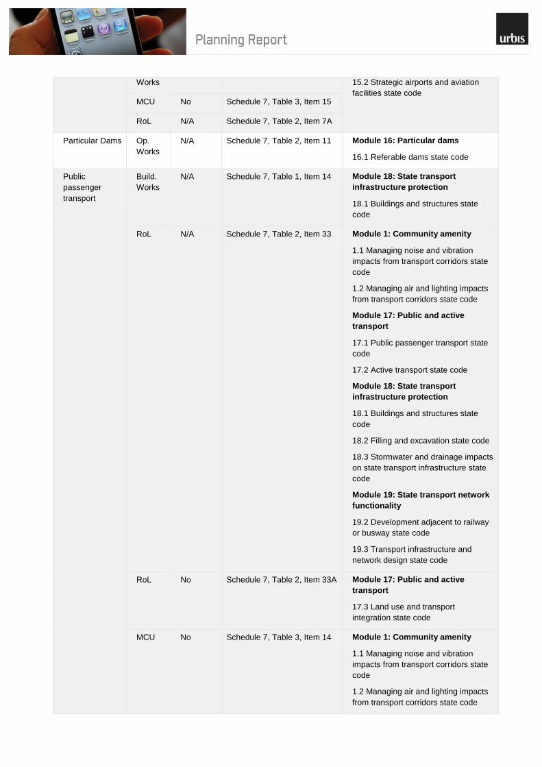
An assessment of the proposed development against the State Assessment criteria for the relevant referral agency role is included in Appendix 2 which indicates that the proposal requires referral to the DSDIP for the following matters:
Proximity to State-Controlled Road– pursuant to Schedule 7, Table 3, Item 1 as the proposed development comprises of land within 25m of a state-controlled road.
Given the above, the proposed development will require assessment against the following State Codes and more specifically, the relevant provisions of each code:
Table 2 – Applicable State Codes
Module Applicable State Code Relevant Provisions of Code
Module 1: Community amenity
1.1 Managing noise and vibration impacts from transport corridors state code
Table 1.1.1 – Building work, material change of use and reconfiguring a lot
1.2 Managing air and lighting impacts from transport corridors state code
Table 1.2.1 – Building work, material change of use and reconfiguring a lot
Module 18: State infrastructure protection
18.1 Buildings and structures state code
Table 18.1.1 – All development
18.2 Filling and excavation state code Table 18.2.1 - Material change of use, reconfiguring a lot and operational work
18.3 Stormwater and drainage impacts on state transport infrastructure state code
Table 18.3.1 – All development
Module 19: State transport network functionality
19.1 Access to state-controlled road state code
Table 19.1.1 – All development
19.3 Transport infrastructure and network design state code
Table 19.2.1 – All development
The proposal has been referred to SARA in regards to the identified matters.
A comprehensive assessment of the proposed development against the state codes is attached at Appendix 4 of this report. The proposal does not compromise the purpose of the state codes and is capable of fulfilling all of the Acceptable Solutions or associated Performance Criteria.

15
6 Planning Scheme
6.1 Sarina Shire Planning Scheme
As highlighted earlier in this report, the planning scheme applicable to the proposed development is the Sarina Shire Planning Scheme 2005 (the ‗Planning Scheme‘).
6.2 Strategic Framework
The Sarina Shire Planning Scheme outlines a Strategic Framework which reflects the desired environmental outcomes (DEOs) and summarises the approach taken by the Planning Scheme to achieve the DEOs. In facilitating the achievement of the desired environmental outcomes, the Strategic Framework provides a more specific outline of how the three strands of ecological sustainability (environmental, economic and social) are balanced and integrated within the region.
6.3 Definition
Under the Planning Scheme, the proposed development is defined as a Telecommunication Facility. The planning scheme definition is outlined as follows:
“Telecommunication Facility means the use of premises for the purpose of extending telecommunications services throughout the Shire whether or not the operator is a public sector entity or a private sector entity. The term excludes low impact facilities as defined under the provisions of the Telecommunications Act 1997.”
Given the proposal involves the development of a new Telecommunications Facility implementing a freestanding tower and equipment shelter; the proposed facility requires assessment against the provisions applying to a Telecommunication Facility under the Planning Scheme.
6.4 Zoning
The level of assessment is determined from the tables contained in the Rural Zone within the Sarina Shire Plan. The proposed Telecommunications Facility development is considered Code Assessable. Figure 6 illustrates the Rural zoning of the site.
Figure 4 – Zoning Map
(Source: Sarina Shire Planning Scheme Mapping)
Site
16
The Overall Outcomes for the Rural Zone under the Planning Scheme are:
a) “Good quality agricultural land is protected from fragmentation; unless otherwise demonstrated by overwhelming community need; and
b) Existing rural activities are protected from intrusion of incompatible uses, except for urban residential expansion adjoining the northern part of Sarina Township between the Bruce Highway and Sarina Beach Road; and
c) A wide range of agricultural and animal husbandry uses, and other compatible primary production uses occur in the Rural Zone; and
d) The rural character of the Shire is retained; and e) The productive capacity of land is maintained; and f) Residential uses are primarily ancillary to other uses in the Rural Zone; and g) Non-agricultural uses, such as recreation, roadside stall, home based business, host home
accommodation, educational or tourism related uses are of a low intensity and scale; and h) Other uses are located in the Rural Zone if they cannot practically be located in urban areas due to
their: (i) Nature; or (ii) Scale; or (iii) Effects; or (iv) Necessary relationship to a particular cultural heritage feature, natural resource or
feature, infrastructure or activity; and i) Uses and works are located, designed and managed where they:
- Are compatible with other uses and works; and - Maintain the safety of people and works; and - Maintain the health and safety of residents and visitors in the rural area and the amenity
they enjoy; and - Maintain the scenic values of the natural environment enjoyed by residents and visitors
in the rural area; and - Avoid significant adverse effects on the natural and cultural heritage values of the
environment; and - Cause no adverse impact (due to site specific or cumulative effects) on water quality
(surface and ground); - Do not compromise the operation or expansion of the major port and related facilities at
Hay Point; - Do not compromise the efficiency and safety of any road and are connected to the Shire
road network and urban centres by roads capable of accommodating the type and volume of traffic likely to be generated;
- Are provided with a water supply, liquid and solid waste disposal system and electricity supply adequate for all on-site purposes; and
- Do not intrude into buffer areas around activities requiring separation from incompatible uses (such as Extractive Industry, Intensive Animal Industry, Stables, Kennels and Catteries).
It is recognised that despite being located within the Rural Zone, the surrounding area, particularly to the north and west, is predominantly characterised by port related industry. The proposed telecommunication facility benefits from not being located within a residential area and is considered to be a use consistent within the rural zone. As the site is currently used by Telstra for telecommunications purposes, the proposal does not undermine the existing uses and character of the area.
6.5 Codes
The following Code from the Planning Scheme has been identified as being applicable to the application:
Rural Zone Code
A detailed analysis of the proposal against the provisions of the Rural Zone Code is outlined in Appendix 2.
17
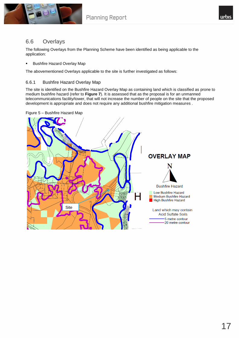
6.6 Overlays
The following Overlays from the Planning Scheme have been identified as being applicable to the application:
Bushfire Hazard Overlay Map
The abovementioned Overlays applicable to the site is further investigated as follows:
6.6.1 Bushfire Hazard Overlay Map
The site is identified on the Bushfire Hazard Overlay Map as containing land which is classified as prone to medium bushfire hazard (refer to Figure 7). It is assessed that as the proposal is for an unmanned telecommunications facility/tower, that will not increase the number of people on the site that the proposed development is appropriate and does not require any additional bushfire mitigation measures .
Figure 5 – Bushfire Hazard Map
Site
18
7 Environmental Impacts
7.1 Environmental Values
7.1.1 State and Local Values
The site does not contain any values of local or state significance.
7.1.2 Vegetation Communities
The location of the facility on the site is not within an area of remnant vegetation. The site is identified as containing some regrowth vegetation containing of least concern regional ecosystems. No vegetation is intended to be removed as part of the construction of the facility and concern will be taken to ensure that impacts on vegetation are restricted to what is completely necessary.
7.1.3 Topography and Scenic Amenity
The site‘s topography is relatively flat. Views of the facility from the surrounding area will be possible; however given the surrounding vegetation at ground level and the predominantly port related industry uses surrounding the site will not have any significant impacts on scenic amenity.
7.1.4 Soil
The site is not located in an erosion prone area and no significant ground disturbance will result as part of the installation. The site is not identified as containing potential or actual acid sulphate soils.
7.1.5 Waterways & Water bodies
The proposal is not located adjacent to any identified waterways. The proposed development is located within the Coastal Zone but is not within the Coastal Management District.
7.1.6 Declared Pests & Environmental Weeds
There are no known pests or environmental weeds on site.
7.2 Public Safety
Public safety will not be jeopardised as the facility will be secure from public access and warning signs will be placed at appropriate locations.
The Australian Radiation Protection and Nuclear Safety Agency (ARPANSA) has set limits for electromagnetic radiation exposure from mobile phone base stations. All licensed carriers must comply with the ARPANSA limits. The ARPANSA limits are consistent with the guidelines of the World Health Organisation. Please refer to the EME report in Appendix 5.
7.3 Visual Impact
To ensure there are no ‗dead spots‘ or ‗drop outs‘ within the coverage perimeter and in order to achieve its desired coverage in the area, Telstra needs to sufficiently elevate its antennas above physical obstructions, such as built form and vegetation.
While the proposed antennas will adequately meet the required Telstra coverage objectives, due care was taken in the design and positioning of the facility so as to minimise impact on the surrounding areas. As a result, Telstra has chosen to install a 40 metre tower and antennas. The height of the facility is required to provide continued mobile and wireless broadband services to Hay Point. The minimal visual impacts on the area and concealment of the facility can be attributed to the following factors:

19
The visual impact of the facility from surrounding uses will be minimised through the presence of existing vegetation throughout the immediate and surrounding vicinity;
The size and configuration of the installation represents the lowest impact option available for the site, to ensure coverage is achieved in the area;
The proposed development represents a continuation of the existing telecommunications use on; and
The proposed removal of the existing lattice tower will provide an improved visual outcome with the removal of the existing lattice tower.
20
8 Conclusion The proposed telecommunications facility at Hay Point Exchange will form an integral component in the enhancement of mobile telecommunications network for Telstra Corporation Limited. Importantly, the proposed facility will provide enhanced mobile phone coverage to the surrounding area, to ensure quality of coverage for users. Telstra, together with Urbis Pty Ltd, has undertaken an assessment of the relevant matters as required by the Telecommunications Act 1997, Environment Protection, Biodiversity and Conservation Act 2000 and the Sustainable Planning Act 2009. The proposal is considered appropriate in light of the relevant legislative, environmental, technical, radio coverage and public safety requirements. This assessment of the site at Hay Point for the development of a Telecommunications Facility indicates that the proposal is a suitable form of development on the site. The proposed facility is considered suitable for this location for the following reasons:
No clearing of vegetation at the site will be necessary;
The proposed use will be screened by existing vegetation nearby;
The size and configuration of the tower represents the lowest impact option available for the site;
The proposed facility provides a structure on which other telecommunications carriers can co-locate in the future if required; and
The installation will address a number of customer complaints relating to mobile telephone coverage, capacity and the quality of mobile telephone calls in the Hay Point area.
The proposal represents sound planning, and will not result in any potential significant adverse impacts on the amenity of the site or the surrounding environment. On the basis of the assessment contained within this report, Mackay Regional Council is requested to favourably consider the development proposal, subject to reasonable and relevant conditions.
Candidate A

21
Appendix 1 – Site Plans
i
Appendix 2 – Codes
RURAL ZONE CODE
Specific Outcomes Probable Solutions Assessment of Proposal
Cultural Heritage
The significance of known places of Indigenous and non-Indigenous cultural heritage value is retained.
No probable solution is provided Not Applicable
The proposed development is not located on a site of known Indigenous or non-indigenous cultural heritage value. Further, there is existing development onsite.
Amenity, Public Health or Safety
There are no significant adverse impacts on amenity, public health or safety, with regard to: I) The siting, scale and design of
buildings or other works; II) Sewage disposal III) Permanent or temporary
occupation of, or access to, areas subject to natural hazards; or
IV) Extractive uses or works located in close proximity to towns, roads or other occupied places
For (1) (b)(i) i) The maximum height of
any building, structure or object is 8.5m; and
ii) The setback for any building, structure or object is 6m from the frontage; and
iii) If a house is located within 200 metres of Strategic Port Land, a 10 metre wide vegetation buffer is established along that side of the house; and
iv) the location of a second house on a lot is situation a minimum distance of 40m from the existing house and if the second house is located within 200 metres of Strategic Port Land, a 10 metre wide vegetation buffer is established along that side of the house; and
v) the maximum number of dwelling units per lot is two
All Performance Solution
Whilst it is recognised that the proposal exceeds that maximum height limit of 8.5 metres, the monopole will be of a narrow stature and will not have the building bulk associated with tall buildings. Furthermore, it is located in an area characterised by industrial development and therefore shadowing is not likely to pose a significant issue.
Telecommunications facilities are required to be elevated above obstacles, which can hinder effective operation of the facility. The elevation also allows the facility to cover more area and this means that the network can operate more efficiently.
AII Not Applicable
The application is for an unmanned telecommunication facility and does not require provisions for sewage disposal.
A2.3 Not Applicable
The proposed telecommunication facility does not include use for temporary or permanent occupation.
A2.4 Not Applicable
The proposal does not involve any extractive uses or works.
Pollution
Uses are located and designed to avoid significantly polluting the air, water or soil
Waste water is not discharged from the site.
Complies
The proposed development will operate within the appropriate levels and will not cause any significant pollution to air, water or soil. There is no waste water generation or disposal associated with the proposed
ii
Specific Outcomes Probable Solutions Assessment of Proposal
telecommunication tower.
Natural Values
Waste disposal areas are situated where there is no risk of contaminating groundwater or surface water resources, and the size and design provides for the amount of waste generated on the site.
No probable solution provided Not Applicable
The proposed telecommunication is not associated within any waste generation and does not require a waste disposal area.
There are no significant adverse effects on the natural values of the environment, including loss of natural vegetation, land degradation and loss of important views, arising from, but not limited to: i. disturbance of the land; ii. public access; iii. fire hazard; iv. siting of buildings and other
works; or v. waste disposal
No probable solution provided Complies
The proposed development of the site for a 40m telecommunications tower will not have any adverse impacts on the natural values of the environment. The proposal does not involve the removal of any vegetation.
Watercourses and adjacent habitat are protected by maintaining bank stability against erosion and slumping, maintaining water quality by filtering sediment, nutrients and other pollutants, and maintaining aquatic and wildlife habitat.
Vegetation is retained along each side of a watercourse within 25 metres of the high bank.
Not Applicable
The proposed telecommunications tower does not adjoin a watercourse.
The use and values of national parks, conservation parks and resource reserves (including State Forests and Timber Reserves) are protected.
No probable solution provided Not Applicable
The proposed development is not located within a national park, conservation park or resource reserve.

iii
Appendix 3 – SARA Referral Agency Role
Matter of
Interest
Type Referral
Required
Relevant provisions of the
regulation
relevant module and codes
Regional Plans MCU No Schedule 7, Table 3, Item 12 Module 2: Regional Plans
2.1 SEQ Regional Plan RoL N/A Schedule 7, Table 2, Item 39
Aquaculture MCU No Schedule 7, Table 2, Item 28 Module 3: Aquaculture
3.1 Aquaculture state code
Strategic
Cropping Land
MCU No Schedule 7, Table 3, Item 27 Module 6: Strategic cropping land
6.1 Particular development on
strategic cropping land state code RoL N/A Schedule 7, Table 3, Item 28
Environmentally
relevant
activities
MCU No Schedule 7, Table 2, Item 1 Module 4: Environmentally relevant
activities
4.1 Concurrence environmentally
relevant activity state code
Wild river area
– certain
agricultural or
animal
husbandry
activities
Op.
Works
N/A Schedule 7, Table 2, Item 42 Module 4: Environmentally relevant
activities
4.1 Concurrence environmentally
relevant activity state code MCU No Schedule 7, Table 2, Item 41
Fish habitat
area – works or
other
development in
or adjoining
Build.
Works
N/A Schedule 7, Table 2, Item 25 Module 5: Fisheries resources
5.1 Development in or adjacent to a
declared fish habitat area state code Op.
Works
N/A Schedule 7, Table 2, Item 26
All Dev. No Schedule 7, Table 2, Item 27
Marine plants –
removal,
destruction or
damage
Op.
Works
N/A Schedule 7, Table 2, Item 30 Module 5: Fisheries resources
5.3 Removal, destruction or damage of
marine plants state code RoL N/A Schedule 7, Table 2, Item 31
MCU No Schedule 7, Table 2, Item 32
No Schedule 7, Table 3, Item 25
Native
vegetation
clearing
RoL N/A Schedule 7, Table 2, Item 4 Module 8: Native vegetation
clearing
The following codes apply based on
the geographic location of the
application:
8.1 South East Queensland bioregion
state code
OR
8.2 Brigalow Belt and New England
Tablelands bioregion state code
OR
Op.
Works
N/A Schedule 7, Table 2, Item 12
MCU No Schedule 7, Table 3, Item 10

iv
8.3 Western bioregions state code
OR
8.4 Coastal bioregions state code
Queensland
heritage
Build.
Works
N/A Schedule 7, Table 1, Item 12 Module 9: Queensland heritage
9.1 Queensland heritage place state
code Various
Dev.
No Schedule 7, Table 2, Item 19
Tidal works or
development in
a coastal
management
district
Op.
Works
N/A Schedule 7, Table 2, Item 13 Module 10: Coastal protection
10.1 Tidal works, or development in a
coastal management district state
code
Schedule 7, Table 2, Item 15 Module 14: Maritime safety
14.1 Marine safety state code
14.2 Ship-sourced pollutants reception
facilities in marinas state code
Schedule 7, Table 2, Item 15A
RoL N/A Schedule 7, Table 2, Item 14 Module 10: Coastal protection
10.1 Tidal works or development in a
coastal management district state
code
MCU No Schedule 7, Table 3, Item 5
Build.
Works
N/A Schedule 7, Table 1, Item 11
Water – taking
or interfering
with
Op.
Works
N/A Schedule 7, Table 2, Item 9 Module 7: Water resources
7.1 Sustainable management of water
resources state code Schedule 7, Table 2, Item 10
Watercourse or
lake – removal
of quarry
material
All
aspects
of Dev.
No Schedule 7, Table 2, Item 9 Module 7: Water resources
7.2 Removal of quarry material state
code Schedule 7, Table 2, Item 10
Waterway
barrier works –
constructing or
raising
Op.
Works
N/A Schedule 7, Table 2, Item 29 Module 5: Fisheries resources
5.2 Constructing or raising waterway
barrier works in fish habitats state
code
Wetland – land
in or near
RoL N/A Schedule 7, Table 2, Item 43A Module 11: Wetland protection and
wild river areas
11.1 Wetland protection area state
code
MCU No Schedule 7, Table 3, Item 21A
Op.
Works
N/A Schedule 7, Table 2, Item 43B
Contaminated
land
RoL N/A Schedule 7, Table 2, Item 22 Module 12: Contaminated land
12.1 Contaminated land state code MCU No Schedule 7, Table 2, Item 23
Schedule 7, Table 3, Item 11
Major hazard
facilities
MCU N/A Schedule 7, Table 2, Item 8 Module 13: Major hazard facilities
13.1 Major hazard facilities state code
Airports Build. N/A Schedule 7, Table 1, Item 15 Module 15: Airports
v
Works 15.2 Strategic airports and aviation
facilities state code MCU No Schedule 7, Table 3, Item 15
RoL N/A Schedule 7, Table 2, Item 7A
Particular Dams Op.
Works
N/A Schedule 7, Table 2, Item 11 Module 16: Particular dams
16.1 Referable dams state code
Public
passenger
transport
Build.
Works
N/A Schedule 7, Table 1, Item 14 Module 18: State transport
infrastructure protection
18.1 Buildings and structures state
code
RoL N/A Schedule 7, Table 2, Item 33 Module 1: Community amenity
1.1 Managing noise and vibration
impacts from transport corridors state
code
1.2 Managing air and lighting impacts
from transport corridors state code
Module 17: Public and active
transport
17.1 Public passenger transport state
code
17.2 Active transport state code
Module 18: State transport
infrastructure protection
18.1 Buildings and structures state
code
18.2 Filling and excavation state code
18.3 Stormwater and drainage impacts
on state transport infrastructure state
code
Module 19: State transport network
functionality
19.2 Development adjacent to railway
or busway state code
19.3 Transport infrastructure and
network design state code
RoL No Schedule 7, Table 2, Item 33A Module 17: Public and active
transport
17.3 Land use and transport
integration state code
MCU No Schedule 7, Table 3, Item 14 Module 1: Community amenity
1.1 Managing noise and vibration
impacts from transport corridors state
code
1.2 Managing air and lighting impacts
from transport corridors state code

vi
Module 17: Public and active
transport
17.1 Public passenger transport state
code
17.2 Active transport state code
Module 18: State transport
infrastructure protection
18.1 Buildings and structures state
code
18.2 Filling and excavation state code
18.3 Stormwater and drainage impacts
on state transport infrastructure state
code
Module 19: State transport network
functionality
19.2 Development adjacent to railway,
busway and light rail state code
19.3 Transport infrastructure and
network design state code
MCU No Schedule 7, Table 3, Item 14A Module 17: Public and active
transport
17.3 Land use and transport
integration state code
Railways Build.
Works
N/A Schedule 7, Table 1, Item 16 Module 1: Community amenity
1.1 Managing noise and vibration
impacts from transport corridors state
code
1.2 Managing air and lighting impacts
from transport corridors state code
Module 18: State transport
infrastructure protection
18.1 Buildings and structures state
code
18.2 Filling and excavation state code
18.3 Stormwater and drainage
impacts on state transport
infrastructure state code
Module 19: State transport network
functionality
19.2 Development adjacent to railway,
busway and light rail state code
MCU No Schedule 7, Table 3, Item 15A Module 1: Community amenity
1.1 Managing noise and vibration

vii
impacts from transport corridors state
code
1.2 Managing air and lighting impacts
from transport corridors state code
Module 17: Public and active
transport
17.1 Public passenger transport state
code
17.2 Active transport state code
Module 18: State transport
infrastructure protection
18.1 Buildings and structures state
code
18.2 Filling and excavation state code
18.3 Stormwater and drainage
impacts on state transport
infrastructure state code
Module 19: State transport
network functionality
19.2 Development adjacent to
railway or busway state code
19.3 Transport infrastructure and
network design state code
Op.
Works
N/A Schedule 7, Table 3, Item 15B Module 18: State transport
infrastructure protection
18.1 Buildings and structures state
code
18.2 Filling and excavation state code
18.3 Stormwater and drainage
impacts on state transport
infrastructure state code
RoL N/A Schedule 7, Table 2, Item 34 Module 1: Community amenity
1.1 Managing noise and vibration
impacts from transport corridors state
code
1.2 Managing air and lighting impacts
from transport corridors state code
Module 17: Public and active
transport
17.1 Public passenger transport state
code
viii
17.2 Active transport state code
Module 18: State transport
infrastructure protection
18.1 Buildings and structures state
code
18.2 Filling and excavation state
code
18.3 Stormwater and drainage
impacts on state transport
infrastructure state code
Module 19: State transport
network functionality
19.2 Development adjacent to
railway, busway and light rail state
code
19.3 Transport infrastructure and
network design state code
State-controlled
road
Build.
Works
N/A Schedule 7, Table 1, Item 8 Module 18: State transport
infrastructure protection
18.1 Buildings and structures state
code
18.2 Filling and excavation state code
18.3 Stormwater and drainage impacts
on state transport infrastructure state
code
RoL N/A Schedule 7, Table 2, Item 2 Module 1: Community amenity
1.1 Managing noise and vibration
impacts from transport corridors state
code
1.2 Managing air and lighting impacts
from transport corridors state code
Module 18: State transport
infrastructure protection
18.1 Buildings and structures state
code
18.2 Filling and excavation state code
18.3 Stormwater and drainage impacts
on state transport infrastructure state
code
Module 19: State transport network
functionality
19.1 Access to state-controlled road
state code
19.3 Transport infrastructure and
ix
network design state code
Op.
Works
N/A Schedule 7, Table 2, Item 3 Module 18: State transport
infrastructure protection
18.1 Buildings and structures state
code
18.2 Filling and excavation state code
18.3 Stormwater and drainage impacts
on state transport infrastructure state
code
Module 19: State transport network
functionality
19.1 Access to state-controlled road
state code
Schedule 7, Table 3, Item 1A
MCU Yes Schedule 7, Table 3, Item 1 Module 1: Community amenity
1.1 Managing noise and vibration
impacts from transport corridors state
code
1.2 Managing air and lighting impacts
from transport corridors state code
Module 18: State transport
infrastructure protection
18.1 Buildings and structures state
code
18.2 Filling and excavation state code
18.3 Stormwater and drainage impacts
on state transport infrastructure state
code
Module 19: State transport network
functionality
19.1 Access to state-controlled road
state code
19.3 Transport infrastructure and
network design state code
State transport
infrastructure
(thresholds)
Various
Aspects
of Dev.
No Schedule 7, Table 3, Item 2 Module 17: Public and active
transport
17.1 Public passenger transport state
code
17.2 Active transport state code
Module 18: State transport
infrastructure protection
18.1 Buildings and structures state
code
18.2 Filling and excavation state code
18.3 Stormwater and drainage impacts
on state transport infrastructure state
code

x
Module 19: State transport network
functionality
19.2 Development adjacent to railway,
busway and light rail state code
19.3 Transport infrastructure and
network design state code
State-controlled
transport
tunnels
RoL N/A Schedule 7, Table 2, Item 34A Module 1: Community amenity
1.1 Managing noise and vibration
impacts from transport corridors state
code
1.2 Managing air and lighting impacts
from transport corridors state code
Module 18: State transport
infrastructure protection
18.1 Buildings and structures state
code
18.2 Filling and excavation state code
18.3 Stormwater and drainage impacts
on state transport infrastructure state
code
Module 19: State transport network
functionality
19.2 Development adjacent to railway,
busway or light rail state code
19.3 Transport infrastructure and
network design state code
MCU No Schedule 7, Table 3, Item 15C Module 1: Community amenity
1.1 Managing noise and vibration
impacts from transport corridors state
code
1.2 Managing air and lighting impacts
from transport corridors state code
Module 18: State transport
infrastructure protection
18.1 Buildings and structures state
code
18.2 Filling and excavation state code
18.3 Stormwater and drainage impacts
on state transport infrastructure state
code
Module 19: State transport network
functionality
19.2 Development adjacent to railway,
busway and light rail state code
19.3 Transport infrastructure and
network design state code

xi

xii
Appendix 4 – State Development Assessment Provisions
Module 1.1 Managing Noise and Vibration Impacts from A.1
Transport Corridors State Code
Performance Outcomes Acceptable Outcomes Assessment of Proposal
Residential buildings near a state-controlled road or type 1 multi modal corridor
PO1 Development involving an
accommodation activity that is a residential building achieves acceptable noise levels for residents and visitors by mitigating adverse impacts on the development from noise generated by a state-controlled road or type 1 multi-modal corridor.
AO1.1 All facades of a residential
building exposed to noise from a state-controlled road or type 1 multi-modal corridor meet the following external noise criteria^#: (1) ≤60 dB(A) L10 (18 hour) facade corrected (measured L90 (8 hour) free field between 10 pm and 6 am ≤40 dB(A)) (2) ≤63 dB(A) L10 (18 hour) facade corrected (measured L90 (8 hour) free field between 10 pm and 6 am >40 dB(A)). AND AO1.2 Private open space* in
residential land uses exposed to noise from a state-controlled road or type 1 multi-modal corridor meet the following external noise criteria^#: (1) ≤57 dB(A) L10 (18 hour) free field (measured L90 (18 hour) free field between 6 am and 12 midnight ≤45 dB(A)) (2) ≤60 dB(A) L10 (18 hour) free field (measured L90 (18 hour) free field between 6 am and 12 midnight >45 dB(A)).
AND
AO1.3 Every passive recreation
area* exposed to noise from a state-controlled road or type 1 multi-modal corridor meets the following external noise criteria^#: (1) 63 dB(A) L10 (12 hour) free field (between 6 am and 6 pm).
AND
AO1.4 For a residential building, not
located in a transport noise corridor, every habitable room is designed, sited and constructed to meet the following internal noise criteria^#: (1) ≤35 dB(A) Leq (1 hour) (maximum hour over 24 hours).
AND
AO1.5 A residential building not
located in a transport noise corridor, is designed, sited and constructed to incorporate noise attenuation treatments in accordance with AS3671–1989 Acoustics – Road traffic noise intrusion – building siting and construction.
Note: Noise levels from a state-controlled road or type 1 multi-modal corridor are to be measured in accordance with AS1055.1–1997
AO1.1 – 1.5 Not Applicable
The proposed telecommunication tower does not involve an accommodation activity that is a residential building.
xiii
Acoustics – Description and measurement of environmental noise.
Editor‘s note: Habitable rooms of residential buildings located within a transport noise corridor must comply with the Queensland Development Code MP4.4 Buildings in a transport noise corridor, Queensland Government, 2010. Transport noise corridors are mapped on the Department of Housing and Public Works website.
Residential buildings near a railway with more than 15 passing trains per day or a type 2 multi modal corridor
PO2 Development involving an
accommodation activity that is a residential building achieves acceptable noise levels for residents and visitors by mitigating adverse impacts on the development from noise generated by a railway with more than 15 passing trains per day or a type 2 multi-modal corridor.
AO2.1 All facades of a residential
building exposed to noise from a railway with more than 15 passing trains per day or a type 2 multi-modal corridor meet the following external noise criteria^#: (1) ≤65 dB(A) Leq (24 hour) facade corrected (2) ≤87 dB(A) Leq (single event maximum sound pressure level) facade corrected.
AND
AO2.2 Every private open space
and passive recreation area* exposed to noise from a railway with more than 15 passing trains per day or type 2 multi-modal corridor meet the following external noise criteria^#: (1) ≤62 dB(A) Leq (24 hour) free field (2) ≤84 dB(A) Leq (single event maximum sound pressure level) free field.
AND
AO2.3 For a residential building, not
located in a transport noise corridor, every habitable room is designed, sited and constructed to meet the following internal noise criteria^#: (1) ≤45 dB(A) single event maximum sound pressure level (railway). Note: Noise levels from railways or type 2 multi-modal corridors are to be measured in accordance with AS1055.1–1997 Acoustics – Description and measurement of environmental noise. Editor‘s note: Habitable rooms of residential buildings located within a transport noise corridor must comply with the Queensland development code MP4.4 Buildings in a transport noise corridor, Queensland Government, 2010. Transport noise corridors are mapped on the Department of Housing and Public Works website.
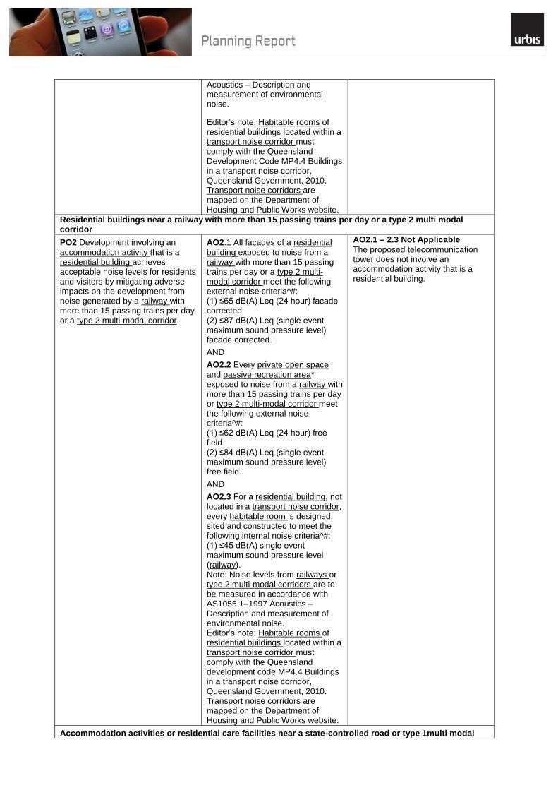
AO2.1 – 2.3 Not Applicable
The proposed telecommunication tower does not involve an accommodation activity that is a residential building.
Accommodation activities or residential care facilities near a state-controlled road or type 1multi modal

xiv
corridor
PO3 Development involving an
accommodation activity or residential care facility achieves acceptable noise levels for residents and visitors by mitigating adverse impacts on the development from noise generated by a state-controlled road or type 1 multi-modal corridor.
AO3.1 All facades of an
accommodation activity and residential care facility (other than a residential building) exposed to noise from a state-controlled road or type 1 multi-modal corridor meet the following external noise criteria^#: (1) ≤60 dB(A) L10 (18 hour) facade corrected (measured L90 (8 hour) free field between 10 pm and 6 am ≤40 dB(A)) (2) ≤63 dB(A) L10 (18 hour) facade corrected (measured L90 (8 hour) free field between 10 pm and 6 am >40 dB(A)).
AND
AO3.2 Every private open space* in
an accommodation activity or residential care facility (other than a residential building) exposed to noise from a state-controlled road or type 1 multi-modal corridor meet the following external noise criteria^#: (1) ≤57 dB(A) L10 (18 hour) free field (measured L90 (18 hour) free field between 6 am and 12 midnight ≤45 dB(A)) (2) ≤60 dB(A) L10 (18 hour) free field (measured L90 (18 hour) free field between 6 am and 12 midnight >45 dB(A)).
AND
AO3.3 Every passive recreation
area* in an accommodation activity or residential care facility (other than a residential building) exposed to noise from a state-controlled road or type 1 multi-modal corridor meet the following external noise criteria^#: (1) 63 dB(A) L10 (12 hour) free field (between 6 am and 6 pm).
AND
AO3.4 Every habitable room in an
accommodation activity or residential care facility (other than a residential building) exposed to noise from a state-controlled road or type 1 multi-modal corridor meet the following internal noise criteria^#: (1) ≤35 dB(A) Leq (1 hour) (maximum hour over 24 hours). Note: Noise levels from state-controlled roads or type 1 multi-modal corridors are to be measured in accordance with AS1055.1–1997 Acoustics – Description and measurement of environmental noise.
AO3.1 – 3.4 Not Applicable
The proposed development is for a telecommunications facility and does not involve an accommodation activity or residential care facility.
Accommodation activities or residential care facilities near a railway with more than 15 passing trains per day or a type 2 multi modal corridor
PO4 Development involving an
accommodation activity or residential care facility achieves acceptable noise levels for residents
AO4.1 All facades of an
accommodation activity or residential care facility (other than a residential building) exposed to
AO4.1 – 4.3 Not Applicable
The proposed development is for a telecommunications facility and does not involve an accommodation
xv
and visitors by mitigating adverse impacts on the development from noise generated by railways with more than 15 passing trains per day or type_ 2 multi-modal corridors.
noise from a railway with more than 15 passing trains per day or a type 2 multi-modal corridor meet the following external noise criteria^#: (1) ≤65 dB(A) Leq (24 hour) facade corrected (2) ≤87 dB(A) Leq (single event maximum sound pressure level) facade corrected.
AND
AO4.2 Every private open space
and passive recreation area* in an accommodation activity or residential care facility (other than a residential building) exposed to noise from a railway with more than 15 passing trains per day or a type 2 multi-modal corridor meet the following external noise criteria^#: (1) ≤62 dB(A) Leq (24 hour) free field (2) ≤84 dB(A) Leq (single event maximum sound pressure level) free field.
AND
AO4.3 Every habitable room in an
accommodation activity or a residential care facility (other than a residential building) exposed to noise from a railway with more than 15 passing trains per day or a type 2 multi-modal corridor meet the following internal noise criteria^#: (1) ≤45 dB(A) single event maximum sound pressure level (railway). Note: Noise levels from railways or type 2 multi-modal corridors are to be measured in accordance with AS1055.1–1997 Acoustics – Description and measurement of environmental noise.
activity or residential care facility.
Accommodation activities or residential care facilities near a busway or light rail
PO5 Development involving an
accommodation activity or residential care facility achieves acceptable noise levels for residents and visitors by mitigating adverse impacts on the development from noise generated by a busway or light rail.
AO5.1 All facades of an
accommodation activity or residential care facility (other than a residential building) exposed to noise from a busway or light rail meet the following external noise criteria^#: (1) ≤55 dB(A) Leq (1 hour) facade corrected (maximum hour between 6 am and 10 pm) (2) ≤50 dB(A) Leq (1 hour) facade corrected (maximum hour between 10 pm and 6 am) (3) ≤64 dB(A) Lmax (1 hour) facade corrected (between 10 pm and 6 am).
AND
AO5.2 Every private open space
and passive recreation area* in an accommodation activity or residential care facility (other than a residential building) exposed to noise from a busway or light rail
AO5.1 – 5.3 Not Applicable
The proposed development is for a telecommunications facility and does not involve an accommodation activity or residential care facility.
xvi
meet the following external noise criteria^#: (1) ≤52 dB(A) Leq (1 hour) free field (maximum hour between 6 am and 10 pm) (2) ≤66 dB(A) Lmax free field.
AND
AO5.3 Every habitable room of an
accommodation activity or residential care facility (other than a residential building) exposed to noise from a busway or light rail meet the following internal noise criteria^#: (1) ≤35 dB(A) Leq (1 hour) (maximum hour over 24 hours). Note: Noise levels from a busway or light rail are to be measured in accordance with AS1055.1–1997 Acoustics – Description and measurement of environmental noise.
Particular development near a state-controlled road or type 1 multi modal corridor
PO6 Development involving a:
(1) child care centre, or (2) community use, or (3) educational establishment, or (4) health care service, or (5) hospital, or (6) office, or (7) place of worship achieves acceptable noise levels for workers and patrons by mitigating adverse impacts on the development from noise generated by a state-controlled road or type 1 multi-modal corridor.
AO6.1 All facades of buildings for
the particular development exposed to noise from state-controlled roads or type 1 multi-modal corridors meet the following external noise criteria^#: (1) ≤58 dB(A) L10 (1 hour) facade corrected (maximum hour during normal opening hours).
AND
AO6.2 Every outdoor education
area and passive recreation area* for the particular development exposed to noise from a state-controlled road or type 1 multi-modal corridor meet the following external noise criteria^#: (1) ≤63 dB(A) L10 (12 hours) free field (between 6 am and 6 pm).
AND
AO6.3 A childcare centre, health
care service, hospital, educational establishment, library and place of worship exposed to noise from a state-controlled road or type 1 multi-modal corridor meet the following internal noise criteria^#: (1) ≤35 dB(A) Leq (1 hour) (maximum hour during opening hours).
AND
AO6.4 A community use (except for
a library) and office exposed to noise from a state-controlled road or type 1 multi-modal corridor meet the following internal noise criteria^#: (1) ≤45 dB(A) Leq (1 hour) (maximum hour during opening hours). Note: Noise levels from state-controlled roads or type 1 multi-modal corridors are to be measured
AO6.1 – 6.4 Not Applicable
The proposal is not for a sensitive development as it is an unmanned facility.
xvii
in accordance with AS1055.1–1997 Acoustics – Description and measurement of environmental noise.
Particular development near a railway (with more than 15 passing trains per day) or a type 2 multi modal corridor
PO7 Development involving a:
(1) child care centre, or (2) community use, or (3) educational establishment, or (4) health care service, or (5) hospital, or (6) office, or (7) place of worship achieves acceptable noise levels for workers and patrons by mitigating adverse impacts on the development from noise generated by a railway with more than 15 passing trains per day or a type 2 multi-modal corridor.
AO7.1 All facades of buildings for
the particular development exposed to noise from a railway with more than 15 passing trains per day or a type 2 multi-modal corridor meet the following external noise criteria^#: (1) ≤65 dB(A) Leq (1 hour) facade corrected (maximum hour during normal opening hours) (2) ≤87 dB(A) (single event maximum sound pressure level) facade corrected.
AND
AO7.2 Every outdoor education
area and passive recreation area* exposed to noise from a railway with more than 15 passing trains per day or a type 2 multi-modal corridor meet the following external noise criteria^#: (1) ≤62 dB(A) Leq (12 hour) free field (between 6 am and 6 pm) (2) ≤84 dB(A) (single event maximum sound pressure level) free field.
AND
AO7.3 Sleeping areas in a child
care centre, health care service or hospital exposed to noise from a railway with more than 15 passing trains per day or a type 2 multi-modal corridor meet the following internal noise criteria^#: (1) ≤45 dB(A) single event maximum sound pressure level (railway).
AND
AO7.4 Other rooms in a child care
centre, health care service or hospital exposed to noise from a railway with more than 15 passing trains per day or a type 2 multi-modal corridor meet the following internal noise criteria^#: (1) ≤50 dB(A) single event maximum sound pressure level (railway).
AND
AO7.5 An educational
establishment, library or place of worship exposed to noise from a railway with more than 15 passing trains per day or a type 2 multi-modal corridor meet the following internal noise criteria^#: (1) ≤50 dB(A) single event maximum sound pressure level (railway).
AO7.1 – 7.6 Not Applicable
The proposed development does not comprise any of the identified sensitive particular development and is not located near a railway or type 2 multi-modal corridor.

xviii
AND
AO7.6 A community use (except
library) or office exposed to noise from a railway with more than 15 passing trains per day or a type 2 multi-modal corridor meet the following internal noise criteria^#: (1) ≤55 dB(A) single event maximum sound pressure level (railway). Note: Noise levels from railways or type 2 multi-modal corridors are measured in accordance with AS1055.1–1997 Acoustics – Description and measurement of environmental noise.
Particular development near a busway or light rail
PO8 Development involving a:
(1) child care centre, or (2) community use, or (3) educational establishment, or (4) health care service, or (5) hospital, or (6) office, or (7) place of worship
achieves acceptable noise levels for workers and patrons by mitigating adverse impacts on the development from noise generated by a busway and light rail.
AO8.1 All facades of buildings for
the particular development exposed to noise from a busway or light rail meet the following external noise criteria^#: (1) ≤55 dB(A) Leq (1 hour) facade corrected (maximum hour during normal opening hours).
AND
AO8.2 Every outdoor education
area and passive recreation area* exposed to noise from a busway or light rail meet the following external noise criteria^#: (1) ≤52 dB(A) Leq (1 hour) free field (maximum hour during normal opening hours) (2) ≤66 dB(A) Lmax free field (during normal opening hours).
AND
AO8.3 Every childcare centre,
health care service, hospital, educational establishment, library and place of worship exposed to noise from a busway or light rail meet the following internal noise criteria^#: (1) ≤35 dB(A) Leq (1 hour) (maximum hour during opening hours).
AND
AO8.4 A community use (except
library) or office exposed to noise from a busway or light rail meet the following internal noise criteria^#: (1) ≤45 dB(A) Leq (1 hour) (maximum hour during opening hours).
Note: Areas exposed to noise from a busway or light rail are measured in accordance with AS1055.1–1997 Acoustics – Description and measurement of environmental noise.
AO8.1 – 8.4 Not Applicable
The proposed development does not comprise of any of the identified particular development.
Noise barriers
PO9 Noise barriers or earth mounds
erected to mitigate noise from
AO9.1 Where adjacent to a state-
controlled road or type 1 multi-
AO9.1 – Not Applicable
The telecommunications facility is an unmanned use; therefore noise
xix
transport operations and infrastructure are designed, sited and constructed to ensure: (1) adequate clearances to state transport infrastructure to incorporate safety requirements and facilitate maintenance requirements (2) privacy, security and amenity of surrounding properties are not significantly impacted (3) appropriate colour schemes, textures and landscaping are used in barrier design (4) design of noise barriers complements existing terrain (5) fauna movement is maintained along appropriate corridors (6) noise barriers are durable and fit for purpose.
modal corridor, noise barriers and earth mounds are designed, sited and constructed in accordance with Chapter 5 Integrated Noise Barrier Design of the Road traffic noise management: Code of practice, Department of Transport and Main Roads, 2007.
OR
AO9.2 Where adjacent to a railway
or type 2 multi-modal corridor, noise barriers and earth mounds are designed, sited and constructed in accordance with Queensland Rail Systems and Capability Technical Requirement – MCE-SR-014 Design of noise barriers adjacent to railways, Queensland Rail, 2010 and Part B.7 (d) of the Guide for development in a railway environment, Department of Infrastructure and Planning, 2010.
Editor‘s note: The Guide for development in a railway environment is part of the Transit oriented development guide: guide for practitioners in Queensland, Department of Infrastructure and Planning, 2010.
barriers are not required. AO9.2 – Not Applicable
The site is not adjacent to a railway or type 2 multi-modal corridor. The telecommunications facility is an unmanned use; therefore noise barriers are not required.
Vibration
PO10 Development mitigates
adverse impacts on the development from vibration generated by transport operations and infrastructure.
No acceptable outcome is prescribed.
AO10 – Complies
The application is for a telecommunications facility and will not be adversely impacted from vibration and any additional vibration mitigation required by council can be provided as necessary.
Module 1.2 Managing Air and Lighting Impacts from Transport A.2
Corridors State Code
Performance Outcomes Acceptable Outcomes Assessment of Proposal
Air quality
PO1 Development involving
sensitive development achieves acceptable levels of air quality for occupiers or users of the development by mitigating adverse impacts on the development from air emissions generated by state transport infrastructure.
AO1.1 Every private open space
and passive recreation area of an accommodation activity or residential care facility (other than a residential building) meet the air quality objectives in the Environmental Protection (Air) Policy 2008 for the following indicators: (1) carbon monoxide (2) nitrogen dioxide (3) sulphur dioxide (4) photochemical oxidants (5) respirable particulate matter (PM10) (6) fine particulate matter (PM2.5) (7) lead (8) toluene
AO1.1 – 1.2 – Not Applicable
The application for a telecommunication facility and does not involve any form of sensitive development.
xx
(9) formaldehyde (10) xylenes.
AND
AO1.2 Every outdoor education
area and passive recreation area of an educational establishment, childcare centre, health care service, hospital, community use, place of worship and office meet the air quality objectives in the Environmental Protection (Air) Policy 2008 for the following indicators: (1) carbon monoxide (2) nitrogen dioxide (3) sulphur dioxide (4) photochemical oxidants (5) respirable particulate matter (PM10) (6) fine particulate matter (PM2.5) (7) lead (8) toluene (9) formaldehyde (10) xylenes.
Lighting impacts
PO2 Development involving an
accommodation activity, residential care facility, health care service or hospital achieves acceptable levels of amenity for residents and patients by mitigating lighting impacts from state transport infrastructure.
AO2.1 Buildings for an
accommodation activity, residential care facility (other than a residential building), health care service and hospital are designed, sited and constructed to incorporate treatments to attenuate ingress of artificial lighting from state transport infrastructure during the hours of 10 pm – 6 am.
AO2.1 – Not Applicable
The application does not involve development for an accommodation activity, residential care facility, health care service or hospital.
Module 18.1 Building and Structures State Code A.3
Performance Outcomes Acceptable Outcomes Assessment of Proposal
PO1 Buildings, services, structures
and utilities do not adversely
impact on the safety or operation
of existing and future state
transport infrastructure and state
transport corridors.
No acceptable outcome is prescribed.
AO1 – Complies
The telecommunications facility will not adversely impact on the safety of the existing and future state transport infrastructure and state transport corridors.
PO2 Buildings and structures in or
over an existing or future state transport corridor (including a buffer associated with a state-controlled transport): (1) are able to sustain impacts to their structural integrity in the event of an impact from state transport infrastructure (2) have no adverse impact on the structural integrity of the state transport infrastructure, including tunnels, retaining walls and viaducts or bridges during construction or thereafter
No acceptable outcome is prescribed.
AO2 – Complies
The telecommunications facility is well setback from the state controlled road and it is unlikely to experience an impact from state transport infrastructure. The proposed monopole will not adversely impact on the continuing safe operation of the state controlled road.
xxi
(3) minimise the impacts of: (a) fire (b) explosion (c) chemical spill (d) liquid fuel spill (e) gas leak (f) any other emission or hazard generated from a dangerous goods incident.
PO3 Parts of the development
visible from state transport infrastructure on existing and future state transport corridors minimise potential to distract drivers and cause a safety hazard.
AO3.1 Advertising devices
proposed on a state-controlled road are designed to meet the standards outlined in the Roadside advertising guide, Department of Transport and Main Roads, 2009. AO3.2 Landscaping on a state-
controlled road is undertaken in accordance with the Road landscape manual, Department of Transport and Main roads, 2013. Editor‘s note: Works on a state-controlled road reserve require the applicant to obtain an ancillary works and encroachments permit under section 50 of the Transport Infrastructure Act 1994. OR AO3.3 Development adjacent to a
railway is in accordance with the Guide for development in a railway environment, Department of Infrastructure and Planning, 2009. Note: The Guide for development in a railway environment is part of the Transit oriented development: Guide for practitioners, Department of Infrastructure and Planning, 2009.
AO3.1 – 3.2 Not Applicable
The proposed development does not comprise of any advertising devices or landscaping on a state controlled road. AO3.3 – Complies
The proposed development is not adjacent to the railway and will not cause a safety hazard to the operation of the railway.
Module 18.2 Filling and Excavation Code A.4
Performance Outcomes Acceptable Outcomes Assessment of Proposal
Filling and excavation
PO1 Filling and excavation does not
adversely impact on or compromise the safety or operation of an existing or future state-controlled road.
AO1.1 Filling and excavation is
undertaken to ensure no undermining, subsidence, groundwater seepage, drainage or stormwater impacts occur within an existing or future state-controlled road. Editor‘s note: To meet the above acceptable outcome, a filling and excavation report assessing the proposed filling and excavation should be prepared to demonstrate compliance with this code and the requirements of the Road planning and design manual, Department of Transport and Main Roads, 2010.
AO1.1 – Not Applicable
Only minor excavation is required for the foundations of the monopole. Given the minor nature of this excavation, it will not impact on the operation of the state controlled road in any way.
PO2 Filling and excavation on an
existing or future state-controlled road is minimised through alternative design solutions, where practical and is cost-effective.
No acceptable outcome is prescribed. Editor‘s note: If a development involves filling and excavation within a state-controlled road, an approval
AO2 – Not Applicable
Only minor excavation is required for the foundations of the monopole. Given the minor nature of this excavation, it will not impact on the

xxii
Editor‘s note: Where this applies to a future state-controlled road corridor, planning for the corridor must be sufficiently progressed for impacts from filling and excavation to be considered as part of the development application.
issued by the Department of Transport and Main Roads under section 33 of the Transport Infrastructure Act 1994 may be required.
operation of the state controlled road in any way.
Services and public utilities
PO3 Filling and excavation does not
interfere with or impact on existing or future planned services or public utilities on a state-controlled road.
AO3.1 Any alternative service and
public utility alignments must satisfy the standards and design specifications of the service or public utility provider, and with any costs of relocation being borne by the developer. Editor‘s note: An approval issued by the Department of Transport and Main Roads under section 33 of the Transport Infrastructure Act 1994 may be required.
AO3.1 – Not Applicable
Only minor excavation is required for the foundations of the monopole. Given the minor nature of this excavation, it will not impact on services and utilities on the state controlled road in any way.
Retaining or reinforced soil structures
PO4 Retaining or reinforced soil
structures required to contain fill and excavation: (1) do not encroach on a state-controlled road (2) are capable of being constructed and maintained without adversely impacting a state-controlled road (3) are constructed of durable materials which maximise the life of the structure.
AO4.1 Retaining or reinforced soil
structures (including footings, rock anchors and soil nails) are sited outside an existing or future state-controlled road. AO4.2 Retaining or reinforced soil
structures in excess of an overall height of 1 metre are to be designed and certified by a structural Registered Professional Engineer of Queensland (RPEQ). AO4.3 Retaining or reinforced soil
structures that are set back less than 750 millimetres from a common boundary alignment with a state-controlled road are designed to achieve a low maintenance external finish, and are certified by a structural RPEQ. AO4.4 Retaining or reinforced soil
structures in excess of an overall height of 2 metres incorporate design treatments (such as terracing or planting) to reduce the overall height impact. AO4.5 Construction materials of all
retaining or reinforced soil structures have a design life exceeding 40 years, and comply with the specifications approved by a RPEQ.
AO4.1 – 4.5 Not Applicable
There is only minor groundwork associated with this application and no associated retaining or reinforced soil structures.
Stormwater flows and infrastructure on state-controlled roads
PO5 Upstream or downstream fill
and excavation does not alter or create a worsening effect on the operation and capacity of existing drainage infrastructure, including culverts, floodway systems or overland flow paths within the state-controlled road network.
AO5.1 Filling and excavation is
undertaken with provision of suitable surface and sub-surface drainage to avoid adverse impacts from overland flow and stormwater events that exist prior to development up to a 1 per cent annual exceedance probability on a state-controlled road. AO5.2 Surface and sub-surface
drainage carried out as part of the filling and excavation works prevents water seepage; creating barriers to overland flow and ponding; or a concentration of run-
AO5.1 – 5.2 Not Applicable
There is only minor excavation associated with this application and this will not impact on the overland flow of stormwater.

xxiii
off on state-controlled roads.
Compaction, stabilisation and erosion management
PO6 Filling and excavation does not
cause siltation and erosion run-off from the property, or wind-blown dust nuisance onto a state-controlled road.
AO6.1 Compaction of fill is carried
out in accordance with the requirements of AS 1289.0 2000 – Methods of testing soils for engineering purposes. AO6.2 Erosion and siltation control
measures are managed and completed in accordance with Guide to assess development applications for stormwater drainage
AO6.1 – 6.2 Not Applicable
There is only minor filling and excavation associated with the proposal, which will not render the site more susceptible to erosion.
Transporting spoil on state-controlled roads
PO7 Where the quantity of fill or
excavated spoil material being imported or exported for a development exceeds 10 000 tonnes, and haulage will be on a state-controlled road, any impact on the infrastructure is identified and mitigation measures implemented.
AO7 The impacts on the state-
controlled road network are identified, and measures are implemented to avoid, reduce or compensate the effects on the asset life of the state-controlled road. Editor‘s note: It is recommended that a pavement impact assessment report be prepared to address this acceptable outcome. Guidance for preparing a pavement impact assessment is set out in Guidelines for assessment of road impacts of development (GARID), Department of Transport and Main Roads, 2006.
AO7 – Not Applicable
There is a negligible amount of fill or excavated spoil material being imported or exported in associated with this development application.
Driveway crossover to a state-controlled road
PO8 Filling and excavation
associated with providing a driveway crossover to a state-controlled road does not compromise the operation or capacity of existing drainage infrastructure.
AO8 Filling and excavation
associated with the design of driveway crossovers complies with the relevant Institute of Public Works Engineering Australia Queensland (IPWEAQ) standards. Editor‘s note: The construction of any crossover requires the applicant to obtain a permit to work in the state-controlled road corridor under section 33 of the Transport Infrastructure Act 1994 and a section 62 approval under the Transport Infrastructure Act 1994 for the siting of the access and associated works.
AO8 – Not Applicable
The proposed development will utilise the existing access to the telecommunications facility and will not require any filling and excavation to provide a new crossover.
Contamination
PO9 Fill material does not cause
contamination from the development site onto a state-controlled road.
AO9 Fill material is free of
contaminants including acid sulphate content, and achieves compliance with AS 1289.0 – Methods of testing soils for engineering purposes and AS 4133.0-2005 – Methods of testing rocks for engineering purposes
AO9 – Not Applicable
There is no fill material associated with the proposal.
Vibration through compaction
PO10 Vibration generated through
fill compaction does not result in damage or nuisance to a state-controlled road.
AO10.1 Fill compaction does not
result in any vibrations beyond the site boundary, and is in accordance with AS 2436–2010 – Guide to noise and vibration control on construction, demolition and maintenance sites.
AO10 – Not Applicable
There is no fill material associated with the proposal.
All state transport corridors except state-controlled roads
PO11 Excavation, retaining works
and other ground disturbance works associated with a development, including retaining walls and
AO11 No acceptable outcome is
prescribed.
AO11 – Not Applicable
There is only minor excavation associated with the development to accommodate the foundation of the
xxiv
reinforced soil structures, must not impact on the safety of state transport infrastructure on existing and future state transport corridors.
monopole. No retaining will be required.
Module 18.3 Stormwater and Drainage Impacts on State A.5
Transport Infrastructure State Code
Performance Outcomes Acceptable Outcomes Assessment of Proposal
Stormwater and drainage management
PO1 Stormwater management for
the development must ensure there is no worsening of, and no actionable nuisance in relation to peak discharges, flood levels, frequency or duration of flooding, flow velocities, water quality, sedimentation and scour effects on an existing or future state transport corridor for all flood and stormwater events that exist prior to development, and up to a 1 per cent annual exceedance probability.
AO1.1 The development does not
result in stormwater or drainage impacts or actionable nuisance within an existing or future state transport corridor.
Editor‘s note: It is recommended that basic stormwater information is to be prepared to demonstrate compliance with A01.1.
OR
AO1.2 A stormwater management
statement certified by an RPEQ demonstrates that the development will achieve a no worsening impact or actionable nuisance on an existing or future state transport corridor.
OR
A01.3 A stormwater management
plan certified by an RPEQ demonstrates that the development will achieve a no worsening impact or actionable nuisance on a state-controlled road.
OR
AO1.4 For development on
premises within 25 metres of a railway, a stormwater management plan certified by an RPEQ demonstrates that: (1) the development will achieve a no worsening impact or actionable nuisance on the railway (2) the development does not cause stormwater, roofwater, ponding, floodwater or any other drainage to be directed to, increased or concentrated on the railway (3) the development does not impede any drainage, stormwater or floodwater flows from the railway (4) stormwater or floodwater flows have been designed to: (a) maintain the structural integrity of the rail transport infrastructure (b) avoid scour or deposition (5) additional railway formation drainage necessitated by the development is located within the premises where the development is carried out
AO1.1 – 1.4 Not Applicable
The proposal for a steel telecommunications monopole will have no significant impact on the flow of stormwater across the site and the existing stormwater management processes are sufficient.

xxv
(6) retaining structures for excavations abutting the railway corridor provide for drainage.
Lawful point of discharge
PO2 Stormwater run-off and
drainage are directed to a lawful point of discharge to avoid adverse impacts on a future or existing state transport corridor.
AO2.1 Where stormwater run-off is
discharged to a state transport corridor, the discharge is to a lawful point of discharge in accordance with section 1.4.3 of the Road drainage manual, Department of Transport and Main Roads, 2013 and section 3.02 of Queensland urban drainage manual, Department of Natural Resources and Mines, 2013.
AND
AO2.2 Development does not cause
a net increase in or concentration of stormwater or floodwater flows discharging onto the state transport corridor during construction or thereafter.
AND
AO2.3 Development does not
create any additional points of discharge or changes to the condition of an existing lawful point of discharge to the state transport corridor.
AND AO2.4 For development on
premises within 25 metres of a railway, approval from the relevant railway manager for the railway, as defined in the Transport Infrastructure Act 1994, schedule 6 has been gained to verify the lawful point of discharge for stormwater onto the railway.
AO2.1 – 2.4 Not Applicable
The proposed development is not associated with an increase in stormwater run-off.
Sediment and erosion management
PO3 Run-off from upstream
development is managed to ensure that sedimentation and erosion do not cause siltation of stormwater infrastructure in the state transport corridor.
AO3.1 Development with a
moderate to high risk of erosion incorporates erosion and sediment control measures. Editor‘s note: Where a development has a moderate to high risk of erosion as per section 13.5 of the Road drainage manual, Department of Transport and Main Roads, 2013, an erosion and sedimentation control plan should be provided to support either a stormwater management statement or stormwater management plan.
AO3.1 – Not Applicable
The proposed telecommunications facility does not comprise any significant groundworks and is not associated with a moderate to high risk of erosion.
Module 19.1 Access to state-controlled roads state code A.6
Performance Outcomes Acceptable Outcomes Assessment of Proposal
Location of the direct vehicular access to the state-controlled road
PO1 Any road access
location to the state-
AO1.1 1 Any road access location to the state-controlled
road from adjacent land complies with a decision under section 62 of the TIA.
AO1.1 – 1.7 Not Applicable
The proposed development of an unmanned
xxvi
controlled road from adjacent land does not compromise the safety and efficiency of the state-controlled road.
OR all of the following acceptable outcomes apply AO1.2 Any road access location for the development is
provided from a lower order road where an alternative to the state-controlled road exists. AND A01.3 A traffic impact assessment certified by a
Registered Professional Engineer of Queensland (RPEQ) demonstrates that the development will maintain the safety and efficiency of the state-controlled road. AND AO1.4 Any road access location meets the sight distance
requirements outlined in Chapter 9 – Sight distance of the Road planning and design manual – interim guide to road planning and design practice, Department of Transport and Main Roads, 2010. AND AO1.5 Any road access location is not located adjacent to
an existing or planned functional area of an intersection in accordance with Chapter 13 – Intersections at grade of the Road planning and design manual – interim guide to road planning and design practice, Department of Transport and Main roads, 2010. AND AO1.6 Any road access location does not conflict with
any adjacent lands‘ access location and operation. AND AO1.7 A new or upgraded road access location is
designed to accommodate 10 year traffic growth past completion of the final stage of development. Editor‘s note: In order to demonstrate that the acceptable outcomes can be achieved, it is recommended that a traffic impact assessment certified by an RPEQ be provided. It should be prepared in accordance with the Guidelines for assessment of road impacts of development(GARID), Department of Main Roads, 2006, and the requirements of part 13 of the Road planning and design manual – interim guide to road planning and design practice, Department of Transport and Main Roads, 2010, SIDRA analysis or traffic modelling.
telecommunication facility on the site will utilise the existing vehicle crossover from Hay Point Road to the site and is not associated with any traffic generation. The proposed development will in no way compromise the safety and efficiency of Hay Point Road.
Direct access to a limited access road
PO2 Access to a limited
access road is in accordance with the approved limited access policy. Editor‘s note: Limited access roads are declared by the chief executive under section 54 of the TIA. Details can be accessed by contacting the appropriate DTMR regional office.
No acceptable outcome is prescribed Not Applicable
The proposed development does not require access from a limited access road
Number of road accesses to the state-controlled road
PO3 The number of road
access locations to the state-controlled road maintains the safety and efficiency of the state-controlled road.
AO3.1. Development does not increase the number of
road access locations to the state-controlled road.
AO3.1 – Complies
The proposed telecommunications facility will utilise the existing access to the site.
PO4 The number of road
access locations to the state-controlled road is rationalised to maintain the safety and efficiency of the state- controlled road.
AO4.1 Where multiple road access locations to the
premises exist, access is rationalised to reduce the overall number of road access locations to the state-controlled road
AND
AO4.2 Shared or combined road access locations are
AO4.1 – Not Applicable
The site does not have multiple road access locations AO4.2 – Complies

xxvii
provided for adjoining land having similar uses to rationalise the overall number of direct accesses to the state-controlled road.
Editor‘s note: Shared road access locations may require easements to provide a legal point of access for adjacent lots. If this is required, then the applicant must register reciprocal access easements on the titles of both of the lots for the shared access.
The proposed telecommunication facility will share the existing access to the site and adjoining Melco Engineering Site.
Design vehicle and traffic volume
P05 Any road access
location maintains the safety and efficiency of the state-controlled road.
AO5.1 Any road access location meets the minimum
standards associated with the design vehicle.
Editor‘s note: The design vehicle to be considered is the same as the design vehicle set under the relevant local government planning scheme.
AND
AO5.2 Any road access location is designed to
accommodate the forecast volume of vehicle movements in the peak periods of operation or conducting the proposed use of the premises.
AND
AO5.3 Any road access location is designed to
accommodate 10 year traffic growth past completion of the final stage of development.
AND
AO5.4 Any road access location, for an urban activity, is
designed in accordance with the relevant local government standards or IPWEAQ R-050, R-051 and R-053 drawings.
AND
AO5.5 Any road access location for all other uses other
than urban activities is designed in accordance with the Road planning and design manual – interim guide to road planning design and practice, Department of Transport and Main Roads, 2010, in particular Chapter 13.
AO5.1 – 5.5 Complies
The existing road access location that will be utilised by the proposed telecommunications facility will not compromise the safety and efficiency of the state controlled road.
Internal and external manoeuvring associated with direct vehicular access to the state-controlled road
PO6 Turning movements
for vehicles entering and exiting the premises via the road access location maintain the safety and efficiency of the state-controlled road.
AO6.1 The road access location provides for left in and
left out turning movements only. AND AO6.2 Internal manoeuvring areas on the premises are
designed so the design vehicle can enter and leave the premises in a forward gear. Editor‘s note: The design vehicle to be considered is the same as the design vehicle set under the relevant local government planning scheme.
AO6.1 – 6.2 Complies
The existing road access location is appropriately designed to provide for left in and left out movements only and to allow the appropriate design vehicle to enter and leave the premises in a forward gear.
PO7 On-site circulation is
suitably designed to accommodate the design vehicle associated with the proposed land use, in order to ensure that there is no impact on the safety and efficiency of the state-controlled road.
AO7.1 Provision of on-site vehicular manoeuvring space
is provided to ensure the flow of traffic on the state-controlled road is not compromised by an overflow of traffic queuing to access the site in accordance with AS2890 – Parking facilities.
AND
AO7.2 Mitigation measures are provided to ensure that
the flow of traffic on the state-controlled road is not disturbed by traffic queuing to access the site.
AO7.1 – 7.2 Complies
Vehicles are able to manoeuvre within the lease area in order to enter and exit in a forward direction.
Temporary vehicular road access location to the state-controlled road
PO8 Any proposed
temporary road access locations ensure that the safety and efficiency of the state-controlled road is maintained.
Editor‘s note: Temporary
No acceptable outcome is prescribed Not Applicable
No temporary road access locations are proposed.
xxviii
road access locations may be conditioned to ensure the temporary nature of the access. Where appropriate, use of the temporary access may be restricted to the approved type and number of vehicles, and the times the temporary access is able to be used will also be limited.
Vehicular access to local roads within 100 metres of an intersection with a state-controlled road
PO9 Development having
road access to a local road within 100 metres of an intersection with a state-controlled road maintains the safety and efficiency of the state-controlled road.
AO9.1 The road access location to the local road is
located as far as possible from where the road intersects with the state-controlled road and does not compromise the existing operation or any future upgrades to the intersection or state-controlled road.
AND
AO9.2 The road access location to the local road network
is in accordance with chapter 13 – Intersections at grade of the Road planning and design manual – interim guide to road planning design and practice, Department of Transport and Main Roads, 2010, and is based on the volume of traffic and speed design of both the local road and intersecting state-controlled road for a period of 10 years past completion of the final stage of development.
AND
AO9.3 Vehicular access to the local road and internal
vehicle circulation is designed to remove or minimise the potential for vehicles entering the site to queue in the intersection with the state-controlled road or along the state- controlled road itself.
AO9.1 – 9.3 Not Applicable
The proposed development does not have road access to a local road within 100m of an intersection with a state-controlled road.
Module 19.3 Transport Infrastructure and Network Design State A.7
Code
Performance Outcomes Acceptable Outcomes Assessment of Proposal
All state transport infrastructure – except state-controlled roads
PO1 Development does not
compromise the safe and efficient management or operation of state transport infrastructure or transport networks.
AO1 Any impact from the
development on the safe and efficient management and operation of the state transport corridor or transport network is identified and mitigated. Editor‘s note: A traffic impact assessment will assist in addressing this acceptable outcome. A traffic impact assessment should identify any upgrade works required to mitigate impacts on the safe and efficient management and operation of the state transport corridor.
AO1 – Complies
The proposed development will not compromise the safe and efficient management or operation of state transport infrastructure or transport networks.
PO2 Development does not
compromise planned upgrades to state transport infrastructure or the development of future state transport infrastructure in future state transport corridors.
AO2.1 Written advice has been
provided by DTMR that there are no planned upgrades of state transport infrastructure or future state transport corridors which will be compromised by the development. OR both of the following acceptable outcomes apply AO2.2 The layout and design of the
proposed development accommodates planned upgrades
AO2.1 – 2.3 Complies
The proposed development is a for a telecommunications tower and does not compromise any planned or future upgrades to state transport infrastructure or the development of future state transport infrastructure or transport corridors.

xxix
to adjacent state transport infrastructure in the state transport corridor. AND AO2.3 The layout and design of the
development does not compromise the delivery of state transport infrastructure in future state transport corridors. Editor‘s note: A traffic impact assessment will assist in addressing this acceptable outcome.
State-controlled roads
PO3 Development does not
compromise the safe and efficient management or operation of state-controlled roads. Editor‘s note: A traffic impact assessment will assist in addressing this performance outcome.
A03 Any impact from the
development on the safe and efficient management and operation of the state-controlled road is identified and mitigated. Editor‘s note: A traffic impact assessment will assist in addressing this acceptable outcome.
AO3 – Not Applicable
The proposed development is an unmanned telecommunications facility and will not cause any increase in traffic. The proposal will not compromise the safe and efficient management or operation of Hay Point Road.
PO4 Development does not
compromise planned upgrades of the state-controlled road network or delivery of future state-controlled roads.
AO4.1 Written advice has been
provided by DTMR that there are no planned upgrades of state-controlled roads or future state-controlled roads which will be compromised by the development. OR AO4.2 Any impact from the
development does not compromise planned upgrades of the state-controlled road network or the delivery of future state-controlled roads. Editor‘s note: A traffic impact assessment will assist in addressing this acceptable outcome.
AO4.1 – 4.2 Not Applicable
The proposed development is not expected to compromise any planned upgrades of a state-controlled road network or the delivery of future state-controlled roads.
PO5 Upgrade works on or
associated with the state-controlled road network are undertaken in accordance with applicable standards.
PO5 Upgrade works on or
associated with the state-controlled road network are undertaken in accordance with applicable standards.
AO5 – Not Applicable
The proposed development does not comprise any works associated with the state-controlled road network.
PO6 Development does not impose
traffic loadings on the state-controlled road network which could be accommodated on the local road network.
AO6.1 New roads proposed as part
of the development are consistent with the road hierarchy adopted by the relevant local government, and new lower order roads do not connect directly to a state-controlled road.
AND
AO6.2 Where the opportunity is
available, development provides for road access locations to lower order roads.
AND
AO6.3 Where possible, the layout
and design of the development encourages traffic generated by the development to use lower order roads.
AO6.1 – 6.3 Not Applicable
There is no increase in traffic or traffic loadings associated with the proposed development.

xxx
Appendix 5 – EME Report