
Placing the Hunebedden - Archeologiehuis Zuid-Holland
19
1 Placing the Hunebedden How Dutch megaliths are situated in their landscape Roelien Rap Introduction In our surroundings today, human presence is visible everywhere. We see human statements in the shape of extravagant architecture and the construction of large monuments. This was no different in prehistory. From the Neolithic, megalithic and none-megalithic monuments were built throughout Atlantic Europe (Cunliffe, 2008:159; Oswald et al., 2001: x). The Netherlands was part of this Atlantic network of monuments as well. Around 3400 B.C. the people of the Funnelbeaker culture (FBC) started to build megalithic monuments in the northern Netherlands, where stones were available. This culture used them as grave monuments until 2850 B.C. (Bakker, 1992: 144; Brindley, 1986: 105). The FBC spread all the way across northern Europe, between the Ukraine and Sweden, this cul- ture is divided into several groups based on the or- namentation on pottery (figure 1). The Netherlands and western Germany, belong to the West-Group of the FBC. In the Netherlands it is known that the set- tlements of the FBC are mostly situated on higher dry sandy soils with a low degree of loam. This was a fertile surface and therefore suitable for farming (Spek, 2004: 129). Depositions, for instance of stone axes, were made in the lower wet areas (Wiersma & Raemaekers, 2011: 34). These areas were peaty and thus not easily accessible. Therefore they presumably had a mysterious and sacred character (Wiersma & Raemaekers, 2011: 33). How did the megalithic grave monuments fit in this landscape? Answers to this question may be found on several spatial scales. First, most Dutch megaliths are found on the Dutch Hondsrug. This is a glacial ridge in the north east of the Netherlands, running from the north to the south (Spek, 2004: 129; figure 2). Secondly, it is known that most Dutch megaliths are situated no further than 350 m from ‘stonefields’ Fig. 1. Map of FBC groups (from: Midgley, 1992: figure 10).
Transcript of Placing the Hunebedden - Archeologiehuis Zuid-Holland

1
Placing the HunebeddenHow Dutch megaliths are situated in their landscape
Roelien Rap
IntroductionIn our surroundings today, human presence is visible everywhere. We see human statements in the shape of extravagant architecture and the construction of large monuments. This was no different in prehistory. From the Neolithic, megalithic and none-megalithic monuments were built throughout Atlantic Europe (Cunliffe, 2008:159; Oswald et al., 2001: x). The Netherlands was part of this Atlantic network of monuments as well. Around 3400 B.C. the people of the Funnelbeaker culture (FBC) started to build megalithic monuments in the northern Netherlands, where stones were available. This culture used them as grave monuments until 2850 B.C. (Bakker, 1992: 144; Brindley, 1986: 105). The FBC spread all the way across northern Europe, between the Ukraine and Sweden, this cul-ture is divided into several groups based on the or-namentation on pottery (figure 1). The Netherlands
and western Germany, belong to the West-Group of the FBC. In the Netherlands it is known that the set-tlements of the FBC are mostly situated on higher dry sandy soils with a low degree of loam. This was a fertile surface and therefore suitable for farming (Spek, 2004: 129). Depositions, for instance of stone axes, were made in the lower wet areas (Wiersma & Raemaekers, 2011: 34). These areas were peaty and thus not easily accessible. Therefore they presumably had a mysterious and sacred character (Wiersma & Raemaekers, 2011: 33). How did the megalithic grave monuments fit in this landscape? Answers to this question may be found on several spatial scales. First, most Dutch megaliths are found on the Dutch Hondsrug. This is a glacial ridge in the north east of the Netherlands, running from the north to the south (Spek, 2004: 129; figure 2). Secondly, it is known that most Dutch megaliths are situated no further than 350 m from ‘stonefields’
Fig. 1. Map of FBC groups (from: Midgley, 1992: figure 10).

2
Roelien Rap
(Bakker & Groenman van Waateringe, 1988: 153). These are areas where the fine boulder clay has erod-ed away, leaving the large boulders behind. Even after the boulders were covered again by sand, they were probably still visible and available for the construc-tion of megalithic grave monuments. This article is focussed on an even smaller spatial scale, where every Dutch megalith has been looked at individually. The Dutch megaliths were plotted on el-evation maps of their surrounding area. This will, of course, provide the information of how the megaliths are situated on an elevation map. When this is estab-lished, patterns may occur. After this, the megaliths can be viewed in relation to other activities from the FBC and we can learn more about the purpose and meaning of the Dutch megaliths.
Looking abroadThe Netherlands is just one part of Europe where prehistoric monuments were constructed. The Early Neolithic partly defines itself in Europe by the con-struction of (megalithic) monuments (Whittle, 1996: 151). Trigger (1990: 119) states that a principal de-fining feature of a monument is ‘that its scale and elaboration exceed the requirements of any practical functions that a building is intended to perform’. His
example is of a palace, which may have to be large be-cause of the need of many storerooms and accounting offices to serve the needs of the king. Yet archaeolo-gists have no problem defining it as a palace because of its size and quality of construction, which greatly exceed practical need (Trigger, 1990: 120). The same is true for the Dutch megaliths. Large boulders under a great earthen mound are certainly not necessary to bury your dead, still the effort was put in to do so. Concerning the location and architecture of mon-uments, the Dutch megaliths share certain charac-teristics with other megalithic structures in Europe. Firstly, the visibility of certain parts of the landscape from the monumental structure. Oswald et al. (2001) performed a study on the relation between cause-wayed enclosures on the British Isles and surround-ing water. A division is made between the location of causewayed enclosures on slight rises in the valley floor and the location on valley sides (Oswald et al., 2001: 91). The latter can be further divided on the basis of their orientation, with one group from which the lower ground is visible, and the other from which the higher ground is visible (Oswald et al., 2001: 91). These locations and orientations were deliberate-ly chosen by the humans who built them. Visibility seems to be a central topic, either low or high places
Fig. 2. locations of the Dutch mega-liths. 1): megaliths still visible today, 2) megaliths no longer visible, 3) sandy soil around ca. 3000 B.C., 4) peat and sea deposits, Dotted lines: province borders. In the east mega-liths lie along the Hondsrug (from: Van Ginkel et al.,2005: 88).

3
Placing the Hunebedden
were visible and in this way the monuments were linked to specific sectors in the landscape (Oswald et al., 2001: 106). Secondly, monuments change the surroundings of the location in which they are built and add a layer of symbolism to it. Bradley (2000: 104) askes the question ‘what do monuments do to the places where they are built?’ The first is that the construction of a monument on a place already significant, changes the entire experi-ence of a location (Bradley, 2000: 104). A construction creates restriction and boundaries and thus creates zones for activities (Bradley, 2000: 105). A second way in which monuments change places is the scale on which they were built (Bradley, 2000: 106). Many people were drawn in the construction monuments and therefore they gained a close relationship with these locations. Not only were monuments dominating through their lo-cation, but while under construction, they also dominat-ed daily life (Bradley, 2000: 106). A third characteristic of monuments, is that they add additional layers of sym-bolism to the natural landscape (Bradley, 2000: 107). A natural place already loaded with symbolism, for exam-ple a peak sanctuary, is made even more special by, for instance, a building with ornamentation (Bradley, 2000: 107). These three characteristics show that monuments can be used to order the natural landscape and the lives of the people building and using the monuments. Thirdly, the landscape is ordered by the presence of monuments. Richards (1996a; 1996b) discusses henge monuments and the relation with their sur-rounding landscape. He explains that humans have the tendency to order their world (Richards, 1996a: 315). Because the natural landscape is part of that world, it takes part in the ordering system. The Stones of Stenness and the Ring of Brodgar are used as examples of monuments that order the landscape (Richards, 1996b: 205). Both monuments represent their surrounding topography and are therefore a method to order nature (Richards, 1996b: 205, 193). And finally, monuments serve as means of trans-formation. This is discussed by Fowler and Cummings (2003) in their study on Neolithic megaliths in the Irish Sea area and their relation to stone and water. They suggest that there was a metaphorical associa-tion between water and stone in the Neolithic of the Irish Sea area. This association was centred on prac-tices of transformation (Fowler & Cummings, 2003: 2). Most megalithic sites in the eastern Irish Sea area have views on the sea. They argue that the megalith-ic chambers created a connection between the sea and stone structures, like the mountains (Fowler & Cummings, 2003: 2-3). They also state that apart from the megaliths along the Irish Sea area, mega-lithic monuments throughout Europe were involved in rites transforming the human body after death
(Fowler & Cummings, 2003: 8). An indication for these rites is the presence of partial human remains, which are found in the Dutch megaliths as well.
The landscape setting of Dutch megaliths
MethodsEach of the Dutch megaliths was plotted on an ele-vation map of the Netherlands: the AHN1. The AHN1 was chosen, instead of the AHN2 which is more pre-cise, because it gives a more general overview of the relief in the landscape. Each megalith was plotted on its own elevation map of approximately 3300x2000 metres, with a scale of 5 metres above and 5 metres below the height of the location of the megalith. Thus, each map has a differ-ent minimum and maximum height, but maintain the same vertical scale. This was done to enhance height differences and improve recognisability of differenc-es in elevation. Megaliths are marked with a spot in the middle of each map and an arrow to indicate the direction in which the entrance of the megalith is fac-ing. These directions were duplicated from an over-view of megalith orientation made by Bom (1978: 10). Groups of megaliths are plotted on the same map, and megaliths which are not the subject of the map, but still lie within the map borders, are shown as well.
Fig. 3. Examples of megaliths located on north, east, south and west flank.

4
Roelien Rap
The megaliths were then classified. After it became apparent that all megaliths are situated on flanks, four groups were made: north, east, south and west flank (figure 3). After allocating a megalith in one of these four groups, a further distinction was made: whether the entrance is facing an elevation (‘high’) or a depression (‘low’). Because some of the entrances are facing parallel to the ridge, another category was added called ‘parallel’. If the megaliths were not intentionally placed with the entrance facing a certain way, every direction would take up 25% (figure 4). This means the catego-ry ‘parallel’ would take up 50%, because the entrance can face two ways parallel to the ridge.
Results When all Dutch megaliths were plotted on elevation maps, 38 maps were produced (appendix 1). Their lo-cation and orientation are presented in table 1. The dif-ference between the compass directions of the flanks is not striking (figure 5). A χ2 – test was executed to calcu-late if the observed values differ significantly from the expected values. The outcome, 2.547, indicates there is no statistical evidence for a preferred orientation in relation to the landscape setting1. The differences in entrance direction seem more outspoken (figure 6).
1 The χ2 was calculated using Yates’ correction (Yates, 1934) on account of the small number of observations (less than 30 per cell):
This calculation resulted in a χ2 of 2.547. At 3 degrees of free-dom (n rows - 1: 4-1=2), the value of the χ2 had to be at least 7.815 to pass the α of 0.05. Instead, the α lies between 0.1 and 0.9, which means there is a significant chance that the location of the megaliths is random
For these results a χ2 – test was executed as well. The outcome of 27.028 means that there is a chance of less than 0.5% that the placement of the entrance of the megaliths is due to chance2. In other words, there is a preference for certain parts of the landscape. Referring back to figure 4, almost half of the Dutch megaliths are facing the lower areas, the landscape part associated with deposition. Still, the percentage of Dutch mega-liths facing the higher parts, associated with settle-ments, is considerable as well.
DiscussionIt was researched whether the scale and size of the map influenced the classification. When more of the
2 Again using Yates’ correction (Yates, 1934), this calculation resulted in a χ2 of 27.028. At 2 degrees of freedom (n rows - 1: 3-1=2), the value of the χ2 had to be at least 10.597 to pass the α of 0.005.
Fig. 4. Schematic representation of a flank from a cover-sand ridge. The green house is on the highest part of the ridge. The red axe is in the lowest part of the landscape, on the bottom of the ridge (Wiersma & Raemaekers, 2011). The grey megalith is on the flank.
Fig. 5. Percentage of Dutch megaliths, per compass direction of flanks.
Fig. 6. Percentage of Dutch megalith entrances facing dif-ferent elevations.

5
Placing the Hunebedden
surroundings are visible on the map, classification is based on the landscape visible on the map. To de-termine how much of an influence the map size was, overlays were made with different sizes: 100x100 metres, 300x300 metres and 1000x1000 metres. Every megalith was placed in the centre of the small-er frame and classified again (table 2). With a scale of 1000x1000 results do not differ much from the results of this research. If anything, the differences are more extreme. In the smaller map sizes the class ‘Parallel’ is much higher than in the larger sizes. This is mainly because with a small map it is difficult to assess the course of a ridge. Despite the small differences in results with the other map sizes, a larger map size gives a more re-liable result. This way it is possible to see the gener-al flow of the landscape and to see extremes in the
Table 1. Dutch megaliths and their location on a ridge and in which direction the entrance is facing.
Flank Direction Entrance Direc. Flank Direction Entrance Direc.
Megalith North East South West High Parallel Low Megalith North East South West High Parallel Low
D1 x x D28 x x
D2 x x D29 x x
D3 x x D30 x x
D4 x x D31 x x
D5 x x D32 x x
D6 x x D34 x x
D7 x x D35 x x
D8 x x D36 x x
D9 x x D37 x x
D10 x x D38 x x
D11 x x D39 x x
D12 x x D40 x x
D13 x x D41 x x
D14 x x D42 x x
D15 x x D43 x x
D16 x x D44 x x
D17 x x D45 x x
D18 x x D46 x x
D19 x x D47 x x
D20 x x D49 x x
D21 x x D50 x x
D22 x x D51 x x
D23 x x D52 x x
D24 x x D53 x x
D25 x x D54 x x
D26 x x G1 x x
D27 x x
Megaliths %
Scale 100*100 300*300 1000*1000 3300*2000
Flank North 24 25 21 19
East 36 32 34 28
South 17 19 19 21
West 23 24 26 32
Entrance High 34 30 32 36
Paral-lel 25 21 15 15
Low 42 49 53 49
Table 2. percentage of megaliths per classification. In the columns different map sizes are shown in metres.

6
Roelien Rap
landscapes that are further away, but would have been noticeable for FBC people as well.
ConclusionThe Dutch megalithic monuments were part of a landscape created by nature and humans. The natural environment was a significant influence on the choic-es people made in the organisation of the landscape. They are built on a place in the landscape, which is al-ready special: the flanks of ridges. By building a mega-lithic grave monument on this location, an additional layer of symbolism was added and the experience of the location changed. With the construction of the megaliths on flanks of ridges, a border between high and low, dry and wet, living and divine was created and the landscape was ordered. In figure 7 the order-ing of the FBC landscape is depicted. In the high and dry area, settlements are located. The settlements are either restricted or connected from the lower deposi-tion area by the megalithic monument. But the Dutch megaliths seem to have fulfilled a more specific purpose. It has been established that half of all Dutch megaliths have an entrance facing a low area. This means that these megaliths are facing the higher parts of the landscape with their closed “back”. From the settlement area, people would have to go around an enormous earthen monument to reach the divine landscape. This monument does not only have the role to impress, but also to com-memorate the dead (Scarre, 2011: 9). With its size and meaning the megalithic monument orders the landscape and could have a role of transformation be-tween the place of the living (the settlement area) and the place of the divine (the deposition area).
ReferencesBakker, J.A., 1992. The Dutch Hunebedden. Megalithic
tombs of the Funnel Beaker Culture. Michigan: International Monographs in Prehistory.
Bakker, J.A. & W. Groenman-van Wateringe, 1988. Megaliths, soils and vegetation on the Drenthe Plateau. In: Groenman-van Wateringe, W. & M. Robinson (eds.). Man-made soils, pp. 143-181. Oxford: B.A.R.
Bom, F., 1978. Het mysterie van de hunebedden. Buitenaardse hulp? Deventer: Uitgeverij Ankh-Hermes BV.
Bradley, R., 2000. An Archaeology of Natural Places. London: Routledge.
Brindley, A.L., 1986. Hunebed G2: Excavation and finds. Palaeohistoria 28, pp. 27-93.
Fowler, C. & V. Cummings, 2003. Places of Transformation: Building Monuments from Water and Stone in the Neolithic of the Irish Sea. The Journal of the Royal Anthropological Institute 9:1, pp. 1-20.
Ginkel, L., van, S. Jager & W. van der Sanden, 2005. Hunebedden, Monumenten van een Steentijdcultuur. Abcoude: Uitgeverij Uniepers.
Midgley, M., 1992. TRB Culture. The First Farmers of the North European Plain. Edinburg: University Press.
Oswald, A., C. Dyer & M. Barber, 2001. The Creation of Monuments. Neolithic Causewayed enclosures in the British Isles. Swindon: English Heritage.
Raemaekers, D.C.M. & J.J. Wiersma, 2011. Over de plaats van leven en dood in het neolithicum. Een landschapsbenadering van de trechterbekercultu-ur in Drenthe. In: M.J.L.Th. Niekus (ed.): Gevormd en ongevormd landschap. Van prehistorie tot Middeleeuwen, pp. 32-43. Drents Prehistorische Vereniging.
Richards, C., 1996a. Henges and Water: Towards an Elemental Understanding of Monumentality and Landscape in Late Neolithic Britain. Journal of Material Culture 1:3, pp. 313-336.
Richards, C., 1996b. Monuments as Landscape: Creating a Centre of the World in Late Neolithic Orkney. World Archaeology 28:2, pp. 190-208.
Scarre, C., 2011. Monumentality. In: T. Insoll (ed.) Oxford Handbook of the Archaeology of Ritual and Religion, pp. 9-23. Oxford: Oxford University Press.
Spek, T., 2004. Het Drentse esdorpenlandschap. Een historisch-geografische studie. Utrecht: Uitgeverij Matrijs.
Trigger, B.G., 1990. Monumental Architecture: A ther-modynamic Explanation of Symbolic Behaviour. World Archaeology 22:2, pp. 119-132.
Whittle, A.W.R., 1996. Europe in the Neolithic: The Creation of New Worlds. Cambridge: Cambridge University Press.
Yates, F., 1934. Contingency Tables Involving Small Numbers and the χ 2 Test. Journal of the Royal Statistical Society 1, pp. 217-235.
AHN viewer. Available at: http://ahn.geodan.nl/ahn/ [Accessed 17 May 2015].
AuthorRoelien RapE-mail: [email protected]
Fig. 7. Schematic representation of an FBC landscape. The green house represents the settlements in the higher dry areas. The megaliths in grey are located on the flanks of ridges. The lower areas contain depositions, like axes (in red).

7
Placing the Hunebedden
Appendix 1
Megalith Map D1
D2
D3 -D4 (left to right)

8
Roelien Rap
D5
D6
D7

9
Placing the Hunebedden
D8
D9
D10

10
Roelien Rap
D11
D12-D13 (left to right)
D14

11
Placing the Hunebedden
D15
D16
D17 (top) -
D18 (bottom)

12
Roelien Rap
D19 – D20
(left to right)
D21-D25 (left to right)
D26
13
Placing the Hunebedden
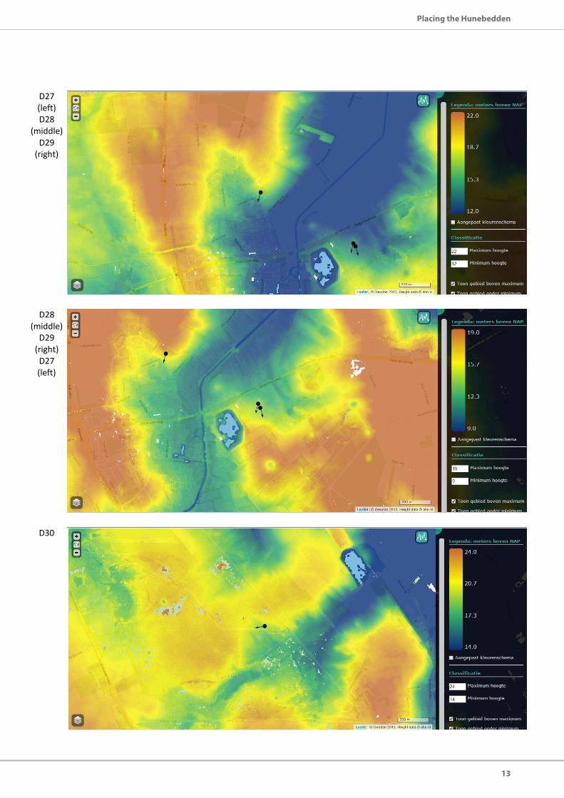
D27 (left) D28
(middle) D29
(right)
D28 (middle)
D29 (right) D27 (left)
D30

14
Roelien Rap
D31
D32
D34

15
Placing the Hunebedden
D35
D36 - D37
(left to right)
D38 – D40
(top to bottom)

16
Roelien Rap
D41 (top) D42
(middleD43
(bottom)
D42 (middle)
D41 (top) D43
(bottom)
D43 (bottom)
D41 (top) D42
(middle)

17
Placing the Hunebedden
D44 (bottom)
D42 (top) D43
(middle)
D45 (bottom)
D41 (top) D43
(middle)
D46 – D47
(top to bottom)

18
Roelien Rap
D49
D50-D51 (top to
bottom)
D52

19
Placing the Hunebedden
D53 – D54
(left to right)
G1