NOAA Fleet Update
32
1 NOAA Fleet Update December 2019 The following update provides the status of NOAA’s fleet of ships and aircraft, which play a critical role in the collection of oceanographic, atmospheric, hydrographic, and fisheries data. NOAA’s current fleet of 15 ships – the largest civilian research and survey fleet in the world – and nine aircraft, are operated, managed, and maintained by NOAA’s Office of Marine and Aviation Operations (OMAO). OMAO includes civilians, mariners, and officers of the United States NOAA Commissioned Officer Corps (NOAA Corps), one of the nation’s seven Uniformed Services.
Transcript of NOAA Fleet Update

1
NOAA Fleet
Update December 2019
The following update provides the status of NOAA’s fleet of ships and aircraft, which play a critical role in the collection
of oceanographic, atmospheric, hydrographic, and fisheries data. NOAA’s current fleet of 15 ships – the largest civilian
research and survey fleet in the world – and nine aircraft, are operated, managed, and maintained by NOAA’s Office of
Marine and Aviation Operations (OMAO). OMAO includes civilians, mariners, and officers of the United States NOAA
Commissioned Officer Corps (NOAA Corps), one of the nation’s seven Uniformed Services.

2
Table of Contents
OMAO’s Ships and Centers 5
National 5
OMAO’S MARINE OPERATIONS 5
New Castle, New Hampshire 6
NOAA Ship Ferdinand R. Hassler 6
Newport, Rhode Island 6
NOAA Ship Henry B. Bigelow 6
North Kingstown (Davisville), Rhode Island 6
NOAA Ship Okeanos Explorer 6
Norfolk, Virginia 7
NOAA Ship Thomas Jefferson 7
OMAO’S MARINE OPERATIONS CENTER – ATLANTIC (MOC-A) 7
Charleston, South Carolina 7
NOAA Ship Nancy Foster 7
NOAA Ship Ronald H. Brown 8
Pascagoula, Mississippi 8
NOAA Ship Pisces 8
NOAA Ship Oregon II 8
NOAA Ship Gordon Gunter 8
San Diego, California 9
NOAA Ship Reuben Lasker 9
Newport, Oregon 9
NOAA Ship Rainier 9
NOAA Ship Bell M. Shimada 9
OMAO’S MARINE OPERATIONS CENTER – PACIFIC (MOC-P) 10
Ketchikan, Alaska 11
NOAA Ship Fairweather 11
Kodiak, Alaska 11
NOAA Ship Oscar Dyson 11
Honolulu, Hawaii 11

3
NOAA Ship Oscar Elton Sette 11
OMAO’S MARINE OPERATIONS CENTER – PACIFIC ISLANDS (MOC-PI) 12
OMAO’s Aircraft 13
Lakeland, Florida 13
OMAO’S AIRCRAFT OPERATIONS CENTER (AOC) 13
P3 “Hurricane Hunter" [Tail ID# N42RF] 13
P3 “Hurricane Hunter" [Tail ID# N43RF] 13
G-IV “Hurricane Hunter" [Tail ID# N49RF] 14
King Air [Tail ID# N68RF] 14
Jet Prop Commander [Tail ID# N45RF] 15
Twin Otter [Tail ID# N46RF] 15
Twin Otter [Tail ID# N48RF] 15
Twin Otter [Tail ID# N56RF] 15
Twin Otter [Tail ID# N57RF] 16
Unmanned Aerial System (UAS) Section 16
Unmanned Systems Support 17
Nationwide 17
OMAO Partnerships 23
United States House of Representatives 23
National Science Foundation 23
Department of Defense – U.S. Pacific Command 23
Department of Defense – U.S. Northern Command 23
Department of Defense – U.S. Navy 24
Department of Homeland Security – U.S. Coast Guard 24
NOAA Teacher at Sea Program 25
NOAA Diving Program__ 26
NOAA Diving Center and Program 26
NOAA Small Boat Program 27
Office of Marine & Aviation Operations 28
NOAA Commissioned Officer Corps 30
OMAO/NOAA Corps Resources 32

4
OMAO Sites 32
Two Pagers, Reports, and Informational Slide Decks 32
Other Web Resources 32

5
OMAO’s Ships and Centers
OMAO’s Ship Tracker shows information about the present location of our fleet of research and survey ships. Please
note: To access Ship Tracker you must have an account with a .gov or .mil email address. All other access is restricted.
OMAO’s ships and related Marine Centers are listed below based on the geographical location of the vessels’ homeports
starting in the Northeast and ending in the Pacific.
NOAA Ship locations at the start of December, 2019.
[Photo Credit: NOAA]
National
OMAO’S MARINE OPERATIONS
Director of Marine Operations: Mr. Troy Frost
OMAO’s Marine Operations oversees the operations of OMAO’s ships and the three regional Centers, including the
Marine Operations Center-Pacific, Marine Operations Center-Atlantic, and Marine Operations Center-Pacific Islands.
Employees of Marine Operations are stationed nationwide to provide strategic, administrative, engineering,
maintenance, electronic, budgetary, and personnel support to the OMAO fleet. Each year these ships conduct dozens of
missions to assess fish and marine mammal stocks, conduct coral reef research, collect seafloor data to update nautical
charts, and explore the ocean.
6
New Castle, New Hampshire
NOAA Ship Ferdinand R. Hassler
Commanding Officer: Commander Mark Blankenship
Primary Mission Category: Hydrographic Surveys
In Port: Brooklyn, New York
Ship Status: Dry docked for repairs in Brooklyn, New York. Planned departure TBD.
Newport, Rhode Island
NOAA Ship Henry B. Bigelow
Commanding Officer: Captain William Mowitt
Primary Mission Category: Fisheries Research
In Port: Newport, Rhode Island
Ship Status: Alongside for scheduled repairs in Newport, Rhode Island until late February, 2020.
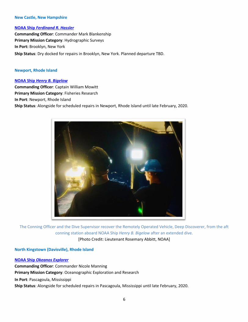
The Conning Officer and the Dive Supervisor recover the Remotely Operated Vehicle, Deep Discoverer, from the aft
conning station aboard NOAA Ship Henry B. Bigelow after an extended dive.
[Photo Credit: Lieutenant Rosemary Abbitt, NOAA]
North Kingstown (Davisville), Rhode Island
NOAA Ship Okeanos Explorer
Commanding Officer: Commander Nicole Manning
Primary Mission Category: Oceanographic Exploration and Research
In Port: Pascagoula, Mississippi
Ship Status: Alongside for scheduled repairs in Pascagoula, Mississippi until late February, 2020.

7
Norfolk, Virginia
NOAA Ship Thomas Jefferson
Commanding Officer: Commander Briana Hillstrom
Primary Mission Category: Hydrographic Surveys
In Port: Norfolk, Virginia
Ship Status: Alongside for scheduled repairs in Norfolk, Virginia until late February, 2020.
OMAO’S MARINE OPERATIONS CENTER – ATLANTIC (MOC-A)
Commanding Officer: Captain David Zezula
MOC-A serves as homeport for NOAA Ship Thomas Jefferson. Its personnel provide administrative and logistical support
and manage the day-to-day operations for the research and survey ships in NOAA's Atlantic and Gulf of Mexico fleet of
nine vessels. Each year, these ships conduct dozens of missions, to assess marine ecosystems including fish and marine
mammal stocks, coral reef research, collect seafloor data to update nautical charts, and explore the ocean.
Charleston, South Carolina
NOAA Ship Nancy Foster
Commanding Officer: Commander James Brinkley
Primary Mission Category: Oceanographic Research, Environmental Assessment
Inport: Charleston, South Carolina
Ship Status: Dry docked for scheduled repairs in Charleston, South Carolina until early February, 2020.
During the 2019 field season, the crew of NOAA Ship Nancy Foster deploy a Tucker Trawl (left) and a Conductivity,
Temperature, Depth sensor (CTD) (right).
[Photo Credit: (left) Lieutenant Kristin Sojka, NOAA; (right) Ivan Hurzeler, Subcontractor to BOEM]

8
NOAA Ship Ronald H. Brown
Commanding Officer: Commander Jeffrey Shoup
Primary Mission Category: Oceanographic Research, Environmental Assessment
Depart: Charleston, South Carolina
Arrive: Bridgetown, Barbados
Ship Status: Departed in early December for Western Boundary Time Series / Meridional Overturning Variability
Experiment (MOVE) project.
Pascagoula, Mississippi
NOAA Ship Pisces
Commanding Officer: Commander Patrick Murphy
Primary Mission Category: Fisheries Research
Inport: Pascagoula, Mississippi
Ship Status: Alongside for scheduled repairs in Pascagoula, Mississippi until February, 2020.
NOAA Ship Oregon II
Commanding Officer: Master David Nelson
Primary Mission Category: Fisheries Research
In Port: Pascagoula, Mississippi
Ship Status: Dry docked for scheduled repairs in Pascagoula, Mississippi until late March, 2020.
NOAA Ship Gordon Gunter
Commanding Officer: Lieutenant Commander Christopher Skapin
Primary Mission Category: Fisheries Research
In Port: Tampa, Florida
Ship Status: Dry docked for scheduled repairs in Tampa, Florida until early February, 2020.
NOAA Ship Gordon Gunter dry docked in Tampa, Florida, after a successful field season.
[Photo Credit: NOAA]

9
San Diego, California
NOAA Ship Reuben Lasker
Commanding Officer: Captain Chad Cary
Primary Mission Category: Fisheries Research
In Port: San Diego, California
Ship Status: Alongside for scheduled repairs in San Diego, California until early January, 2020.
Newport, Oregon
NOAA Ship Rainier
Commanding Officer: Commander Samuel Greenaway
Primary Mission Category: Hydrographic Surveys In Port: Vallejo, California Ship Status: Dry docked for scheduled repairs in Vallejo, California until February, 2020.
NOAA Ship Rainier’s Change of Command at Mare Island Shipyard in Vallejo, California, in November 2019.
[Photo Credit: HSST Audrey Jerauld, NOAA]
NOAA Ship Bell M. Shimada
Commanding Officer: Captain Arthur “Jesse” Stark
Primary Mission Category: Fisheries Research
In Port: Vallejo, California Ship Status: Dry docked for scheduled repairs in Vallejo, California until February, 2020.

10
NOAA Ship Bell M. Shimada departs Newport, Oregon in November for a dry dock repair period in Vallejo, California.
[Photo Credit: NOAA]
OMAO’S MARINE OPERATIONS CENTER – PACIFIC (MOC-P)
Commanding Officer: Captain Michael Hopkins
MOC-P serves as a homeport for two NOAA ships. Its personnel provide administrative and logistical support, and
manage the day-to-day operations, for the research and survey ships in NOAA's Pacific fleet. Each year, these ships
conduct dozens of missions to assess fish and marine mammal stocks, conduct coral reef research, collect seafloor data
to update nautical charts, and explore the ocean. MOC-P also serves as the home of OMAO’s Marine Operations.
MOC-P has two USCG-approved classrooms for professional training. NOAA Corps officers take a USCG-approved ECDIS
(Electronic Chart Display Information System) course in Newport, Oregon in November, 2019.
[Photo Credit: Lieutenant Commander Timothy Sinquefield, NOAA]

11
Ketchikan, Alaska
NOAA Ship Fairweather
Commanding Officer: Captain Marc Moser
Primary Mission Category: Hydrographic Surveys
In Port: Seattle, Washington Ship Status: Alongside for scheduled repairs in Seattle, Washington until February, 2020.
Kodiak, Alaska
NOAA Ship Oscar Dyson
Commanding Officer: Commander Sarah Duncan
Primary Mission Category: Fisheries Research
In Port: Newport, Oregon
Ship Status: Alongside for scheduled repairs in Newport, Oregon until January, 2020.
The view of NOAA Ship Oscar Dyson from MOC-P, where she is undergoing major dockside repairs.
[Photo: Lieutenant Commander Timothy Sinquefield, NOAA]
Honolulu, Hawaii
NOAA Ship Oscar Elton Sette
Commanding Officer: Commander Tony Perry III
Primary Mission Category: Fisheries Research
Inport: Honolulu, Hawaii
Ship Status: Alongside for scheduled repairs in Honolulu, Hawaii until January, 2020. On December 17th, Commander
Tony Perry III relieved Commander Héctor Casanova as Commanding Officer.

12
OMAO’S MARINE OPERATIONS CENTER – PACIFIC ISLANDS (MOC-PI)
Commanding Officer: Captain Joe Bishop
MOC-PI serves as a homeport for one NOAA ship. Its personnel provide administrative and logistical support, and
manage the day-to-day operations for NOAA Ship Oscar Elton Sette and for ships operating in the western Pacific. Each
year, these ships conduct dozens of missions to assess fish and marine mammal stocks, conduct coral reef research,
collect seafloor data to update nautical charts, and explore the ocean.
NOAA’s MOC-PI (Ford Island; Honolulu, Hawaii) with NOAA ship Oscar Elton Sette alongside
[Photo Credit: Lieutenant (Junior Grade) Christopher Gallagher, NOAA]

13
OMAO’s Aircraft
Lakeland, Florida
OMAO’S AIRCRAFT OPERATIONS CENTER (AOC)
Commanding Officer: Commander Christian Sloan
The AOC, located at Lakeland Linder Regional Airport in Lakeland, Florida, serves as the main base for OMAO’s fleet of
nine aircraft and provides capable, mission-ready aircraft and professional crews to the scientific community. Whether
studying global climate change or acid rain, assessing marine mammal populations, surveying coastal erosion,
investigating oil spills, flight checking aeronautical charts, or improving hurricane prediction models, the AOC flight
crews continue to operate in some of the world's most demanding flight regimes. On December 2nd, Commander
Christian Sloan relieved Captain Timothy Gallagher as AOC Commanding Officer.
AOC personnel and aircraft in the hangar at the NOAA Aircraft Operations Center in Lakeland, Florida
[Photo Credit: NOAA]
AOC is committed to the safe, efficient and economical use of NOAA aircraft and has more than four decades of
experience developing, coordinating and successfully and safely conducting airborne environmental data gathering
missions. OMAO’s aircraft fleet includes the following platforms and the web links provide additional photos,
information on each aircraft, and the missions they serve:
P-3 “Hurricane Hunter" [Tail ID# N42RF]
Training and science test flights scheduled.
P-3 “Hurricane Hunter" [Tail ID# N43RF]
The aircraft is in scheduled maintenance.

14
NOAA P-3 Orion, “Miss Piggy”, prior to deployment to the Eastern Caribbean to fly reconnaissance missions into
Hurricane Lorenzo, in September, 2019.
[Photo Credit: NOAA]
G-IV “Hurricane Hunter" [Tail ID# N49RF]
The aircraft is in scheduled maintenance.
King Air 350 [Tail ID# N68RF]
Who: Officers and crew of OMAO/NOAA Corps along with scientists from the National Ocean Service, NGS Grav-D
Program
What: Gravity for the Redefinition of the American Vertical Datum (GRAV-D)
When: December 7 - December 22
Where: Midwest/Southeast U.S.
Why: Grid pattern flight lines will be flown at 20,000 feet while collecting GPS and inertial data to update the U.S.
vertical datum. A vertical datum is a base measurement point (or set of points) from which all elevations are
determined.
Jet Prop Commander
[Photo Credit: NOAA]

15
Jet Prop Commander [Tail ID# N45RF]
Training flights scheduled.
Twin Otter [Tail ID# N46RF]
Training flights scheduled.
NOAA Twin Otter N46RF flying above North Dakota in November.
[Photo Credit: Lieutenant Conor Maginn, NOAA]
Twin Otter [Tail ID# N48RF]
Who: Officers and crew of OMAO/NOAA Corps along with scientists from the National Marine Fisheries Service (NMFS),
Southeast Fisheries Science Center (SEFSC)
What: Southeast North Atlantic Right Whale Surveys
When: December 7 - March 31
Where: St. Simons Island, Georgia
Why: Provide real time sighting information to commercial shipping interests in an effort to reduce ship collisions, to
better understand the distribution and abundance, and collect photographic images of critically endangered North
Atlantic Right Whales. With as few as 400 remaining, surveillance flights to track their migration patterns are important
for conservation and recovery efforts.
Twin Otter [Tail ID# N56RF]
Who: Officers and crew of OMAO/NOAA Corps along with scientists from the National Marine Fisheries Service (NMFS),
Northeast Fisheries Science Center (NEFSC)
What: Northeast North Atlantic Right Whale Surveys
When: December 7 - December 22
Where: Cape Cod, Massachusetts
Why: Provide real time sighting information to commercial shipping interests in an effort to reduce ship collisions, to
better understand the distribution and abundance, and collect photographic images of critically endangered North
Atlantic Right Whales. With as few as 400 remaining, surveillance flights to track their migration patterns are important
for conservation and recovery efforts.

16
Twin Otter [Tail ID# N57RF]
Who: Officers and crew of OMAO/NOAA Corps along with scientists from National Marine Fisheries Service (NMFS),
Northeast Fisheries Science Center (SEFSC)
What: Southeast Atlantic Marine Assessment Program for Protected Species (AMAPPS)
When: December 7 - January 25
Where: Fort Lauderdale, Florida (additional cities TBD)
Why: Improved information is needed on living marine resource abundance, distribution, habitat use, and behavior in
the Atlantic Ocean to properly mitigate and monitor for potential impacts of human activities, including those related to
offshore energy development.
Unmanned Aerial System (UAS) Section
The UAS Section provides nationwide policy input, oversight, and guidance for all of NOAA’s UAS operations. The UAS
Section of AOC is staffed by a team of aviation professionals who specialize in operational UAS implementation. The UAS
Section tracks all small UAS (sUAS) operations for NOAA to include aircraft hours, types, pilot qualifications, and pilot
training. The UAS Section also coordinates airspace approvals for operations within the United States National Airspace
System, special use airspace, and foreign airspace. AOC conducts a thorough review of all projects by applying
established risk management procedures to UAS missions, including an airworthiness review of all aircraft. This support
is provided to NOAA Line Offices and partners to further develop and refine the use of sUAS for NOAA’s research and
data collection.

17
Unmanned Systems Support
Nationwide
APH-22 Hexacopter
Location: Oahu, Hawaii Mission: Pacific Islands Fisheries Science Center APH-22 Training Pacific Islands Fisheries Science Center utilizes the Kawainui Model Airplane Field to conduct training and proficiency flights. This allows APH-22 operators to maintain proficiency for future operations at a reduced cost. Training flights are also approved from NOAA small boats.
Location: San Miguel Island, California Mission: Marine Mammal Laboratory/Alaska Fisheries Science Center/NOAA Fur Seals and California Sea Lions Marine Mammal Laboratory's California Current Ecosystem Program is conducting northern fur seal and California sea lion surveys to identify tagged/branded individuals and conduct population assessments.
Location: Sea Life Park and Dolphin Quest Oahu, Hawaii Mission: Pacific Islands Fisheries Science Center Cetacean Research Program Images taken by the APH-22 are used to collect photogrammetric measurements of captive cetaceans. Photogrammetric measurements are compared with the known manual measurements to determine accuracy. Consistent trade winds can make image collection difficult. Practices found to improve image quality and accuracy can be used to improve operations over wild populations
APH-22 Hexacopter APH-28 Hexacopter Image taken by an APH-28 Hexacopter
APH-28 Hexacopter
Location: Cape Shirreff, Livingston Island, Antarctica Mission: Antarctic Ecosystem Research Division Cape Shirreff The Antarctic Ecosystem Research Division will conduct flights to survey Penguin and Seal Colonies in Cape Shirreff, Livingston Island, Antarctica.
APH-22 Hexacopter / APH-28 Hexacopter
Location: Muskeget Island, Massachusetts Mission: Northeast Fisheries Science Center Grey Seal Survey Northeast Fisheries Science Center is conducting Grey Seal Pup surveys on Muskeget Island using the APH-22 and APH-28.
18
Location: Woods Hole, Massachusetts Mission: NMFS Northeast Fisheries Science Center Training sites Northeast Fisheries Science Center is approved to conduct proficiency and demonstration flights at Woods Hole Pier, Waquoit Bay National Estuarine Research Reserve, and nearshore waters in the Woods Hold area. Location: NOAA Aircraft Operations Center, Lakeland, Florida Mission: New Aircraft The NOAA Aircraft Operations Center acquired 1 APH-22 and 1 APH-28 for training, testing and fleet support. Training flights will be conducted monthly.
Location: Western Regional Center, NOAA Campus, Seattle, Washington Mission: Alaska Fisheries Science Center Training Site Alaska Fisheries Science Center has been approved to conduct proficiency training, manufacturer training, and payload calibration flights at the Western Regional Center-Seattle, NOAA Campus. These flights will allow Alaska Fisheries Science Center to remain proficient and prepare for upcoming projects.
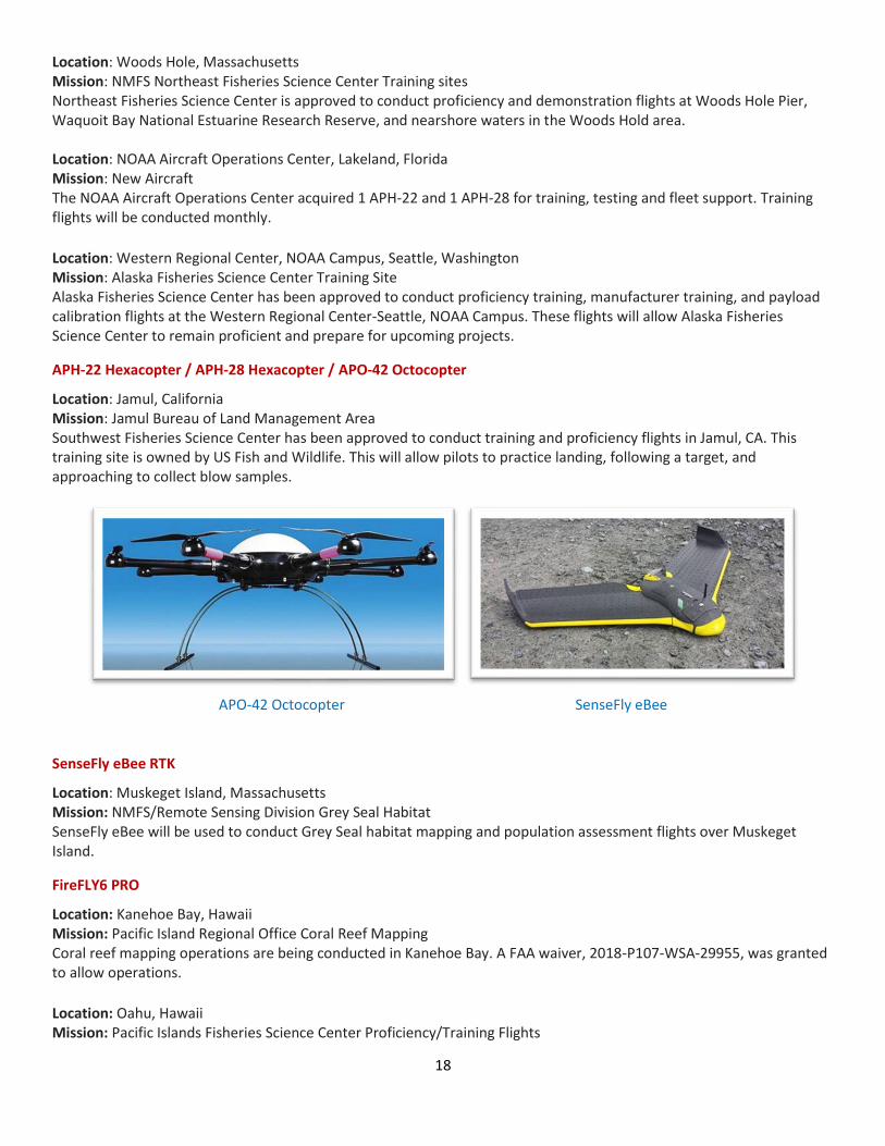
APH-22 Hexacopter / APH-28 Hexacopter / APO-42 Octocopter
Location: Jamul, California Mission: Jamul Bureau of Land Management Area Southwest Fisheries Science Center has been approved to conduct training and proficiency flights in Jamul, CA. This training site is owned by US Fish and Wildlife. This will allow pilots to practice landing, following a target, and approaching to collect blow samples.
APO-42 Octocopter SenseFly eBee
SenseFly eBee RTK
Location: Muskeget Island, Massachusetts Mission: NMFS/Remote Sensing Division Grey Seal Habitat SenseFly eBee will be used to conduct Grey Seal habitat mapping and population assessment flights over Muskeget Island.
FireFLY6 PRO
Location: Kanehoe Bay, Hawaii Mission: Pacific Island Regional Office Coral Reef Mapping Coral reef mapping operations are being conducted in Kanehoe Bay. A FAA waiver, 2018-P107-WSA-29955, was granted to allow operations.
Location: Oahu, Hawaii Mission: Pacific Islands Fisheries Science Center Proficiency/Training Flights

19
Kawainui Model Airplane Field will be used monthly to perform proficiency flights for Pacific Islands Fisheries Science Center operators. The main objective will be to practice hand launches, recoveries and locating targets. These flights are essential in providing the necessary skills needed for successful operations. Location: Jamul, California Mission: Southwest Fisheries Science Center Proficiency Flights Southwest Fisheries Science Center is utilizing the BLM Jamul California site to conduct proficiency flights.
FireFly 6 PRO 3DR Solo
3DR Solo
Location: MOC-P, Newport, Oregon Mission: Public Outreach and ship inspection The UAS will proceed to take aerial photographs from the MOC-P pier. An FAA Certificate of Authorization (COA) has been granted for operations in the Class E airspace around MOC-P. AOC has received and installed updated software that will allow marine-based UAS operations. Location: Roanoke (Virginia) and Charleston (South Carolina) Weather Forecast Offices (WFO) Mission: New mission 3DR Solos have been deployed to these Weather Forecast Offices for the National Weather Service to integrate UAS into their mission. Original Equipment Manufacturer training or equivalent has been conducted in preparation for future operations. Location: Alafia River State Park (Tampa-area), Florida Mission: AOC airworthiness 3DR Solo airworthiness flights at Alafia River State Park. Meteodrone SSE / Blackswift S-2
Location: Oak Ridge, Tennessee Mission: Instrument Testing and Calibration A combination of these UAS will be used to conduct flights to in an experiment at Oliver Springs Airport up to 3500’ in altitude. Operation will occur under an approved COA.

20
Blackswift S2 Meteomatics Meteodrone SSE MD4-1000
Meteodrone SSE / Blackswift S-2
Location: Oak Ridge, Tennessee Mission: Instrument Testing and Calibration A combination of these will be used to conduct vertical profile flights to at Oliver Springs Airport up to 1,200’ in altitude. The NOAA Class G Blanket COA is utilized for these operations.
MD4-1000 / Meteodrone SSE / Blackswift S-2
Location: Oak Ridge, Tennessee Mission: Instrument Testing and Calibration A combination of these will be used to conduct vertical profile flights to at Oliver Springs Airport up to 1,200’ in altitude. The NOAA Class G Blanket COA is utilized for these operations.
DJI S-1000 Matrice 210
Matrice 210 / DJI Phantom 4
Location: Santa Barbara, California Mission: Payload testing and training Payload and software testing flights are being conducted at University of California Santa Barbara. Location: Newport, Oregon Mission: Remote Sensing Division/Office of Coast Survey MOC-P testing and training Remote Sensing Division and Office of Coast Survey are developing procedures and protocols for static launch and recovery of the Matrice 210 system. Launch and recovery training from a ship is being conducted.

21
DJI Phantom 4 Image taken from Phantom 4
DJI Phantom 4
Location: Pivers Island, North Carolina Mission: National Centers for Coastal Ocean Science Pivers Island Method development flights will be conducted to determine the most efficient way of mapping intertidal wetlands and shallow nearshore habitats. For the purpose of tracking changes in vegetative cover and creating digital elevation models.
DJI Phantom 4 / DJI Mavic
Location: Norfolk, Virginia Mission: NOAA Ship Thomas Jefferson, Proficiency Training DJI Phantom 4 and Mavic Zoom proficiency flights are being conducted at Marine Operations Center Atlantic. Location: Newport, Oregon Mission: Remote Sensing Division/Office of Coast Survey MOC-P testing and training Six personnel are being trained to operate the DJI Mavic and Phantom 4. Operations are being conducted at the MOC-P facility.
DJI M6000
Location: Santa Barbara, California Mission: University of California Santa Barbara M600 Test Flights National Marine Fisheries Science is planning flights at University of California Santa Barbara to test and validate a hyperspectral scanner payload.

22
DJI M600 Planck Shearwater Latitude FVR-55
Planck Shearwater
Location: Nearshore Maui, Hawaii
Mission: Channel Islands National Marine Sanctuary Shearwater Training and Testing Channel Islands National Marine Sanctuary will be conducting flights in and around the Hawaiian Islands Humpback Whale National Marine Sanctuary. Flights will be conducted to train personnel and assess the Planck Shearwaters ability to support whale disentanglement efforts.
L3 Latitude FVR-55
Location: Lakeland, Florida Mission: Atomic 2020/Initial Testing/Payload integration The L3 Latitude FVR-55 UAS will support operations from the NOAA Ship Ronald H. Brown in January and February FY20. Payloads have been designed for the vehicle to support NOAA Office of Atmospheric Research Pacific Marine Environmental Laboratory’s project goals for the upcoming Atomic 2020 project. A charter vessel is expected to be utilized for additional aircraft testing.
L3 Latitude FVR-55
Location: Aircraft Operations Center, Lakeland, Florida Mission: P-3 Deployed UAS AOC, Hurricane Research Division and the Unmanned Aircraft Systems Program Office are currently exploring new vehicle options for a hurricane deployed UAS.

23
OMAO Partnerships
OMAO and the NOAA Commissioned Officer Corps provide key services and leadership to a number of federal agencies
and external partners to help them meet their mission – and ours – and to better leverage federal resources.
United States House of Representatives - Natural Resource Committee
Location: Washington, District of Columbia
Detail: Lieutenant Commander Zachary Cress
Lieutenant Commander Cress is currently on detail with the staff to the Committee Chair, Representative Raúl M.
Grijalva (D-AZ), where he is assisting on activities pertaining to the Committee’s work on oversight and authorization of
NOAA programs, as well as other matters within the Committee’s jurisdiction.
National Science Foundation (NSF)
Location: South Pole, Antarctica
Embedded Liaison: Lieutenant (Junior Grade) Marisa Gedney
Members of the NOAA Commissioned Officer Corps carry out NOAA’s mission in remote locations across the globe.
Lieutenant (Junior Grade) Gedney is assigned to Antarctica where she serves as the Station Chief for NOAA’s
Atmospheric Research Observatory (ARO) at the Amundsen-Scott South Pole Station. The ARO at the Amundsen-Scott
South Pole Station is a National Science Foundation facility used in support of scientific research related to atmospheric
phenomena.
Department of Defense – U.S. Pacific Command
Location: Honolulu, Hawaii
Embedded Liaison: Captain Joe Bishop
The U.S. Pacific Command (USPACOM) area of responsibility encompasses approximately half the earth’s surface and
more than half of its population. The 36 nations that comprise the Asia-Pacific include: two of the three largest
economies and nine of the ten smallest; the most populous nation; the largest democracy; the largest Muslim-majority
nation; and the smallest republic in the world. The region is a vital driver of the global economy and includes the world’s
busiest international sea lanes and nine of the ten largest ports. By any meaningful measure, the Asia-Pacific is also the
most militarized region in the world, with seven of the world’s ten largest standing militaries and five of the world’s
declared nuclear nations. Under these circumstances, the strategic complexity facing the region is unique. Captain
Bishop is linked closely with the activities within the region allowing for identification of opportunities and cooperation
between USPACOM and NOAA, and better overall government function situational awareness in the region.
Department of Defense – U.S. Northern Command
Location: Boulder, Colorado
Embedded Liaison: Captain Catherine Martin
The U.S. Northern Command (USNORTHCOM) area of responsibility includes air, land and sea approaches and
encompasses the continental United States, Alaska, Canada, Mexico and the surrounding water out to approximately
500 nautical miles. It also includes the Gulf of Mexico, the Straits of Florida, and portions of the Caribbean region to

24
include The Bahamas, Puerto Rico, and the U.S. Virgin Islands. The commander of USNORTHCOM is responsible for
theater security cooperation with Canada, Mexico, and The Bahamas. The embedded NOAA liaison is linked closely with
the activities within the region allowing for identification of opportunities and cooperation between USNORTHCOM and
NOAA, and serves as a liaison between fostering greater situational awareness of NOAA response activities to natural
disasters and Arctic activities.
Department of Defense – U.S. Navy
Location: Stennis Space Center, Mississippi
Embedded Liaison: Lieutenant (junior grade) Garrison Grant
Embedded in the Navy’s Naval Oceanography Mine Warfare Center, Lieutenant (junior grade) Garrison Grant works side
by side with Navy officers operating Unmanned Underwater Vehicles worldwide and is currently stationed at Stennis
Space Center. This collaboration will provide knowledge and experience that will keep NOAA on the cutting edge of this
emerging technology as well as strengthen the partnership between NOAA and the Navy.
Department of Homeland Security – U.S. Coast Guard
Location: Washington, District of Columbia
Embedded Liaison: Captain Kurt Zegowitz
As the NOAA liaison to the United States Coast Guard (USCG), Captain Zegowitz maintains a current and comprehensive
knowledge of interagency activities and policies related to the USCG and NOAA. He identifies potential conflicts or
benefits issues for analysis and evaluation, conducts appropriate assessments and studies, and serves as the interface
between NOAA and the USCG. Captain Zegowitz initiates, designs, and implements strategies through federal agency
liaison and coordination that results in cooperative arrangements for maritime security, oceanographic research,
hazardous materials spill response, and many other activities.

25
NOAA Teacher at Sea Program
The mission of NOAA’s Teacher at Sea Program (TAS) is to provide teachers hands-on, real-world research experience
working at sea with world-renowned NOAA scientists, thereby giving them unique insight into oceanic and atmospheric
research crucial to the nation. The program provides a unique opportunity for kindergarten through college-level
teachers to sail aboard NOAA research ships and work under the tutelage of scientists and crew.
Since its inception in 1990, the program has enabled more than 800 teachers to gain first-hand experience of science
and life at sea. By participating in this program, teachers enrich their classroom curricula with knowledge that can only
be gained by living and working side-by-side, day and night, with those who contribute to the world’s body of oceanic
and atmospheric scientific knowledge. Former teacher at sea blogs can be accessed, which document their missions at
sea and offer a wealth of information about the research being conducted as well as personal stories.
The 2019 TAS Field Season ended in October. Applications for the 2020 Field Season were accepted ahead of a deadline
on November 30, 2019.
NOAA Teacher at Sea Kathy Schroeder holds up a king snake eel captured during a longline survey in the Gulf of Mexico
aboard NOAA Ship Oregon II, in October. (Photo Credit: NOAA)

26
NOAA Diving Program Seattle, Washington
NOAA Diving Center and Program
OMAO manages and implements NOAA’s Diving Program (NDP), which trains and certifies scientists, engineers, and
technicians from federal, state, tribal governments, and the private sector to perform the variety of tasks carried out
underwater to support NOAA’s mission. NDP also has cooperative diving agreements with over 100 government
agencies and academic institutions. NOAA has approximately 350 divers who perform over 8,000 dives per year and
leverages its cooperative agreements to accomplish twice that number of dives contributing to scientific research. The
NDP is headquartered at the NOAA Diving Center (NDC), which is located at the NOAA Western Regional Center in
Seattle, Washington.
With most diving units experiencing a slower operational tempo in the winter months, The NOAA Diving Center staff
have shifted their efforts to making sure dive units are prepared for the upcoming field season. The major task at hand
currently is preparing for the January NOAA Diver Training that will be taking place in Key West, Florida. Hosting the
training off-site requires the coordination of logistics months in advance. NDC works with the Florida Keys National
Marine Sanctuary and U.S. Army Special Forces training facility to make the training possible which requires classroom
space, pool facilities as well as access to open water environments. Currently, NDC's 10-ft conex box is being packed
with (literally) tons of gear and equipment to be sent to Key West. NDC is anticipating a full roster and hopes to have 18
new divers and 10 new divemasters ready to report to the field for diving duty by February.
The lull in the field season is also a great time to conduct internal training. One of the NOAA Dive Center’s instructors
recently spent three weeks in the frozen Cascade Mountains outside of Seattle attending Wilderness EMT training.
Given the remote areas where NOAA Divers operate, higher levels of care are often hours away by airlift so having
Wilderness EMT trained personnel increases the ability to respond to emergencies (dive-related or otherwise) in the
field.
Aside from the NOAA Diver and Divemaster training taking place January 6-24 in Key West, NDC is also starting to plan
the UDS (Unit Dive Supervisor) Workshop that will take place in March, 2020.

27
NOAA Small Boat Program
Direction, technical and administrative support is provided by OMAO through the NOAA Small Boat Program Office.
Oversight of the NOAA Small Boat Fleet is a collaboration across OMAO, NMFS, NOS, OAR and NWS. The Small Boat
Program (SBP) was established in 2004 to create policies and procedures to ensure safety in support of NOAA’s field
operations. NOAA Line and Program Offices are responsible for acquisitions, operational funding and mission support.
The NOAA Small Boat Safety Board is comprised of NOAA Line Offices, SBP, and Safety and Environmental Compliance
Office (SECO) representatives and is charged with initiating policies and training, program metrics, and compliance.
In addition to its ships and aircraft, NOAA relies on hundreds of small boats located throughout the country to complete
the organization’s complex and varied scientific missions. The NOAA Small Boat Program is committed to supporting the
safe operation of these small boats through the principles of risk management.
The NOAA Small Boat Program manages a fleet of about 400 small boats that perform various data collection missions
for NOAA throughout the United States and its territories including hydrographic surveys, fishing, diving, scientific
instrument deployment/recovery, water and air quality monitoring, law enforcement and marine mammal surveys.
Vessels vary in size from a simple 10-ft. kayak to a complex 85-foot research vessel. The majority of small boats fall
within the range of 16-26 feet in length and operate in near-shore environments, but extended missions in deep water
environments are common among the larger vessels.
The Small Boat Program Office and Safety Board held a NOAA Small Boat Summit in St. Petersburg, Florida in early
November at the Florida Fish & Wildlife Research Institute. NOAA’s Deputy Under Secretary for Operations, Benjamin
Friedman, was the keynote speaker on the opening day. In attendance were 114 people from most of NOAA’s Line
Offices. The goal of the 2019 Small Boat Summit was a focus on safety, new technologies and resources for small boat
operations. The summit provided resources, training, exchanges of best industry practices and networking opportunities
for the NOAA small boat community who hold responsibilities for maintaining safety and assuring mission success.
Attendees at the NOAA Small Boat Summit in St. Petersburg, Florida in November.
[Photo Credit: NOAA]

28
Office of Marine and Aviation Operations Providing Environmental Intelligence for a Dynamic World
The personnel, ships, and aircraft of NOAA play a critical role in gathering environmental data vital to the nation's
economic security, the safety of its citizens, and the understanding, protection, and management of our natural
resources. The NOAA fleet of ships and aircraft is managed and operated by the Office of Marine and Aviation
Operations (OMAO), an office comprising civilians, mariners, and officers of the NOAA Commissioned Officer Corps, one
of the seven uniformed services of the United States. NOAA's roots trace back to 1807 when President Thomas Jefferson
ordered the first comprehensive coastal survey. Those early surveys ensured safe passage of ship-borne cargo for a
young nation. As the needs of the nation have grown, so too have OMAO's responsibilities. Today, OMAO civilians and
NOAA Corps officers operate, manage, and maintain NOAA's active fleet of 15 research and survey ships and 9
specialized aircraft. Together, OMAO and the NOAA Corps support nearly all of NOAA's missions.
NOAA has the largest fleet of federal research and survey ships in the nation. The fleet ranges from large oceanographic
ships capable of exploring and charting the world's deepest ocean, to smaller vessels responsible for surveying the
shallow bays and inlets of the United States. The fleet supports a wide range of marine activities including fisheries
surveys, nautical charting, and ocean and climate studies. Based throughout the continental United States, Alaska, and
Hawaii, the ships operate in all regions of the nation and around the world.
NOAA's aircraft provide a wide range of airborne capabilities. Our highly specialized Lockheed WP-3D aircraft are
equipped with an unprecedented variety of scientific instrumentation, radars, and recording systems for both in situ and
remote sensing measurements of the atmosphere, the Earth, and its environment. Equipped with both C-band weather
radar and X-band tail Doppler radar systems, the WP-3Ds have the unique ability to conduct tropical cyclone research in
addition to storm reconnaissance. Together with NOAA's Gulfstream IV-SP jet, these ‘hurricane hunter’ aircraft greatly
improve our physical understanding of hurricanes and enhance the accuracy of tropical cyclone forecasts. NOAA's light
aircraft also play a vital role in monitoring our environment. Our King Air, Turbo Prop Commander, and Twin Otter
aircraft support marine mammal population studies, shoreline change assessments, oil spill investigations, and water
resource/snowpack surveys for spring flood forecasts.

29
The NOAA fleet provides immediate response capabilities for unpredictable events. For example, during the 2019
Hurricane season, NOAA flight crews and scientists flew a combined 468 hours for hurricane surveillance, research,
reconnaissance, and emergency response. NOAA’s Lockheed WP-3D and Gulfstream IV-SP collected and provided vital
data used by NOAA scientists for improving modeling, forecasting, and ensuring accurate forecasts were provided to the
public. NOAA’s Beechcraft King Air 350 rapidly responded to demand from emergency managers, using state-of-the-art
equipment to collect thousands of aerial images from Miami, Florida to Norfolk, Virginia, and the northern Bahamas, of
damaged and affected communities following Hurricane Dorian. This imagery provided a timely and cost-effective way
to better understand the damage sustained to both property and the environment.
While manned aircraft and sea-going vessels have been, and will continue to be, a primary source of environmental
data, new technology will have a significant role to play in the future NOAA fleet. OMAO, in coordination with other
NOAA offices and federal agencies, is evaluating and deploying unmanned aerial and marine systems that could
significantly contribute to environmental observations. To better serve the needs of the Nation, NOAA is examining the
composition of the fleet through an exhaustive and critical review of at-sea science and observation requirements. Our
objective is to develop a clear, cost-efficient path forward to ensure that the NOAA fleet can continue to conduct at-sea
surveys and research vital to fisheries management, updating nautical charts, responding to natural and manmade
disasters, and understanding coastal and marine systems more fully. Meeting these requirements is essential to the
development of sustainable, science-based management and conservation plans that protect the health and resiliency
of these resources over the long-term.
We continue our efforts to build a civilian and NOAA Corps officer workforce that is uniquely qualified to gather critical
environmental intelligence and be adaptive and responsive to a changing world and work to expand our partnerships
with other federal agencies. For example, NOAA Corps officers are currently assigned to work in the Department of
Defense, National Science Foundation, and the U.S. House Representatives among others where they lend their
leadership, expertise and service. We also continue to strengthen our partnership with the Department of Homeland
Security through the U.S. Coast Guard. Our basic NOAA Corps officer training class is held at the U.S. Coast Guard
Academy, where newly commissioned officers train alongside Coast Guard officer candidates, developing skills and
professional relationships that will benefit both services, especially during challenging times. Active collaboration the
Federal family is critical to ensuring the long-term capability and success of the federal ocean infrastructure. Our
partners' success is our success.

30
NOAA Commissioned Officer Corps – Honor, Respect, Commitment –
The NOAA Commissioned Officer Corps is one of the United States’ seven Uniformed Services and commissioned officers
serve with the ‘special trust and confidence’ of the President. NOAA Corps officers are an integral part of the National
Oceanic and Atmospheric Administration, an agency of the U.S. Department of Commerce. With an authorized strength
of 321 officers, the NOAA Corps serves throughout the agency’s Line and Staff Offices to support nearly all of NOAA’s
programs and missions. The combination of commissioned service and scientific expertise makes these officers uniquely
capable of leading some of NOAA’s most important initiatives. The NOAA Corps is part of NOAA’s Office of Marine and
Aviation Operations and traces its roots back to the former U.S. Coast and Geodetic Survey, which dates back to 1807
and President Thomas Jefferson. The U.S. Coast and Geodetic Survey Corps was founded in 1917 to provide officers to
command U.S. coastal survey ships and field survey parties locally and abroad. In 1970, NOAA was created to develop a
coordinated approach to oceanographic and atmospheric research and subsequent legislation converted the
commissioned officer corps to the NOAA Corps. The NOAA Corps today provides a cadre of professionals trained in
engineering, earth sciences, oceanography, meteorology, fisheries science, and other related disciplines. Corps officers
operate NOAA’s ships, fly aircraft, manage research projects, conduct diving operations, and serve in staff positions
throughout NOAA. The NOAA Corps celebrated its Centennial year in 2017.
Benefits of the NOAA Corps to the Nation
The combination of commissioned service with scientific and operational expertise, allows the NOAA Corps to provide a
unique and indispensable service to the nation. Discipline and flexibility are inherent in the NOAA Corps personnel
system. Officers are trained for positions of leadership and command in the operation of ships and aircraft; in the
conduct of field projects on land, at and under the sea, and in the air; in the management of NOAA observational and
support facilities; as members or leaders of research efforts; and in the management of various organizational elements
throughout NOAA. NOAA Corps officers must be technically competent to assume positions of leadership and command
in NOAA and Department of Commerce programs and in the Armed Forces during times of war or national emergency.
NOAA Corps officers enable NOAA to fulfill mission requirements, meet changing environmental concerns, take
advantage of emerging technologies, and serve as environmental first responders. For example:
• In 2019, NOAA aircraft flew over 468 hours in support of storm reconnaissance, surveillance, research and
emergency response. NOAA assets performed multiple operations in the Gulf of Mexico, North Atlantic and the
Caribbean for Hurricanes Barry, Dorian, Humberto, Jerry, Lorenzo and Tropical Storm Nestor. During the
reconnaissance of Hurricane Lorenzo, NOAA’s two Orion P-3s provided on-scene coordination during the Search and
Rescue operation for the M/V Bourbon Rhode. In response to Hurricane Dorian, NOAA’s King Air 350 flew post-
storm, damage assessment imagery over areas of the northern Bahamas, and of the U.S. east coast from the north
end of the Florida Keys to Virginia Beach, Virginia. Nearly 27,000 images were collected, covering over 11,000 square
kilometers, including shorelines, ports, and impacted inland areas of several islands to aid in emergency response.
• In 2018, NOAA aircraft flew over 556 hours in support of storm reconnaissance, surveillance, research and
emergency response for Hurricanes Hector, Lane, and Norman in the Central Pacific, and Hurricanes Chris, Florence,
Gordon, Isaac, and Michael in the Gulf of Mexico, North Atlantic, and Caribbean Sea. In response to Hurricane
Florence, NOAA Ship Ferdinand R. Hassler surveyed eastern North Carolina for multiple days in order to ensure
vessels could safely navigate the area. NOAA Ship Thomas Jefferson conducted 66 days of post-Hurricane Maria
surveys in and around Puerto Rico to support the island’s recovery efforts.

31
• In 2017, NOAA aircraft flew over 600 hours in support of storm reconnaissance, surveillance, research, and
emergency response for Hurricanes Harvey, Irma, Jose, Maria, and Nate. NOAA Ship Thomas Jefferson conducted
post-storm surveys of waterways of Puerto Rico following Hurricane Maria to help re-open the ports for maritime
delivery of critical supplies to the island.
• The BP Deepwater Horizon oil spill was the worst oil disaster in U.S. history. The NOAA fleet and the NOAA Corps
played a major role in the response to the Deepwater Horizon oil spill. NOAA's entire Atlantic fleet and over a
quarter of the total strength of the NOAA Corps were deployed to the Gulf of Mexico following this devastating
event.

32
OMAO/NOAA Corps Resources
OMAO Sites
• OMAO
• NOAA Corps
Two Pagers, Reports, and Informational Slide Decks
• Monthly NOAA Fleet Update - The latest version is provided to Committee staff and is also available through the Office of Legislative and Intergovernmental Affairs.
• Hurricane Michael Flight and Mission Info Recap - 2018
• Tornado Formation, Intensity, and Path for the Southeast United States: Research Flight and Mission Info Recap – 2018
• Hurricane Lane Flight and Mission Info Recap - 2018
• OMAO two pager with Recent Mission Highlights – 2018
• OMAO Fleet Recapitalization Slide Deck – Building NOAA’s 21st Century Fleet
• OMAO Fleet Recapitalization Questions and Answers (Q&As)
• NOAA Fleet Independent Review Team Final Report
• The NOAA Fleet Plan: Building NOAA’s 21st Century Fleet
Other Web Resources
• OMAO Marine Operations
• OMAO Aircraft Operations
• OMAO on Facebook
• Hurricane Hunters on Facebook
• OMAO on Twitter
• Hurricane Hunters on Twitter
• OMAO Ship Tracker - (restricted to only .gov or .mil users)