Make data actionable using open mapping technologies
12
Making Data Actionable Using Open Mapping Technologies Pratik Gautam Web-GIS Engineer Kathmandu Living Labs JS Developers’ Meetup 3rd September, 2016 Kathmandu
-
Upload
pratik-gautam -
Category
Science
-
view
871 -
download
1
Transcript of Make data actionable using open mapping technologies

Making Data Actionable Using Open Mapping Technologies
Pratik GautamWeb-GIS EngineerKathmandu Living Labs
JS Developers’Meetup
3rd September, 2016Kathmandu
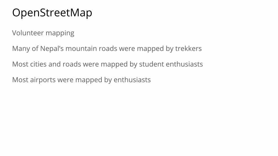
OpenStreetMap
Volunteer mapping
Many of Nepal’s mountain roads were mapped by trekkers
Most cities and roads were mapped by student enthusiasts
Most airports were mapped by enthusiasts

Between 2012 and 2016
Kathmandu, 2016

Between 2012 and 2016
Gorkha, 2016

Pokhara Mapping, 2016

Tools and Technology
● Mapping: Smartphones with GPS, Satellite Imagery, Map Editor
● Map Visualization using JavaScript: Leaflet.js

Ok, but how is this useful?

Navigation
Search
Custom-Styled Maps
Usage

“Unrelated” Data
Ward-level construction projects for year 2014-15
model4g.net
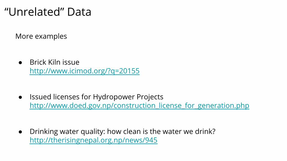
“Unrelated” Data
More examples
● Brick Kiln issuehttp://www.icimod.org/?q=20155
● Issued licenses for Hydropower Projectshttp://www.doed.gov.np/construction_license_for_generation.php
● Drinking water quality: how clean is the water we drink?http://therisingnepal.org.np/news/945

Contextualizing Data with Maps
● Map of Ward-level Projects for year 2014-15http://model4g.net/ne/projects/71-72
● Brick Kilns in Kathmandu before the 2015 earthquakehttp://www.kathmandulivinglabs.org/mapbrickkiln/
● Hydropower Projects in Nepalhttp://www.kathmandulivinglabs.org/hydropower/
● Drinking water qualityhttp://www.kathmandulivinglabs.org/water/

END