UAS - Landfills: Creating Actionable Data · UAS - Landfills: Creating Actionable Data Bill...
51
UAS - Landfills: Creating Actionable Data Bill Edmonson – Lead Mapping Product Specialist – RDOIC
Transcript of UAS - Landfills: Creating Actionable Data · UAS - Landfills: Creating Actionable Data Bill...
UAS - Landfills: Creating Actionable Data
Bill Edmonson – Lead Mapping Product Specialist – RDOIC
Drone
Bill Edmonson
DroneUAV
Bill Edmonson
DroneUAVUAS
Bill Edmonson

UAS = Unmanned Aerial System
Bill Edmonson

UAS = Unmanned Aerial SystemOperator + Control Software + Aircraft
Bill Edmonson
UAS = Unmanned Aerial SystemOperator + Control Software + Aircraft
Bill Edmonson
DATA
Bill Edmonson

DATAThe UAS is just the tool
Bill Edmonson

How Does A UAS Work?
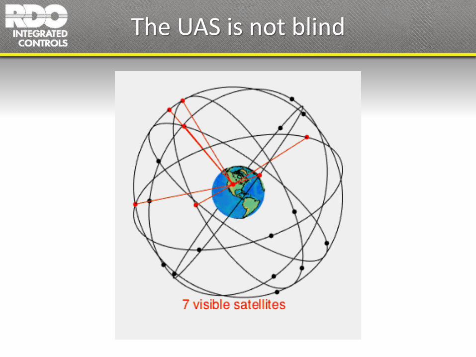
The UAS is not blind
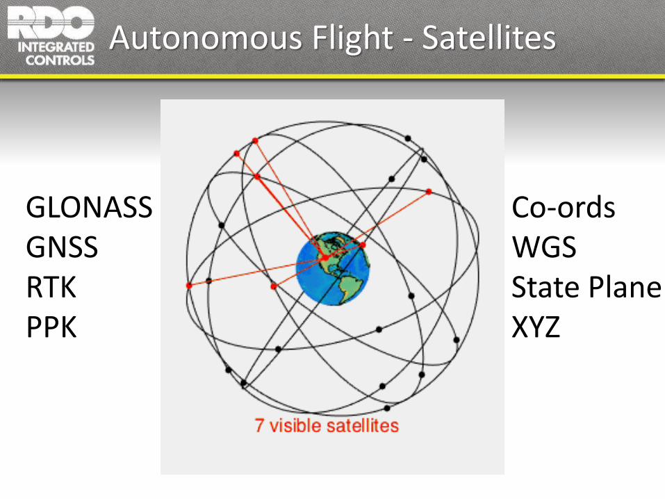
Autonomous Flight - Satellites
GLONASSGNSSRTKPPK
Co-ordsWGSState PlaneXYZ
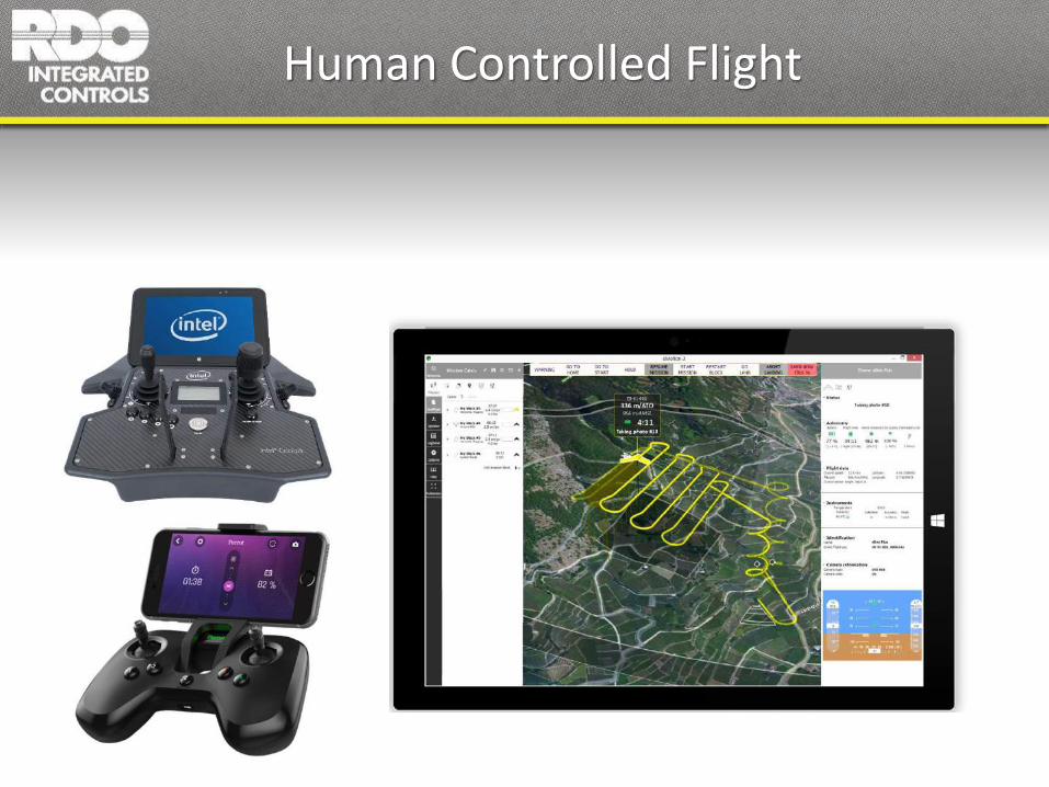
Human Controlled Flight

What is a Commercial UAS?
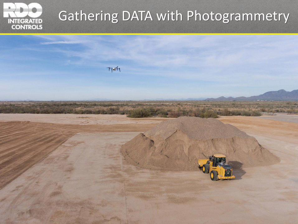
Gathering DATA with Photogrammetry

A Base Methodology For Creating;
• Topography / Contour• Digital Surface Models• Orthographically Correct Site Maps• Chronological Comparisons• Volume Measurements• Drainage Maps• Slope Analysis• Reclamation Progress Reports• Insurance Investigation Data• More….
Photogrammetry
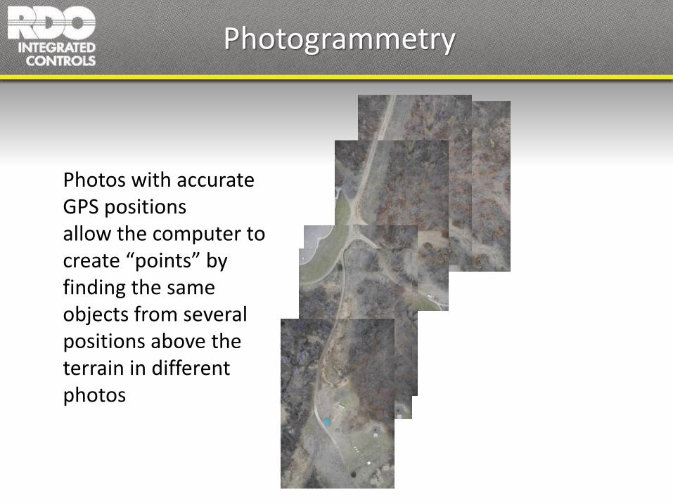
Photogrammetry
Photos with accurate GPS positionsallow the computer to create “points” by finding the same objects from several positions above the terrain in different photos

Data in Point Clouds

Data in Point Clouds
…this collection of points is called a point cloud
every point hasA 3D coordinate
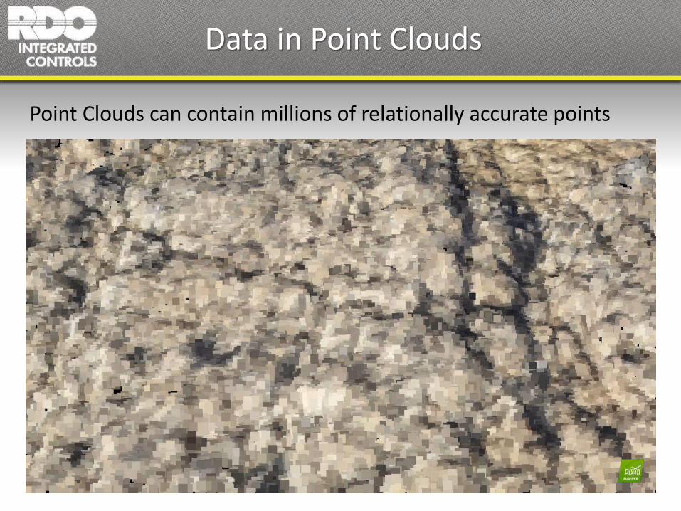
Data in Point Clouds
Point Clouds can contain millions of relationally accurate points
Data in Point Clouds
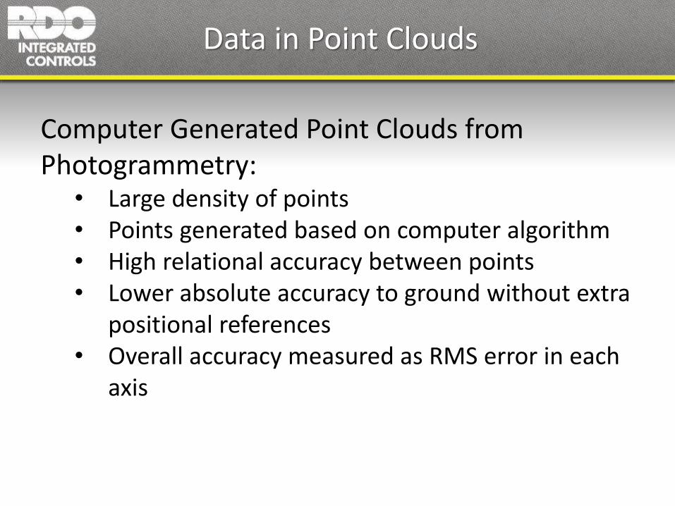
Computer Generated Point Clouds from Photogrammetry:
• Large density of points• Points generated based on computer algorithm• High relational accuracy between points• Lower absolute accuracy to ground without extra
positional references• Overall accuracy measured as RMS error in each
axis

Points from a Terrestrial Survey (X-Y)
Base Station GPS/RTK/Total Station etc

Points from Photogrammetry (X-Y)
Base Station GPS/RTK/Total Station etcPoints from Photogrammetry
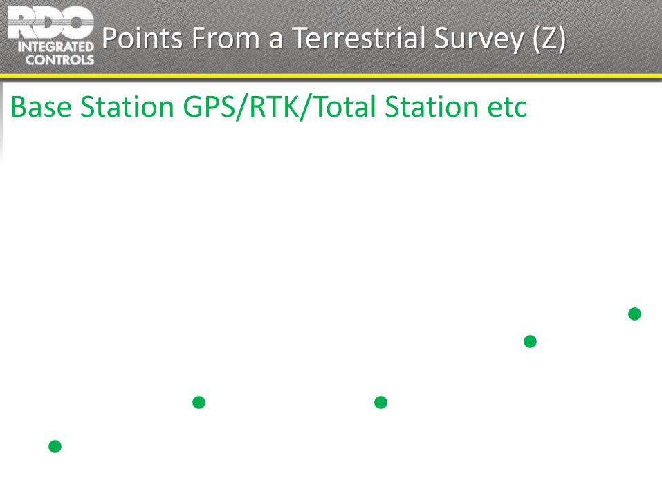
Points From a Terrestrial Survey (Z)
Base Station GPS/RTK/Total Station etc
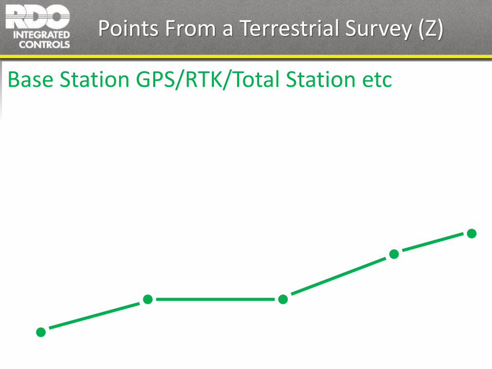
Points From a Terrestrial Survey (Z)
Base Station GPS/RTK/Total Station etc

Photogrammetry (Z)
Base Station GPS/RTK/Total Station etcPoints from Photogrammetry
Photogrammetry (Z)
Base Station GPS/RTK/Total Station etcPoints from Photogrammetry
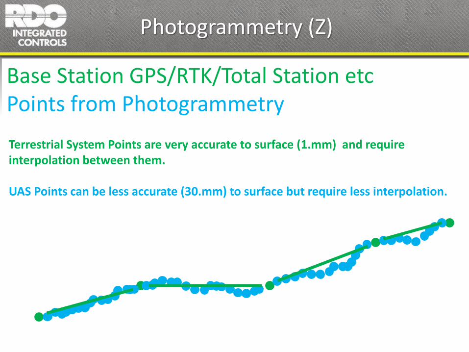
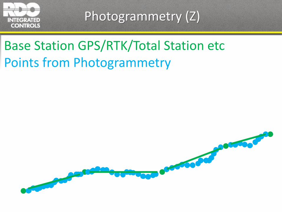
Photogrammetry (Z)
Base Station GPS/RTK/Total Station etcPoints from Photogrammetry
Terrestrial System Points are very accurate to surface (1.mm) and require interpolation between them.
UAS Points can be less accurate (30.mm) to surface but require less interpolation.
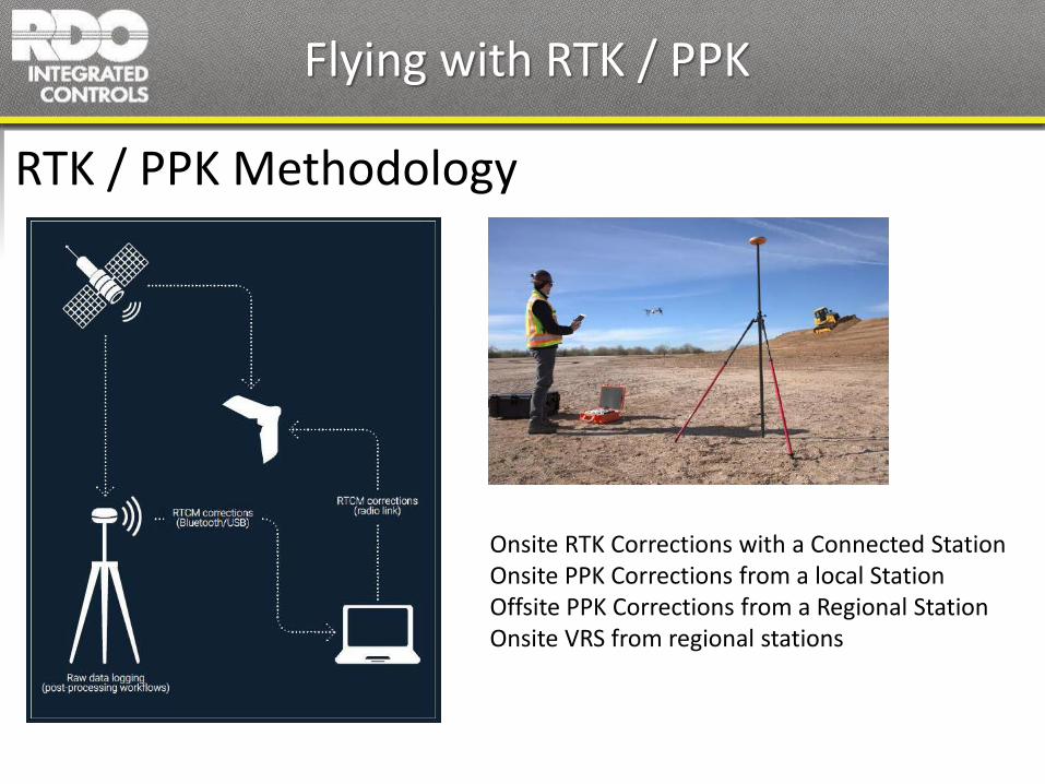
Flying with RTK / PPK
RTK / PPK Methodology
Onsite RTK Corrections with a Connected StationOnsite PPK Corrections from a local StationOffsite PPK Corrections from a Regional StationOnsite VRS from regional stations

Digital Surface ModelDigital Terrain ModelDigital Elevation Model
Point Cloud
3D MeshShape FilePLY file
CAD ContoursPDF Contours
Ortho-mosaic ImageKMLElevation Models
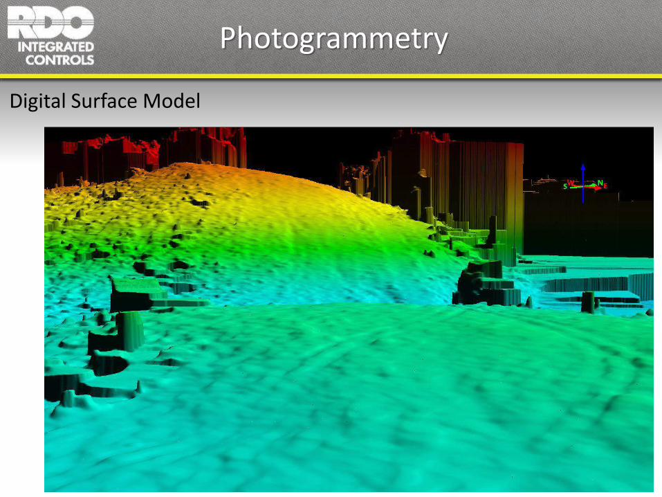
Photogrammetry
Digital Surface Model
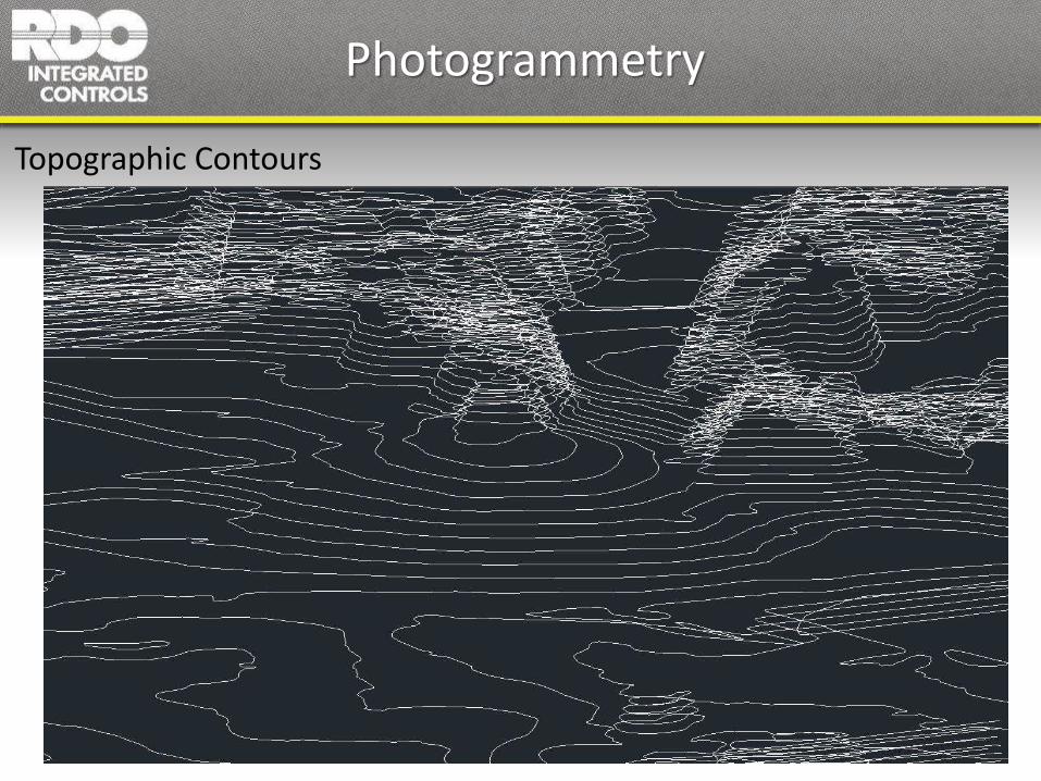
Photogrammetry
Topographic Contours

Photogrammetry
Volume Measurements

Photogrammetry
Distance and Angle Measurements

Temperature Mapping
Infrared Photogrammetry

Plant Health Analysis
Infrared Photogrammetry

Multi-Spectral Photogrammetry
Vegetative Index NDVI (Normalized Difference Vegetative Index)

Multi-Spectral Photogrammetry
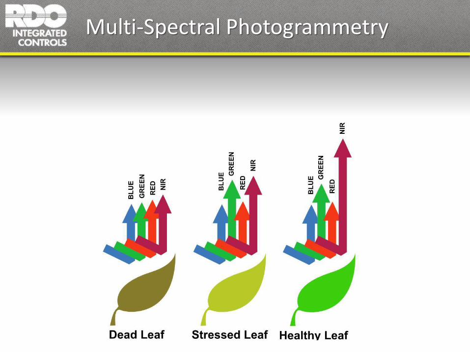
Multi-Spectral Photogrammetry
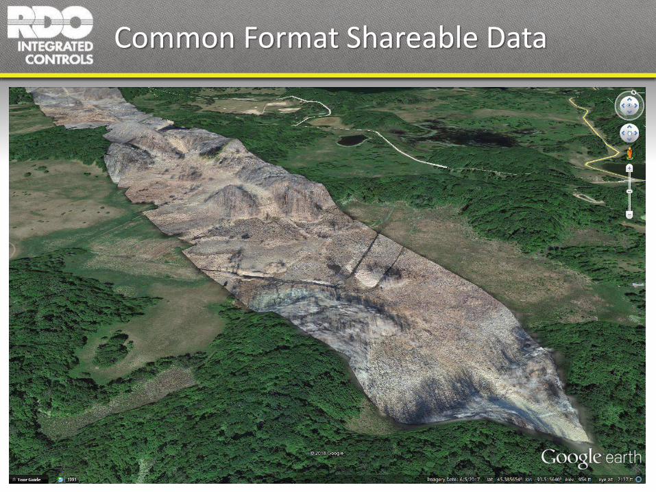
Common Format Shareable Data
Other Applications
Wildlife / livestock monitoring
LIDAR mapping
Photography / videography
Security
Law enforcement
Disaster management
Search and Rescue
Actionable UAS Data
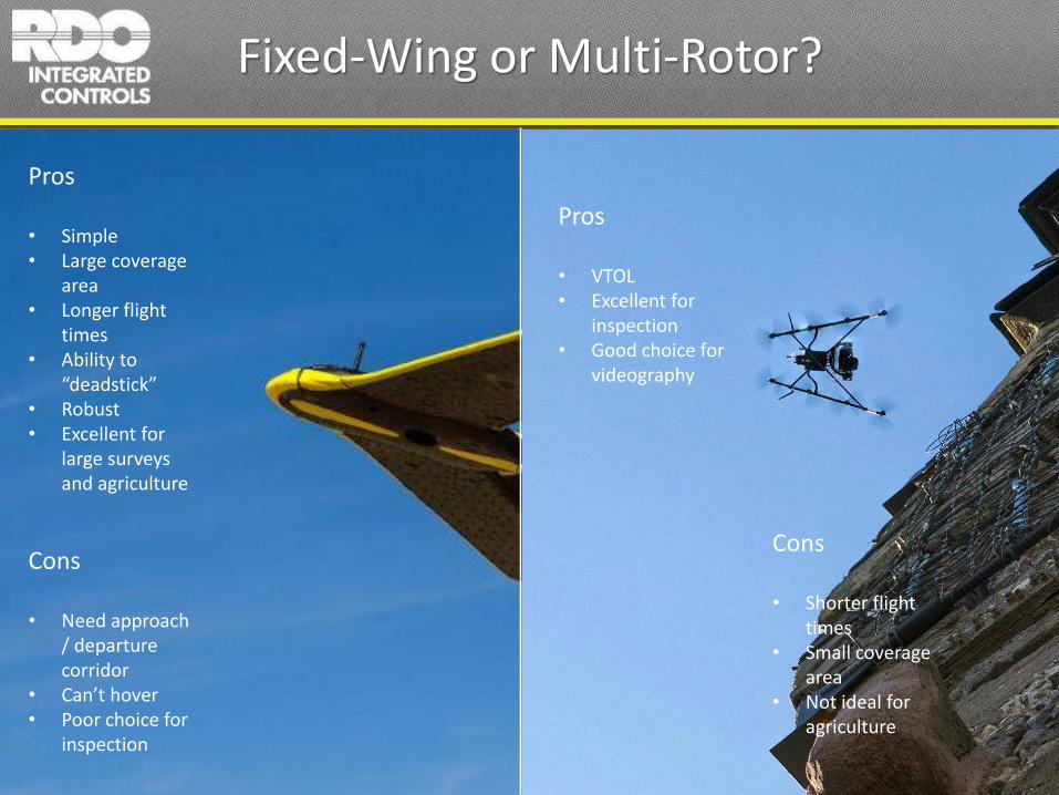
Fixed-Wing or Multi-Rotor?
Pros
• Simple• Large coverage
area• Longer flight
times• Ability to
“deadstick”• Robust• Excellent for
large surveys and agriculture
Cons
• Need approach / departure corridor
• Can’t hover• Poor choice for
inspection
Pros
• VTOL• Excellent for
inspection• Good choice for
videography
Cons
• Shorter flight times
• Small coverage area
• Not ideal for agriculture

Vertical Takeoff-Landing Fixed wing

REGULATIONS
• < 55 pounds• 400 feet above ground level (AGL) maximum altitude• 100 mph maximum speed• Must maintain visual line-of-sight• Must have a visual observer if using first-person view• Single UAV only• Prohibited from flying:
a) At nightb) Over people not directly participating in the operationc) Under a covered structured) From a moving vehicle unless in a sparsely populated areae) In Class B, C, D, and E airspace without ATC approval

AIRSPACE

AIRSPACE
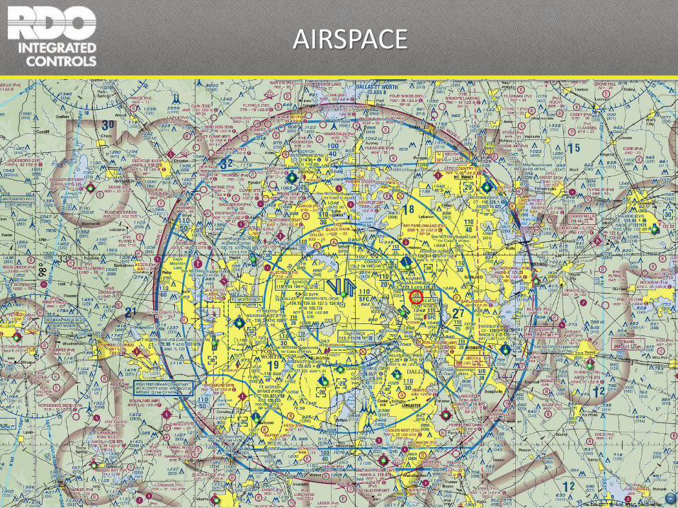
AIRSPACE

FAA Permission / Waivers

PART 107 EXAM
• 60 questions• 2 hour time limit• Must score 70% or better• Designated testing facility• $150.00• Must re-test every 2 years
1. Applicable regulations relating to small unmanned aircraft system rating privileges, limitations,
2. Flight operation3. Airspace classification, operating requirements, and flight restrictions affecting small
unmanned aircraft operation4. Aviation weather sources and effects of weather on small unmanned aircraft
performance5. Small unmanned aircraft loading6. Emergency procedures7. Crew resource management8. Radio communication procedures9. Determining the performance of small unmanned aircraft10. Physiological effects of drugs and alcohol11. Aeronautical decision-making and judgment12. Airport operations13. Maintenance and preflight inspection procedures.

Thank You!Bill Edmonson – Lead Mapping Product Specialist – RDOIC