

Linked Places In the Context of Library Metadatachgis/work/docs/papers/HVD_LibraryLinkedDat… ·...
31
Linked Places In the Context of Library Metadata Harvard Libraries Linked Data Discussion Group Nov 10 th 2016 Merrick Lex Berman Center for Geographic Analysis, Harvard
Transcript of Linked Places In the Context of Library Metadatachgis/work/docs/papers/HVD_LibraryLinkedDat… ·...

Linked Places
In the Context of Library Metadata
Harvard Libraries
Linked Data Discussion Group
Nov 10th 2016
Merrick Lex Berman
Center for Geographic Analysis, Harvard

Geospatial datasets - GIS
Maps and scanned maps
The catalog as geodata

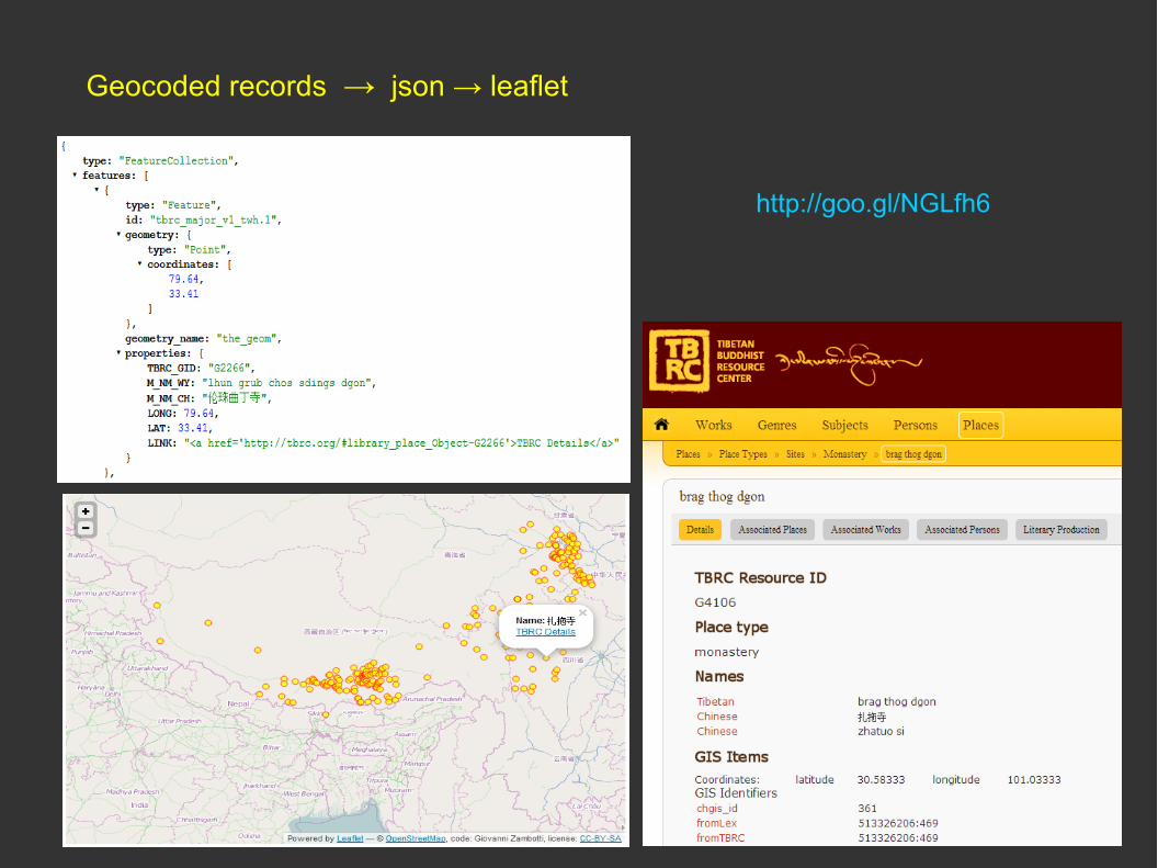
Geocoding toponyms
651 - Subject Added Entry-Geographic Name
https://maps.googleapis.com/maps/api/geocode/json?address=Georgia

What to geocode?
651 - Geographic Name
260 – Place of Publication
245 – Title
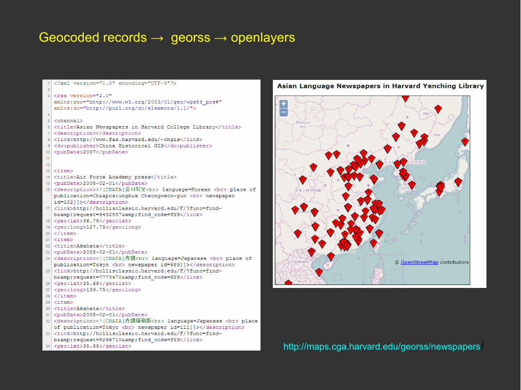
Geocoded records → georss → openlayers
http://maps.cga.harvard.edu/georss/newspapers/
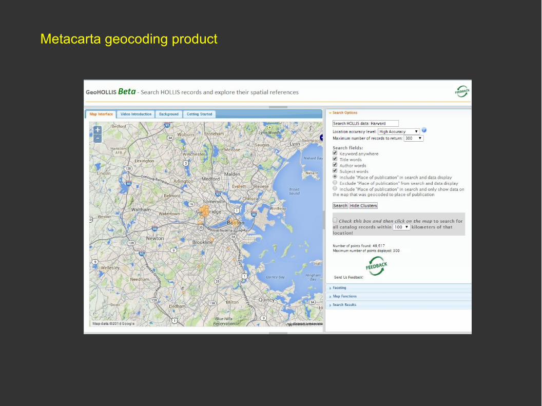
Metacarta geocoding product

Internal catalogs → federated catalogs → linked data
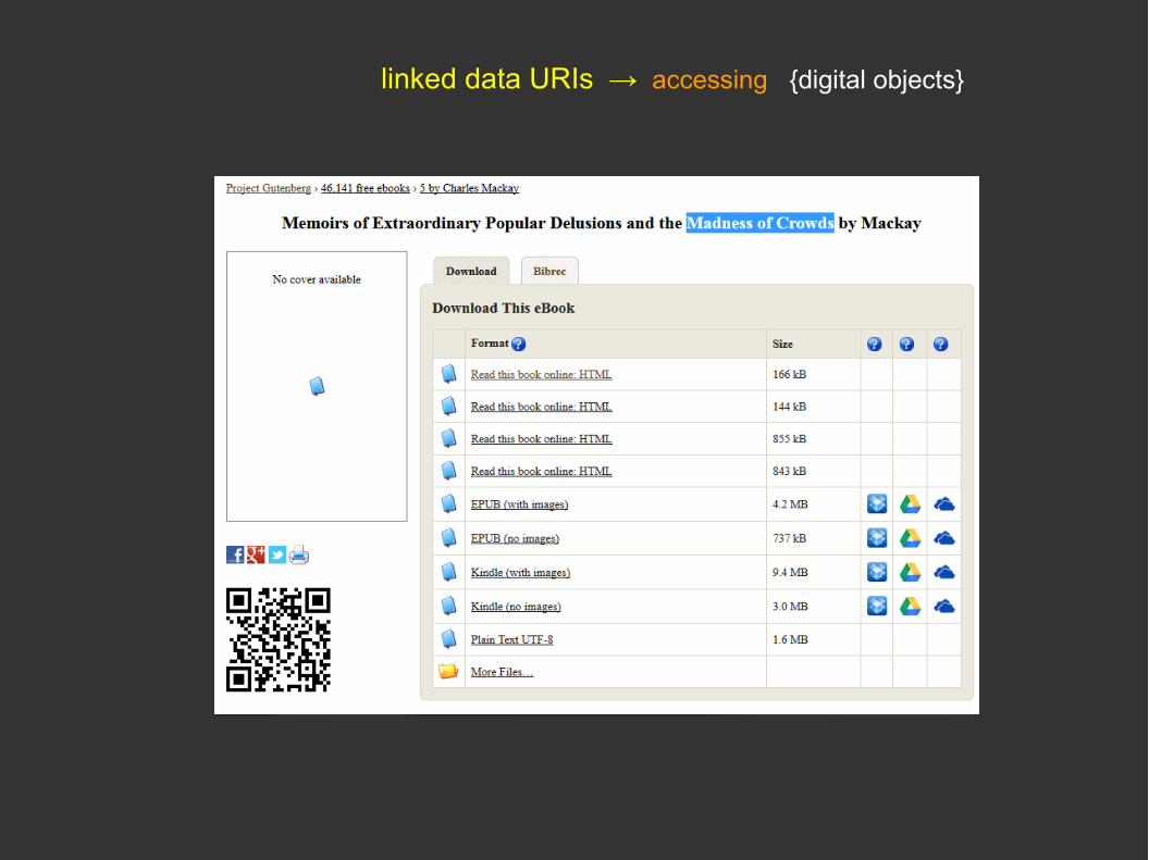
linked data URIs → accessing {digital objects}

traversing {internal structures}
Denver Public Library – Horses, biography.John Allen, “Farewell Cards,” On Wisconsin Magazine, Summer 2012.
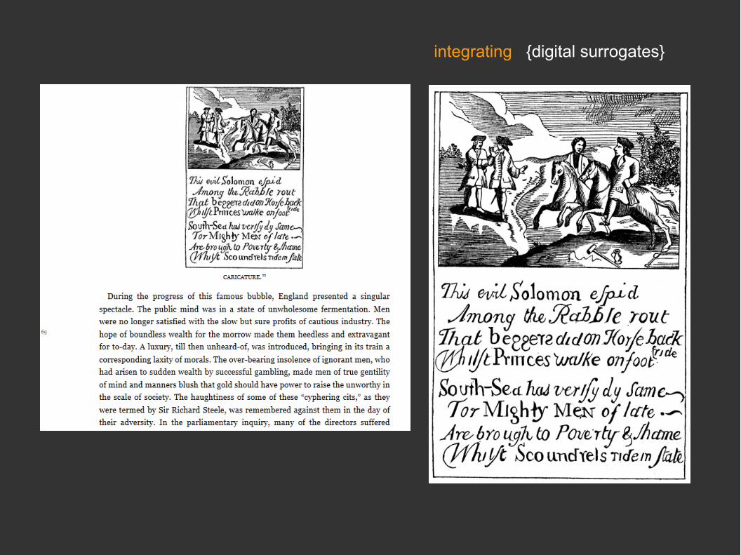
integrating {digital surrogates}
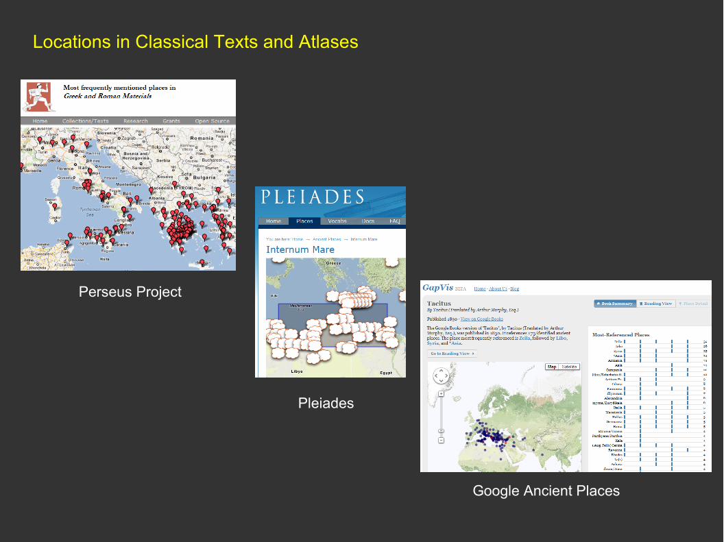
Locations in Classical Texts and Atlases
Perseus Project
Pleiades
Google Ancient Places

Pelagios - linking historical objects to places - using Pleiades
Pelagios API http://pelagios.dme.ait.ac.at/api
Documentation http://pelagios-project.blogspot.com/
Pleiades

Pelagios - linking historical objects to places - using CHGIS
Pelagios API http://pelagios.dme.ait.ac.at/api
Documentation http://pelagios-project.blogspot.com/
Pleiades CHGIS

XML web service for Chinese historical placenames:
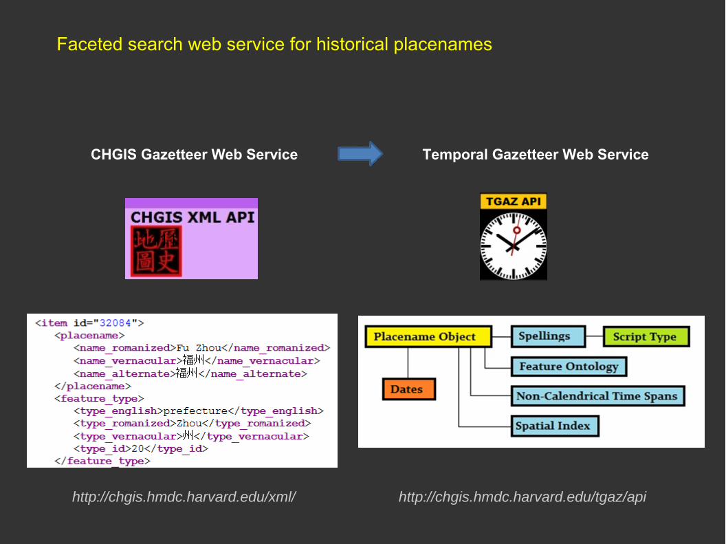
http://chgis.hmdc.harvard.edu/tgaz/apihttp://chgis.hmdc.harvard.edu/xml/
11111
CHGIS Gazetteer Web Service Temporal Gazetteer Web Service
Faceted search web service for historical placenames

RDF gazetteer interchange format

Moving forward: the semantic web linking geodata {rdf}

What can we DO with geo-LOD ?
Geosparql is “not easy for laymen to use correctly”
http://de.slideshare.net/larsgsvensson/enriching-thegermannationallibraryslinkeddataservicewithgeographiccoordinates

Mashup as in Peripleo
http://journal.code4lib.org/articles/11144
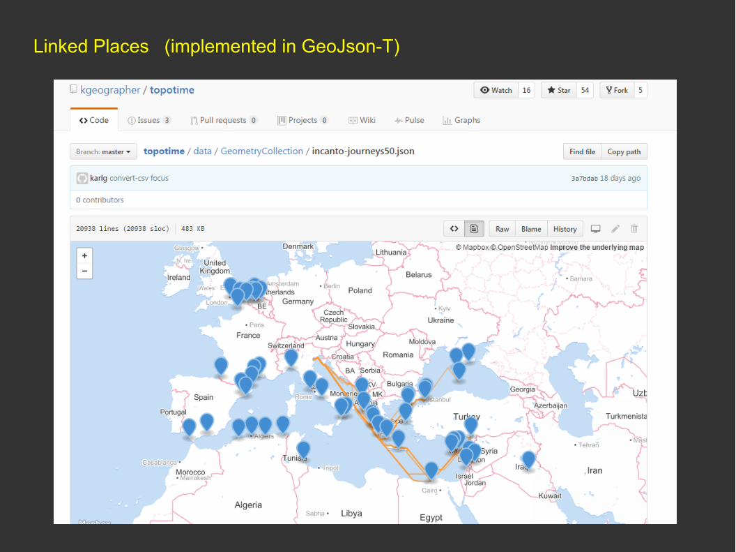
Linked Places (implemented in GeoJson-T)
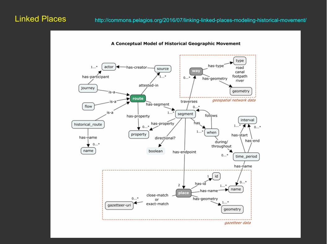
Linked Places http://commons.pelagios.org/2016/07/linking-linked-places-modeling-historical-movement/

Linked Places (example, journey to Baikonur)

LD4L 2014
http://search.ld4l.org/?utf8=%E2%9C%93&q=baikonur

Google Knowledge Graph
Mano Marks “Geospatial Data and Linked Data”W3C LGD, Shoreditch 2014 https://www.w3.org/2014/03/lgd/agenda
LD4L 2014

Graphs for Linked Data
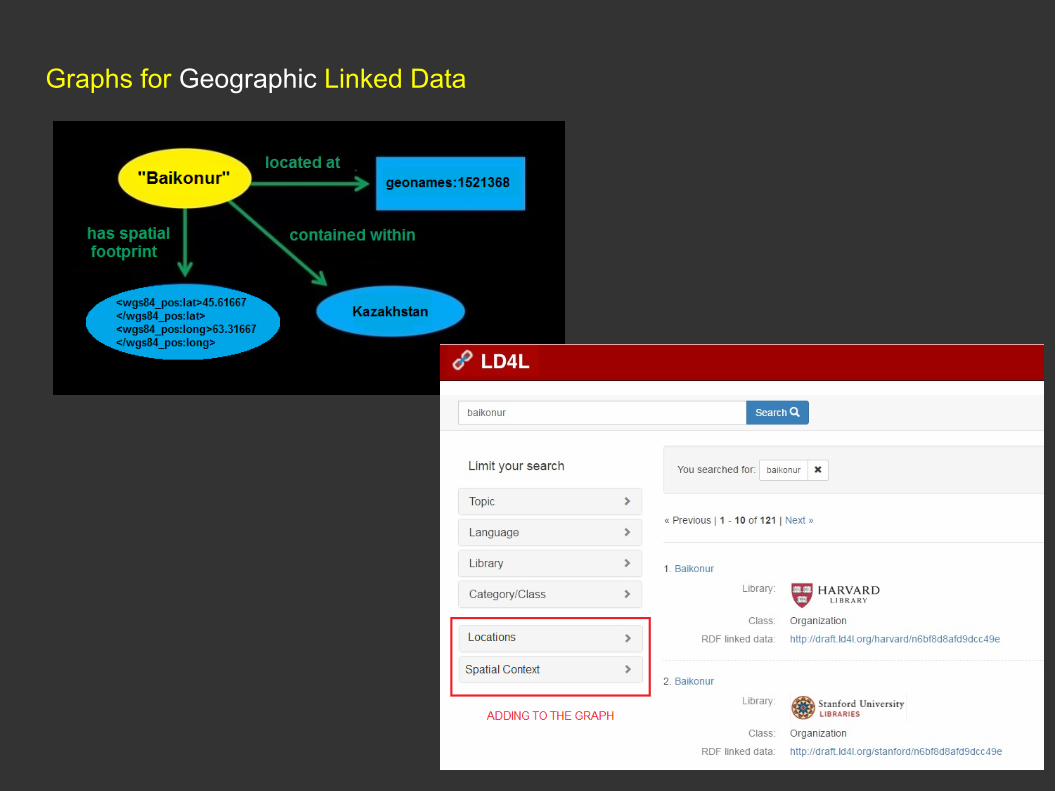
Graphs for Geographic Linked Data

Integration with other geospatial services
Catalog → Geojson.io → LinkedPlaces

Implications for the future
Transformation of the catalog:
- metadata describing resources → direct access to digital resources
- users expect instant, machine-readable information
- human readable forms & facets → in combination with APIs
- users expect both discovery and deeper analysis of content
- aggregated data and visualizations of data rather than lists
- linked open data and the semantic web will encroach into library science - graph databases and structures will get applied to search tools
For Geographic data:
- search and visualization using maps will be more commonplace
- catalog metadata will be geocoded (internally or on-the-fly)

Bibliography on big data and spatial humanities
https://www.zotero.org/groups/dh_and_big_data/items
Temporal Gazetteers and Linked Geodata
http://www.fas.harvard.edu/~chgis/gazetteer