Hydrology and Hydraulic Modeling for Flash Floods Risk...
14
Session: Flood Hazard Assessment Methodologies 18/03/2014 Konstantinos Papatheodorou Eleni A. Tzanou Konstantinos Ntouros Hydrology and Hydraulic Modeling for Flash Floods Risk Assessment and Mapping A Methodology Proposal
-
Upload
truongkhanh -
Category
Documents
-
view
222 -
download
1
Transcript of Hydrology and Hydraulic Modeling for Flash Floods Risk...
Session: Flood Hazard
Assessment Methodologies 18/03/2014
Konstantinos Papatheodorou
Eleni A. Tzanou
Konstantinos Ntouros
Hydrology and Hydraulic Modeling for
Flash Floods Risk Assessment and Mapping
A Methodology Proposal
Session: Flood Hazard
Assessment Methodologies 18/03/2014
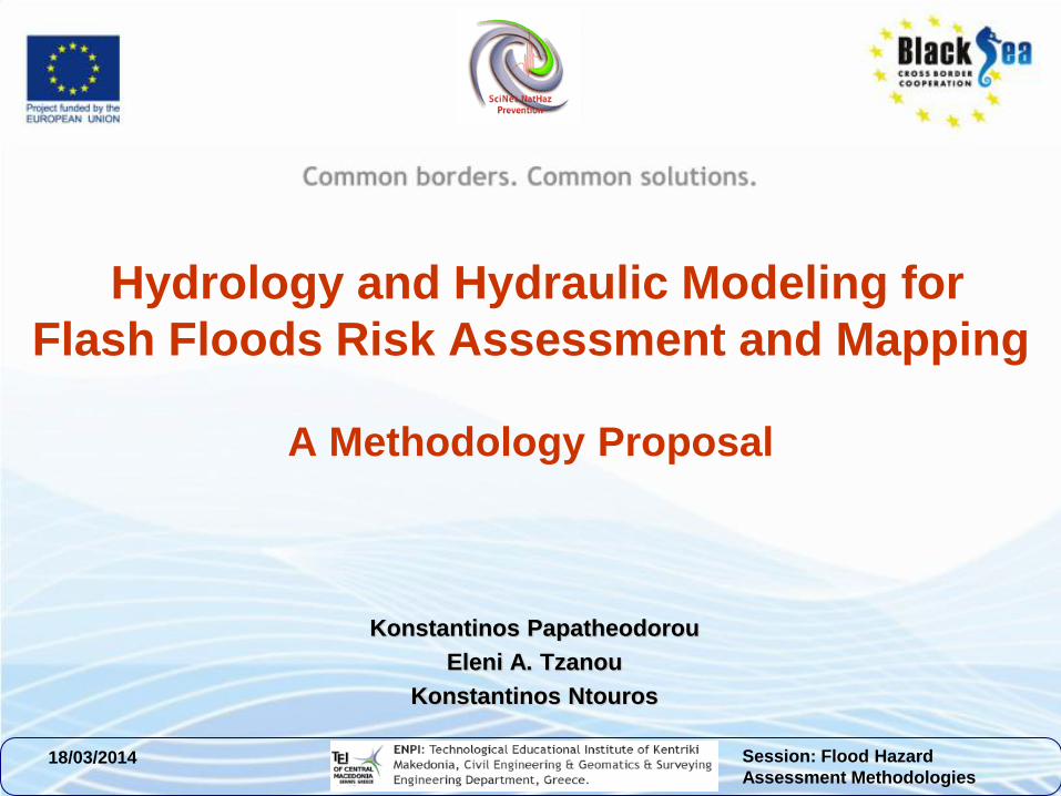
Flash Flood Assessment
From Regional to Local Scale • Hydraulic models are used to calculate on a local scale, all
flood related parameters
• Flood Hazard and Disaster Risk may be “accurately”
assessed-as possible
• AIM = Spot Problematic areas according to the hydraulic
analysis performed
The procedure has been implemented in the
area of Serres (Kentriki Makedonia)
Session: Flood Hazard
Assessment Methodologies 18/03/2014
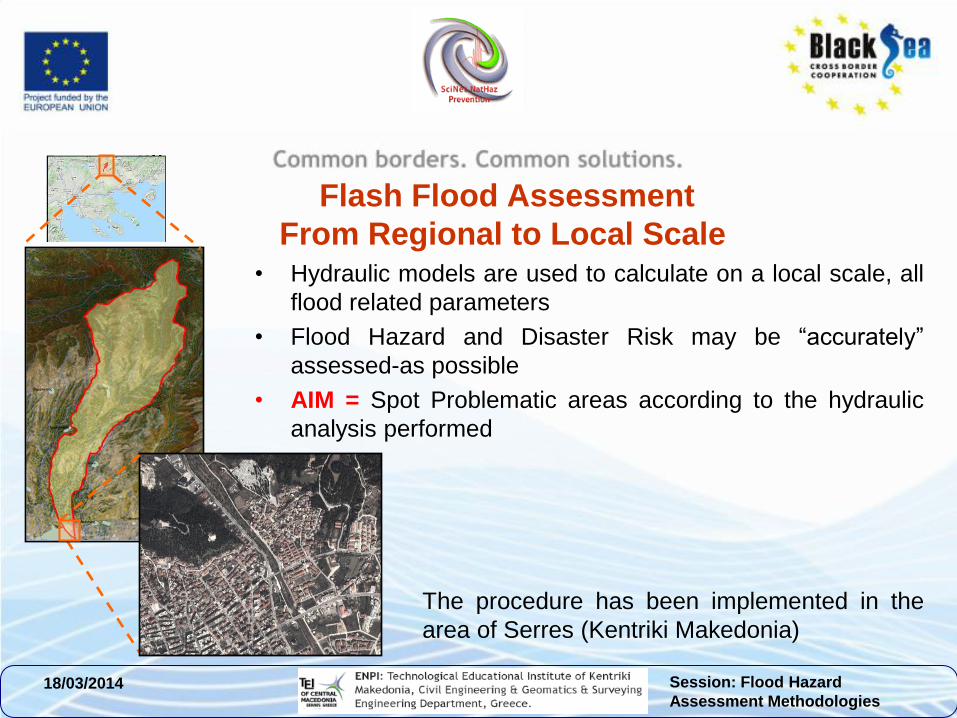
Methodological Framework
for Flash Flood Hazard (FFH)
• Methodology for FFH is structured (among others) on basic principles of hydrology and hydraulics
• Standardized methodology for flood map production (step by step)
• Use of Open Source Software
• Geo-morphological and hydrological features of the river basin
• Calculation of hydrographs for different return periods
• Simulation of the river system-Detailed hydraulic analysis
• Estimation and Mapping of floodplain Inundation
Session: Flood Hazard
Assessment Methodologies 18/03/2014
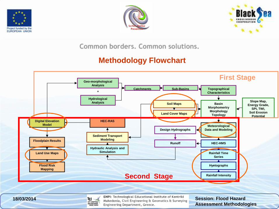
Methodology Flowchart
Digital Elevation
Model
HEC-RAS
Floodplain Results
Land Use Maps
Flood Risk
Mapping
Hydraulic Analysis and
Simulation
Hydrological
Analysis
Geo-morphological
Analysis
Catchments Sub-Basins Topographical
Characteristics
Basin
Morphomertry
Morphology
Topology
Meteorological
Data and Modeling
HEC-HMS
Rainfall Time
Series
Hyetographs
Rainfall Intensity
Design Hydrographs
Soil Maps
Land Cover Maps
Sediment Transport
Modeling
+
Runoff
Slope Map,
Energy Grade,
SPI, TWI,
Soil Erosion
Potential
First Stage
Second Stage
Session: Flood Hazard
Assessment Methodologies 18/03/2014
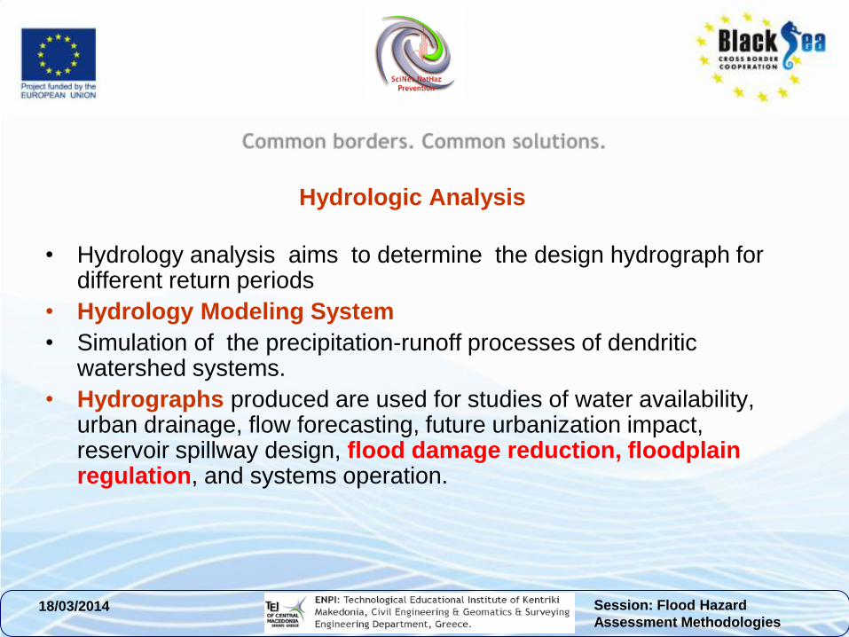
Hydrologic Analysis
• Hydrology analysis aims to determine the design hydrograph for different return periods
• Hydrology Modeling System
• Simulation of the precipitation-runoff processes of dendritic watershed systems.
• Hydrographs produced are used for studies of water availability, urban drainage, flow forecasting, future urbanization impact, reservoir spillway design, flood damage reduction, floodplain regulation, and systems operation.
Session: Flood Hazard
Assessment Methodologies 18/03/2014
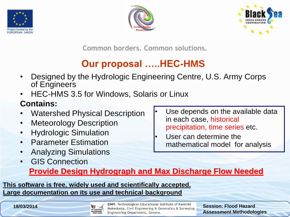
Our proposal …..HEC-HMS
• Designed by the Hydrologic Engineering Centre, U.S. Army Corps of Engineers
• HEC-HMS 3.5 for Windows, Solaris or Linux
Contains:
• Watershed Physical Description
• Meteorology Description
• Hydrologic Simulation
• Parameter Estimation
• Analyzing Simulations
• GIS Connection
Provide Design Hydrograph and Max Discharge Flow Needed
• Use depends on the available data in each case, historical precipitation, time series etc.
• User can determine the mathematical model for analysis
This software is free, widely used and scientifically accepted.
Large documentation on its use and technical background
Session: Flood Hazard
Assessment Methodologies 18/03/2014
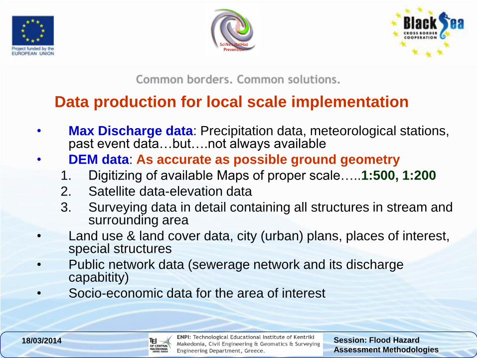
Data production for local scale implementation
• Max Discharge data: Precipitation data, meteorological stations, past event data…but….not always available
• DEM data: As accurate as possible ground geometry
1. Digitizing of available Maps of proper scale…..1:500, 1:200
2. Satellite data-elevation data
3. Surveying data in detail containing all structures in stream and surrounding area
• Land use & land cover data, city (urban) plans, places of interest, special structures
• Public network data (sewerage network and its discharge capabitity)
• Socio-economic data for the area of interest
Session: Flood Hazard
Assessment Methodologies 18/03/2014
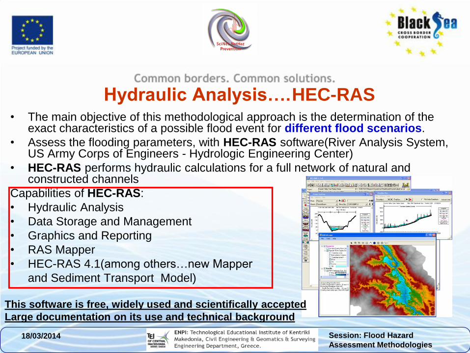
Hydraulic Analysis…. HEC-RAS • The main objective of this methodological approach is the determination of the
exact characteristics of a possible flood event for different flood scenarios.
• Assess the flooding parameters, with HEC-RAS software(River Analysis System, US Army Corps of Engineers - Hydrologic Engineering Center)
• HEC-RAS performs hydraulic calculations for a full network of natural and constructed channels
Capabilities of HEC-RAS:
• Hydraulic Analysis
• Data Storage and Management
• Graphics and Reporting
• RAS Mapper
• HEC-RAS 4.1(among others…new Mapper
and Sediment Transport Model)
This software is free, widely used and scientifically accepted
Large documentation on its use and technical background
Session: Flood Hazard
Assessment Methodologies 18/03/2014
Implementation…..so far Application steps:
1. Preparation, evaluation and synthesis of digital data
2. Field work
3. Hydrologic analysis through HEC-HMS
4. Hydraulic analysis through HEC-RAS
5. Flash Flood scenarios and Flood Risk maps
Digital Data produced:
• Contour lines and hydrographic network of 1:5.000 scale maps (HGMS-Hellenic Geographic Military Service),
• Corine Land Cover 2000 data updated by in situ research
• Precipitation data for a period of about 27years (HNMS Hellenic National Meteorological Service) -2 meteorological stations in the area.
• Surveying data of the stream bed and the surrounding area (stream geometry, cross sections, long sections-profile1:200 scale)
• Street and city plan of 1:1000 scale maps.
Session: Flood Hazard
Assessment Methodologies 18/03/2014
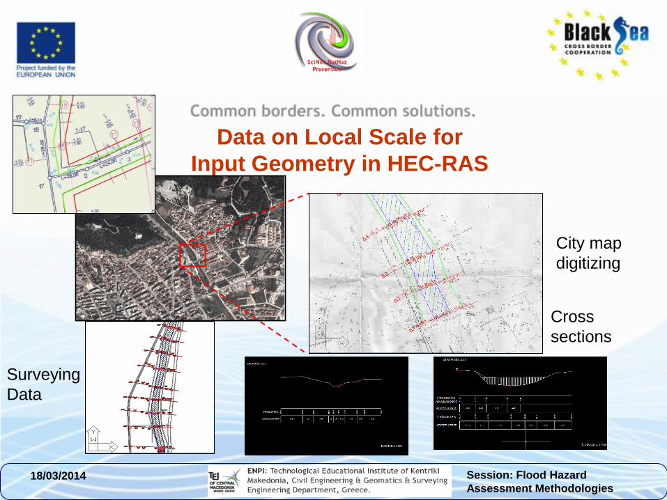
Data on Local Scale for
Input Geometry in HEC-RAS
Surveying
Data
Cross
sections
City map
digitizing
Session: Flood Hazard
Assessment Methodologies 18/03/2014
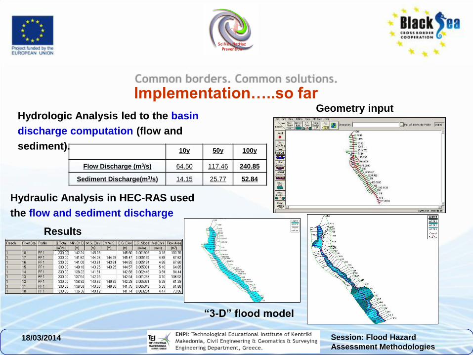
10y 50y 100y
Flow Discharge (m3/s) 64.50 117.46 240.85
Sediment Discharge(m3/s) 14.15 25.77 52.84
Hydrologic Analysis led to the basin
discharge computation (flow and
sediment).
Implementation…..so far
Hydraulic Analysis in HEC-RAS used
the flow and sediment discharge
Geometry input
Results
“3-D” flood model
Session: Flood Hazard
Assessment Methodologies 18/03/2014
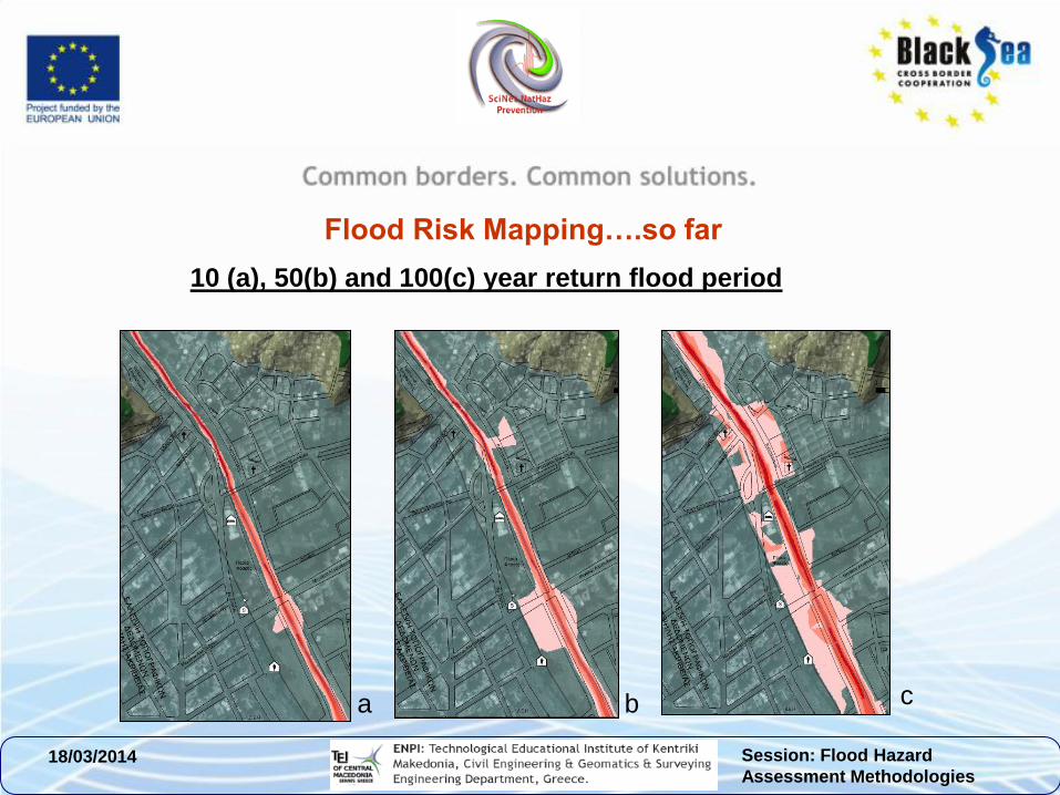
Flood Risk Mapping….so far
10 (a), 50(b) and 100(c) year return flood period
a b c
Session: Flood Hazard
Assessment Methodologies 18/03/2014
Suggestive Bibliography
• Alexander, D., 1993. Natural disasters, New York, Chapman & Hall
• Balica, S.F., Douben, N., Wright, N.G., 2009. Flood Vulnerability Indices at Varying Spatial Scales, Water Science and Technology Journal, 60 (10), 2571-2580
• Balica, S.F., Wright N.G., 2010. Reducing the complexity of Flood Vulnerability Index, Environmental Hazard Journal, 9 (4), 321 - 339.
• Barredo, J.I., de Roo, A., Lavalle, C., 2007. Flood risk mapping at European scale. Water Science and Technology, 56 (4), 11-17
• Hansson, K., Danielson, M., Ekenberg, L., 2008. A framework for evaluation of flood management strategies, Journal of Environmental Management 86, (3), 465–480
• Schanze, J., 2006. Flood risk management – a basic framework, Flood Risk Management:
• Hazards, Vulnerability and Mitigation Measures NATO Science Series: IV: Earth and Environmental Sciences, 2006, 67, Part 1, 1-20
• Bedient P. B., and W. C. Huber (2002). Hydrology and Floodplain Analysis. Third edition. Prentice Hall. 763 p.
• Floodplain Mapping Program, North Carolina Division of Emergency Management. NC Floodplain Mapping: Watauga River Basin; LiDAR Bare Earth Mass Points, Feb-Apr and Dec 2003; EarthData International of North Carolina: High Point, NC, USA, 2004.
• US Army Corps of Engineers. HEC-RAS River Analysis System, User’s Manual; U.S. Army Corps of Engineers, Hydrologic Engineering Center, Institute for Water Resources: Davis, CA, USA, 2010.
• Johnson, L.E. 9: GIS for Floodplain Management. In Geographic Information Systems in Water Resource Engineering; Taylor and Francis, LLC: Boca Raton, FL, USA, 2009; pp. 187–206.
• Hicks F. E. and Peacock, T. (2005), Suitability of HEC-RAS for Flood Forecast-ing, Canadian Water Resources Journal Vol. 30(2): 159–174
• MHL (2006), Review and Assessment of Hydrologic/Hydraulic Flood Models, Department of Natural Resources, New South Wales, ISBN 0 7347 5854 5, pp. 47-69.
Session: Flood Hazard
Assessment Methodologies 18/03/2014
Thank you!
Acknowledgments: The research was partially funded by the
EU within the context of the Black Sea Basin Joint Operational
Programme 2007-2013