GPS Basics - Western Michigan University
21
Page 1 GPS Overview The Global Positioning System GPS
Transcript of GPS Basics - Western Michigan University

Page 1GPS Overview
The Global Positioning SystemGPS

Page 2GPS Overview
NAVSTAR Global Positioning System
The NAVSTAR Global Positioning System is managed by the NAVSTAR GPS Joint Program Office at the Space and Missile Systems Center, Los Angeles Air Force Base, Calif.
NAVSTAR GPS is a space-based radio-positioning system nominally consisting of a constellation of 24 orbiting satellites that provide navigation and timing information to military and civilian users worldwide. In addition to the satellites, the system consists of a worldwide satellite control network and GPS receiver units that pick up signals from the satellites and translate them into position information.
GPS provides 24-hour navigation services which include: • Extremely accurate three-dimensional location (latitude, longitude and
altitude), velocity, and precise time • A worldwide common grid that is easily converted to any local grid • Passive all-weather operations • Continuous real-time information • Support to unlimited number of users and areas • Support to civilian users at a slightly less accurate level

Page 3GPS Overview
Launch
Delta II expendable launch vehicles are used to launch the GPS satellites from Cape Canaveral Air Station, Fla., into six circular orbits of nearly 11,000 nautical miles.
GPS satellites orbit the earth every 12 hours, emitting continuous navigation signals on two different L-band frequencies.
Weight: 2,050 pounds (in orbit)Power plant: Solar panels generating 1100 wattsDimensions: 5 feet wide, 17.5 feet long (length includes solar arrays)Orbit altitude: 10,900 nautical milesLaunch vehicle: Delta II

Page 4GPS Overview
GPS Block IIR Team

Page 5GPS Overview
ConstellationThe nominal GPS Operational Constellation consists of 24 satellites. There are often more than 24 operational satellites as new ones are launched to replace older satellites. The satellite orbits repeat almost the same ground track (as the earth turns beneath them) once each day.
The orbit altitude is such that the satellites repeat the same track and configuration over any point approximately each 24 hours (4 minutes earlier each day).
There are six orbital planes (with nominally four SVs in each), equally spaced (60 degrees apart), and inclined at about fifty-five degrees with respect to the equatorial plane. This constellation provides the user with between five and eight SVsvisible from any point on the earth.

Page 6GPS Overview
Current Constellation
0 5 10 15 200
2
4
6
8
10
12
14G P S S a te llite Vis ib ility : e l = 5.0
Tim e of Da y (hours )
SV
s V
isib
le
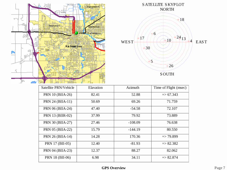
Page 7GPS Overview
S ATELLITE S KYP LOTS ATELLITE S KYP LOT
EAS TWES T
NORTH
S OUTH
1024
613
30
526
174
18
Satellite PRN/Vehicle Elavation Azimuth Time of Flight (msec)
PRN 10 (BIIA-26) 82.41 52.88 => 67.343
PRN 24 (BIIA-11) 50.69 69.26 71.759
PRN 06 (BIIA-24) 47.40 -54.58 72.107
PRN 13 (BIIR-02) 37.99 79.92 73.889
PRN 30 (BIIA-27) 27.46 -108.09 76.638
PRN 05 (BIIA-22) 15.79 -144.19 80.550
PRN 26 (BIIA-14) 14.28 170.36 => 79.899
PRN 17 (BII-05) 12.40 -81.93 => 82.382
PRN 04 (BIIA-23) 12.37 88.27 82.062
PRN 18 (BII-06) 6.98 34.11 => 82.874

Page 8GPS Overview
Master Control StationThe GPS Master Control Station, operated by the 50th Space Wing's 2nd Space Operations Squadron (2SOPS) at Schriever AFB, Colo., is responsible for monitoring and controlling the GPS satellite constellation.
The GPS-dedicated ground system consists of five monitor stations and four ground antennas located around the world. The monitor stations use GPS receivers to passively track the navigation signals on all satellites. Information from the monitor stations is then processed at the MCS and used to update the satellites' navigation messages.
The MCS operations crew sends updated navigation information to GPS satellites through ground antennas using an S-band signal. The ground antennas are also used to transmit

Page 9GPS Overview
GPS Receiver Applications
• Avionics• Marine Survey and Construction• Mobile Positioning• Precision Agriculture• Land Survey• Mapping and GIS (Geographical
Information Systems)• Mining and Construction• Communications• Timing and Synchronization• Cellular E-911• Military
Page 10GPS Overview
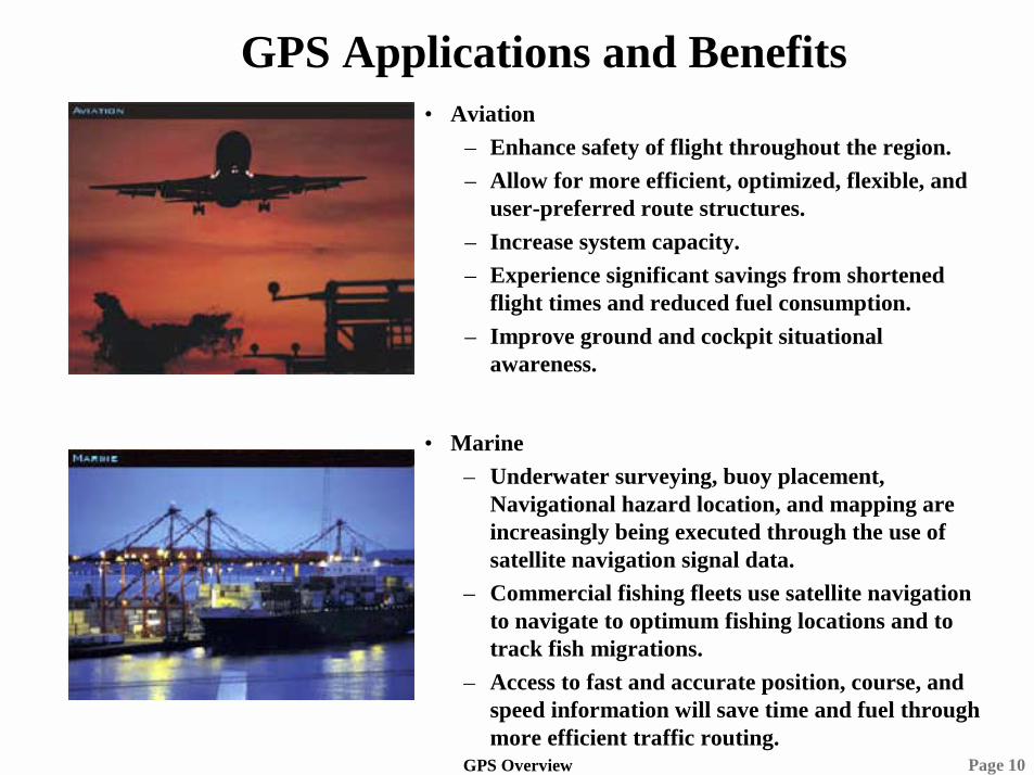
GPS Applications and Benefits• Aviation
– Enhance safety of flight throughout the region. – Allow for more efficient, optimized, flexible, and
user-preferred route structures. – Increase system capacity. – Experience significant savings from shortened
flight times and reduced fuel consumption. – Improve ground and cockpit situational
awareness.
• Marine– Underwater surveying, buoy placement,
Navigational hazard location, and mapping are increasingly being executed through the use of satellite navigation signal data.
– Commercial fishing fleets use satellite navigation to navigate to optimum fishing locations and to track fish migrations.
–
Page 11GPS Overview
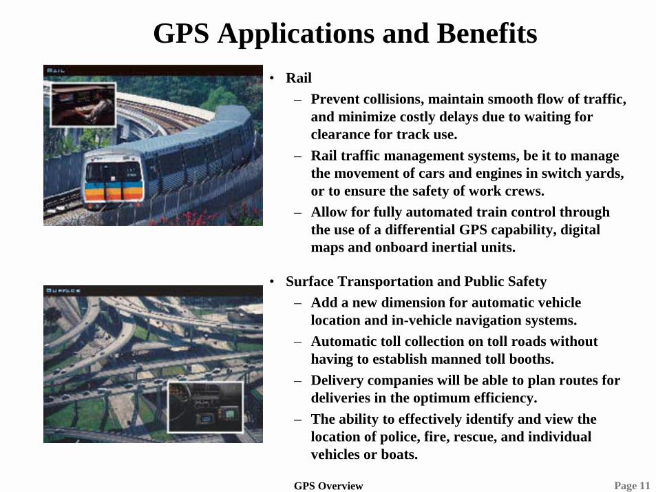
GPS Applications and Benefits• Rail
– Prevent collisions, maintain smooth flow of traffic, and minimize costly delays due to waiting for clearance for track use.
– Rail traffic management systems, be it to manage the movement of cars and engines in switch yards, or to ensure the safety of work crews.
– Allow for fully automated train control through the use of a differential GPS capability, digital maps and onboard inertial units.
• Surface Transportation and Public Safety– Add a new dimension for automatic vehicle
location and in-vehicle navigation systems. – Automatic toll collection on toll roads without
having to establish manned toll booths. – Delivery companies will be able to plan routes for
deliveries in the optimum efficiency. – The ability to effectively identify and view the
location of police, fire, rescue, and individual vehicles or boats.
Page 12GPS Overview
GPS Applications and Benefits
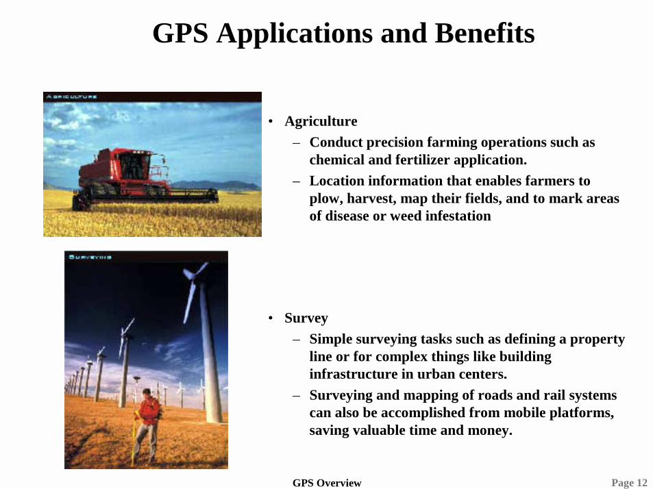
• Agriculture– Conduct precision farming operations such as
chemical and fertilizer application.– Location information that enables farmers to
plow, harvest, map their fields, and to mark areas of disease or weed infestation
• Survey– Simple surveying tasks such as defining a property
line or for complex things like building infrastructure in urban centers.
– Surveying and mapping of roads and rail systems can also be accomplished from mobile platforms, saving valuable time and money.

Page 13GPS Overview
GPS Applications and Benefits
• Timing and Synchronization– With the accuracy of atomic clocks, satellite
navigation systems are used to synchronize clocks and events around the world.
– Telephone and paging companies depend on these satellites to synchronize the transmission of data packets throughout their systems.
– Investment banking firms also rely on this service every day so international transactions can be recorded simultaneously.
• Military– Mapping, aerial refueling, rendezvous operations,
geodetic surveying, and search and rescue operations have all benefited greatly from GPS's accuracy.
– Forward air controllers, pilots, tank drivers, and ground troops all use GPS.
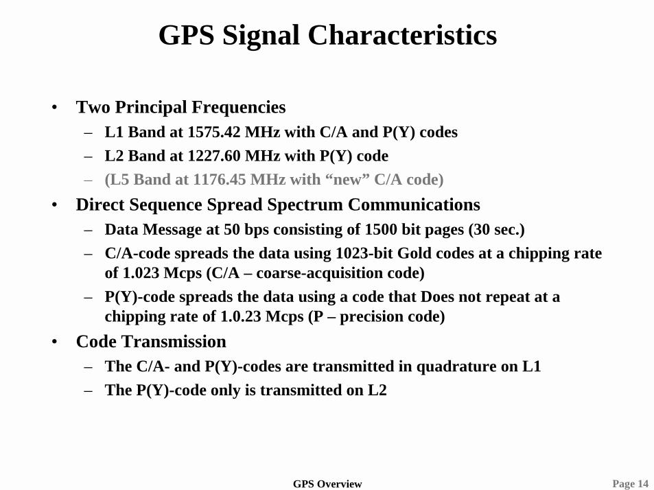
Page 14GPS Overview
GPS Signal Characteristics
• Two Principal Frequencies– L1 Band at 1575.42 MHz with C/A and P(Y) codes– L2 Band at 1227.60 MHz with P(Y) code– (L5 Band at 1176.45 MHz with “new” C/A code)
• Direct Sequence Spread Spectrum Communications– Data Message at 50 bps consisting of 1500 bit pages (30 sec.)– C/A-code spreads the data using 1023-bit Gold codes at a chipping rate
of 1.023 Mcps (C/A – coarse-acquisition code)– P(Y)-code spreads the data using a code that Does not repeat at a
chipping rate of 1.0.23 Mcps (P – precision code)• Code Transmission
– The C/A- and P(Y)-codes are transmitted in quadrature on L1– The P(Y)-code only is transmitted on L2

Page 15GPS Overview
GPS Receiver Characteristics
• Receive up to 12 satellites simultaneously• User Minimum received power
– L1 C/A-Code: –130 dBm– L1 P-Code: –133 dBm– L2 P-Code: –136 dBm– kTB (20 MHz): –101 dBm
-10 -5 0 5 10-160
-150
-140
-130
-120
-110
-100
dBm
/ H
z
F re qua nc y (MHz )
The rm a l Nois e P owe rC/A Code P (Y) C ode

Page 16GPS Overview
GPS Code Correlation
• Code Lock to Satellite Vehicle’s Pseudo Random Sequence (acquisition process)• GPS satellites have highly accurate atomic clocks on board to maintain an
absolute reference.• When a GPS receiver locates one satellite, it can download all satellite location
information, and find the remaining needed satellites much more quickly.
Tc
ττττ
A2
Tc-Tc
NTc-NTcR(ττττ) = A2 (1 - | ττττ | / Tc) for | ττττ | <=<=<=<= Tc
= - A2 /N elsewhere
Page 17GPS Overview
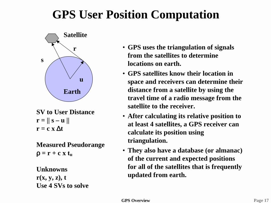
GPS User Position Computation
Earth
Satellite
r
u
s
SV to User Distancer = || s – u ||r = c x ∆∆∆∆t
Measured Pseudorangeρρρρ = r + c x tu
Unknownsr(x, y, z), tUse 4 SVs to solve
• GPS uses the triangulation of signals from the satellites to determine locations on earth.
• GPS satellites know their location in space and receivers can determine their distance from a satellite by using the travel time of a radio message from the satellite to the receiver.
• After calculating its relative position to at least 4 satellites, a GPS receiver can calculate its position using triangulation.
• They also have a database (or almanac) of the current and expected positions for all of the satellites that is frequently updated from earth.

Page 18GPS Overview
All-Digital GPS Implementation
Code Generat
or w/ NCO
Carrier-Doppler
Generator w/ NCO
Code Partial Correlation
SA-AS Key Data
Processor Functions
Key Loading
Doppler Removal
Post-Doppler
Integration Loop Filters
PE L
PE L
PE
L
Code Loop
Carrier Loop
PR & DPR App.
Proc.
Delta Pseudo Range
(DPR)
Pseudo Range (PR)
PVT Kalman
Proc.
SV Mgmt: Acq,
Track, & Reacq.
IMU (optional)
Receiver Interfaces
RF Tuner Downconverter:
1.6, 2, 10, 16 or 24 MHz IF BW
PRDPR
Codes
Doppler
NAV
Aiding
Cmd & Cntrl
DemodData
Data
NA
V
SA-AS Module (SAASM)
ADC Digitizer:
1- to 14-bit ADC
PEmbedded DSP
and Software
GPS Antenna
Cmd & Cntrl
Data
Cm
d & C
ntrl
Code Paradigm
Code Paradigm
Temporal Anti-Jam
Filter (optional)
Code Paradigm
Dedicated Hardware or ASIC
ASICs GPS S/W
GFE/GFIRF-ADC
Antenna
IMU
Data

Page 19GPS Overview
Advanced Commercial GPS Features
• Differential GPS (DGPS)– Use a reference station to provide a known position reference.
Provide GPS corrections to a second receiver based on differences between the reference station actual and computed position.
– Coast Guard maintains DGPS for all coasts and navigable waterways in the United States.
• FAA Augmentations– LAAS: Local Area Augmentation System
• Local area reference station that provide GPS reference and offset information for a fixed ground site, such as an airport.
– WAAS: Wide Area Augmentation System• Region reference station based on geosynchronous satellites
transmitting GPS reference and offset data for aircraft in-flight navigation.
Page 20GPS Overview
Global Positioning System Summary
• Position, Velocity, and Time (PVT) Reference• Applications continue to expand• Technical Challenges Abound• Excellent Technical Career Opportunities

Page 21GPS Overview