GIS applications in Emergency / Disaster Management
10
Represented by Mr.Phongsakorn UAR - AMRUNGKOON Geo - informatics (international program) CMU
-
Upload
phongsakorn-uar-amrungkoon -
Category
Technology
-
view
108 -
download
5
Transcript of GIS applications in Emergency / Disaster Management
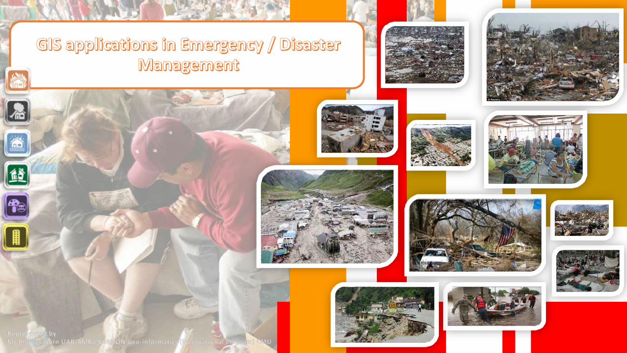
Represented byMr.Phongsakorn UAR-AMRUNGKOON Geo-informatics (international program) CMU

COPYRIGHT byMr.Phongsakorn UAR-AMRUNGKOON Geo-informatics (international program) Chiang Mai university THAILAND
GIS is an essential technology for all phases of emergency management preparation, mitigation, response, and recovery. Find out how GIS provides a foundation for comprehensive emergency management .
To prepare for and mitigate emergencies, GIS can map and model potential disasters to help visualize critical vulnerabilities and damage consequences. As rebuilding begins, GIS aids local, state, and federal agencies with technology that supports collaboration between multiple agencies.
Field data captured with mobile GIS provides the ability to add updates from remote locations for more efficient incident management. It also supplies rapid damage assessment and more accurate recovery operations.
Overview
Explore the ArcGIS for Emergency
Management solution and learn how GIS can
support your mission by leveraging the common operating platform.

GIS is the most complete information system for analyzing, modeling, and displaying community vulnerability. When hazard locations can be viewed along with critical infrastructure, critical values at highest risk become apparent. Models can be processed to determine potential impacts and appropriate mitigation requirements. When events occur, response preparedness is more comprehensive. The basic foundation of developing an emergency management program is the analysis of risks and hazards to determine values at risk and operations necessary to reduce exposure, respond effectively, and recover quickly.
How GIS is used
Planning and analysis
The following core capabilities can be
enhanced using GIS technology
enabling staff to more effectively carry
out all types of tasks for supporting every kind of public safety emergency.
COPYRIGHT byMr.Phongsakorn UAR-AMRUNGKOON Geo-informatics (international program) Chiang Mai university THAILAND

To achieve comprehensive preparedness, a great deal of information must be gathered and maintained in advance of an event. ArcGIS is a flexible information platform that enables full integration with other information systems. ArcGIS is a standards-based and provides an extendable architecture for true interoperability. Accurate cataloging of GIS data and services, combined with your organization's existing investments, gives you an edge for turning raw data into useful information.
How GIS is used
Planning and analysis
Data Management
COPYRIGHT byMr.Phongsakorn UAR-AMRUNGKOON Geo-informatics (international program) Chiang Mai university THAILAND

Situational awareness is the corner stone of emergency and disaster management. As an emergency unfolds, it is paramount to an effective response to understand the current circumstances and to monitor events as they dynamically unfold over time. You need to know what's happening and where, and you have to be able to see it in real time. GIS aids in quickly establishing full situational awareness by linking people, processes, and information together using geography. It provides the map interface into getting a handle on an emergency and nimbly adjusting to change.
How GIS is used
Planning and analysis
Data Management
Situation awareness
COPYRIGHT byMr.Phongsakorn UAR-AMRUNGKOON Geo-informatics (international program) Chiang Mai university THAILAND
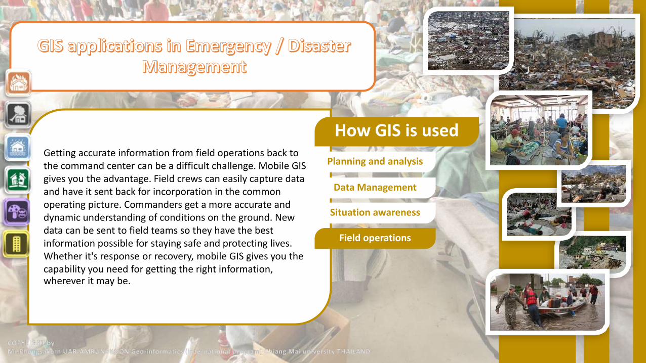
Getting accurate information from field operations back to the command center can be a difficult challenge. Mobile GIS gives you the advantage. Field crews can easily capture data and have it sent back for incorporation in the common operating picture. Commanders get a more accurate and dynamic understanding of conditions on the ground. New data can be sent to field teams so they have the best information possible for staying safe and protecting lives. Whether it's response or recovery, mobile GIS gives you the capability you need for getting the right information, wherever it may be.
How GIS is used
Planning and analysis
Data Management
Situation awareness
Field operations
COPYRIGHT byMr.Phongsakorn UAR-AMRUNGKOON Geo-informatics (international program) Chiang Mai university THAILAND
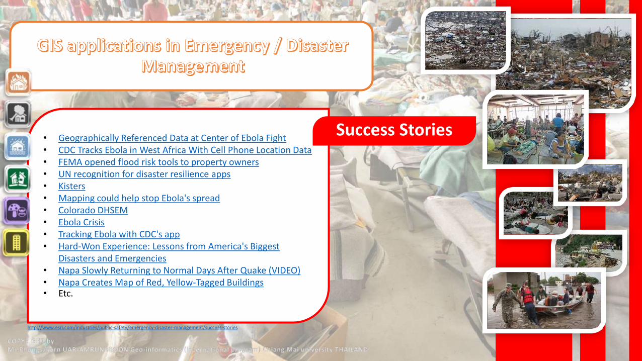
• Geographically Referenced Data at Center of Ebola Fight• CDC Tracks Ebola in West Africa With Cell Phone Location Data• FEMA opened flood risk tools to property owners• UN recognition for disaster resilience apps• Kisters• Mapping could help stop Ebola's spread• Colorado DHSEM• Ebola Crisis• Tracking Ebola with CDC's app• Hard-Won Experience: Lessons from America's Biggest
Disasters and Emergencies• Napa Slowly Returning to Normal Days After Quake (VIDEO)• Napa Creates Map of Red, Yellow-Tagged Buildings• Etc.
Success Stories
http://www.esri.com/industries/public-safety/emergency-disaster-management/success-stories
COPYRIGHT byMr.Phongsakorn UAR-AMRUNGKOON Geo-informatics (international program) Chiang Mai university THAILAND

CDC Tracks Ebola in West Africa With Cell Phone Location Data
The Centers for Disease Control and Prevention is tracking the approximate locations of cell phone users in West Africa who dial emergency call centers in an effort to predict the onset and spread of Ebola outbreaks."The data is just the number of calls by cell tower but from that you can get a rough idea of the area that the calls are coming in from, and then derive census, neighborhood data from that," CDC spokeswoman Kristen Nordlund told Nextgovon Thursday.It's one of the high-tech approaches the U.S. government is piloting to stop the spread of the disease.There is deep cell phone penetration in many parts of West Africa, where land lines sometimes are nonexistent.By collecting tower data from telecommunications providers, CDC officials can visualize the beginnings of an outbreak, explained Este Geraghty, chief medical officer at software mapping provider Esri. She's working with the agency on response efforts.In Liberia, special call centers and a "4455" hotline number were set up for residents to ask Ebola-related questions and report cases.The Liberia Ministry of Health and telecom companies, with CDC support, "looked at the cell tower locations and tower traffic — in other words, which tower the call came in through," Geraghty said. "It isn't an exact location of the population with questions, but it does give them an idea of which part of the community questions are coming from — and presumably populations of need that may not be identified through formal case investigations."A spike in the number of calls could suggest a crisis.
Success Stories
Example case 1
Volunteers push cart with a man suspected of having Ebola virus, to a health centre in central area Monrovia, Liberia, on Oct. 5, 2014. IMAGE: ABBAS DULLEH/ASSOCIATED PRESS
http://mashable.com/2014/10/10/cdc-ebola-cell-phone-tracking/
COPYRIGHT byMr.Phongsakorn UAR-AMRUNGKOON Geo-informatics (international program) Chiang Mai university THAILAND

Ebola Crisis
FREETOWN, Sierra Leone -- The president of Sierra Leone declared a public health emergency as the Ebola crisis blamed for nearly 700 deaths deepened across West Africa, vowing to quarantine sick patients at home and conduct house-to-house searches for others who may have been exposed. The announcement from President Ernest Bai Koroma late Wednesday came as neighboring Liberia also ramped up its efforts to slow the virulent disease's spread, shutting down schools and ordering most public servants to stay home from work. The U.S. Peace Corps also was evacuating hundreds of its volunteers in the affected countries. Two Peace Corps workers are under isolation outside the U.S. after having contact with a person who later died of the Ebola virus, a State Department official said. Ebola has been blamed for more than 670 deaths in four West African countries this year, and has shown no signs of slowing down particularly in Liberia and Sierra Leone. Among the dead was the chief doctor treating Ebola in Sierra Leone, who was to be buried Thursday.
Success Stories
Example case 1
Example case 2
Figure 3Shown the Ebola areas in Africahttp://newsmaps.maps.arcgis.com/apps/MapJournal/?appid=d6d55218bc804899a9d38a88a71d1b32
COPYRIGHT byMr.Phongsakorn UAR-AMRUNGKOON Geo-informatics (international program) Chiang Mai university THAILAND

For more informationhttp://www.esri.com/industries/public-safety/emergency-
disaster-management
COPYRIGHT byMr.Phongsakorn UAR-AMRUNGKOON Geo-informatics (international program) Chiang Mai university THAILAND