Geo-Referencing Requirements on Canada Lands
20
Geo-Referencing Requirements on Canada Lands CHC- NSC 2008, Victoria, B.C.
Transcript of Geo-Referencing Requirements on Canada Lands
Geo-Referencing Requirements on Canada Lands
CHC- NSC 2008, Victoria, B.C.

2
Past Geo-Referencing Requirements
1 km rule based on conventional connectionsUsed pin-pricked photos or Topographic MapsCSA Connections
Accuracy of cadastral data in CSA < 10 cmFurther connections provide little benefit in many cases
Northern Land Claim SurveysGeo-referenced surveys has provided accurate cadastral dataData in communities and developed corridors < 30 cmMany areas do not need further geo-referencing
3
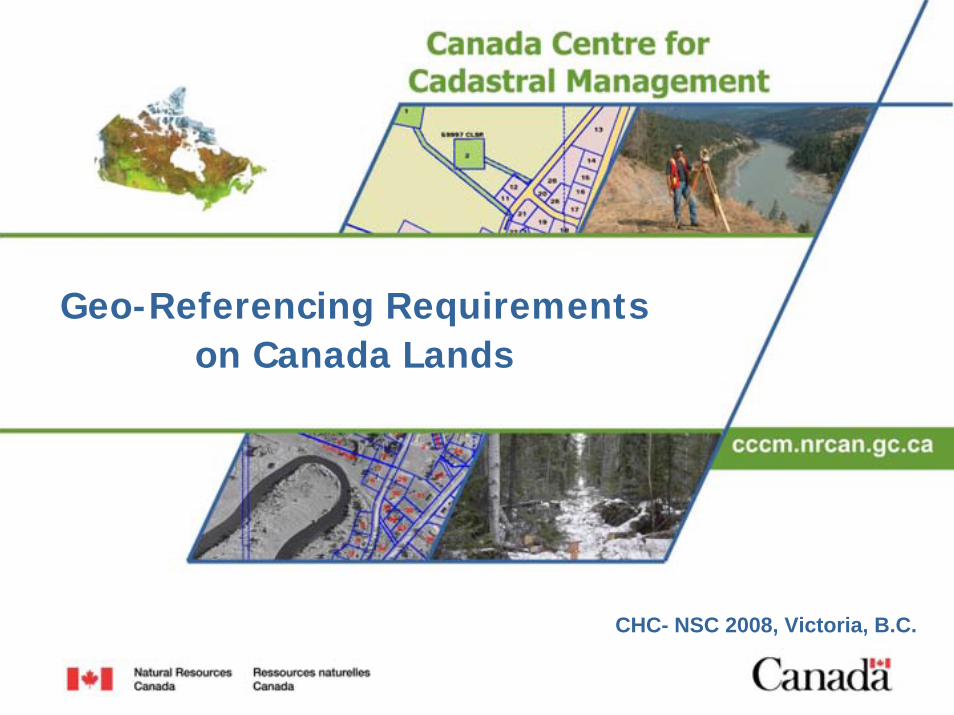
Background
1999 – Technical, Social and Legal Implications of Using Coordinates-only to Define Boundaries2002 – Integrated Land Surveys2005 – CCOG Resolution on Integrated Surveys
NAD83CSRS Connections: Urban 5 cm, Rural 20 cm, Remote 1 m
GNSS positioning technologies
New Spatial Applications: Google Earth, Navigation, Municipal Infrastructure GIS
Users are demanding more accurate spatial data
4
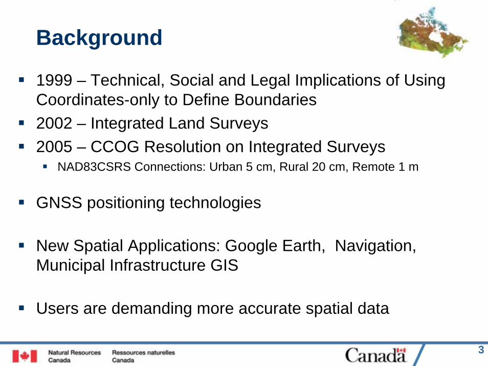
Data Accuracy Demands, e.g. Google Earth
5
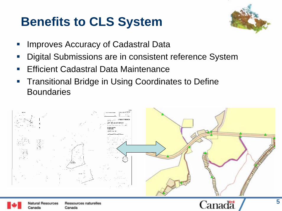
Benefits to CLS SystemImproves Accuracy of Cadastral Data Digital Submissions are in consistent reference SystemEfficient Cadastral Data MaintenanceTransitional Bridge in Using Coordinates to Define Boundaries
6
Benefits to Surveyor
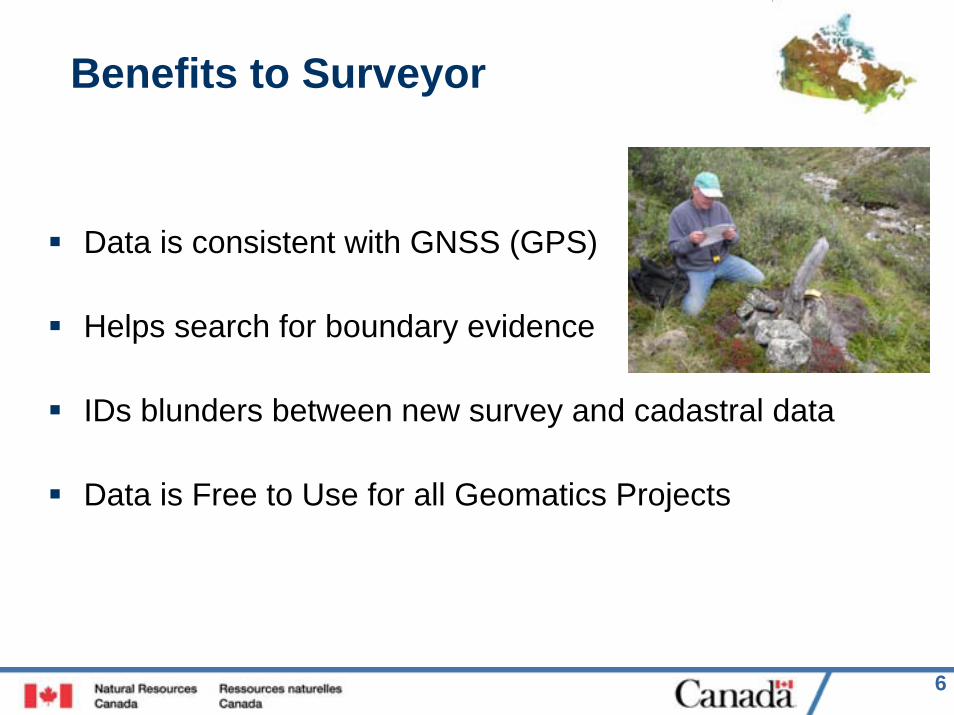
Data is consistent with GNSS (GPS)
Helps search for boundary evidence
IDs blunders between new survey and cadastral data
Data is Free to Use for all Geomatics Projects
7
New Geo-Referencing Standards
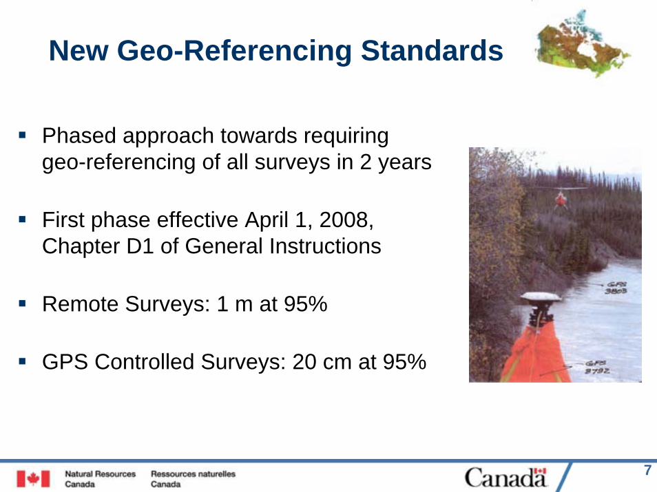
Phased approach towards requiring geo-referencing of all surveys in 2 years
First phase effective April 1, 2008, Chapter D1 of General Instructions
Remote Surveys: 1 m at 95%
GPS Controlled Surveys: 20 cm at 95%
8
New Geo-referencing standard
Remote surveys: includes areas outside inhabited urban and rural areas, and small Reserves
20 cm requirement applies when survey grade receivers are being used to control or measure the boundaries, e.g. RTK, GPS baselines, bearing control
Exempt if survey is connected to accurately geo-referenced cadastral fabric
20 cm and 1 m accuracies are required for the entire survey

9
Absolute Accuracy of Survey
10
Why NAD83(CSRS)
National Reference System as is CLS systemDistortion “Free”; removed errors in NAD83Directly linked to Global Reference Frame (ITRF); aligned with GNSS observationsUses Higher Precision Markers and GNSSSource Coordinates have known accuraciesAccess to ground control is NOT requiredNTv2 Models available to convert NAD83 databasesAdopt now rather than playing catch-up later with distorted cadastral data
11
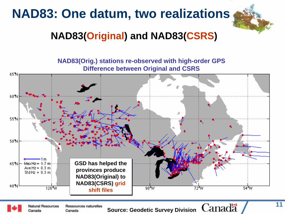
NAD83: One datum, two realizations
NAD83(Orig.) stations re-observed with high-order GPSDifference between Original and CSRS
GSD has helped the provinces produce NAD83(Original) to NAD83(CSRS) grid
shift files
NAD83(Original) and NAD83(CSRS)
GSD has helped the provinces produce NAD83(Original) to NAD83(CSRS) grid
shift files
Source: Geodetic Survey Division
12
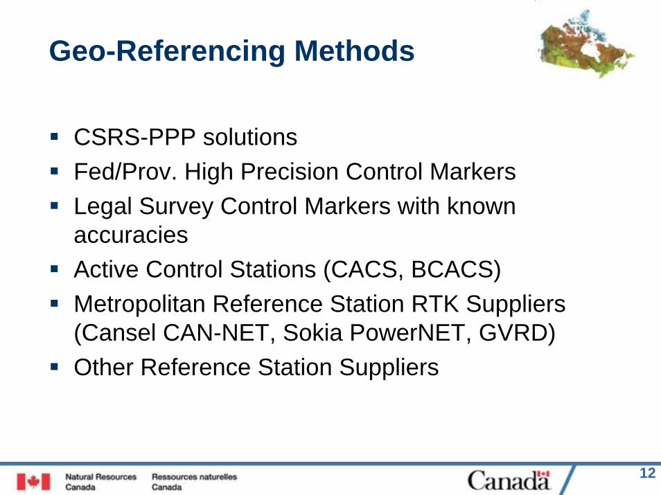
Geo-Referencing Methods
CSRS-PPP solutionsFed/Prov. High Precision Control MarkersLegal Survey Control Markers with known accuraciesActive Control Stations (CACS, BCACS)Metropolitan Reference Station RTK Suppliers (Cansel CAN-NET, Sokia PowerNET, GVRD)Other Reference Station Suppliers
13
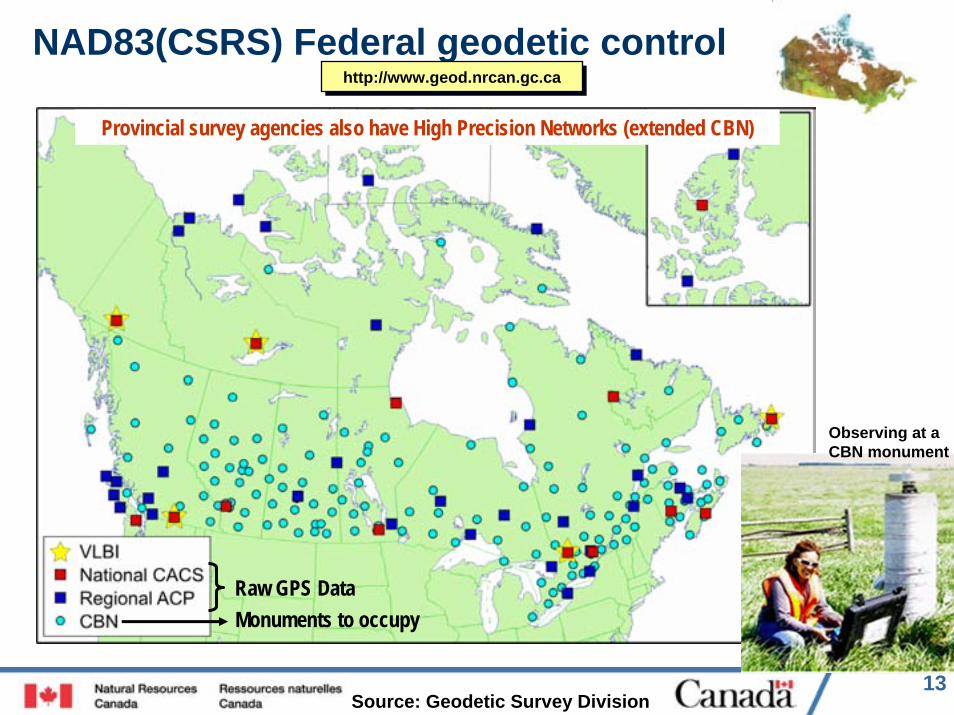
NAD83(CSRS) Federal geodetic control
Raw GPS DataMonuments to occupy
http://www.geod.nrcan.gc.cahttp://www.geod.nrcan.gc.ca
Provincial survey agencies also have High Precision Networks (extended CBN)
Observing at a CBN monument
Source: Geodetic Survey Division
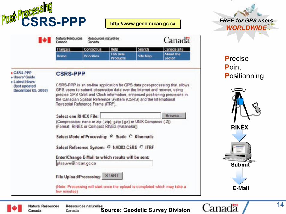
14
CSRS-PPP FREE for GPS usersWORLDWIDEhttp://www.geod.nrcan.gc.cahttp://www.geod.nrcan.gc.ca
Submit
RINEX
PrecisePointPositionning
Source: Geodetic Survey Division
15
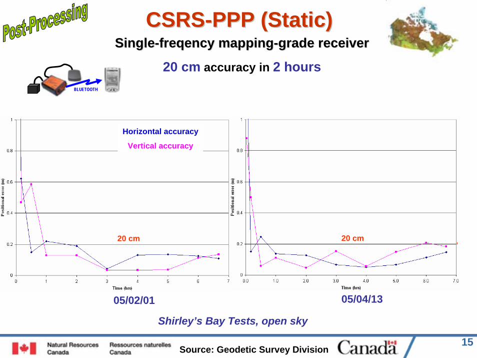
CSRSCSRS--PPP (Static)PPP (Static)
05/04/1305/02/01
SingleSingle--freqencyfreqency mappingmapping--grade receivergrade receiver
20 cm accuracy in 2 hoursBLUETOOTH
Horizontal accuracy
Vertical accuracy
20 cm 20 cm
Shirley’s Bay Tests, open sky
Source: Geodetic Survey Division
16
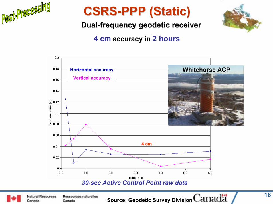
CSRSCSRS--PPP (Static)PPP (Static)DualDual--frequency geodetic receiverfrequency geodetic receiver
4 cm accuracy in 2 hours
Horizontal accuracy
Vertical accuracy
30-sec Active Control Point raw data
4 cm
Whitehorse ACP
Source: Geodetic Survey Division

17
Geo-referencing ReportingList the Coordinates / Heights of the Source Control, Established Control and Key Monuments on the plan
Show the GPS Control Stations and Network Sketchon the plan
Accuracy Report; specify the absolute accuracy of the control stations and of the survey
18
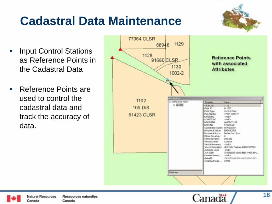
Cadastral Data Maintenance
Input Control Stations as Reference Points in the Cadastral Data
Reference Points are used to control the cadastral data and track the accuracy of data.
19
Cadastral Data Maintenance
Improving the cadastral data by:Requiring geo-referenced surveysData updates attempt to preserve the relative accuracy of the new survey and existing data while improving the absolute accuracy of the dataDeveloping new adjustment techniques and looking at measurement-based systemsDoing re-builds when there are large updates Assess and document the accuracy of the dataRequiring Digital Spatial Files of Surveys as per New Appendix E5 (Oct 1 effective date)

20
More Details and Questions?
Procedural Guide being developed by CCCM; available May 31. Contact any CCCM Office for a Copy of the Guide; also will be on CCCM web site