Fruit/Melon Fly Mapping in Mekong Region S. Jothiganesh GIS Specialist, RIMES, Bangkok.
27
Fruit/Melon Fly Mapping in Mekong Region S. Jothiganesh GIS Specialist, RIMES, Bangkok.
-
Upload
darnell-prestridge -
Category
Documents
-
view
215 -
download
0
Transcript of Fruit/Melon Fly Mapping in Mekong Region S. Jothiganesh GIS Specialist, RIMES, Bangkok.
Fruit/Melon Fly Mapping in Mekong Region
S. JothiganeshGIS Specialist,
RIMES, Bangkok.
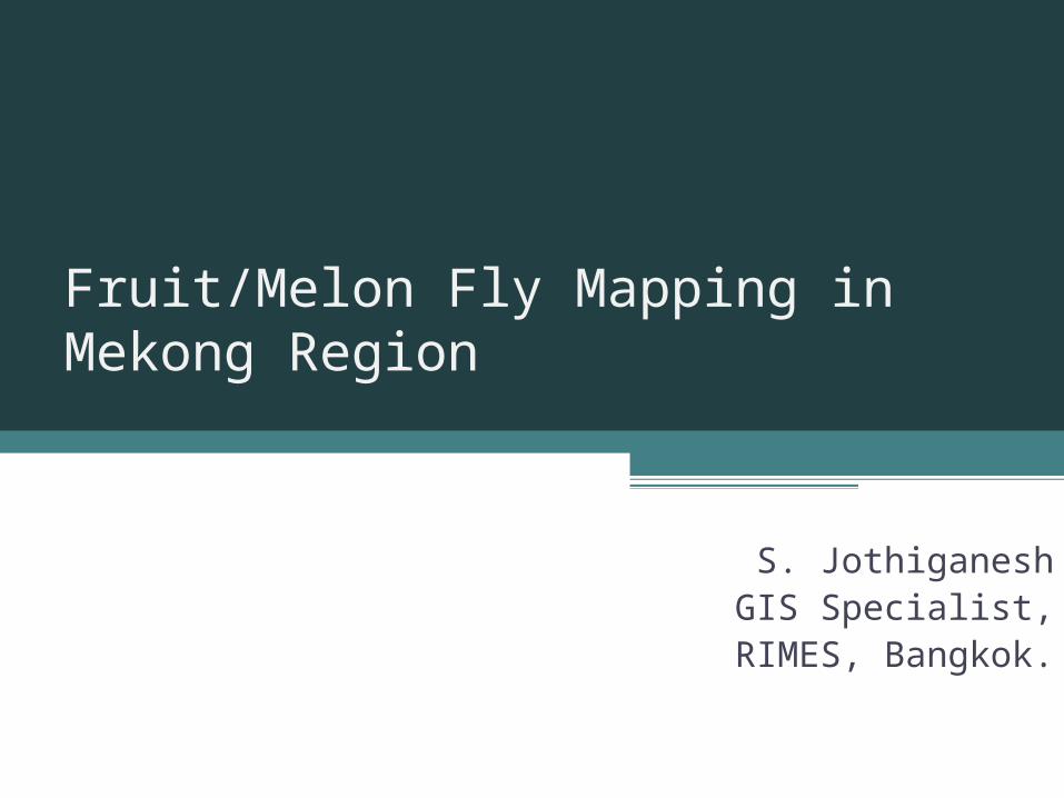
The fruit fly infestation has been a major problem for the crops that have been grown along the Mekong Region. GIS helps to identify vulnerable areas, pattern of infestation and the damages caused due to the Oriental fruit fly and Melon fly at various geographic scales .
Introduction
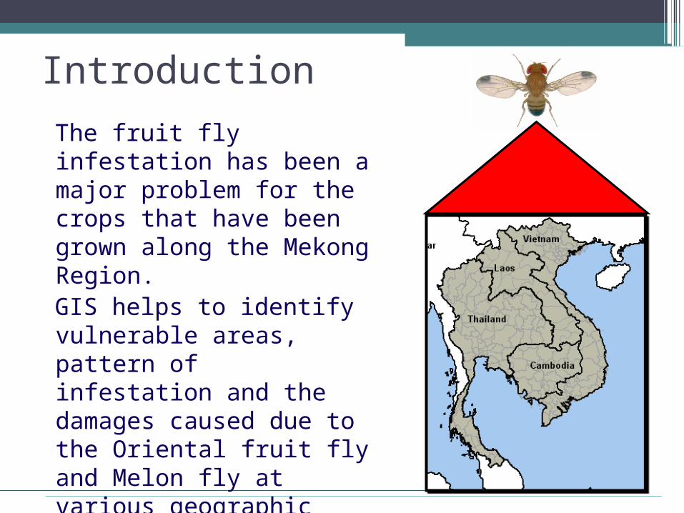
GIS for IPM
● Effective tool in monitoring, predicting, managing and fighting the spread of crop diseases and pests.
● Identify the spatial extent and spatial patterns of the infestation.
● Forecasting spatial spread of diseases through risk assessment models which will be of help for pest control activities
● Infestation data can be combined with environment and socio-economic data as an effort to create a decision support model. This allows the identification of vulnerable areas that need to be targeted first for pest control activities
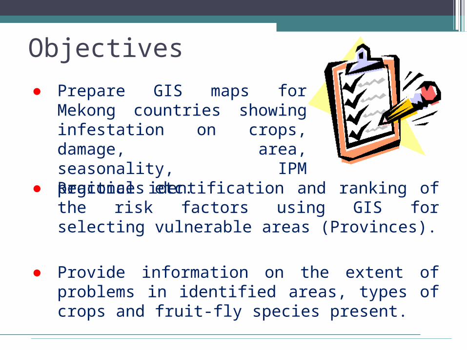
Objectives
● Prepare GIS maps for Mekong countries showing infestation on crops, damage, area, seasonality, IPM practices etc.
● Regional identification and ranking of the risk factors using GIS for selecting vulnerable areas (Provinces).
● Provide information on the extent of problems in identified areas, types of crops and fruit-fly species present.
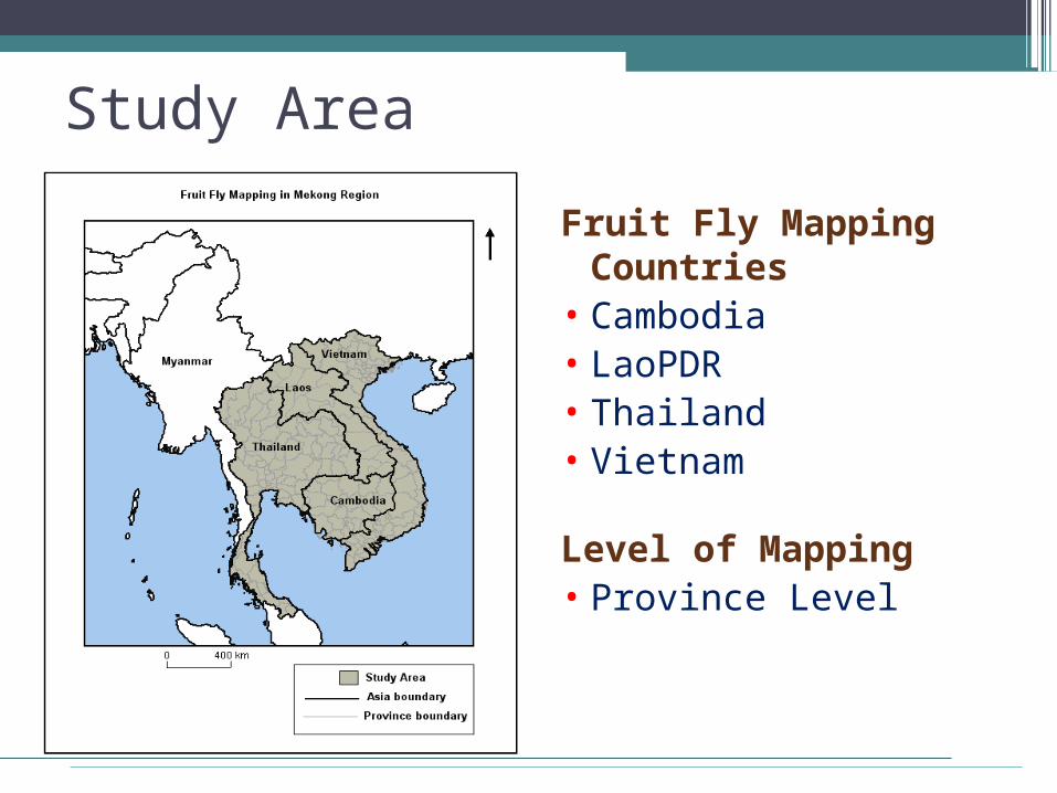
Study Area
Fruit Fly Mapping Countries
• Cambodia• LaoPDR• Thailand• Vietnam
Level of Mapping• Province Level
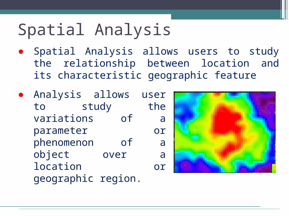
Spatial Analysis● Spatial Analysis allows users to study the
relationship between location and its characteristic geographic feature
● Analysis allows user to study the variations of a parameter or phenomenon of a object over a location or geographic region.
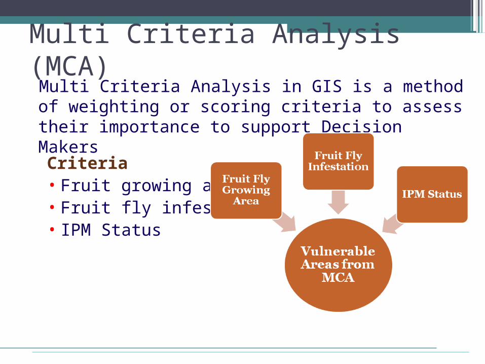
Multi Criteria Analysis (MCA)Multi Criteria Analysis in GIS is a method of weighting or scoring criteria to assess their importance to support Decision Makers
Criteria• Fruit growing area• Fruit fly infestation• IPM Status
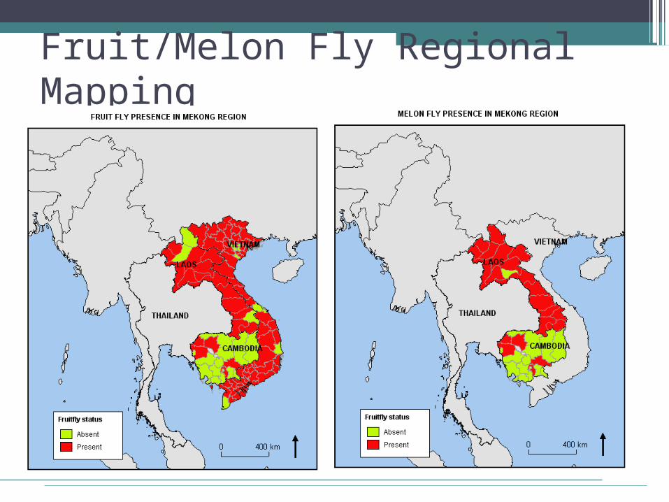
Fruit/Melon Fly Regional Mapping
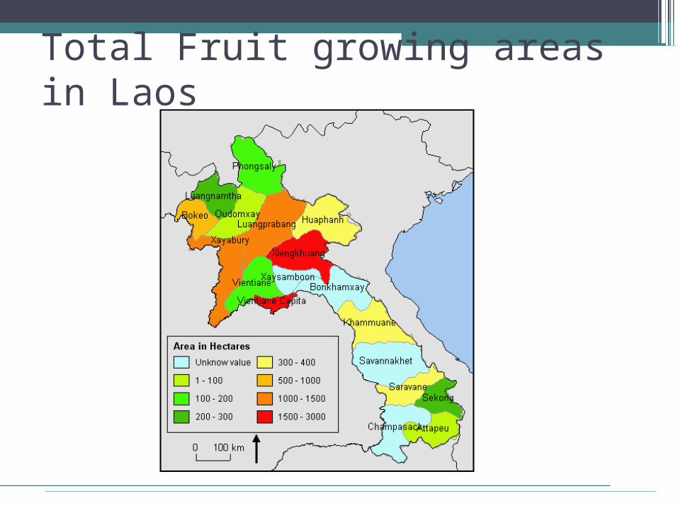
Total Fruit growing areas in Laos
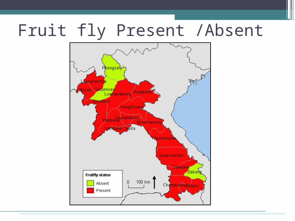
Fruit fly Present /Absent
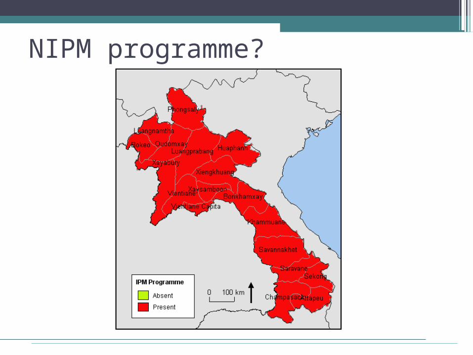
NIPM programme?
Preliminary Suggestive Map for Project Activities
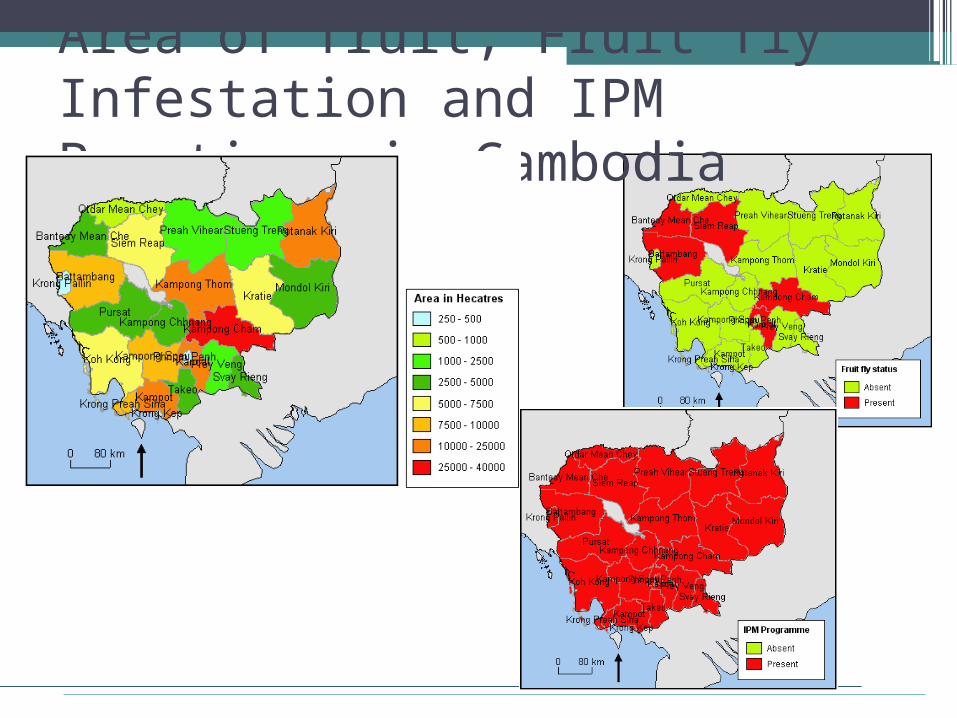
Area of fruit, Fruit fly Infestation and IPM Practices in Cambodia

Preliminary Suggestive Map for Project Activities for Cambodia
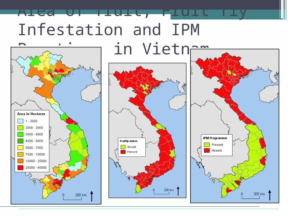
Area of fruit, Fruit fly Infestation and IPM Practices in Vietnam
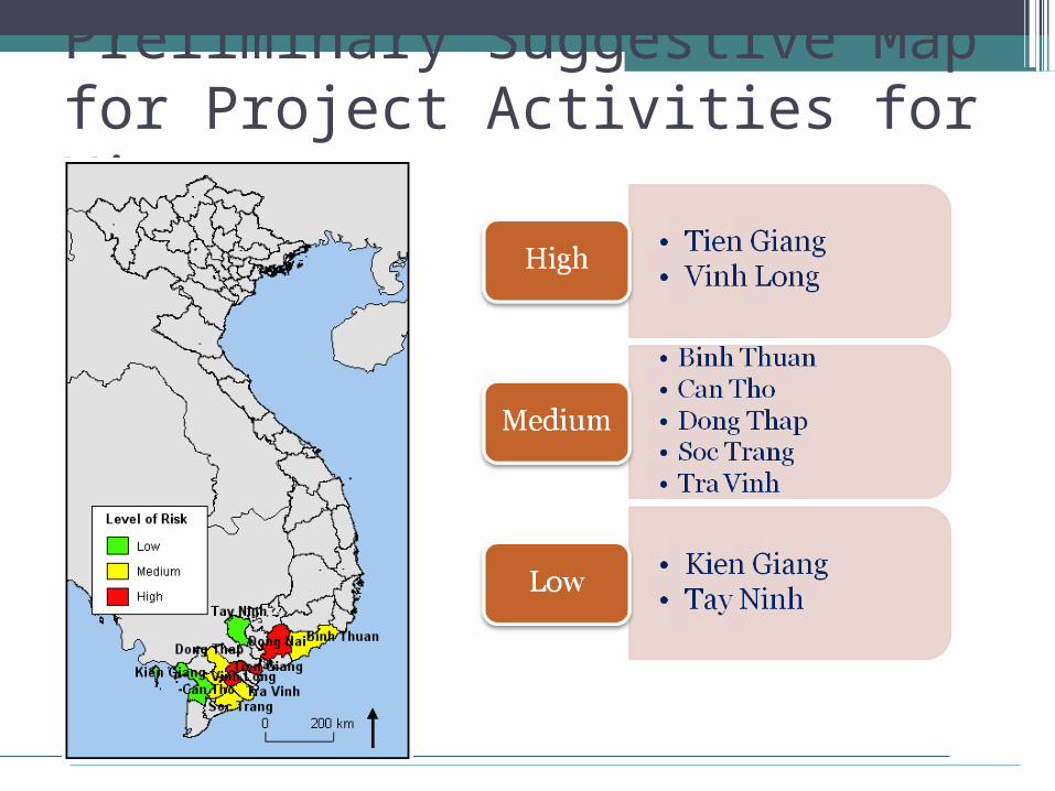
Preliminary Suggestive Map for Project Activities for Vietnam
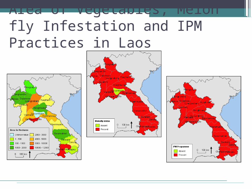
Area of Vegetables, Melon fly Infestation and IPM Practices in Laos
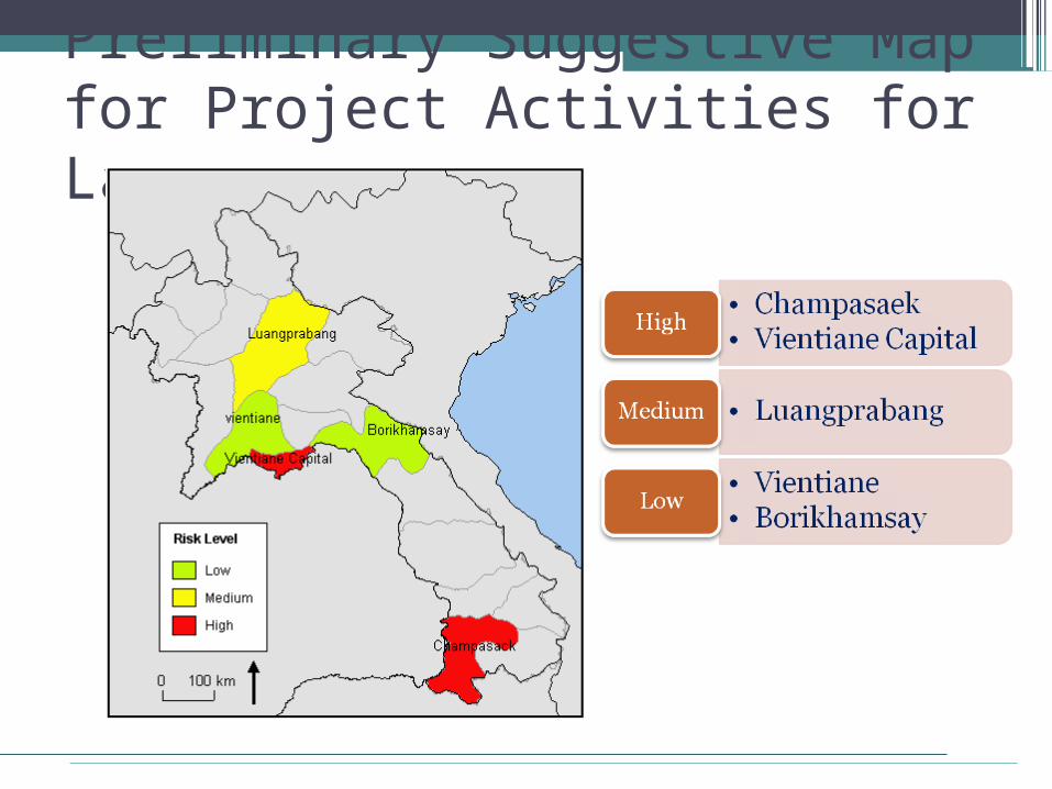
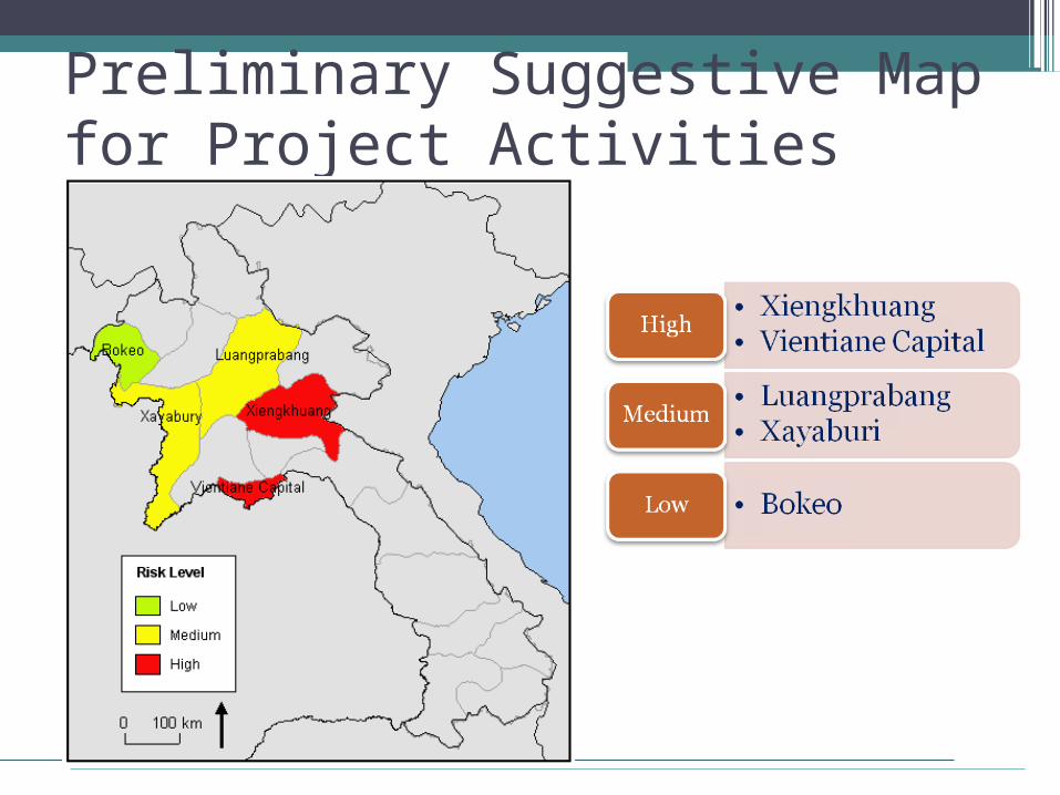
Preliminary Suggestive Map for Project Activities for Laos
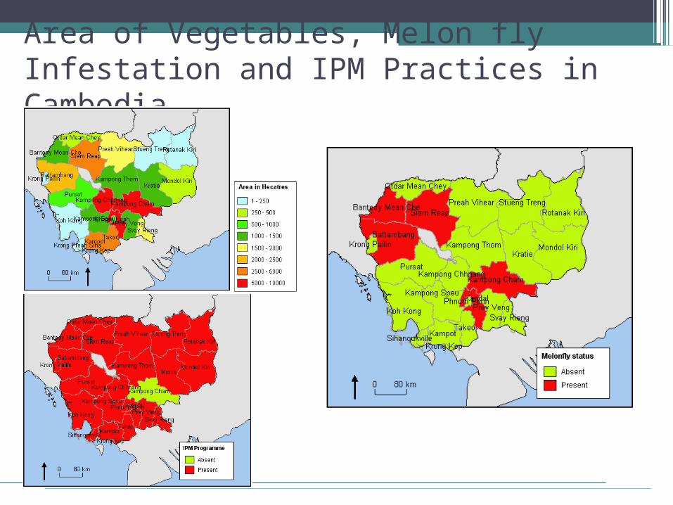
Area of Vegetables, Melon fly Infestation and IPM Practices in Cambodia
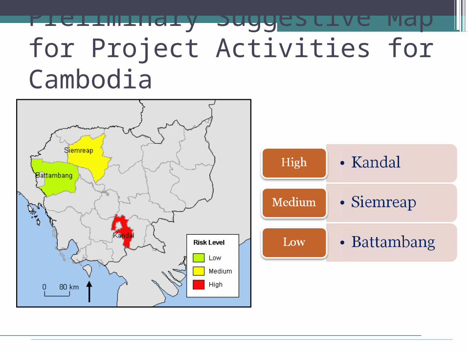
Preliminary Suggestive Map for Project Activities for Cambodia
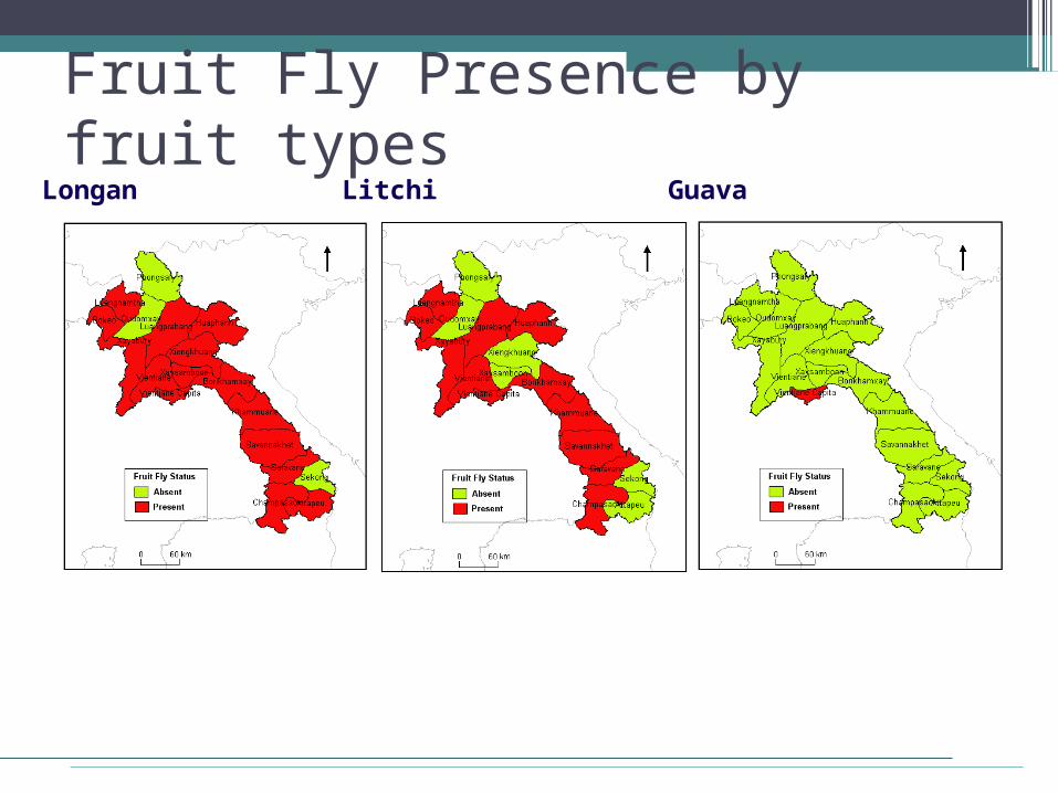
Fruit Fly Presence by fruit typesLongan Litchi Guava
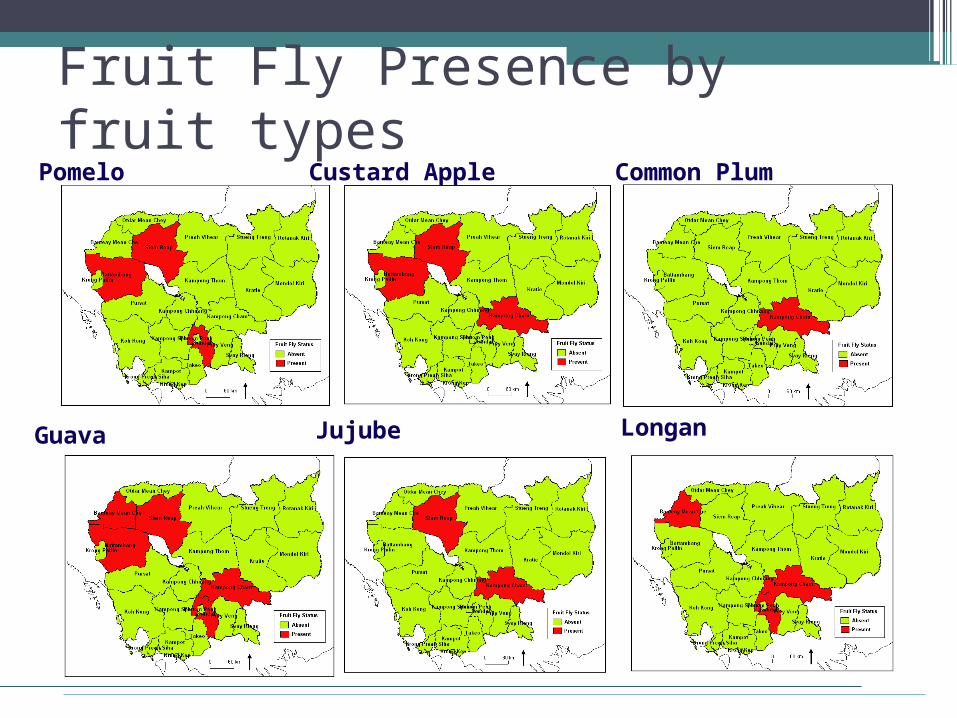
Fruit Fly Presence by fruit types Pomelo Custard Apple Common Plum
Guava Jujube Longan
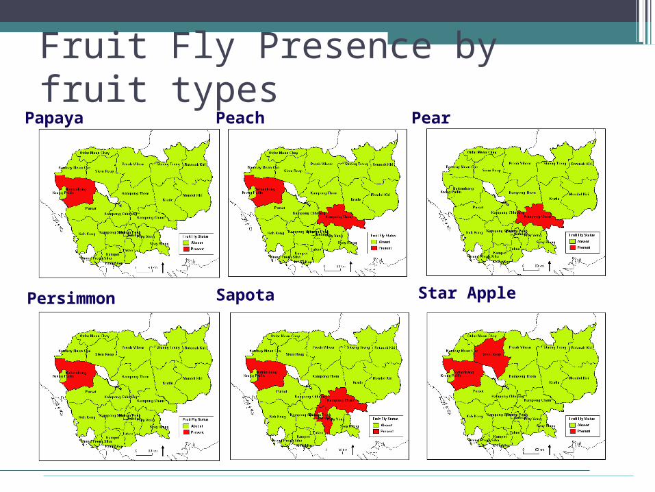
Fruit Fly Presence by fruit typesPapaya Peach Pear
Persimmon Sapota Star Apple
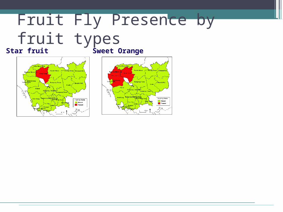
Fruit Fly Presence by fruit typesStar fruit Sweet Orange
Mapping Status and Limitations● Infestation data considered is at province
level and not actual pest outbreak location.
● Extent of damage in crops and the period of information has to be collected for all kind of crops in all province.
● Spread of the pests may be linked with environment and climatic condition. Extensive information on land use, soil, climatic factors is needed
Comments and Suggestions?● What analysis could be added to this so
as to improve preliminary findings?
● What all additional information can be included and used ?
● Is it possible to get exact location of incidence of pests?
● Any other comments?