Europe’s Quest for Satellite Navigation: The Structure of EGNOS and Galileo Dominic De Mello April...
35
Europe’s Quest for Europe’s Quest for Satellite Navigation: Satellite Navigation: The Structure of EGNOS The Structure of EGNOS and Galileo and Galileo Dominic De Mello Dominic De Mello April 24, 2006 April 24, 2006
-
Upload
caden-hutton -
Category
Documents
-
view
217 -
download
0
Transcript of Europe’s Quest for Satellite Navigation: The Structure of EGNOS and Galileo Dominic De Mello April...
Europe’s Quest for Europe’s Quest for Satellite Navigation: Satellite Navigation: The Structure of The Structure of EGNOS and GalileoEGNOS and Galileo
Dominic De MelloDominic De Mello
April 24, 2006April 24, 2006
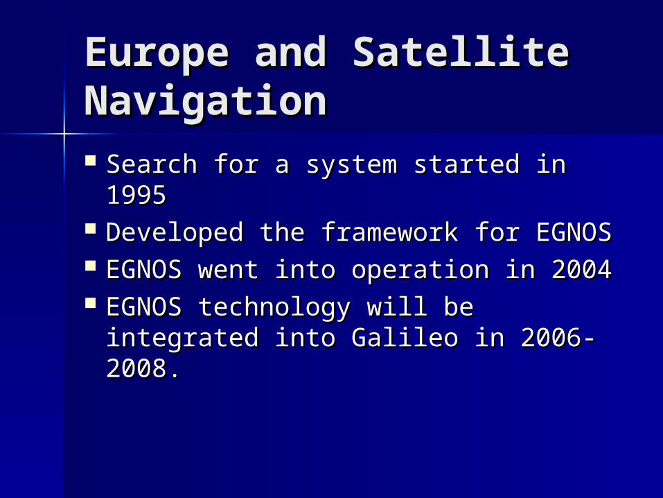
Europe and Satellite Europe and Satellite NavigationNavigation Search for a system started in 1995Search for a system started in 1995 Developed the framework for EGNOSDeveloped the framework for EGNOS EGNOS went into operation in 2004EGNOS went into operation in 2004 EGNOS technology will be integrated EGNOS technology will be integrated
into Galileo in 2006-2008.into Galileo in 2006-2008.

EGNOSEGNOS
European Geostationary Navigation European Geostationary Navigation Overlay ServiceOverlay Service
Precursor to GalileoPrecursor to Galileo Enhances GPS/GLONASSEnhances GPS/GLONASS Has 3 segments:Has 3 segments: Space SegmentSpace Segment Ground SegmentGround Segment User SegmentUser Segment
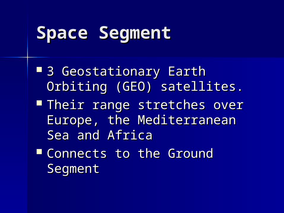
Space SegmentSpace Segment
3 Geostationary Earth Orbiting 3 Geostationary Earth Orbiting (GEO) satellites.(GEO) satellites.
Their range stretches over Their range stretches over Europe, the Mediterranean Sea Europe, the Mediterranean Sea and Africaand Africa
Connects to the Ground SegmentConnects to the Ground Segment
Ground SegmentGround Segment
Consists of:Consists of: 4 Mission Control Centers which contain 4 Mission Control Centers which contain
a Central Processing Facility (CPF)a Central Processing Facility (CPF) 34 Ranging and Integrity Monitoring 34 Ranging and Integrity Monitoring
Stations (RIMS)Stations (RIMS) 6 Navigation Land Earth Stations6 Navigation Land Earth Stations Utilizes the EGNOS Network Time (ENT)Utilizes the EGNOS Network Time (ENT)
User SegmentUser Segment
Consists of one of two receivers; Consists of one of two receivers; one that uses GPS or one that uses one that uses GPS or one that uses GLONASS.GLONASS.
EGNOS is also programmed into EGNOS is also programmed into that receiver.that receiver.
EGNOS helps sharpen the receiver’s EGNOS helps sharpen the receiver’s position from 20 meters of error to position from 20 meters of error to as little as 5 meters of error.as little as 5 meters of error.
EGNOS in GalileoEGNOS in Galileo
EGNOS will be used when Galileo is EGNOS will be used when Galileo is operational in order to decrease operational in order to decrease errors.errors.
The systems will use independent The systems will use independent technology to ensure that both technology to ensure that both systems will not fail at the same time systems will not fail at the same time if an error occurs.if an error occurs.
This will ensure that Europe will This will ensure that Europe will always have some form of always have some form of functioning satellite navigation.functioning satellite navigation.

Europe and Satellite Europe and Satellite NavigationNavigation Search for their own system Search for their own system
commenced in 1998.commenced in 1998. By 1999, planning was under By 1999, planning was under
way, and the name Galileo was way, and the name Galileo was chosen for the system.chosen for the system.
Was supposed to be fully Was supposed to be fully operational by the end of 2008; operational by the end of 2008; looks like 2010 is more realisticlooks like 2010 is more realistic
Why was it developed?Why was it developed?
As opposed to GPS, which was As opposed to GPS, which was developed primarily for military developed primarily for military uses, Galileo was developed uses, Galileo was developed exclusively for civilian use.exclusively for civilian use.
There are zero militarily uses for There are zero militarily uses for Galileo as of right now, and no Galileo as of right now, and no plans for military use in the plans for military use in the future.future.

GalileoGalileo
Joint venture of European Space Joint venture of European Space Agency (ESA) and European Union Agency (ESA) and European Union (EU)(EU)
Estimated cost of 3.2 billion euros Estimated cost of 3.2 billion euros 1.1 billion euros for the development.1.1 billion euros for the development. 2.1 billion euros for the deployment.2.1 billion euros for the deployment. 2 phases: EGNOS and Galileo2 phases: EGNOS and Galileo
Galileo TechnologyGalileo Technology
2 aspects of Galileo:2 aspects of Galileo: Space SegmentSpace Segment Ground SegmentGround Segment
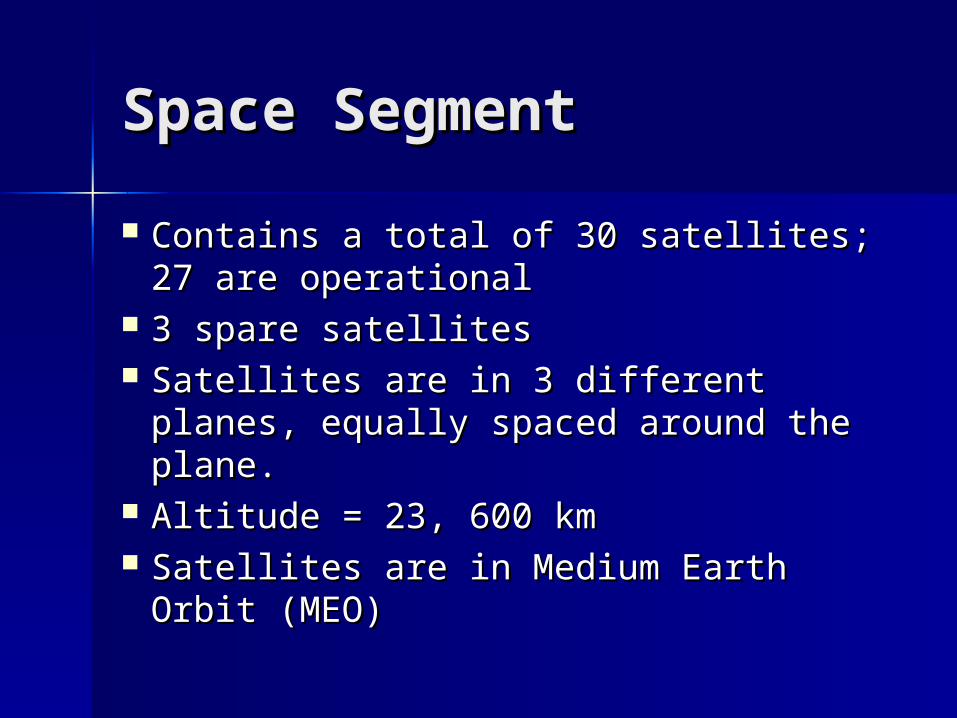
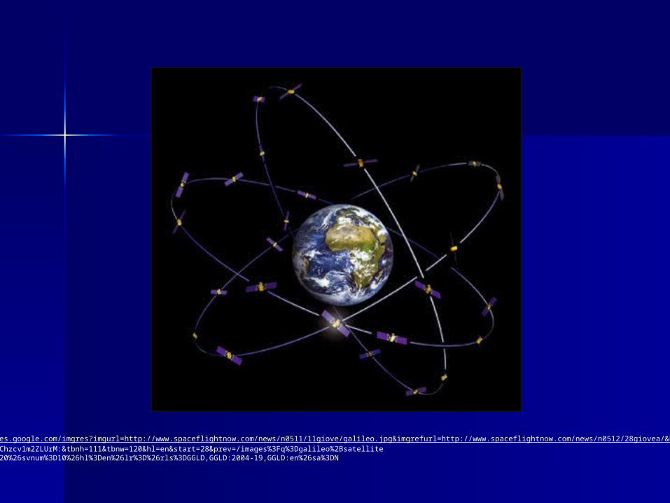
Space SegmentSpace Segment
Contains a total of 30 satellites; 27 Contains a total of 30 satellites; 27 are operational are operational
3 spare satellites 3 spare satellites Satellites are in 3 different planes, Satellites are in 3 different planes,
equally spaced around the plane. equally spaced around the plane. Altitude = 23, 600 kmAltitude = 23, 600 km Satellites are in Medium Earth Orbit Satellites are in Medium Earth Orbit
(MEO)(MEO)
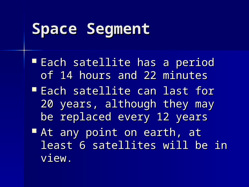
Space SegmentSpace Segment
Each satellite has a period of 14 Each satellite has a period of 14 hours and 22 minuteshours and 22 minutes
Each satellite can last for 20 Each satellite can last for 20 years, although they may be years, although they may be replaced every 12 yearsreplaced every 12 years
At any point on earth, at least 6 At any point on earth, at least 6 satellites will be in view.satellites will be in view.
http://images.google.com/imgres?imgurl=http://www.spaceflightnow.com/news/n0511/11giove/galileo.jpg&imgrefurl=http://www.spaceflightnow.com/news/n0512/28giovea/&h=370&w=398&sz=24&tbnid=gChzcv1m2ZLUrM:&tbnh=111&tbnw=120&hl=en&start=28&prev=/images%3Fq%3Dgalileo%2Bsatellite%26start%3D20%26svnum%3D10%26hl%3Den%26lr%3D%26rls%3DGGLD,GGLD:2004-19,GGLD:en%26sa%3DN

Ground SegmentGround Segment
2 Control Stations Satellite control – monitors if the Satellite control – monitors if the
satellite orbits are on pathsatellite orbits are on path Mission control - maintains the Mission control - maintains the
synchronization of satellite clockssynchronization of satellite clocks
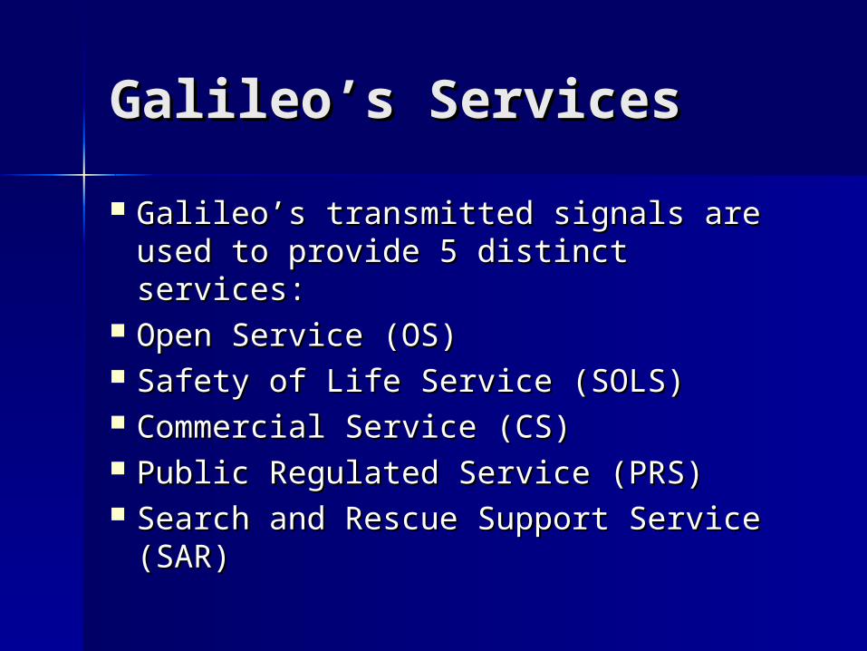
Galileo’s ServicesGalileo’s Services
Galileo’s transmitted signals are used Galileo’s transmitted signals are used to provide 5 distinct services:to provide 5 distinct services:
Open Service (OS)Open Service (OS) Safety of Life Service (SOLS)Safety of Life Service (SOLS) Commercial Service (CS)Commercial Service (CS) Public Regulated Service (PRS)Public Regulated Service (PRS) Search and Rescue Support Service Search and Rescue Support Service
(SAR)(SAR)

Open ServiceOpen Service
OS can determine speed, velocity, and OS can determine speed, velocity, and timing informationtiming information
Is free of charge and can be used on a Is free of charge and can be used on a handheld receiverhandheld receiver
Can also be used in car navigation Can also be used in car navigation systemssystems
Will never be intentionally jammed, Will never be intentionally jammed, Will have few ionospheric and Will have few ionospheric and
tropospheric delaystropospheric delays Accurate to 15 metersAccurate to 15 meters
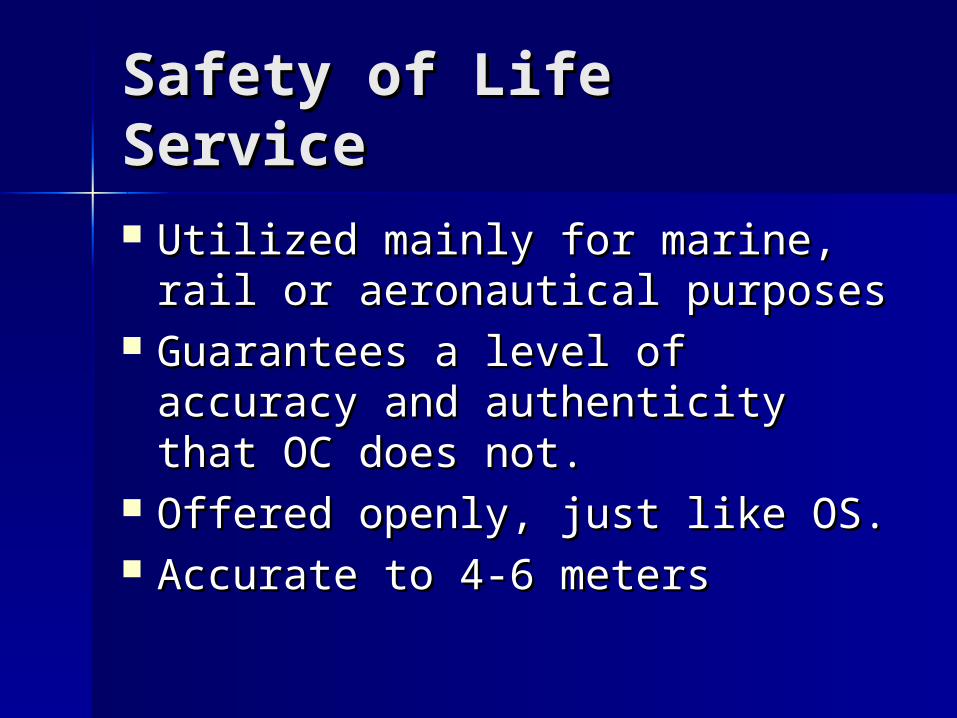
Safety of Life ServiceSafety of Life Service
Utilized mainly for marine, rail or Utilized mainly for marine, rail or aeronautical purposesaeronautical purposes
Guarantees a level of accuracy Guarantees a level of accuracy and authenticity that OC does and authenticity that OC does not.not.
Offered openly, just like OS.Offered openly, just like OS. Accurate to 4-6 metersAccurate to 4-6 meters

Commercial ServiceCommercial Service
Is encodedIs encoded Must pay fee in order to get Must pay fee in order to get
encryption keyencryption key Is much more precise than Open Is much more precise than Open
ServiceService Is accurate to 1 meterIs accurate to 1 meter Generates revenue for GalileoGenerates revenue for Galileo

Public Regulated Public Regulated ServiceService The PRS is used for governmental purposesThe PRS is used for governmental purposes PRS is encoded; can be utilized by PRS is encoded; can be utilized by
intelligence services, law enforcement, etc...intelligence services, law enforcement, etc... Is guaranteed to always have a continuous Is guaranteed to always have a continuous
signal; this is its main strength over OS.signal; this is its main strength over OS. By utilizing “appropriate interference By utilizing “appropriate interference
mitigation technologies”, the PRS is more mitigation technologies”, the PRS is more accurate than OS. accurate than OS.
However, it is only accurate to about 10 However, it is only accurate to about 10 metersmeters
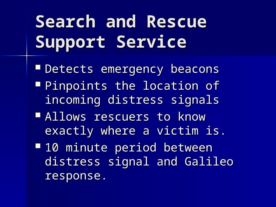
Search and Rescue Search and Rescue Support ServiceSupport Service Detects emergency beaconsDetects emergency beacons Pinpoints the location of incoming Pinpoints the location of incoming
distress signalsdistress signals Allows rescuers to know exactly Allows rescuers to know exactly
where a victim is.where a victim is. 10 minute period between distress 10 minute period between distress
signal and Galileo response.signal and Galileo response.
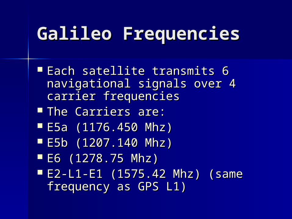
Galileo FrequenciesGalileo Frequencies
Each satellite transmits 6 Each satellite transmits 6 navigational signals over 4 carrier navigational signals over 4 carrier frequenciesfrequencies
The Carriers are:The Carriers are: E5a (1176.450 Mhz)E5a (1176.450 Mhz) E5b (1207.140 Mhz)E5b (1207.140 Mhz) E6 (1278.75 Mhz)E6 (1278.75 Mhz) E2-L1-E1 (1575.42 Mhz) (same E2-L1-E1 (1575.42 Mhz) (same
frequency as GPS L1)frequency as GPS L1)
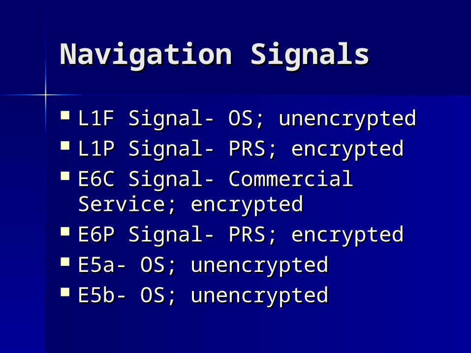
Navigation SignalsNavigation Signals
L1F Signal- OS; unencryptedL1F Signal- OS; unencrypted L1P Signal- PRS; encryptedL1P Signal- PRS; encrypted E6C Signal- Commercial Service; E6C Signal- Commercial Service;
encryptedencrypted E6P Signal- PRS; encryptedE6P Signal- PRS; encrypted E5a- OS; unencryptedE5a- OS; unencrypted E5b- OS; unencryptedE5b- OS; unencrypted

Navigation DataNavigation Data
Ephemeris dataEphemeris data Time parametersTime parameters AlmanacsAlmanacs
Using this data, positioning for any Using this data, positioning for any user on earth can be derived.user on earth can be derived.

Ephemeris DataEphemeris Data
Indicates the position of the Indicates the position of the satellite which is nearest the user.satellite which is nearest the user.
Provides 17 different parameters Provides 17 different parameters from each satellitefrom each satellite

http://www.galileoju.com/doc/Galileo%20standardisation%20document%20for%203GPP.pdf
Ephemeris Data

Time ParametersTime Parameters By accurately measuring the time By accurately measuring the time
between transmission and reception, between transmission and reception, the location of a receiver can be the location of a receiver can be determined.determined.
Galileo Standard Time (GST) is the Galileo Standard Time (GST) is the time that Galileo uses.time that Galileo uses.
Each satellite broadcasts a Time of Each satellite broadcasts a Time of Transmission (TOT)Transmission (TOT)
Satellite Time Corrections are Satellite Time Corrections are employed.employed.
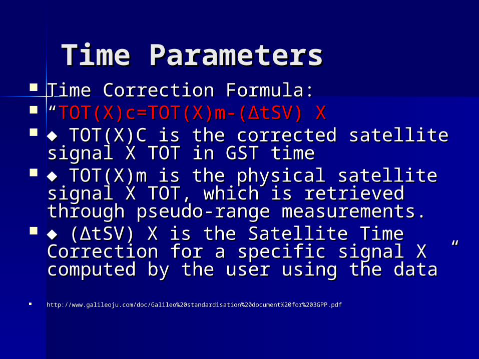
Time ParametersTime Parameters Time Correction Formula:Time Correction Formula: ““TOT(X)c=TOT(X)m-(ΔtSV) XTOT(X)c=TOT(X)m-(ΔtSV) X ♦ ♦ TOT(X)C is the corrected satellite signal TOT(X)C is the corrected satellite signal
X TOT in GST timeX TOT in GST time ♦ ♦ TOT(X)m is the physical satellite signal TOT(X)m is the physical satellite signal
X TOT, which is retrieved through pseudo-X TOT, which is retrieved through pseudo-range measurements.range measurements.
♦ ♦ (ΔtSV) X is the Satellite Time Correction (ΔtSV) X is the Satellite Time Correction for a specific signal X computed by the for a specific signal X computed by the user using the data”user using the data”
http://www.galileoju.com/doc/Galileo%20standardisation%20document%20for%203GPP.pdfhttp://www.galileoju.com/doc/Galileo%20standardisation%20document%20for%203GPP.pdf

Galileo Standard TimeGalileo Standard Time
Encrypted in Weeks and Time of WeekEncrypted in Weeks and Time of Week 4096 weeks (78 years)4096 weeks (78 years) The Weeks integer will be set back to The Weeks integer will be set back to
zero after 4096 weeks elapsezero after 4096 weeks elapse Time of Week is encrypted in secondsTime of Week is encrypted in seconds 604,800 seconds in a week.604,800 seconds in a week. The seconds integer is set back to zero The seconds integer is set back to zero
after a week elapses.after a week elapses.
AlmanacsAlmanacs
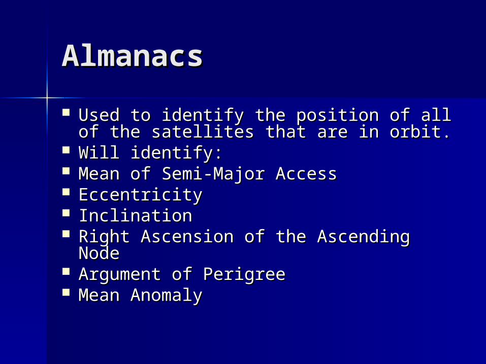
Used to identify the position of all of Used to identify the position of all of the satellites that are in orbit. the satellites that are in orbit.
Will identify:Will identify: Mean of Semi-Major AccessMean of Semi-Major Access EccentricityEccentricity InclinationInclination Right Ascension of the Ascending NodeRight Ascension of the Ascending Node Argument of PerigreeArgument of Perigree Mean Anomaly Mean Anomaly
Satellite SignalsSatellite Signals
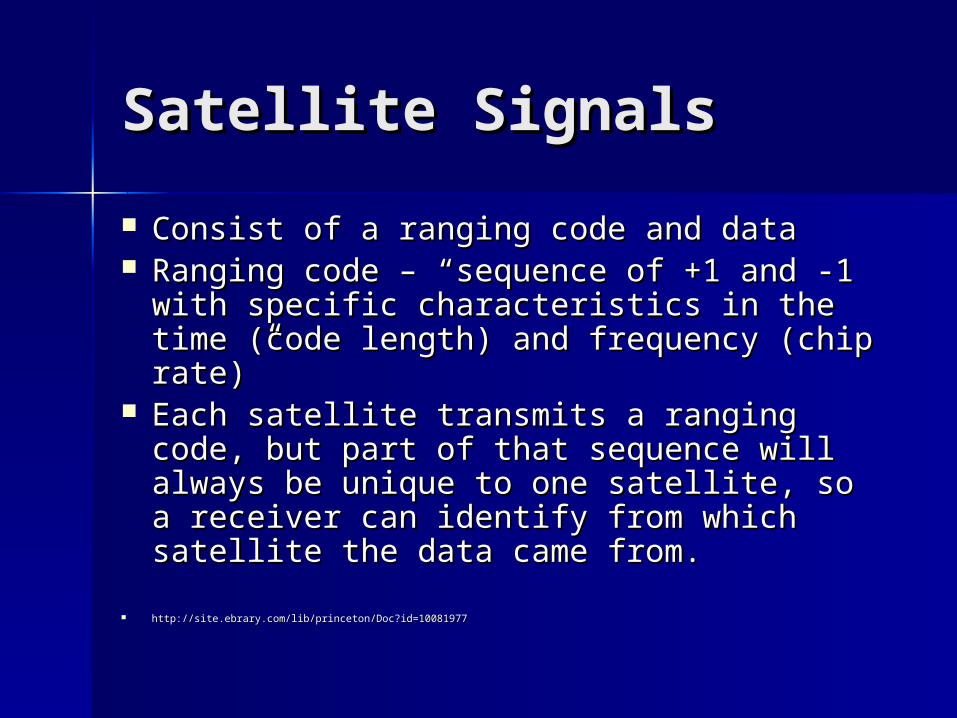
Consist of a ranging code and dataConsist of a ranging code and data Ranging code – “sequence of +1 and -1 Ranging code – “sequence of +1 and -1
with specific characteristics in the time with specific characteristics in the time (code length) and frequency (chip rate)”(code length) and frequency (chip rate)”
Each satellite transmits a ranging code, Each satellite transmits a ranging code, but part of that sequence will always be but part of that sequence will always be unique to one satellite, so a receiver can unique to one satellite, so a receiver can identify from which satellite the data identify from which satellite the data came from.came from.
http://site.ebrary.com/lib/princeton/Doc?id=10081977http://site.ebrary.com/lib/princeton/Doc?id=10081977
EncodingEncoding
The signals are either encoded for The signals are either encoded for OS, CS, or PRS.OS, CS, or PRS.
Based on what service you have, Based on what service you have, your receiver will decode the your receiver will decode the signal, and you will receive your signal, and you will receive your coordinates.coordinates.

ConclusionConclusion
EGNOS and Galileo will ensure EGNOS and Galileo will ensure that there Europe will always that there Europe will always have a functioning form of have a functioning form of Satellite Navigation.Satellite Navigation.
Europe will not be reliant on other Europe will not be reliant on other countries since Galileo’s signal countries since Galileo’s signal will never be interruptedwill never be interrupted
Works CitedWorks Cited
Lindstrom, Gustav. “The Galileo Lindstrom, Gustav. “The Galileo Satellite System and its Security Satellite System and its Security Implications”. European Union Implications”. European Union Institute for Security Studies: Institute for Security Studies: 2003 2003 <http://www.iss-eu.org/occasion/o<http://www.iss-eu.org/occasion/occ44.pdf>cc44.pdf>
Works CitedWorks Cited
Prasad, Ramjee. “Applied Satellite Prasad, Ramjee. “Applied Satellite Navigation Using GPS, Galileo, and Navigation Using GPS, Galileo, and Augmentation Systems”. Artech Augmentation Systems”. Artech House, 2005 House, 2005 http://site.ebrary.com/lib/princeton/Dohttp://site.ebrary.com/lib/princeton/Doc?id=10081977c?id=10081977
““Program Galileo”. Galileo Joint Program Galileo”. Galileo Joint Undertaking. 2005. Undertaking. 2005. http://www.galileoju.com/doc/Galileo%http://www.galileoju.com/doc/Galileo%20standardisation%20document%20fo20standardisation%20document%20for%203GPP.pdfr%203GPP.pdf