Copyright C. Doswell A Few Issues Concerning Nowcasting Applications Based on Oklahoma Lightning...
25
Copyright C. Doswell A Few Issues Concerning Nowcasting Applications Based on Oklahoma Lightning Mapping Array Data Don MacGorman NOAA/National Severe Storms Laboratory CIMMS/University of Oklahoma and NOAA
-
Upload
taylor-ridall -
Category
Documents
-
view
215 -
download
0
Transcript of Copyright C. Doswell A Few Issues Concerning Nowcasting Applications Based on Oklahoma Lightning...

Copyright C. Doswell
A Few Issues Concerning Nowcasting Applications Based on
Oklahoma Lightning Mapping Array Data
Don MacGormanNOAA/National Severe Storms LaboratoryCIMMS/University of Oklahoma and NOAA
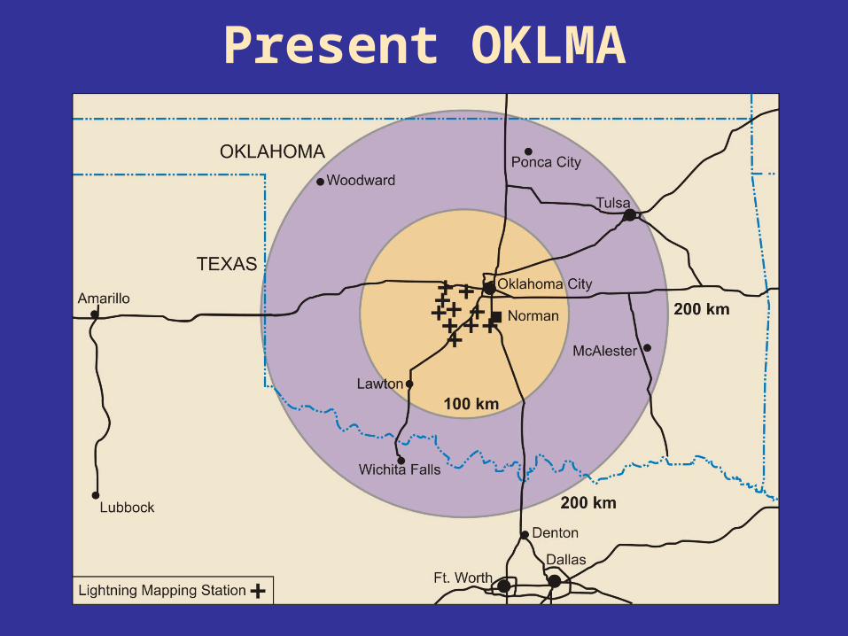
Present OKLMA
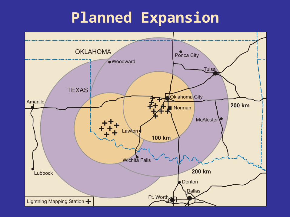
Planned Expansion

Planned Expansion
Switching to internet communicationthrough ONENET towers
of Univ. of Oklahoma Regents
Just successfully switched one station to internet
Goals:Reduce latency to 1 min
Add remote stationsDownload all data remotely

29-30 May 2004Flash Rates
• Sudden jump in flash rates just before first F-2 tornado• Estimated peak flash rate of 8/second
Time (UTC)
Fla
sh
es (
per
min
)F2 F2
Reflectivity and LMA Event Density
-50 00
15
5
10
X (km)
Alt
itu
de
(km
MS
L)
Radar: 0016:45 – 0018:32 UTC
LMA Data: 0015 – 0020 UTC
45 dBZ45 dBZ
6.8 km MSL
A B
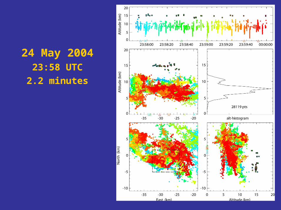
24 May 200423:58 UTC
2.2 minutes

Preliminary Findings
• Lightning in overshooting top of all warm-season supercells checked thus far
• Lightning not in overshooting top of much shallower February supercell

Anvil Flash29 May 2004, 2321:45 UTC
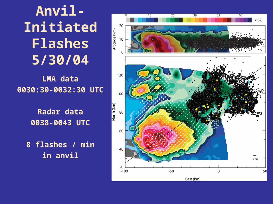
Anvil-InitiatedFlashes5/30/04
LMA data
0030:30-0032:30 UTC
Radar data
0038-0043 UTC
8 flashes / min
in anvil
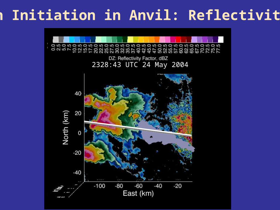
2328:43 UTC 24 May 2004
Flash Initiation in Anvil: Reflectivity Max
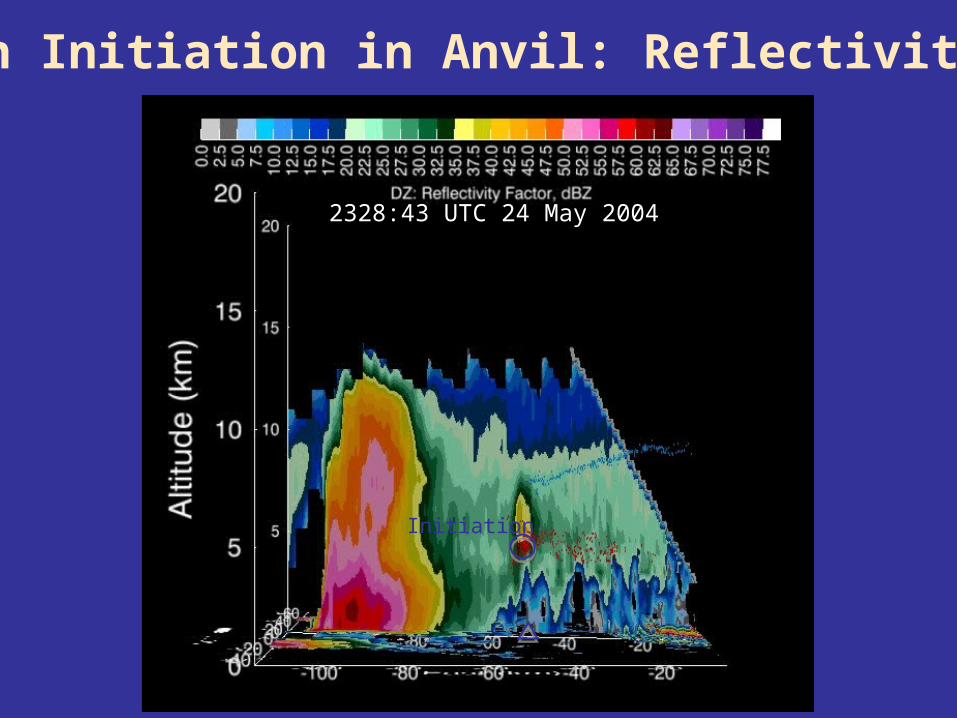
2328:43 UTC 24 May 2004
Initiation
Flash Initiation in Anvil: Reflectivity Max
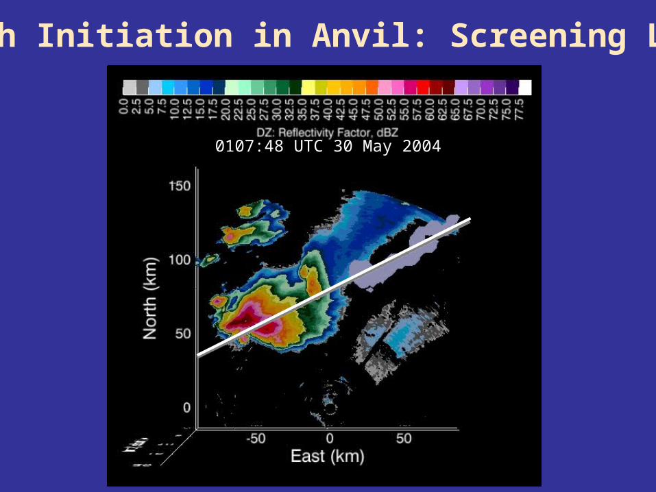
0107:48 UTC 30 May 2004
Flash Initiation in Anvil: Screening Layer
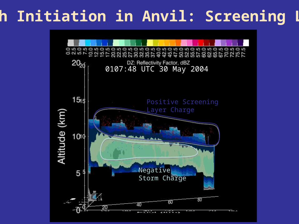
Positive Screening Layer Charge
Negative Storm Charge
0107:48 UTC 30 May 2004
Flash Initiation in Anvil: Screening Layer
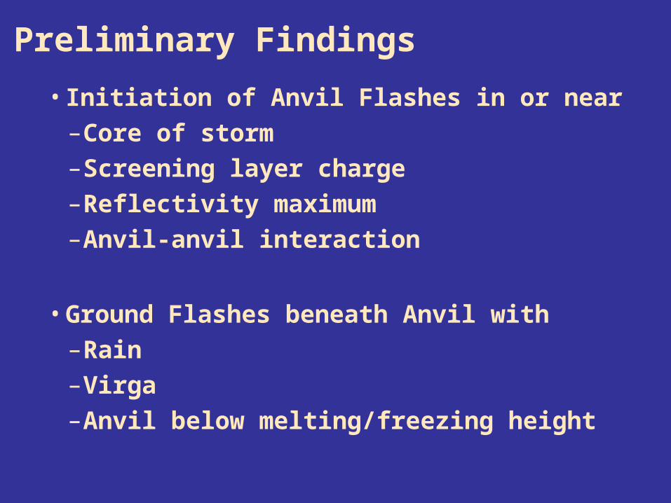
• Initiation of Anvil Flashes in or near–Core of storm–Screening layer charge–Reflectivity maximum–Anvil-anvil interaction
• Ground Flashes beneath Anvil with–Rain–Virga–Anvil below melting/freezing height
Preliminary Findings
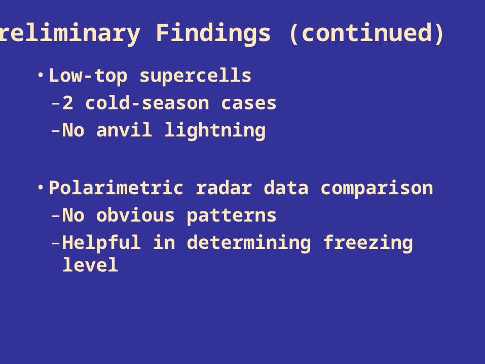
• Low-top supercells–2 cold-season cases–No anvil lightning
• Polarimetric radar data comparison–No obvious patterns–Helpful in determining freezing level
Preliminary Findings (continued)
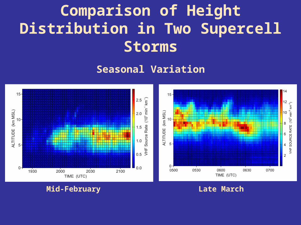
Comparison of Height Distribution in Two Supercell Storms
Seasonal Variation
Mid-February Late March

Height of peak in vertical source distribution coincides roughly with height of -30 deg C isotherm
Z-30 C
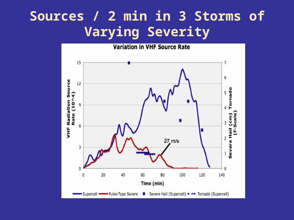
Sources / 2 min in 3 Storms of Varying Severity


30 May 200400:39:06 UTC
1 second
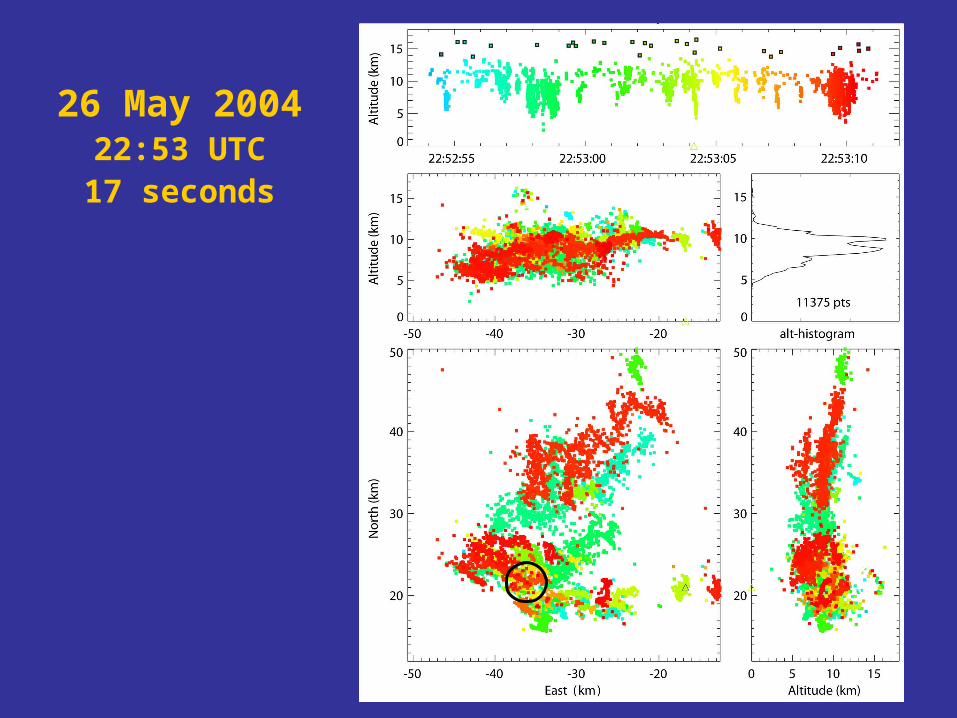
26 May 200422:53 UTC
17 seconds
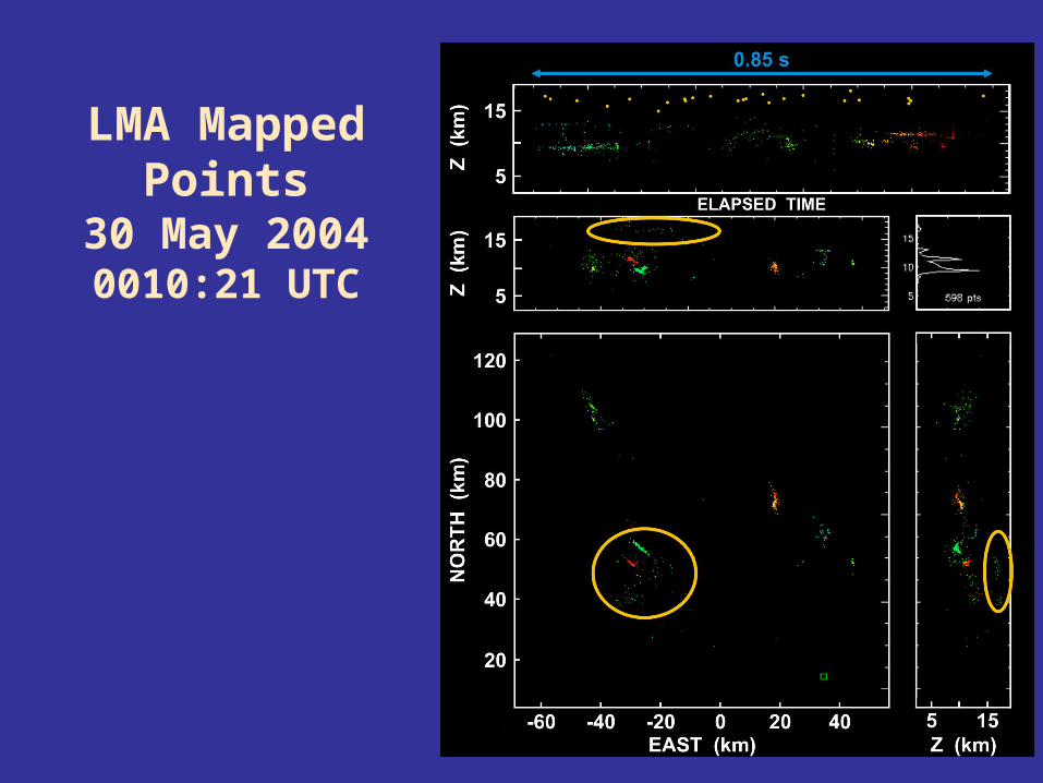
LMA Mapped Points
30 May 20040010:21 UTC
Status and Plans for the Oklahoma Lightning Mapping Array
Don MacGorman, NOAA/National Severe Storms Laboratory
CIMMS/Univ. of Oklahoma & NOAA
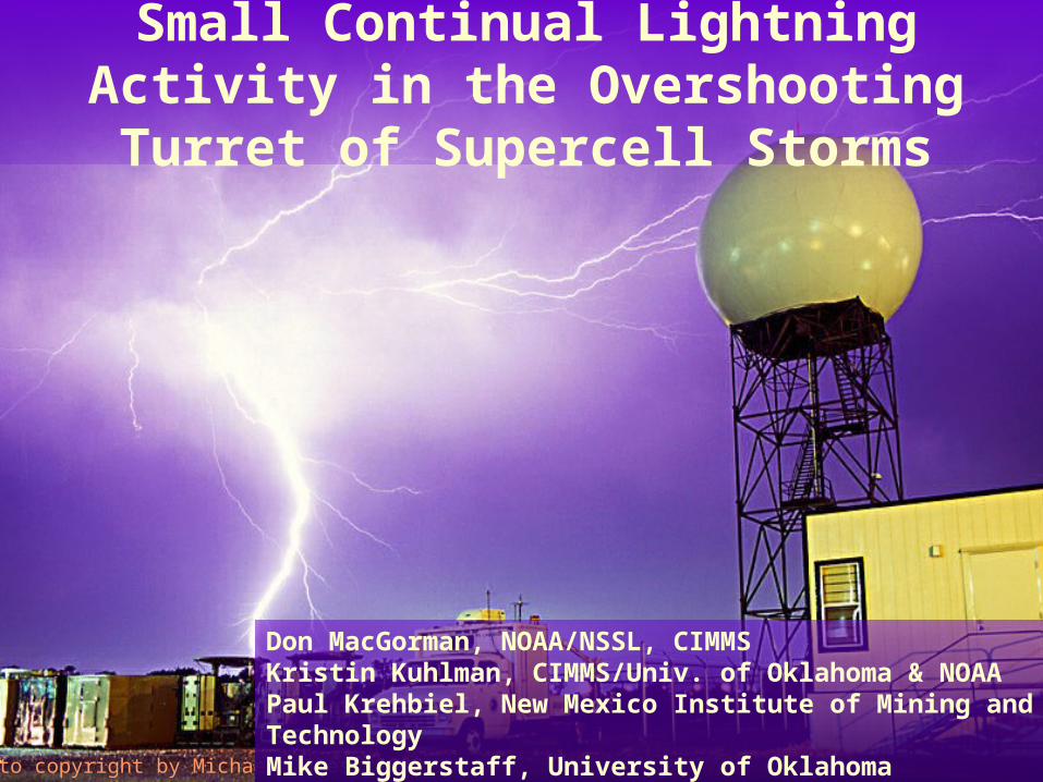
Small Continual Lightning Activity in the Overshooting Turret of Supercell Storms
Photo copyright by Michael James, 2003
Don MacGorman, NOAA/NSSL, CIMMSKristin Kuhlman, CIMMS/Univ. of Oklahoma & NOAAPaul Krehbiel, New Mexico Institute of Mining and TechnologyMike Biggerstaff, University of Oklahoma