Copyright 2015 Jane Whittaker and Dovetail …...Copyright 2015 Jane Whittaker and Dovetail Games....
26
Copyright 2015 Jane Whittaker and Dovetail Games. All Rights Reserved Page 1
Transcript of Copyright 2015 Jane Whittaker and Dovetail …...Copyright 2015 Jane Whittaker and Dovetail Games....

Copyright 2015 Jane Whittaker and Dovetail Games. All Rights Reserved Page 1
Copyright 2015 Jane Whittaker and Dovetail Games. All Rights Reserved Page 2
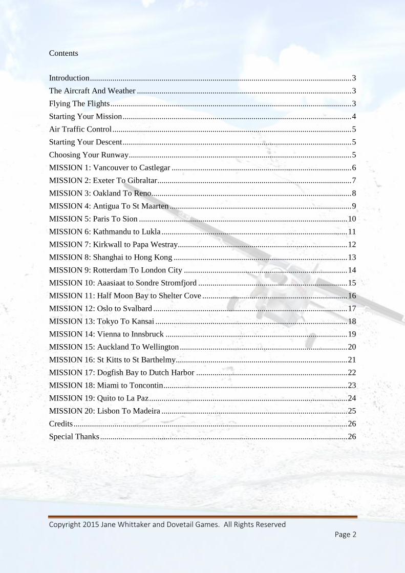
Contents
Introduction ................................................................................................................................ 3
The Aircraft And Weather ......................................................................................................... 3
Flying The Flights ...................................................................................................................... 3
Starting Your Mission ................................................................................................................ 4
Air Traffic Control ..................................................................................................................... 5
Starting Your Descent ................................................................................................................ 5
Choosing Your Runway ............................................................................................................. 5
MISSION 1: Vancouver to Castlegar ........................................................................................ 6
MISSION 2: Exeter To Gibraltar ............................................................................................... 7
MISSION 3: Oakland To Reno.................................................................................................. 8
MISSION 4: Antigua To St Maarten ......................................................................................... 9
MISSION 5: Paris To Sion ...................................................................................................... 10
MISSION 6: Kathmandu to Lukla ........................................................................................... 11
MISSION 7: Kirkwall to Papa Westray................................................................................... 12
MISSION 8: Shanghai to Hong Kong ..................................................................................... 13
MISSION 9: Rotterdam To London City ................................................................................ 14
MISSION 10: Aaasiaat to Sondre Stromfjord ......................................................................... 15
MISSION 11: Half Moon Bay to Shelter Cove ....................................................................... 16
MISSION 12: Oslo to Svalbard ............................................................................................... 17
MISSION 13: Tokyo To Kansai .............................................................................................. 18
MISSION 14: Vienna to Innsbruck ......................................................................................... 19
MISSION 15: Auckland To Wellington .................................................................................. 20
MISSION 16: St Kitts to St Barthelmy.................................................................................... 21
MISSION 17: Dogfish Bay to Dutch Harbor .......................................................................... 22
MISSION 18: Miami to Toncontin .......................................................................................... 23
MISSION 19: Quito to La Paz ................................................................................................. 24
MISSION 20: Lisbon To Madeira ........................................................................................... 25
Credits ...................................................................................................................................... 26
Special Thanks ......................................................................................................................... 26

Copyright 2015 Jane Whittaker and Dovetail Games. All Rights Reserved Page 3
Introduction Thank you for purchasing Dangerous Approaches!
Put yourself in the pilot’s hot seat as man and machine come together in perfect harmony to
overcome some of the world’s most challenging aviation approaches. Start your engines and
tour the world with 20 adrenalin charged missions that separate the amateur aviators from the
professional pilots.
Can you land a Boeing 747 in a major thunderstorm over Hong Kong? Do you have the skills
to collect intrepid mountaineers from the Everest base camp? Can you fly through the
majestic Sierra Nevada range or transport medical supplies through a snowstorm in the icy
wastes of Greenland? Can you navigate your way across the blustery Orkney Islands as rain
lashes your cockpit? If that is too cold for you then turn up the heat and fly the notorious
Caribbean beach approach in to St Maarten.
Conquer all 20 challenges and you deserve the accolade of ace pilot, but that only scratches
the surface of the high altitude adventure provided in Dangerous Approaches.
The Aircraft And Weather All of the flights are setup by default to use aircraft supplied to you within Flight Simulator
X: Steam Edition. You can just jump in right away and fly any flight, knowing that you have
a perfect choice of aircraft for the task in hand.
However, should you wish to use a favourite aircraft of your own, simply check the “Enable
changes in selected mission” box on the missions selections screen. You can then use your
own aircraft from within each mission by utilising the Aircraft menu and selecting any
aircraft within your hangar. It is wise to always validate that the aircraft you choose is
suitable for both the flight duration and the length of runway of your chosen mission.
If you wish to make the challenges even more spectacular, you can adjust the weather to your
heart’s content utilising the same method as discussed above and changing the weather from
within the mission.
Flying The Flights Each flight has been designed to be flown by following the flight plan automatically provided
within the flight simulator’s GPS for each mission. For maximum enjoyment, rather than just
set up each mission pre-prepared for final approach, each mission includes a full and
authentic flight plan taking you to your destination. Flight durations vary from 30 minutes to
over 3 hours and follow actual flight plans used by the airlines and general aviation aircraft.
You should follow the approach procedures at each airport by ensuring you always track the
GPS.
Please note that the FSX mission compass has not been included. Most of the dangerous
approaches included in this mission pack require a very specific approach route to the airfield
and are not suitable for a simple arrow pointer. That would be a sure fire approach to flying

Copyright 2015 Jane Whittaker and Dovetail Games. All Rights Reserved Page 4
in to the side of a mountain! Instead, you should always let the GPS be your guide as you
embark on your journey and line up for final approach.The approaches are simply too
sophisticated for a simple compass pointer.
Starting Your Mission Each mission, complete with a briefing can be found from within the Missions screen of
Flight Simulator X: Steam Edition. Change the category, using the drop down menu and
select “Dangerous Approaches” to list each mission in the display window.
Copyright 2015 Jane Whittaker and Dovetail Games. All Rights Reserved Page 5
Air Traffic Control Dangerous Approaches has been designed not to use the Air Traffic Control (ATC) facilities
within the core simulator. Unfortunately, due to the complex nature of the approaches in each
mission the default ATC is unable to support the correct approach path to each runway. It is
imperative that you follow the GPS flight plan, which has been very carefully designed to
align you with your landing runway. However, it is possible to set your communications
radio to the ATC frequencies given. This is very useful, in giving you an overall awareness of
other aircraft traffic in your area and planning your arrival.
Starting Your Descent In aviation, there is no set point at which aircraft will start their descent for an airport. When
you descend is based on a number of factors, including ATC requirements, weather, and
performance limitations of your aircraft.
However, there is a handy rule of thumb used by pilots that will help you decide when you
should be descending:-
Divide your altitude by 1000
Multiply this number by 3
This will give you the number of miles to start your descent to reach sea level. Modify
accordingly, based on the elevation of your arrival airport.
For example, we wish to reach sea level from 30,000ft. This yields 30x3, giving us a guide to
start our descent 90 miles from the airport.
To arrive at an airport 10,000ft above sea level from 30,000ft we must descend 20,000ft. This
yields 20x3, giving us a descent distance of 60 miles.
I usually give another 10 miles to this figure, for good measure, allowing plenty of time for
deceleration to landing speeds.
Choosing Your Runway Unless stated in the mission you should choose the departure runway facing in to the wind at
your airport of origin. When there are no winds, the departure runway is at your own
discretion. Your aircraft should always take off in to a head wind. A handy tip is to use
SHIFT-Z key combination in the simulator, which will give you the current wind strength
and direction.

Copyright 2015 Jane Whittaker and Dovetail Games. All Rights Reserved Page 6
MISSION 1: Vancouver to Castlegar
AIRCRAFT: LearJet 45
ESTIMATED TIME TO COMPLETE: 1hr 30 minutes
BRIEFING: Fly The LearJet 45 from Vancouver to the notorious airport at Castlegar. The
approach is regarded as one of the most difficult in the world, with mountainous terrain to all
sides of the airport.
Castlegar (CYCG)
Centre: 134.200 MHz
FSS: 122.100 MHz
FSS: 126.700 MHz
MULTICOMM: 122.100 MHz
Latitude: N49*17.78'
Longitude: W117*37.95'
Elevation: 1600 FT
Runway Length Surface ILS ID ILS Freq ILS Hdg
15 5371 Asphalt XCG 110.100 177
33 5371 Asphalt
HINTS AND TIPS: One of the most difficult approaches you will ever fly, but you can
make life much easier for yourself by preparing for your arrival ahead of time. The trick is to
slow your LearJet, deploying landing flaps and gear as you pass over the Castlegar beacon,
marked on your GPS. Aim to accomplish the steep descent to the airfield at around 110kts.
Remember the slower you go, the steeper your rate of descent, which is ideal for the very
steep approach into the airfield. A good tip for all steep approaches is to slow down to just
over landing speed, with flaps and landing gear deployed before commencing the approach.
Early deployment of the flaps and gear will add drag to your aircraft helping to keep the
approach speed manageable and assisting your rate of descent.
Copyright 2015 Jane Whittaker and Dovetail Games. All Rights Reserved Page 7
MISSION 2: Exeter To Gibraltar
AIRCRAFT: Airbus A321
ESTIMATED TIME TO COMPLETE: 2hr 30 minutes
BRIEFING: Fly the Airbus from Exeter to Gibraltar and commence your final approach into
Gibraltar Runway 09. The sharp 90 degree turn on to final approach and the short runway at
Gibraltar ensures that this is a landing that won’t easily be forgotten!
Gibraltar AB (LXGB)
Tower: 131.200 MHz
Approach: 122.800 MHz
Approach: 130.400 MHz
Latitude: N36*09.07'
Longitude: W5*20.98'
Elevation: 10 FT
Runway Length Surface
9 5840 Concrete
27 5840 Concrete
HINTS AND TIPS: Renowned as one of the most difficult approaches in the world the
landing at Gibraltar is nothing short of hair raising. Add to that, being barred from overflying
the Spanish mainland on final approach forces the pilot to fly a very tight approach path.
Ensure that you are configured for landing, your altitude down to around 1200ft and slowed
to around 140kts by waypoint BRAVO. Care should then be taken to time the turn to align
your aircraft with the final approach course. As the runway appears at your 2 o’clock view
make the sharp right turn to a heading of 90 degrees. Correct for any undershoot or overshoot
as necessary, descending all the while to the runway ahead. Monitor the runway approach
lights. Four whites is a signal that you are too high, four reds and you are too low. Aim for
two white and two reds as a confirmation that you are on the correct glidepath. This is a
purely visual approach with no ILS facilities available at the airport.

Copyright 2015 Jane Whittaker and Dovetail Games. All Rights Reserved Page 8
MISSION 3: Oakland To Reno
AIRCRAFT: Boeing 737-800
ESTIMATED TIME TO COMPLETE: 1 hour
BRIEFING: Fly the Boeing 737 on a short hop across the Sierra Nevada’s from Oakland to
Reno, Nevada. The approach at Reno is complicated by the surrounding mountains and is
renowned for severe turbulence, due to gusting winds and downdrafts throughout the year!
Reno/Tahoe Intl (KRNO)
ATIS: 135.800 MHz
Clearance Delivery: 124.900 MHz
Ground: 121.900 MHz
Tower: 118.700 MHz
Departure: 119.200 MHz
Departure: 126.300 MHz
Approach: 119.200 MHz
Approach: 126.300 MHz
FSS: 122.200 MHz
FSS: 122.500 MHz
UNICOM: 122.950 MHz
Latitude: N39*29.95'
Longitude: W119*46.09'
Elevation: 4415 FT
Runway Length Surface ILS ID ILS Freq ILS Hdg
16R 11008 Concrete IRNO 110.900 164
34L 11008 Concrete
16L 9006 Concrete
34R 9006 Concrete
7 6093 Concrete
25 6093 Concrete
HINTS AND TIPS: Shoot an approach on to runway 34L at Reno. Due to the winds today,
this will be a visual approach on to runway 34L. Use the approach lighting to guide you down
to the runway after being guided to the centreline by your GPS. It is imperative that you
maintain the runway centreline to avoid rising terrain either side of the airport. As always,
with high altitude approaches ensure that you are configured for approach ahead of time,
making a smooth and gentle descent in to the runway.
Copyright 2015 Jane Whittaker and Dovetail Games. All Rights Reserved Page 9
MISSION 4: Antigua To St Maarten
AIRCRAFT: Cessna Grand Caravan
ESTIMATED TIME TO COMPLETE: 1 hour
BRIEFING: Fly the Grand Caravan on an idyllic flight from Antigua to the island of St
Maarten. Flying one of the most dramatic approaches in the world, your aircraft will skim at
low altitude over the beach before landing on runway 09.
Princess Juliana Intl (TNCM)
Tower: 118.700 MHz
Approach: 128.950 MHz
Latitude: N18*02.45'
Longitude: W63*06.57'
Elevation: 13 FT
Runway Length Surface
9 7150 Asphalt
27 7150 Asphalt
HINTS AND TIPS: This is one of the most famous approaches in the world, landing at St
Maarten. The most obvious issue to avoid is an undershoot. Land short on this runway and
you will find your aircraft floating gently in the Caribbean! In addition to being idyllic, this
airport is known as one of the most dangerous in the world. Coastal turbulence forces the
pilot to take great care when reaching the runway threshold. There is also a temptation to stay
a little too high on approach to avoid the tourists on the beach! Keep your nerve and your
approach profile, sticking like glue to a visual aiming point on the runway and you will be
just fine!
Copyright 2015 Jane Whittaker and Dovetail Games. All Rights Reserved Page 10
MISSION 5: Paris To Sion
AIRCRAFT: Beechcraft Baron 58
ESTIMATED TIME TO COMPLETE: 1 hour 30 minutes
BRIEFING: Fly the Baron across the Alps, culminating with the notoriously treacherous
approach in to Sion, Switzerland.
Sion (LSGS)
Ground: 121.700 MHz
Tower: 118.275 MHz
Approach: 122.350 MHz
Approach: 126.825 MHz
Approach: 134.275 MHz
FSS: 122.350 MHz
Latitude: N46*13.15'
Longitude: E7*19.62'
Elevation: 1581 FT
Runway Length Surface ILS ID ILS Freq ILS Hdg
7 6609 Asphalt
25 6609 Asphalt ISI 108.350 246
8L 2165 Grass
26R 2165 Grass
HINTS AND TIPS: A fantastic opportunity for some sightseeing in the Alps, but ensure that
you gain enough altitude to clear the peaks beneath your wings! Descend down the valley,
using the Sion (SIO) waypoint of the GPS flight plan as a marker for the start of your final
approach on the ILS. You will need to fly a slightly offset approach to runway 25, allowing
you to intercept the ILS for finals. Make sure that you keep correcting for the centreline just
before touchdown. This should keep you well clear of the steep valley walls to either side of
the aircraft. Ensure that you stay as slow as possible, descending steeply in the valley to avoid
being too high on approach.
Copyright 2015 Jane Whittaker and Dovetail Games. All Rights Reserved Page 11
MISSION 6: Kathmandu to Lukla
AIRCRAFT: Mooney Bravo
ESTIMATED TIME TO COMPLETE: 30 minutes
BRIEFING: A short 30 minute flight, deep in the Himalayas. Your task is to transport a
group of adventurous tourists to the Everest base camp at Lukla.
Lukla (VNLK)
FSS: 122.300 MHz
FSS: 122.500 MHz
Latitude: N27*40.05'
Longitude: E86*44.00'
Elevation: 10000 FT
Runway Length Surface
6 1616 Asphalt
24 1616 Asphalt
HINTS AND TIPS: It is not without reason that they refer to the pilots who fly regularly
into Lukla as the finest pilots in the world! Even in the best of weather, this is arguably the
world’s most difficult approach. Follow the GPS flight plan to the airport, but much of your
time will be spent carefully navigating around the terrain. You should aim for a cruising
altitude of 25,000ft and a steep descent in to Lukla, but you will have to hand fly through the
nearby valleys, avoiding terrain before you can align with the runway, perched at the tip of
Everest!. You will have to work hard to quickly gain altitude with your aircraft and work
equally as hard for the rapid descent in to the valley. The airport is at an elevation of 10,000ft
above sea level. Use the GPS to guide you to the runway, which is obscured by valley walls
until the final few seconds of the approach, If you are unsure, don’t be afraid to abort your
approach and give it another go. Remember, there are bold pilots, but no old bold pilots, so
get your bearings before committing yourself to landing!
Copyright 2015 Jane Whittaker and Dovetail Games. All Rights Reserved Page 12
MISSION 7: Kirkwall to Papa Westray
AIRCRAFT: Cessna 172
ESTIMATED TIME TO COMPLETE: 30 minutes
BRIEFING: A hop across the Orkney Islands in poor weather to the island of Papa Westray
Papa Westray (EGEP)
Latitude: N59*21.10'
Longitude: W2*54.02'
Elevation: 91 FT
Runway Length Surface
7 820 Grass
25 820 Grass
4 1530 Asphalt
22 1530 Asphalt
18 1250 Grass
36 1250 Grass
HINTS AND TIPS: Despite being a short flight, our trip to Papa Westray, in the Orkney
Islands archipelago is not short on challenge. You will have to deal both with driving rain and
wind buffeting your aircraft as you head north to Papa Westray. There is no need to climb
above 3000ft as the ideal technique is to remain below the cloudbase for a visual arrival in to
the airport. Don’t be afraid to circle the airport on your arrival, to familiarise yourself with
the runway layout before commencing your final approach. If visibility is poor, you may need
to circle for a while until the weather clears.

Copyright 2015 Jane Whittaker and Dovetail Games. All Rights Reserved Page 13
MISSION 8: Shanghai to Hong Kong
AIRCRAFT: Boeing 747-400
ESTIMATED TIME TO COMPLETE: 1 hour 20 minutes
BRIEFING: Fly from Shanghai to Hong Kong, landing your Boeing 747-400 in a raging
thunderstorm!
Hong Kong Intl (VHHH)
ATIS: 128.200 MHz
Clearance Delivery: 124.650 MHz
Clearance Delivery: 129.900 MHz
Ground: 121.600 MHz
Ground: 121.775 MHz
Ground: 122.550 MHz
Tower: 118.200 MHz
Tower: 118.400 MHz
Departure: 123.800 MHz
Departure: 124.050 MHz
Approach: 119.100 MHz
Approach: 119.350 MHz
Latitude: N22*18.53'
Longitude: E113*54.88'
Elevation: 28 FT
Runway Length Surface ILS ID ILS Freq ILS Hdg
7R 12465 Asphalt ISR 109.300 073
25L 12465 Asphalt IFL 108.900 253
7L 12468 Asphalt IZSL 111.100 073
25R 12468 Asphalt ITFR 110.900 253
HINTS AND TIPS: A night flight from Shanghai to Hong Kong, that is fraught with danger
from a massive thunderstorm system, threatening the whole China Pacific region. Follow the
GPS flight plan to the airport before executing an ILS approach. However, you should expect
regular deviations from your course as you aim to avoid the heart of the deadly
cumulonimbus clouds. You should aim to get as much altitude as possible, as quickly as
possible after take-off from Shanghai to get above the weather. That, however, will not save
you from the towering cumulonimbus clouds stretching high in to the stratosphere which
should be avoided at all costs. To ease your workload, use the ILS for runway 25R for your
final approach in to Hong Kong International. Beware of storm clouds directly overhead of
the runway and be prepared to go around, hold and wait for the worst of the weather to pass.
Copyright 2015 Jane Whittaker and Dovetail Games. All Rights Reserved Page 14
MISSION 9: Rotterdam To London City
AIRCRAFT: Beechcraft King Air 350
ESTIMATED TIME TO COMPLETE: 1 hour
BRIEFING: A short trip across the North Sea brings us to London City airport and its
famous steep approach!
London City (EGLC)
ATIS: 136.350 MHz
Tower: 118.075 MHz
Tower: 118.400 MHz
Approach: 132.700 MHz
Approach: 119.725 MHz
Approach: 128.025 MHz
Latitude: N51*30.32'
Longitude: E0*03.32'
Elevation: 19 FT
Runway Length Surface ILS ID ILS Freq ILS Hdg
9 5030 Concrete ILST 111.150 096
27 5030 Concrete ILSR 111.150 276
HINTS AND TIPS: London City Airport, in the heart of the capital is famed throughout the
world for its steep approach. Whilst most ILS glideslopes are configured for a 3 degree
descent path, things are a little different here! To avoid the high rise buildings that litter this
part of London, the descent path is an extremely steep 5.5 degrees! You will also need all of
the braking distance that you can muster as you touchdown on the short runway. The
technique is to fly the glideslope as slowly as practicable in landing configuration. The
slower your touchdown speed, the less distance that is required for braking. The landing
configuration and the drag it provides will assist you in keeping your speed under control
during the descent. As always, if you are not happy with your approach, go around and try
again. There is no shame in “going around the block” until you get this dangerous approach
on the numbers!
Copyright 2015 Jane Whittaker and Dovetail Games. All Rights Reserved Page 15
MISSION 10: Aaasiaat to Sondre Stromfjord
AIRCRAFT: Grumman Goose
ESTIMATED TIME TO COMPLETE: 2 hours 30 minutes
BRIEFING: A stunning flight over the glaciers of Greenland brings us to Sondre Stromfjord,
known for its difficult approach, requiring pilots to fly the length of a fjord! We are carrying
urgent medical supplies, so time is of the essence!
Kangerlussuaq (Sondre Stromfjord) (BGSF)
Tower: 118.300 MHz
Approach: 126.200 MHz
Latitude: N67*01.02'
Longitude: W50*41.36'
Elevation: 165 FT
Runway Length Surface ILS ID ILS Freq ILS Hdg
10 9191 Asphalt ISF 109.550 100
28 9191 Asphalt
HINTS AND TIPS: The airport at BGSF is well known to airliner pilots, often being used as
a nominated alternate airport for transatlantic crossings. It is also renowned for its extremely
difficult approach down the fjord, often beset by heavy weather and treacherous turbulence!
Follow the path of the fjord until picking up the ILS for runway 10. The GPS will guide you
to the mouth of the waterway, but given the urgency of the flight, if you want to save some
time go ahead and cut some corners. If you do, beware the mountains to the north and south
of the runway line. Certainly, the easiest approach is the path of least resistance, following
the fjord from the ocean all the way to the airport.

Copyright 2015 Jane Whittaker and Dovetail Games. All Rights Reserved Page 16
MISSION 11: Half Moon Bay to Shelter Cove
AIRCRAFT: P-51 Mustang
ESTIMATED TIME TO COMPLETE: 45 minutes
BRIEFING: A flight from Half Moon Bay, takes us north over San Francisco, tracking the
Pacific coast to Shelter Cove. We should just be in time for the yearly fly-in event!
Shelter Cove (0Q5)
CTAF: 122.900 MHz
MULTICOMM: 122.900 MHz
Latitude: N40*01.66'
Longitude: W124*04.40'
Elevation: 69 FT
Runway Length Surface
12 3400 Asphalt
30 3400 Asphalt
HINTS AND TIPS: The little airport at Shelter Cove is host to a yearly fly-in where pilots
from all over the world gather to shoot the breeze and indulge in a barbecue. The other pilots
are likely to be impressed by our shiny P-51 Mustang. However, this is a high performance
aircraft and has to be treated with due respect. With an aircraft of this speed and power it is
essential to think ahead of your Mustang, anticipating all course, altitude and speed changes
ahead of time. You will need to slow to around 90kts for landing, ensuring that you
touchdown with alacrity on runway 30, lest you find yourself running out of tarmac on this
short field projecting out in to the ocean. High terrain to the right of the runway and the
Pacific Ocean on the other 3 sides reminds pilots that any mistakes will see their aircraft
either in the water or embedded in the side of a mountain! The trick is to remain in absolute
control of your aircraft and be prepared for your final approach well ahead of time. The
airfield is easy to spot from a distance, so your primary concern is managing your airspeed
and your landing configuration for such a high performance aircraft.

Copyright 2015 Jane Whittaker and Dovetail Games. All Rights Reserved Page 17
MISSION 12: Oslo to Svalbard
AIRCRAFT: Boeing 737
ESTIMATED TIME TO COMPLETE: 2 hours 15 minutes
BRIEFING: We head north from Oslo to Longyear Airport, Svalbard; the most northerly
airport in the world served by regular airline services. The relatively short runway and heavy
icing has earned the airport the reputation as one of the most challenging on the planet!
Longyear (ENSB)
FSS: 118.100 MHz
FSS: 119.850 MHz
Latitude: N78*14.77'
Longitude: E15*27.93'
Elevation: 88 FT
Runway Length Surface ILS ID ILS Freq ILS Hdg
10 7598 Asphalt LB 110.300 102
28 7598 Asphalt LA 109.500 298
HINTS AND TIPS: This journey to Svalbard takes us well inside the Arctic Circle, roughly
midway between the north of Norway and the North Pole so the key feature is ice – lots of it!
Care should be taken to avoid ice accretion during the course of your flight. Boeing policy is
simple, if the temperature is below 10 degrees Celsius and there is visible moisture, in the
form, of rain, ice, snow, fog and cloud then engine anti-icing should be using. Use the engine
anti-ice switch located on the forward overhead panel. If flying through icing conditions you
should also periodically use the wing anti-icing to remove any ice accrued from wings and
control surfaces. Failure to adhere to anti ice procedure can lead to the loss of your aircraft!
You have sufficient runway for landing on the westerly runway, but keep your landing speed
down, touching down at 130kts and immediately applying reverse thrust. Whilst the runway
is suitable and used regularly by a Boeing 737, it is considerably shorter than the runways of
major international airports. You should also be aware of the reduced braking effect of any
ice that has formed on the runway.
Copyright 2015 Jane Whittaker and Dovetail Games. All Rights Reserved Page 18
MISSION 13: Tokyo To Kansai
AIRCRAFT: Boeing 747-400
ESTIMATED TIME TO COMPLETE: 25 minutes
BRIEFING: A short, high density, domestic flight across Japan takes us to the unique
Kansai Airport.
Kansai Intl (RJBB)
ATIS: 127.850 MHz
Clearance Delivery: 121.900 MHz
Ground: 121.600 MHz
Ground: 126.200 MHz
Tower: 118.200 MHz
Tower: 126.200 MHz
Departure: 119.200 MHz
Departure: 119.750 MHz
Departure: 120.650 MHz
Approach: 120.250 MHz
Approach: 121.150 MHz
Approach: 124.700 MHz
Latitude: N34*25.63'
Longitude: E135*14.65'
Elevation: 15 FT
Runway Length Surface ILS ID ILS Freq ILS Hdg
6 11483 Asphalt IKD 108.100 058
24 11483 Asphalt IKN 110.70 238
HINTS AND TIPS: Kansai airport was built to relieve overcrowding at the nearby Osaka
International Airport. However, land is at such a premium in Japan a whole artificial island
was created in Osaka Bay on which to site the airport. As such, this is the only airport in the
world built on a custom created island! Heavy swells, crosswinds, typhoons and even the
occasional earthquake has cemented the reputation of Kansai being one of the world’s
toughest approaches. An undershoot or overshoot will see your huge Boeing 747-400 dipping
in to the waters of the bay! As such, the deceptively simple looking approach should be
treated with the utmost care. Ensure that you are configured at full flaps, gear down and
145kts of airspeed when you capture the ILS. Always confirm that you are on the glideslope
throughout the approach. Dipping too low on the glideslope will bring you dangerously close
to the water surface below. Too high on the glideslope and you will be flying a difficult to
manage overly steep approach. The key to the whole landing at Osaka is good glideslope
management. This is an airport that rewards good airmanship and strict attention to your
approach path. The prize is a fantastic view of Osaka Bay and the chance to marvel at one of
the manmade wonders of the world!

Copyright 2015 Jane Whittaker and Dovetail Games. All Rights Reserved Page 19
MISSION 14: Vienna to Innsbruck
AIRCRAFT: Douglas DC-3
ESTIMATED TIME TO COMPLETE: 2 hours 20 minutes
BRIEFING: An opportunity to fly the veteran Douglas DC-3 on a flight from Vienna to
Innsbruck. This flight is a demonstration flight of the illustrious DC-3 for an eager crowd of
spectators on the ground at Innsbruck. Be sure to show them what this old girl can do!
Innsbruck (LOWI)
ATIS: 126.025 MHz
Tower: 120.100 MHz
Approach: 119.275 MHz
Latitude: N47*15.62'
Longitude: E11*20.63'
Elevation: 1900 FT
Runway Length Surface ILS ID ILS Freq ILS Hdg
8 6551 Bituminus OEJ 109.700 068
26 6551 Bituminus OEV 111.100 255
8C 3500 Grass
26C 3500 Grass
8L 1300 Grass
26R 1300 Grass
HINTS AND TIPS: Innsbruck quite rightly as the reputation of having one of the toughest,
mountainous approaches in Europe. Prior to flying this flight it is recommended that you
study the GPS flight plan until you are familiar with the final approach path and the approach
to runway 26. From overhead the RTT VOR beacon turn to a heading of 211 degrees whilst
descending to 9500ft to capture the localiser for runway 26, continuing your descent after
capture. Please note, the localiser beam does NOT line you up with the runway, having a
displaced localiser! Once a visual sighting is made of the runway, you should depart the
localiser, making a right turn to a manual final approach on to the runway. The steep descent
through the mountains, coupled to the turn just before touchdown combine to make Innsbruck
one of Europe’s most extreme aviation challenges!
Copyright 2015 Jane Whittaker and Dovetail Games. All Rights Reserved Page 20
MISSION 15: Auckland To Wellington
AIRCRAFT: Boeing 737
ESTIMATED TIME TO COMPLETE: 30 minutes
BRIEFING: A short hop, from Auckland to Wellington, New Zealand, transporting
commuters in the Boeing 737.
Wellington Intl (NZWN)
ATIS: 126.900 MHz
Clearance Delivery: 121.900 MHz
Ground: 118.800 MHz
Ground: 121.900 MHz
Tower: 118.800 MHz
Tower: 120.000 MHz
Approach: 119.300 MHz
Approach: 121.100 MHz
Approach: 122.300 MHz
Approach: 126.500 MHz
Latitude: S41*19.63'
Longitude: E174*48.32'
Elevation: 42 FT
Runway Length Surface ILS ID ILS Freq ILS Hdg
16 6359 Asphalt IEB 110.300 161
34 6359 Asphalt IMP 109.900 341
HINTS AND TIPS: Conditions at Wellington are often exceptionally difficult, due in no
small part to an exceptionally short runway after a tricky approach through coastal high
ground that is renowned for its turbulence generating qualities! We arrive on the northerly
runway. Use should make good use of the downwind leg, as you fly abeam the airport,
heading south to configure the aircraft for landing and slowing to 140kts airspeed. A series of
right turns to base and thence final, will line us up for the northerly runway. You should be
fully configured for landing ahead of these final turns, maintaining the low airspeed to avoid
overshooting the turns to final approach. The trick to a successful landing is ensuring the
aircraft is fully configured well ahead of time and careful management of both speed and
altitude as we enter the traffic pattern for the airport.
Copyright 2015 Jane Whittaker and Dovetail Games. All Rights Reserved Page 21
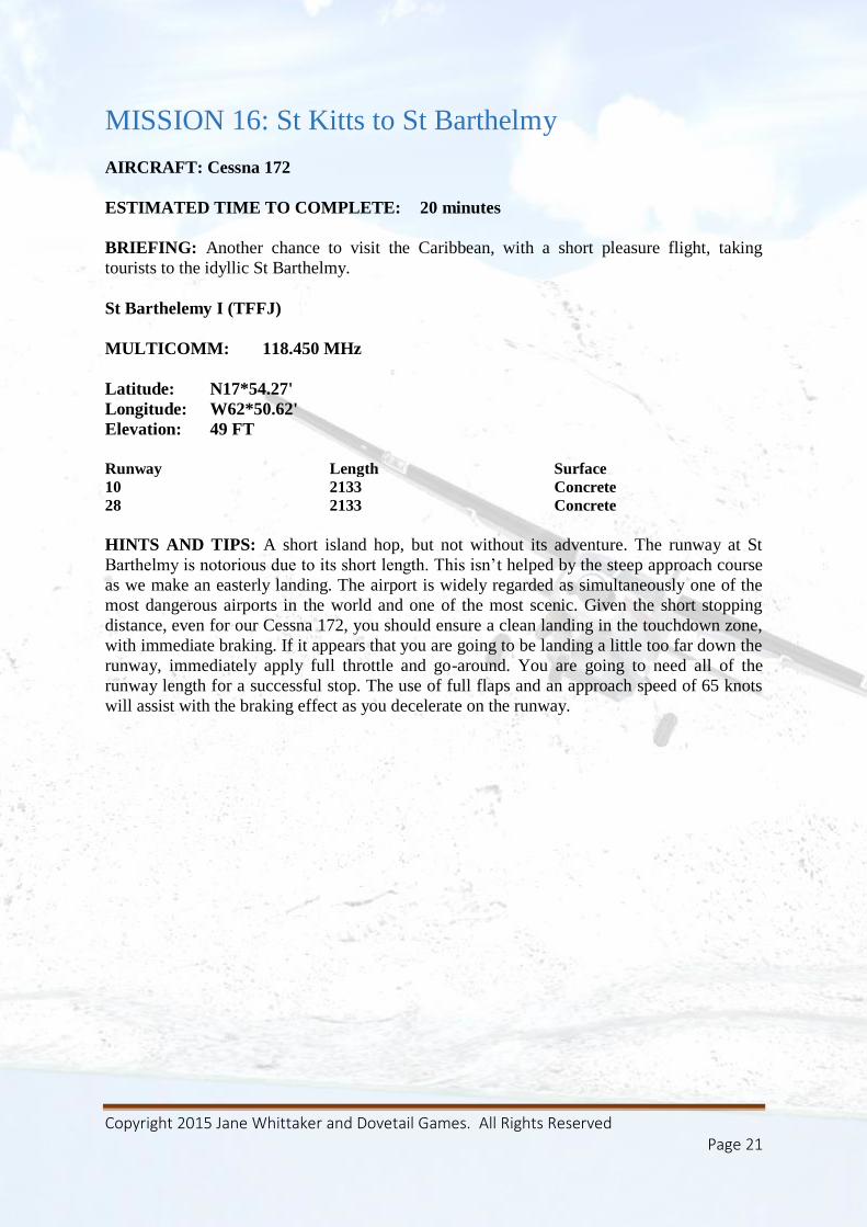
MISSION 16: St Kitts to St Barthelmy
AIRCRAFT: Cessna 172
ESTIMATED TIME TO COMPLETE: 20 minutes
BRIEFING: Another chance to visit the Caribbean, with a short pleasure flight, taking
tourists to the idyllic St Barthelmy.
St Barthelemy I (TFFJ)
MULTICOMM: 118.450 MHz
Latitude: N17*54.27'
Longitude: W62*50.62'
Elevation: 49 FT
Runway Length Surface
10 2133 Concrete
28 2133 Concrete
HINTS AND TIPS: A short island hop, but not without its adventure. The runway at St
Barthelmy is notorious due to its short length. This isn’t helped by the steep approach course
as we make an easterly landing. The airport is widely regarded as simultaneously one of the
most dangerous airports in the world and one of the most scenic. Given the short stopping
distance, even for our Cessna 172, you should ensure a clean landing in the touchdown zone,
with immediate braking. If it appears that you are going to be landing a little too far down the
runway, immediately apply full throttle and go-around. You are going to need all of the
runway length for a successful stop. The use of full flaps and an approach speed of 65 knots
will assist with the braking effect as you decelerate on the runway.
Copyright 2015 Jane Whittaker and Dovetail Games. All Rights Reserved Page 22
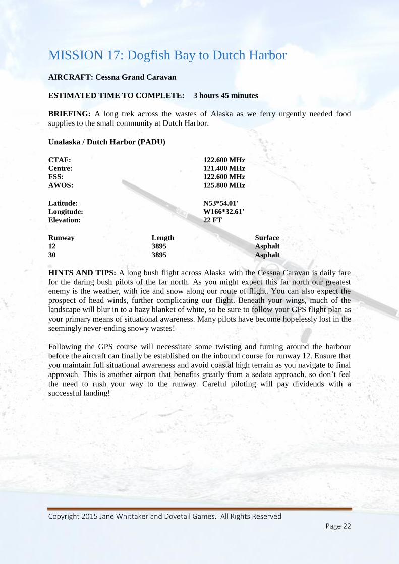
MISSION 17: Dogfish Bay to Dutch Harbor
AIRCRAFT: Cessna Grand Caravan
ESTIMATED TIME TO COMPLETE: 3 hours 45 minutes
BRIEFING: A long trek across the wastes of Alaska as we ferry urgently needed food
supplies to the small community at Dutch Harbor.
Unalaska / Dutch Harbor (PADU)
CTAF: 122.600 MHz
Centre: 121.400 MHz
FSS: 122.600 MHz
AWOS: 125.800 MHz
Latitude: N53*54.01'
Longitude: W166*32.61'
Elevation: 22 FT
Runway Length Surface
12 3895 Asphalt
30 3895 Asphalt
HINTS AND TIPS: A long bush flight across Alaska with the Cessna Caravan is daily fare
for the daring bush pilots of the far north. As you might expect this far north our greatest
enemy is the weather, with ice and snow along our route of flight. You can also expect the
prospect of head winds, further complicating our flight. Beneath your wings, much of the
landscape will blur in to a hazy blanket of white, so be sure to follow your GPS flight plan as
your primary means of situational awareness. Many pilots have become hopelessly lost in the
seemingly never-ending snowy wastes!
Following the GPS course will necessitate some twisting and turning around the harbour
before the aircraft can finally be established on the inbound course for runway 12. Ensure that
you maintain full situational awareness and avoid coastal high terrain as you navigate to final
approach. This is another airport that benefits greatly from a sedate approach, so don’t feel
the need to rush your way to the runway. Careful piloting will pay dividends with a
successful landing!
Copyright 2015 Jane Whittaker and Dovetail Games. All Rights Reserved Page 23
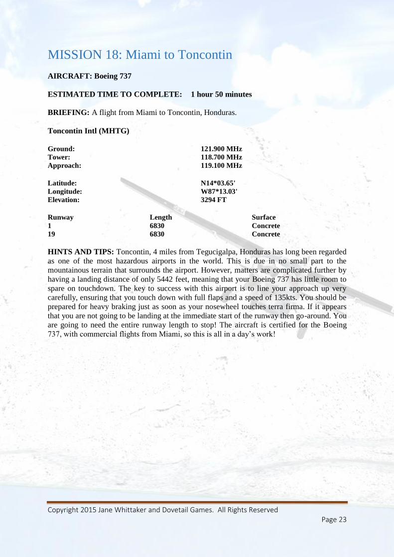
MISSION 18: Miami to Toncontin
AIRCRAFT: Boeing 737
ESTIMATED TIME TO COMPLETE: 1 hour 50 minutes
BRIEFING: A flight from Miami to Toncontin, Honduras.
Toncontin Intl (MHTG)
Ground: 121.900 MHz
Tower: 118.700 MHz
Approach: 119.100 MHz
Latitude: N14*03.65'
Longitude: W87*13.03'
Elevation: 3294 FT
Runway Length Surface
1 6830 Concrete
19 6830 Concrete
HINTS AND TIPS: Toncontin, 4 miles from Tegucigalpa, Honduras has long been regarded
as one of the most hazardous airports in the world. This is due in no small part to the
mountainous terrain that surrounds the airport. However, matters are complicated further by
having a landing distance of only 5442 feet, meaning that your Boeing 737 has little room to
spare on touchdown. The key to success with this airport is to line your approach up very
carefully, ensuring that you touch down with full flaps and a speed of 135kts. You should be
prepared for heavy braking just as soon as your nosewheel touches terra firma. If it appears
that you are not going to be landing at the immediate start of the runway then go-around. You
are going to need the entire runway length to stop! The aircraft is certified for the Boeing
737, with commercial flights from Miami, so this is all in a day’s work!
Copyright 2015 Jane Whittaker and Dovetail Games. All Rights Reserved Page 24
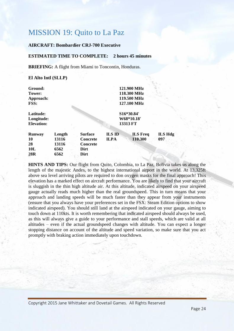
MISSION 19: Quito to La Paz
AIRCRAFT: Bombardier CRJ-700 Executive
ESTIMATED TIME TO COMPLETE: 2 hours 45 minutes
BRIEFING: A flight from Miami to Toncontin, Honduras.
El Alto Intl (SLLP)
Ground: 121.900 MHz
Tower: 118.300 MHz
Approach: 119.500 MHz
FSS: 127.100 MHz
Latitude: S16*30.84'
Longitude: W68*10.18'
Elevation: 13313 FT
Runway Length Surface ILS ID ILS Freq ILS Hdg
10 13116 Concrete ILPA 110.300 097
28 13116 Concrete
10L 6562 Dirt
28R 6562 Dirt
HINTS AND TIPS: Our flight from Quito, Colombia, to La Paz, Bolivia takes us along the
length of the majestic Andes, to the highest international airport in the world. At 13,325ft
above sea level arriving pilots are required to don oxygen masks for the final approach! This
elevation has a marked effect on aircraft performance. You are likely to find that your aircraft
is sluggish in the thin high altitude air. At this altitude, indicated airspeed on your airspeed
gauge actually reads much higher than the real groundspeed. This in turn means that your
approach and landing speeds will be much faster than they appear from your instruments
(ensure that you always have your preferences set in the FSX: Steam Edition options to show
indicated airspeed). You should still land at the airspeed indicated on your gauge, aiming to
touch down at 110kts. It is worth remembering that indicated airspeed should always be used,
as this will always give a guide to your performance and stall speeds, which are valid at all
altitudes – even if the actual groundspeed changes with altitude. You can expect a longer
stopping distance on account of the altitude and speed variation, so make sure that you act
promptly with braking action immediately upon touchdown.
Copyright 2015 Jane Whittaker and Dovetail Games. All Rights Reserved Page 25
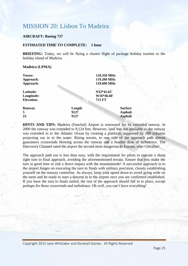
MISSION 20: Lisbon To Madeira
AIRCRAFT: Boeing 737
ESTIMATED TIME TO COMPLETE: 1 hour
BRIEFING: Today, we will be flying a charter flight of package holiday tourists to the
holiday island of Madeira.
Madeira (LPMA)
Tower: 118.350 MHz
Approach: 119.200 MHz
Approach: 119.600 MHz
Latitude: N32*41.65'
Longitude: W16*46.68'
Elevation: 711 FT
Runway Length Surface
5 9127 Asphalt
23 9127 Asphalt
HINTS AND TIPS: Madeira (Funchal) Airport is renowned for its extended runway. In
2000 the runway was extended to 9,124 feet. However, land was not available so the runway
was extended in to the Atlantic Ocean by creating a platform, supported by 180 columns
projecting out in to the water. Rising terrain, to one side of the approach path almost
guarantees crosswinds blowing across the runway and a healthy dose of turbulence. The
Discovery Channel rated the airport the second most dangerous in Europe, after Gibraltar!
The approach path too is less than easy, with the requirement for pilots to execute a sharp
right turn to final approach, avoiding the aforementioned terrain. Ensure that you make the
turn in good time or risk a direct impact with the mountainside! A successful approach in to
the airport hinges on executing the turn to finals with military precision, cleanly establishing
yourself on the runway centreline. As always, keep your speed down to avoid going wide on
the turns and be ready to start a descent in to the airport once you are confirmed established.
If you have the turn to finals nailed, the rest of the approach should fall in to place, except
perhaps for those crosswinds and turbulence. Oh well, you can’t have everything!
Copyright 2015 Jane Whittaker and Dovetail Games. All Rights Reserved Page 26
Credits
Mission Design and Programming – Jane Whittaker
Voiceovers - Angel Heaven Lee
Art Support - Daniel Dunn
Special Thanks
Nick Rooke, Simon Sauntson, Aimee Sanjari and all the Dovetail team
Ellie, Thimble, Tanna, Kate, Ben and all the Silverman family!
The MacIntyre Family
Derek Davis and all the PC Pilot team.
Claire Whittaker
Especially, you for buying and we hope enjoying this product!


![WHITTAKER MODELS FOR REAL GROUPSfshahidi/articles/Shahidi [1980, 27pp]---Whitt… · WHITTAKER MODELS FOR REAL GROUPS FREYDOON SHAHIDI Introduction. Whittaker functions were first](https://static.fdocuments.in/doc/165x107/5f6ff2171fdfde08b537c325/whittaker-models-for-real-fshahidiarticlesshahidi-1980-27pp-whitt-whittaker.jpg)