Copyright 2005SIEP B.V.Shell Exploration & ProductionEPT-EIP0 Shell Exploration & Production 1 End...
17
Shell Exploration & Production 1 Copyright 2005 SIEP B.V. Shell Exploration & Production EPT-EI P0 End user requirements (2) – some examples Alaska summer operations Paul Verlaan
-
Upload
justin-pearson -
Category
Documents
-
view
215 -
download
1
Transcript of Copyright 2005SIEP B.V.Shell Exploration & ProductionEPT-EIP0 Shell Exploration & Production 1 End...

Shell Exploration & Production
1
Cop
yri
gh
t 2
00
5S
IEP B
.V.
Sh
ell
Exp
lora
tion
& P
rod
uct
ion
EPT-E
IP0
End user requirements (2) – some examples
Alaska summer operations
Paul Verlaan

Assess Select Design Construct Operations
Phases of a project

Assess Select Design Construct Operations
Phases of a project
1. Preliminary area description
• historical data on ice type and ice concentration at one location (offshore structure) or along a certain route (shipping, pipeline)
Assess Select Design Construct Operations
Phases of a project
2. drilling
• ice type, ice thickness, ice drift, floe size data around drilling rig
• continuous data around one location
3. seismic operations
• ice edge
• avoid small floes of ice
• cover a wide area once per day
Assess Select Design Construct Operations
Phases of a project
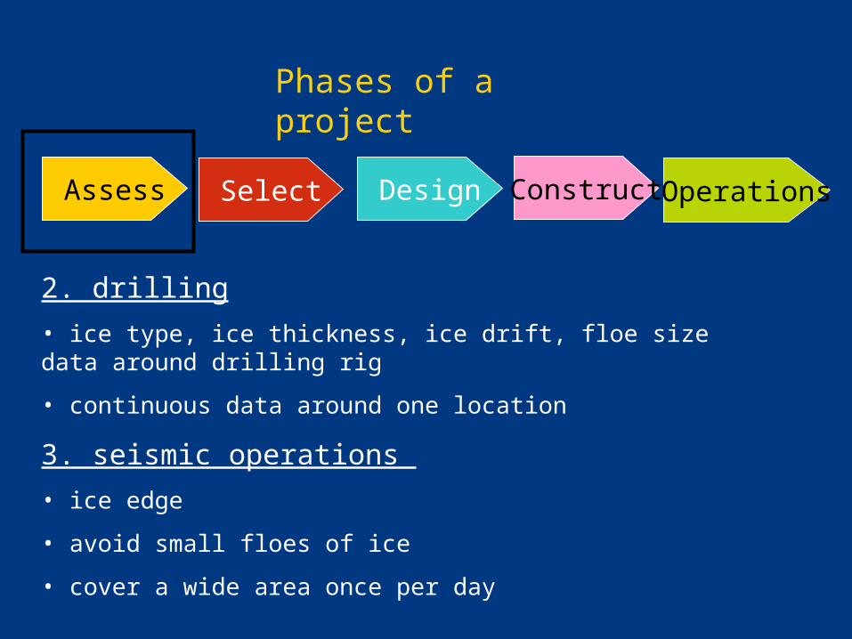
Geotechnical, surveys
• ice edge
• cover a wide area once per day

Assess Select Design Construct Operations
Phases of a project
Local and global ice loads
• historical data on ice type, ice drift, floe size data
• historical data on ice thickness, keel depth, sail height, consolidated layer thickness
• mechanical properties of ice
• full-scale ice load data
• ice-structure interaction data

Assess Select DesignConstruct+ install Operations
Phases of a project
Installation of structures, pipelines
• ice edge
• cover a wide area once per day
Assess Select Design Construct Operations
Phases of a project
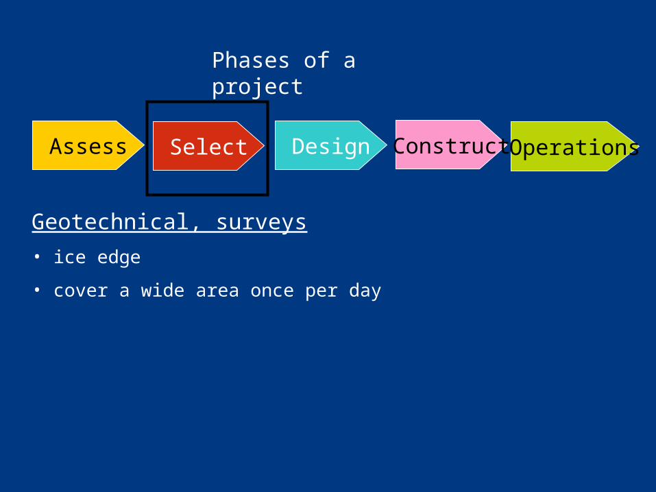
1. Marine transportation of oil and gas
• ice concentration, ice type, ice thickness, ice pressure
• cover a wide area once per day
2. Evacuation, oil spill response, platform operations
• ice type, ice thickness, ice pressure, ice drift
• continuous data around one location
Assess Select Design Construct Operations
Phases of a project
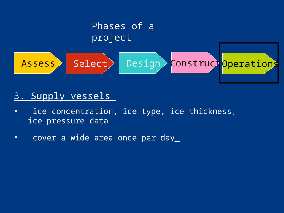
3. Supply vessels
• ice concentration, ice type, ice thickness, ice pressure data
• cover a wide area once per day

Limitations of present ice data
1. Limited temporal resolution
• Operations around one location (drilling, EER, OSR)
2. Limited insight in ice-thickness parameters
• Design
• Navigation
Alaska summer/autumn operations
(June –December 2007)
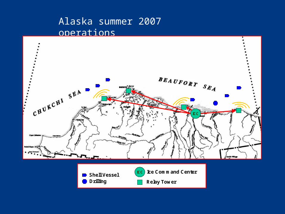
Alaska summer 2007 operations
ICCShell VesselDrilling
Ice Command Center
Relay Tower
ICCShell VesselDrilling
Ice Command Center
Relay Tower
ICC
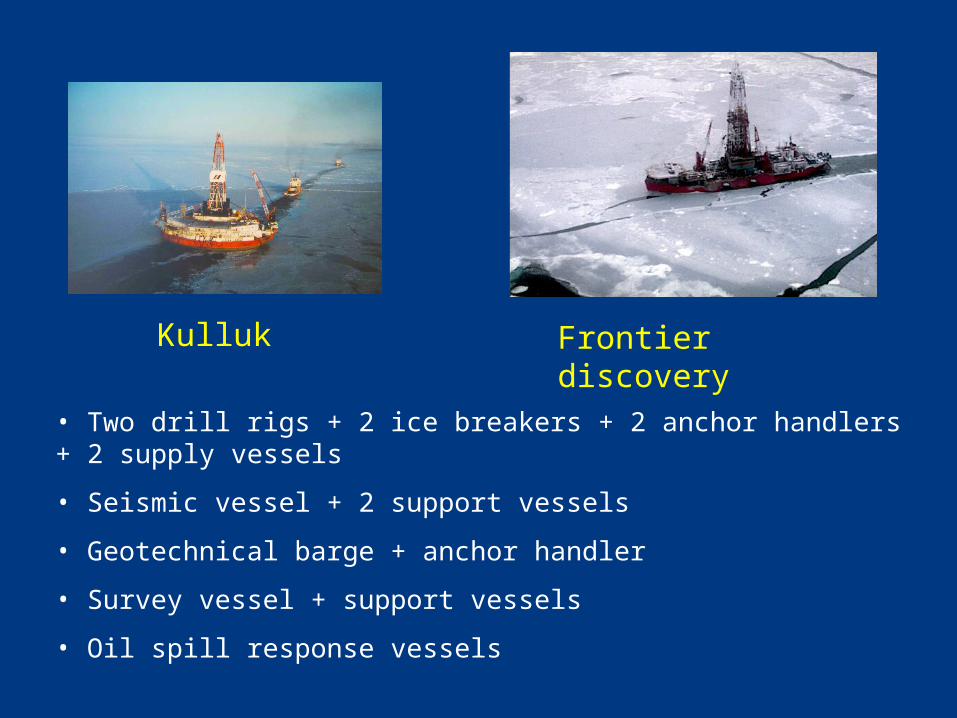
• Two drill rigs + 2 ice breakers + 2 anchor handlers + 2 supply vessels
• Seismic vessel + 2 support vessels
• Geotechnical barge + anchor handler
• Survey vessel + support vessels
• Oil spill response vessels
Kulluk Frontier discovery
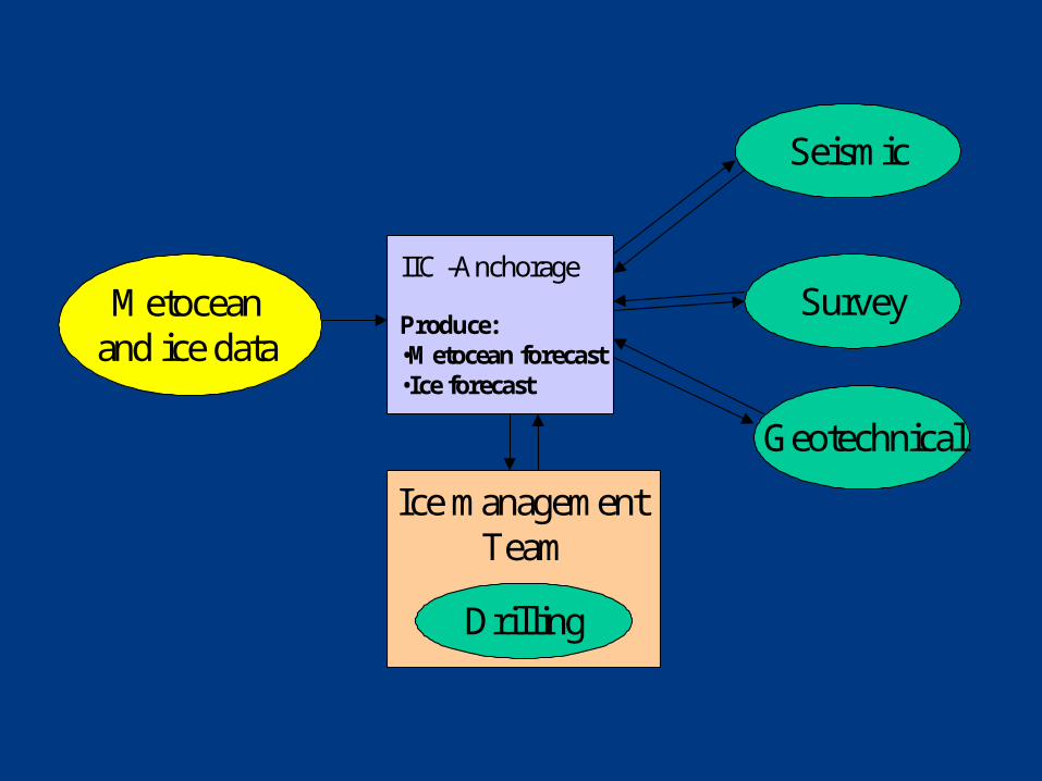
IIC -Anchorage
Produce:•Metocean forecast•Ice forecast
Metocean and ice data
Seismic
Geotechnical
Survey
Ice management Team
Drilling
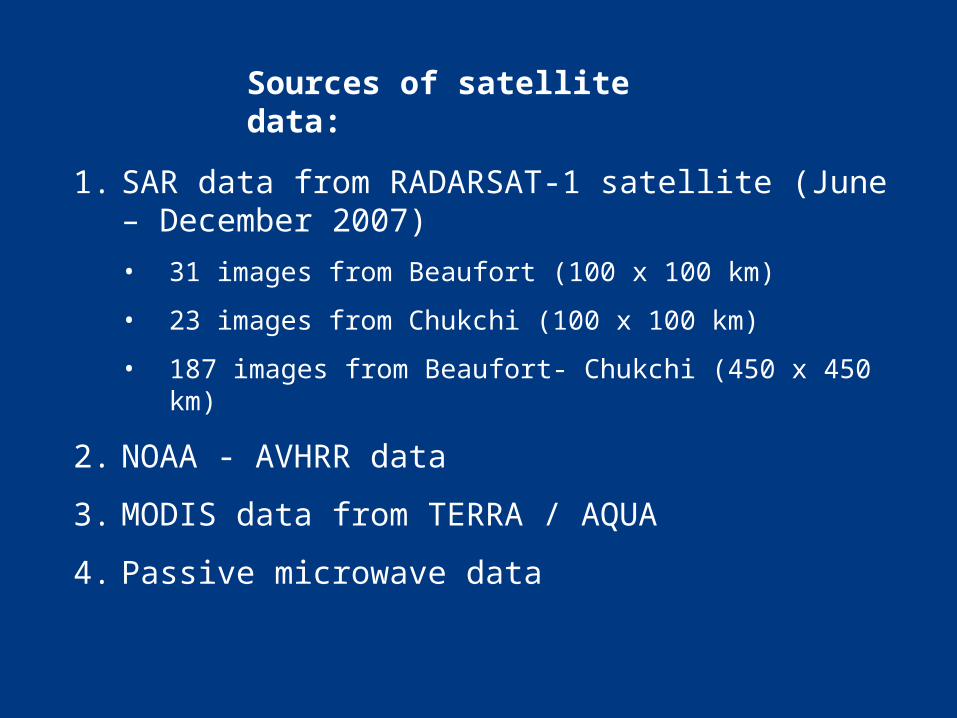
Sources of satellite data:
1. SAR data from RADARSAT-1 satellite (June – December 2007)
• 31 images from Beaufort (100 x 100 km)
• 23 images from Chukchi (100 x 100 km)
• 187 images from Beaufort- Chukchi (450 x 450 km)
2. NOAA - AVHRR data
3. MODIS data from TERRA / AQUA
4. Passive microwave data

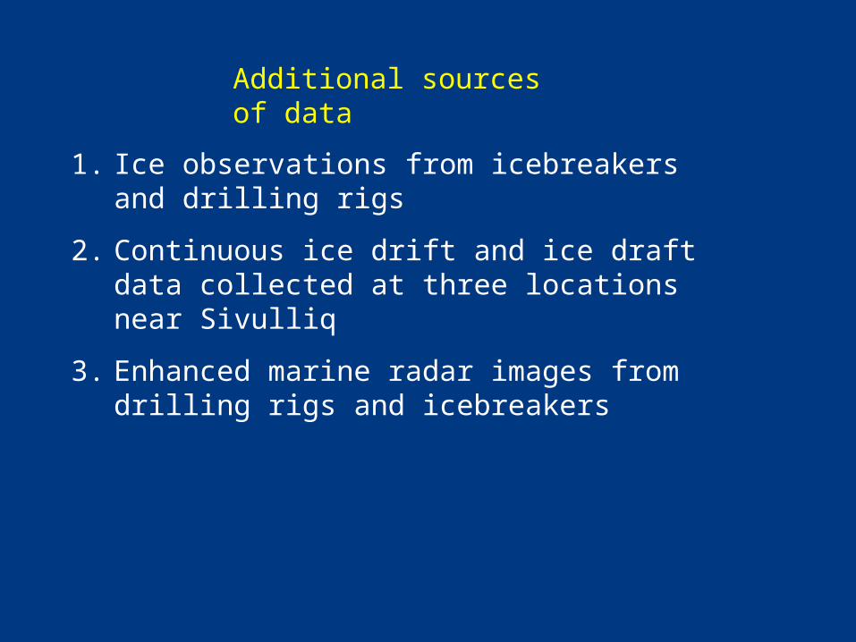
Additional sources of data
1. Ice observations from icebreakers and drilling rigs
2. Continuous ice drift and ice draft data collected at three locations near Sivulliq
3. Enhanced marine radar images from drilling rigs and icebreakers