CFS Study Guide 2014 - North Carolina Society of Surveyors · August 6, 2014 . Dear 2014 CFS...
149
North Carolina Floodplain Mapping Program 4218 Mail Service Center Raleigh, NC 27699-4218 August 6, 2014 Dear 2014 CFS registrants: On behalf of the Certified Floodplain Surveyor (CFS) Certification Program’s presenters, we look forward to meeting you at the Otis A. Jones Educational Institute that will be held October 8-10, 2014. The CFS three-day certification program covers a large amount of information and builds upon a basic understanding of FEMA's National Flood Insurance Program (NFIP) and their two main methods of presenting flood hazard information: Flood Insurance Study (FIS) reports and Flood Insurance Rate Maps (FIRMs). Therefore, participants should be familiar with the NFIP and the use of FIS reports and FIRMs prior to the three-day certification course. In order to facilitate your review, we have compiled the following study guide for your use prior to the Otis A. Jones Educational Institute: CFS Study Guide 2014 1. Introduction to North Carolina Certified Floodplain Surveyor Training (attached to this cover letter) 2. CFM Home Study Course ( http://www.ncfloodmaps.com/cfm_home_study.htm ): a. The following chapters of the Carrying out floodplain management in your locality with assistance from the National Flood Insurance Program: A manual for North Carolina officials book ( http://www.ncfloodmaps.com/pubdocs/cfm_home_study/cfm_home_study_course.pdf ): Chapter Page numbers of the PDF file* Title 3: 72 - 132 NFIP Flood Studies and Flood Hazard Maps 4: 133 - 177 Using NFIP Studies and Maps 5: 178 - 258 Standards for Floodplain Development *The book does not have the pages numbered consecutively from beginning to end, but begins each chapter with page 1. b. The following NFIP regulations under 44 CFR ( http://www.fema.gov/pdf/floodplain/nfip_sg_appendix_e.pdf ): Citation Pages Title § 59.1 E-1 – E-9 Definitions § 60.3 E-16 – E-21 Flood plain management criteria for flood-prone areas § 65.1 – § 65.17 E-29 – E-43 IDENTIFICATION AND MAPPING OF SPECIAL HAZARD AREAS Thank you. Respectfully, Curt D. Johnson, CFM NCGS technical writer
Transcript of CFS Study Guide 2014 - North Carolina Society of Surveyors · August 6, 2014 . Dear 2014 CFS...

North Carolina Floodplain Mapping Program 4218 Mail Service Center Raleigh, NC 27699-4218 August 6, 2014 Dear 2014 CFS registrants: On behalf of the Certified Floodplain Surveyor (CFS) Certification Program’s presenters, we look forward to meeting you at the Otis A. Jones Educational Institute that will be held October 8-10, 2014. The CFS three-day certification program covers a large amount of information and builds upon a basic understanding of FEMA's National Flood Insurance Program (NFIP) and their two main methods of presenting flood hazard information: Flood Insurance Study (FIS) reports and Flood Insurance Rate Maps (FIRMs). Therefore, participants should be familiar with the NFIP and the use of FIS reports and FIRMs prior to the three-day certification course. In order to facilitate your review, we have compiled the following study guide for your use prior to the Otis A. Jones Educational Institute:
C F S S t u d y G u i d e 2 0 1 4 1. Introduction to North Carolina Certified Floodplain Surveyor Training (attached to this cover letter) 2. CFM Home Study Course ( http://www.ncfloodmaps.com/cfm_home_study.htm ):
a. The following chapters of the Carrying out floodplain management in your locality with assistance from the National Flood Insurance Program: A manual for North Carolina officials book ( http://www.ncfloodmaps.com/pubdocs/cfm_home_study/cfm_home_study_course.pdf ):
Chapter Page numbers of the PDF file* Title 3: 72 - 132 NFIP Flood Studies and Flood Hazard Maps 4: 133 - 177 Using NFIP Studies and Maps 5: 178 - 258 Standards for Floodplain Development
*The book does not have the pages numbered consecutively from beginning to end, but begins each chapter with page 1.
b. The following NFIP regulations under 44 CFR ( http://www.fema.gov/pdf/floodplain/nfip_sg_appendix_e.pdf ):
Citation Pages Title § 59.1 E-1 – E-9 Definitions § 60.3 E-16 – E-21 Flood plain management criteria for flood-prone areas § 65.1 – § 65.17 E-29 – E-43 IDENTIFICATION AND MAPPING OF SPECIAL HAZARD AREAS
Thank you. Respectfully, Curt D. Johnson, CFM NCGS technical writer
Introduction to North Carolina Certified Floodplain Surveyor
Training
Randy Mundt, CFM, AICP NCFMP Outreach Coordinator

Introduction to NC CFS Training
• North Carolina Certified Floodplain Surveyor (CFS) Pilot Program is a joint effort between:
– Federal Emergency Management Agency (FEMA)
– American Congress on Surveying and Mapping (ACSM)
– North Carolina Society of Surveyors (NCSS)
– North Carolina Division of Emergency Management (NCEM)
– North Carolina Geodetic Survey (NCGS)
2

Introduction to NC CFS Training
• Goal of the CFS Program:
– Provide training to NC surveyors to enable them to submit Letters of Map Change (LOMCs) requests to FEMA in a complete and proper format. An accelerated review process and determination issuance will occur within 5 business days.
3

What is a CFS?
• Any licensed Land Surveyor who has successfully completed CFS training courses and passed a final exam
• Can process “simple” Letters of Map Change (LOMCs) and submit these to FEMA for accelerated processing and issuance
4

Who is Qualified for CFS? • Professional Surveyors Licensed in the State Where
Certification is Offered
• What is Criteria to Obtain CFS? – Any licensed Land Surveyor who has successfully completed CFS
training courses and passed a final exam
– Attend Training Sessions (2 ½ Days) – Pass Examination
• Multiple Choice, 125 Questions • 4 Hours, 2 Parts • Must receive 75% on Part I and 85% on Part II
– Fail Either = FAILURE – Must be re-examined for entire exam
5

Why Did This CFS Pilot Program Start?
• The State of North Carolina is a Cooperating Technical State (CTS), as designated by FEMA:
– North Carolina is delegated with primary responsibility for all Flood Insurance Rate Maps (FIRMs), including map maintenance and updates
6

Why Did This CFS Pilot Program Start?
• North Carolina began a partnership with FEMA for map maintenance within the State: – One step is establishment of statewide
program to acquire, process, and disseminate current, accurate, and detailed elevation data, flood hazard studies, and digital FIRMs
7

Why Did This CFS Pilot Program Start?
• FEMA is interested in working with its Mapping Partners in map maintenance. This will facilitate digital FIRM updates and to direct limited resources to other priorities
8

NC CFS Pilot Program
• CFS Pilot Program may become permanent in North Carolina, and possibly elsewhere, if it proves successful
• Transfer of map maintenance responsibility from FEMA to State will save FEMA money
9

Why Did the State Become a CTS?
• 18 Federally declared disasters in NC since 1999
• Hurricane Floyd revealed flood hazard data and map limitations
• Most flood maps in NC were older than 12 years – some up to 30 years old
10

Effects of Hurricane Floyd on North Carolina
• 51 deaths
• $3.5 billion in damages to homes, businesses, roads, and infrastructure
• 31,000 jobs lost
11
Goldsboro, NC

CTS Agreement
• Signed September 15, 2000, by State, FEMA, and other relevant partners
• Establishes formal overall partnerships among State, Federal, and local partners
• North Carolina, FEMA, and other Federal partners will collaborate on flood hazard identification and post-flood hazard verification activities
• Establishes CTS Committee
12

Expectations
• You must be present for all training courses, quizzes, and labs to get credit for the course
• You must not be more than 15 minutes late for a training course
• You must be on time for the exam
• Exam passing grade
– 75% for Part I
– 85% for Part II
13

NFIP Overview
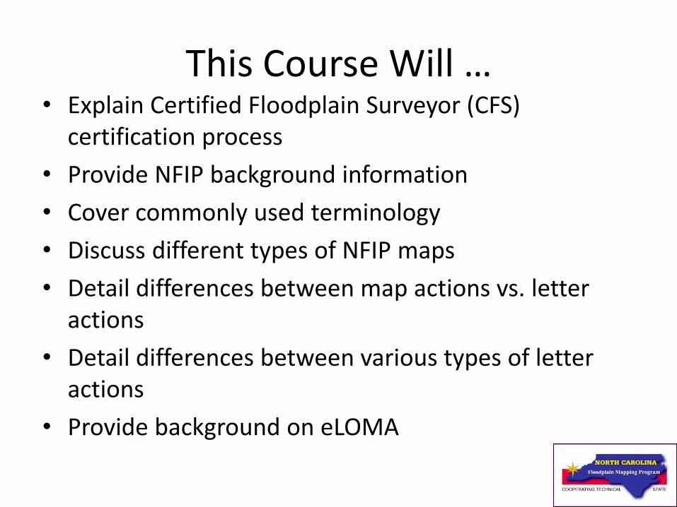
This Course Will … • Explain Certified Floodplain Surveyor (CFS)
certification process
• Provide NFIP background information
• Cover commonly used terminology
• Discuss different types of NFIP maps
• Detail differences between map actions vs. letter actions
• Detail differences between various types of letter actions
• Provide background on eLOMA
15

FEMA
• Part of the Department of Homeland Security
• Functionally organized to mirror life-cycle of emergency management
16

FEMA
• NFIP is administered by FEMA’s Federal Insurance and Mitigation Administration
• Headquartered in Washington, D.C.
• Divided into 10 regional offices
17

FEMA’s Mission • To support our citizens and first
responders to ensure that as a nation we work together to build, sustain, and improve our capability to prepare for, protect against, respond to, recover from, and mitigate all hazards.
18

Purposes of the NFIP • Identify and map flood hazard areas
• Provide a framework for floodplain management regulations
• Make flood insurance available in communities that participate in the NFIP
19

NFIP
• 21,800+ participating communities
• 5.5 million flood insurance policies in force (2014)
• As of July 8, 2013, since 1978, over $48.1 billion in flood insurance claims have been paid (25% of all claims paid for policies outside the mapped floodplain
• FEMA has mapped more than 100 million acres of flood hazard areas and designated approximately 5 million acres of floodway
20

NFIP Background • Prior to the creation of the NFIP:
– Flood insurance coverage was not available
– No national flood mapping program
– No Federal minimum standards for floodplain management
– Escalating costs to taxpayers for flood disaster relief
21

NFIP Goals • Reduce loss of life and property
• Reduce rising disaster relief costs
• Increase importance of hazard mitigation (flood resistant construction, guide future development, and prohibit development in floodplains that would increase flood levels)
• Restore and protect natural resources and functions of floodplains
• Decrease taxpayer-funded disaster costs
• Make Federally backed insurance coverage available to property owners
22
Floodplain Management Principles
• Federal government has fundamental interest in floodplain management, but regulating floodplain use lies with State and local authorities
• Floodplain must be considered in context of total community, regional, and national planning and management
23

Floodplain Management Principles
• Floodplains can be managed to achieve acceptable levels of natural resource protection values and reduction of flood loss potential
24

Floodplain Management Principles
• Sound floodplain management requires:
– Setting goals and objectives
– Sharing decision making across governments
– Mitigating against flood damages
– Establishing incentives and disincentives
– Sustaining a coordination process
– Evaluating continuously
25

Community Participation in the NFIP
• To join NFIP, communities must submit:
– Resolution of intent to “maintain in force…adequate land use and control measures” and to cooperate with FEMA
– Its adopted floodplain management regulations (often are referenced within zoning ordinances, building codes, subdivision ordinances, sanitary ordinances, or floodplain ordinances)
26

Role of NFIP Participating Community
• Issuing or denying floodplain development and/or building permits
• Inspecting all development to ensure compliance with local ordinances
• Maintaining records of floodplain development
• Assisting in preparation and revision of floodplain maps
• Helping residents obtain information on flood hazards, floodplain map data, flood insurance, and proper construction measures
27

Sanctions for Non-Participation • No Federal grants or loans for development in
Special Flood Hazard Areas (SFHAs) under Federal programs
• No Federal disaster assistance to repair insurable buildings located in SFHAs
• No Federal mortgage insurance or loan guarantees in SFHAs
• Federally insured or regulated lenders must notify applicants seeking loans in SFHAs that: – There is a flood hazard
– The property is not eligible for Federal disaster relief
28

Key Legislation

National Flood Insurance Act of 1968
• Established NFIP
• Required mapping of floodprone areas (SFHAs)
• Made flood insurance available in communities that meet floodplain management criteria
30

Flood Disaster Protection Act of 1973
• Represented significant expansion of provisions and national impact of NFIP
• Required acceleration of Flood Insurance Studies
• Required notification to communities of floodprone identification
• Created mandatory flood insurance purchase requirement relative to Federally backed loans
• Required participation in NFIP as condition for most types of Federal financial assistance
31

National Flood Insurance Reform Act of 1994
• Strengthened flood insurance requirements, particularly regarding secondary mortgage market
• Required that community’s NFIP maps be reviewed and assessed for map update needs every 5 years
• Established Technical Mapping Advisory Council (from 1995 – 2000)
32

National Flood Insurance Reform Act of 1994
• Created penalties for lender non-compliance
• Created Increased Cost of Compliance coverage (to bring damaged structures up to compliance standards)
• Increased flood insurance coverage limits
• Created Flood Mitigation Assistance (FMA) Program
33 .

Biggert-Waters Flood Insurance Reform Act of 2012
• Move away from subsidized rates toward full risk/actuarial @ 25% increases/year for:
– Non-primary residential and business properties
– Pre-FIRM primary residential at sale/lapse/SD-SI
• Discontinue grandfathering rates @ 20%/year to achieve full-risk in 5 years
34 .

Homeowner Flood Insurance Affordability Act of 2014
• Repeals and/or modifies certain provisions of BW-12
– Non-primary residential and business properties
– Severe repetitive loss properties
– Sale or lapse will NOT trigger full-risk
• Reinstates grandfathering rates for map changes
• New: Surcharges for all policies
– $25 primary residence
– $250 all other policies
35
.

North Carolina State Law Floodplain Management
• The provisions of this Part shall not preclude the imposition by responsible local governments of land use controls and other regulations in the interest of floodplain management for the 100- and 500-year floodplain
• Enabling law that allows local communities to regulate floodplains in the state
36 .

North Carolina State Law • GS_143-215.61§ 143‑215.61. Floodplain management
• GS_143-215.51Part 6. Floodway Regulation.
• GS_143-215.52§ 143‑215.52. Definitions.
• GS_143-215.53§ 143‑215.53: Repealed by Session Laws 2000;150, s.1.
• GS_143-215.54§ 143‑215.54. Regulation of flood hazard areas; prohibited uses.
• GS_143-215.54A§ 143‑215.54A. Minimum standards for ordinances; variances for prohibited uses.
• GS_143-215.55§ 143‑215.55. Acquisition of existing structures.
37 .

North Carolina State Law • GS_143-215.56§ 143‑215.56. Delineation of flood hazard
areas and 100 year floodplains; powers of Department; powers of local governments and of the Department.
• GS_143-215.56A§ 143‑215.56A. Floodplain Mapping Fund.
• GS_143-215.57§ 143‑215.57. Procedures in issuing permits.
• GS_143-215.58§ 143‑215.58. Violations and penalties.
• GS_143-215.59§ 143‑215.59. Other approvals required.
• GS_143-215.60§ 143‑215.60. Liability for damages.
38 .

NFIP Regulations

NFIP Regulations • Communities must adopt and enforce ordinances
that meet or exceed NFIP criteria
• NFIP criteria ensures that new buildings will be protected from flood levels shown on digital FIRM
• Over time, stock of pre-FIRM buildings should be replaced with post-FIRM buildings and risk to flooding reduced
40
NFIP Regulations will be covered separately

Importance of Regulations
• Describe the Program • Define the terms used to run
the Program • Provide minimum floodplain
management criteria for communities to adopt and enforce
• Provide technical criteria and requirements for revising and amending flood hazard areas on maps
• Codify fees charged for reviewing requests for possible map changes
41

Organization of NFIP Regulations
• NFIP Regulations are contained in Parts 59 through 77 of Title 44 of the Code of Federal Regulations (CFR), under Emergency Management and Assistance
• This training will focus on Parts 59, 60, 65, 67, 70, and 72 during Course 3: NFIP Regulations
42

Definitions and Acronyms

Definitions
• A “flood” is defined by the NFIP as “a temporary condition of partial or complete inundation of normally dry land areas from:
• Overflow of inland or tidal waters or
• Unusual or rapid accumulation or runoff of surface waters from any source”
44

Floodplain
Any land area susceptible to inundation by
water from any source

Definition of SFHA • Shaded area on a digital FIRM which
identifies the area that has a 1% annual chance of being flooded in any given year. The digital FIRM identifies these shaded areas as flood zones A, AO, AH, AE, A99, V, and VE.
46

Base Flood
• A flood that has a 1% annual chance of being equaled or exceeded in any given year
• Formerly referred to as the “100-year” flood
47

Floodway • Channel of stream plus any adjacent
floodplain areas that must be kept free of encroachment so that 1% annual chance flood discharge can be conveyed without increasing elevation of 1% annual chance flood by more than specified amount (1 foot in most States)
• Mecklenburg County has unique floodways and procedures
48

Mecklenburg County • Mecklenburg County has unique floodplain and
floodways procedures.
• City of Charlotte, Mecklenburg County and each of the six Towns have Floodplain regulations.
• These regulations place additional restrictions on Building and Renovations in a Floodplain
• There are two Floodplains and Floodways – FEMA Floodplain and Floodway and Community Encroachment Floodplain and Floodway
49

Mecklenburg County Floodways • FEMA Floodway Encroachment
Lines with 0.5 foot allowable above BFE – FEMA floodway
• Community Floodway Encroachment Lines with 0.1 foot allowable above BFE – linked to Mecklenburg County water quality buffer regulations
50

Non-Encroachment Area
• The channel of a river or other watercourse and the adjacent land areas that must be reserved in order to discharge the base flood without cumulatively increasing the water surface elevation more than a designated height
44 CFR and local ordinance definition
51

Potential Violation • May occur with any re-channelization of a
stream or development in the floodway, without first obtaining a no-rise certification or Conditional Letter of Map Revision (CLOMR)
• May include a project (bridges, culverts, grading, fill placement) within the floodway
52

FLOODWAY SCHEMATIC
SURCHARGE
FLOODWAY
100 YEAR FLOODPLAIN
FLOODWAY
FRINGE
FLOODWAY + FLOODWAY FRINGE = 100-YEAR FLOODPLAIN
SURCHARGE NOT TO EXCEED 1.0 FOOT

Depiction of a Floodway on the
Digital FIRM
Floodway

Definitions and Acronyms
• Base Flood Elevation (BFE): – Elevation associated with base flood (1%
annual chance), shown on digital FIRM, and rounded to nearest whole foot
• Base Map: – Depicts cultural features (roads, bridges,
dams, etc.), drainage features, and corporate limits
55

Definitions and Acronyms
• Coastal Barrier Resource System (CBRS): – Units of land consisting of undeveloped
coastal barriers and other areas located on the coast of the U.S. that were initially identified under the Coastal Barrier Resources Act of 1982, and later amended by the 1990 Act; flood insurance is not available for structures built after coastal barrier was identified
56

Definitions and Acronyms
• Coastal High Hazard Area:
– Subject to coastal wave action hazards most often associated with hurricanes and northeasters; are designated on digital FIRM as Zones V or VE
• Code of Federal Regulations (CFR):
– Codification of general and permanent rules published in Federal Register by Executive Departments and Federal Agencies
57

Definitions and Acronyms
• Community Identification Number (CID):
– Unique 6-digit identification number assigned to each community by FEMA; shown on FIS report and digital FIRM
– Refer to FEMA’s Community Status Book for CID numbers and Map Index dates
58

Definitions and Acronyms
• Cross Section:
– Surveyed line developed from topographic information, spanning across floodplain at which computations of flood flow have been made to establish base flood elevations
– Shown on digital FIRM and Flood Profiles in Flood Insurance Study (FIS) report
59

Definitions and Acronyms
• Digital Flood Insurance Rate Map (DFIRM):
– Depicts 1% and 0.2% annual chance floodplains, floodways, BFEs, and zones
– Includes Flood Hazard Data Table for streams with a floodway
– Many Zone A areas are updated with Limited Detailed Study
– Enables insurance agents to issue accurate flood insurance policies to NFIP participating communities
60

Definitions and Acronyms
• Effective Map: – Current NFIP map issued by FEMA that is
official as of “EFFECTIVE DATE” or “MAP REVISED” date shown on map Title Block
• Encroachment: – Construction, placement of fill, or similar
alteration of topography in floodplain that reduces area available to convey flood discharge
61

Definitions and Acronyms
• Letter of Map Amendment (LOMA):
– Official determination that a specified structure or property is not within 1% annual chance floodplain
– Amends effective digital FIRM
– Removes Federal requirement for mandatory flood insurance
62

Definitions and Acronyms
• Letter of Map Revision (LOMR): – Letter that revises BFEs, flood hazard zones,
floodplain boundaries, non-encroachment areas, or floodways as shown on effective digital FIRM
– A similar action that proposes the above changes is known as a conditional LOMR, or CLOMR.
– NCFMP and Mecklenburg County have pilot MT-2 LOMC Delegation Programs (contact information provided at end of presentation)
63

Definitions and Acronyms • Map Repository:
– Location within community for storage of reference copies of FIS report and digital FIRMs
• National Flood Insurance Program (NFIP): – Federal regulatory program under which
floodprone areas are identified and flood insurance is made available to property owners of participating communities
64

Definitions and Acronyms
• Preliminary:
– FIS report and digital FIRMs issued to community for review and comment
• V Zone:
– Coastal high hazard area
65

Definitions and Acronyms
• Water-Surface Elevation:
– Height, in relation to National Geodetic Vertical Datum (NGVD) of 1929 or North American Vertical Datum (NAVD) of 1988, of floods of various magnitudes and frequencies in identified coastal or riverine floodplains areas
66

Development
“...means any man-made change to improved or unimproved real estate, including but not limited to buildings or other structures, mining, dredging, filling, grading, paving, excavation or drilling operations or storage of equipment or materials.”
67

Lowest Adjacent Grade
• Elevation of ground, sidewalk, patio, or deck support immediately next to building
• Lowest ground elevation touching structure or supporting members of structure
68
For LOMA submittals, must be certified
to nearest tenth of a foot

Lowest Adjacent Grade
69
Lowest
Adjacent
Grade

Lowest Adjacent Grade – Building with Crawl-Space Foundation
70
Lowest
Adjacent
Grade Opening
(typical)

Lowest Adjacent Grade- Split Level Building
71
Lowest
Adjacent
Grade
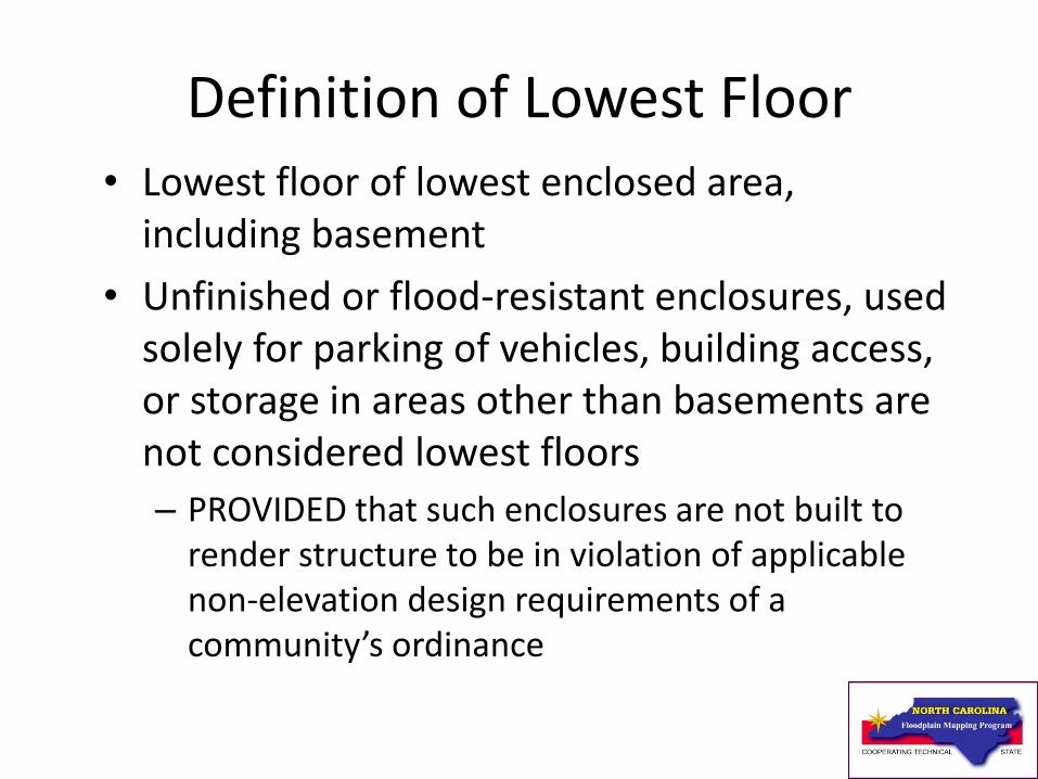
Definition of Lowest Floor • Lowest floor of lowest enclosed area,
including basement
• Unfinished or flood-resistant enclosures, used solely for parking of vehicles, building access, or storage in areas other than basements are not considered lowest floors
– PROVIDED that such enclosures are not built to render structure to be in violation of applicable non-elevation design requirements of a community’s ordinance
72

Lowest Floor Elevations Crawl-Space Foundation
73
Lowest
Floor Opening
(typical)

Lowest Floor Elevation
74
Lowest
Floor

Lowest Floor Elevations- Split Level Building
75
Garage
Lowest
Floor

Lowest Floor
Lowest Floor Elevations- Basement Foundation

Flood Zone Designations
A
Areas of 1% annual chance flood determined by
approximate methods; base flood elevations not
determined
AE SFHAs inundated by 1% annual chance flood;
base flood elevations are shown
AH
Areas of 1% annual chance shallow flooding
(usually ponding) where average depths are
between 1 and 3 feet; whole-foot base flood
elevations are shown
AO
Areas of 1% annual chance shallow flooding
where average depths are between 1 and 3 feet
(usually sheet flow on sloping terrain); average
whole-foot depths are shown
77

Flood Zone Designations
AR
SFHAs that result from decertification of previously accredited
flood protection system that is in process of being restored to
provide 1% annual chance or greater level of flood protection.
After restoration is complete, these areas will still experience
residual flooding from other flooding sources
A99 SFHAs inundated by 1% annual chance flood to be protected from
1% annual chance flood by a Federal flood protection system
under construction; no base flood elevations are determined
V SFHAs inundated by 1% annual chance flood; coastal floods with
velocity hazards (wave action); no base flood elevations are
determined
VE SFHAs inundated by 1% annual chance flood; coastal floods with
velocity hazards (wave action); base flood elevations are shown
78

Flood Zone Designations X
(unshaded)
Areas determined to be outside the 0.2% annual
chance floodplain
X (shaded)
Areas of 0.2% annual chance flood; areas subject to
1% annual chance flood with average depths less
than 1 foot or with contributing drainage area less
than 1 square mile; and areas protected by levees
from base flood
X (future)
Zone X (Future Base Flood) is a flood insurance risk
zone that corresponds to the 1% annual chance
floodplains that are determined based on future-
conditions hydrology. No BFEs or base flood depths
are shown within this zone.
D Areas in which flood hazards are undetermined
79

Flood Insurance Study
Report and FIRM

FISs Are Used To • Identify SFHAs
• Identify location of specific property
• Estimate BFE at specific site
• Identify magnitude of flood hazard in specific area
• Determine flood insurance zone at specific location
• Determine location of regulatory floodway or non-encroachment area
81

FIS Components
• DFIRM – Digital representation and spatial distribution of flood hazard areas, flood insurance risk zone, BFEs, floodways, and other flood related data
• FIS Report – written text, Flood Profiles, figures, and tables
82

FISs • Appraises a community’s flood
problems/risk
• Estimates flood flow frequency
• Establishes flood elevation profiles
• Plots floodplain boundaries
• Provides data to delineate floodways and non-encroachment areas
• Establishes insurance risk zones
83

FIS Report
• Background, authority, and scope
• Principal flood problems
• Existing and/or proposed flood control projects
• Engineering methods used
• Floodplain management and/or insurance applications
84

Floodway Data Table
85

Floodway Data Table
• Provides data from hydraulic model for each stream studied by detailed H&H methods
• Includes cross section ID, distance from start of model, floodway width, section area, mean velocity, and base flood water-surface elevations
• Included in most FIS reports
86

Flood Profile
87
Stream Bed
10% Annual Chance Flood
Cross-Section
Bridge
1% Annual Chance Flood
0.2% Annual Chance Flood
2% Annual Chance Flood

Flood Profile
• Depiction of stream invert elevations, cross section locations, and flood elevations along stream
• Depicts hydraulic structures used in the hydraulic modeling analysis
• Shows the extent of the hydraulic modeling analysis
• Used to determine intermediate/exact BFEs between cross sections
88

What You Will Find on Flood Maps
• DFIRMs contain variety of information, including:
– SFHAs
– Common physical features (highways, railroads, streams, other waterways)
– Base Flood Elevations (BFEs)
– Flood insurance risk zones
– Areas subject to inundation by 0.2% annual chance flood
89

What You Will Find on Flood Maps
• DFIRMs may also show:
– Areas subject to inundation by the Zone X (future) flood
– Areas designated as regulatory floodways
– Areas designated as Limited Detailed Study
– Undeveloped coastal barriers
– Coastal Barrier Resource Systems
90

Other Types of Maps
• Flood Hazard Boundary Maps (FHBM) - Flat flood map, consisting of one or more 11” x 17” size pages, that includes an index map and legend
• Flood Insurance Rate Map (FIRM) & Flood Boundary and Floodway Map (FBFM) - Z-fold maps, much like a highway map, with more than one panel includes an index
91

Where to Find Flood Maps
Digital Flood Maps can be downloaded from…
• the FEMA Map Service Center
• HTTP://FRIS.NC.GOV/FRIS
• Flood maps are in various formats (i.e. .tif, .pdf, .png)
92

93
HTTP://FRIS.NC.GOV/FRIS
• NC Flood Risk Information System (FRIS)
– Download FIS reports, digital FIRM panels, vector data, imagery, topographic data
– Digital data provided at preliminary and effective stages

Basic Elements of Flood Maps
• Map Index:
– Serves as guide to information found on various panels and provides information to map user
• Panel:
– Each page of the flood map is called a panel; number of panels depends on community size and scale(s) of panels
95

Basic Elements of Flood Maps
• Legend/Key to Map: – Found on Z-fold flood maps
– Provides additional information, including flood insurance risk zone definitions and notes for users
• Title Block: – Found on each panel or page
– Contains community name, panel/page number, and other information necessary to correctly identify panel
96

Some Flood Maps Cover Only One Community
• If community is a county, flooding information is only shown for areas under jurisdiction of county government
– Flooding information for incorporated areas (e.g., towns and cities) will not be found on flood maps
• Separate flood maps are available for incorporated areas
97

Some Flood Maps Cover Entire Counties
• Flooding information is shown for all geographic areas of county, including towns and cities
98

Information Shown on All Flood Maps
• Community Name:
– Provides mapped community name, type (e.g., city, county), county, and State
– When mapped community is a county, it is often referred to as “Unincorporated Areas”; indicates that incorporated areas in county are not included on flood map
– When mapped community is a county, and the map includes “and Incorporated Areas”, indicates that flood map covers entire geographic area of county
99

Information Shown on All Flood Maps
• Community Identification Number (CID):
– Six-digit identification number assigned to mapped community
– Use CID number when ordering flood maps from FEMA’s Map Service Center
• Corporate Limits and County Boundaries:
– Identify jurisdictional limits
– May include extraterritorial jurisdictions (ETJs)
100

Previously Published Types of Flood Maps

Flood Hazard Boundary Map (FHBM)

Pre-Map Initiatives
FIRM

Pre-Map Initiatives FIRM
104

Pre-Map Initiatives Flood Boundary
and Floodway Map (FBFM)

Pre-Map Initiatives FBFM
106

Map Initiatives FIRM

Map Initiatives FIRM (dated after 1985)
108

FIRM with
Coastal
Flooding
Zone V flooding

How To Read a Map Index

How To Read a Map Index
• Panel Layout:
– Identifies digital FIRM paneling scheme of community
• North Arrow:
– Orients the flood map
• Panel Limit Line:
– Shows extent of area covered by each panel shown on Index
111

How To Read a Map Index
• Panel-Not-Printed Notes:
– Identifies panels included in layout that are not printed and explains why they are not printed
• Example — Panels that do not include any flooding information (entire panel is Zone X)
• Special User Notes
112

How To Read a Map Index
• Effective or Revised Date:
– Date that Federal and community requirements for floodplain management regulations for SFHAs take effect
• List of Printed Panels:
– Identifies those panels that are printed out of total number shown on Index
• Map Repositories
113

How To Read a Map Index • List of Communities, including:
– All floodprone communities covered by flood map
– CID numbers for each community
– Panels on which each community is shown
– Previous map publication history
114

How To Read Flood Map Panels

Same Information as Index
• All map panels, regardless of format, include six items that also appear on Index; these are:
– Community Name
– CID Number
– Panel Number
– Corporate Limit or County Boundary
– North Arrow
– Effective or Revised Date
116

Found on All Panels
• BFE Line and Label: – Indicate water-surface elevation of base flood in
relation to standard set of data in SFHAs
– Wavy line intended to represent BFE when flood elevations vary along watercourse
– Label is used when BFE is uniform across large area
– Shown in feet
117

Found on All Panels
• Flood Hazard Area Designations:
– Appear as dark, light, or color tints
– Dark shading indicates areas of greater flood hazard; light tints indicate areas of lesser flood hazard
• Floodplain Boundaries:
– Show limits of 1% and 0.2% annual chance floodplains
118

Found on All Panels
• Map Scale: – Allows you to relate distances measured on
flood map to actual distances on ground
– Scale shown on panel applies only to that panel
• Notes to User:
– Provide additional information to clarify data
119

Found on All Panels
• Zone Division Line:
– Separates SFHAs with different zone designations or similar zone designations but different BFEs
• Zone Labels
120

Found on Many Panels
• Cross Section Symbol:
– Shows locations of floodplain cross section used for computing BFEs
• Floodway Boundaries:
– Show limits of regulatory floodways
• Floodway Designation:
– Identifies floodway areas
121

FEMA Maps Online
• All North Carolina FEMA-issued digital FIRMs and FIS reports are available for download through NCFMP at HTTP://FRIS.NC.GOV/FRIS
• Download data by clicking the link to the North Carolina Floodplain Mapping Information System (FMIS)
122

FEMA Maps Online • All FEMA-issued FIRMs, DFIRMs, and FIS reports
are available to view online or for purchase through FEMA’s Flood Map Store at msc.fema.gov.
• Full-scale section of FIRM panel can be printed out using the “FIRMette” tool as described below:
1. From FEMA.gov -Click on “MSC Search” near the top of the screen; then click on “Search all Products”; “Jurisdiction” to select the community you need; click on the blue “Search” button; then click on the link for “Effective Products”
123

124
1. Select ‘MSC
Search’

125
3. Select ‘Search’
2. Select Jurisdiction
4. Select ‘Effective Products’
5. Select ‘FIRM Panels’

126
6. Select FIRM Index Panel
(or, if you know which Panel)
6.(b) Select ‘View’
FIRM Panel

127
7. Select ‘Make a FIRMette

128
8. Select
page size
9. Move highlighted box
to select area to include
in FIRMette 10. Select
Scale and
Title Block
11. Choose FIRMette format –
either PDF or TIF

Sample FIRMette- Wake Forest, NC
129
12. FIRMette
image will
appear; save
image to disk
or to hard
drive.
13. Print

Unique North Carolina Map Features

Digital Map- 2009 NC Statewide DFIRM Panel

Older Map versus Digital Map- Dotey’s Branch in Jacksonville, NC

Map Frame and Panel Layout • Tiling scheme — 10,000’ X 10,000’ squares
following State Land Records Management Program system: – Matches other local map products
• State Plane Projection
• Grids and Graticules: – State Plane Corner Coordinates
133

North Carolina DFIRM Legend

Aerial Imagery • Only aerial imagery used for base maps
• Community base map used in place of, or in conjunction with, USGS DOQs
• Most NC counties maintain local base map in accordance with State Land Records Management Program
135

Limited Detailed Study Area
• BFEs, cross section locations, and 1% annual chance floodplain delineated on DFIRM panels
• Replaces approximate Zone A areas
• Standard H&H study methods used
• FEMA-regulated floodway not depicted on DFIRM
• Non-encroachment widths available in FIS report
• “Buildable” product

FIS Report Components – Limited Detailed Study
137
Limited Detailed Flood Hazard Data
Cross Section
Stream
Station1
Flood Discharge
(cfs)
1% Annual Chance Water-
Surface Elevation
(feet NAVD 88)
Non-Encroachment Width2
(feet)
STREAM NAME
Beaverdam Creek 1200 400 100.6 25/60
1 Feet above mouth 2 Left/Right Distance from the Mapped Center of Stream to Encroachment Boundary Based on a 1.0 foot or less surcharge (Looking Downstream)

Flood Hazard Data Table

Flood Hazard Data Table
• Located on DFIRM panels
• Table includes: – Cross Section Identifier
– Stream Station
– Base Flood Discharge
– 1% annual chance water-surface elevation
– Floodway widths
• Users do not have to refer to FIS report for some tabular data

Title Block • Statewide DFIRM
• 4-digit panel number
• Community names and 6-digit CID numbers
• 11-digit map numbering system with a suffix of “J” or “K, L, M, N” for newer maps
• State of NC and FEMA Seals
140

Other Unique Features
141
• Panel locator diagram
• First statewide implementation of vertical datum change: – All elevations referenced to NAVD 88
– Datum conversion factor provided on DFIRM and in FIS report
• Cross sections labeled with numbers based on stream stationing: – Provides simple link to stationing
in model
• Inclusion of NGS and NC Geodetic Survey bench marks on DFIRM
• Notes to Users customized

Map Update Methods

Map Update Methods
• FEMA-Funded Updates:
– Study/Restudy
– Limited Map Maintenance Program (LMMP) Revision
– Existing Data Study (XDS)
143

Map Update Methods
• Community/Property Owner-Initiated Amendments and Revisions:
– Letters of Map Change (LOMCs)
• Letter of Map Amendment (LOMA)
• Letter of Map Revision – based on Fill (LOMR-F)
• Letter of Map Revision (LOMR)
– Physical Map Revisions (PMRs)
144

Quiz

Conclusion
• You should: – Have an understanding of CFS certification and NC CTS
program
– Understand NFIP background information
– Be comfortable with commonly used terminology
– Understand different types of NFIP maps
– Understand differences between map actions and letter actions
– Understand differences between different types of letter actions
146

Conclusion
• You should: – Have an understanding of CFS certification and NC CTS
program
– Understand NFIP background information
– Be comfortable with commonly used terminology
– Understand different types of NFIP maps
– Understand differences between map actions and letter actions
– Understand differences between different types of letter actions
147

Questions?