Advancing open source geospatial software for the do d ic edward pickle opengeo 20100802a
date post
19-Dec-2015Category
view
216download
0
Building the Same Digital Earth:Spatial Data Infrastructure and Architectures of
Participation
Chris Holmes
OpenGeo

Collaboration


<individual>

<underground network>

<emerging from the underground>

Architectures of Participation

An “Architecture of Participation” is both social and technical, leveraging the skills and energy of individuals as much as possible to cooperate in building something bigger than
any single person or organization could alone.

Stop complaining
Help make it better

Software Creation Sharing
Geospatial Collaboration

Software
Geospatial Collaboration


<svn blame>


04/26/10

+
WebProcessingService

Creation

OpenStreetMap

OSM Shortcomings
Single repository No branching / merging / tagging Difficult to adapt the software to other layers
and workflows No way to ‘endorse’ a revision as authoritative

Distributed Versioning


Versioning Specs
• WFS-V (never standardized)
• OWS-8 GeoSynchronization Service for OGC / NGA
• WFS 2.0 Versioning for IGN France


GeoGit next steps• Build javascript tools for visualization of Diffs,
rollbacks, conflict resolution, pull requests
• Create RESTful spec of advanced features, driven by front end requirements
• Test in low and no bandwidth scenarios
• Mobile implementation
• Test and iterate

Versioning and Geo Collaboration• Enable discrete edits to be associated with
individuals
• Geospatial ‘patch’, so a fix to a feature can go across multiple repositories
• Citizens and non-authoritative organizations can clone a repository and improve it
• Authoritative source could pull changes back in and apply rigorous QA
• Towards crowd-sourced and authoritative

Automated Validation


04/26/10


• Topology rules and auto-corrections written in Javascript with GeoScript
• Saved as geoprocesses that are exposed as Web Processing Service operations
• Hooked up WFS Transactions to WPS operations, run validation on pre-commit hook
• Overload WFS operations for better exceptions, auto-corrections and commit messages.

Data Collaboration
• Encode business rules and quality assurance as WPS using GeoScript, build on traditional GIS
• Version to never lose an edit
• Provenance tracking of every single change
• Enables innovation, needed to adapt the governance and advanced tools of Open Source Software to geospatial data and workflows

Data Architectures of Participation
• Experiment with a variety of projects enabling individuals to collaborate on creation of geodata
• Different automated QA
• Various approval procedures
• Alternate licensing
• Spread innovation with open source code
• Find the ‘linux’ of geospatial data workflows

Sharing

Spatial Data Infrastructure (SDI)


+ GIS


+

+

+

04/26/10
Federation


<<tsudat demo/screens>

<<tsudat layers demo/screens>

04/26/10


04/26/10


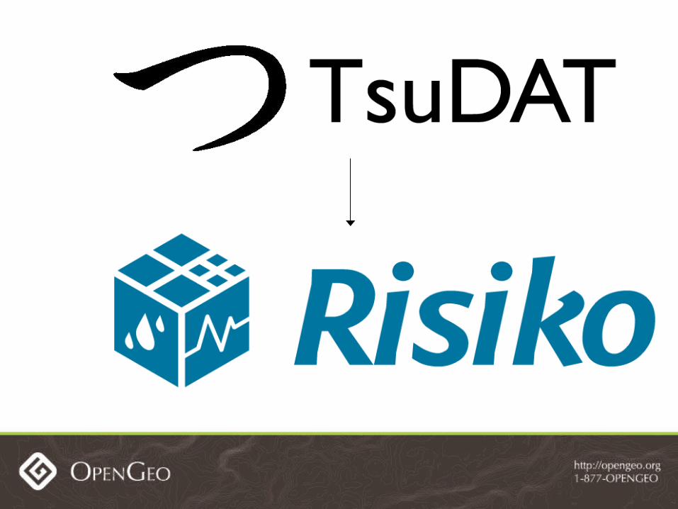
OpenStreetMap and Risiko


Layers of Collaboration
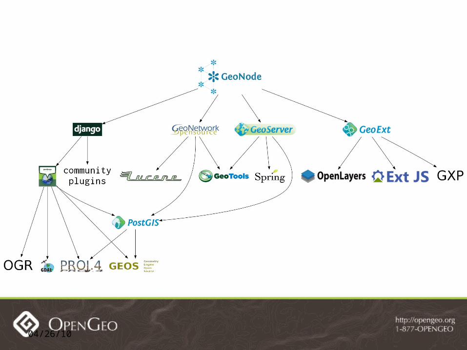
• Geospatial Software• Risiko and TsuDAT built on GeoNode and GXP
• Built on GeoExt/OpenLayers, GeoServer and GeoNetwork, PostGIS, GeoTools/JTS, GDAL/OGR
• Geospatial Data• Risk Map generated by TsuDAT model and OSM Buildings
• TsuDAT layers built by ANUGA model, shared DEMs, user drawn simulation areas, all exposed by GeoNode
• Buildings created by OSM Mapping Parties


Spatial Marketplace

ANZSM Operating Principles
• Everyone can discover and anyone can play
• Make it easier or don’t do it
• Embracing competition brings opportunity and encourages innovation
• This will make a difference – and that matters

Beyond Portals
• To real collaboration at all levels: on software, individual layers, and sharing new layers
• Thousands of nodes of collaboration
• Custom apps like TsuDAT
• Data communities like USGS NHD
• Each feeding in to other nodes that build on top
• Digital Earth shouldn’t require searching on ‘portals’ and spending the majority of time finding data

Building the Same Digital Earth
• Open Collaboration at the level of the individual will reduce duplication
• We must align incentives so nodes of collaboration naturally build on one another, be they NGO’s, Governments or Companies
• Geospatial becomes a fabric to solve real problems, we stop talking about building the Digital Earth and start just using it.

Thank You!

Powered By


![HOLMES,GEORGE · Holmes Spear, dec ], and George Holmes, heirs of Oliver Holmes subsequent to his death. I always understood that Oliver Holmes got the lot from Kamehameha 1. Holmes](https://static.fdocuments.in/doc/165x107/60677df317bc235d9b7d2724/holmesgeorge-holmes-spear-dec-and-george-holmes-heirs-of-oliver-holmes-subsequent.jpg)