Spatial Data Infrastructure Best Practices With Sebastian Benthall + Galen Evans OpenGeo World Bank.
94
Spatial Data Infrastructure Best Practices With Sebastian Benthall + Galen Evans OpenGeo World Bank
-
date post
22-Dec-2015 -
Category
Documents
-
view
215 -
download
0
Transcript of Spatial Data Infrastructure Best Practices With Sebastian Benthall + Galen Evans OpenGeo World Bank.

Spatial Data InfrastructureBest Practices
With
Sebastian Benthall + Galen Evans
OpenGeo World Bank

Spatial Data Infrastructure (SDI)

“…the sources, systems, network linkages, standards, and institutional issues involved in delivering spatially-related
data from many different sources to the widest possible group of potential users at affordable costs.”
– Groot & McLaughlin 2000
Spatial Data Infrastructure (SDI)

The theory of SDIdeveloped before
we learned what waspossible with the Internet

...what an ideal SDI would be like
Imagine...
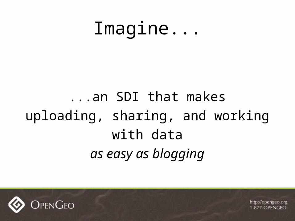
...an SDI that makesuploading, sharing, and working
with dataas easy as blogging
Imagine...

Publishing data
Anthony has some spatial data and wants to display it as part of a blog post.

Publishing data
Anthony uploads it to a public SDI, styles it, provides a background, and then a map widget
on his blog.

Publishing data
Meanwhile, the data, style, and map remain available on the public SDI
for others to use.

Metadata and reputation
The World Organization tells Cameron, their consultant, to put data she has gathered on
their SDI.

Metadata and reputation
Other users notice mistakes in the metadata. They notify Cameron and give it a low rating.

Metadata and reputation
Cameron fixes the mistakes, and the other users rate the data more highly. Her reputation on
the SDI improves.

Federated search
A regional Health agency and a regional Transit agency have separate SDI systems.

Federated search
Phillip, a GIS analyst doing research, seeks out correlations between health and bicycle routes

Federated search
Phillip searches for data in a single federated index and downloads the data as a batch.
How do you make an SDIthat's as compelling
as modern, widely-used web services?

Make an SDI using the best practices of these web services and projects

General Principles
Build Bottom Up Align Incentives Be Open Non expert use

04/26/10
“Bottom-up SDI”
Start with data.Let users work with it.
Generate metadata as needed.

04/26/10
“Bottom-up SDI”
Reduce barriers to participation as much as possible.

Align Incentives
Align incentivesfor contribution and use
so that itdevelops naturally

Be Open
• Give users a reason to participate in the system
• Reward collaboration with recognition and harvest the results
• Make as much information transparent for others to use as possible.

Non-expert User
You shouldn't have to be a GIS expertto use your SDI
There's so much more
These principles just scratch the surface of the qualities the next generation of SDI should
have.

But can it be?
These are nice dreams. But will they ever be a reality?

is a new software projectto build this SDI

It's open source. Of course.

Founders
Founders are interested in GeoNode primarily for disaster risk management
Global Facility for Disaster Reduction and Recovery (GFDRR) and World Bank
UN International Strategy for Disaster Reduction (UNISDR)
That's the vision and the context.
What have we actually built?
Whichbest practices?
How does GeoNode implement them?

Give a reason to participate
A major problem with SDIis that too few people have
an incentive to use it

Problems with Portals No benefit to registering Few real users No recognition or reward for the effort Uses stick, not carrot
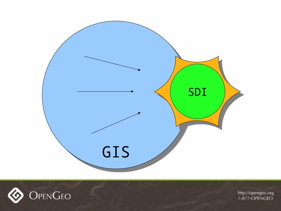
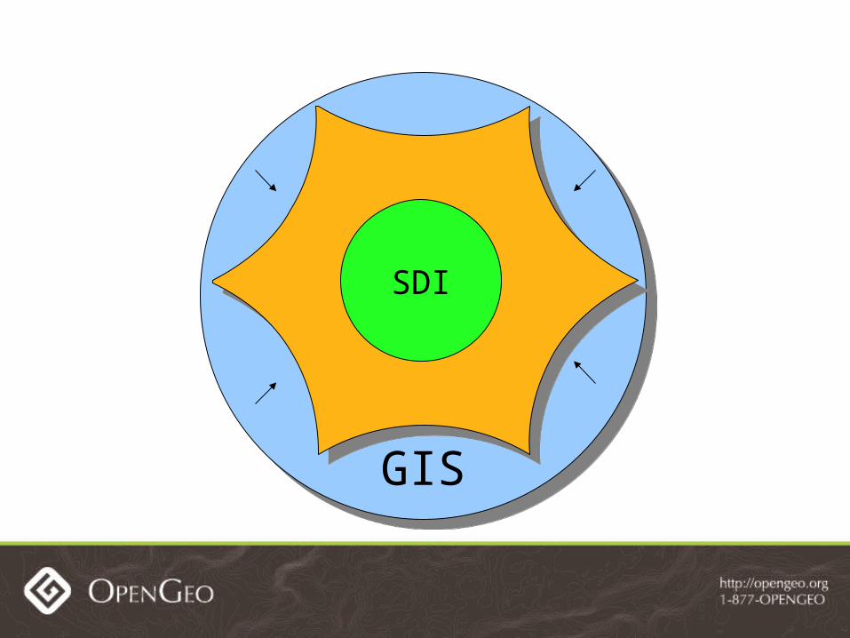
GISGIS
SDI
GISGIS
SDI

Embed SDIin the real work ofGIS practitioners,
it will have more impact.

Provides styling and cartography tools Users can use the tools on data they upload GeoNode provides a reason to participate


Map composer makes Maps Maps are an important content type They bind together ecosystem of geospatial
content


Maps, Data and Users forman ecosystem to be browsed

Users Have Identity
People like to fill user profiles to establish identity on the web
Profiles then become useful data

Metadata pain
Good metadata for geospatial data is important but hard to produce.

GeoNode has user profiles and features them prominently
Those profiles have ISO metadata fields within them

Metadata Made Easy

Metadata Published
Metadata is publishedwith open standard
CSWusing GeoNetwork

Open standards and API's
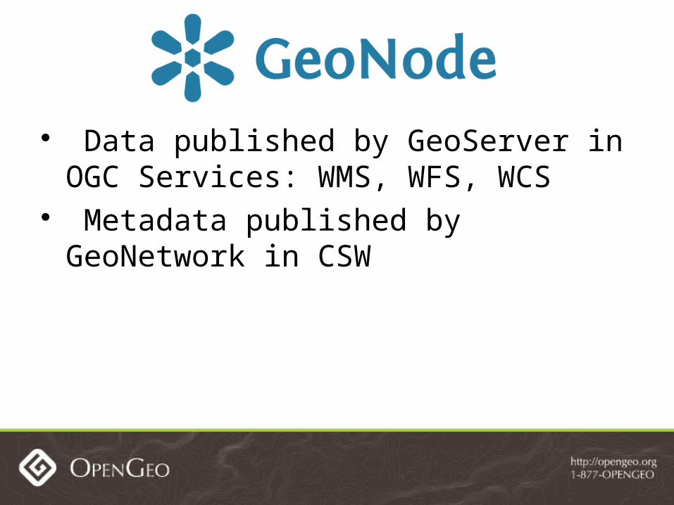
Data published by GeoServer in OGC Services: WMS, WFS, WCS
Metadata published by GeoNetwork in CSW

KML for Google

We use open standards for data access.
GeoNode also has open APIs

HTTP HTTP
HTTP
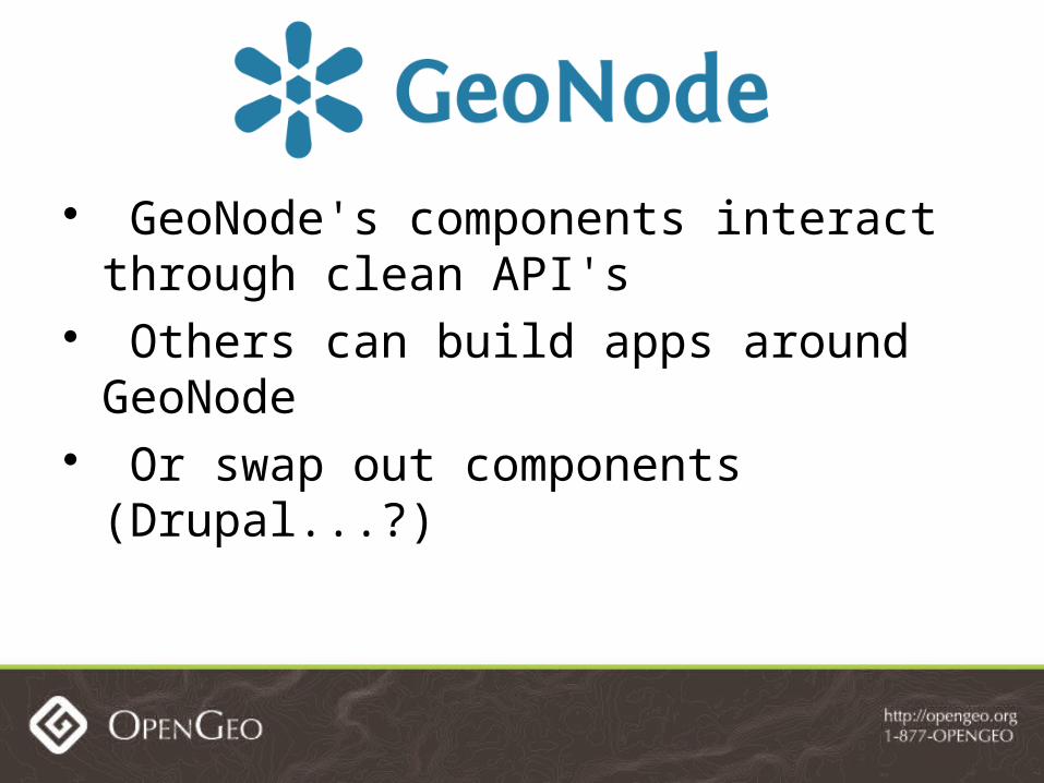
GeoNode's components interact through clean API's
Others can build apps around GeoNode Or swap out components (Drupal...?)
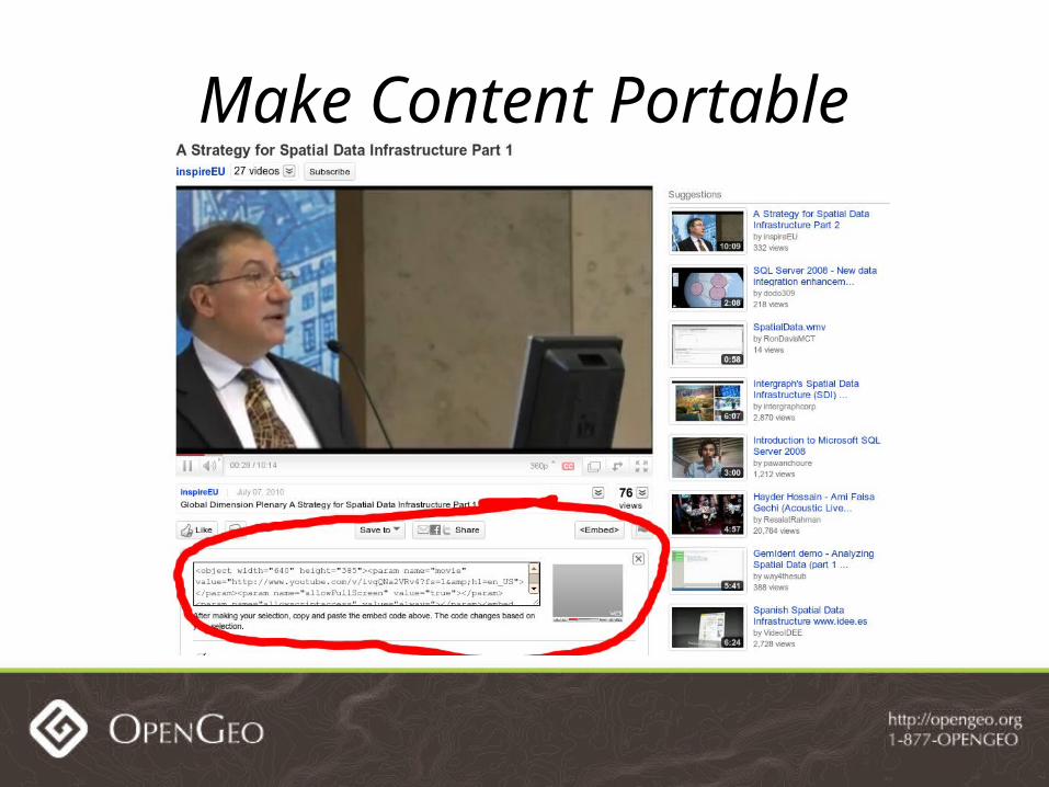
Make Content Portable


Let Users Control Content

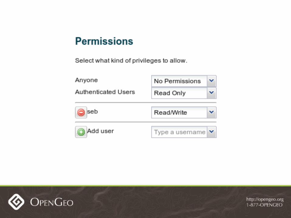

Content owners control access with easy user interface
Data security extends to OGC services

All these features are included inthe current 1.0-beta release.

DEMO

They only scratch the surface.
GeoNode has a much more ambitious roadmap.

Use the Social Network

The Social for Search


04/26/10

04/26/10

Record statistics on usage Let users comment on and rate content Use that information to improve search
results

The Social for Quality

Ratings affect user reputation Will encourage quality content on SDI

04/26/10
Groups Matter

04/26/10

Organizations will have a presence
Allows organizationalendorsement of data
These features,based on the best practices of the web,
will likely be developed within a year
Big Plans

There are also features specific toSpatial Data Infrastructure
on our roadmap
Even Bigger Plans

Editing

04/26/10
Federation
FrequentlyAsked
Questions

What's it made of?

HTTP HTTP
HTTP
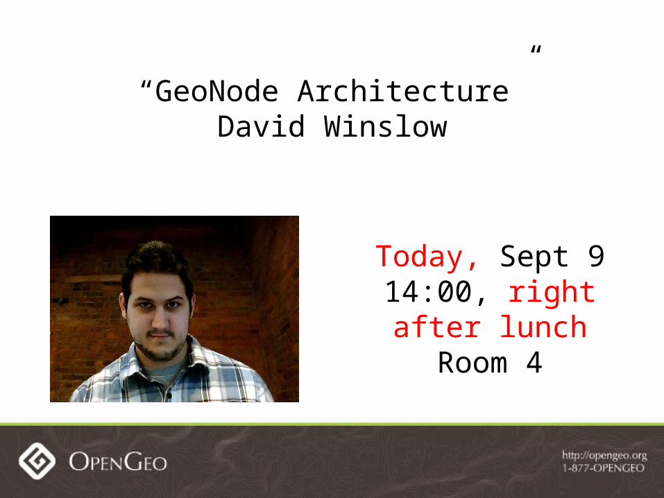
Today, Sept 914:00, right after lunch
Room 4
“GeoNode Architecture”David Winslow

What about INSPIRE?
GeoServer needs WMS 1.3 and WFS 2.0 for GeoNode to meet INSPIRE standards
OpenGeo is looking for partners to fund this development

Open Data Skepticism
Isn't GeoNode an open data platform?
Doesn't open data raise concerns aboutdata quality and data security?

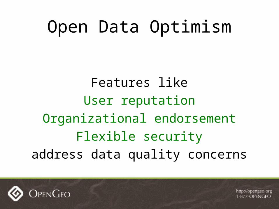
Open Data Optimism
Yes, GeoNode is designed to promote open data.
Open Data Optimism
Features likeUser reputation
Organizational endorsementFlexible security
address data quality concerns

Open Data Optimism
GeoNode supports
the continuum
of openness with a common platformfor institutional GIS and neogeography

What about Features X,Y, Z?
OpenGeo: We welcome your investment
in new GeoNode features!Inquire at the OpenGeo Booth.
(Also, patches are very welcome)
GeoNode Action

August 6th - GeoNode 1.0-beta release
September 27th ?? - GeoNode 1.0 released

Developer Community
• Contributing Organizations: OpenGeo, World Bank, Civic Works
• We hope others will join the developer community

OpenGeo: We're Hiring!
OpenGeo is hiring to fillGeoNode
software developerand consultant positions

OpenGeo: We're Selling!
OpenGeo is offering aFOSS4G Specialon GeoNode 1.0
Support, Deployment, and Services
Inquire at our booth.

Any questions?