An open source software suite for multi- …...An open source software suite for multi-dimensional...
30
An open source software suite for multi- dimensional geoscience data computation and visualization combined with GIS technology Yaqiang Wang Chinese Academy of Meteorological Sciences
Transcript of An open source software suite for multi- …...An open source software suite for multi-dimensional...
An open source software suite for multi-
dimensional geoscience data computation and
visualization combined with GIS technology
Yaqiang Wang
Chinese Academy of Meteorological Sciences
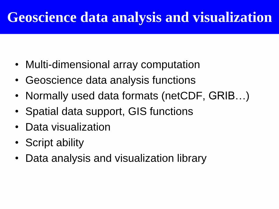
Geoscience data analysis and visualization
• Multi-dimensional array computation
• Geoscience data analysis functions
• Normally used data formats (netCDF, GRIB…)
• Spatial data support, GIS functions
• Data visualization
• Script ability
• Data analysis and visualization library
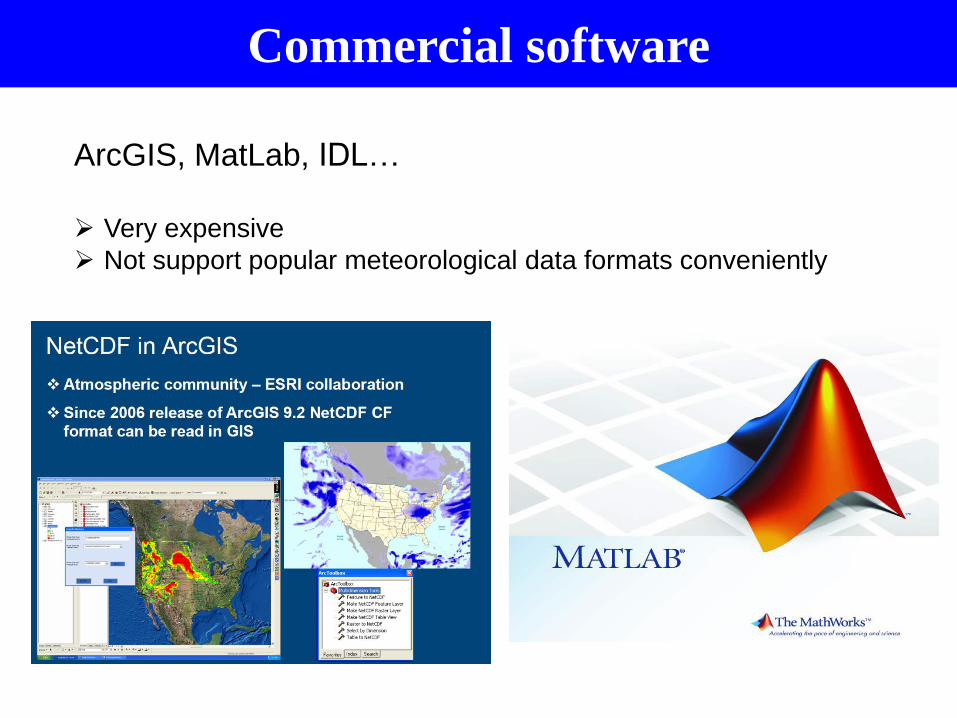
Commercial software
ArcGIS, MatLab, IDL…
Very expensive
Not support popular meteorological data formats conveniently

Freely available software – Atmospheric
community
GrADS
NCL
Python: Numpy + Matplotlib + Basemap…
…
We may need open source
“ArcGIS” + “MatLab”
MeteoInfo software package
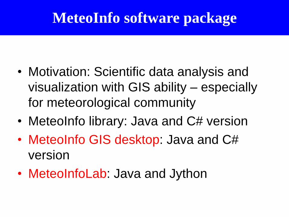
• Motivation: Scientific data analysis and
visualization with GIS ability – especially
for meteorological community
• MeteoInfo library: Java and C# version
• MeteoInfo GIS desktop: Java and C#
version
• MeteoInfoLab: Java and Jython

(Wang 2014 Meteorological Applications)
GIS functions were developed from ground level.
Two editions: Java and C#.
Freely and open source from the website http://www.meteothinker.com
Cross-platform: Windows, Unix, Linux, Mac OS.
Support netCDF, GRIB 1&2, HDF, GrADS, MICAPS, AWX …
Script ability.
MeteoInfo:GIS Desktop application
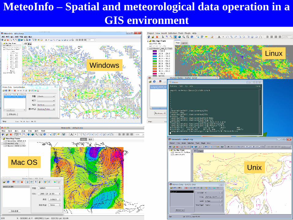
Windows
Mac OS
Linux
Unix
MeteoInfo – Spatial and meteorological data operation in a
GIS environment
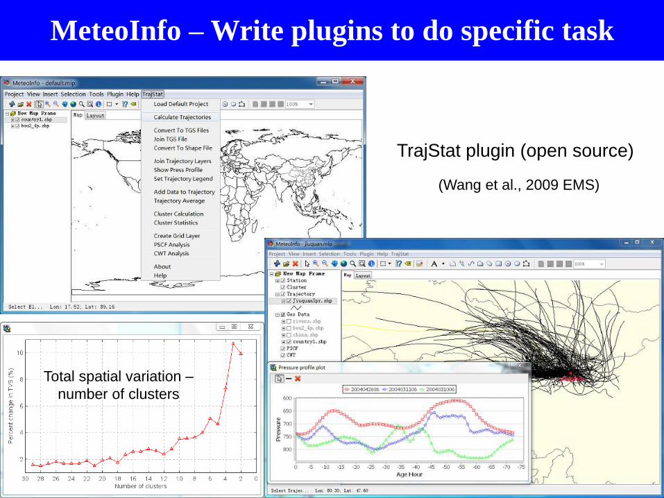
TrajStat plugin (open source)
(Wang et al., 2009 EMS)
Total spatial variation –
number of clusters
MeteoInfo – Write plugins to do specific task

MeteoInfo – Software development using the library

MeteoInfoLab: Scientific data analysis and visualization
MeteoInfoLab is open source software product developed using Java and Jython based on MeteoInfo Java library (Unidata netCDF Java library is used). The purpose is to provide an optional scientific computation and visualization tool similar with MatLab, NCL or Python (Numpy + Matplotlib + Basemap).

Multi-dimensional array support in Java

mipylib – Jython library of MeteoInfoLab
minum.py
miplot.py
midata.py

Mathematics and statistics components

MeteoInfoLab GUI

MeteoInfoLab GUI

MeteoInfoLab GUI

MeteoInfoLab GUI

MeteoInfoLab - Multi-dimensional array
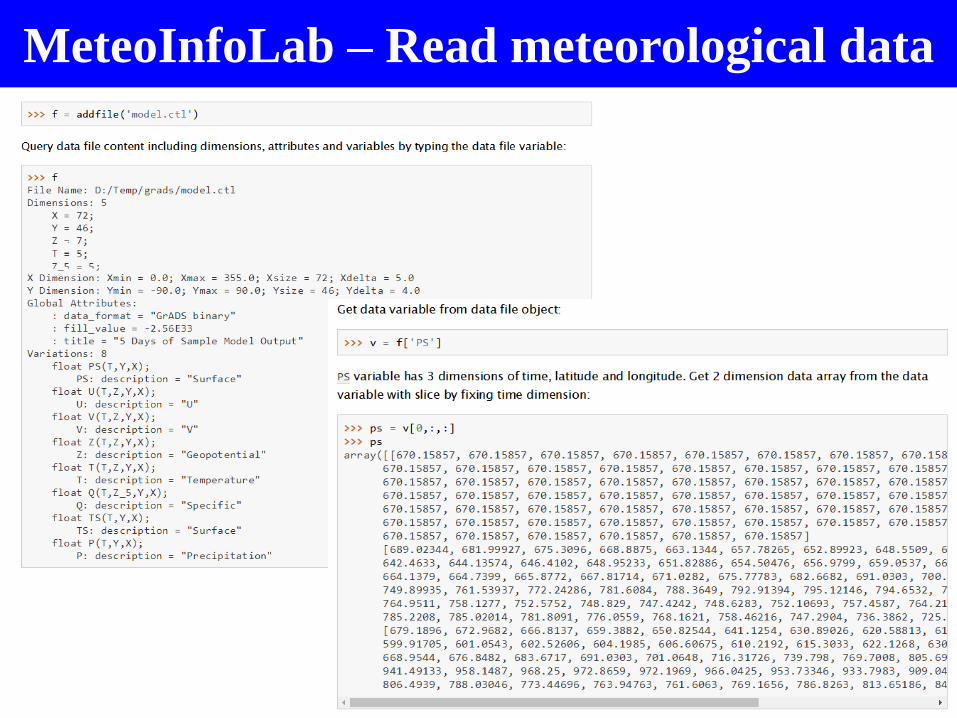
MeteoInfoLab – Read meteorological data
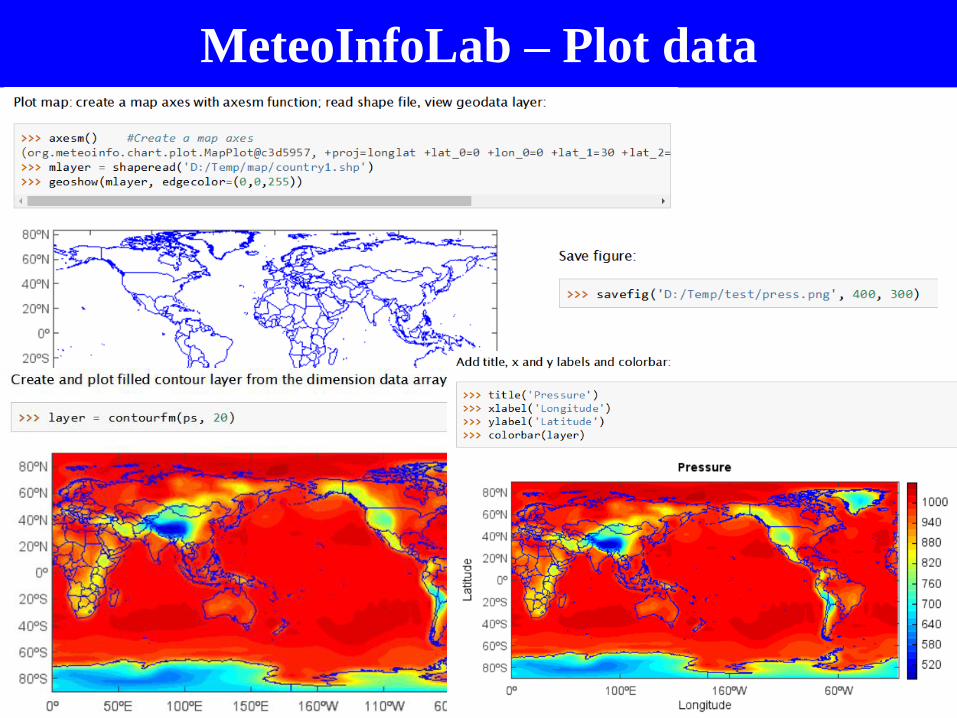
MeteoInfoLab – Plot data
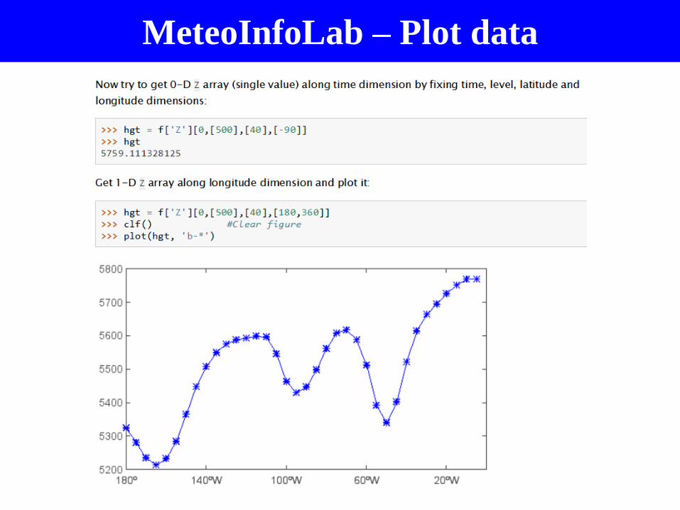
MeteoInfoLab – Plot data

MeteoInfoLab – Plot data
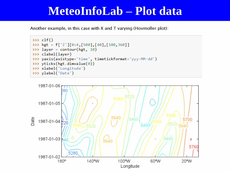
MeteoInfoLab – Plot data

MeteoInfoLab – Plot data

MeteoInfoLab – Meteorological analysis

MeteoInfoLab – Satellite data examples
Himawari-8
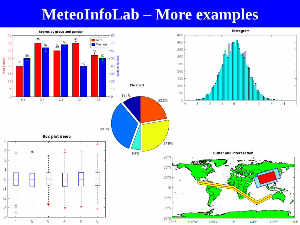
MeteoInfoLab – More examples
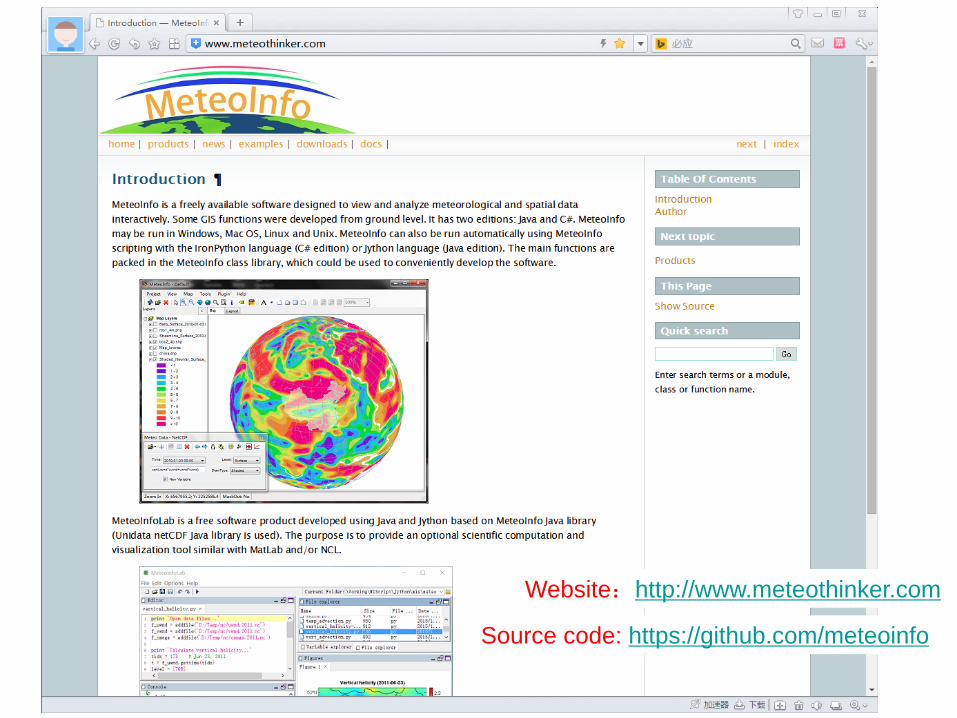
Website:http://www.meteothinker.com
Source code: https://github.com/meteoinfo
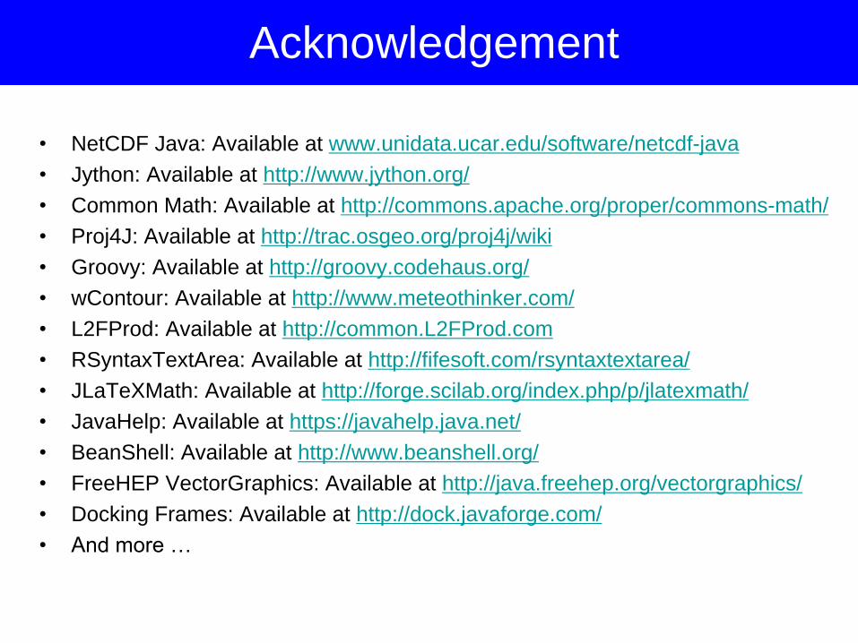
• NetCDF Java: Available at www.unidata.ucar.edu/software/netcdf-java
• Jython: Available at http://www.jython.org/
• Common Math: Available at http://commons.apache.org/proper/commons-math/
• Proj4J: Available at http://trac.osgeo.org/proj4j/wiki
• Groovy: Available at http://groovy.codehaus.org/
• wContour: Available at http://www.meteothinker.com/
• L2FProd: Available at http://common.L2FProd.com
• RSyntaxTextArea: Available at http://fifesoft.com/rsyntaxtextarea/
• JLaTeXMath: Available at http://forge.scilab.org/index.php/p/jlatexmath/
• JavaHelp: Available at https://javahelp.java.net/
• BeanShell: Available at http://www.beanshell.org/
• FreeHEP VectorGraphics: Available at http://java.freehep.org/vectorgraphics/
• Docking Frames: Available at http://dock.javaforge.com/
• And more …
Acknowledgement

Thanks for your attention !
Welcome to use and develop MeteoInfo !