


Languages
Pages
Legal

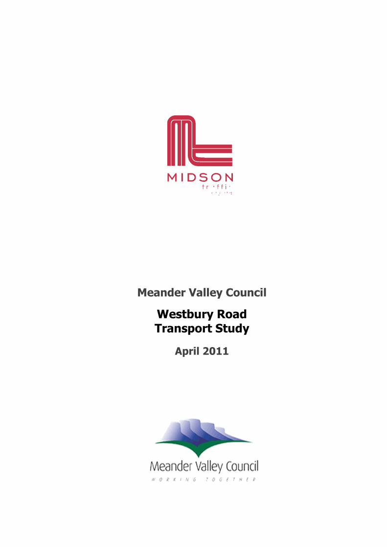
Meander Valley Council
Westbury Road Transport Study
April 2011

2
Contents
1. Executive Summary 5
2. Introduction 6
2.1 Objectives 6
2.2 Information and Data Sources 6
2.3 Strategic Plan 6
2.4 Glossary of Terms 7
3. Background 8
3.1 Study Area 8
4. Existing Conditions 16
4.1 Transport Network 16
4.2 Road Hierarchy 20
4.3 Public Transport 21
4.4 Road Safety Performance 24
5. Consultation 26
5.1 Stakeholder Engagement 26
5.2 Key Stakeholders 26
5.3 Issues Raised in Consultation 29
6. Future Trends 30
6.1 Land use 30
6.2 Traffic Growth 31
6.3 Cycling 32
6.4 Pedestrians 33
7. Identified Traffic and Road Safety Issues 34
7.1 General Westbury Road Issues 34
7.2 Intersections 35
7.3 Prospect Vale Marketplace 37
7.4 Petrol Plus and BWS 39
8. Recommendations 40
8.1 Traffic management 40
8.2 Prospect Vale Marketplace 46

3
8.3 Land Use Planning 47
8.4 St Patrick’s College 48
8.5 Ongoing Monitoring 49
9. Conclusion 50
Appendix A1
Appendix A2
Figure Index
Figure 1 Subject Site (Source: Google Maps) 8
Figure 2 Westbury Road Corridor 1 9
Figure 3 Westbury Road Corridor 2 9
Figure 4 Westbury Road Corridor 3 10
Figure 5 Westbury Road Corridor 4 10
Figure 6 Westbury Road Corridor 5 11
Figure 7 Westbury Road Corridor 6 11
Figure 8 Westbury Road Corridor 7 12
Figure 9 Westbury Road Planning Scheme Zoning 13
Figure 10 Prospect Vale Market Place Access 14
Figure 11 Prospect Vale Marketplace Car Park 14
Figure 12 Westbury Road 17
Figure 13 Country Club Avenue 17
Figure 14 Mt Leslie Road Roundabout from Westbury Road 18
Figure 15 Counter Locations and Traffic Volumes (vpd) 20
Figure 16 Road Hierarchy Function 21
Figure 17 Launceston (west) Bus Route Map (Source: Metro Tas) 23
Figure 18 Westbury Road Link Crash Locations 24
Figure 19 Westbury Road Intersection and Side Road Crashes 25
Figure 20 Future Land Use Development 31
Figure 21 Greater Launceston Bicycle Network (Extract) 32
Figure 22 Bradford Avenue Intersection 36
Figure 23 Donalds Avenue Intersection 37
Figure 24 Prospect Vale Marketplace Car Park 38
Figure 25 Petrol Plus/ BWS Access 39
Figure 26 New Pedestrian Refuges 41
Figure 27 Mace Street Intersection Treatment 42
Figure 28 Bradford Avenue Intersection Treatment 43

4
Figure 29 Real Estate Access at Country Club Avenue 44
Figure 30 Westbury Road Roundabout 45
Figure 31 Bicycle Lane Guidelines 46
Figure 32 Market Place Access Configuration 47
Figure 33 Jardine Crescent Subdivision 48
Table Index
Table 1 Abbreviations Summary 7
Table 2 Traffic Volumes and Speeds 19
Table 3 Bus Routes 22
Table 4 Summary of Key Issues Raised in Consultation 29

5
Westbury Road – Transport Study
1. Executive Summary
Westbury Road is strategically important road for Meander Valley Council municipality. It connects
between Bass Highway and Launceston and provides access to a large residential catchment area as well
as shopping, commercial and industrial precincts.
The objectives of this report were to identify all traffic, parking and road safety issues within the
Westbury Road corridor and the surrounding road network, and to propose potential solutions to
alleviate these issues, both in the short and long term. Extensive consultation with key stakeholders was
undertaken during the study to capture the key traffic, parking and road safety issues.
Westbury Road provides a collector road function as it carries a significant volume of through traffic that
is growing at a steady rate. It also provides access to properties along its length. Both of these
functions are important, although it is difficult to cater for increased accessibility and through traffic at
same time.
Many of the identified issues associated with Westbury Road relate to access to and from property and
side roads. Westbury Road also provides a barrier for pedestrians. Reported crash data show that
Westbury Road has a relatively high rate of mid-block crashes, highlighting the conflict between the
through traffic and access functions of the road.
It is likely that Westbury Road and its surrounding roads will cater for more pedestrians and cyclists over
time due to land use development in the nearby area. Westbury Road will need to be modified to
provide improved accessibility for these modes of transport over time.
This study identified the following traffic management strategies to improve Westbury Road over time:
Reduced speed limit to 50-km/h along the full length of Westbury Road
Roundabout at Vale Street
Pedestrian actuated traffic lights near Prospect Vale shopping centre
Improved accessibility for the Prospect Vale Shopping Centre for both vehicles and pedestrians
Provision of on-street cycling lanes
Various intersection upgrades
Increased number of pedestrian refuge islands to improve crossability
Land use recommendations to improve connectivity within the study area and place less reliance
on key intersections
Roundabout at the connection of Bass Highway off ramp with Westbury Road

6
Westbury Road – Transport Study
2. Introduction
Midson Traffic Pty Ltd were commissioned by Meander Valley Council to undertake a corridor study of
Westbury Road, Prospect Vale, in the Meander Valley municipality. The purpose of the study is to make
recommendations for the planning and implementation of improvements to Westbury Road and its
surrounds. The study is intended to provide guidance for future land use planning and infrastructure
development to meet the future needs of the community in a sustainable way.
2.1 Objectives
Westbury Road is a major collector road in Prospect Vale in the Meander Valley municipality. In a
strategic context, Westbury Road connects between Bass Highway and Launceston and provides access
to a large residential catchment area as well as shopping, commercial and industrial precincts.
This report outlines the traffic, parking and road safety issues identified through site investigation and
consultation with key stakeholders.
The existing road network, land use, traffic loads and road safety performance were considered as well
as forecasts for future traffic growth and land use development.
The objectives of this report were to identify all traffic, parking and road safety issues within the
Westbury Road corridor and the surrounding road network, and to propose potential solutions to
alleviate these issues, both in the short and long term.
2.2 Information and Data Sources
The following organisations were contacted during the preparation of this report:
Department of Infrastructure, Energy and Resources (DIER) – Provision of crash data and traffic
data.
Meander Valley Council – Provision of traffic data, general network and land use.
Launceston City Council – provision of network information and data.
Metro Tasmania – Public transport information.
2.3 Strategic Plan
The Meander Valley Strategic Plan 2004 – 2014 outlines the future directions for the Meander Valley
municipality:
The Strategic Plan has been developed using the outcomes of the future search conference that
was held over three days in April 2004 involving 80 community members. That group set a vision
of where they’d like Meander Valley to be in 2014, identified the values that would guide choices
along the way and the future directions to follow.

7
Westbury Road – Transport Study
This report assists Council’s future planning for this road corridor and aligns with the following Strategic
Objectives in the Strategic Plan:
Work in partnership with the State Government to meet the health and well being needs of the
community, in particular the needs of the elderly.
Help provide and improve the quality of recreation facilities and programs and encourage
increased participation in structured and informal recreation.
Help develop and promote nature based recreation and trails across Meander Valley.
Develop communication and consultation processes and standards between Council and the
community.
2.4 Glossary of Terms
The key abbreviations used in this report are shown in Table 1.
Table 1 Abbreviations Summary
Abbreviation Description
ABS Australian Bureau of Statistics
ADT Average Daily Traffic
AM Morning Peak Period (typically 8:00am to 9:00am)
CBD Central Business District
DIER Department of Infrastructure, Energy and Resources
Drv Drive
est Estimated
Hwy Highway
HV Heavy Vehicle
km/h Kilometres Per Hour
LCC Launceston City Council
m² Square metres
MVC Meander Valley Council
N/A Not Applicable or Not Available
PM Evening Peak Period (typically 5:00pm to 6:00pm)
Rd Road
St Street
vpd Vehicles Per Day
vph Vehicles Per Hour

8
Westbury Road – Transport Study
3. Background
3.1 Study Area
The study area consists of the Westbury Road corridor in Prospect Vale within the Meander Valley
Council municipality; that is, between the Mount Leslie Road intersection and the Bass Highway
interchange as shown in Figure 1. The broader transport network and land use outside this corridor was
also considered in the overall context of the study as it relates to Westbury Road.
Figure 1 Subject Site (Source: Google Maps)
The study area is shown in further detail, including the location of various existing key traffic
management elements of Westbury Road, in Figure 2 to Figure 8.
Study Area

9
Westbury Road – Transport Study
Figure 2 Westbury Road Corridor 1
Figure 3 Westbury Road Corridor 2
To Launceston
Location of recently
constructed roundabout
St Patrick’s College
Pedestrian median refuge
Allan’s Garden Centre

10
Westbury Road – Transport Study
Figure 4 Westbury Road Corridor 3
Figure 5 Westbury Road Corridor 4
Tyler Village
Pedestrian median refuge
Pedestrian median refuge
Prospect Vale
Marketplace Pedestrian median refuge
Bus bay
Petrol Plus/BWS

11
Westbury Road – Transport Study
Figure 6 Westbury Road Corridor 5
Figure 7 Westbury Road Corridor 6
Pedestrian median refuge
Pedestrian median refuge
Roundabout
Australian
Italian Club

12
Westbury Road – Transport Study
Figure 8 Westbury Road Corridor 7
3.1.1 Land Use
Westbury Road runs through a predominantly residential area, with small commercial zones between
Bimbimbi Avenue and Burrows Street. To the southern end of Westbury Road there is an industrial zone
and sports field. The land use is depicted in Figure 9.
Prospect
Vale Park

13
Westbury Road – Transport Study
Figure 9 Westbury Road Planning Scheme Zoning
3.1.2 Prospect Vale Marketplace
The Prospect Vale Marketplace (shown in Figure 11 and access from bottle shop and service station in
Figure 10) is a shopping centre on Westbury Road containing a supermarket, petrol station, drive-
through bottle shop and a number of other stores. The shopping centre also contains a large car park
with three accesses onto Westbury Road. Of these accesses, one accesses the petrol station and bottle
shop, and the other two access the main car park area.
Westbury Road
Bass Hwy
Country Club
Avenue

14
Westbury Road – Transport Study
Figure 10 Prospect Vale Market Place Access
Figure 11 Prospect Vale Marketplace Car Park

15
Westbury Road – Transport Study
3.1.3 Schools
There are two secondary schools within the study area. St Patrick’s College (years 7 – 12) has
approximately 1,200 enrolled students at the Prospect Campus and is located on the corner of Mount
Leslie Road and Westbury Road. Prospect High School (7 – 10) has approximately 740 enrolled students
and is located on Lila Drive, with pedestrian access from Bradford Avenue.
Both of these schools are likely to expand in the future. The additional students will generate more
pedestrians, more traffic and more parking demands in the nearby area over time.
16
Westbury Road – Transport Study
4. Existing Conditions
4.1 Transport Network
For the purpose of this report, the transport network consists of Westbury Road from the Bass Highway
to the roundabout at the Westbury Road/ Mount Leslie Road intersection and all streets intersecting with
Westbury Road. Some consideration was also given to Mount Leslie Road, Country Club Avenue and
Westbury Road north of the Mount Leslie Road intersection.
4.1.1 Westbury Road
Westbury Road is a major collector road connecting between the Bass Highway and the City of
Launceston, providing access to the suburbs of Prospect, Prospect Vale, Blackstone Heights and, to a
lesser extent, Summerhill. Westbury Road provides access to Launceston to/from Bass Highway without
the need to utilise the Midland Highway.
It is a two lane, two way road with several roundabouts and uncontrolled give-way intersections along
its length. The posted speed limit on Westbury Road is 60-km/h with a 40-km/h school zone in the
vicinity of the Mount Leslie Road roundabout, where St Patricks College is located.
There is generally good pedestrian footpath provision throughout the length of Westbury Road, with
footpaths being provided on both sides of the road and the majority of Westbury Road has no on-street
parking available.
Westbury Road carries approximately 15,000 vehicles per day between Mount Leslie Road and Mace
Street, with an 85th percentile speed of around 60-km/h. The traffic entering Westbury Road from the
Bass Highway (west) was found to be approximately 2,500 vehicles per day.

17
Westbury Road – Transport Study
Figure 12 Westbury Road
4.1.2 Country Club Avenue
Country Club Avenue is a minor collector road providing access to the Country Club Casino, as well as
the suburb of Blackstone Heights via Casino Rise. It is a wide road with access from Westbury Road by
means of a three-legged roundabout. In the vicinity of Westbury Road Country Club Avenue is in a
predominantly residential Area.
Traffic volumes for Country Club Avenue are approximately 7,500 vehicles per day between Westbury
Road and Cheltenham Way, with an 85th percentile speed of around 60-km/h.
Figure 13 Country Club Avenue

18
Westbury Road – Transport Study
4.1.3 Mount Leslie Road
The function of Mount Leslie Road is similar to Country Club Avenue. Mount Leslie Road is a minor
collector road with access from Westbury Road by means of a recently constructed three-legged
roundabout. It passes through a residential area and also provides access to St Patrick’s College,
located just west of the Westbury Road intersection.
Mount Leslie Road also provides an alternative access to the suburbs of Summerhill and Blackstone
Heights.
Council traffic data indicates that Mount Leslie Road carries approximately 3,000 vehicles per day
between Willow Lane and Richard Street, with an 85th percentile speed of 55-km/h.
Figure 14 Mt Leslie Road Roundabout from Westbury Road
4.1.4 Harley Parade
Harley Parade is located at the southern end of Westbury Road and provides access to a small residential
area and a sports ground. Traffic volumes on Harley Parade are 1,100 and 770 vehicles per day to the
east and west of the sports ground respectively.

19
Westbury Road – Transport Study
4.1.5 Summary of Traffic Data
Council traffic data for Westbury Road, Country Club Avenue, Mount Leslie Road and Harley Parade
along with the remainder of the streets connecting to Westbury Road is summarised in Table 2. Road
and counter locations for the traffic data as listed are shown in Figure 15.
Table 2 Traffic Volumes and Speeds
Road Category Traffic Volume
(vehicles per day)
85th Percentile
Speed
Westbury Road (north) Major Collector Road 14,614 61-km/h
Westbury Road (south) Major Collector Road 2,436 59-km/h
Country Club Avenue Minor Collector Road 7,452 62-km/h
Mount Leslie Road Minor Collector Road 2,931 54-km/h
Harley Parade (east) Local Residential Street 1,072 47-km/h
Harley Parade (west) Local Residential Street 768 58-km/h
Donalds Avenue Access Road 2001 -
Burrows Street Local Residential Street 1,376 49-km/h
Stuart Avenue Local Residential Street 2001 -
Vale Street Local Residential Street 380 49-km/h
Bimbimbi Avenue Local Residential Street 449 51-km/h
Mace Street Local Residential Street 1,667 54-km/h
Bradford Avenue Local Residential Street 269 40-km/h
1 No traffic data available, figure is estimated
20
Westbury Road – Transport Study
Figure 15 Counter Locations and Traffic Volumes (vpd)
4.2 Road Hierarchy
Westbury Road plays an important role from a road hierarchy perspective. A road hierarchy is defined
as the “Grading of roads according to increasing or decreasing importance or their traffic carrying or
other function”. It creates tributary systems & networks that acknowledge which roads act as access,
feeder and arterial roads.
A road hierarchy formalises the importance of each road to the whole network. It provides justification
21
Westbury Road – Transport Study
for providing different levels of service.
At a broad level, roads provide two primary functions:
1. Land service function (access to residential, retail and other land uses)
2. Traffic function, moving large volumes of freight and traffic.
Roads cannot provide both of these primary functions to a high level simultaneously, however Westbury
Road has a mix of access and traffic function, as shown in Figure 16 (source: NZ Transport Agency).
The functions of through traffic and land use access are of equal importance for Westbury Road.
Figure 16 Road Hierarchy Function
4.3 Public Transport
Metro Tasmania have six regular bus routes on Westbury Road, including use of the Country Club
Avenue roundabout, the Burrows Street intersection and the connection to the Bass Highway for the
route servicing Hadspen and Rutherglen.
The route numbers and number of trips per day are summarised in Table 3.

22
Westbury Road – Transport Study
Table 3 Bus Routes
Route No Intersections Affected Trips per weekday
60 Country Club Avenue 14
64 Country Club Avenue 7
70 Country Club Avenue 13
74 Country Club Avenue 7
76 Burrows Street
Country Club Avenue 4
78 Bass Highway Interchange 11
At present, public transport provision in the Launceston (west) area is relatively good, with buses
travelling to and from Launceston at regular intervals throughout the day. As the population ages, and
more families move to the Prospect and Prospect Vale areas, reliance on public transport will increase
and a high standard of public transport should continue to be provided.
The bus route map obtained from Metro Tas is shown in Figure 18. Future development of the road
infrastructure utilised by public transport should be designed and maintained with consideration of bus
manoeuvrability.

23
Westbury Road – Transport Study
Figure 17 Launceston (west) Bus Route Map (Source: Metro Tas)

24
Westbury Road – Transport Study
4.4 Road Safety Performance
Crash data can provide valuable information on the road safety performance of a road network. This
information can be utilised as a tool to assist in identification of possible road safety deficiencies
associated with a network. In Tasmania, all crashes that are reported to police are maintained in a
database managed by DIER.
Available crash data was obtained from DIER for the most recent 5 year time period for Westbury Road,
between Mount Leslie Road and the Bass Highway, as well as the intersecting side-streets within the
study area.
The crash data is summarised as follows:
A total of 69 crashes were reported during this time period. Of these, 19 resulted in injury and
the remaining 50 crashes involved property damage only.
44 of the crashes occurred on Westbury Road, 9 of which involved injury. The remaining 25
occurred on side-streets with 10 involving injury.
Intersections accounted for a total of 11 crashes, 2 resulting in injury, whereas the majority of
crashes occurred at mid-block locations with 58 crashes total with 17 resulting in injury.
The crash data is typical of a major collector road that provides property access along its length within
an urban area.
The crash location map for link crashes (crashes occurring between intersections) is shown in Figure 18.
Crash location map for intersection crashes and side roads is provided in Figure 19.
Figure 18 Westbury Road Link Crash Locations

25
Westbury Road – Transport Study
Figure 19 Westbury Road Intersection and Side Road Crashes

26
Westbury Road – Transport Study
5. Consultation
5.1 Stakeholder Engagement
This study has involved extensive stakeholder engagement throughout its development. Council
advertised the study in The Examiner and Valley Views, the Council newsletter, for submissions from the
public. Council also actively sought comment from key stakeholders.
Two public meetings were held at the Australian Italian Club in Prospect Vale. The first meeting was on
Thursday 11 November, 2010. Approximately 25 people were present at the first consultation evening
and were given an opportunity to have their say and fill in a survey form about the Westbury Road
corridor. A similar number of people attended the second consultation evening, which was held on 3rd
February, 2011.
A letter box drop for all residents bordering on Westbury Road was also undertaken by Council to inform
them of the study, provide information regarding the public meetings and inviting community comment.
The key issues that arose during the consultation stage of the project are summarised in Appendix A.
The second public presentation presented the findings from the consultation as well as the
recommendations to overcome the issues identified.
5.2 Key Stakeholders
Council recognised the following key stakeholders as being important to the study:
Meander Valley Council
Department of Infrastructure, Energy and Resources (DIER)
Launceston City Council
Prospect Vale Marketplace
St Patrick’s College
Prospect High School
Metro Tasmania
Emergency services
Local businesses
Cycling groups
RACT
General public
Each of these key stakeholders is outlined in the following sections.

27
Westbury Road – Transport Study
5.2.1 Meander Valley Council
Meander Valley Council is the local government organisation responsible for Westbury Road and
connecting roads (with exception of Bass Highway) in the study area. The Council has direct
responsibility for the maintenance of Westbury Road and the land use planning authority within the
study area.
Meander Valley Council have developed the Strategic Plan 2004-2014, which details the direction of
future development within the municipality.
5.2.2 Department of Infrastructure Energy and Resources
DIER is the Tasmanian State Government department responsible for the maintenance of the Bass
Highway. DIER is also the statutory authority for the approval of new traffic control devices in
Tasmania.
5.2.3 Launceston City Council
Launceston City Council (LCC) is the local governing body responsible for the municipality of Launceston.
LCC own and maintain the northern section of Westbury Road, between Mount Leslie Road and its
northern origin in Wellington Street.
A large amount of the traffic on Westbury Road within the subject area consists of vehicles travelling
between Launceston and facilities in Prospect Vale.
5.2.4 Prospect Vale Market Place
Prospect Vale Marketplace is a shopping centre on Westbury Road containing a supermarket, petrol
station, drive-through bottle shop and a number of other stores. The shopping centre also contains a
large car park with three accesses onto Westbury Road. One access services the petrol station and
bottle shop, and the other two access the main car park area. The shopping centre is one of the largest
traffic generators in the study area, with the petrol station and bottle shop contributing a relatively large
amount of the traffic generation.
5.2.5 St Patrick’s College
St Patrick’s College is a catholic secondary school located on the corner of Mount Leslie Road and
Westbury Road at the northern end of the subject site. The school caters for grades seven to twelve
and has approximately 1,200 enrolled students at the Prospect campus.
5.2.6 Prospect High School
Prospect High School is a state government high school located on Lila Drive, with pedestrian access
from Bradford Avenue. It caters for grades seven to ten and has approximately 740 enrolled students.

28
Westbury Road – Transport Study
5.2.7 Metro Tasmania
Metro Tasmania are the public transport providers in the Greater Launceston area, with several bus
routes utilising Westbury Road.
5.2.8 Emergency Services
The emergency services, including Tasmania Police, Tasmania Fire Service and Ambulance services.
5.2.9 Local Businesses
There are numerous local businesses located on or near Westbury Road within the subject site, most of
which are in and around the Prospect Vale Marketplace and the Industrial Zone to the south. Westbury
Road provides primary access for patrons and service vehicles for these businesses.
5.2.10 Cycling Groups
The Westbury Road corridor provides an opportunity to significantly increase the numbers of people
cycling along what is a relatively flat corridor with significant resident population and trip destinations.
Cycling as a mode of transport has seen a relatively sharp increase in trips in Tasmania in the last
decade.
Council held discussions with a number of members of the Genesys Cycling Team in regards to the
provision of cycling routes - their comments are included in Appendix A1.
5.2.11 RACT
The Royal Automobile Club of Tasmania (RACT) is Tasmania’s leading service organisation providing a
number of services including roadside assistance, insurance, car finance, travel, driving lessons. A
detailed response to the Draft Report was received from Mr Gary O’Keefe on behalf of RACT and the
Regional Road Safety Taskforce. The full response is attached in Appendix A2.
5.2.12 General Public
The general public, including but not limited to residents of Prospect Vale, are also considered key
stakeholders for the purpose of this study. And have been given the opportunity to submit comments
about the current operation of Westbury Road during the course of this study.

29
Westbury Road – Transport Study
5.3 Issues Raised in Consultation
The main issues raised during the consultation phase of the study are summarised in Table 4.
Table 4 Summary of Key Issues Raised in Consultation
Location Issue Representation
Westbury Road General congestion General public
Vehicles speeding General public
Pedestrian facilities General public
Local businesses
Access to driveways General public
Local businesses
Pick up and drop off General public
Local businesses
Prospect Vale Marketplace Car park configuration General public
Difficulty of access to car park General public
Local businesses
Country Club Avenue Business access on roundabout General public
Mace Street/ Bradford Avenue U-turn manoeuvres General public
Donalds Avenue Heavy vehicle turning paths General public
Local business
General congestion General public
Local business
Harley Parade General congestion General public

30
Westbury Road – Transport Study
6. Future Trends
6.1 Land use
In the future, it is expected that there will be significant development, both industrial and residential,
utilising Westbury Road as a main corridor to and from the City of Launceston and Bass Highway.
The likely areas of future residential development are:
The Ben Lomond Views subdivision, currently under development on Mace Street.
Behind Prospect Vale Marketplace on Jardine Crescent.
Blackstone Heights.
Harley Parade.
Southeast of the Bass Highway interchange.
There is also some small industrial development expected inside the industrial zone at the southern end
of Westbury Road on Donalds Avenue.
These key development areas are shown in Figure 20.

31
Westbury Road – Transport Study
Figure 20 Future Land Use Development
6.2 Traffic Growth
There has been steady and progressive traffic growth in Westbury Road and surrounds over the last few
decades. This has mainly been driven by land use development both within the study area and external
to it (such as in Launceston and to the west on Bass Highway corridor).
Based on available historical traffic data, it is likely that traffic volumes will continue to grow at a rate of
around 2% per annum. This equates to a likely traffic volume of approximately 18,000 vehicles per day
in the year 2020, and 22,000 vehicles per day in 2030.
Similarly, Country Club Drive can expect traffic volumes in the order of 9,000 vehicles per day in the year
2020, and 10,000 vehicles per day by 2030. Mount Leslie Road can expect traffic volumes of 3,500
vehicles per day in the year 2020, and 4,000 vehicles per day in 2030.
Future Residential
Development
Future Residential
Development
Future Industrial/
Light Commercial
Development

32
Westbury Road – Transport Study
6.3 Cycling
Council actively promotes cycling within Meander Valley as a way of improving the health and wellbeing
of the community along with being an alternative mode of transport.
Identified in the Greater Launceston Cycling Strategy, Westbury Road is identified as a cycling corridor
for residents within the Prospect/ Blackstone Heights area and as a link between Launceston and
Meander Valley Road that accesses areas West and South of Launceston.
An extract from the proposed Greater Launceston Bicycle Network map is shown in Figure 21.
Figure 21 Greater Launceston Bicycle Network (Extract)

33
Westbury Road – Transport Study
6.4 Pedestrians
The future expansion of residential housing, commercial areas, such as the Prospect Vale Marketplace,
and Schools will result in an increased number of pedestrians, children in particular, utilising Westbury
Road.
Council have developed the Prospect Vale Fitness Trail that runs parallel to Westbury Road from
Prospect Vale through to Willow Lane. Council has an ongoing strategy to promote health and wellbeing
within the community.
Pedestrian activity is likely to increase along and across Westbury Road over time.

34
Westbury Road – Transport Study
7. Identified Traffic and Road Safety Issues
7.1 General Westbury Road Issues
7.1.1 Vehicle Speeds
Although vehicle speeding was raised through consultation as an issue on Westbury Road and within the
surrounding road network, the traffic data suggests that vehicles within the subject site are generally
sticking to the speed limits, with 85th percentile vehicle speeds approximately equal to the speed limit at
most counter locations. The issue of speeding is often a relative matter, particularly when pedestrians
are involved. It is likely that the speed issue is more related to constant traffic volumes along Westbury
Road, and the difficulties associated with crossing the road.
According to the traffic data shown in Table 2, the largest occurrence of speeding is on Harley Parade to
the west of the sports ground, with the 85th percentile speed exceeding the speed limit by approximately
8-km/h.
7.1.2 Pedestrian Facilities
There are very few pedestrian crossing facilities present on Westbury Road. Coupled with the large
traffic volumes, it is very difficult for pedestrians to select an appropriate gap in the traffic stream to
allow for a safe crossing and wait times of over 60 seconds are not uncommon. This is particularly
noticeable at the Prospect Vale Marketplace, the two secondary schools and bus stops which are three
areas of high pedestrian activity.
The only pedestrian crossing facility in close proximity to the Prospect Vale Marketplace is a
small pedestrian median refuge located adjacent to the northern car park access.
A roundabout has recently been constructed at the intersection of Mount Leslie Road and
Westbury Road, which forms the main pedestrian crossing point for St Patrick’s College. The
majority of pedestrian activity from Prospect High School occurs outside Allan’s Garden Centre,
which is a popular pick-up and drop-off location.
The signalised pedestrian crossing on the Launceston City Council side of Westbury Road is well
utilised by students of both St Patricks College and Prospect High School.
7.1.3 Access to Driveways
With the relatively high traffic volumes on Westbury Road during most times of the day, it is becoming
increasingly difficult to enter and exit driveway and side-streets, particularly with right-turn movements.
As a result, there appears to be a tendency for vehicles to undertake left turn manoeuvres and perform
U-turn manoeuvres at roundabouts or other intersections.
7.1.4 Pick-Up/ Drop-Off Activity
There is also a high level of pick-up and drop-off activity on Westbury Road, specifically near each of the

35
Westbury Road – Transport Study
two schools (and also on Westbury Road within the Launceston City Council municipality). Given the
high traffic volumes and general congestion during peak times, parking and un-parking vehicles cause an
increased risk of rear end collisions at these locations.
7.1.5 Parking
Most parking on Westbury Road is associated with commercial activity and the schools. The high
parking demands within the Prospect Vale Marketplace car park often results in parking activity on
Westbury Road.
Parking activity associated with the schools is generally confined to morning and afternoon peak periods.
Some provision for on-site parking is provided by the schools to reduce on-street congestion and
improve road safety outcomes.
Other high activity parking areas on Westbury Road include near the butcher and take away opposite
Stuart Avenue, and the residential parking north of Mace Street.
7.2 Intersections
7.2.1 Bradford Avenue
There are high traffic volumes utilising the Bradford Avenue intersection during peak times. Combined
with the high volumes along Westbury Road, there are large delays occurring, particularly for right-
turning vehicles.
There is a property access located on the northeastern corner of the intersection, which conflicts with
the footpath. This is shown in Figure 22.

36
Westbury Road – Transport Study
Figure 22 Bradford Avenue Intersection
The difficulty of right-turn manoeuvres from driveways and side-streets along Westbury Road also
results in vehicles performing U-turn’s in the Bradford Avenue intersection.
7.2.2 Mace Street
There are high traffic volumes utilising the Bradford Avenue intersection during peak times. Combined
with the high volumes along Westbury Road, there are lengthy delays occurring, particularly for right-
turning vehicles. This is likely to be exacerbated due to land development to the east of Mace Street.
Vehicles exiting the Prospect Vale Market Place car park often undertake a left turn exit and perform a
U-Turn at the Mace Street intersection. This compounds the congestion and traffic issues at Mace
Street.
The difficulty of right-turn manoeuvres from driveways and side-streets along Westbury Road are also
resulting in vehicles performing U-turn’s in the Bradford Avenue intersection.
7.2.3 Donalds Avenue
The general congestion and delays experience on most intersections within the Westbury Road corridor
are further compounded at Donalds Avenue by the high heavy vehicle utilisation of this intersection.
Heavy vehicles require a larger gap in traffic than light vehicles in order to enter the major traffic stream.
Property Access

37
Westbury Road – Transport Study
Figure 23 Donalds Avenue Intersection
The physical configuration of the Donalds Avenue/ Westbury Road intersection (Figure 23) causes issues
with heavy vehicle turning paths and there is a tendency to mount the footpath or encroach into the
oncoming traffic lane.
7.3 Prospect Vale Marketplace
7.3.1 Car Park Configuration
The Prospect Vale Marketplace car park is shown in Figure 24.

38
Westbury Road – Transport Study
Figure 24 Prospect Vale Marketplace Car Park
At present, the Prospect Vale Marketplace car park is heavily utilised with narrow, bi-directional aisles
and very tight parking spaces. The traffic movements within the car park causes safety concerns for
pedestrians and general increased risk of minor manoeuvring collisions within the car park.
7.3.2 Access from Westbury Road
There are two direct car park accesses on Westbury Road which are heavily utilised and can have
relatively large delays associated with them during peak times. The car park is also accessible from the
bottle shop and service station. These issues are particularly prevalent for right-turning vehicles
(although right turns are banned at the northern access for small vehicles).
The delays for right-turning vehicles are causing large queues which cause:
Lengthy delays for vehicles desiring to turn left out of the car park (due to the short right-turn
storage lane blocking the left turning traffic); and
General congestion of the parking aisle within the car park due to parking and un-parking
manoeuvres;
These problems are compounded by the presence of heavy vehicles at the site accesses. The northern
access provides primary access to the shopping centre for heavy vehicles, which access the service dock
near the northern boundary of the site.

39
Westbury Road – Transport Study
7.4 Petrol Plus and BWS
The Petrol Plus and BWS site access is shown in Figure 25.
Figure 25 Petrol Plus/ BWS Access
As with the Prospect Vale Marketplace car park accesses, the southern Petrol Plus and BWS access often
experience relatively lengthy delays and congestion during peak times. This component of Prospect Vale
Market Place are relatively high traffic generators.

40
Westbury Road – Transport Study
8. Recommendations
8.1 Traffic management
8.1.1 Speed Limit
The current posted speed limit on Westbury Road is 60-km/h. Due to the high levels of congestion, the
presence of roundabouts and future plans for traffic calming, the traffic is rarely free-flowing at 60-km/h,
particularly during peak times.
It is recommended to reduce the speed limit along Westbury Road to 50-km/h. This will have the
following effects:
Improved safety at areas with heavy pedestrian activity;
Reduced delays at intersections by reducing gap acceptance criteria for turning movements;
Negligible increase in end-to-end travel times along Westbury Road.
Assist in encouraging greater use of the Bass Highway and Southern Outlet to access
Launceston.
This measure is consistent with other collector roads in Tasmania that have been converted from 60-
km/h to 50-km/h (including Cascade Road in the Hobart municipality).
8.1.2 Pedestrian Crossings
There are a large number of traffic control islands located along Westbury Road. It is recommended
that the majority of these be converted or reconstructed to pedestrian refuge islands complete with the
extension of the footpath to the road edge and concrete apron.
As a general recommendation, as intersections are upgraded (as part of normal maintenance,
reconstruction, or works associated with other recommendations in this report), kerb ramps should be
installed to the current DDA requirements.
It is also recommended that a new pedestrian refuge island be constructed outside Allan’s Garden Centre
where a large amount of pick-up and drop-off activity occurs as shown in Figure 26.

41
Westbury Road – Transport Study
Figure 26 New Pedestrian Refuges
8.1.3 Pedestrian Actuated Traffic Signals
The level of difficulty for pedestrians to cross Westbury Road near Prospect Vale Market Place will
compound over time. The increased traffic volume and increased pedestrian movements will result in a
difficult and dangerous location for pedestrians.
The Austroads publication, Guide to Traffic Engineering Practice Series – Part 7: Traffic Signals, 2003,
states guidelines for the installation of mid-block signalised crossings. In general, signalised crossings
should be considered if one or more of the following warrants is met:
For each of four one-hour periods of an average day, the pedestrian flow crossing the road
exceeds 250 ped/h, and the vehicular flow exceeds 600 veh/h in both directions, or where there
is a central pedestrian refuge at least 1.2 m wide, the major road flow exceeds 1000 veh/h in
both directions. OR
For each of eight one-hour periods of an average day, the pedestrian flow crossing the road
exceeds 175 ped/h, and the vehicular flow exceeds 600 veh/h in both directions, or where there
is a central pedestrian refuge at least 1.2 m side, the major road flow exceeds 1000 veh/h in
both directions and there is no other pedestrian (Zebra) crossing or signalised crossing within a
reasonable distance. OR
Where the crossing is used predominantly by children, and for each of two one-hour periods of
an average day, the pedestrian flow exceeds 50 ped/h and the vehicular flow exceeds 600 veh/h
in both directions. OR
Where at least 50 per cent of pedestrians using the crossing are elderly or handicapped persons,
and for each of two one-hour periods of an average day, the pedestrian flow exceeds 50 ped/h,
and the vehicular flow exceeds 600 veh/h in both directions.
New pedestrian
refuge island Allan’s Garden
Centre

42
Westbury Road – Transport Study
Given the high pedestrian traffic volumes crossing, and that vehicle volumes generally exceed 1,000 vph
on Westbury Road, it is recommended that consideration be made for the installation of pedestrian
actuated traffic signals adjacent to the shopping centre (potentially between Vale Street and Bimbimbi
Avenue).
8.1.4 Footpath opposite Stuart Avenue
The footpath area adjacent to the service station opposite Stuart Avenue is poorly defined, with conflicts
for vehicles entering and exiting the service station.
A defined footpath area should be installed at this location to improve safety for all users.
8.1.5 Mace Street Intersection
It is recommended to install a pedestrian refuge island on the Mace Street intersection complete with
concrete aprons for pedestrian access. The island will improve the safety for pedestrians travelling along
Westbury Road across Mace Street and restrict U-turn manoeuvres within the intersection.
This is shown in Figure 27.
Figure 27 Mace Street Intersection Treatment
8.1.6 Bradford Avenue Intersection
The following recommendations for the improvement of the Bradford Avenue/ Westbury Road
intersection have been made:
Divert the footpath on the south side to align with Westbury Road;
Continue the footpath on the northern side of Bradford Avenue;
Remove the property access on the northern side of the intersection;

43
Westbury Road – Transport Study
Construct a traffic island on Bradford Avenue.
These changes are shown in Figure 28.
Figure 28 Bradford Avenue Intersection Treatment
The above recommendations will have the following effects:
Improved sight distance for cyclists and pedestrians through the realignment of the footpath;
Increased safety due to the removal of the property access, and construction of the footpath;
Prevention of U-turn manoeuvres within the intersection.
8.1.7 Country Club Avenue Roundabout
The access to the real estate car park adjacent to the roundabout should be redesigned to provide a
clearer definition of the car park access. The existing wide cross-over is confusing for drivers within the
roundabout.

44
Westbury Road – Transport Study
Figure 29 Real Estate Access at Country Club Avenue
8.1.8 Westbury Road Interchange
A new roundabout is recommended for the intersection of the Bass Highway off-ramp and Westbury
Road (Figure 30) which will serve to:
Clearly define the “entrance” to Westbury Road and Prospect Vale,
Provide traffic calming for vehicles coming off the Bass Highway,
Reduce delays from the Bass Highway off-ramp approach to the intersection.
The roundabout should be designed to accommodate heavy vehicle movements and provision for a
potential fourth leg for alternative access to Donalds Avenue.
45
Westbury Road – Transport Study
Figure 30 Westbury Road Roundabout
8.1.9 Bicycle Lanes
Promoting cycling as a recreational activity is an important Health and Wellbeing outcome of the
Meander Valley Council Strategic Plan 2004 – 2014, and good linkage between population centres and
natural trails is of a high priority.
Westbury Road is to be part of the Greater Launceston Bicycle Commuting Network, and as such, bicycle
lanes should be provided on the road pavement to connect to Westbury Road within the Launceston
Municipality.
Standard guidelines for bicycle lanes for a road with over 10,000 vehicles per day are shown in Figure
31.

46
Westbury Road – Transport Study
Figure 31 Bicycle Lane Guidelines
These lanes should be provided along the entire length of Westbury Road and Country Club Avenue,
shown in the Greater Launceston Bicycle Network in Figure 21, as part of the long-term strategic plan for
the area.
8.1.10 Indented Bus Bays
Where possible, bus parking bays should be designed to be indented from the road behind the proposed
bicycle lanes. This may require earthworks due to level differences between the pavement and the
footpath.
8.2 Prospect Vale Marketplace
The current Prospect Vale Marketplace car park is heavily utilised and has large delays associated with
right turn movements in and out of the site. This situation is likely to worsen as more residential
subdivision occurs in the nearby area (thus increasing the catchment area for the shopping centre).
A new roundabout is recommended as shown in Figure 32 between Westbury Road, Vale Street and the
Prospect Vale Marketplace to form the main access. The existing northern and southern car park
accesses should become “left-in, left-out” only excepting heavy vehicles which cannot utilise the
roundabout.
As part of the development, a car park redesign is recommended with potential one way circulation to
reduce general congestion and improve vehicular circulation and pedestrian safety.

47
Westbury Road – Transport Study
Figure 32 Market Place Access Configuration
Clear line-marking and definition should be added to the Petrol Plus site access south of the Prospect
Vale Marketplace car park.
8.3 Land Use Planning
8.3.1 Jardine Crescent Connectivity
If future subdivision of land is proposed between Las Vagas Drive, Stuart Avenue and Jardine Crescent,
it is recommended that development provide connectivity between Stuart Avenue, Jardine Crescent and
Las Vegas Drive as shown in Figure 33. This will aid in reducing congestion on Westbury Road, and at
the Country Club Avenue roundabout, by providing an alternative route. It will also greatly increase
connectivity for Stuart Avenue by providing safer access via alternative routes. It should be noted that
connectivity between all three streets is not necessarily required, but connection between two or more of
these roads is considered desirable.
New Roundabout
Redesigned
Car park
Left In/ Left Out only
(heavy vehicles
excepted)
Left In/ Left Out only
(heavy vehicles
excepted)
Access to/from
bottle shop and
service station

48
Westbury Road – Transport Study
Figure 33 Jardine Crescent Subdivision
8.4 St Patrick’s College
St Patricks College should continue to consider improved pick-up and drop-off parking facilities within the
school where possible to reduce the impacts on on-street parking on Westbury Road. On-street parking
should be banned in the immediate vicinity of the Mt Leslie roundabout to support this. Observations
indicate that some pick-up/ drop-off activity occurs on Westbury Road to the north of the roundabout
(within Launceston City Council boundary), which increases the potential for rear-end collisions at this
location.
Improved pedestrian crossing facilities (as mentioned in earlier sections of this report) will greatly
improve road safety for students of the school.
Potential
Connectivity
Prospect Vale
Marketplace

49
Westbury Road – Transport Study
8.5 Ongoing Monitoring
The Westbury Road corridor should continue to be monitored into the future, specifically in relation to
the following:
Traffic Volumes – Traffic counters should be used regularly to monitor the traffic growth and
saturation of Westbury Road.
Crash Data – The crash rates should be examined annually in order to identify any new road
safety deficiencies arising due to increasing traffic volumes.
Public Comments – Council should continue to actively seek community feedback on the
Westbury Road corridor, including the modifications as recommended in this report.

50
Westbury Road – Transport Study
9. Conclusion
This report details the findings of a transport study of Westbury Road and surrounding areas. Westbury
Road connects between Bass Highway and Launceston and provides access to a large residential
catchment area as well as shopping, commercial and industrial precincts.
This report should be utilised for future planning of Westbury Road and adjacent land use.
Westbury Road provides a collector road function as it carries a significant volume of through traffic that
is growing at a steady rate. It also provides access to properties along its length. Both of these
functions are important, although it is difficult to cater for increased accessibility and through traffic at
same time.
Issues identified through key stakeholder engagement and site investigations predominantly related to
access to and from property and side roads. Westbury Road also provides a barrier for pedestrians.
Reported crash data show that Westbury Road has a relatively high rate of mid-block crashes,
highlighting the conflict between the through traffic and access functions of the road.
It is likely that Westbury Road and its surrounding roads will cater for more pedestrians and cyclists over
time due to land use development in the nearby area. Westbury Road will need to be modified to
provide improved accessibility for these modes of transport over time.
This study identified the following traffic management strategies to improve Westbury Road over time:
Reduced speed limit to 50-km/h along the full length of Westbury Road
Roundabout at Vale Street
Pedestrian actuated traffic lights near Prospect Vale shopping centre.
Improved accessibility for the Prospect Vale Shopping Centre for both vehicles and pedestrians
Provision of on-street cycling lanes
Various intersection upgrades
Increased number of pedestrian refuge islands to improve crossability
Land use recommendations to improve connectivity within the study area and place less reliance
on key intersections (e.g. Jardine Crescent)
Roundabout at the connection of Bass Highway off ramp with Westbury Road
The Westbury Road corridor should continue to be monitored over time with respect to traffic
volumes, crash data and public comments

51
Westbury Road – Transport Study
Appendix A1
Submissions from Public Consultation

52
Westbury Road – Transport Study
GENERAL SUMMARY
Westbury Road
Westbury Road suffers from a high level of congestion during peak traffic periods.
Parking
On-street parking on Westbury Road restricts the sight distance from some intersections. In some
areas, the lack of on-street parking is causing workers to mount the footpath, restricting pedestrian
access and forcing them onto the road.
Driveway Access
Access into and out of side-streets and driveways on Westbury Road is difficult and there are large
delays associated with right turn manoeuvres. Indication often results in driver confusion when turning
into a rarely utilised street or driveway.
Vehicle Speeds
Motorists tend to exceed the 60-km/h speed limit imposed on Westbury Road, particularly south of the
Country Club Avenue roundabout. Residents have requested a reduction in speed limit, or variable
speed signage, to be applied to Westbury Road during peak times.
Pedestrian Access
There is a general lack of pedestrian crossing facilities on Westbury Road. This is particularly noticeable
near Prospect High School, St Patrick’s College, Prospect Vale Marketplace and Tyler Village. People
utilising public transport often have to wait a large amount of time or attempt a dangerous road
crossing.
Prospect Vale Marketplace
There are large delays for vehicles performing right-turn manoeuvres into, and vehicles existing, the
Prospect Vale Marketplace. Right turn movements out of the northern end of the marketplace,
particularly by heavy vehicles, are causing unnecessary additional delays for left turning vehicles as well
as reducing intersection sight distance.
Due to the delays, there is a tendency for vehicles to turn left out of the car park and use either one of
the roundabouts or another intersection to perform U-turn manoeuvres rather than turning right directly.
Parking spaces and aisle widths within the Prospect Vale Marketplace car park are very narrow, further
increasing the congestion of the car park.
Petrol Plus Service Station
Access to the Petrol Plus Service Station and BWS bottle shop is congested and have large delays
associated. Additionally, there is a poor definition of the entrance and exit.
Allan’s Garden Centre
There is a high rate of drop off and pick up occurring outside the Allan’s Garden Center on Westbury
Road during peak periods. In addition, there is a bus stop at this location and no safe pedestrian

53
Westbury Road – Transport Study
crossing facilities nearby.
Country Club Avenue
The access to the Statewide Real Estate is located on the Country Club Avenue roundabout.
Bradford Avenue
There is limited sight distance at the intersection of Bradford Avenue and Westbury Road, particularly for
pedestrian and cyclists travelling along the footpath. Vehicles having difficulty turning right onto
Westbury Road are performing U-turn manoeuvres at the Bradford Avenue intersection.
Mace Street
The new Ben Lomond Views subdivision located on Mace Street will increase the already high traffic
volumes utilising the intersection of Mace Street and Westbury Road. Vehicles having difficulty turning
right onto Westbury Road are performing U-turn manoeuvres at the Mace Street intersection.
Donalds Avenue
The intersection of Donalds Avenue and Westbury Road is heavily utilised by heavy vehicles due to the
industrial area at this location. The congestion is causing large delays and heavy vehicles are pulling out
into the major traffic stream with little regard for vehicles on Westbury Road.
The narrow intersection is also causing larger vehicles to mount the footpath and/or encroach into the
oncoming traffic lane in order to negotiate the intersection. Holding lines have worn off.
Harley Parade
A large amount of residential growth in the Harley Parade area, in addition to the sports ground, is
causing a large amount of congestion and high delays at the Harley Parade/ Westbury Road intersection.
This is particularly noticeable during Targa Tasmania.
There are also sight distance concerns with respect to on-street parking near Harley Parade.

54
Westbury Road – Transport Study
WESTBURY ROAD CORRIDOR STUDY – RESPONSES FROM SURVEY FORM & EMAILS, AND
NOTES
Question Response Council Comment
1.0
Do you have any
concerns about
Westbury Road?
(please outline)
1.1 Entry/exit points of Petrol Plus service station – the
number of vehicles exiting from the entry driveway has
increased over the past year. It may be there is an
increased volume with the opening of the BWS store.
Survey Form
1.2 Traffic required to turn left at Bimbimbi end of
Marketplace on to Westbury Road are now doing U-
turns at Mace Street intersection; this is a very
dangerous manouevre.
Survey Form
1.3 As trucks are not required to turn left at road exit
Bimbimbi end of Marketplace, their right turn blocks up
this exit as they need more room than cars and quite
often do not leave enough room or visibility for cars to
continue to turn left.
Survey Form
1.4 Points taken from drawing on survey form:
STOP sign should be located at intersection of W’bury Road and Donald Avenue
extra turning lane for access into Australian Italian Club
- no parking between 420 Westbury Road and the Australian Italian Club due to turning of trucks and cranes
60km limit should be moved towards (St Patricks?) roundabout
Survey Form
1.5 Traffic Control – exits and entrances to Service
Station, Bottle Shop and supermarket congested and
highly dangerous.
Survey Form
1.6 Roundabout at Casino Rise needs a guard rail round
footpath particularly when turning left out of Casino
Rise.
Survey Form

55
Westbury Road – Transport Study
WESTBURY ROAD CORRIDOR STUDY – RESPONSES FROM SURVEY FORM & EMAILS, AND
NOTES
Question Response Council Comment
1.7 Pedestrians from Tyler House have difficulty crossing
the main entrance to the shopping centre. They find it
confusing watching traffic leaving and entering.
Suggest installing a pedestrian crossing over the
supermarket driveway.
Email from Manager at
Tyler House

56
Westbury Road – Transport Study
WESTBURY ROAD CORRIDOR STUDY – RESPONSES FROM SURVEY FORM & EMAILS, AND
NOTES
Question Response Council Comment
1.8 My family and I are residents of Bradford Avenue,
Prospect of which we have been for the past 18
months. The corner of concern is the T-junction of
Bradford Avenue which meets with Westbury Road.
Many vehicles use this as a turning circle, and many
cyclists cross over this intersection at high speed. The
concern is where cyclists cycling along the footpath
from the Mace Street side to the old shop side heading
towards Allen’s garden centre have nil vision until they
are onto that intersection, and any vehicle coming
down Bradford Avenue is at risk of hitting any
cyclist/pedestrian moving fast. (Because of the open
space opposite in front of the old shop – people think
they can see – but they cannot. I know it seems
strange, but is constantly proving to be true.
My solution: There needs to be a mirror for vision set
up there, or a roundabout. The fence on the property
situated on the corner of Bradford Avenue and
Westbury Road also needs to be lowered or removed.
This intersection is heavy with school traffic (back of
Prospect High and easy for St Patrick’s students) and
local traffic and now heavy vehicles which are
developing the new subdivision. My concern is that I
have already been involved in one accident whereby a
cyclist hit our vehicle whilst I was entering Westbury
Road from Bradford Avenue (thousands of dollars
damage to our vehicle and he nearly went under our
car). A second time a young cyclist just missed us by
an inch and had the fright of his lift – not to mention
us. What if we were a big truck that could not take
quick evasive action – or be ready each time for such
an event? It would be deadly. We have always
approached slow to this corner anyway.
Email from Alison
Hollingworth

57
Westbury Road – Transport Study
WESTBURY ROAD CORRIDOR STUDY – RESPONSES FROM SURVEY FORM & EMAILS, AND
NOTES
Question Response Council Comment
1.9 How awful it is to get out of the
supermarket/servo/bottleshop there anytime – let
alone at peak hour. Donalds Avenue is not much
better.
Email from Andrew
Howell
1.10 Woolworths Entries/Exits: This is ridiculous. I don’t
know what you can do here but it is nearly impossible
to get out of here during peak hour without doing
something illegal…
The car parks and accesses/entries/exits for the
bottleshop, servo and supermarket are all terrible and
this contributes to chaos. Anyone trying to exit from
the supermarket and turning right holds traffic up for
literally 10 minutes sometimes – backing traffic up into
the bottle-o, supermarket carpark and servo.
I can only think of not allowing people to turn right out
of the supermarket, but instead making all traffic turn
left and go down to St Patricks roundabout and turning
around. Traffic lights are probably too restrictive on
Westbury Road and no room for a roundabout.
Email from Andrew
Howell
2.0
How do you
think Westbury
Road could be
improved?
2.1 Re access/exit to Petrol Plus - Installment of metal
plates which sit up but can be driven over in the
correct direction because they fold down flat, however
cannot be driven over from the wrong direction.
Survey Form
2.2 Slip lane into Petrol Plus and clear signage to
persuade drivers to use correct exit.
Survey Form
2.3 Direct some traffic from the Marketplace out the rear of
the carpark instead of all of it entering/exiting on to
Westbury Road. Residents in those streets may not be
too happy about that though!
Survey Form

58
Westbury Road – Transport Study
WESTBURY ROAD CORRIDOR STUDY – RESPONSES FROM SURVEY FORM & EMAILS, AND
NOTES
Question Response Council Comment
2.4 By taking traffic through Silverdome roundabout via an
exit to highway and entrance, thus reducing traffic flow
on Westbury Road. Traffic existing supermarket on
Bimbimbi Avenue side, causing problems as they have
to turn left only, forcing them to turn into Christ Street
and round that block to get to turn right. One major
entrance and exit from supermarket via a roundabout.
Survey Form
2.5 Install Traffic lights along the road to make getting out
of the driveway at the Marketplace easier.
Email from Manager at
Tyler House

59
Westbury Road – Transport Study
WESTBURY ROAD CORRIDOR STUDY – RESPONSES FROM SURVEY FORM & EMAILS, AND
NOTES
Question Response Council Comment
2.6 I am writing to complain about the car park at the
Prospect Vale Shopping Complex) I have found in the
11 years that I have been accessing the shopping
centre that there have been improvement made to car
parks and access to the car park, however I believe
that more needs to be done.
Ultimately I believe that the centre requires traffic
lights controlling one access point of entry and exit.
This would allow for the management of traffic on the
busy Westbury Road and ensure that vehicles are
entering and exiting the complex safely. (Three entry
and two exit points to the complex is excessive and
over complicates the area). The addition of traffic
lights would also allow pedestrians (many of whom are
elderly) safe crossing over Westbury Road. As I
appreciate that this is an expensive request and that it
is unlikely to occur in the near future, I would like to
ask that it be proposed as an addition for future
budgets. I would have preferred to see my rates go
towards this than the resurfacing of Pitcher Parade
(that really did not need to be done).
Assuming that traffic lights are outside the current
budget, I would like to request some further small
changes to the existing car park, given the recent
changes made:
1. Right-hand turn access from Westbury Road into
the car park be removed from the middle entry point
(between the petrol station and the main building)
which is now the only right-hand turn exit point.
2. Paint arrows on the one-way exit from the petrol
station into the car park – two lanes with one with a
right and the other a left-hand arrow (encouraging cars
to move to the right of the lane when existing the
petrol station and the complex itself).
I believe that these two small changes will aid in
making the entry into and out of the complex and the
Email from Rebecca
Doumouras

60
Westbury Road – Transport Study
WESTBURY ROAD CORRIDOR STUDY – RESPONSES FROM SURVEY FORM & EMAILS, AND
NOTES
Question Response Council Comment
petrol station flow better and reduce the frustration of
drivers.
2.7 I believe that the main lane for traffic flow around the
car park should be widened to give vehicles better
access to and from the main area of car parks.
Redesign of car park spaces so that vehicles are not
backing out onto such lanes as well as the installation
of gutters (or similar) to prevent vehicles from taking
shortcuts through spaces onto the access lane would
also help improve traffic flow around the car park
(obviously this may not be completely achievable
given the space involved and the number of car
spaces required). Such a redesign is probably only
possible if traffic in and out of the complex is reduced
to a single access point with a traffic light (probably
also retaining the entry point into the petrol station).
Email from Rebecca
Doumouras

61
Westbury Road – Transport Study
WESTBURY ROAD CORRIDOR STUDY – RESPONSES FROM SURVEY FORM & EMAILS, AND
NOTES
Question Response Council Comment
2.8 Donalds Avenue Intersection/Westbury Road and also
Bass Highway intersection/Westbury Road: We have a
suggestion on how we think Council should address
the intersections which immediately impact on our
business – the Donalds Avenue-Westbury Road
junction and also the Westbury Road/Bass Highway
junction (where Interpump now is on the corner) – this
is another HV route with the industrial businesses
along towards Dulux, Volvo, Harley’s etc. Both are
notoriously difficult to get out of, even when it is not
peak hour and HV often just pull out in front of people
and hold traffic up after waiting there 5-10 minutes at
times.
We think one solution might be to look at placing a
roundabout on the interpump intersection which would
possibly resolve the issue with traffic (particularly HV)
coming out from near Roberts, Dulux, Volvo, etc.
As a second part to this, we think you should close off
the front of Donalds Avenue where it accesses
Westbury Road and acquire a small strip of land down
through the open area of Galvline for a new road – to
meet up with a new roundabout above, forming one
large intersection instead of two that don’t currently
work well. This takes all traffic back to this new
roundabout intersection which has plenty of space to
construct, and you also get a block at the end of
Donalds Avenue (where it used to meet Westbury
Road) to sell off to acquire necessary land off Galvline
and/or contribute towards roundabout costs. Has
advantage of removing part of blind corner for Donalds
Avenue intersection, encloses all the industrial bit and
potentially gets some leverage to get rid of Galvline
limited access if you wanted – they currently use this
open area we propose for a new road as an access
through their premises anyway as they can’t turn
semi’s easily inside.
Email from Andrew
Howell

62
Westbury Road – Transport Study
WESTBURY ROAD CORRIDOR STUDY – RESPONSES FROM SURVEY FORM & EMAILS, AND
NOTES
Question Response Council Comment
2.9 I am Fred Mace, one of the older generation of
Prospect; Tom Barker, Mrs Nancy Roteral and Mrs
Philis Rudd, there could be others. I have seen
Prospect grow from horse and cart days to its present
township. There were only 75 houses from Normanton
Road in the whole area, including Summer Hill,
Prospect, Prospect Vale, Blackstone Heights and Mt
Leslie. With all new shops and supermarkets and
factories and now 8,000 houses, so when schools are
opening it is at is busiest time.
So if the new highway (had not been) opened it would
have been chaotic. I have studied the area and the
only solution I can see is to advise those that work in
Launceston to travel down the new highway. It is
quicker to turn left and travel down the new highway.
It has been asked if (it were) possible to have:
a pedestrian light at (the) Woolworth crossing the road as older people and pram and wheelchair people are slower to get across. Coming out of the supermarket, if you try to get to the island it is dangerous as cars are onto you before (you) know.
Arrows in and out of Woolworths, cars are not allowed to right; semi trailers do (only) one lane.
Letter received from
Fred Mace - 329
Westbury Road,
Prospect Vale
3.0
What do you
think Westbury
Road might look
like in the
future?
3.1 Hopefully much nicer. Overhead power lines and
poles, odd nature strip trees add to the messiness and
busy appearance of the road. MVC has done an
excellent job at the corner of Bass Highway near
Galvline. Looks very nice there.
Survey Form
3.2 A congested mess due to lack of foresight and
planning, ie supermarket, service station and bottle
department, all of which are the major contributors to
most of the problems.
Survey Form

63
Westbury Road – Transport Study
WESTBURY ROAD CORRIDOR STUDY – RESPONSES FROM SURVEY FORM & EMAILS, AND
NOTES
Question Response Council Comment
4.0
Do you have any
specific
comments
relating to:
vehicular
access to
properties?
Vehicular
access to side
roads? Trucks?
Pedestrians?
Bicyclists?
Motorcyclists?
4.1 Confusing arrangements at BWS and service station
as to how to exit the BWS. This results in cars exiting
at the entrance to the service station.
Survey Form
4.2 Marketplace carpark is way too tight – lucky for two
small cars to pass each other anywhere within the
carpark.
Survey Form
4.3 Improve entries and exits for supermarket and Petrol
Plus service station.
Survey Form
4.4 Install fold down steel driveway barriers to encourage
people to use correct entries and exits. Barriers fold
down when driven over in the correct direction and
stay in place all other times.
Survey Form
4.5 Truck movement in Donaldson Avenue and cranes
need more room for turning as sometimes they end up
on the footpath.
Survey Form
4.6 No parking signs on one side have been knocked
over.
Survey Form
4.7 Poor lighting in reserve at end of Wenlock Way is a
concern; also motorcyclists use the reserve as a
through road. Very dangerous indeed for pedestrians!
Survey Form
4.8 As a Manager (of Tyler Village) and a driver, the only
issues I and a few other people find frustrating is the
time it can take to get out of our driveway at Tyler
Village. Sometimes you can sit there for 10 minutes
and that is not an exaggeration.
Email from Damien
Bailey, Manager at
Tyler House
5.0
Harley Parade /
Westbury Road
5.1 Parking of parents near junction as a school bus drop
off point is busy, vehicles cut this corner and there is a
parked car obstructing visibility along with the fences
on this corner. It needs an island!
Notes/observations by
Ted Ross

64
Westbury Road – Transport Study
WESTBURY ROAD CORRIDOR STUDY – RESPONSES FROM SURVEY FORM & EMAILS, AND
NOTES
Question Response Council Comment
Junction 5.2 If Harley Parade has any more growth (through
subdivisions) it will need an alternative access as
combined with the sports grounds there is a lot of
traffic now and only one way in and one way out.
5.3 During Targa staff from the Country Club Hotel use an
access onto Harley Parade and this causes a lot of
problems.
5.4 Also during Targa with all the traffic coming in from the
Bass Highway it is difficult to get onto Westbury Road.
6.0
Mace Street
6.1 Cars do U-turns after exiting the supermarket by
turning left as it is too hard to turn right or you are not
allowed to do this.
6.2 Concerns in regards to Ben Lomond Views there are
68 new houses, how are we dealing with this? There
will be an increase on Bradford and Mace Streets and
it will be even harder to get in and out of this road.
6.3 There should be a roundabout at Mace Street!
7.0
Accident Data
7.1 Residents think the crash data is likely to be higher in
the order of 3 or 4 times. Not all accidents are reported
to the police.
8.0
Speed
8.1 Speed off the highway – people still in highway mode,
people don’t slow down until they reach the country
club roundabout.
8.2 Can we slow it down to 50km/h? Will motorists be
more frustrated by slower speeds and cause more
accidents? Will this reduce the ability of the road to
take the amount of traffic for now and into the future?

65
Westbury Road – Transport Study
WESTBURY ROAD CORRIDOR STUDY – RESPONSES FROM SURVEY FORM & EMAILS, AND
NOTES
Question Response Council Comment
8.3 Could we use variable speed signage for busy periods
and to control speed near the school.
8.4 Cars seem to be speeding at greater than 60+ km/h
9.0
Access to
Driveways
9.1 Very difficult to get into and out of driveways. When
you indicate people think you are turning into a road
e.g. on the approach to Country Club roundabout
when you are actually turning into the Australian Italian
Club or a house.
9.2 It is almost impossible to turn right out of driveways in
peak periods and residents are forced to turn left and
go for a distance before they can use a roundabout to
come back.
9.3 Turning into driveways there are a lot of crashes and
potential accidents.
10.0
Subdivisions
10.1 Population expansion = more vehicles/pedestrians
11.0
Donalds Avenue
11.1 Not shown on plans and is busy it needs traffic counts
and it need to be considered.
11.2 Line marking Donaldson Avenue is missing an extra
wide white line (holding line) worn off, never put back.
This would help get trucks in and out of the road.
Sometimes trucks just go and don’t stop because they
find it hard to get a gap in the traffic.
11.3 Crane goes across to the other side of the road when
they are entering Westbury Road.

66
Westbury Road – Transport Study
WESTBURY ROAD CORRIDOR STUDY – RESPONSES FROM SURVEY FORM & EMAILS, AND
NOTES
Question Response Council Comment
12.0
Marketplace
Carpark
12.1 Having 2 x entrances at the supermarket is
problematic and could be improved by having a slip
road (this is common for many mainland shopping
centres) or a roundabout. The nature strips could be
removed and a slip road installed from before the
service station. This would prevent queuing on the
main road and improve sight distance for those turning
out. Suggestion that you could have a slip road on one
side and a slip road on the other side to exit the car
park.
12.2 Access to the supermarket and service station is
narrow and needs to be widened. Cars propped in the
centre to turn in block the way of vehicles that are
turning right out of the car park can this be fixed?
12.3 Why are heavy vehicles allowed to turn right out of the
Marketplace carpark while cars have to wait and can
only turn left (northern access).
12.4 Marketplace = CHAOS so many accidents,
pedestrians can’t cross accesses.
12.5 Tight car parking spaces can they be bigger?
12.6 People blocking traffic (right turners), left turn should
be able to go without waiting, pedestrian sometimes
have to wait for lots of cars entering and exiting the
carpark before they can cross!
13.0
Pedestrian
Crossings
13.1 Is it possible to use an under or over pass? Concern
by residents that overpasses are difficult to use for the
elderly and that young people would be unlikely to use
them (access/mobility issues). Perceived safety issues
with underpasses.

67
Westbury Road – Transport Study
WESTBURY ROAD CORRIDOR STUDY – RESPONSES FROM SURVEY FORM & EMAILS, AND
NOTES
Question Response Council Comment
13.2 Westbury Road is very difficult to cross and elderly
residents who try and cross are unable to do so in
many cases. Suggestions that traffic lights for
pedestrians could be installed between Mt Leslie Road
and Brandford Avenue to service the two schools and
also lights at the shopping centre to improve this as a
crossing point.
13.3 Need a pedestrian crossing for kids at Mt Leslie Road,
other schools have this and the roundabout does not
help pedestrian safety.
14.0
Access to Bass
Highway
14.1 Council should extend Chris St to have an access onto
highway from Ben Lomond Views. This would be an
on ramp only to take pressure off Westbury Road.
14.2 Have Council looked at providing access onto the
highway from the Silverdome. This would take away
all the traffic from events and also residents from
Summerhill and other residents that currently access
the highway by travelling through Prospect.
15.0
Traffic Lights
15.1 If traffic lights are used they need to allow for flow so it
doesn’t hold up the traffic.
16.0
Parking
16.1 Parking restricts view from side streets, especially at
Mace Street where there is always a car parked just
up the road and you can’t see traffic coming from the
right.
16.2 Trades people have been parking on Westbury Road
on the footpath and students are forced to walk on the
road. Council should police this more.

68
Westbury Road – Transport Study
WESTBURY ROAD CORRIDOR STUDY – RESPONSES FROM SURVEY FORM & EMAILS, AND
NOTES
Question Response Council Comment
17.0
Allens Garden
Centre
17.1 High pick up point for parents at this location and
during peak periods it is very busy and concern that
there could be accidents. Also a bus stop at this
location and it is not safe for kids to be crossing at this
location with all this other stuff happening.
18.0
Roundabouts
18.1 Drivers need to be educated on how to drive them,
they should work like a cog and not stop start as it is
very inefficient and means that it doesn’t work as well
as it should.
19.0
Access to
Blackstone
19.1 Council should make Mt Leslie Road wider and then
extend this road along to join in with pitcher parade.
20.0
Bimbimbi
Avenue/Jardine
Crescent
20.1 Is it possible to have another access to the
supermarket via the rear? This would require widening
of Bimbimbi. Residents of Bimbimbi are not happy
about this suggestion.
20.2 Council have previously said that the undeveloped
land at the end of Jardine Cres can only be developed
using three cal de sacs (Jardine, Stuart, Off Las
Vegas) is there an opportunity to join these up to
access Las Vegas drive and Country Club Avenue to
take pressure off Westbury Road.
21.0
Congestion
21.1 How much traffic is on the road, fundamental question,
do we need more or less? There is just too much
traffic at the Market Place and it doesn’t seem to be
coping.
22.0
Further
Consultation
22.1 Suggestion that a card table at the Marketplace could
bring out more issues.

69
Westbury Road – Transport Study
WESTBURY ROAD CORRIDOR STUDY – RESPONSES FROM SURVEY FORM & EMAILS, AND
NOTES
Question Response Council Comment
22.2 Need to talk with school bus operators to find out what
they are doing.
23.0
Stuart Avenue
23.1 Child care creates additional vehicles in and out. They
are spread out so it is not as bad as we thought it
would be. Suggest though that each additional
business creates more traffic.
24.0
Bass Highway
24.1 Reluctance of elderly in the community to use the
Southern Outlet as it is a steep hill with lots of
vehicles, high speed and large trucks. Prefer to use
Westbury Road to access Launceston.
24.2 Difficult to get onto the Southern Outlet from the Bass
Highway because of the speed and number of lanes.
Need to extend the lane further down towards the
Westbury Road overpass to improve the merge. Can
you reduce the speed here?
25.0
Country Club
Avenue
25.1 Working well, if it wasn’t there then residents think that
people would still be waiting to get onto Westbury
Road.
25.2 Dangerous statewide access opposite Country Club
Ave on the roundabout, near misses for vehicles
exiting, they seem to access wherever they want and
do not give way to vehicles on the roundabout.
26.0
Metro
26.1 Various bus routes go through Westbury Road at
different times. Sometimes need to wait for more than
an hour. Hadspen, Blackstone, Summerhill at various
times drop off, difficult as you need to cross the Bass
Highway (Westbury Road?) so sometimes you are
better off just staying on the bus and travelling out to
Hadspen and when you get back get off on the right
side of the road.

70
Westbury Road – Transport Study
Cycling:
Council officers had discussions with a number of members of the Genesys cycling team in regards to
the provision of cycling routes and received the following feedback:
Cyclists train in rural areas where there are lower traffic volumes and there is less disruption
(start/ stop). The difficulty is gaining access to these areas through the city of Launceston and
the provision of cycling lanes helps to delineate travel paths and gain awareness from other road
users that cyclists exist.
Westbury Road is a good example of a link used to access training areas within Meander Valley
and also links through to Northern Midlands via Pateena Road.
One of the most difficult traffic situations is negotiating roundabouts where the road narrows
and where turning movements cause traffic conflict. Skilled cyclists on the approach to a
roundabout assess the situation by either speeding up, or slowing down, to then merge in with
the traffic. The difficulty is with less experienced cyclists and road users who try and speed up to
get past the slow cyclist before the roundabout. The actual speed of movement within the
roundabout itself is similar so there are no problems once traffic users have merged.
Use of a cyclist zone on the approach to roundabouts would be ideal where on long stretches of
road a white line and cycling symbols are appropriate. Highlighting conflict areas in green as
undertaken in other areas around Australia improves delineation and lets other road users know
that it is ok for a cyclist to come across and merge with the traffic.
Ideally cycling lanes would be separated from other traffic however having lanes is better than
the current situation.

71
Westbury Road – Transport Study
Appendix A2
Submissions from Public Consultation

72
Westbury Road – Transport Study
RACT Response:
The following is a summarised response to the Draft Westbury Road Transport Study from Mr Gary
O’Keefe on behalf of RACT and the Regional Road Safety Taskforce:
RACT support the reduction of speed limit on Westbury Road to 50-km/hr.
RACT are in favour of future consideration of the Mace Street/ Westbury Road and Bradford
Street/ Westbury Road intersections for the construction of roundabouts.
RACT support the construction of pedestrian actuated traffic signals near the Prospect Vale
Marketplace entrance.
RACT have expressed concern over the historical ad hoc approach to bicycle lanes in the Greater
Launceston area and that careful planning is required for bicycle lanes on Westbury Road.
Future development of subdivisions in the Westbury Road corridor will cause increased traffic
volumes. RACT expressed concern over the additional strain this will have on intersections
within the road network.
RACT are in favour of Council negotiating for the acquisition of land to reroute Donalds Avenue
to connect to the recommended roundabout at Harley Parade.

73
Westbury Road – Transport Study
Midson Traffic Pty Ltd ABN: 26 133 583 025
Room 5, Level 1, Bank Arcade 64 Liverpool Street, Hobart
TASMANIA 7000 T: (03) 6231 1111 E: [email protected] W: www.midsontraffic.com.au
© Midson Traffic Pty Ltd 2011
This document is and shall remain the property of Midson Traffic Pty Ltd. The document may only be
used for the purposes for which it was commissioned and in accordance with the Terms of Engagement
for the commission. Unauthorised use of this document in any form whatsoever is prohibited.
Document Status
Revision Author Review Date
0 Keith Midson Mark Petrusma 17 January 2011
1 Keith Midson Zara Kacic-Midson 24 January 2011
2 Keith Midson Mark Petrusma 6 April 2011
Top Related