


Languages
Pages
Legal

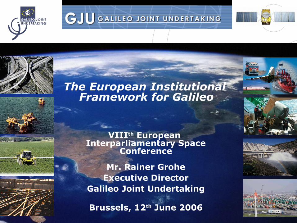
The European Institutional Framework for Galileo
VIIIth European Interparliamentary Space
Conference
Mr. Rainer GroheExecutive Director
Galileo Joint Undertaking
Brussels, 12th June 2006
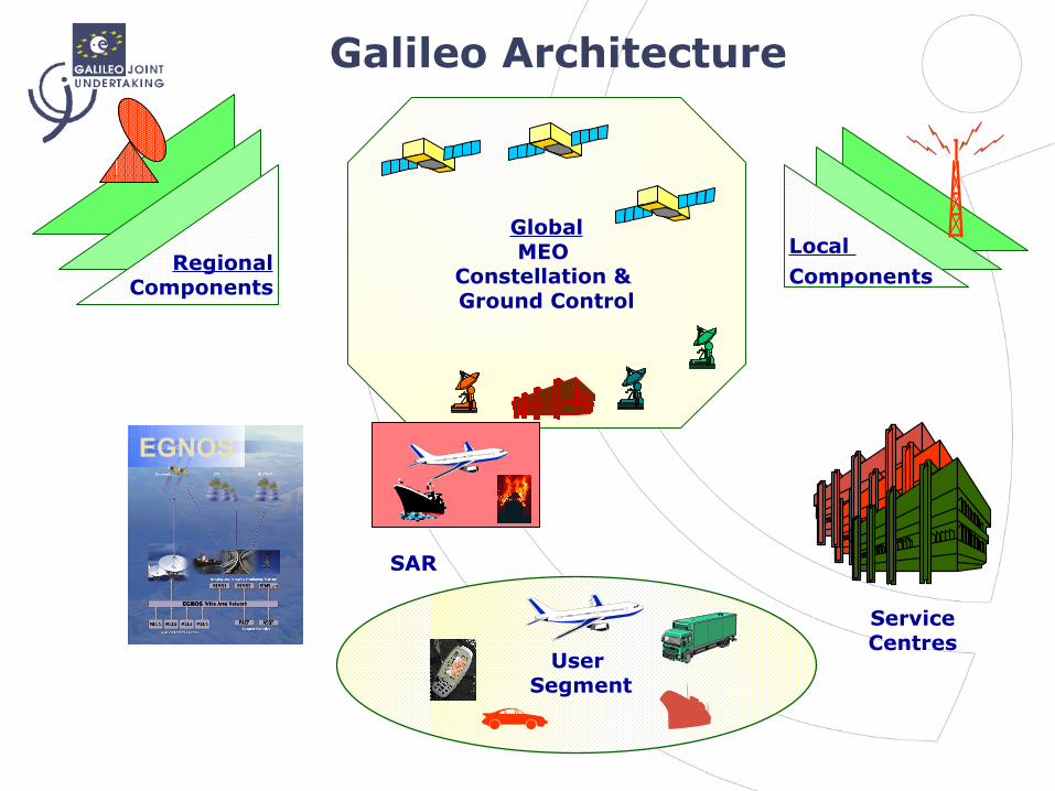
GlobalMEO
Constellation & Ground Control
EGNOS
SAR
User Segment
ServiceCentres
Local Components Regional
Components
Galileo Architecture

Galileo Constellation
• 30 satellites in three Medium Earth Orbit MEO planes at 23,200 km altitude
• 1 satellite per orbital plane is a spare
• Inclination of orbital planes 56 degrees
• One revolution 14 hours 4 min
• Ground track repeat 10 days
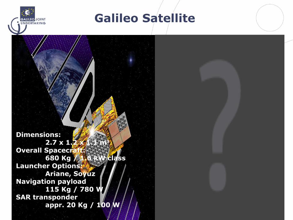
Galileo Satellite
Dimensions:2.7 x 1.2 x 1.1 m3
Overall Spacecraft: 680 Kg / 1.6 kW class
Launcher Options: Ariane, Soyuz
Navigation payload115 Kg / 780 W
SAR transponderappr. 20 Kg / 100 W
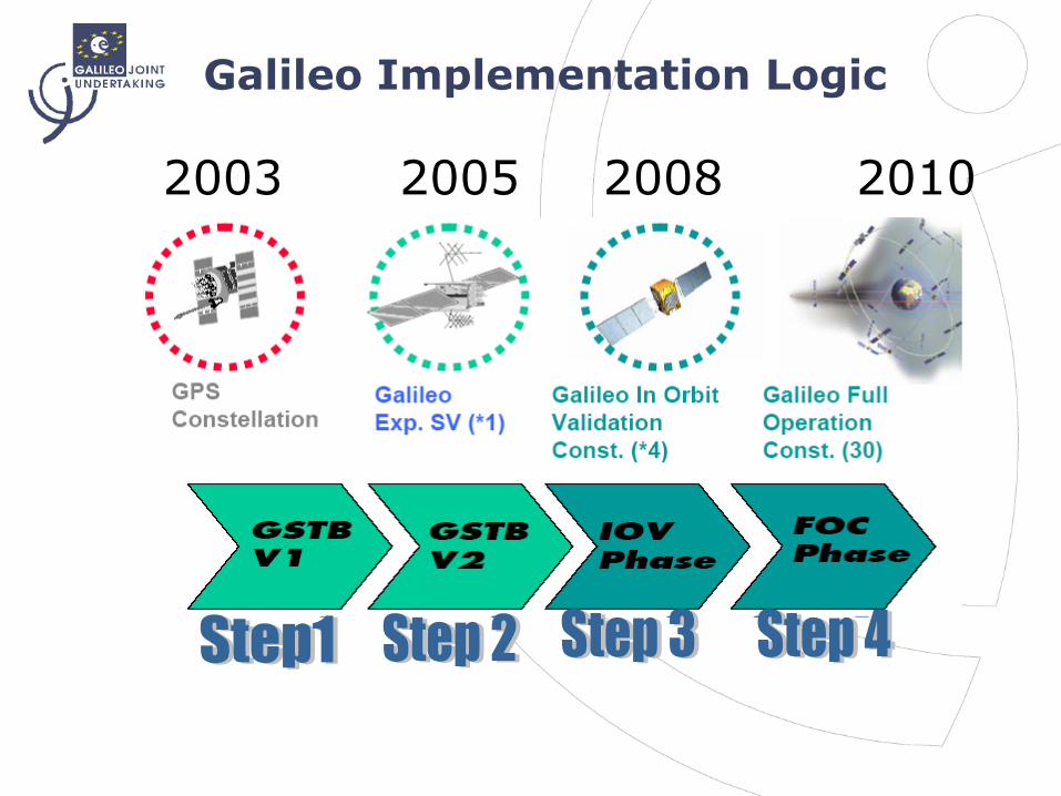
Galileo Implementation Logic
2003 2005 2008 2010
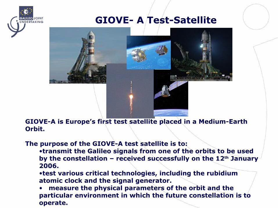
GIOVE- A Test-Satellite
GIOVE-A is Europe’s first test satellite placed in a Medium-Earth Orbit.
The purpose of the GIOVE-A test satellite is to:•transmit the Galileo signals from one of the orbits to be used by the constellation – received successfully on the 12th January 2006. •test various critical technologies, including the rubidium atomic clock and the signal generator.• measure the physical parameters of the orbit and the particular environment in which the future constellation is to operate.

Technology Developments
Test Satellit
es
Antennas
Atomic Clocks
GALILEO Satellite
Amplifiers

Fascination Galileo
Founding Members Motivation to jointly:
• Develop this High-Tech Project
• Realize GALILEO as a PPP Project
• Found a private company (GJU) for the development phase
• Find a private concessionaire
• Cooperate on a worldwide level
10 New Members (since 1st May 2004)
Czech Rep.EstoniaCyprusLatviaLithuaniaHungaryMaltaPolandSloveniaSlovakia
GermanyFranceItalyGBSpainAustriaHollandBelgiumDenmarkSwedenFinlandIrelandPortugal GreeceLuxemburg
SwitzerlandNorway(Canada)

GALILEO Joint UndertakingGALILEO Joint Undertaking
- Executive Director -
Administrative Board
EC , ESA, NRSCC, MATIMOPSupervisory Board
EU Member States
PB NAVESA Member States
Executive Committee
EC, ESA, Presidency
GJU – ESA Agreement for the Development Phase
Concession Process
6th Framework Programme
EGNOS Integration
GJU Interfaces
GNSS Supervisory Authority (GSA)
The above GNSS Supervisory Authority was established under the Council Regulation (EC) No. 1321/2004 on the 12th July 2004
It will:
• Act as the owner of the European Satellite Navigation Program (Galileo)
• Be the legal counterpart of the Concessionaire
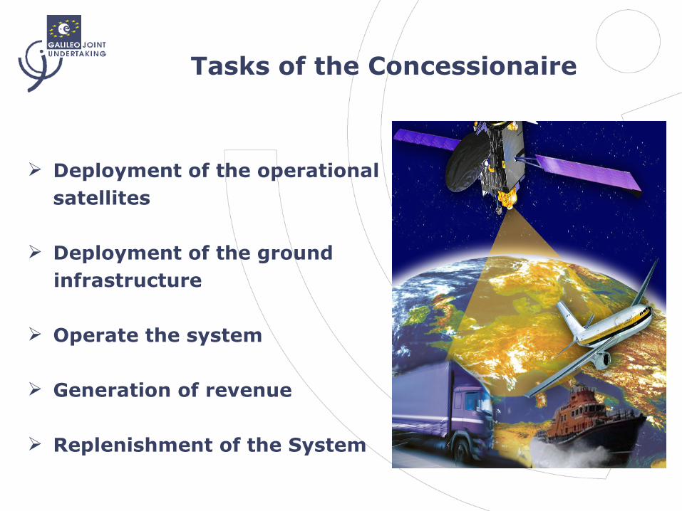
Tasks of the Concessionaire
Deployment of the operational satellites
Deployment of the ground infrastructure
Operate the system
Generation of revenue
Replenishment of the System
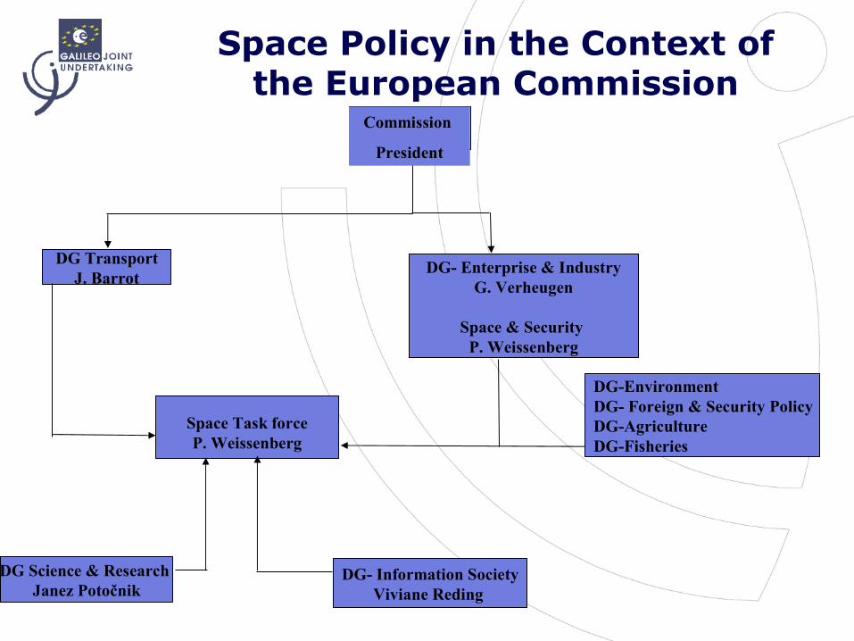
DG- Enterprise & IndustryG. Verheugen
Space & Security P. Weissenberg
DG TransportJ. Barrot
Space Task forceP. Weissenberg
DG Science & Research Janez Potočnik
DG- Information SocietyViviane Reding
DG-EnvironmentDG- Foreign & Security PolicyDG-AgricultureDG-Fisheries
Commission
President
Space Policy in the Context of the European Commission
Galileo’s Economic Impact
•Cost-profit factor 4.6
•Positive Multiplier Effect
•Innovation through new
applications
•Creation of 140,000 new jobs
in Europe and much more on a
global scale
•Research & development for
present & future generations
•Contribution to the Lisbon
Strategy

Galileo - Five Services
Open Access
Commercial
Safety of Life
Search and Rescue
Free to air; Mass market; Simple positioning
Encrypted; High accuracy; Guaranteed service
Open Service + Integrity and Authentication of signal
Encrypted; Integrity; Continuous availability
Near real-time; Precise; Return link feasible
Public Regulated
Navigation
SAR
EU Transport Council Decision- December 2004
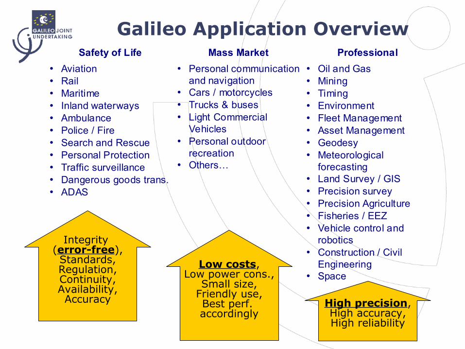
Galileo Application OverviewSafety of Life Mass Market Professional
• Aviation • Rail • Maritime • Inland waterways • Ambulance • Police / Fire • Search and Rescue • Personal Protection • Traffic surveillance • Dangerous goods trans. • ADAS
• Personal communication and navigation
• Cars / motorcycles • Trucks & buses • Light Commercial
Vehicles • Personal outdoor
recreation • Others…
• Oil and Gas • Mining • Timing • Environment • Fleet Management • Asset Management • Geodesy • Meteorological
forecasting • Land Survey / GIS • Precision survey • Precision Agriculture • Fisheries / EEZ • Vehicle control and
robotics • Construction / Civil
Engineering • Space
Integrity (error-free),Standards,Regulation,Continuity,Availability,Accuracy
Low costs,Low power cons.,
Small size,Friendly use,Best perf. accordingly
High precision,High accuracy,High reliability
European Transport Policyfor 2010
RoadRail TransportAir TransportSea & Inland WaterwaysIntermodalityTEN’s
In the implementation of the European Transport Policy, Galileo is a key instrument in
achieving the main objectives of the White Paper
‘European Transport Policy for 2010’
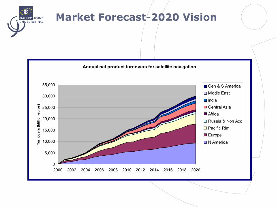
Market Forecast-2020 Vision
Annual net product turnovers for satellite navigation
0
5,000
10,000
15,000
20,000
25,000
30,000
35,000
2000 2002 2004 2006 2008 2010 2012 2014 2016 2018 2020
Turn
over
s (M
illio
n eu
ros)
Cen & S AmericaMiddle East
IndiaCentral AsiaAfrica
Russia & Non AccPacific RimEurope
N America

Galileo’s Contribution to the Lisbon Strategy
In March 2000, European leaders at the Lisbon Council set the target of making the European Union
‘….The most dynamic and competitive knowledge-based economic area in the world, capable of sustainable economic growth, with more and better jobs and greater social cohesion and respect for the environment by 2010’
The Galileo Program achieves this - via:
Investment in Research & Development Being Environmentally respectful Its International & wide-ranging
scale The Public Private Partnership
approach
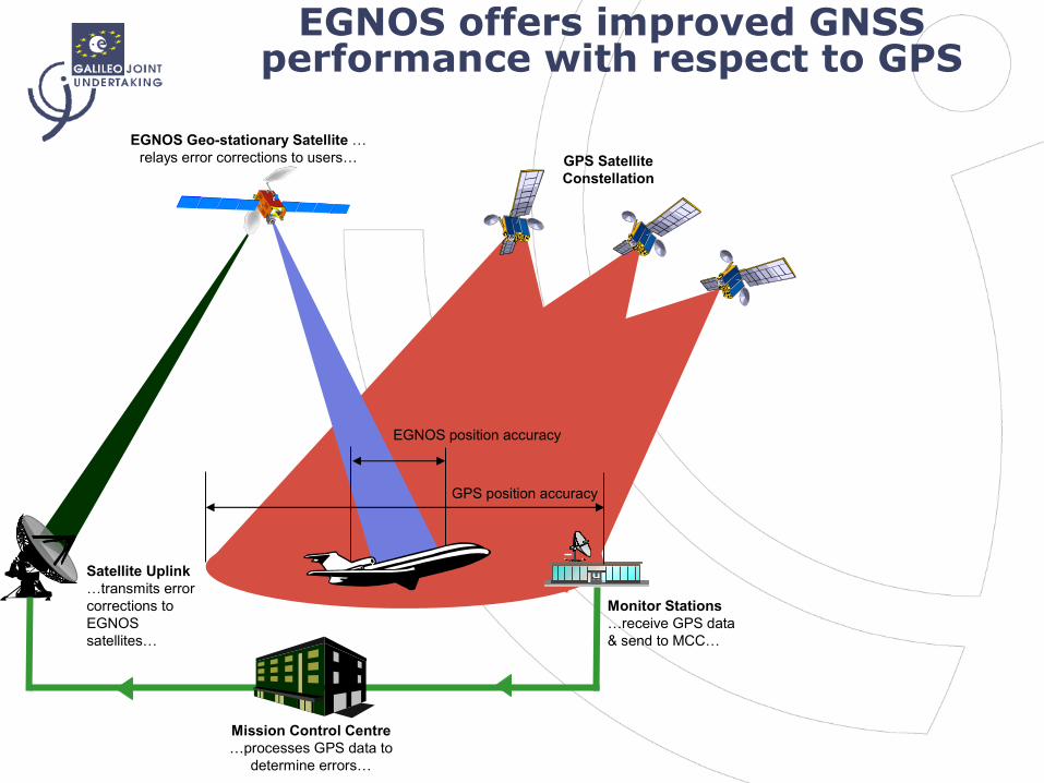
EGNOS offers improved GNSS performance with respect to GPS
Satellite Uplink …transmits error corrections to EGNOS satellites…
EGNOS Geo-stationary Satellite …relays error corrections to users… GPS Satellite
Constellation
Mission Control Centre…processes GPS data to
determine errors…
GPS position accuracy
EGNOS position accuracy
Monitor Stations …receive GPS data & send to MCC…
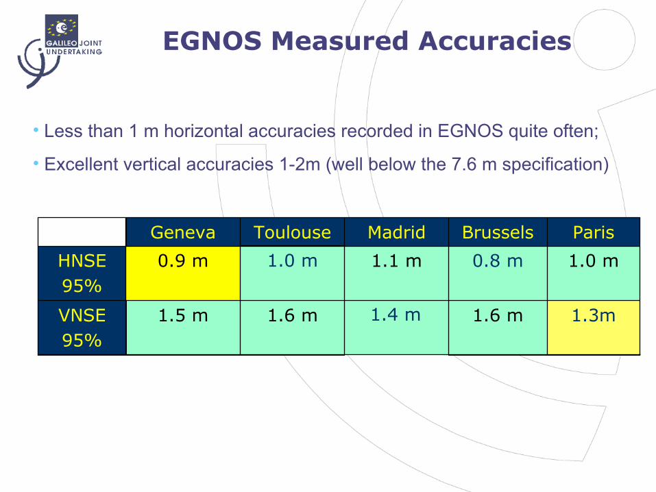
EGNOS Measured Accuracies
1.6 m
0.8 m
Brussels
1.3m1.4 m1.6 m1.5 mVNSE95%
1.0 m1.1 m1.0 m0.9 mHNSE95%
ParisMadridToulouseGeneva
• Less than 1 m horizontal accuracies recorded in EGNOS quite often;
• Excellent vertical accuracies 1-2m (well below the 7.6 m specification)
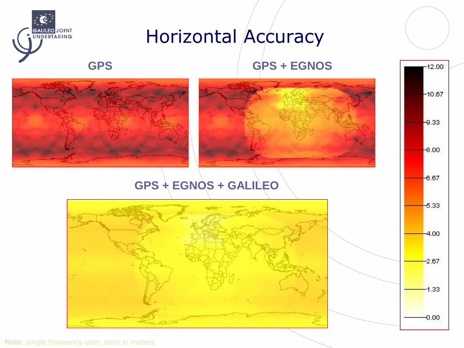
GPS GPS + EGNOS
GPS + EGNOS + GALILEO
Note: single frequency user, error in meters.
Horizontal Accuracy
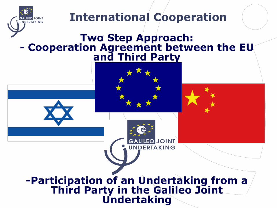
International Cooperation
Two Step Approach:- Cooperation Agreement between the EU
and Third Party
-Participation of an Undertaking from a
Third Party in the Galileo Joint Undertaking
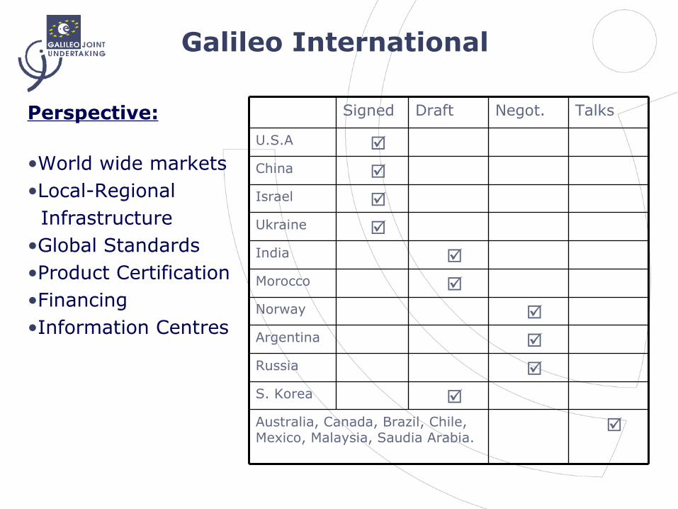
Galileo International
Perspective:
•World wide markets•Local-Regional Infrastructure•Global Standards•Product Certification•Financing•Information Centres
☑S. Korea
☑Argentina
☑Norway
☑Russia
☑Australia, Canada, Brazil, Chile, Mexico, Malaysia, Saudia Arabia.
☑Morocco
☑India
☑Ukraine
☑Israel
☑China
☑U.S.A
TalksNegot.DraftSigned
Cooperation with China
• Co-operation Agreement EU/CN - 30th October 2003
• The National Remote Sensing Centre of China (NRSCC) became a member of the Galileo Joint Undertaking (GJU) on the 9th October 2004.
• The Chinese side committed EUR 200 million to the Galileo Programme:..EUR 70 million in the development phase .. EUR 130 for the deployment phase
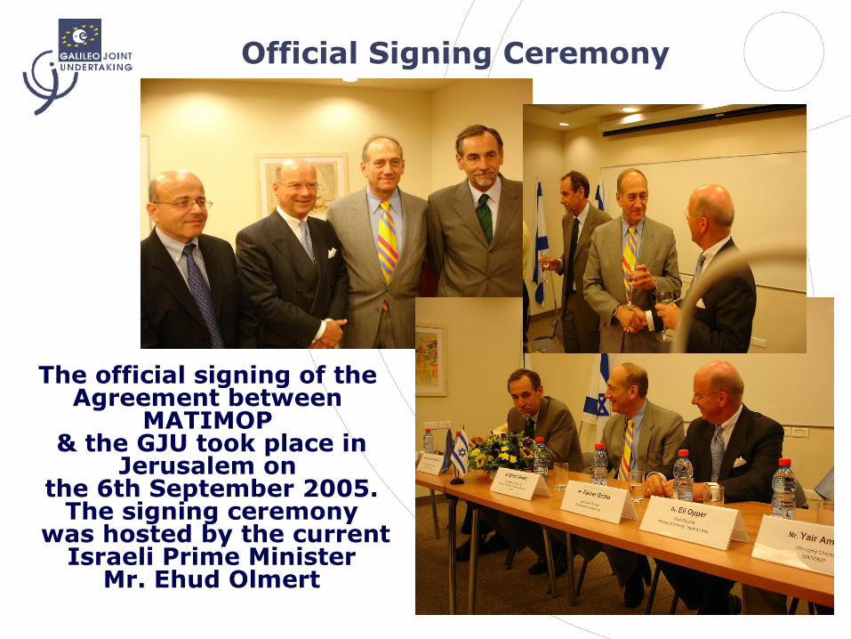
Official Signing Ceremony
The official signing of the Agreement between
MATIMOP & the GJU took place in
Jerusalem on the 6th September 2005.
The signing ceremony was hosted by the current
Israeli Prime MinisterMr. Ehud Olmert
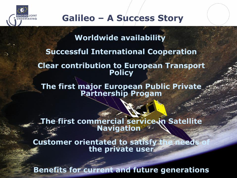
Galileo – A Success Story
Worldwide availability
Successful International Cooperation
Clear contribution to European Transport Policy
The first major European Public Private Partnership Progam
The first commercial service in SatelliteNavigation
Customer orientated to satisfy the needs of the private user
Benefits for current and future generations
Many thanks for your attention
Brussels, 12th June 2006
Mr. Rainer Grohe Galileo Joint Undertaking
www.galileoju.com
Top Related