


Languages
Pages
Legal


Scenario for Maritime Intelligence
Global Vessel Tracking & Vessel Investigation
Maritime Security Expo 2007
New York City, NY

Proprietary
Scenario Details
• Location:– South / Pacific Ocean approach to Panama
Canal Zone.– Transition to North / Atlantic Panama Canal.
• Objectives:– Confirm all known targets from AIS reporting– Acquire targets (High Interest Vessel) whose
AIS reporting does not match the vessel.
Proprietary
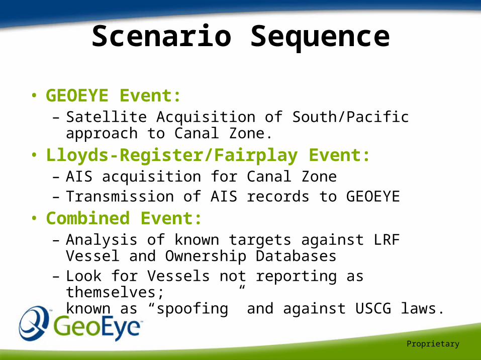
Scenario Sequence
• GEOEYE Event:– Satellite Acquisition of South/Pacific approach
to Canal Zone.
• Lloyds-Register/Fairplay Event:– AIS acquisition for Canal Zone– Transmission of AIS records to GEOEYE
• Combined Event:– Analysis of known targets against LRF Vessel
and Ownership Databases– Look for Vessels not reporting as themselves;
known as “spoofing” and against USCG laws.
Proprietary
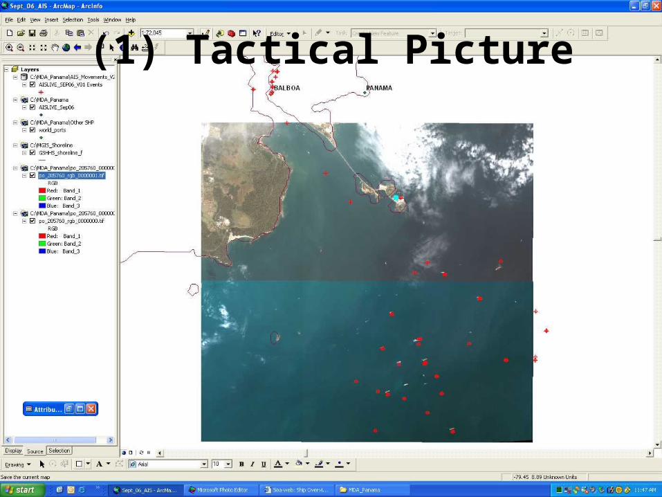
(1) Tactical Picture
Proprietary
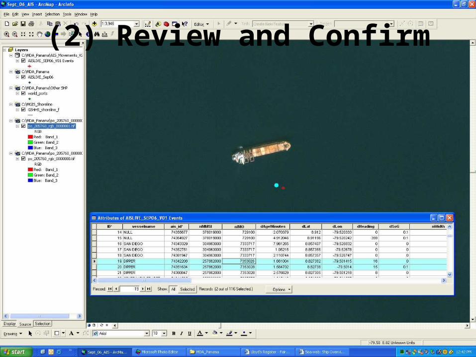
(2) Review and Confirm
Proprietary
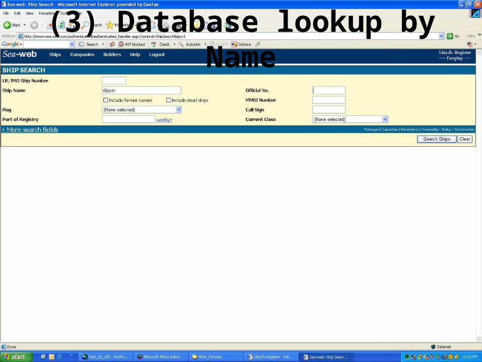
(3) Database lookup by Name
Proprietary
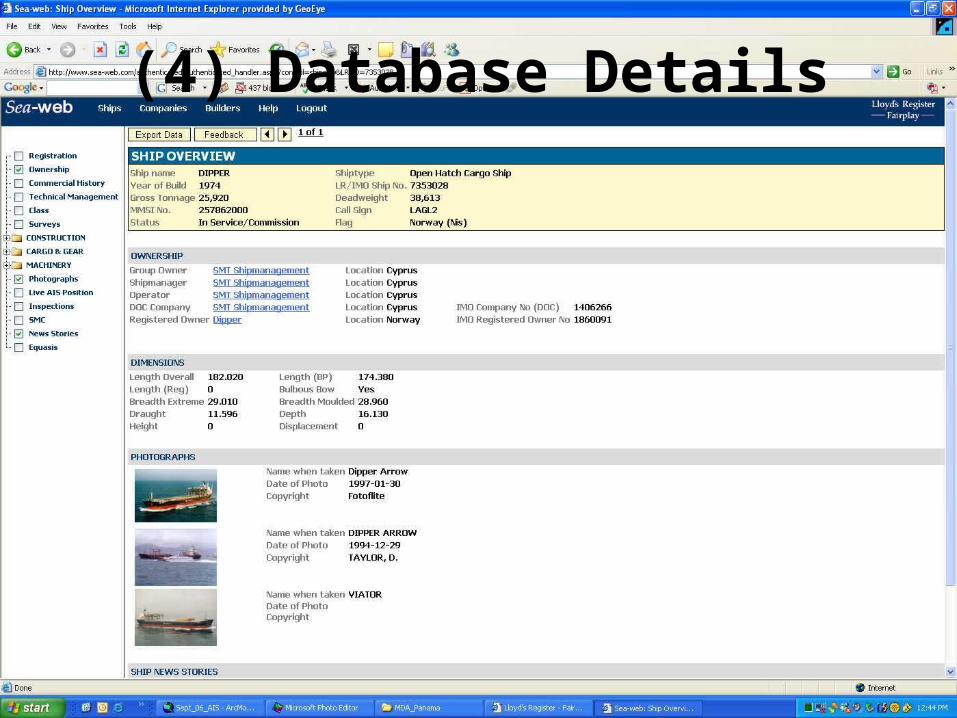
(4) Database Details
Proprietary
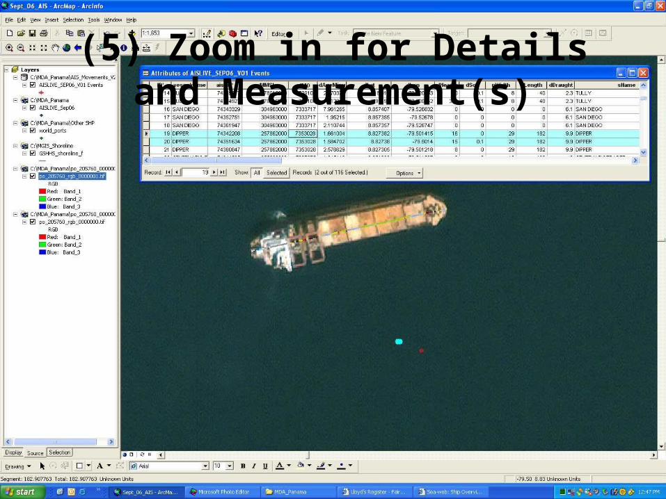
(5) Zoom in for Details and Measurement(s)
Proprietary
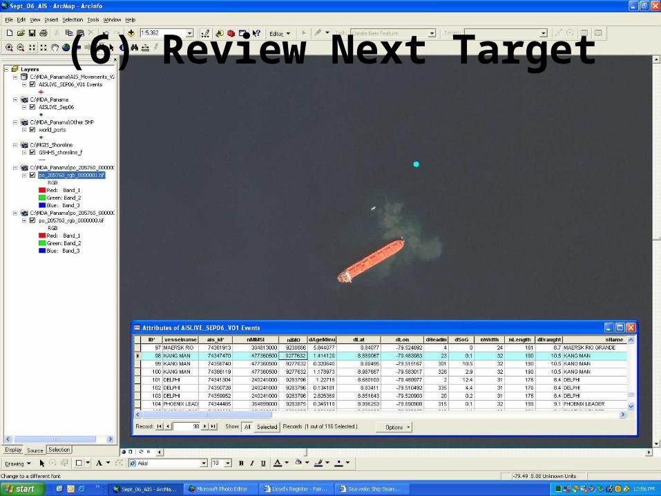
(6) Review Next Target
Proprietary
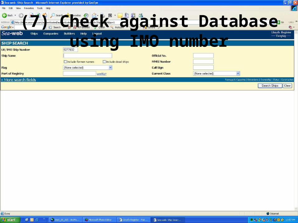
(7) Check against Database using IMO number

Proprietary
(8) Database Record unsure?
Proprietary
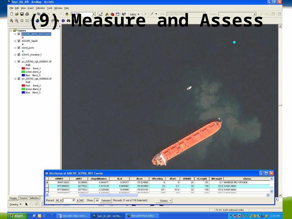
(9) Measure and Assess
Proprietary
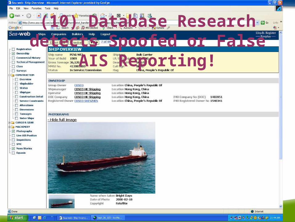
(10) Database Research detects Spoofed or False
AIS Reporting!

Proprietary
Conclusions?
• We can locate vessels using 82-cm color commercial satellites (41-cm in 2008).
• We can identify ships from their AIS reporting and locate complete details in Lloyds-Register/Fairplay databases.
• We can identify Vessels whose reporting does not match their registration.
• We can identify Vessels that are not producing AIS reporting at all
Top Related