Zondervan Atlas of the Bible - Monergism Books :: … · zondervan atlas of the Bible / Carl G....
13
ZONDERVAN Zondervan Atlas of the Bible Copyright © 2010 by Carl G. Rasmussen This title is also available as a Zondervan ebook. Visit www.zondervan.com/ebooks. Requests for information should be addressed to: Zondervan, Grand Rapids, Michigan 49530 Library of Congress Cataloging-in-Publication Data Rasmussen, Carl. Zondervan atlas of the Bible / Carl G. Rasmussen. — Rev. ed p. cm. Rev. ed. of: Zondervan NIV atlas of the Bible. Includes bibliographical references (p. 263 — 64) and index. ISBN 978-0-310-27050-8 (hardcover, printed) 1. Bible — Geography. 2. Bible — Geography — Maps. 3. Bible — History of Biblical events. 4 Bible — History of contemporary events. I. Rasmussen, Carl. Zondervan NIV atlas of the Bible. II. Title. III. Title: Atlas of the Bible. BS630.R37 2009 220.9’1 — dc22 2009015937 All Scripture quotations, unless otherwise indicated, are taken from the Holy Bible, New International Ver- sion®, NIV®. Copyright © 1973, 1978, 1984 by Biblica, Inc.™ Used by permission of Zondervan. All rights reserved worldwide. Maps by International Mapping. Copyright © 2010 by Zondervan. All rights reserved . All pictures in this book were taken by the author, Carl G. Rasmussen, unless otherwise indicated. Many of the photos in this atlas, plus over 3,000 more, are available at the author’s website www.HolyLandPhotos.org. Any Internet addresses (websites, blogs, etc.) and telephone numbers printed in this book are offered as a resource. They are not intended in any way to be or imply an endorsement by Zondervan, nor does Zondervan vouch for the content of these sites and numbers for the life of this book. All rights reserved. No part of this publication may be reproduced, stored in a retrieval system, or transmit- ted in any form or by any means — electronic, mechanical, photocopy, recording, or any other — except for brief quotations in printed reviews, without the prior permission of the publisher. Cover design: Rob Monacelli Interior design: Kirk DouPonce Printed in China 10 11 12 13 14 15 16 17 18 19 20 21 • 24 23 22 21 20 19 18 17 16 15 14 13 12 11 10 9 8 7 6 5 4 3 2 1
-
Upload
duongkhanh -
Category
Documents
-
view
238 -
download
0
Transcript of Zondervan Atlas of the Bible - Monergism Books :: … · zondervan atlas of the Bible / Carl G....
zondervan
Zondervan Atlas of the Bible Copyright © 2010 by Carl G. rasmussen
This title is also available as a zondervan ebook. visit www.zondervan.com/ebooks.
requests for information should be addressed to:
zondervan, Grand Rapids, Michigan 49530
Library of Congress Cataloging-in-Publication data
rasmussen, Carl. zondervan atlas of the Bible / Carl G. rasmussen. — rev. ed p. cm. rev. ed. of: zondervan nIv atlas of the Bible. Includes bibliographical references (p. 263 — 64) and index. ISBn 978-0-310-27050-8 (hardcover, printed) 1. Bible — Geography. 2. Bible — Geography — Maps. 3. Bible — History of Biblical events. 4 Bible — History of contemporary events. I. rasmussen, Carl. zondervan nIv atlas of the Bible. II. Title. III. Title: atlas of the Bible. BS630.r37 2009 220.9’1 — dc22 2009015937
all Scripture quotations, unless otherwise indicated, are taken from the Holy Bible, new International ver-sion®, nIv®. Copyright © 1973, 1978, 1984 by Biblica, Inc.™ Used by permission of zondervan. all rights reserved worldwide.
Maps by International Mapping. Copyright © 2010 by zondervan. all rights reserved .
all pictures in this book were taken by the author, Carl G. rasmussen, unless otherwise indicated. Many of the photos in this atlas, plus over 3,000 more, are available at the author’s website www.HolyLandPhotos.org.
any Internet addresses (websites, blogs, etc.) and telephone numbers printed in this book are offered as a resource. They are not intended in any way to be or imply an endorsement by zondervan, nor does zondervan vouch for the content of these sites and numbers for the life of this book.
all rights reserved. no part of this publication may be reproduced, stored in a retrieval system, or transmit-ted in any form or by any means — electronic, mechanical, photocopy, recording, or any other — except for brief quotations in printed reviews, without the prior permission of the publisher.
Cover design: Rob MonacelliInterior design: Kirk DouPonce
Printed in China
10 11 12 13 14 15 16 17 18 19 20 21 • 24 23 22 21 20 19 18 17 16 15 14 13 12 11 10 9 8 7 6 5 4 3 2 1
0310270502_zondervan_atlas CS4.indd 4 1/18/10 6:01 PM

Preface . . . . . . . . . . . . . . . . . . . . . . . . . . . . . . . . . . . . . . . . . . . . . . . . . . . . . . . 11
Abbreviations . . . . . . . . . . . . . . . . . . . . . . . . . . . . . . . . . . . . . . . . . . . . . . . . . . 12
Introduction . . . . . . . . . . . . . . . . . . . . . . . . . . . . . . . . . . . . . . . . . . . . . . . . . . . 13
Geographical Section
Introduction to the middle East as a Whole . . . . . . . . . . . . . . . . . . . . . . . . . . . . . 16
The Geography of Israel and Jordan . . . . . . . . . . . . . . . . . . . . . . . . . . . . . . . . . . 21
The Five Major Longitudinal Zones . . . . . . . . . . . . . . . . . . . . . . . . . . . . . . . . 21
Introduction to the Five Zones . . . . . . . . . . . . . . . . . . . . . . . . . . . . . . . . . . . . . . . . . . . 21
Coastal Plain . . . . . . . . . . . . . . . . . . . . . . . . . . . . . . . . . . . . . . . . . . . . . . . . . . . 21
Central Mountain Range . . . . . . . . . . . . . . . . . . . . . . . . . . . . . . . . . . . . . . . . . . . . . . 23
The Rift Valley . . . . . . . . . . . . . . . . . . . . . . . . . . . . . . . . . . . . . . . . . . . . . . . . . . 24
Transjordanian Mountains . . . . . . . . . . . . . . . . . . . . . . . . . . . . . . . . . . . . . . . . . . . . 27
The Eastern Desert . . . . . . . . . . . . . . . . . . . . . . . . . . . . . . . . . . . . . . . . . . . . . . . . 28
Weather Patterns . . . . . . . . . . . . . . . . . . . . . . . . . . . . . . . . . . . . . . . . 28
The Dry Season — Summer . . . . . . . . . . . . . . . . . . . . . . . . . . . . . . . . . . . . . . . . . . . . 29
The Rainy Season — Winter . . . . . . . . . . . . . . . . . . . . . . . . . . . . . . . . . . . . . . . . . . . . 29
The Transitional Seasons . . . . . . . . . . . . . . . . . . . . . . . . . . . . . . . . . . . . . . . . . . . . . 30
Major Natural Routes — Roads . . . . . . . . . . . . . . . . . . . . . . . . . . . . . . . . . . 31
Roads and Modes of Travel . . . . . . . . . . . . . . . . . . . . . . . . . . . . . . . . . . . . . . . . . . . . . 31
The International North – South Route . . . . . . . . . . . . . . . . . . . . . . . . . . . . . . . . . . . . . . . 32
The International Transjordanian Route . . . . . . . . . . . . . . . . . . . . . . . . . . . . . . . . . . . . . . 33
Interregional and Local Routes . . . . . . . . . . . . . . . . . . . . . . . . . . . . . . . . . . . . . . . . . . . 33
Geographical Regions of Israel and Jordan . . . . . . . . . . . . . . . . . . . . . . . . . . . . . 33
Bashan . . . . . . . . . . . . . . . . . . . . . . . . . . . . . . . . . . . . . . . . . . . . . . . . . . . . . . 33
Huleh Valley . . . . . . . . . . . . . . . . . . . . . . . . . . . . . . . . . . . . . . . . . . . . . . . . . . . 35
Upper Galilee . . . . . . . . . . . . . . . . . . . . . . . . . . . . . . . . . . . . . . . . . . . . . . . . . . . 37
Plain of Acco . . . . . . . . . . . . . . . . . . . . . . . . . . . . . . . . . . . . . . . . . . . . . . . . . . . 37
C o n t e n t s
0310270502_zondervan_atlas CS4.indd 7 1/18/10 6:01 PM

Lower Galilee . . . . . . . . . . . . . . . . . . . . . . . . . . . . . . . . . . . . . . . . . . . . . . . . . . . 37
Jezreel Valley . . . . . . . . . . . . . . . . . . . . . . . . . . . . . . . . . . . . . . . . . . . . . . . . . . . 39
Mount Carmel . . . . . . . . . . . . . . . . . . . . . . . . . . . . . . . . . . . . . . . . . . . . . . . . . . 40
Sea of Galilee . . . . . . . . . . . . . . . . . . . . . . . . . . . . . . . . . . . . . . . . . . . . . . . . . . . 41
Sharon Plain . . . . . . . . . . . . . . . . . . . . . . . . . . . . . . . . . . . . . . . . . . . . . . . . . . . 43
Hill Country of Manasseh . . . . . . . . . . . . . . . . . . . . . . . . . . . . . . . . . . . . . . . . . . . . . 45
Hill Country of Ephraim . . . . . . . . . . . . . . . . . . . . . . . . . . . . . . . . . . . . . . . . . . . . . . 46
Hill Country of Benjamin . . . . . . . . . . . . . . . . . . . . . . . . . . . . . . . . . . . . . . . . . . . . . 46
Hill Country of Judah . . . . . . . . . . . . . . . . . . . . . . . . . . . . . . . . . . . . . . . . . . . . . . . 47
Judean Wilderness . . . . . . . . . . . . . . . . . . . . . . . . . . . . . . . . . . . . . . . . . . . . . . . . 48
Dead Sea/Salt Sea . . . . . . . . . . . . . . . . . . . . . . . . . . . . . . . . . . . . . . . . . . . . . . . . . 49
Philistine Plain . . . . . . . . . . . . . . . . . . . . . . . . . . . . . . . . . . . . . . . . . . . . . . . . . . 51
Shephelah . . . . . . . . . . . . . . . . . . . . . . . . . . . . . . . . . . . . . . . . . . . . . . . . . . . . 52
Negev . . . . . . . . . . . . . . . . . . . . . . . . . . . . . . . . . . . . . . . . . . . . . . . . . . . . . . 54
The “Arabah” South of the Dead Sea . . . . . . . . . . . . . . . . . . . . . . . . . . . . . . . . . . . . . . . . 56
Gilead . . . . . . . . . . . . . . . . . . . . . . . . . . . . . . . . . . . . . . . . . . . . . . . . . . . . . . 57
Jordan Valley . . . . . . . . . . . . . . . . . . . . . . . . . . . . . . . . . . . . . . . . . . . . . . . . . . . 59
Moab . . . . . . . . . . . . . . . . . . . . . . . . . . . . . . . . . . . . . . . . . . . . . . . . . . . . . . 61
Edom . . . . . . . . . . . . . . . . . . . . . . . . . . . . . . . . . . . . . . . . . . . . . . . . . . . . . . 63
The Geography of Egypt . . . . . . . . . . . . . . . . . . . . . . . . . . . . . . . . . . . . . . . . . . . 65
The Geography of Syria and Lebanon . . . . . . . . . . . . . . . . . . . . . . . . . . . . . . . . . 72
The Geography of mesopotamia . . . . . . . . . . . . . . . . . . . . . . . . . . . . . . . . . . . . . 76
Historical Section
The Pre-Patriarchal Period . . . . . . . . . . . . . . . . . . . . . . . . . . . . . . . . . . . . . . . . . 82
Garden of Eden . . . . . . . . . . . . . . . . . . . . . . . . . . . . . . . . . . . . . . . . . 82
Table of Nations . . . . . . . . . . . . . . . . . . . . . . . . . . . . . . . . . . . . . . . . 83
Mesopotamia — Early Bronze Age . . . . . . . . . . . . . . . . . . . . . . . . . . . . . . . . 85
Egypt during the Early Bronze Age . . . . . . . . . . . . . . . . . . . . . . . . . . . . . . . . 85
The Southern Levant during the Early Bronze Age . . . . . . . . . . . . . . . . . . . . . . . . . 87
The Patriarchs and the Egyptian Sojourn . . . . . . . . . . . . . . . . . . . . . . . . . . . . . . . 89
Exodus and Conquest . . . . . . . . . . . . . . . . . . . . . . . . . . . . . . . . . . . . . . . . . . . . 100
The Exodus from Egypt . . . . . . . . . . . . . . . . . . . . . . . . . . . . . . . . . . . . . 100
The Conquest of Canaan . . . . . . . . . . . . . . . . . . . . . . . . . . . . . . . . . . . . . 108
Settlement in the Land of Canaan . . . . . . . . . . . . . . . . . . . . . . . . . . . . . . . . . . . . 113
Allotment of the Land . . . . . . . . . . . . . . . . . . . . . . . . . . . . . . . . . . . . . . 113
0310270502_zondervan_atlas CS4.indd 8 1/18/10 6:01 PM
Judah . . . . . . . . . . . . . . . . . . . . . . . . . . . . . . . . . . . . . . . . . . . . . . . . . . . . . . 113
Simeon . . . . . . . . . . . . . . . . . . . . . . . . . . . . . . . . . . . . . . . . . . . . . . . . . . . . . . 114
Ephraim . . . . . . . . . . . . . . . . . . . . . . . . . . . . . . . . . . . . . . . . . . . . . . . . . . . . . 114
Manasseh . . . . . . . . . . . . . . . . . . . . . . . . . . . . . . . . . . . . . . . . . . . . . . . . . . . . 115
Benjamin . . . . . . . . . . . . . . . . . . . . . . . . . . . . . . . . . . . . . . . . . . . . . . . . . . . . . 115
Zebulun . . . . . . . . . . . . . . . . . . . . . . . . . . . . . . . . . . . . . . . . . . . . . . . . . . . . . 116
Issachar . . . . . . . . . . . . . . . . . . . . . . . . . . . . . . . . . . . . . . . . . . . . . . . . . . . . . 116
Asher . . . . . . . . . . . . . . . . . . . . . . . . . . . . . . . . . . . . . . . . . . . . . . . . . . . . . . 116
Naphtali . . . . . . . . . . . . . . . . . . . . . . . . . . . . . . . . . . . . . . . . . . . . . . . . . . . . . 117
Dan . . . . . . . . . . . . . . . . . . . . . . . . . . . . . . . . . . . . . . . . . . . . . . . . . . . . . . . 117
Reuben, Gad, and Manasseh . . . . . . . . . . . . . . . . . . . . . . . . . . . . . . . . . . . . . . . . . . . . 118
Levitical Cities . . . . . . . . . . . . . . . . . . . . . . . . . . . . . . . . . . . . . . . . . . . . . . . . . . 119
Cities of Refuge . . . . . . . . . . . . . . . . . . . . . . . . . . . . . . . . . . . . . . . . . . . . . . . . . . 121
The Period of the Judges . . . . . . . . . . . . . . . . . . . . . . . . . . . . . . . . . . . . . 121
Transition to the monarchy: Samuel and Saul . . . . . . . . . . . . . . . . . . . . . . . . . . . . 131
The united monarchy: David and Solomon . . . . . . . . . . . . . . . . . . . . . . . . . . . . . . 138
The Divided Kingdom . . . . . . . . . . . . . . . . . . . . . . . . . . . . . . . . . . . . . . . . . . . . . 150
Judah Alone . . . . . . . . . . . . . . . . . . . . . . . . . . . . . . . . . . . . . . . . . . . . . . . . . . . 165
Exile and return . . . . . . . . . . . . . . . . . . . . . . . . . . . . . . . . . . . . . . . . . . . . . . . . 172
The Arrival of the Greeks . . . . . . . . . . . . . . . . . . . . . . . . . . . . . . . . . . . . . . . . . . 180
The maccabean revolt and the Hasmonean Dynasty . . . . . . . . . . . . . . . . . . . . . . . 189
Early roman rule in Palestine . . . . . . . . . . . . . . . . . . . . . . . . . . . . . . . . . . . . . . . 197
The Life of Christ . . . . . . . . . . . . . . . . . . . . . . . . . . . . . . . . . . . . . . . . . . . . . . . 205
The Expansion of the Church in Palestine . . . . . . . . . . . . . . . . . . . . . . . . . . . . . . 216
The Journeys of Paul . . . . . . . . . . . . . . . . . . . . . . . . . . . . . . . . . . . . . . . . . . . . . 224
The Early Life of Saul . . . . . . . . . . . . . . . . . . . . . . . . . . . . . . . . . . . . . . 224
Paul’s First Missionary Journey . . . . . . . . . . . . . . . . . . . . . . . . . . . . . . . . . . 225
Paul’s Second Missionary Journey . . . . . . . . . . . . . . . . . . . . . . . . . . . . . . . . 227
Paul’s Third Missionary Journey . . . . . . . . . . . . . . . . . . . . . . . . . . . . . . . . . 231
Paul’s Journey to Rome . . . . . . . . . . . . . . . . . . . . . . . . . . . . . . . . . . . . . 233
The Seven Churches of revelation . . . . . . . . . . . . . . . . . . . . . . . . . . . . . . . . . . . 235
Ephesus . . . . . . . . . . . . . . . . . . . . . . . . . . . . . . . . . . . . . . . . . . . . 235
Smyrna . . . . . . . . . . . . . . . . . . . . . . . . . . . . . . . . . . . . . . . . . . . . 236
Pergamum . . . . . . . . . . . . . . . . . . . . . . . . . . . . . . . . . . . . . . . . . . 237
0310270502_zondervan_atlas CS4.indd 9 1/18/10 6:01 PM

Thyatira . . . . . . . . . . . . . . . . . . . . . . . . . . . . . . . . . . . . . . . . . . . . 237
Sardis . . . . . . . . . . . . . . . . . . . . . . . . . . . . . . . . . . . . . . . . . . . . . 238
Philadelphia . . . . . . . . . . . . . . . . . . . . . . . . . . . . . . . . . . . . . . . . . . 238
Laodicea . . . . . . . . . . . . . . . . . . . . . . . . . . . . . . . . . . . . . . . . . . . 238
Jerusalem . . . . . . . . . . . . . . . . . . . . . . . . . . . . . . . . . . . . . . . . . . . . . . . . . . . . . 240
The Disciplines of Historical Geography . . . . . . . . . . . . . . . . . . . . . . . . . . . . . . . 254
Philology: Textual Studies . . . . . . . . . . . . . . . . . . . . . . . . . . . . . . . . . . . . 254
The Bible . . . . . . . . . . . . . . . . . . . . . . . . . . . . . . . . . . . . . . . . . . . . . . . . . . . . . 254
Extrabiblical Texts . . . . . . . . . . . . . . . . . . . . . . . . . . . . . . . . . . . . . . . . . . . . . . . . 255
Toponymy: Study of Place Names . . . . . . . . . . . . . . . . . . . . . . . . . . . . . . . . . 257
Archaeology . . . . . . . . . . . . . . . . . . . . . . . . . . . . . . . . . . . . . . . . . . 258
Geography . . . . . . . . . . . . . . . . . . . . . . . . . . . . . . . . . . . . . . . . . . . 261
Conclusion . . . . . . . . . . . . . . . . . . . . . . . . . . . . . . . . . . . . . . . . . . 262
Appendices
Bibliography . . . . . . . . . . . . . . . . . . . . . . . . . . . . . . . . . . . . . . . . . . . . . . . . . . . 263
Glossary . . . . . . . . . . . . . . . . . . . . . . . . . . . . . . . . . . . . . . . . . . . . . . . . . . . . . . 265
Timeline of Biblical History . . . . . . . . . . . . . . . . . . . . . . . . . . . . . . . . . . . . . . . . 266
Index of Scripture references . . . . . . . . . . . . . . . . . . . . . . . . . . . . . . . . . . . . . . 268
Index of Persons . . . . . . . . . . . . . . . . . . . . . . . . . . . . . . . . . . . . . . . . . . . . . . . . 271
Geographical Dictionary and Index . . . . . . . . . . . . . . . . . . . . . . . . . . . . . . . . . . . 273
0310270502_zondervan_atlas CS4.indd 10 1/18/10 6:01 PM

Histor ica l Sec t ion : | 15
GEoGrAPHICAL S E C T I o n
0310270502_zondervan_atlas CS4.indd 15 1/18/10 6:01 PM
16 | G eograph ica l Sec t ion : Int roduct ion to the Middle Ea st a s a Whole
i n t r o d u C t i o n t o t h e M i d d l e e a s t a s a W h o l e
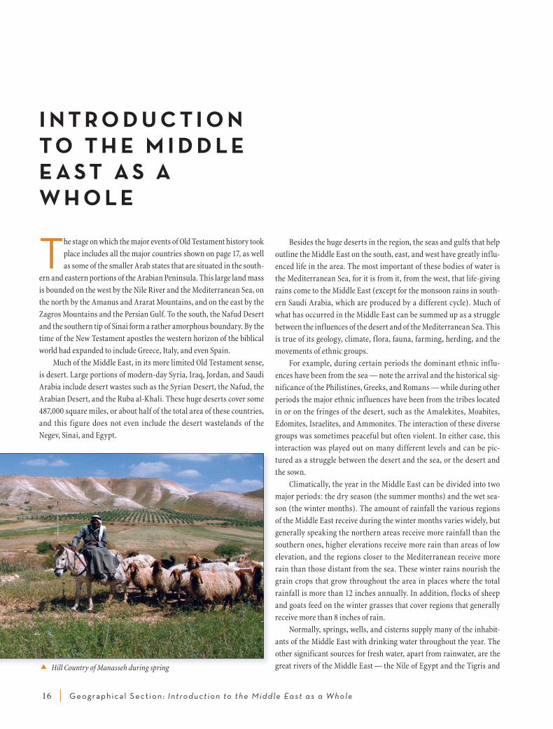
The stage on which the major events of Old Testament history took
place includes all the major countries shown on page 17, as well
as some of the smaller Arab states that are situated in the south-
ern and eastern portions of the Arabian Peninsula . This large land mass
is bounded on the west by the Nile River and the Mediterranean Sea, on
the north by the Amanus and Ararat Mountains, and on the east by the
Zagros Mountains and the Persian Gulf . To the south, the Nafud Desert
and the southern tip of Sinai form a rather amorphous boundary . By the
time of the New Testament apostles the western horizon of the biblical
world had expanded to include Greece, Italy, and even Spain .
Much of the Middle East, in its more limited Old Testament sense,
is desert . Large portions of modern-day Syria, Iraq, Jordan, and Saudi
Arabia include desert wastes such as the Syrian Desert, the Nafud, the
Arabian Desert, and the Ruba al-Khali . These huge deserts cover some
487,000 square miles, or about half of the total area of these countries,
and this figure does not even include the desert wastelands of the
Negev, Sinai, and Egypt .
Besides the huge deserts in the region, the seas and gulfs that help
outline the Middle East on the south, east, and west have greatly influ-
enced life in the area . The most important of these bodies of water is
the Mediterranean Sea, for it is from it, from the west, that life-giving
rains come to the Middle East (except for the monsoon rains in south-
ern Saudi Arabia, which are produced by a different cycle) . Much of
what has occurred in the Middle East can be summed up as a struggle
between the influences of the desert and of the Mediterranean Sea . This
is true of its geology, climate, f lora, fauna, farming, herding, and the
movements of ethnic groups .
For example, during certain periods the dominant ethnic inf lu-
ences have been from the sea — note the arrival and the historical sig-
nificance of the Philistines, Greeks, and Romans — while during other
periods the major ethnic influences have been from the tribes located
in or on the fringes of the desert, such as the Amalekites, Moabites,
Edomites, Israelites, and Ammonites . The interaction of these diverse
groups was sometimes peaceful but often violent . In either case, this
interaction was played out on many different levels and can be pic-
tured as a struggle between the desert and the sea, or the desert and
the sown .
Climatically, the year in the Middle East can be divided into two
major periods: the dry season (the summer months) and the wet sea-
son (the winter months) . The amount of rainfall the various regions
of the Middle East receive during the winter months varies widely, but
generally speaking the northern areas receive more rainfall than the
southern ones, higher elevations receive more rain than areas of low
elevation, and the regions closer to the Mediterranean receive more
rain than those distant from the sea . These winter rains nourish the
grain crops that grow throughout the area in places where the total
rainfall is more than 12 inches annually . In addition, f locks of sheep
and goats feed on the winter grasses that cover regions that generally
receive more than 8 inches of rain .
Normally, springs, wells, and cisterns supply many of the inhabit-
ants of the Middle East with drinking water throughout the year . The
other significant sources for fresh water, apart from rainwater, are the
great rivers of the Middle East — the Nile of Egypt and the Tigris and Hill Country of Manasseh during spring
0310270502_zondervan_atlas CS4.indd 16 1/18/10 6:01 PM

G eograph ica l Sec t ion : Int roduct ion to the Middle Ea st a s a Whole | 17
0 200 miles
0 200 km.
A n N a f u d D e s e r t
Zagros Mts .
AraratMt.
Amanus M
ts .
T a u r u s M t s .
Arabian Peninsula
Sinai
Doha
Baku
Cairo
Amman
Tirana
Tehran
Riyadh
Kuwait
Beirut
Ankara
Nicosia
BaghdadDamascus
Tbilisi
Jerusalem
Manama
Skopje
Athens
Yerevan
Bucharest
Euphrates R .
Tigr i s R
.
Halys R.
Nile R.
Jordan R.
Red Sea
CaspianSea
Black Sea
Pers ianGulf
Aegean Sea
M e d i t e r r a n e a n S e a
West BankGaza Strip
Golan Heights
QATAR
S Y R I ACYPRUS
LEBANON
KUWAITJORDAN
ISRAEL
G R E E C E
BAHRAIN
ALBANIA
GEORGIA
ARMENIA
BULGARIAMACEDONIA
AZERBAIJAN
RUSSIA
ROMANIA
E G Y P T
L I B Y A
I R A Q
I R A N
T U R K E Y
S A U D I A R A B I A
#8 Middle East (Persia)
116% The Middle easT Today
0 200 miles
0 200 km.
Ur
Tema
Nuzi
Akkad?
Susa
Mari
Zoan
Memphis
On Kadesh Barnea
Jerusalem
Ramoth Gilead
Thebes
Tyre
Megiddo
Elath
Dumah
ArvadByblos
Haran
Gozan
Sidon
Asshur
DelphiKanish
Rhodes
MiletusSparta
Athens
Ugarit
AleppoTarsus
Babylon
Nineveh
MycenaePylos
Knossos
Hattusa
Amisus
Attalia
Sinop
Phaistos
Ecbatana
DamascusHazor
Carchemish
Alexandria
TadmorQatna
HamathEbla
Cyrene
Gaza
Euphrates R.
Nile R.
Tigris R.
Red Sea
Pers ianGulf
Black Sea
Caspian Sea
CyprusCrete
A r a b i a n D e s e r t
MYCENAE A N -
M
INOA N
HITTITE - HURRIAN
A MO
RI T
E
AS
S
YR
I A
B A B Y L ON
I
A
EG
YP
T
I A N
E U R O P E
A F R I C A
A S I A
M e d i t e r r a n e a n S e a
Fertile Crescent
Land routes
Sea routes
Cultural spheresAMORITE
#8 Middle East (Persia)
p. 13b The Ancient Near East 116 %
The ancienT near easT
0310270502_zondervan_atlas CS4.indd 17 1/18/10 6:01 PM

18 | G eograph ica l Sec t ion : Int roduct ion to the Middle Ea st a s a Whole
Euphrates of modern-day Turkey, Syria, and Iraq . Some of the earliest
civilizations developed along the banks of these rivers, where the people
could irrigate their crops with river water . Of these great civilizations,
the Bible mentions the mighty powers of Assyria and Babylonia, whose
heartlands were along the Tigris and Euphrates, and, of course, the
perennially powerful Egypt .
One can find the region where the majority of people have lived
in the Near East since earliest historical times (ca . 3000 BC) by high-
lighting on a map the areas watered by the Nile, the Tigris, and the
Euphrates, as well as those regions that receive over 12 inches of rainfall
annually . This area, in which adequate water supplies make the growing
of agricultural products possible, is roughly the shape of a crescent with
one point in the Nile River, the other in the Persian Gulf . Its arc passes
through Iraq, Syria, Lebanon, and Israel, hovering over the desolate
Syrian Desert to the south . In this area, aptly named the “Fertile Cres-
cent,” civilizations have risen and fallen throughout the millennia .
Generally, enough wheat and barley were grown in each of the pop-
ulated areas of the Fertile Crescent to supply the local population, and
some countries (e .g ., Egypt) were able to export grain to neighboring as
well as distant lands during certain periods . Although most of the coun-
tries produced sufficient food supplies, many of them lacked other raw
materials necessary for daily life . For example, the Mesopotamian region
needed timber, building stones, copper, iron, tin, gold, and silver . Egypt,
too, lacked local supplies of timber, copper, and iron . Some of these raw
materials were available from countries within the Fertile Crescent (e .g .,
timber from Lebanon and Syria), but other products, including gold, sil-
ver, copper, tin, and iron, were often imported from outside the region .
Thus, as these raw materials entered the Fertile Crescent and foodstuffs
and finished products such as textiles left it, a network of routes devel-
oped that connected the various countries with one another .
Although there were many ways to travel from one city to another,
travelers tended to follow well-established routes in order to avoid areas
that would impede their progress . These areas included swamps, rivers,
flooded or muddy terrain, regions that were too sandy or too rocky, places
inhabited by hostile tribes or governments, forested regions, and routes
that included long, difficult climbs up and down mountains and hills . In
addition, long-distance travel over great desert expanses was normally
avoided because of the lack of water and the hostility of dangerous tribes .
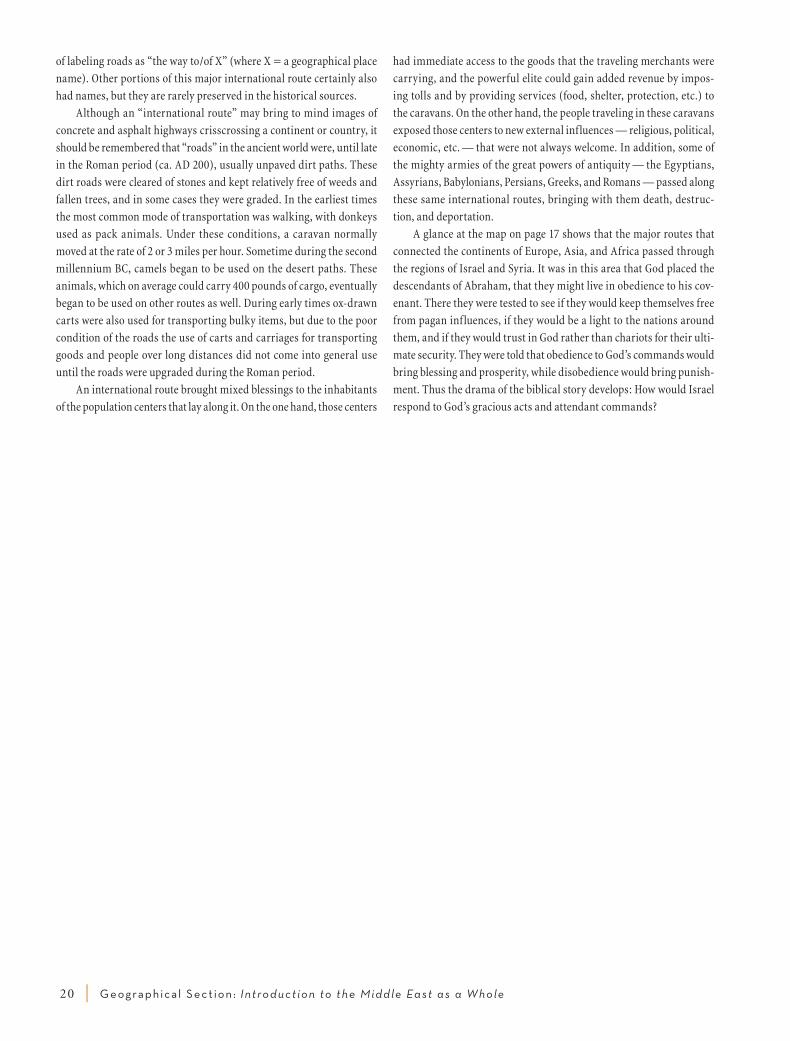
One of the major international routes ran approximately 1,770
miles from Ur in southern Mesopotamia to Thebes in southern Egypt .
Along the way it passed through great urban centers such as Babylon,
Mari, Tadmor, Aleppo, Ebla, Damascus, Hazor, and Gaza . It does not
appear that this route as a whole had a name, but it was made up of
shorter segments that ran from city to city, and in all probability these
shorter stretches had special names . For example, the portion of this
road that ran eastward from Egypt across northern Sinai into southern
Canaan/Philistia was known as the “way of the land of the Philistines”
(Exod 13:17 RSV) . This name is a typical example of the ancient custom
Roman road in Syria Mark Connally
coMparaTive sizes of Middle easT counTries
0310270502_zondervan_atlas CS4.indd 18 1/18/10 6:01 PM

G eograph ica l Sec t ion : Int roduct ion to the Middle Ea st a s a Whole | 19
Nicosia
Cairo
Tehran
Athens
Baghdad
Jerusalem
Amman
Beirut
Damascus
Riyadh
Ankara
OKLAHOMA
TEXAS
ALABAMA
ALASKA
CALIFORNIA
NEW JERSEY
INDIANA
NORTH DAKOTA
TEXAS
Over quarter the size ofCONTINENTAL U.S.A.
Half the size ofMASSACHUSETTS
Half the size ofNEW JERSEY
ARKANSAS
CYPRUS
EGYPT
GREECE
IRAN
IRAQ
ISRAEL
JORDAN
LEBANON
SYRIA
SAUDIARABIA
TURKEY
3,572 sq. mi.
387,048 sq. mi.
636,372 sq. mi.
169,234 sq. mi.
8,522 sq. mi.
45,495 sq. mi.
4,015 sq. mi.
71,479 sq. mi.
830,000 sq. mi.
302,535 sq. mi.
50,944 sq. mi.
COMPARATIVE SIZES OF MIDDLE EAST COUNTRIES (title: place holder only)
0 500 miles
0 500 km.
coMparaTive sizes of Middle easT counTries
0310270502_zondervan_atlas CS4.indd 19 1/18/10 6:01 PM
20 | G eograph ica l Sec t ion : Int roduct ion to the Middle Ea st a s a Whole
of labeling roads as “the way to/of X” (where X = a geographical place
name) . Other portions of this major international route certainly also
had names, but they are rarely preserved in the historical sources .
Although an “international route” may bring to mind images of
concrete and asphalt highways crisscrossing a continent or country, it
should be remembered that “roads” in the ancient world were, until late
in the Roman period (ca . AD 200), usually unpaved dirt paths . These
dirt roads were cleared of stones and kept relatively free of weeds and
fallen trees, and in some cases they were graded . In the earliest times
the most common mode of transportation was walking, with donkeys
used as pack animals . Under these conditions, a caravan normally
moved at the rate of 2 or 3 miles per hour . Sometime during the second
millennium BC, camels began to be used on the desert paths . These
animals, which on average could carry 400 pounds of cargo, eventually
began to be used on other routes as well . During early times ox-drawn
carts were also used for transporting bulky items, but due to the poor
condition of the roads the use of carts and carriages for transporting
goods and people over long distances did not come into general use
until the roads were upgraded during the Roman period .
An international route brought mixed blessings to the inhabitants
of the population centers that lay along it . On the one hand, those centers
had immediate access to the goods that the traveling merchants were
carrying, and the powerful elite could gain added revenue by impos-
ing tolls and by providing ser vices (food, shelter, protection, etc .) to
the caravans . On the other hand, the people traveling in these caravans
exposed those centers to new external influences — religious, political,
economic, etc . — that were not always welcome . In addition, some of
the mighty armies of the great powers of antiquity — the Egyptians,
Assyrians, Babylonians, Persians, Greeks, and Romans — passed along
these same international routes, bringing with them death, destruc-
tion, and deportation .
A glance at the map on page 17 shows that the major routes that
connected the continents of Europe, Asia, and Africa passed through
the regions of Israel and Syria . It was in this area that God placed the
descendants of Abraham, that they might live in obedience to his cov-
enant . There they were tested to see if they would keep themselves free
from pagan influences, if they would be a light to the nations around
them, and if they would trust in God rather than chariots for their ulti-
mate security . They were told that obedience to God’s commands would
bring blessing and prosperity, while disobedience would bring punish-
ment . Thus the drama of the biblical story develops: How would Israel
respond to God’s gracious acts and attendant commands?
0310270502_zondervan_atlas CS4.indd 20 1/18/10 6:01 PM
G eograph ica l Sec t ion : The G eogra phy of I s rael a nd Jorda n | 21
t h e G e o G r a P h y o f i s r a e l a n d J o r da n
The Five major Longitudinal ZonesIntroduction to the Five Zones
The land of Israel is situated at the southeastern corner of the Medi-
terranean at approximately the same latitude as southern Georgia,
Dallas, and San Diego . The proximity of Israel to the Mediterra-
nean Sea and the Arabian Desert has greatly influenced her topography,
climate, flora, fauna, and human history . Throughout the ages, the desert
and the sea have vied with one another for control of the land .
The stability of Israel’s permanent western boundary, the Mediter-
ranean Sea, stands in contrast to the f luctuations of her eastern bor-
der . At times the edge of the eastern desert served as the boundary,
while during other periods Israel’s territory ended at the Jordan River .
This variability is reflected in the fact that, although the Jordan River
formed the traditional eastern boundary of the land of Canaan (e .g .,
Num 34:12; map p . 106), the Israelite tribes settling east of the Jordan
in Gilead considered themselves part of Israel in spite of the fact that
the “land of Gilead” was outside the “land of Canaan” (Josh 22; map
p . 106) .
The classical boundary description of the heartland of Israel was
summed up in the phrase “from Dan to Beersheba” (Judg 20:1; 1 Sam
3:20) . However, to the south, Judah was allotted territory as far as the
Kadesh Barnea/Desert of Zin area, and during periods of strength she
extended her rule even farther south, down to Elath on the Red Sea
(1 Kings 9:26; 2 Kings 14:22; 2 Chron 26:2) . Only on rare occasions was
Israel able to extend her rule as far north as Damascus, even though
that region was included in the traditional descriptions of the “land of
Canaan” (Num 34:7 – 11; Josh 13:4 – 5; map p . 106) . It seems that Israel
was not able to control the Phoenician coast to the northwest, except
possibly during the days of David (2 Sam 24:7) .
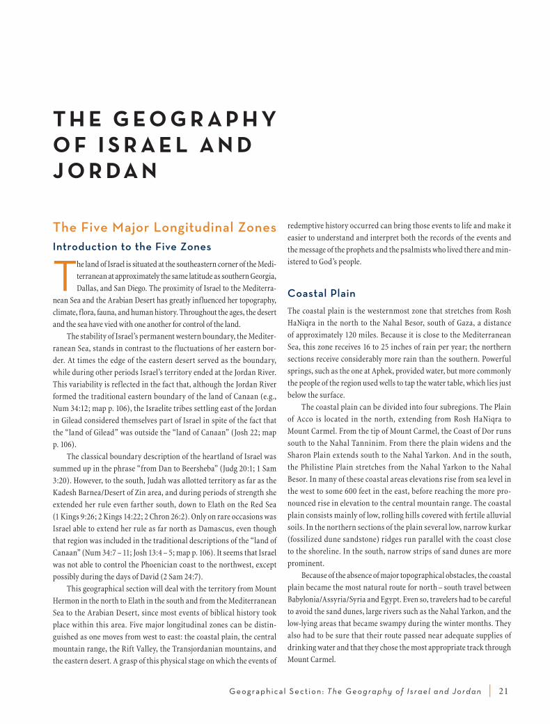
This geographical section will deal with the territory from Mount
Hermon in the north to Elath in the south and from the Mediterranean
Sea to the Arabian Desert, since most events of biblical history took
place within this area . Five major longitudinal zones can be distin-
guished as one moves from west to east: the coastal plain, the central
mountain range, the Rift Valley, the Transjordanian mountains, and
the eastern desert . A grasp of this physical stage on which the events of
redemptive history occurred can bring those events to life and make it
easier to understand and interpret both the records of the events and
the message of the prophets and the psalmists who lived there and min-
istered to God’s people .
Coastal PlainThe coastal plain is the westernmost zone that stretches from Rosh
HaNiqra in the north to the Nahal Besor, south of Gaza, a distance
of approximately 120 miles . Because it is close to the Mediterranean
Sea, this zone receives 16 to 25 inches of rain per year; the northern
sections receive considerably more rain than the southern . Powerful
springs, such as the one at Aphek, provided water, but more commonly
the people of the region used wells to tap the water table, which lies just
below the surface .
The coastal plain can be divided into four subregions . The Plain
of Acco is located in the north, extending from Rosh HaNiqra to
Mount Carmel . From the tip of Mount Carmel, the Coast of Dor runs
south to the Nahal Tanninim . From there the plain widens and the
Sharon Plain extends south to the Nahal Yarkon . And in the south,
the Philistine Plain stretches from the Nahal Yarkon to the Nahal
Besor . In many of these coastal areas elevations rise from sea level in
the west to some 600 feet in the east, before reaching the more pro-
nounced rise in elevation to the central mountain range . The coastal
plain consists mainly of low, rolling hills covered with fertile alluvial
soils . In the northern sections of the plain several low, narrow kurkar
(fossilized dune sandstone) ridges run parallel with the coast close
to the shoreline . In the south, narrow strips of sand dunes are more
prominent .
Because of the absence of major topographical obstacles, the coastal
plain became the most natural route for north – south travel between
Babylonia/Assyria/Syria and Egypt . Even so, travelers had to be careful
to avoid the sand dunes, large rivers such as the Nahal Yarkon, and the
low-lying areas that became swampy during the winter months . They
also had to be sure that their route passed near adequate supplies of
drinking water and that they chose the most appropriate track through
Mount Carmel .
0310270502_zondervan_atlas CS4.indd 21 1/18/10 6:01 PM

22 | G eograph ica l Sec t ion : The G eogra phy of I s rael a nd Jorda n
One of the most noticeable features of the coastline of Israel is
that it is relatively unbroken by any major promontories that could
provide natural harbors, except in the Mount Carmel – Acco region .
Because it lacked natural harbors, Israel never developed into a sea-
faring nation as did Phoenicia, its neighbor to the north . Acco, slightly
sheltered by a small promontory, was Israel’s major port throughout
antiquity, while Joppa, which had little natural protection, was of less
significance . Eventually some coastal cities also served as harbors,
but only Caesarea ever rivaled the Phoenician cities of Tyre, Sidon,
and Byblos .
In portions of the coastal plain, grain crops f lourished in the win-
ter and spring months while f locks grazed there during the remain-
der of the year . But to the international powers of antiquity, such as
Egypt and Babylonia, the road that passed through the coastal plain
was of prime importance for their commercial and military activi-
ties . For the local inhabitants this was a mixed blessing; in times of
peace they gained income by servicing the caravans, but during times
of war the populace suffered as armies swept through the territory,
consuming their recently harvested crops and taking their wives and
children captive .
The five Major longiTudinal zones Topographical Map
Joppa
Caesarea
Tyre
Acco
Sidon
Hebron
En Gedi
Jerusalem
Arad
Zoar
Dan
ShechemAphek
Medeba
Dibon
Heshbon
Beth Shan
Rabbah(of the Ammonites)
Mt.HermonMt.
Carmel
N. Tanninim
Yarkon R.
Arnon Gorge
Zered R.
Jabbok R.
Yarmuk R.
W. Farah
Jordan River
Dead Sea
Sea ofGali lee
M e d i t e r r a n e a n S e a
Coastsof Dor
Plain of Acco
RoshHaNiqra
Phil i s t ine Plain
Jezreel Valley
Huleh Basin
Mts . of E
dom
Sharon Plain
Arava(Arabah)
G i l e a d
Phoenicia
G o l a n( B a s h a n )
J u d a h
M o a b
M i s h o r
L o w e rG a l i l e e
U p p e rG a l i l e e
E p h r a i m
M a n a s s e h
CENTRAL
MOUNTAIN RANGE
RIFT
VALLEY
TRANSJORD
ANIAN
MO
UNTAINS
TH
E EASTERN
DESERT
COASTAL PLAINS
Gaza
ToElath/Aqaba
p. 17__The Five Major Longitudinal Zones
0310270502_zondervan_atlas CS4.indd 22 1/18/10 6:01 PM