Why are local variations found in the processes operating at Muriwai?
25
Why are local variations found in the processes operating at Muriwai?
-
Upload
lesley-jefferson -
Category
Documents
-
view
223 -
download
2
Transcript of Why are local variations found in the processes operating at Muriwai?

Why are local variations found in the processes operating at
Muriwai?
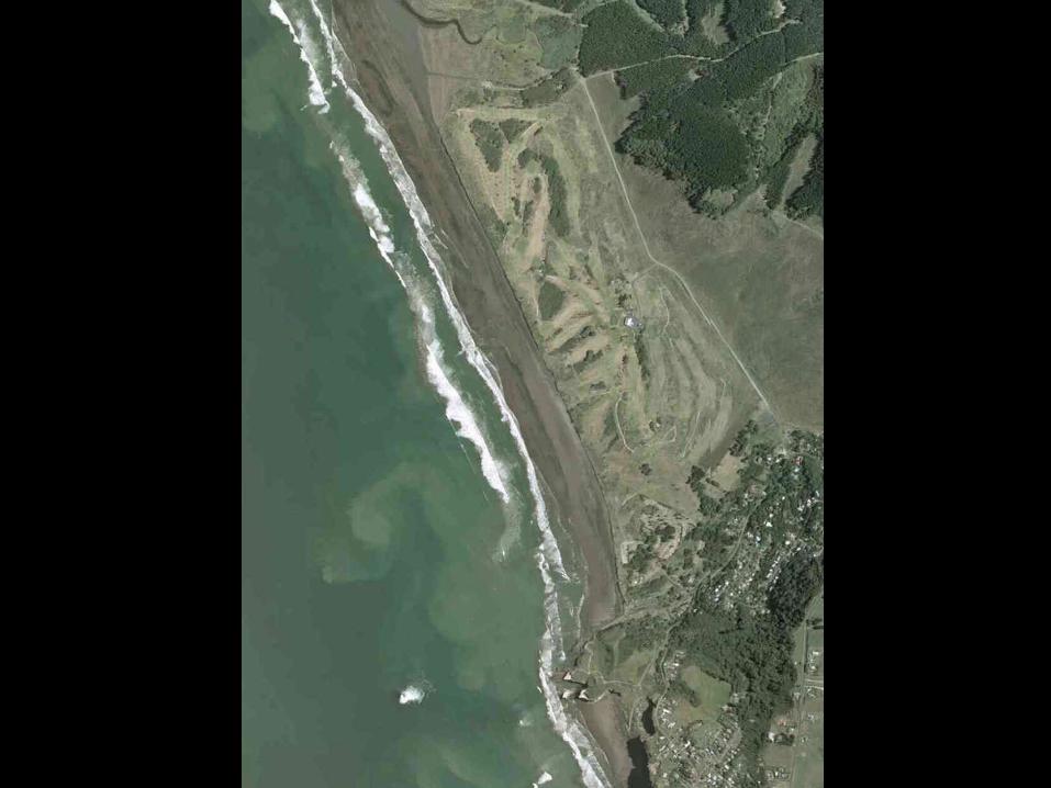
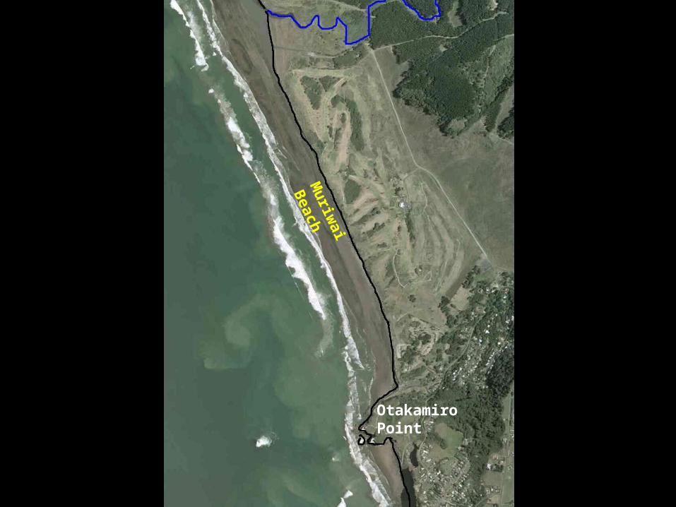
Muriw
ai Beach
Otakamiro Point
OP
Muriw
ai Beach
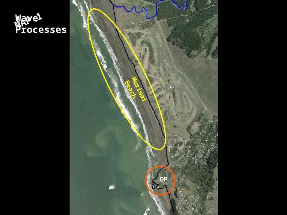
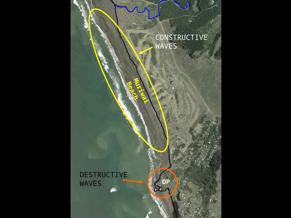
MAP 1Wave Processes
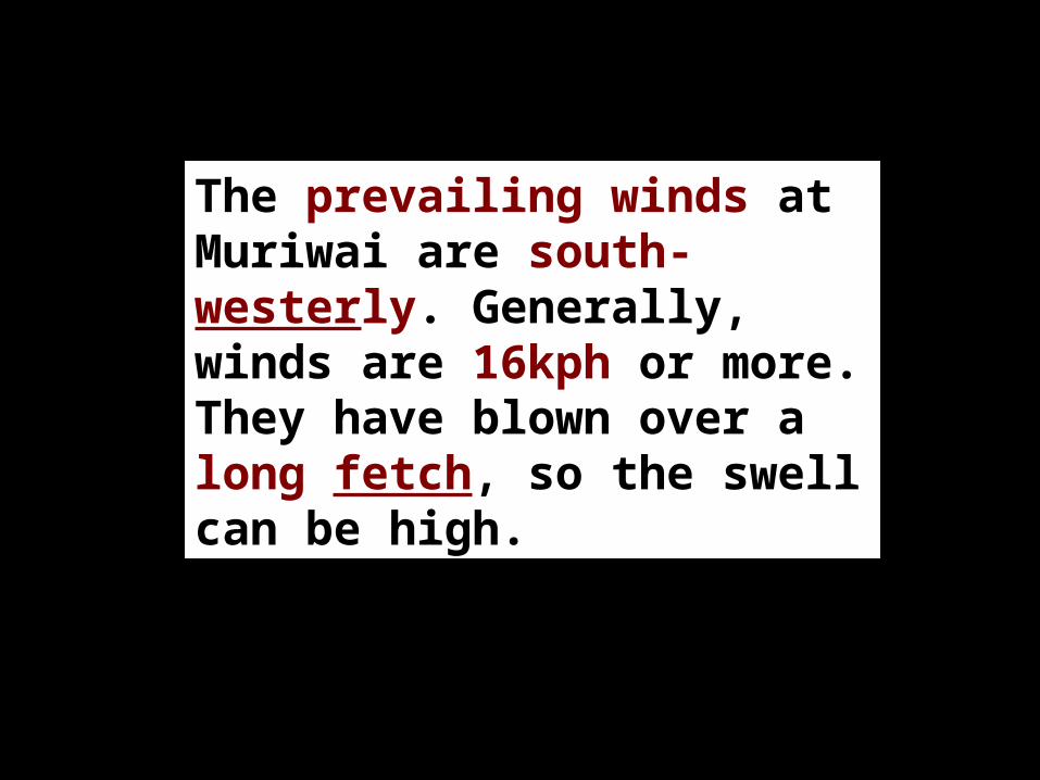
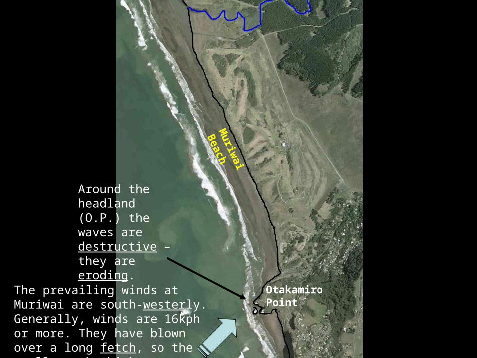
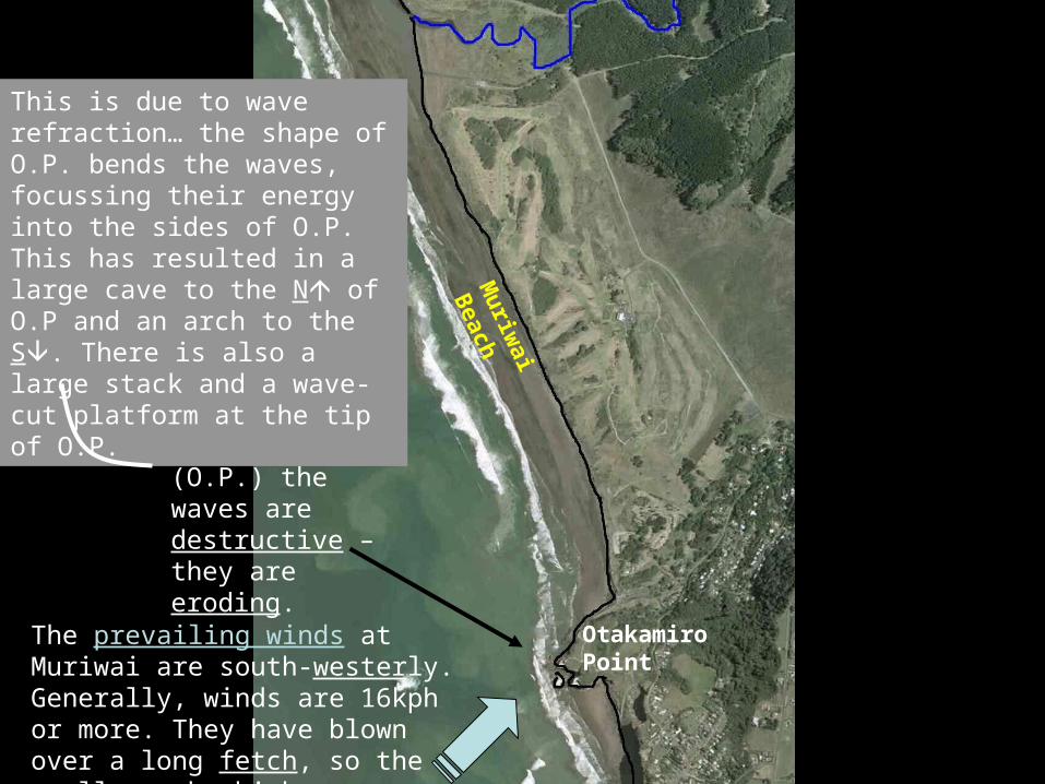
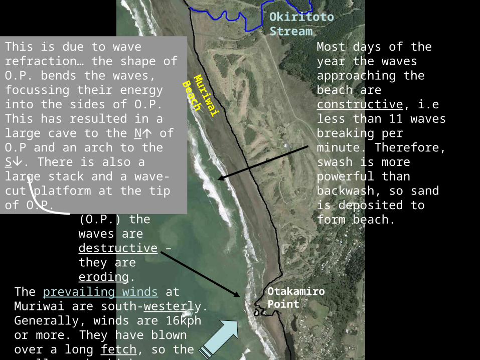
The prevailing winds at Muriwai are south-westerly. Generally, winds are 16kph or more. They have blown over a long fetch, so the swell can be high.
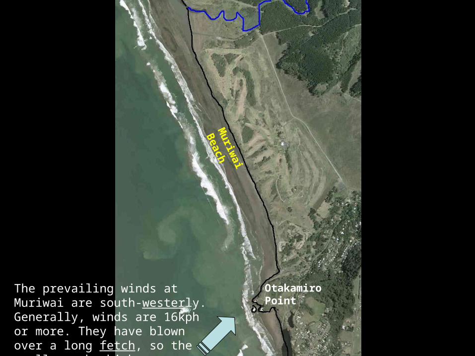
The prevailing winds at Muriwai are south-westerly. Generally, winds are 16kph or more. They have blown over a long fetch, so the swell can be high.
Muriw
ai Beach
Otakamiro Point
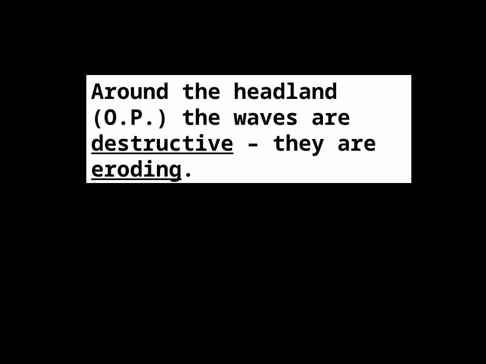
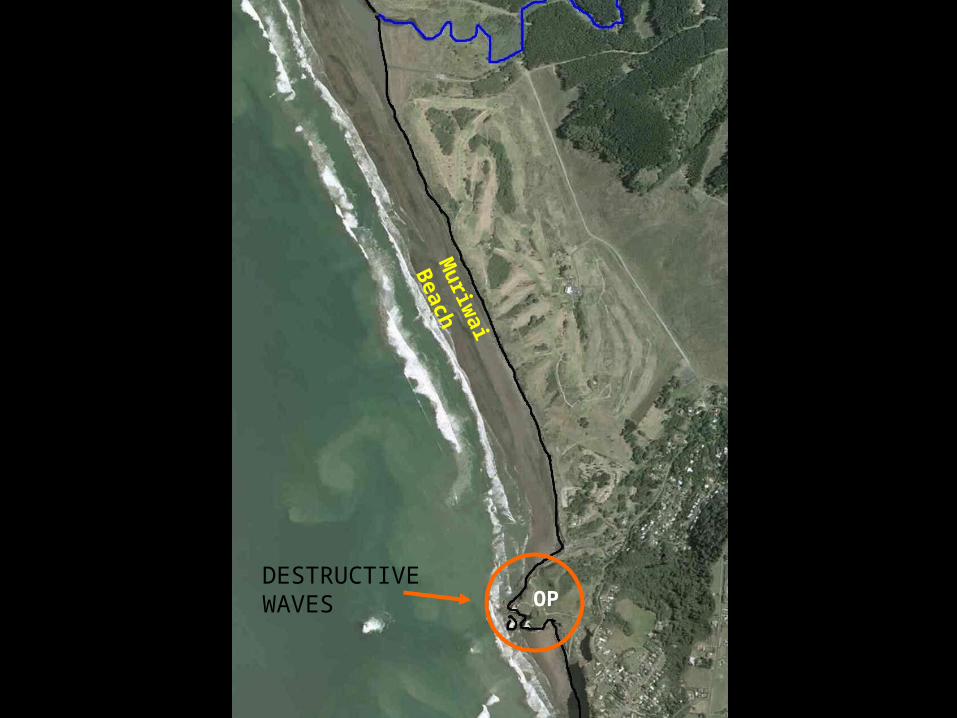
Around the headland (O.P.) the waves are destructive – they are eroding.
The prevailing winds at Muriwai are south-westerly. Generally, winds are 16kph or more. They have blown over a long fetch, so the swell can be high.
Around the headland (O.P.) the waves are destructive – they are eroding.
Muriw
ai Beach
Otakamiro Point
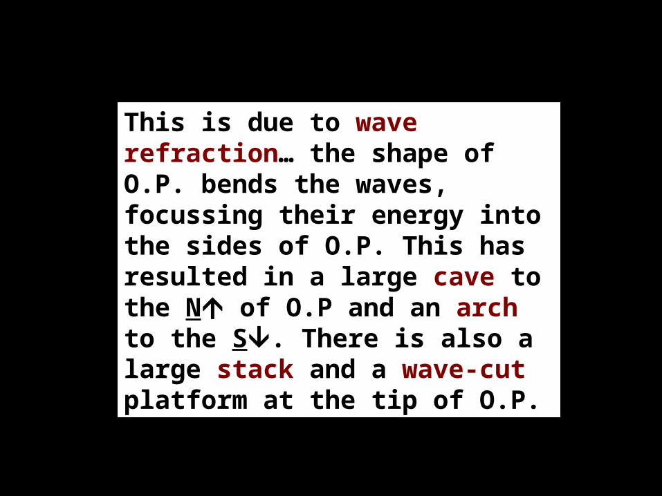
This is due to wave refraction… the shape of O.P. bends the waves, focussing their energy into the sides of O.P. This has resulted in a large cave to the N of O.P and an arch to the S. There is also a large stack and a wave-cut platform at the tip of O.P.
The prevailing winds at Muriwai are south-westerly. Generally, winds are 16kph or more. They have blown over a long fetch, so the swell can be high.
Around the headland (O.P.) the waves are destructive – they are eroding.
This is due to wave refraction… the shape of O.P. bends the waves, focussing their energy into the sides of O.P. This has resulted in a large cave to the N of O.P and an arch to the S. There is also a large stack and a wave-cut platform at the tip of O.P.
Otakamiro Point
Muriw
ai Beach
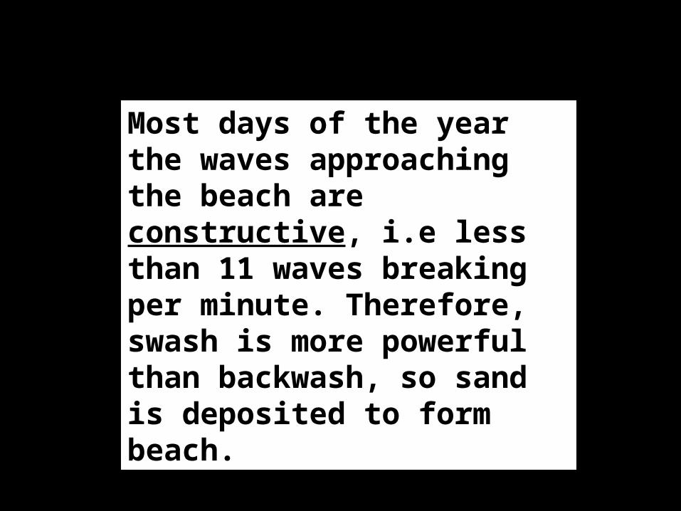
Most days of the year the waves approaching the beach are constructive, i.e less than 11 waves breaking per minute. Therefore, swash is more powerful than backwash, so sand is deposited to form beach.
The prevailing winds at Muriwai are south-westerly. Generally, winds are 16kph or more. They have blown over a long fetch, so the swell can be high.
Around the headland (O.P.) the waves are destructive – they are eroding.
This is due to wave refraction… the shape of O.P. bends the waves, focussing their energy into the sides of O.P. This has resulted in a large cave to the N of O.P and an arch to the S. There is also a large stack and a wave-cut platform at the tip of O.P.
Otakamiro Point
Muriw
ai Beach
Most days of the year the waves approaching the beach are constructive, i.e less than 11 waves breaking per minute. Therefore, swash is more powerful than backwash, so sand is deposited to form beach.
Okiritoto Stream
DESTRUCTIVE WAVES OP
Muriw
ai Beach
DESTRUCTIVE WAVES
CONSTRUCTIVE WAVES
OP
Muriw
ai Beach
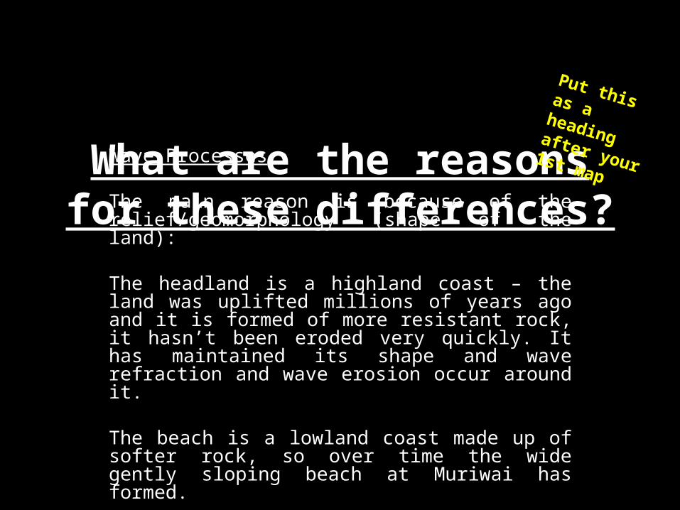
What are the reasons for these differences?
Wave Processes
The main reason is because of the relief/geomorphology (shape of the land):
The headland is a highland coast – the land was uplifted millions of years ago and it is formed of more resistant rock, it hasn’t been eroded very quickly. It has maintained its shape and wave refraction and wave erosion occur around it.
The beach is a lowland coast made up of softer rock, so over time the wide gently sloping beach at Muriwai has formed.
Put this as a heading after your 1st map
OP
Muriw
ai Beach
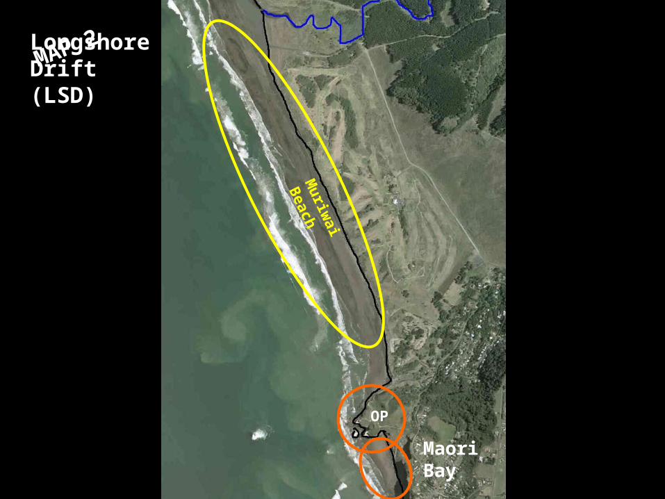
MAP 2Longshore Drift (LSD)
Maori Bay
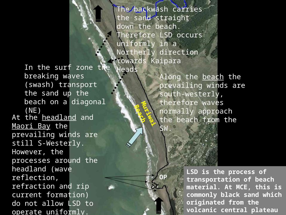
LSD is the process of transportation of beach material. At MCE, this black sand which originated from the volcanic central plateau of NZ
Along the beach the prevailing winds are south-westerly, therefore waves normally approach the beach from the SW.
In the surf zone the breaking waves (swash) transport the sand up the beach on a diagonal (NE)
The backwash carries the sand straight down the beach. Therefore LSD occurs uniformly in a Northerly direction towards Kaipara Heads
At the headland and Maori Bay the prevailing winds are still S-Westerly. However, the processes around the headland (wave reflection, refraction and rip current formation do not allow LSD to operate uniformly. So LSD does not occur in the northerly direction predicted.
Muriw
ai Beach
OPLSD is the process of transportation of beach material. At MCE, this is commonly black sand which originated from the volcanic central plateau of NZ.
Along the beach the prevailing winds are south-westerly, therefore waves normally approach the beach from the SW.
In the surf zone the breaking waves (swash) transport the sand up the beach on a diagonal (NE)
The backwash carries the sand straight down the beach. Therefore LSD occurs uniformly in a Northerly direction towards Kaipara Heads
At the headland and Maori Bay the prevailing winds are still S-Westerly. However, the processes around the headland (wave reflection, refraction and rip current formation) do not allow LSD to operate uniformly. So LSD does not occur in the northerly direction predicted.
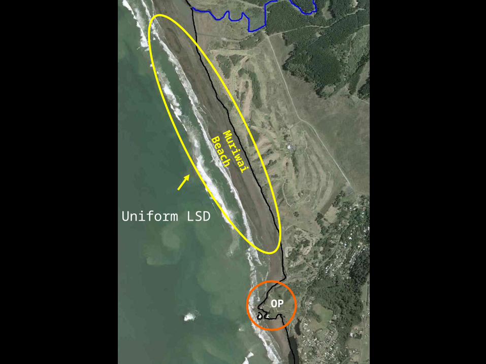
Uniform LSD
OP
Muriw
ai Beach
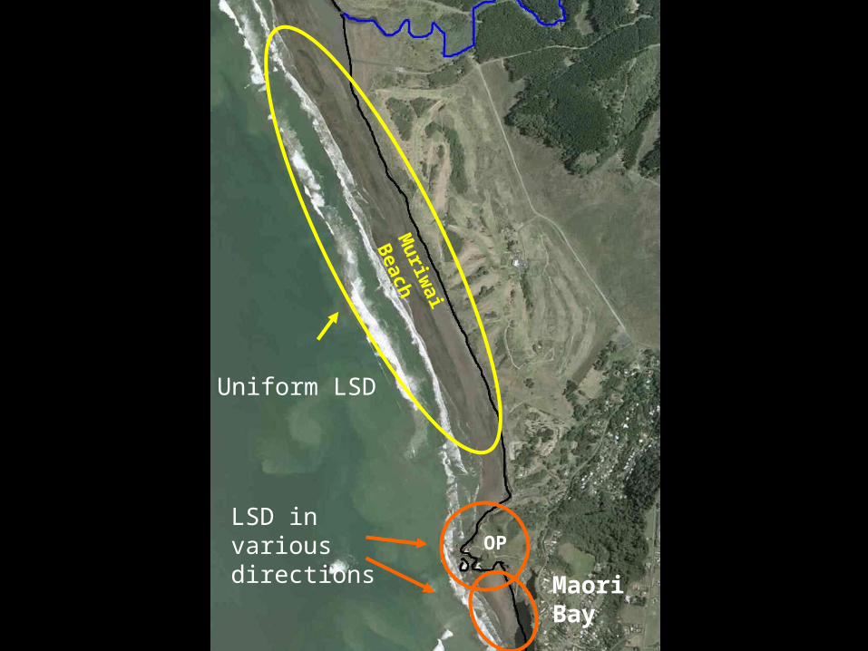
LSD in various directions OP
Muriw
ai Beach
Uniform LSD
Maori Bay
What are the reasons for these differences?
Longshore Drift
The difference is again due to the geomorphology of the MCE:
The beach is long and straight so wave processes can operate without interruption.
Around the headland reflection, refraction and rips cause many currents in the water which cause LSD to occur locally around the headland in various directions.
Put this as a heading after your 2nd map
Maori Bay
Muriw
ai Beach
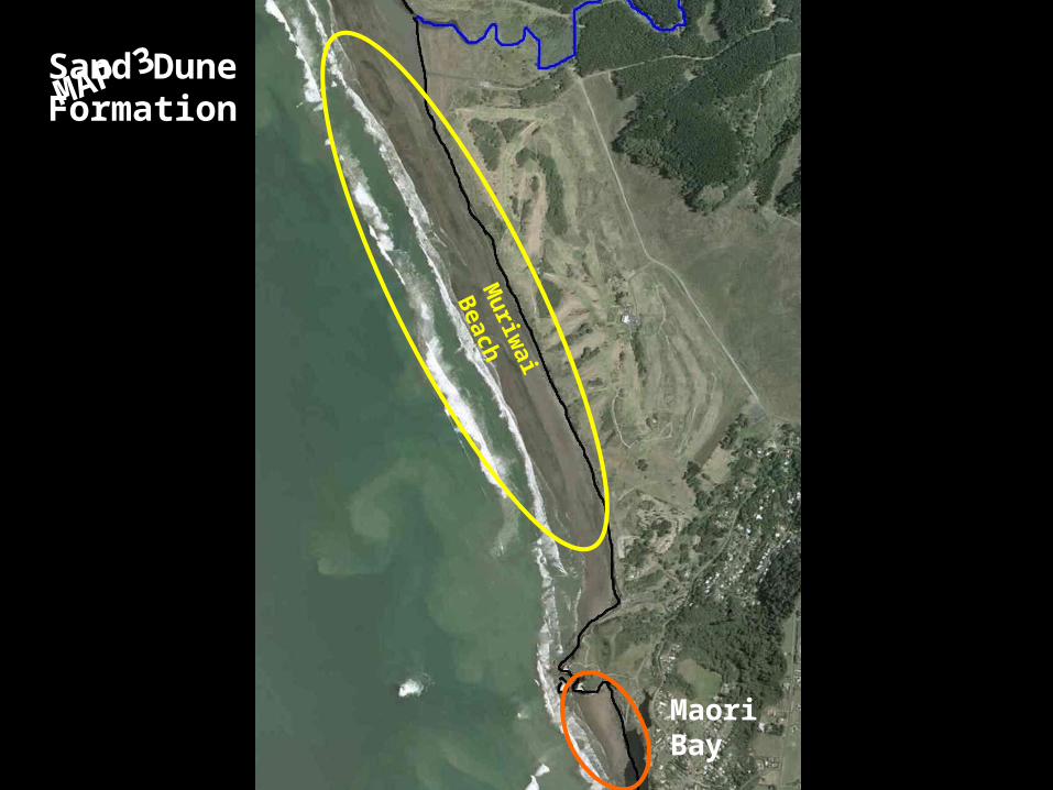
MAP 3Sand Dune Formation
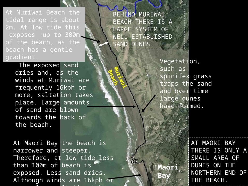
BEHIND MURIWAI BEACH THERE IS A LARGE SYSTEM OF WELL-ESTABLISHED SAND DUNES.
At Muriwai Beach the tidal range is about 2m. At low tide this exposes up to 300m of the beach, as the beach has a gentle gradient.
The exposed sand dries and, as the winds at Muriwai are frequently 16kph or more, saltation takes place. Large amounts of sand are blown towards the back of the beach.
Vegetation, such as spinifex grass traps the sand and over time large dunes have formed.
At Maori Bay the beach is narrower and steeper. Therefore, at low tide less than 100m of beach is exposed. Less sand dries. Although winds are 16kph or more, less saltation takes place.
AT MAORI BAY THERE IS ONLY A SMALL AREA OF DUNES ON THE NORTHERN END OF THE BEACH.
Maori Bay
Muriw
ai Beach
BEHIND MURIWAI BEACH THERE IS A LARGE SYSTEM OF WELL-ESTABLISHED SAND DUNES.
AT MAORI BAY THERE IS ONLY A SMALL AREA OF DUNES ON THE NORTHERN END OF THE BEACH.
At Maori Bay the beach is narrower and steeper. Therefore, at low tide less than 100m of beach is exposed. Less sand dries. Although winds are 16kph or more, less saltation takes place.
At Muriwai Beach the tidal range is about 2m. At low tide this exposes up to 300m of the beach, as the beach has a gentle gradient.
The exposed sand dries and, as the winds at Muriwai are frequently 16kph or more, saltation takes place. Large amounts of sand are blown towards the back of the beach.
Vegetation, such as spinifex grass traps the sand and over time large dunes have formed.
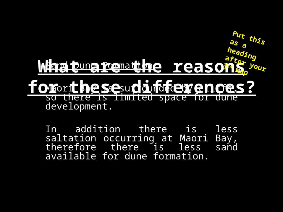
What are the reasons for these differences?
Sand Dune Formation
Maori Bay is surrounded by cliffs, so there is limited space for dune development.
In addition there is less saltation occurring at Maori Bay, therefore there is less sand available for dune formation.
Put this as a heading after your 3 rd map


![The multiplier problem of the calculus of variations for ...hchan/J-multiplier.pdf · The multiplier problem of the calculus of variations for… Page 5 of 32 40 be found in [6,9,11].](https://static.fdocuments.in/doc/165x107/5f6ff2ba82913d616a1fd51d/the-multiplier-problem-of-the-calculus-of-variations-for-hchanj-multiplierpdf.jpg)