What is GIS - A public health example
13
Dr John Snow (1813-1858) What is GIS? The following is a story about… A 19 th century doctor A cholera outbreak map A pump handle Ian Alla Mapping disease
-
Upload
learnpracticalgis -
Category
Education
-
view
813 -
download
3
description
In this episode of my What is GIS series I use the example of the classic John Snow cholera mapping exercise to show that very simple mapping techniques coupled with a good understanding of the problem being mapped can lead to an incredibly useful understanding of a public health issue. For the accompanying blog post and explanatory video goto http://learnpracticalgis.com/19th-century-public-health-map/ For more articles like this goto http://learnpracticalgis.com/
Transcript of What is GIS - A public health example
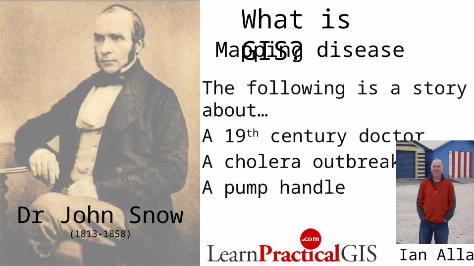
Dr John Snow(1813-1858)
What is GIS?
The following is a story about… A 19th century doctorA cholera outbreak mapA pump handle
Ian Allan
Mapping disease
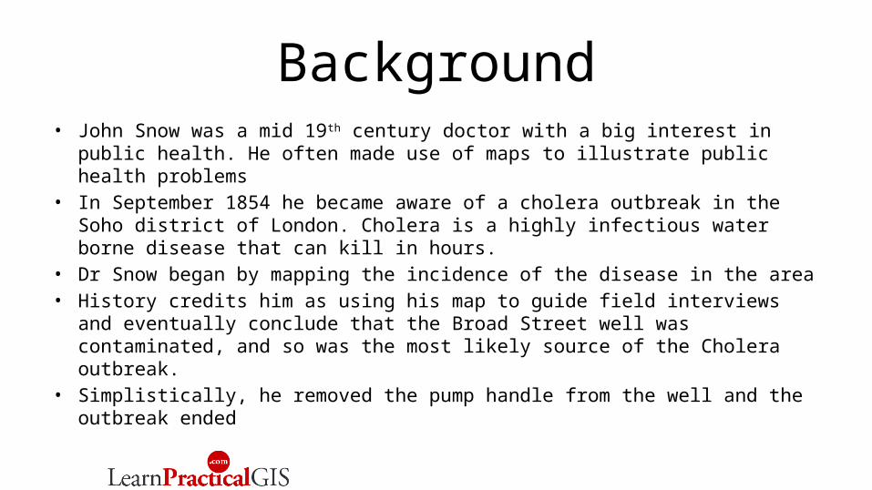
Background• John Snow was a mid 19th century doctor with a big interest in public health.
He often made use of maps to illustrate public health problems• In September 1854 he became aware of a cholera outbreak in the Soho
district of London. Cholera is a highly infectious water borne disease that can kill in hours.
• Dr Snow began by mapping the incidence of the disease in the area • History credits him as using his map to guide field interviews and eventually
conclude that the Broad Street well was contaminated, and so was the most likely source of the Cholera outbreak.
• Simplistically, he removed the pump handle from the well and the outbreak ended
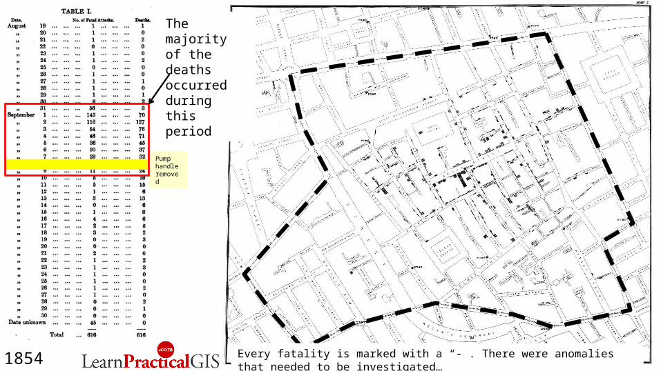
Pump handle removed
1854
The majority of the deaths occurred during this period
Every fatality is marked with a “-”. There were anomalies that needed to be investigated…

Pump handle removed
1854Why were there fatalities so close to other pumps? And why so few fatalities in the nearby brewery and workhouse?
Workhouse
BreweryBROAD ST
PUMP
Pump handle removed
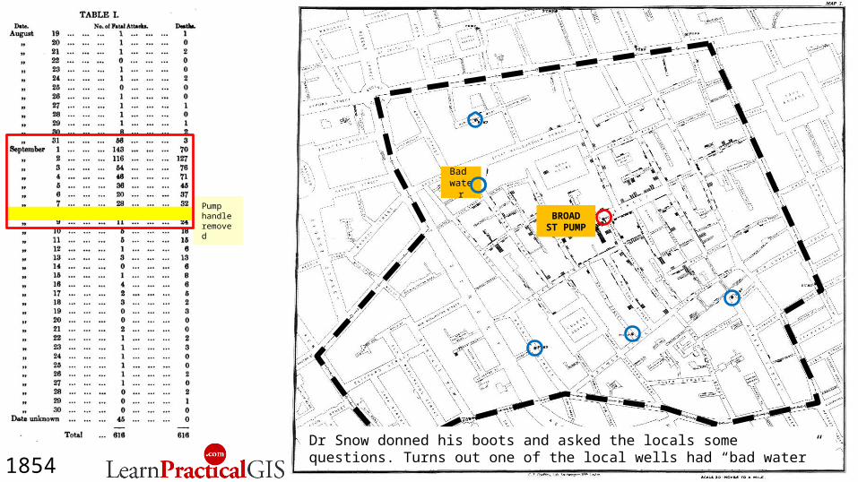
1854Dr Snow donned his boots and asked the locals some questions. Turns out one of the local wells had “bad water”
Bad water
BROAD ST PUMP

Pump handle removed
Bad water
Workhouse535 people Private bore
1854 …and the local workhouse had a private bore
BROAD ST PUMP
Pump handle removed
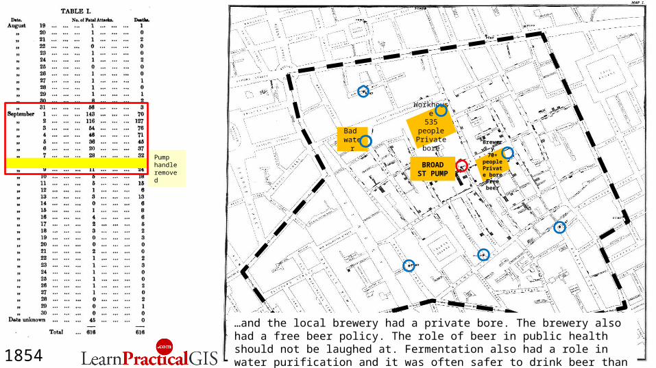
Workhouse535 people Private bore
Brewery70+
people Private
boreFree beer
1854
…and the local brewery had a private bore. The brewery also had a free beer policy. The role of beer in public health should not be laughed at. Fermentation also had a role in water purification and it was often safer to drink beer than water.
Bad water
BROAD ST PUMP

Pump handle removed
Workhouse535 people Private bore
Brewery70+
people Private
boreFree beer
1854
Street pattern an obstacle
…and one area that was close to the Broad Street pump as the crow flies, was actually quite distant due to dead-end streets blocking the way. This is classic geographic analysis.
Bad water
BROAD ST PUMP

Pump handle removed
Workhouse535 people Private bore
Brewery70+
people Private
boreFree beer
1854
Street pattern an obstacle
People evacuated
early
…and in Poland Street immediately to the north, people evacuated the area in the first days of the outbreak, so there was nobody around to contract the disease. The area was said to be a ghost town.
Bad water
BROAD ST PUMP
Summing up• John Snow used his mapping of the cholera outbreak to support his
investigation. Rather than using the map as “gospel” he used it as a “guide”. The big lesson in this is that its often important to don your boots when doing GIS mapping. The best and most convincing mapping is done from those who make the effort to understand the problem being mapped.
• For geographical analyses such as public health, GIS should be seen a powerful tool to assist with understanding.
• The best GIS mapping will be done by…– Epidemiologists who learn GIS or team up with a GIS practitioner– GIS practitioners who learn epidemiology or team up with an epidemiologist

My thanks to the UCLA department of epidemiology for their brilliant site dedicated to Dr John Snow www.ph.ucla.edu/epi/snow.html
Watch the video and read the blog post here
Download your free eBook “10 Practical Applications Of Geographical Information Systems” here
Ian Allan


Pump handle removed
1854
Workhouse535 people Private bore
Brewery70+
people Private
boreFree beer
Street pattern an obstacle
People evacuated
early
Bad water
BROAD ST PUMP