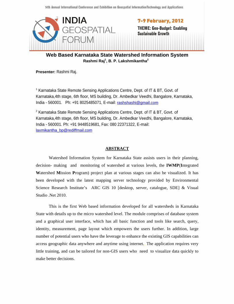
Web Based Karnataka State Watershed Information System
13
Web Based Karnataka State Watershed Information System Rashmi Raj 1 , B. P. Lakshmikantha 2 Presenter: Rashmi Raj. 1 Karnataka State Remote Sensing Applications Centre, Dept. of IT & BT, Govt. of Karnataka,4th stage, 6th floor, MS building, Dr. Ambedkar Veedhi, Bangalore, Karnataka, India - 560001. Ph: +91 8025485071, E-mail: [email protected] 2 Karnataka State Remote Sensing Applications Centre, Dept. of IT & BT, Govt. of Karnataka,4th stage, 6th floor, MS building, Dr. Ambedkar Veedhi, Bangalore, Karnataka, India - 560001. Ph: +91 9448519681, Fax: 080 22371322, E-mail: [email protected] ABSTRACT Watershed Information System for Karnataka State assists users in their planning, decision- making and monitoring of watershed at various levels, the IWMP(Integrated Watershed Mission Program) project plan at various stages can also be visualized. It has been developed with the latest mapping server technology provided by Environmental Science Research Institute’s ARC GIS 10 [desktop, server, catalogue, SDE] & Visual Studio .Net 2010. This is the first Web based information developed for all watersheds in Karnataka State with details up to the micro watershed level. The module comprises of database system and a graphical user interface, which has all basic function and tools like search, query, identity, measurement, page layout which empowers the users further. In addition, large number of potential users who have the leverage to enhance the existing GIS capabilities can access geographic data anywhere and anytime using internet.. The application requires very little training, and can be tailored for non-GIS users who need to visualize data quickly to make better decisions.
Transcript of Web Based Karnataka State Watershed Information System
Web Based Karnataka State Watershed Information System
Rashmi Raj1 B P Lakshmikantha2
Presenter Rashmi Raj
1 Karnataka State Remote Sensing Applications Centre Dept of IT amp BT Govt of Karnataka4th stage 6th floor MS building Dr Ambedkar Veedhi Bangalore Karnataka India - 560001 Ph +91 8025485071 E-mail rashshashigmailcom
2 Karnataka State Remote Sensing Applications Centre Dept of IT amp BT Govt of Karnataka4th stage 6th floor MS building Dr Ambedkar Veedhi Bangalore Karnataka India - 560001 Ph +91 9448519681 Fax 080 22371322 E-mail laxmikantha_bprediffmailcom
ABSTRACT
Watershed Information System for Karnataka State assists users in their planning
decision- making and monitoring of watershed at various levels the IWMP(Integrated
Watershed Mission Program) project plan at various stages can also be visualized It has
been developed with the latest mapping server technology provided by Environmental
Science Research Institutersquos ARC GIS 10 [desktop server catalogue SDE] amp Visual
Studio Net 2010
This is the first Web based information developed for all watersheds in Karnataka
State with details up to the micro watershed level The module comprises of database system
and a graphical user interface which has all basic function and tools like search query
identity measurement page layout which empowers the users further In addition large
number of potential users who have the leverage to enhance the existing GIS capabilities can
access geographic data anywhere and anytime using internet The application requires very
little training and can be tailored for non-GIS users who need to visualize data quickly to
make better decisions
To build a foundation for sound decision-making and reduce electronic data
transfer time it is important to build an information management system concurrent
with the development of a watershed management framework Web based Karnataka
State Watershed Information System is a computerized system that delivers Watershed
information or tools to a manager or decision maker using a thin-client Web browser like
Firefox or Internet Explorer The Web based Watershed information system is made user
friendly by adding geographic data querydisplayprocess and is comprised of Hypertext
Markup Language (HTML) user interfaces internet interface programs computational
models and geographic databases Expansion of the computer systems and advances in
internet related technologies extend GIS in a new horizon Developing a Web based
information system collecting data delivering materials (maps) manipulating and updating
data becomes easier and faster Web based system utilizes internet to full extent and gives
mass accessibility to geographic data It also makes quick accessible to larger audience
more importantly worldwide
Web based Watershed Information System for Karnataka State watersheds is
developed by using Visual StudioNet 35 and Arc GIS 10 [desktop server
catalogSDE] It is a useful tool to access spatial and non spatial data and gives
information of Watershed (rivers and water bodies drainage) over the Web
Use of Web enabled application comes largely from the ability to simultaneously
access and process both map and attribute data faster Web Based Watershed information
system will be useful to assist the respective departments in their day to day decisions
depicting sub mini and micro w atersheds which are essential for planners decision
makers and implementing agencies The Web Application developed has a full-fledged
combination of tools for both spatial and non spatial data Using Arc Catalog the coveragersquos
were converted to shape file These shape files are transferred to DBO format with the
help of Arc SDE Data updating is done in Arc Map for this DBO files and saved as
m x d document file Later services are created for this m x d files using Arc
Catalog (GIS server) Microsoft Visual Studio Net 2010 is used to design a user interface
and coding in C Net An interactive map is displayed in Internet explorer which has
all basic functions Important modules are developed like search query identity
measurement page layout Identity displays the information of the selected feature in
the result panel The Search function helps user to select a set of fields provided by
resources in which to search for the occurrence of a user provided value Query tool
provides a drop down list of preset choices or a textbox for general text entry
Web based K a r n a t a k S t a t e Watershed I nformation S ystem developed is first
of its kind for the entire state of Karnataka This is a technology from which it gets data
from sources simultaneously in exact time intervals which will give clear edge to user
especially Watershed Development Department GOK
Key words KSWIS Desktop GIS Visual Studio Net 2010 C Net ArcGIS 10 ArcSDE
Introduction
To build a foundation for sound decision-making and reduce electronic data
transfer time it is important to build an information management system concurrent
with the development of a watershed management frame work Web based Watershed
information system is a computerized system that delivers Watershed information or
tools to a manager or decision maker using a thin-client Web browser like Firefox or
internet explorer The computer server that hosts the application is linked to the users
computer by a network with the Transmissions Control Protocol Internet Protocol
(TCPIP) The Web based Watershed information system can be made user friendly by
adding geographic data querydisplayprocess and is comprised of Hypertext
Markup Language (HTML) user interfaces internet interface programs
computational
Advantages of having Web based Watershed information system is
i It is very useful database for planners decision makers and implementation
agencies There is a tremendous scope for updating the database eg Watershed
treated ongoing and completed Watershed area in spatial database
ii Ability to access everywhere over the internet
iii Reducing time and minimizing effort to reach data
iv Ability to produce reports based on user specified parameters
v Analysis for building various structures for watershed improvement as well as water
bodies is enhanced further by visualization that the application creates as it integrates
watershed boundaries with that of administrative boundaries up to the village level
Scope of the Study
i Watershed information system which provides complete data of Karnataka
w atersheds where user can get required information via Internet
ii Provide both spatial and non-spatial information Generate live updated prospective
plan Status Reports of the Integrated Watershed Management Programme(IWMP)
iii To generate IWMP project status information for Karnataka State in Excel format
iv Geospatial web application incorporation of IWMP project prospective plan which
includes different five year plans information
Study Area The state of Karnataka is part of two well-defined regions of India namely the
Deccan Plateau and the Coastal Plains and Islands It can be further divided into four
physiographic regions-the Northern Karnataka Plateau Central Karnataka Plateau Southern
Karnataka Plateau and the Coastal Karnataka Region
Location Set on the meeting point of Western and Eastern Ghats the state has a positional
coordinate of 115deg to 185 deg Northern latitude and 74deg to 785 deg Eastern longitude
Extent Karnataka extends to about 750 km from north to south and about 400 km from
east to west The Coastal belt with an average width of 50 to 80 km covers a distance of
about 267 km from north to south
Data Used Data generated under Project Sate Natural Resources Information System
has been collected from KSRSAC which consists of point line amp polygon themes
including attribute data on 150000 scale and using LISS IV satellite image of 2000-2001
Feature Class Details are as follows
i Administration Boundaries State Boundary District TalukHobliVillage Settlements
ii Transportation Roads Railway line
iii Drainage Info Canals Drainage(Line)Water bodies River Streams
iv Watershed Info Watershed ( 8 Levels) IWM P project Status(prospective plan viz
treated ongoingamp to be treated)
Materials and Methodology
All the data that has been procured from KSRSAC is in the Polyconic
Everest Bangladesh projection system which is a local Datum for standardized acceptance of
data following OGC Standards the entire data has been reprojected to UTM (Zone 43 North)
WGS84 and the web page is developed on the same lines Thereby taking care of data
Interoperability and Standards into consideration UTM coordinates are not unique across the
globe They are certainly unique within the zone but the same address can exist in each UTM
zonemost popular shapefile appendage is the optional prj file It tells you what projection
the data is in
Further this data is refined and prepared according the components used for web application
development The dbf of the files is linked to the SQL server using the import data wizard
queries are custom written generate the searches such as drop down for District Taluk
Watershed The service is generated using the Arc Server and published this is the service
that is used to display using the Java script API The steps involved in generation of this web
application (Figure 1) Spatial data requirements of Water Resources Information System is
recommended as the spatial information of whole Karnataka either have to be prepared from
SOI topographic map or to be procured from concerned departments who are custodians of
various map data that is available in digital form
Fig 1 Project flow diagram
Database Structure The database structures of the various attributes used are as mentioned
in the tables below
Data Collection (from KSRSAC)
Convert From Polyconic Projection to UTM (Zone 43 N)
Export Data from Coverage to File Geodatabase
Redesign the Data as per standards amp Data Updation
Design Database in Sql Server and Updation
Create Arc Map Documents amp Public Map Services
Design Web User Interface using Visual Studio
Coding using C JQuery Dojo ESRI Javascript API
Testing amp Publishing Web Site
Training to Users
Exporting feature datasets classes and tables Exporting data allows you to share data
across multiple geodatabase and optionally change the format of the data There are several
ways to export data using ArcMap and ArcCatalogUsing the context-sensitive menu in
ArcCatalog Using geoprocessing toolsUsing the Extract Data Wizard in ArcMap Using the
Export Data command in ArcMap etc
The project uses File Geodatabase to create database connections A File
Geodatabase stores datasets in a folder of files on your computer Each dataset is held as a
file and can be up to 1 TB in size (and you can optionally configure a file geodatabase to
store much larger datasets) File geodatabases can be used across platforms and can be
compressed and encrypted for read-only secure use
Web service URLs
For clients to access Web services they will need to know the URL When we make
an Internet connection to the server we will use a URL in this format
i httpltserver namegtltinstance namegtservices
To connect to a specific service the URL takes a longer format
ii httpltserver namegtltinstance namegtservicesltfolder name (if the service
resides in a folder)gtltservice namegtltservice type (required for some
services)gtltcapability type (required for some services)gt
Further instructions on the URL formats to use with our services see the
documentation topic specific to the type of service we are creating To change the format of
the URL we can use URL mapping
Capabilities that require Web access
Some capabilities require that clients access the service through the Internet
therefore there is no option to disable Web access for these capabilities The capabilities that
require Web access are KML WMS and Mobile Data Access
User Interface Designing (GUI) Using AspNet
ASPNet became a ldquogrown uprdquo version of its ASP technology using its mature
programming languages C ASPNet 35 fundamentally reduces the barriers for
development of complex Web sites HTML is sent to the browser there is no
requirement for special capability on the browser beyond display of HTML and the
execution of a single simple Java script Any browser that can display HTML can display
ASPNet 35 pages
Master and Content pages
A site benefits from a consistent look and feel and we rarely find sites on the Internet that
deviate from having a generic site layout which generally includes the following
i A common header and menu system for the entire site
ii A bar on the left side of the page offering some page navigation options
iii A footer providing copyright information and a secondary menu for contacting the
Webmaster
The master page contains some of the content available to each page on the site so
standard copyright footer text can be defined here along with positioning the main site logo
at the top of the page
It is decided to develop a master page amp a content page for this project A master
page defines the layout to be used by all pages based on the master Itrsquos the overall
parent that controls layout specifying how big the header will be on every page where the
navigation features will be placed and the text to display in the footer on every page a bit
like a cookie cutter for each page
A content page is a page based on a master and is where we add the content for each
page on a site that varies from page to page The content page contains text HTML
JQuery JavaScriptAPI and controls within ltasp contentgt tags When the content page is
requested its content is combined with a copy of the master page with the specific content
defined in the conten page placed within the specified placeholder on the master page
Preparation of Maps Maps are prepared by storing in mxd files using Arc Map
Following are the maps prepared in the present study
The findings of the study and discussion are included in this Chapter Results of the study
are explained in detail below It includes following functionalities
Toolbar Collection This toolbar contains a series of tools(Figure-5) that can be
used interactively in the map display First click the tool icon to select it (pan tool is
selected) and then click in the map display to use it
Zoom out Used to Zoom-out the map There are two ways in which this tool can be used
One is by single left clicking and the map will Zoom-out and re-center where it is clicked
The second is to draw a rectangle around the area we want to display and the map will
Zoom-out to the area of the rectangle This is accomplished by left clicking and dragging to
draw the rectangle and then releasing the mouse button to cause the map to Zoom-out The
smaller the rectangle we draw the more the map will Zoom-out
Zoom in Used to Zoom-in the map There are two ways in which this tool can be used
One is by single left clicking and the map will Zoom-in and re-center where it is clicked
The second is to draw a rectangle around the area which we want to display and the map
will Zoom-in to the area of the rectangle This is accomplished by left clicking and
dragging to draw the rectangle and then releasing the mouse button to cause the map to
Zoom-in When we Zoom-in selecting a particular taluk it highlights particular
Watershed falling within the respective taluk
PanThis tool is used to move around the map without changing the scale With this tool
selected left-click and drag the map to move it around
Full Extent Clicking this tool in the toolbar will zoom the map all the way out to the full
Extent (the entire state)
Identity Select the tool and click on the feature to identify (get information) An
identify icon will be placed on the map at the location clicked Feature information
should then display in the results panel It displays the following results if we click on
taluk
a) Watershed code amp names of Micro amp Mini Watershed
b) Rivers and water bodies information
c) Taluk boundary with its respective area and perimeter
Zoom Back To Previous Extent Clicking this tool in the toolbar will zoom the map back to the previously viewed extent
Search Option The Search control enables a developer to select a set of fields
provided by resources in which it searches for the occurrence of a user provided value At
runtime each field is queried for the occurrence of a value provided by the user Partial
values are permitted Only feature layers in resources provided by a MapResourceManager
can be used
Search by District This is the customized Search that is designed as illustrated below the
task and results are shown as drop down widgets the auto zoom to selected search is shown
as result filtering is done for District Taluk and Watershed wise
Export Search results to Excel format The required details District wise and Taluk wise
can be generated and exported to excel Printout of the same can also be taken
Result and Discussion
The findings of the present study with previous works are discussed here From
Science planners to public recent advances in technology are more broadly accepted and
adopted User now a days is interested in embracing online forms of Geographic Information
Systems (GIS) without the need for technical understanding and all of this is happening very
rapidly Associated with these opportunities for information sharing are increased
expectations which are user friendly Web based Watershed information presents data to the
user in many ways Tabulated data from Water Resource Region to Microwatershed online
status update features visualization of Admin boundaries etc Will be useful to users in
overlaying along with spatial data The developmental measures undertaken at micro-
watersheds level include soil and moisture conservation land shaping bunding construction
of water harvesting structures ground water recharge structures and drainage line treatment
structures micro-watershed wise implementation is ideal as it helps in concentrating on the
smaller area with low financial burden and also to take care of all the villages coming under
the area In the present study this is taken care of as data visualized is up to the
microwatershed level
The system design encompasses the database and the server Web based Watershed
information system provides the user with easy access to timely data in various formsThe
end user need not have all the high end GIS software
Watershed Programs Monitoring Information System (WPMIS) developed by
Department of Land Resources Ministry of Rural Development Govt of India
(httpWatershednicin) gives list of all the projects and their fund-releases sanctioned for
the concerned district will be presented to the authenticated DRDAZP users of WPMIS This
application displays non spatial data whereas present study includes both spatial and non
spatial data The spatial database is very important for planners decision makers and
monitoring This feature is much more enhanced as the IWMP data and plan progress can
also be visualized
[1]Sudhirendar Sharma 2001 reported that few successful Watershed projects are
outnumbered by many unsuccessful ones because of lack of proper database both spatial and
non spatial This kind of problems can be overcome by developing Web enabled applications
which is emphasized in the present study
Centre for Spatial technologies Arkansas US have also developed Watershed
information system It is a comprehensive statewide Watershed Atlas consisting of series of
practical maps and reports for 308 Watershed units Land use changes soil slope maps and
reports were utilized in this system But it is having a limited tool option In the present study
query and search option tools are developed which is very important for planning and
monitoring of Watersheds as well as for prioritizing and follow up of various plan progress
made the analysis capabilities are also enhanced Further in the present study all the thematic
layers ([2]Lakshmikantha etal 2006) were utilized in development of Web based Watershed
information system
The Geospatial database created for IWMP prospective plan containing treated
ongoing yet to be treated categories has been utilized in the present study for web application
development This is very useful for the planning decision making assessment and
understanding the watershed at various levels viz Taluk District State ([2]DrLakshmikantha
BP elal2011)
Missouri Watershed Based Information on the Web using ArcView Internet Map
Server the Center for Agricultural Resource and Environmental Systems (CARES)
(wwwgisesricom) is serving Watershed based information for the State of Missouri through
the World Wide Web This has been developed using ArcIMS but has limited option of tools
The present Web based Watershed information system for Karnataka state Watershed
provides both spatial and non spatial data along with Watershed code It has many functions
like query identity measurement and search The development of Web based Karnataka
State Watershed information system is first of its kind in the State
Web based Watershed Information System for Karnataka State watersheds is
developed by using Visual StudioNet 35 and Arc GIS 10 [desktop server catalog
SDE] It is a useful tool to access spatial and non spatial data and gives information of
Watershed (rivers and water bodies land useland cover drainage) over the Web
Advantages of having Web based Watershed information system is
i It is very useful database for planners decision makers and implementation
agencies There is a tremendous scope for updating the database eg Watershed
treated ongoing and completed Watershed area in spatial database
ii Ability to access everywhere over the internet
iii Reducing time and minimizing effort to reach data
iv Ability to produce reports based on user specified parameters
v Authenticated user
vi Analysis for building various structures for watershed improvement as well as
water bodies is enhanced further by visualization that the application creates as it
integrates watershed boundaries with that of administrative boundaries up to the
village level
Conclusions
Web based KSWIS is a GIS application developed for more comprehensive
management of watersheds and help authorities in planning and implementing the effective
strategies in tackling the implementation projects through spatial and non-spatial analysis of
the data Watershed department can make use of the tools provided to find area of concern
and get the information using identifier module and on the hand they can edit the data using
update status option The user can use the road network layer in predicting the proximity of
conveyance to the project area Other information like IWMP project status summary can be
exported district and taluk wise updates can be made for the same as well This study
envisions a future where GIS is recognized as an integral and indispensable information
system serving the integrated information needs of the general public It can act as a guide
mainly for watershed department to have a clear visibility on maintaining and improving
watershed regions for locals and various civicgovernment authorities It acts as a base for
the future applications (GIS) development It primarily provides information about the
administrative regions that a particular watershed falls under and presents free up-to-date
interactive information in a visual format The database is useful for planning implementing
and monitoring of Karnataka state watersheds up to micro level The KSWIS is a GIS based
web application developed for the state could provide useful information in further
developmentsThere are many other functions that can be incorporated into the application
However the following are the suggestions that can be taken up
i Integration of Cadastral maps on a Sub Mini Micro watershed
ii Timely Updation of treated and untreated areas of Watershed under IWMP
which is not happening spatially throughout the state
iii Developing Arc hydro Utility Watershed information system
REFERENCES
[1] Sudhirendar Sharma Rethinking Watershed Development in India Strategy fo the Twenty-First Century The Ecological Foundation New Delhi India2001
[2] Lakshmikantha BP Ashok Reddy K Rangaswamappa and Venkatesh GApplication of Remote Sensing and GIS in conceptual planning for drainage line
treatment and water harvesting structures in Bagalkot district of Karnataka State In The fifth International conference of the Asian Federation for Information
Technology in Agriculture EdsVCPatil and Ninomiya 2006
[3] Watershed Atlas of Karnataka (Sub Mini amp Micro Watersheds) KSRSAC 2005
[4] State Natural Resources Information System Karnataka State Report KSRSAC 2007
Web Reference wwwdolrnicin wwwWatershedindia50megscom
wwwWatershednicin httplibinfouarkedugisus
httpwwwgisesrico
httpwwwgisdevelopmentcom
Fig 10Export to excel sheet
Taluk Boundary
Table 4 Taluk Boundary Attributes
SNo Filed Name Data Type Units Description
1 Area Float AcersHa Area of the Taluk
2 Perimeter Float MetersKM Perimeter of the Taluk
3 Dist_Name String Name of the District
4 Taluk_Code Interger Code of Taluk
5 Taluk_Name String Name of the Taluk
6 State_Name String Name of the State
District Bounday
Table3 District Boundary Attributes
SNo Filed Name Data Type Units Description
1 Area Float AcersHa Area of the District
2 Perimeter Float MetersKM Perimeter of the District
3 Dist_Code Interger District Code
4 Dist_Name String Name of the District
5 State_Name String Name of the State
Village Boundary Table 6 Village Boundary Attributes
ID
Filed Name Data Type
Units Description
1 Area Float AcersHa Area of the Village
2 Perimeter Float MetersKM Perimeter of the Village
3 State_Name String Name of the State
4 Dist_Name String Name of the District
5
Taluk_Name
String
Name of the Taluk
6
Hobli_Name
String
Name of the Hobli
8
V_Code
Integer
Village Code
9 V_Name String Village Name
Table 8Drainage Attributes
ID Filed Name Data Type Units Description
1 Length Float MetersKM Length of the Stream
2 Stream_Code Interger Stream Code
3 Order_No Interger Stream Order
Watershed Boundary Table 9 Watershed Boundary Attribute
ID Filed Name Data Type Units Description
1 Area Float AcersHa -
2 Perimeter Float MetersKM -
3 Region_Name String - -
4 Basin_name String - -
5 Catechment_Name String - -
6 Subcatchment_Name String - -
7 Watershed_Name String - -
8 Subwatershed_Name String - -
9 Miniwatershedcode Integer - Alphanumeric
Fig2 Tool bar
Fig3 Results of search by Taluk
Fig 1Master Page developed for Web based KSWIS
Fig 4 Search by District Result
Fig 5 Search by District
Fig 6 Search by Watershed mircowatershed
Fig 7 Search by MicroWatershed Task Results
Fig 8Update IWMP Status Fig 9 Update IWMP Status Window

To build a foundation for sound decision-making and reduce electronic data
transfer time it is important to build an information management system concurrent
with the development of a watershed management framework Web based Karnataka
State Watershed Information System is a computerized system that delivers Watershed
information or tools to a manager or decision maker using a thin-client Web browser like
Firefox or Internet Explorer The Web based Watershed information system is made user
friendly by adding geographic data querydisplayprocess and is comprised of Hypertext
Markup Language (HTML) user interfaces internet interface programs computational
models and geographic databases Expansion of the computer systems and advances in
internet related technologies extend GIS in a new horizon Developing a Web based
information system collecting data delivering materials (maps) manipulating and updating
data becomes easier and faster Web based system utilizes internet to full extent and gives
mass accessibility to geographic data It also makes quick accessible to larger audience
more importantly worldwide
Web based Watershed Information System for Karnataka State watersheds is
developed by using Visual StudioNet 35 and Arc GIS 10 [desktop server
catalogSDE] It is a useful tool to access spatial and non spatial data and gives
information of Watershed (rivers and water bodies drainage) over the Web
Use of Web enabled application comes largely from the ability to simultaneously
access and process both map and attribute data faster Web Based Watershed information
system will be useful to assist the respective departments in their day to day decisions
depicting sub mini and micro w atersheds which are essential for planners decision
makers and implementing agencies The Web Application developed has a full-fledged
combination of tools for both spatial and non spatial data Using Arc Catalog the coveragersquos
were converted to shape file These shape files are transferred to DBO format with the
help of Arc SDE Data updating is done in Arc Map for this DBO files and saved as
m x d document file Later services are created for this m x d files using Arc
Catalog (GIS server) Microsoft Visual Studio Net 2010 is used to design a user interface
and coding in C Net An interactive map is displayed in Internet explorer which has
all basic functions Important modules are developed like search query identity
measurement page layout Identity displays the information of the selected feature in
the result panel The Search function helps user to select a set of fields provided by
resources in which to search for the occurrence of a user provided value Query tool
provides a drop down list of preset choices or a textbox for general text entry
Web based K a r n a t a k S t a t e Watershed I nformation S ystem developed is first
of its kind for the entire state of Karnataka This is a technology from which it gets data
from sources simultaneously in exact time intervals which will give clear edge to user
especially Watershed Development Department GOK
Key words KSWIS Desktop GIS Visual Studio Net 2010 C Net ArcGIS 10 ArcSDE
Introduction
To build a foundation for sound decision-making and reduce electronic data
transfer time it is important to build an information management system concurrent
with the development of a watershed management frame work Web based Watershed
information system is a computerized system that delivers Watershed information or
tools to a manager or decision maker using a thin-client Web browser like Firefox or
internet explorer The computer server that hosts the application is linked to the users
computer by a network with the Transmissions Control Protocol Internet Protocol
(TCPIP) The Web based Watershed information system can be made user friendly by
adding geographic data querydisplayprocess and is comprised of Hypertext
Markup Language (HTML) user interfaces internet interface programs
computational
Advantages of having Web based Watershed information system is
i It is very useful database for planners decision makers and implementation
agencies There is a tremendous scope for updating the database eg Watershed
treated ongoing and completed Watershed area in spatial database
ii Ability to access everywhere over the internet
iii Reducing time and minimizing effort to reach data
iv Ability to produce reports based on user specified parameters
v Analysis for building various structures for watershed improvement as well as water
bodies is enhanced further by visualization that the application creates as it integrates
watershed boundaries with that of administrative boundaries up to the village level
Scope of the Study
i Watershed information system which provides complete data of Karnataka
w atersheds where user can get required information via Internet
ii Provide both spatial and non-spatial information Generate live updated prospective
plan Status Reports of the Integrated Watershed Management Programme(IWMP)
iii To generate IWMP project status information for Karnataka State in Excel format
iv Geospatial web application incorporation of IWMP project prospective plan which
includes different five year plans information
Study Area The state of Karnataka is part of two well-defined regions of India namely the
Deccan Plateau and the Coastal Plains and Islands It can be further divided into four
physiographic regions-the Northern Karnataka Plateau Central Karnataka Plateau Southern
Karnataka Plateau and the Coastal Karnataka Region
Location Set on the meeting point of Western and Eastern Ghats the state has a positional
coordinate of 115deg to 185 deg Northern latitude and 74deg to 785 deg Eastern longitude
Extent Karnataka extends to about 750 km from north to south and about 400 km from
east to west The Coastal belt with an average width of 50 to 80 km covers a distance of
about 267 km from north to south
Data Used Data generated under Project Sate Natural Resources Information System
has been collected from KSRSAC which consists of point line amp polygon themes
including attribute data on 150000 scale and using LISS IV satellite image of 2000-2001
Feature Class Details are as follows
i Administration Boundaries State Boundary District TalukHobliVillage Settlements
ii Transportation Roads Railway line
iii Drainage Info Canals Drainage(Line)Water bodies River Streams
iv Watershed Info Watershed ( 8 Levels) IWM P project Status(prospective plan viz
treated ongoingamp to be treated)
Materials and Methodology
All the data that has been procured from KSRSAC is in the Polyconic
Everest Bangladesh projection system which is a local Datum for standardized acceptance of
data following OGC Standards the entire data has been reprojected to UTM (Zone 43 North)
WGS84 and the web page is developed on the same lines Thereby taking care of data
Interoperability and Standards into consideration UTM coordinates are not unique across the
globe They are certainly unique within the zone but the same address can exist in each UTM
zonemost popular shapefile appendage is the optional prj file It tells you what projection
the data is in
Further this data is refined and prepared according the components used for web application
development The dbf of the files is linked to the SQL server using the import data wizard
queries are custom written generate the searches such as drop down for District Taluk
Watershed The service is generated using the Arc Server and published this is the service
that is used to display using the Java script API The steps involved in generation of this web
application (Figure 1) Spatial data requirements of Water Resources Information System is
recommended as the spatial information of whole Karnataka either have to be prepared from
SOI topographic map or to be procured from concerned departments who are custodians of
various map data that is available in digital form
Fig 1 Project flow diagram
Database Structure The database structures of the various attributes used are as mentioned
in the tables below
Data Collection (from KSRSAC)
Convert From Polyconic Projection to UTM (Zone 43 N)
Export Data from Coverage to File Geodatabase
Redesign the Data as per standards amp Data Updation
Design Database in Sql Server and Updation
Create Arc Map Documents amp Public Map Services
Design Web User Interface using Visual Studio
Coding using C JQuery Dojo ESRI Javascript API
Testing amp Publishing Web Site
Training to Users
Exporting feature datasets classes and tables Exporting data allows you to share data
across multiple geodatabase and optionally change the format of the data There are several
ways to export data using ArcMap and ArcCatalogUsing the context-sensitive menu in
ArcCatalog Using geoprocessing toolsUsing the Extract Data Wizard in ArcMap Using the
Export Data command in ArcMap etc
The project uses File Geodatabase to create database connections A File
Geodatabase stores datasets in a folder of files on your computer Each dataset is held as a
file and can be up to 1 TB in size (and you can optionally configure a file geodatabase to
store much larger datasets) File geodatabases can be used across platforms and can be
compressed and encrypted for read-only secure use
Web service URLs
For clients to access Web services they will need to know the URL When we make
an Internet connection to the server we will use a URL in this format
i httpltserver namegtltinstance namegtservices
To connect to a specific service the URL takes a longer format
ii httpltserver namegtltinstance namegtservicesltfolder name (if the service
resides in a folder)gtltservice namegtltservice type (required for some
services)gtltcapability type (required for some services)gt
Further instructions on the URL formats to use with our services see the
documentation topic specific to the type of service we are creating To change the format of
the URL we can use URL mapping
Capabilities that require Web access
Some capabilities require that clients access the service through the Internet
therefore there is no option to disable Web access for these capabilities The capabilities that
require Web access are KML WMS and Mobile Data Access
User Interface Designing (GUI) Using AspNet
ASPNet became a ldquogrown uprdquo version of its ASP technology using its mature
programming languages C ASPNet 35 fundamentally reduces the barriers for
development of complex Web sites HTML is sent to the browser there is no
requirement for special capability on the browser beyond display of HTML and the
execution of a single simple Java script Any browser that can display HTML can display
ASPNet 35 pages
Master and Content pages
A site benefits from a consistent look and feel and we rarely find sites on the Internet that
deviate from having a generic site layout which generally includes the following
i A common header and menu system for the entire site
ii A bar on the left side of the page offering some page navigation options
iii A footer providing copyright information and a secondary menu for contacting the
Webmaster
The master page contains some of the content available to each page on the site so
standard copyright footer text can be defined here along with positioning the main site logo
at the top of the page
It is decided to develop a master page amp a content page for this project A master
page defines the layout to be used by all pages based on the master Itrsquos the overall
parent that controls layout specifying how big the header will be on every page where the
navigation features will be placed and the text to display in the footer on every page a bit
like a cookie cutter for each page
A content page is a page based on a master and is where we add the content for each
page on a site that varies from page to page The content page contains text HTML
JQuery JavaScriptAPI and controls within ltasp contentgt tags When the content page is
requested its content is combined with a copy of the master page with the specific content
defined in the conten page placed within the specified placeholder on the master page
Preparation of Maps Maps are prepared by storing in mxd files using Arc Map
Following are the maps prepared in the present study
The findings of the study and discussion are included in this Chapter Results of the study
are explained in detail below It includes following functionalities
Toolbar Collection This toolbar contains a series of tools(Figure-5) that can be
used interactively in the map display First click the tool icon to select it (pan tool is
selected) and then click in the map display to use it
Zoom out Used to Zoom-out the map There are two ways in which this tool can be used
One is by single left clicking and the map will Zoom-out and re-center where it is clicked
The second is to draw a rectangle around the area we want to display and the map will
Zoom-out to the area of the rectangle This is accomplished by left clicking and dragging to
draw the rectangle and then releasing the mouse button to cause the map to Zoom-out The
smaller the rectangle we draw the more the map will Zoom-out
Zoom in Used to Zoom-in the map There are two ways in which this tool can be used
One is by single left clicking and the map will Zoom-in and re-center where it is clicked
The second is to draw a rectangle around the area which we want to display and the map
will Zoom-in to the area of the rectangle This is accomplished by left clicking and
dragging to draw the rectangle and then releasing the mouse button to cause the map to
Zoom-in When we Zoom-in selecting a particular taluk it highlights particular
Watershed falling within the respective taluk
PanThis tool is used to move around the map without changing the scale With this tool
selected left-click and drag the map to move it around
Full Extent Clicking this tool in the toolbar will zoom the map all the way out to the full
Extent (the entire state)
Identity Select the tool and click on the feature to identify (get information) An
identify icon will be placed on the map at the location clicked Feature information
should then display in the results panel It displays the following results if we click on
taluk
a) Watershed code amp names of Micro amp Mini Watershed
b) Rivers and water bodies information
c) Taluk boundary with its respective area and perimeter
Zoom Back To Previous Extent Clicking this tool in the toolbar will zoom the map back to the previously viewed extent
Search Option The Search control enables a developer to select a set of fields
provided by resources in which it searches for the occurrence of a user provided value At
runtime each field is queried for the occurrence of a value provided by the user Partial
values are permitted Only feature layers in resources provided by a MapResourceManager
can be used
Search by District This is the customized Search that is designed as illustrated below the
task and results are shown as drop down widgets the auto zoom to selected search is shown
as result filtering is done for District Taluk and Watershed wise
Export Search results to Excel format The required details District wise and Taluk wise
can be generated and exported to excel Printout of the same can also be taken
Result and Discussion
The findings of the present study with previous works are discussed here From
Science planners to public recent advances in technology are more broadly accepted and
adopted User now a days is interested in embracing online forms of Geographic Information
Systems (GIS) without the need for technical understanding and all of this is happening very
rapidly Associated with these opportunities for information sharing are increased
expectations which are user friendly Web based Watershed information presents data to the
user in many ways Tabulated data from Water Resource Region to Microwatershed online
status update features visualization of Admin boundaries etc Will be useful to users in
overlaying along with spatial data The developmental measures undertaken at micro-
watersheds level include soil and moisture conservation land shaping bunding construction
of water harvesting structures ground water recharge structures and drainage line treatment
structures micro-watershed wise implementation is ideal as it helps in concentrating on the
smaller area with low financial burden and also to take care of all the villages coming under
the area In the present study this is taken care of as data visualized is up to the
microwatershed level
The system design encompasses the database and the server Web based Watershed
information system provides the user with easy access to timely data in various formsThe
end user need not have all the high end GIS software
Watershed Programs Monitoring Information System (WPMIS) developed by
Department of Land Resources Ministry of Rural Development Govt of India
(httpWatershednicin) gives list of all the projects and their fund-releases sanctioned for
the concerned district will be presented to the authenticated DRDAZP users of WPMIS This
application displays non spatial data whereas present study includes both spatial and non
spatial data The spatial database is very important for planners decision makers and
monitoring This feature is much more enhanced as the IWMP data and plan progress can
also be visualized
[1]Sudhirendar Sharma 2001 reported that few successful Watershed projects are
outnumbered by many unsuccessful ones because of lack of proper database both spatial and
non spatial This kind of problems can be overcome by developing Web enabled applications
which is emphasized in the present study
Centre for Spatial technologies Arkansas US have also developed Watershed
information system It is a comprehensive statewide Watershed Atlas consisting of series of
practical maps and reports for 308 Watershed units Land use changes soil slope maps and
reports were utilized in this system But it is having a limited tool option In the present study
query and search option tools are developed which is very important for planning and
monitoring of Watersheds as well as for prioritizing and follow up of various plan progress
made the analysis capabilities are also enhanced Further in the present study all the thematic
layers ([2]Lakshmikantha etal 2006) were utilized in development of Web based Watershed
information system
The Geospatial database created for IWMP prospective plan containing treated
ongoing yet to be treated categories has been utilized in the present study for web application
development This is very useful for the planning decision making assessment and
understanding the watershed at various levels viz Taluk District State ([2]DrLakshmikantha
BP elal2011)
Missouri Watershed Based Information on the Web using ArcView Internet Map
Server the Center for Agricultural Resource and Environmental Systems (CARES)
(wwwgisesricom) is serving Watershed based information for the State of Missouri through
the World Wide Web This has been developed using ArcIMS but has limited option of tools
The present Web based Watershed information system for Karnataka state Watershed
provides both spatial and non spatial data along with Watershed code It has many functions
like query identity measurement and search The development of Web based Karnataka
State Watershed information system is first of its kind in the State
Web based Watershed Information System for Karnataka State watersheds is
developed by using Visual StudioNet 35 and Arc GIS 10 [desktop server catalog
SDE] It is a useful tool to access spatial and non spatial data and gives information of
Watershed (rivers and water bodies land useland cover drainage) over the Web
Advantages of having Web based Watershed information system is
i It is very useful database for planners decision makers and implementation
agencies There is a tremendous scope for updating the database eg Watershed
treated ongoing and completed Watershed area in spatial database
ii Ability to access everywhere over the internet
iii Reducing time and minimizing effort to reach data
iv Ability to produce reports based on user specified parameters
v Authenticated user
vi Analysis for building various structures for watershed improvement as well as
water bodies is enhanced further by visualization that the application creates as it
integrates watershed boundaries with that of administrative boundaries up to the
village level
Conclusions
Web based KSWIS is a GIS application developed for more comprehensive
management of watersheds and help authorities in planning and implementing the effective
strategies in tackling the implementation projects through spatial and non-spatial analysis of
the data Watershed department can make use of the tools provided to find area of concern
and get the information using identifier module and on the hand they can edit the data using
update status option The user can use the road network layer in predicting the proximity of
conveyance to the project area Other information like IWMP project status summary can be
exported district and taluk wise updates can be made for the same as well This study
envisions a future where GIS is recognized as an integral and indispensable information
system serving the integrated information needs of the general public It can act as a guide
mainly for watershed department to have a clear visibility on maintaining and improving
watershed regions for locals and various civicgovernment authorities It acts as a base for
the future applications (GIS) development It primarily provides information about the
administrative regions that a particular watershed falls under and presents free up-to-date
interactive information in a visual format The database is useful for planning implementing
and monitoring of Karnataka state watersheds up to micro level The KSWIS is a GIS based
web application developed for the state could provide useful information in further
developmentsThere are many other functions that can be incorporated into the application
However the following are the suggestions that can be taken up
i Integration of Cadastral maps on a Sub Mini Micro watershed
ii Timely Updation of treated and untreated areas of Watershed under IWMP
which is not happening spatially throughout the state
iii Developing Arc hydro Utility Watershed information system
REFERENCES
[1] Sudhirendar Sharma Rethinking Watershed Development in India Strategy fo the Twenty-First Century The Ecological Foundation New Delhi India2001
[2] Lakshmikantha BP Ashok Reddy K Rangaswamappa and Venkatesh GApplication of Remote Sensing and GIS in conceptual planning for drainage line
treatment and water harvesting structures in Bagalkot district of Karnataka State In The fifth International conference of the Asian Federation for Information
Technology in Agriculture EdsVCPatil and Ninomiya 2006
[3] Watershed Atlas of Karnataka (Sub Mini amp Micro Watersheds) KSRSAC 2005
[4] State Natural Resources Information System Karnataka State Report KSRSAC 2007
Web Reference wwwdolrnicin wwwWatershedindia50megscom
wwwWatershednicin httplibinfouarkedugisus
httpwwwgisesrico
httpwwwgisdevelopmentcom
Fig 10Export to excel sheet
Taluk Boundary
Table 4 Taluk Boundary Attributes
SNo Filed Name Data Type Units Description
1 Area Float AcersHa Area of the Taluk
2 Perimeter Float MetersKM Perimeter of the Taluk
3 Dist_Name String Name of the District
4 Taluk_Code Interger Code of Taluk
5 Taluk_Name String Name of the Taluk
6 State_Name String Name of the State
District Bounday
Table3 District Boundary Attributes
SNo Filed Name Data Type Units Description
1 Area Float AcersHa Area of the District
2 Perimeter Float MetersKM Perimeter of the District
3 Dist_Code Interger District Code
4 Dist_Name String Name of the District
5 State_Name String Name of the State
Village Boundary Table 6 Village Boundary Attributes
ID
Filed Name Data Type
Units Description
1 Area Float AcersHa Area of the Village
2 Perimeter Float MetersKM Perimeter of the Village
3 State_Name String Name of the State
4 Dist_Name String Name of the District
5
Taluk_Name
String
Name of the Taluk
6
Hobli_Name
String
Name of the Hobli
8
V_Code
Integer
Village Code
9 V_Name String Village Name
Table 8Drainage Attributes
ID Filed Name Data Type Units Description
1 Length Float MetersKM Length of the Stream
2 Stream_Code Interger Stream Code
3 Order_No Interger Stream Order
Watershed Boundary Table 9 Watershed Boundary Attribute
ID Filed Name Data Type Units Description
1 Area Float AcersHa -
2 Perimeter Float MetersKM -
3 Region_Name String - -
4 Basin_name String - -
5 Catechment_Name String - -
6 Subcatchment_Name String - -
7 Watershed_Name String - -
8 Subwatershed_Name String - -
9 Miniwatershedcode Integer - Alphanumeric
Fig2 Tool bar
Fig3 Results of search by Taluk
Fig 1Master Page developed for Web based KSWIS
Fig 4 Search by District Result
Fig 5 Search by District
Fig 6 Search by Watershed mircowatershed
Fig 7 Search by MicroWatershed Task Results
Fig 8Update IWMP Status Fig 9 Update IWMP Status Window

Fig2 Tool bar
Fig3 Results of search by Taluk
Fig 1Master Page developed for Web based KSWIS
Fig 4 Search by District Result
Fig 5 Search by District
Fig 6 Search by Watershed mircowatershed
Fig 7 Search by MicroWatershed Task Results
Fig 8Update IWMP Status Fig 9 Update IWMP Status Window