US NSDI: The Business Case and
25
US NSDI: The Business Case and Operational Framework Ninth United Nations Regional Cartographic Conference for the Americas New York, August 12, 2009 Ivan B. DeLoatch, Executive Director 2 Title of Paper “How the NSDI reaches significant savings for data collection and use, reduces duplication of efforts among agencies, improves data quality and makes geographic data more accessible to the public”.
Transcript of US NSDI: The Business Case and

US NSDI: The Business Case and Operational Framework
Ninth United Nations Regional Cartographic Conference for the Americas
New York, August 12, 2009
Ivan B. DeLoatch, Executive Director
2
Title of Paper“How the NSDI reaches significant savings for data collection and use, reduces duplication of efforts among agencies, improves data quality and makes geographic data more accessible to the public”.

3
Outline
The NSDI – Keys to Success
Governance – Oversight
Data Collection and Use – Partnerships
Reducing Duplication – Geospatial Line of Business
Improving Data Quality – Standards Implementation
Access to Geographic Data – Public Expectations
4
National Spatial Data Infrastructure (NSDI)
NSDI was conceptualized in 1992-93
Vision“….that current and accurate
geospatial data will be readily available on a local, national and global basis to contribute to economic growth, environmental quality and stability and social progress”.

5
NSDI (as defined in EO 12906)“National Spatial Data Infrastructure" ("NSDI") ….. the technology, policies, standards, and human resources necessary to acquire, process, store, distribute, and improve utilization of geospatial data”.
The components of the NSDI are data themes, metadata, the National Spatial Data Clearinghouse, standards, and partnerships.
Some evolution has occurred over the years with the advancement of the www, web services, applications, service oriented architectures, etc.
6
Keys to SuccessClearly defined, address the identity crisisStrong Leadership and championsUnified business case that is relevant and with incentivesSustainable operations and funding modelsMarketing/Communications StrategyExpanding the user base and types

7
FGDC Governance
1990: Revision of OMB Circular A-16 formally establishes FGDC
1994: Executive Order 12906 calls for development of the National Spatial Data Infrastructure (NSDI) and charters FGDC to lead and coordinate the effort
2002 OMB Circular A-16, Revised Established OMB as Vice Chair
E-Government Act 2002, Section 2162003 Executive Order 12906, Revised
8
The Federal Geographic Data Committee (FGDC) is an interagency committee that provides leadership, guidance, and facilitates coordination between agencies, governments, academia, industry and professional organizations in developing geographic information and technology critical to serving the needs of the Nation. The following are its members:

9
FGDC Governance cont.
FGDC Steering CommitteeMembers are of Senior Agency Officials for Geospatial Information (SAOGIs), who are designated as directed by OMB Memorandum M-06-07. SAOGIs are policy-level officials (Assistant Secretary/CIO level) who have
responsibility, accountability, and authority for geospatial activities with their organizations. Secretary of DOI (Chair) and Deputy Director for Management of OMB (Vice Chair)
New Executive CommitteeProvides assistance to the FGDC Chair and Vice Chair; facilitate the activities of the Steering CommitteeSubset of Steering Committee - Consists of agencies with major geospatial responsibilities (DOI, USDA, DHS, DOD, DOC, EPA)
FGDC Coordination Group –Working-level group – Senior geospatial program managers Operation oversightProvides operational oversight for Geospatial LoB
FGDC Working Groups/Thematic SubcommitteesConduct ongoing standards & data activities
11
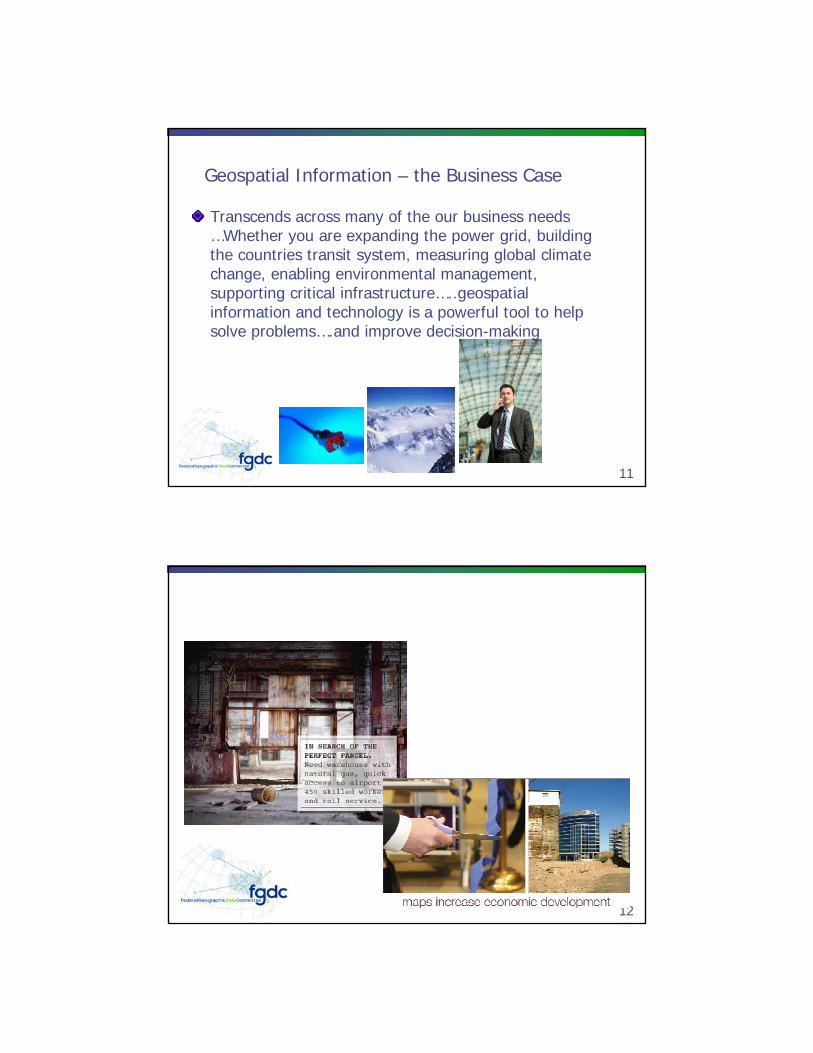
Geospatial Information – the Business Case
Transcends across many of the our business needs …Whether you are expanding the power grid, building the countries transit system, measuring global climate change, enabling environmental management, supporting critical infrastructure…..geospatial information and technology is a powerful tool to help solve problems….and improve decision-making
12

13
14

15
The Fifty States InitiativeStrategic and Business Plans serve to guide data collection and partnershipsExplanation: A fundamental part of the Fifty States Initiative is the adoption of routine strategic and business planning activities that include all of the stakeholder communities. These planning exercises bring disparate groups together to work toward common goals. Standardized templates were developed for this initiative to enhance planning efforts. Marketing materials have also been developed to help bring these planning efforts to the attention of government executivesand elected officials to obtain their help in implementing the plans.
16

17
18
TNM FY08 Data Partnerships NGP Partnership
and Mapping Contracts Funding
Partner Funding Total Project Cost
Leveraging Ratio
Imagery $1,596,902 $30,440,552 $32,037,454 20.1
Elevation $2,239,364 $21,326,959 $23,566,322 10.3
Hydrography $423,766 $1,033,766 $1,457,532 3.4
Names $253,749 $253,749 $378,749 1.5
Transportation $512,758 $6,559,542 $7,072,300 13.8
Structures $329,528 $319,295 $648,823 2.0
Boundaries $20,000 $20,000 $40,000 2.0
NSDI $311,845 $414,359 $726,204 2.3
TOTAL $5,687,912 $60,368,222 $65,927,384 11.6

19
Organized effort to acquire imagery over the entire USOrganized effort to acquire imagery over the entire USInitiated by National State Geographic Information Initiated by National State Geographic Information CouncilCouncilIncorporates current USDA and USGS programsIncorporates current USDA and USGS programsIncludes multiIncludes multi--resolution acquisition (6resolution acquisition (6””, 1, 1’’, 1, 1--meter)meter)Repeat cycles of 1 to 5 yearsRepeat cycles of 1 to 5 yearsImagery stays in public domainImagery stays in public domainConsistent national standards (e.g. image type, quality & Consistent national standards (e.g. image type, quality & security concerns)security concerns)Federal government funds standard productsFederal government funds standard products
Imagery for the Nation Initiative
20
Quantitative Benefits –Statistical Analysis
Baseline – Current State Costs10 Year Average Annual Cost: $191,714,804
IFTN – Future State Costs10 Year Average Annual Cost: $143,992,662
Delta (Current State Costs vs. Future State Costs)10 Year Average Annual Savings: $47,722,142

21
ProtectInterests of Citizens & Investors
Understand Financial
Impact of Projects
Select Best from Many Alternatives
Investment Analysis Is Investment Analysis Is a Fiduciary Responsibilitya Fiduciary Responsibilityand Public Dutyand Public Duty
22
Financial Analysis Quantifies Investment ValueFinancial Analysis Quantifies Investment Value
How long before we see
a return?
How confidentare we in the
financial projections?
Are there better
alternativesfor our money?
By howmuch?
Dobenefitsoutweigh
costs?

23
Geospatial Line of BusinessOptimizing Geospatial Information &
Technology
24
Lines of Business OpportunitiesOMB and the LoB Task Forces are focused on business-driven, common
solutions developed through architectural processes.OMB and the LoB Task Forces are focused on business-driven, common
solutions developed through architectural processes.
The following LoBs were launched inFY 2006:
•Budget Formulation and Execution•IT Infrastructure Optimization•Geospatial
Common Solutions: A business process and/or technology based shared service made available to government agencies.
Business Driven (vs. Technology Driven): Solutions address distinct business improvements that directly impact LoB performance goals.
Developed Through Architectural Processes: Solutions are developed through a set of common and repeatable processes and tools.

25
Geospatial Line of Business (LoB)
Is a government-wide initiative supported by OMB promoting effective geospatial investments and better planning and performance across the Federal government. Provides an operational framework where agencies can….plan, invest, execute, and measure
26
Geospatial LoB…
A business management approach to organize and govern our efforts….to improve planning and investment strategies…that result in common solutions that are effective and efficient… using an enterprise architecture…to serve our business needs and the citizens

27
LoBs and Services
Mapping / Geospatial / Elevation / GPS
Security ManagementRecords Management
Eco
nom
ic
Dev
elop
men
t
Edu
cati
on
Com
mun
ity
and
Soc
ial S
ervi
ces
Hea
lth
Hum
an
Res
ourc
es
Fina
ncia
l M
anag
emen
t
Nat
ural
R
esou
rces
Hom
elan
d S
ecur
ity
HHSEnergy
DHS
InteriorJustice
EPA
SBA
DefenseTreasury
Cro
ss-c
utt
ing
Ser
vice
s
Services to Citizens
Agenc
ies
Management of Government Resources
28
Geospatial LoB
GoalsGoalsCollaboration for geospatial-related activities and investments across all sectors and levels of government
Optimized and standardized common geospatial functions, services, and processes
Cost efficient acquisition, processing, and access to geospatial data and information
The Nation’s interests are served, and the core missions of Federal agencies and their partners are met, through the effective and efficient development, provision, and interoperability of geospatial data and services…
Data Classes
Features
Street
Major Road
Stream/ Water body
Stream/ Water body

2929
Common Solutions Map
30
EnhancedGovernanceImplement Performance Accountability and Compliance Mechanisms
Planning & Investment StrategyCoordinated Budget Planning, Acquisitionand Labor Cost Avoidance
Optimize & StandardizeShared and Reusable Geospatial and Geo-enabled Business Data and Services
Common Solution Framework
defin
es re
spon
sibilit
ies
and
acco
unta
bilit
y fo
r frames and implements
asset base for coordinated use
enforces coordinated lifecycle for
improves effectiveness ofdefin
e as
sets
for

31
Key Benefits Summary• Clarified performance responsibilities and
accountability
• Establishment of a more collaborative and performance oriented culture
• Multi-mission delivery capabilities
• More effective investments through increased sharing and reuse
• Nationally significant data managed as a Federal portfolio
• Better service to agencies and citizens through increased functionality and more coordinated access to geospatial information
• Improved data, services and tools
32
Geospatial SmartBUY Purchase AgreementMost far-reaching and inclusive Federal BPA for geospatial software, data, and other products May be available to state, local, and tribal governmentsProvides the foundation for optimizing and consolidating Government’s geospatial-related investmentsOffers greater transparency into Federal spendingLeverages the government's buying power to purchase commercial off-the-shelf software licenses, resulting in:
Increased accessibilityMore productsGreater discountsReduced contract administration
Common Services Work Group

33
Reducing Duplication•The Geo LOB conducted three data calls to collect data on geospatial investments and activities across the federal government
2006•Broad-focus quantitative data call•Intended to help inform writing of the CS/TA
2007• Limited focus quantitative data call• Geospatial Data and Services Priorities Survey – a qualitative data call on OMB Circular A-16 priorities
34
2006

35
2006 Approach•Conducted April - June of 2006 and covered the years 2005 to 2007
•Requested cost data and information about lifecycle-stage (e.g., development stage, or steady state project)
•Used a broad approach asking for information about:•OMB Circular A-16 data theme (e.g., Cadastral, Transportation, Vegetation, Wetlands, etc.)•Investment Type (Hardware, Software, Data, Services, and ‘Other’)•Geospatial Capability (e.g., Feature Server, Geocoder, GIS Server, Mapping Client, etc.)
3636
2006 Level of Investment
FY 2005FY 2006
FY 2007
DME
SS
Non-IT
Sub-Total
748.7811.6
768.6
294.9 306.0278.2
127.7 153.7155.7
326.0 352.0334.7
$0.0
$100.0
$200.0
$300.0
$400.0
$500.0
$600.0
$700.0
$800.0
$900.0
($M)
3 Year Total: $2.33 Billion
2006 Geospatial Data Call Summary
DME $326.0 $352.0 $334.7SS $127.7 $153.7 $155.7Non-IT $294.9 $306.0 $278.2Sub-Total $748.7 $811.6 $768.6
FY 2005 FY 2006 FY 2007
DME = Development, Modernization, or Enhancement; SS = Steady State

37
Lessons Learned from 2006• Across government, we should enhance the capability to report
geospatial investments and activities in an accurate, consistent, and less burdensome way.
• Without standard definitions and consistent agency reporting, information obtained from data calls of this sort will remain difficult to capture, be non-conclusive, and have limited utility.
• The focus of the 2006 data call was likely too broad. Future data calls should narrow the focus and concentrate on priority data sets.
• Despite data call issues, we saw that the federal government could possibly realize potential cost savings by leveraging SmartBuy or other aggregate purchasing programs.
38
2007

39
2007 Desired Outcomes• Through lessons learned from the 2006 data call, the Geospatial
LoB developed a reporting approach designed to:
•Develop a more accurate and targeted A-16 investment baseline.
•Capture current data related to future Federal enterprise data and services priorities.
•Capture additional data/service attribute requirements for high priority datasets.
•Highlight and prioritize current and future common capability requirements.
•Develop a better understanding of how agencies use A-16 data and services to meet mission requirements
4040
2007 Level of Investment
SubTotal, $602
SubTotal, $660
SubTotal,
Data, $491 Data, $530
Data,
Services, $110 Services, $130
$-
$100
$200
$300
$400
$500
$600
$700
($M)
FY 2007 Geospatial Data Call ResultsTotal Reported Investments
Services $110.43 $129.61
Data $491.50 $530.33
SubTotal $601.93 $659.94
FY 2007 BY 2008 BY 2009
$1.26 B Total in 2007 and 2008
for Selected Data sets

41
2007 Key Findings•The level of geospatial investment was relatively consistent for the three year reporting period.
•Fifty two percent (52%) of agencies reported a three year average of less than one million ($1M) per year in selected geospatial data and services investments
•As in 2006, a high degree of redundant investment types was not readily apparent in comparison with other LoB initiatives
42
Cost Data Issues• Gathering data on geospatial investment relies almost
completely on agency self reporting. Additionally, there are few geospatial investment mechanisms in federal financial and acquisition systems that allow for a reliable and accurate automated accounting of geospatial investment.
• The current designation of a geospatial investment as either Information Technology (IT) or Non-IT can have variable and arbitrary impact on whether the investment is included in a data call exercise such as this one.

43
Lessons Learned• There is a clear need to implement geospatial investment coding
mechanisms in federal financial and acquisition systems that allow for a reliable and accurate automated accounting of geospatial investment.
• It may be more effective to work on influencing lead federal agency NSDI Strategic Plans and promoting a more developed portfolio management capability than to conduct further investment analyses of agency reported investments until further investment coding mechanisms are in place.
44
Personalized Home page -MySearches

45
Recovery.gov - www.recovery.gov
Supporting the development of the American Recovery and Reinvestment Act (ARRA) of 2009, Recovery.gov siteTransparency and accountabilityManagement of application transitioned from OMB to the Recovery Accountability and Transparency Board (RATB)Request for Proposals issued to further support the geospatial capabilitiesCurrently at version 1.0, geospatial capabilities to be included in version 2.0
46

47
48
Data.gov – www.data.govPurpose: to increase public access to high value, machine readable datasets generated by the Executive Branch of the Federal Government.Catalog-based access
“Raw” Data CatalogTool CatalogGeodata Catalog

49
SummaryValue proposition and incentives are keyNo comprehensive information/data on government-wide cost savings – antidotal at bestThere are opportunities to deduce duplication when using effective planning mechanismsImplementation of standards can enhance data qualityThe public expects access to geospatial data
50
Thank You!