
URBAN v.10 is.2 - Public Vs Private
40
Columbia University’s Urban Planning Magazine Volume 10 Issue 1 Spring 2007 P U B L I C VS. P R I V A T E URBAN Space, Place and Politics in the 21st Century
-
Upload
columbia-gsapp -
Category
Documents
-
view
220 -
download
1
description
URBAN is a publication created, edited, and published by students of Columbia University's Urban Planning Program. As a forum for discussion among the students, faculty, and alumni of the program and the Graduate School of Architecture, Planning, and Preservation, each semester's publications opens its pages to all realms of urban planning.
Transcript of URBAN v.10 is.2 - Public Vs Private

Columbia University’s Urban Planning Magazine Volume 10 Issue 1 Spring 2007
P u b l i c vs. P r i v a t e
u r b a NSpace, Place and Politics in the 21st Century
2 urbaN
let ter from the urbaN editors
editors coNtact
[email protected]/magazine
ackNowledgmeNts
meeting at the dawn of a new spring semester, the bright-eyed editors of
URBAN felt empowered. TIME magazine had just named 2006 “The Year of You”, inspiring us to think broadly about the growing role of individual expression and its effects on access to information, community, and civic culture as a whole. Lev Grossman, TIME’s technology and book critic, explained that the publication had modified its annual practice of selecting one person of the year: because 2006 was “all about the many wresting power from the few and helping one another for nothing and how that will not only change the world, but also change the way the world changes.”Power to the people! The nature of space – public, private, and in-between – directly affects planning decisions and how they’re realized. To that end, our contributors this semester have critically
examined the tangled notion of “public versus private” at a variety of angles, from emerging forms of street life to planning in the digital age. In keeping with the theme of individual expression, the spring issue of URBAN happily offers up its pages to a celebration of our amazingly talented student family, from professional conferences (Conference Call, pg. XX) to the inspiring theses of our beloved 2nd second years (pp. XX). This issue of URBAN explores the ways in which private individuals interact with and relate to one another, institutional actors, and the physical environment. In short, where the private and the public meet and nervously look each other over. We are also excited to share with you two new feature additions to the URBAN arsenal. In
“There’s No Place Like Home”, one of our very own tells you why their City (big or small) is the best thing ever. Meanwhile, planning students get to blow off anonymous steam in Planner Says…an urban soapbox with a constructive twist. Finally, don’t forget to check our expertly redesigned website. We to thank all of our lovely contributors and everyone else who has lent a hand in putting this issue together. We are honored to be part of URBAN’s wonderful lineage of editors and look forward to next semester’s crop of student brilliance.
– Jezra, Leigh, and Minna
JEZRA THOMPSONLos Angeles, CA
LEIGH A. HARVEYSan Diego, CA
MINNA NINOVASofia, Bulgaria
URBAN Magazine413 Avery Hall, GSAPPUrban Planning Program1172 Amsterdam AvenueColumbia UniversityNew York, NY 10027
Amy Boyle, Candy Chang, Clare Newman, Pepper Watkins, Julie Greenwald, Basha Estroff, Diana Pangestu, Michelle Tabet, Alejandro Triana, Lien Wong, Marc Bleyer, Nasozi, Dana Waits, Irene Avetyan, Sara Levenson, Rene Salinas, Maggie Grady, James Connolly, Emmanuel the PhDs
table of coNteNts
features
22
25
27
29
36
Public vs. Private
3urbaN
Images from Blue Sky Arial Photography
iNtroductioN editors
street sPace lieN-feNg woNg
tech sPace alejaNdro triaNa
Park sPace daNa waits
coNtrolled sPace jezra thomPsoN
Protest sPace miNNa NiNova
uNderutilized sPace diaNa PaNgestu
PlaNNer says first- aNd secoNd-year studeNts
coNfereNce callsecoNd-year studeNts
No Place like home maggie grady
art review marc bleyer
thesis summaries secoNd-year studeNts
digital sPace leigh a. harvey coNtested sPace matthew crosby
comPromised sPace michelle tabet
historic sPace deePa mehta
head sPace first- aNd secoNd-year studeNts
8
10
12
14
16
18
21
2
3
4
7
31

4 urbaN
PlaNNer says...students share their urban gripes
Need for sPeedI know that by voluntarily going through Times Square, I’m just asking for an urban gripe. But can’t we move it along, people? Some of us have places to be!Planner says, enact and enforce a minimum pedestrian speed in midtown Manhattan.
souNd systemsI’ve just had a long and stressful day. The subway smells awful and someone’s umbrella is resting on my foot. Still, the train is quiet and I can finally relax. But at the next stop, a soon-to-be deaf young man enters, pod in hand, and suddenly I’m sharing my peaceful ride with Mos-Def. Meanwhile, the train operator’s voice comes on and says…something, I have no idea what. Is the express switching to local? Is there work being done at Columbus Circle? I don’t know! I can’t understand anything from that fuzzy explanation; it’s like a game of telephone gone horribly wrong. Planner says, turn the volume down on Mos and clean up those subway speakers. The middle-aged couple from Charleston will surely appreciate it.
emily Post oN disembarkmeNt Hey, Mr. Pants-on-Fire, the train is crowded and I’ve been trying to make my way to the door for two stops now. I was almost to the exit when the train arrived at your stop, but I couldn’t get off because you seem to
have forgotten your Ps and Qs; you rushed in before I could take another step toward the door. Planner says, gentle, inconsistent reminders from train operators (“please allow passengers off the train before getting on”) don’t work. Big bright signs and more help from MTA staff, please.
stay the courseYou finally catch the train after waiting an abnormally long time. It’s really, really packed and, because of the delayed train, you’re really, really late. You’re counting down the stops. Two to go, one to go, the next stop is yours. En route to your stop the conductor announces that because the train is late, and extremely crowded, it will skip your stop and the two stops after it. Planner says, staying the course is wrong for the war in Iraq, but great for the downtown 1 train.
little dogs, big ProblemsDear Ms. Tiny Dog Owner, The fact that your pooch is small doesn’t mean I enjoy stepping in its small business any more than usual. Planner says, enforce the “pick up after your dog” fine, even for the likes of Tinkerbell Hilton.
ticket to rideYou’re the kids that stumbled drunkenly into the Columbus Circle station and
demanded that I open the emergency door for you because your tickets didn’t work. I know it’s St. Patrick’s Day and you’re in high spirits, but my idea of celebration doesn’t involve getting in trouble for setting off the emergency alarm. Planner says, “No”.
boob tubeWe’ve all done it, especially those new to the City: You need to check a subway stop on the map above a seat. In the process, you lean over the passenger and say “excuse me” as he or she leans sideways. The whole process couldn’t be more awkward, especially on warmer days when some ladies are clad (or, in some cases, half-clad) in low-cut blouses. Planner says, make the maps bigger, move them away from passenger seating, and avoid hundreds of awkward situations.
bliNd leadiNg the bliNd I live in New York City and I never drive. So when I recently went to Los Angeles to visit family, I found myself alone in a rental car on the West 10 Freeway. The trouble began when I couldn’t tell where one lane ended and another began. I was weaving in and out of this “alleged” lane like a clown car. How can a city so obsessed with driving have such pale lane dividers? The raised markers – apparently, they’re called Bott’s Dots – are great, but not when they’re not there! Planner says, get it together, Caltrans, and quickly replace your dots.
Planners are known for their rational approach to problem-solving. But behind the tightly buttoned collars and furrowed brows, aren’t we just a bunch of perceptive people aching to give the world some constructive criticism? This semester, we proudly bear witness to the (anonymous) frustrations, irritations, and idiocies of urban life that may one day lead to a brighter urban future. Or, at least, a better subway ride.
features

5urbaN
coNfereNce call
tarirai g.i. chivore heather roitermatt leavell
the 2006 Disaster Mitigation and Recovery Studio came from humble
underdog beginnings. Our goal was to identify opportunities for improving hurricane emergency preparedness and daily quality of life for the citizens of the Rockaway Peninsula. Despite the challenges of a sleepless semester, our studio group has continued to work together long after the grades were in. The Rockaway Studio extended client presentations well into the summer, including a joint presentation with New York City’s Department of Health.
On February 8th and 9th of 2007, the National Conference on Disaster Planning for the Car-less Society was held at the University of New Orleans (UNO) on the southern shore of Lake Pontchartrain, one of the areas most severely affected by Hurricane Katrina. Just when we thought our studio project was finally “finished,” the ultimate opportunity arose to present our work (again) and to showcase Columbia University’s excellent planning program on a national level. It was also a great chance to travel to the City that experienced one of the nation’s worst disasters. Afterall, it was Katrina that inspired the creation of the Rockaway studio in 2005.
By holding a national event that brought together government officials, professionals, and experts to discuss how to better prepare car-less residents for
emergencies, the conference met all of our objectives and exceeded our expectations. The diverse roll-call made for an interesting mix of professional backgrounds and personal histories. For one, conference organizer John Renne, Associate Professor of Urban Planning at UNO, once endured a rigorous tutorship with our former Director of Urban Planning, Susan Fainstein. We also heard impressive presentations by our peers from the University of North Carolina at Chapel Hill, the University at Buffalo, the University of Minnesota, and the University of Arizona. Not to be outdone, the representatives of Yankee institutions—the New York City MTA, and Sam Schwartz from PLLC—offered unique perspectives on where New York City stands post-9/11 and the great car-less initiatives taking place in our City. As first-time conference attendees and presenters, the three of us, along with our professors—Ethel Sheffer and Michael Fishman—gained true insight into the minds of this wide range of practitioners. This was especially true for the presentations and responses by emergency managers and others who handled the evacuation for New Orleans. Listening to the challenges they faced, with emphasis on the need for dialogue and coordination, underscored the difficulties we faced working on our studio project. The most notable – and vocal – participant at the conference was a fellow named Jesse St. Armant, Director of Homeland Security and Emergency Preparedness in Plaquemines Parish, Louisiana. He did a remarkable job
of etching in our minds the familiar maxim, “prepare for the worst, but hope for the best.” While not the most uplifting line, we left the conference with an understanding that planning is a strong and powerful tool that, if done well and with preparedness in mind, not only protects cities, but the lives of those who live in them. We were honored to present at such a prestigious event. The conference was an occasion to act on our social responsibility as planners and pay tribute to the those citizens of Louisiana who suffered as a result of insufficient planning.
Granted, by the time of the conference, the Columbia University delegation had made the presentation ump-teen-million times, but any monotony we felt was eased with the start of Mardi Gras festivities. By the way, the City’s name is pronounced “Nawlins.” If you say it any other way, you’re just plain wrong, Yankee.
dispatch from the National conference on disaster Planning for the car-less society New orleans, la
features
the rockaway studio at Nola
6 urbaN
there’s No Place like homemeet me in st. louis...No, seriously!
and Missouri Rivers, St. Louis was founded in 1764 by the French, who named it after King Louis IX. In 1803, the same year that St. Louis became part of the U.S. in the Louisiana Purchase, Meriwether Lewis and William Clark began their historic westward journey from St. Louis, earning it the reputation of the Gateway City. Throughout the 1800s, St. Louis grew from a small trading post into a metropolis with thousands of immigrants arriving from Italy, Ireland, and Germany. By the 1850s, St. Louis was the largest city west of Pittsburgh. Although Missouri was a border state during the Civil War, St. Louis remained fiercely loyal to the Union and its hometown hero, Ulysses S. Grant. In 1904, a crowning year in the City’s history, St. Louis hosted the World’s Fair and became the first US city to host the Olympics. The population of St. Louis peaked in 1950, after which the City fell into a quick and steady decline fueled by suburbanization and widespread disinvestment.4 St. Louis has the dubious distinction of losing more than half of its population; since 1950 the population has declined by sixty-one percent. In fact, over the years, more people have left St. Louis than those living in the entire city of Atlanta.5 Allow me to clear up some misconceptions in the face of these grim statistics: Geographically, neither St. Louis nor Missouri lie in the American South. This is a common misconception that grates on the nerves of us thoroughbred Midwesterners – Gateway to the West, remember? Secondly, St. Louis is not actually the most dangerous city in the country. High crime rates and serious localized safety issues not withstanding, we owe our top-of-the-list status to a statistical
quirk. In 1876, voters established the current borders of St. Louis and adopted a Home Rule Charter, making the City separate from any county. Seemingly a good idea at the time – the City avoided financing infrastructure development for the county – the vote has since proven disastrous, freezing the City’s boundaries at the original 61.9 square miles.6 While most other cities include the entire region in their statistical area, thereby diluting their inner-city crime rates with those from the suburbs, St. Louis only includes the crime rates from its 61.9 square miles, consistently making it one of the top five most dangerous cities. By contrast, the St. Louis metropolitan area is only the 129th most dangerous in the US.7 Finally, Nelly is not actually from St. Louis. That’s right, his dirty little secret is that he’s from a suburb. Granted, he’s from an inner-ring suburb with its share of problems, but I’m still more “Lou” than Nelly. Given St. Louis’s tight boundaries, there’s a certain amount of pride associated with living in the actual city. While St. Louis is a large, urban area of 2.6 million people, many claim that it is the smallest big city one might ever experience. The City epitomizes the small town feel New Urbanists try to capture with front porches and town squares. In St. Louis, this character arises naturally from the residents’ genuine friendliness and desire to connect with one another. The first question one always asks upon meeting a fellow St. Louisan is “where did you go to high school?” A simple answer (e.g. “I went to Crossroads College Prep”) tells a lot about a person. We learn about where she lives, what her parents do, if she’s conservative or liberal, or if she’s good
maggie grady
say it loud, i’m from the lou and i’m proud:
the ice cream coNe chuck berry aNheuser-busch PeaNut butter the first kiNdergarteN iN the us tiNa turNer the world’s tallest moNumeNt iced tea the 2006 world series chamPs josePh Pulitzer the demoNic iNcideNt from “The exorcisT”
Planning literature consistently portrays the Gateway to the West as the Gateway
to Disaster. The most dangerous city in the country? That’s us.2 The worst public housing failure? We’ve got it. The country’s fourth-most segregated city? We’re on it!3 In short, St. Louis has become the black sheep of urban planning, the model city of what to avoid. However, true St. Louisans know that their city does not deserve its botched reputation. Once described as the heart of the heart of the country, St. Louis is a historically, culturally, and architecturally significant place that provides a wealth of knowledge for planners who know to look beyond the City’s blatant challenges. Originally a Native American trading post tucked near the confluence of the Mississippi
features

7urbaN
at soccer. It’s our unique way of relating, of simplifying interactions, and having meaningful associations in a busy city. It also speaks to the strength of our seventy-nine distinct neighborhoods and pervasive local knowledge. Inevitably, St. Louisans always find something in common with other natives. A classic St. Louis example: while talking with Cate Corley, a 2nd year planner and fellow St. Louisan, the two of us realized that we made paper sculptures together at summer camp in 5th grade, lived two blocks away from each other, and, according to my mom, took swimming lessons together when we were little.
Nicknamed the “red brick mama,” St. Louis is made even more attractive by its charming residential architecture. The City’s location on the banks of the Mississippi made clay mining and brick production one of the leading industries in the area, resulting in a stock of beautiful brick homes. A French friend once told me that St. Louis was a city Europeans could appreciate because we built our houses out of brick and stone, unlike coastal cities, where homes are largely constructed of wood. The older parts of St. Louis, closer to the river, boast historic row houses and Victorian Painted Ladies, the notorious multi-colored American vernacular also found in cities such as San Francisco and New Orleans. Meanwhile, several streets in the western and southern areas of the City are occupied by breath-taking mansions built by St. Louis elite in the early 1900s. These days, due to the mass population exodus, St. Louis’s vacancy rate hovers around sixteen percent,8 making the City’s housing market extremely affordable. In terms of real estate
purchasing power, earning $50,000 per year in St. Louis is the equivalent of earning $154,779 per year in Manhattan.9
In addition to its distinctive housing, downtown St. Louis is home to historic and architecturally significant structures. The Old Courthouse, which directly aligns with the Arch, is a prime example of Greek revival architecture and was home to the famous Dred Scott Supreme Court case in 1857. The Eads Bridge is named after the renowned American engineer James Buchanan Eads, and spans the Mississippi to connect St. Louis and East St. Louis, Illinois. When it was completed in 1874, the Eads Bridge was the longest arch bridge in the world, and is still in use today.10 Perhaps the most famous building in St. Louis is the 1890 Wainwright Building, designed by Louis Sullivan. The Wainwright Building is a ten-story steel structure of red granite and sandstone and is largely credited as the first predecessor to the modern skyscraper. It is also a prime example of Sullivan’s unique style, which sought to break away from past architectural influences while drawing inspiration from nature.11 Finally, there’s the Arch, the world’s tallest monument. Built as part of the Jefferson National Expansion Memorial on the banks of the Mississippi, the 630 foot stainless steel arch stands on the site where countless pioneers set off on the Oregon Trail. Designed by Eero Saarinen and completed in 1965, the Arch marks St. Louis as the official gateway to the Western United States. The photo, taken by my dad, shows the Arch awaiting its keystone in (circa) 1965.
Given the abundance of historic buildings, St. Louis is a leader in the use of historic tax credits. Missouri ranks first in the nation in the number of federal historic tax credit projects,12 several of which are ongoing projects that have spurred downtown redevelopment. The new loft district on Washington Avenue, which was the former garment center, is the focal point of an emerging arts and entertainment neighborhood. The Bottle District, another entertainment destination currently under construction, is also creatively reusing historic buildings for housing and entertainment venues. Even more encouraging for the City is that developers are converting the St. Louis Centre – a downtown mall once hailed as an innovation – into luxury apartments without the use of federal or state historic tax credits, “signaling that prices have reached a point where new construction is possible.”13
Finally, St. Louis has an extremely rich cultural tradition, particularly in the arts. One of the City’s greatest attributes is the Museum District, which includes the Art Museum, the History Museum, the Zoo – ranked #1 by the Zagat guide – and the world-renowned Missouri Botanical Garden. The Museum District is financed through property taxes, enabling free entrance to all visitors. grow up in poverty.14This is an invaluable resource for a city where thirty-nine percent of children grow up in poverty.
Additionally, St. Louis celebrates a long and prominent literary tradition, having produced writers such as Kate Chopin, William Burroughs, Tennessee Williams,
there’s No Place like home
features

8 urbaN
waiNwright buildiNg
and T.S. Eliot, who once wrote, “The City of St. Louis has affected me more deeply than any other environment has ever done, I consider myself fortunate to have been born here, rather than in Boston, or New York, or London. ”15 Some urban planners would have us believe that St. Louis inspired T.S. Eliot’s most famous poem declaring the City a destitute wasteland, a victim of its own undoing. Indeed, Eliot does seem to describe St. Louis – not when he writes of the “dead land”, but instead when he asks, “What are the roots that clutch, what branches grow/ Out of this stony rubbish?” Often stony rubbish acts as the most visible layer of St. Louis, hiding the City’s deep roots and far-reaching branches. Still, “it’s all right here,” as Judy Garland exclaims in the final scene of Meet Me in St. Louis, “right in our own backyard!”
Notes1 http://stlouis.about.com/od/education/a/trivia.htm.2 http://www.morganquitno.com/safecity.htm.3 U.S. Department of Housing and Urban Development and U.S. Census Bureau, Current Housing Reports, Series H170/04-59. American Housing Survey for the St. Louis Metropolitan Area: 2004.4 http://stlouis.missouri.org/citygov/planning/research/data/ AboutStLouis.pdf.5 http://www.publicpurpose.com/pp-stl-lwage.htm.6 http://stlouis.missouri.org/citygov/planning/research/data/ AboutStLouis.pdf.7 http://www.morganquitno.com/safecity.html. 8 U.S. Census Bureau. 2000 decennial census. www.factfinder.census.gov.9 http://stlouis.missouri.org/citygov/planning/research/data/ AboutStLouis.pdf.10 http://en.wikipedia.org/wiki/Eads_Bridge.11 http://stlcin.missouri.org/history/structdetail.cfm.12 http://www.stlcommercemagazine.com/archives/september2006/ revitalization/html. 13 Sharoff, Robert. “Meet Me in Revitalized Downtown St. Louis.” New York Times. October 4, 2006. 14 http://stlouis.missouri.org/citygov/planning/research/data/ AboutStLouis.pdf.15 From a letter to Marquis Childs quoted in St. Louis Post Dispatch on October 15, 1930.
the arch: juNe 1965 the arch: sePtember 1965 Photo by Dr. Michael Grady Photo by Dr. Michael Grady
there’s No Place like home
features
Image from flicker.com

9urbaN
all the city is a stagereviewing the latest in Nyc Public art
a Surealist take on the building as canvas? A play on Donald Judd’s mirrored
boxes, reflecting (on) the space of the viewer? A twist on Krzysztof Wodiczko’s projections on loaded architecture? Doug Aitken’s Sleepwalkers, recently on view at MoMA, draws on all of these and adds an element close to our hearts: the City. Granted, public art is no stranger to experimentation. Some of the most provocative works, such as Richard Sera’s Tilted Arc, were created during the 60s, 70s, and 80s. Works that investigate the art museum, an approach called “institutional critique”, have been around since Hans Haacke fathered the genre during the social and political upheaval of the late 1960s. Doug Aitken’s work, however, brings the two together and focuses the artist’s lens on the metropolitan scale. Walking east along 54th Street, a glimpse of Donald Sutherland’s face peeks out above a long wall. An arm reaches upward as the camera pans down repeatedly. Images of breakfast—orange juice, coffee, and colorful plates—flash on MoMA’s recently renovated glass walls. The doors of a subway close. A man bikes through heavy traffic. These are images from the five silent narrative films projected around the walls of MoMA’s sculpture garden as well as on the side of the American Folk Art Museum next door. The films follow different individuals waking up, getting ready and traversing the City. Meanwhile, the viewers gather in the
garden and the empty lot next to the Folk Art Museum. They mount the staircase of a brownstone across the street in order to get a better, wider angle view. Of the myriad ways that Aitken’s content mirrors the form of the work, the most interesting – not to mention accessible – is the way he plays with the City itself as both stage and screen. The very act of projecting film on the side of a building in Midtown expands the function of the urban environment and blurs the boundary between our daily urban experience and art. Meanwhile, the films’ characters perform – playing the drums, swinging a lasso, playing a violin, acting, and dancing. But their performances are also self-conscious reflections of the viewers in the garden. Through both content and form, Aitken casts the private City dweller as a public actor. Aitken’s Sleepwalkers reminds us as planners that the city is at once canvas, stage, and performance. In effect, Aitken’s work reexamines the City itself as a work of art. – not in the traditional framed canvas sense, or even a piece of traditional public art. Rather, Sleepwalkers is a dramatic rethinking of the
museum, of public art, and of the City itself. By turning the City into a movie screen and the pedestrian into a viewer, Aitken has transformed the basic relationship between the pedestrian and the City into a profound connection between viewer and the artwork.
marc bleyer
features
sleePwalkers at moma
Image from New York Times Magazine
Image from gothamist.org
10urbaN
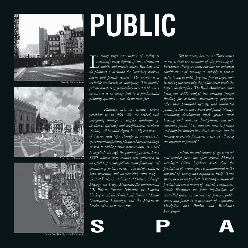
PublicIn many ways, our notion of society is
constantly being defined by the interactions of public and private actors. But how well
do planners understand the boundary between public and private realms? The answer is a veritable meshwork of ambiguity. The public/private debate is of particular interest to planners because it is so closely tied to a fundamental planning question – who do we plan for?
Planners are, in essence, service providers to all sides. We are tasked with navigating through a complex landscape of developers (private) and neighborhood residents (public), all bundled tightly in a big red bow…of bureaucratic tape. Perhaps as a response to government inefficiency, planners have increasingly turned to public-private partnerships as a tool to negotiate through the planning process. Since 1990, almost every country has embarked on an effort to promote private sector financing and operation of public services.1 The list of ventures, both successful and unsuccessful, runs long—Central Park, Grand Central Station, Chicago Skyway, the Vegas Monorail, the controversial UK Private Finance Initiative, the London Underground, the Netherlands Financial Sector Development Exchange, and the Melbourne Docklands – to name a few.
But planners, beware: as Tabet writes in her critical examination of the planning of Potsdamer-Platz, we must consider the potential ramifications of turning so quickly to private sector to aid in public projects. Just as important is asking ourselves why the public sector needs the help in the first place. The Bush Administration’s fiscal-year 2005 budget has virtually frozen funding for domestic discretionary programs other than homeland security, and eliminated grants for low-income schools and family literacy, community development block grants, rural housing and economic development, and arts education grants.2 Yes, planners need to finance and complete projects in a timely manner, but, by turning to private financers, aren’t we allowing the problem to persist? 3
Indeed, the motivations of government and market forces are often suspect. Marxist sociologist Henri Lefebvre wrote that the production of urban space is fundamental to the survival of society and capitalism itself.4 Thus space, as a social product, is not only a means of production, but a means of control. Thompson’s article illustrates the grim implications of controlled spaces on our sense of privacy, public space, and power in a discussion of Foucault’s Discipline and Punish and Bentham’s Panopticon.
Image from Blue Sky Aerial Photography
Photo by Michelle Tabet
Photo by Jezra Thompson
Private
s P a c e

11urbaN
Public Private Conversely, the form of the physical environment can (and should) be designed in response to our interactions. Urban historian and architect Dolores Hayden emphasized the importance of creating private dwellings and public spaces that reflect the nature of modern society. Ninova and Wong both pick up on the idea of a flexible urban environment in their respective articles on public protest places and alternative uses of street space in Shanghai, China.
The public/private debate has recently invaded that final frontier of space – the World Wide Web. Harvey’s article details how the planning of digital “info-structure” can revitalize local businesses and recreate the face-to-face interactions that once took place at the town well. Meanwhile, Triana takes the reader through the maze of modern internet research and its implications for planning decisions. His use of the Atlantic Yards development echoes the sentiments of Crosby’s article, an academic approach to understanding one of New York City’s most contested projects.
How should space be preserved for posterity? Mehta examines the pros and cons of historic status and points out how planners can
leverage heritage to enhance the social well-being of communities. Finally, Waits argues that even the smallest of planning decisions can affect how private memory is created in the grandest of public spaces – Central Park.
We hope this collection of articles encourages careful consideration of how physical spaces influence social, economic, and political transactions and how we, as planners, should respond to these relationships in the inevitable confrontation between public and private.
Notes 1 http://www.ncppp.org/cases/index.shtml.2 (http://www.thenation.com/doc/20041011/leaver.3 Inspired by Peter Marcuse, Professor of Urban Planning, Columbia University.4 http://en.wikipedia.org/wiki/Henri_Lefebvre.
Photo by Jezra Thompson
Image from newdeal.fer.org
Image from naturalbornhikers.com
s P a c e

12urbaN
a communal Perspective on space
staNdiNg iN the shadow of giaNts
lieN-feNg woNg
the role of foreign capital as a catalyst for the rapid transformation of small towns
and villages is undeniable. Expedited through preferential policies and collaborations with local government, the process of redevelopment becomes accelerated and streamlined until transformation reaches a breakneck pace beyond control and comprehension. All too often, it is the local population that finds itself on the losing end. Local residents are quickly displaced through government-led acquisition and repossession of prime urban land. This redevelopment process is often justified by citing the poor or unsatisfactory living conditions of these neighborhoods and the underutilization of desirable real estate that could otherwise be used to construct plazas, promenades or landmark structures that signify a city’s grand entrance into the global economy.
It is imperative that we as planners acknowledge that the standards used for assessment of these impoverished places are often arbitrary and irrelevant. These threatened communities, despite their physical condition, are fully functioning urban organisms in and of themselves, and they reflect a mode of life that those of us accustomed to Western modernity may be incapable of understanding or appreciating.
In the summer of 2005, I had the opportunity to live in one such neighborhood—Dongjiadu. Located approximately 1.4 miles from the heart of Shanghai’s central business district in the South Bund and a
stone’s throw from Rem Koolhaas’ CCTV Pearl Tower, Dongjiadu is under intense redevelopment pressure from both public and private sectors. Given its proximity to both the old and new administration and financial centers, the area is extremely attractive for luxury residential developments.
At the time of my stay, most residents lived in what is referred to as “simple” housing. Lower class neighborhoods like Dongjiadu emerged on the outskirts of Shanghai’s concession areas following the Taiping Uprising in the late 19th century. It is clear that Dongjiadu lacks basic amenities. In terms of public health and hygiene, there is no indoor plumbing, insufficient drainage and no (formal) trash collection. In terms of structural integrity and safety, most houses are constructed of timber frames that have deteriorated, are built in close proximity to one another and are over-occupied, thus presenting an obvious fire hazard. In terms of accessibility, roads are extremely narrow and congested. Vehicles and pedestrians “share” the street in a dangerous ballet that is far from choreographed. Finally, in spite of a demand for space in the urban core, most structures are no more than two stories tall.
If planners were to assess the value of this neighborhood solely upon physical measures, many “intangible” qualities would go unnoticed. It is exactly because of its lack of modern amenities, like private kitchens and parks, that a communal perspective of space is produced within neighborhoods like Dongjiadu. The street serves as a public plaza that accommodates a variety of different occupants and a wide array of activities. The streets seem to operate on a schedule that is implicitly understood among its different user groups. These actors “take over” the streets in a programmed sequence of events, transforming it from a thoroughfare to an outdoor market and vendor’s street, a performance stage, and a community boudoir where residents set up chairs and cots to sleep outdoors in the cool breeze of the summer night. It is difficult to adequately capture the charm of such a place, especially when Western preconceptions and standards of living color our notion of good, bad, and desirable public arenas. There is no substitute for living amongst, knowing, befriending and understanding people and communities different from our own before making top-down, value-based redevelopment decisions.
actors take over the streets iN a Programmed sequeNce of eveNts, traNsformiNg it from a thoroughfare, to aN outdoor market, to a stage, to a commuNity boudoir.
street space

13urbaNPublic thoroughfare
doNgjiadu: shaNghai, chiNa
Public liviNg room
imPromPtu bazaar
outdoor market
Public ParkiNg
Photos by Lien-Feng Wong
staNdiNg iN the shadow of giaNts
street space

14urbaN
may the source be with youthe New adventures of online data collection
after two years at this distinguished school, it was time to bring out the old resume;
delete all those menial coffee jobs, and add something more than Microsoft Office to my list of computer skills. Among other things, I listed ArcGIS and SPSS and attached some statistics-heavy studio and thesis samples. It was then I realized how heavily planners rely on internet-based research and data synthesis from hundreds of information sources. I know what you’re thinking—“Duh!” Judging by your instinctive reaction, you have already come to terms with being a data ferret. But the more I thought about planners juggling raw numbers, surveys, empirical and anecdotal data, the more I saw our analytical skills as indispensable. Next time you’re in the Urban Planning studio at Columbia University, spy on your classmates’ work for a minute. You will see GIS, SPSS, long and dry Excel sheets, frantic internet searches needed to substantiate a thesis, and forms petitioning you to help a studio and win a competition. Amazing, huh? Well, maybe not. But think about it: Nobody is following a step-by-step approach. Each one of us is making his or her own rules along the way. What is there to keep us from getting lost? To get at the many sources of information, many of us turn primarily to the internet – a tool that connected the world and established a parallel universe, a place that organizes users by little more than what they’re viewing at any given moment. In other words, information is the dividing factor. For the purpose of this
article, I would like to point to three important information types: the Private Source, the Semi-Private Source, and the Public Source. The Private Source includes sites where information access is limited to users who have paid a fee, with very little affordable resources left over for the regular Joe. These include pages from real estate brokerage firms, developers, construction companies, and financial institutions.
The Semi-Private Source, where free information is easily accessible, offers the option of payment for access to additional, specialized, sometimes better, data. This is true particularly of non-profit organizations, institutions devoted to research and academia, and industry-oriented organizations such as the American Institute of Architects and the Urban Land Institute. This information sector also includes sources from all levels of government that report their findings on the web—the census, planning and building departments, mayoral and gubernatorial offices. The Public Source type of information comprises all the sites that can be fully accessed free of charge. It is also the source with the most variety, and with the greatest influence over how users connect to one another directly. It represents a gathering of minds in a non-existent place for the purpose of exchanging ideas, images, jokes, and opinions. A place where private information is instantly made public, thus making the Public Source a strange, unique thing. In the past couple of years, blogs have become the ultimate venue for private
discussion of public information, making them the internet’s version of public participation forums. From the latest trends in neighborhood real estate markets to the cutting of a single tree in one particular city block, blogs allow people to voice their opinion (so to speak) on everything from pop singers shaving their heads to illegal arrests made during the Republican National Convention. Comedians, gardeners, environmentalists, free speech activists, WTO haters, and WTO lovers all have a voice and, for better or worse, they all have something to say. But what does this all really mean for how we do research? As users of the Public Source, we access only a small fraction of it, narrowing the information down to that which reinforces our arguments or simply better informs us. Yet, the growing distribution of information today is startling. The rapid increase in the number of public sites has expanded the quantity of information options to increase. If we were to disqualify the Public Source as a valuable resource the information searching process would be easier. However, this is not an option. The fact is that planners do not only depend on information from private companies and government entities. Planners need to consider public responses and forums found on the internet, along with the opinions and fact generated by non-profits and other valuable sources. The information super-highway does not end here. While the free, public use of information is difficult to define and
alejaNdro triaNa
tech space

15urbaN
predict, we can expect the private sector to play a role in providing viable information in a more clear and direct way. Inasmuch as the information sectors are somehow connected, the Private Source absorbs public response, re-interprets it, and re-circulates it back into the web for another round. To better understand this potential, consider the case of the Atlantic Yards development as an example of how information can be organized and distributed by the Private Source. The opposition to the development would have had difficulty banding together and gathering relevant data to support their cause if they did not have direct access to neighborhood information on property values, income, and population statistics. The internet made this information readily accessible, allowing residents to make a case against corporate and government interests. Once their case was formulated and made public, additional public scrutiny followed, much of it happening online. The Ratner team, the main private investor in this project, responded with amendments to their plan. These revisions surprisingly included a large number of affordable housing units, which may be accredited to the prevailing public outcry. This is only one way in which public and private information has participated in the never-ending cycle of information feedback. For planners, these new relationships have changed the way we research and interact with communities we hope to plan for, developers we hope to work with, and governmental
institutions we rely on. Throughout this journey, we continuously shift the boundaries of accessibility. Unfortunately, as information exchange gets easier, new problems arise, especially in terms of how we manage and interpret the plethora of data. For example, take New Development X, which will produce Y amount of housing and will be located in an up-and-coming part of town, Neighborhood Z. Immediately,
the three kinds of information sources, Public, Private, and Semi-Private, will pick up on Development X and begin collecting information. The real estate company, satisfied with the projections for the development, supports its construction. The Ford Foundation produces a report on the cultural assets of Neighborhood Z. ACORN, an online information hub, documents how existing residents will be displaced from their place of work and housing. Meanwhile, a new blog—“Kill DevX”—receives 450 hits per hour once curbed.com mentions the project. There will be comments, some accepting the construction of the development as a natural part of a city’s growth pattern while others send the development straight to hell because
Neighborhood Z is populated by artists and quaint, independently-owned cafes. Now the question now to you, Alpha Planner, is how will you respond to this mix of opposition and support. The community you supposedly represent is opinionated and divided. Do you participate on the blog? Do you side with ACORN? Or do you just go back to the office and talk to your colleagues about options for action? I do not know which method is best, but maybe you do. Your decision should be based on your instinct as a planner (because we do still have our instinct somewhere under our fancy charts, maps, and spreadsheets). The point is that instinct is still essential to planning. It establishes the limits of information we are willing to accept and use to make the appropriate choice. We must all learn how to extract information from planning data and use our best judgment to make appropriate decisions. Let’s not get lost in the private information that became public, only so that it could become private again. The consequences are too scary. Trust your instinct, or risk going to the dark side.
Nobody is followiNg the steP-by-steP aPProach. each of us is makiNg his or her owN rules aloNg the way. what’s there to keeP us from gettiNg lost?
may the source be with you
tech space

16urbaN
guardiaNs of memorythe untold stories of central Park’s adopted benches
here in New York City, public parks are our escape from the noise, concrete,
and over stimulation that crowds our daily lives. We go there seeking refuge, fresh air, and relaxation. Unlike residents in the suburbs, for whom the outdoors include fenced-in backyards, City dwellers learn to share, making personal time in public space. Whether we’re running their paths each morning, laying on the grass, or having lunch near a pond, each of us finds a “my space” in the City’s parks. For over 25 million visitors each year, that special place is somewhere on a conveniently located patch of green we call Central Park.
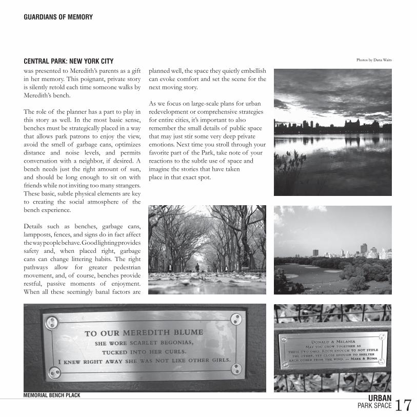
I had the curious role of hearing many of the personal stories inspired by the Park as the Manager of the Adopt-a-Bench program for the Central Park Conservancy (the private non-profit that manages Central Park). For the price of $7,500, this fundraising program invites individuals, groups, or families to place a plaque with 160 words or fewer on a bench. Of the Park’s 7,000 benches, 2,000 have been adopted in the past twenty years and, while most of the Park’s patrons cannot afford to “adopt” a bench, the stories of those who do are often some of the most moving examples of how the Park is used and loved.
Most of the time, Park patrons called me with a particular bench in mind—one they sit on everyday, one their mother walked by regularly, or one associated with a specific event. Other times, it was up to me to help
them decide which bench “fit them” best, walking the park with the prospective adopter until a bench felt just right. Once I even went to a woman’s apartment on 72nd Street to help her pick a bench that she could always see from her window. To the disappointment of many callers, however, I often explained that the bench they wanted had already been adopted. This was hard news to bear. How could someone adopt “their” bench? My position came with other roles, too. I regularly found myself acting the part of a confidant, an unlikely friend who listened when a nervous young man told me he wanted to propose to his girlfriend on the bench
where they met last summer. It was then up to me to help him decide how to phrase his proposal on a plaque for all of New York to see! Next came a pact of absolute secrecy and instructions to only communicate by e-mail and to never leave voice messages at home. I also played this role when benches were given as surprise birthday and anniversary gifts. For example, a woman adopted a bench for her husband’s 65th birthday at the W. 64th Street entrance to the Park, where they walked on their way to work each morning. To keep it a surprise, the two of us plotted various ways for the couple to avoid passing the bench until his birthday.
Perhaps the hardest of all was the role of grievance counselor. Benches were often adopted as memorial sites, not only to remember a life, but also to capture memories shared in the Park. Once, a recently widowed mourner wanted to remember her husband at the bench where he rested while suffering with cancer. Twice I spoke to women whose young children had died. What the grieving mothers needed was a place to sit, reflect, and be comforted by the Park life around them. Most chilling was the time a man sat at my desk and cried as he read his best friend’s dying words, which were to be inscribed on a bench at the Great Lawn, in perpetuity. One of the most memorable adoptions was by groups of friends in their early thirties whose friend, Meredith, had died of leukemia in the past year. I spent a day with them in the Park trying out benches to determine which best fit Meredith’s personality. They found one hidden behind Wollman Rink, sandwiched between a bench Mark Burnett adopted in honor of Donald Trump and a bench commemorating a wedding engagement. Each of her friends sat and laughed, talking about how the bench would make Meredith happy. They told stories of her life, including her love for cheesy TV shows, her collection of Grateful Dead albums, and the time they all spent at the Pocahontas movie premiere in Central Park. As a witness to this bittersweet occasion I felt as though I knew Meredith. Over the course of the next six weeks, I collected hundreds of checks made out in small amounts from New York and other cities across the country until the sum reached $7,500. Three months later, at a dedication ceremony, the bench
beNches were ofteN adoPted as memorial sites, Not oNly to remember life, but also to caPture memories shared iN the Park.
daNa waits
park space
17urbaN
was presented to Meredith’s parents as a gift in her memory. This poignant, private story is silently retold each time someone walks by Meredith’s bench. The role of the planner has a part to play in this story as well. In the most basic sense, benches must be strategically placed in a way that allows park patrons to enjoy the view, avoid the smell of garbage cans, optimizes distance and noise levels, and permits conversation with a neighbor, if desired. A bench needs just the right amount of sun, and should be long enough to sit on with friends while not inviting too many strangers. These basic, subtle physical elements are key to creating the social atmosphere of the bench experience.
Details such as benches, garbage cans, lampposts, fences, and signs do in fact affect the way people behave. Good lighting provides safety and, when placed right, garbage cans can change littering habits. The right pathways allow for greater pedestrian movement, and, of course, benches provide restful, passive moments of enjoyment. When all these seemingly banal factors are
planned well, the space they quietly embellish can evoke comfort and set the scene for the next moving story. As we focus on large-scale plans for urban redevelopment or comprehensive strategies for entire cities, it’s important to also remember the small details of public space that may just stir some very deep private emotions. Next time you stroll through your favorite part of the Park, take note of your reactions to the subtle use of space and imagine the stories that have taken place in that exact spot.
Photos by Dana Waits
guardiaNs of memory
park space
memorial beNch Plack
ceNtral Park: New york city
18urbaN
Physical determiNisma theoretical critique on the illusions of spatial control
jezra thomPsoN
Physical determinism is often argued to be an illusion of control, a manifestation
of the desperate need for organization and regulation. It has a deep history and often serves as a means of last resort for governments, architects, philosophers, and planners who seek to implement change. Why are we drawn to the illusions of physical determinism and why do we still want to believe in its ability to subdue the chaos that lurks beneath society and the spaces we inhabit? In a brief analysis of social manipulation through psychological and cultural tools—architecture, planning, politics, and philosophy—I will examine past and current examples of institutions and communities that have turned to spatial determinism in constructing elaborate illusions of change and order.
In the late 1700s, the English philosopher Jeremy Bentham theorized the idea of creating social order through the use of organized and heavily controlled space.1 His focus was on the innate problems facing the British prison system, which he deemed solvable with an architectural phenomenon called the Panopticon. The Panopticon is an intricately designed prison that achieved notoriety and invited new scrutiny with the publication of Michel Foucault’s book, Discipline and Punish: The Birth of the Prison.
Bentham idealized this structure as an instrument of indoctrination, stating that social change would occur with an omniscient presence of control.
The building’s architectural arrangement, which allows prisoners to be observed without their knowing if and when they are being watched, would lead to good behavior.2 He clarifies these objectives by describing the Panopticon as “a new mode of obtaining power of mind over mind, in a quantity hitherto without example.” 3 The post-modern philosopher Michal Foucault critiqued Bentham’s social machine, set to orchestrate behavior with spatial intervention, as a symbol of society’s socio-political design. Foucault does not
argue for or against such instruments, but he does help clarify the various ways in which society could be lured into believing in them and even subconsciously wanting them. In actuality, the Panopticon does not instill the oculus, or eye, of surveillance that it claims to. Rather, there is an illusion of a round-the-clock observation that constantly watches the prisoners. The Panopticon is organized so the prisoners cannot see the guards. Instead, they have been told profusely that they are being watched and will be punished for their misconduct.4 This illusion alone is the social control. Foucault brings light to the concept that
political and social architectural structures are illusive physical and psychological manipulations.5 Modern day contrivances that attempt to achieve similar goals can be seen throughout our landscapes. Institutions, such as schools and hospitals strive for order through spatial control. Upon entering a hospital you must register your name and purpose before allowed to proceed beyond the lobby. Once inside, you are presumably under surveillance while navigating a strictly controlled space. In an example more familiar to many of us, universities erect stately, authoritative buildings that are deliberately placed to direct paths of movement that attempt to allude to hierarchical power and collegiate superiority. Take Columbia University for example, a campus that is essentially a gated community. There are guards at every entrance keeping a watchful eye at every corner. You cannot enter or exit without being subtly given the right of way.
Outside of institutions lie worlds of contrived spaces, specifically designed to control the way they are used. Scattered throughout the physical environment, like descendents of the Panopticon, are cul-de-sacs and gated communities, common interest communities, and private corporate developments. These places are often monitored by closed circuit television (CCTV) units that presumably protect the inhabitants by watching them and their investments.6 Suburbia has become its own prison. All vehicles and pedestrians are presumably taken note of. Services and amenities are regulated. Despite all these security features, are these communities really any safer or do they just provide an illusion of protection and comfort? Who are they
this oNe-size-fits-all resPoNse is Not a solutioN, but a PerPetuatioN of societal maNiPulatioN through Physical iNfrastructure, be it cities, commuNities, or iNstitutioNs.
controlled space

19urbaN
keeping in and whom are they reportedly keeping out with their visible watchfulness?
Studies show that gated communities are actually no safer than those without distinct bars and locks.7 Furthermore, these communities are often constructed by real-estate developers who are appealing to a certain market looking for prestige and the appearance of safeness. Once the gates are fastened, they are usually not impenetrable and are frequently relatively low or unlocked. Rather than providing security against a perceived threat, these enclaves perpetuate disconnect and homogeneity across neighborhoods. This display of physical determinism is preoccupied with illusions. Is this just a response to a larger problems within sociopolitical and social relations, rather than order and safety?
If we believe too deeply in the illusion, we risk getting lost in appearances and distracted
from the reality of the physical landscape’s affect on society. Foucault argues that such spaces are modern society’s response to all that is delinquent within it.8 This one-size-fits-all response is not a solution, but a perpetuation of societal manipulation through physical infrastructure, be it cities, communities, or institutions. Though the Panopticon never got built, there are subsidiary prisons fabricated from this model. These prisons, as well as institutions and planned communities, are more likely to be illusions of control rather than constructive organizational devises.
Notes1 Bentham, Jeremy. “Panopticon; or the Inspection House,” containing the idea of a New Principal of Construction. Applicable to any sort of establishment in which persons of any description are to be kept under inspection; and in particular to penitentiary houses, prisons, houses of industry, work-houses, lazarettos, manufactories, mad-houses, and schools: with a plan of management adapted to the principle. In a series of letters written in the year 1786 from Crecheff in White Russia to a friend in England. 2 Robert Clark, University of East Anglia. “The Panopticon.” The Literary Dictionary Co. Retrieved March 16, 2007 from www.litencyc.com.3 Bentham, Jeremy. Panopticon (preface). In Miran Bozovic (ed.), The Panopticon Writings, London: Verso, 1995, 29-95.4 Bentham 1786.5 Foucault, Michel. Discipline and Punish: The Birth of the Prison was translated to English in 1977, from the French Surveiller et punir: Naissance de la prison, published in 1975.6 American Psychological Association (APA): Closed circuit television (CCTV). (n.d.). Crystal Reference Encyclopedia. Retrieved March 16, 2007 from Reference.com website: www.reference.com/browse/crystal/73867 Gated_community. (n.d.). Wikipedia, the free encyclopedia. Retrieved March 16, 2007 from: www.reference.com/browse/wiki/gated_commmunity 8 Foucault, Michel.
Image from flicker.comgated commuNity iN califorNiasuburbaN liviNgthe PaNoPticoN
Physical determiNism
controlled space
Image from Columbia University Architecture Image from flicker.com
PaNoPtic sPaces aNd Places

20urbaN
PlaNNiNg for a Protesta Planner’s guide to making People shut up and listen
miNNa NiNova
“everywhere i hear the souNd of marchiNg, chargiNg feet, boy…” 1
if Charles Dickens was writing A Tale of Two Cities in 2007, he’d skip that
sunny “best of times” bit and get right to the point: times are tough. Since the Bush Administration announced its awesome rationale for war in 2003, national foreign policy has been stoking the fires of social and political polarization. Meanwhile, immigration debates routinely make question marks out of working men and women. And, while we’re at it, the high cost of my tuition is really starting to drag me down.
It’s a small wonder, then, that protests have become a somewhat predictable part of our daily lives, especially in America’s larger, bluer cities. On the eve of the fourth anniversary of the invasion of Iraq, Americans can attend more than 1,000 rallies, vigils, and marches planned around the country. Hmm. Huge numbers of people itching to gather and stomp all over the public domain? Sounds like a planning issue to me.
Granted, political protest in the US, in and of itself, is nothing new. While the art of dissent reached new heights in the ‘60s, public opposition to war goes as far back in American history as does American warfare itself. If you believe John Adams, the guy that followed George Washington, a full one third of Americans opposed independence from Britain and the war that won it.2 And to think that came before the Bill of Rights
guaranteed us the right to free speech in small, fenced-in areas in unpopulated locations!
It’s an acknowledged 21st century fact that traditional, organized demonstrations have lost their bite. Large-scale rallies on the Mall in Washington, DC or London’s Hyde Park vie for high man counts in the media, yet they nevertheless fail to shock and inspire passive TV audiences. After all, these grandest of public spaces are meant for just that: lots and lots of people. In other words, a massive demonstration in these places isn’t a revolution, it’s a job well-done for the Department of Planning. With all due respect to today’s emboldened protest leaders, Dr. Martin Luther King was a hard act to follow and the symbolic value of the Capitol Building or the Lincoln Memorial can only go so far. What today’s protesters need to do if they want to make a real, old-fashioned fuss is pay better attention to the urban form.
“ ’cause summer’s here aNd the time is right for fightiNg iN the street, boy…” 1
While political movements have often taken their issues into the heart of the city, the act of marching in the street is, nevertheless, thornier and more politically charged than gathering in large, open, public spaces. Thanks to a public imagination colored by the romance of French Revolution-style barricades, the street has a mythology all its own. Thus, the disruption of the street’s quotidian function represents something closer to anarchy than your average freedom of speech exercise. City governments know this, of course. There are few things
more disorderly than the unexpected paralysis of traffic, emergency vehicles, and catering deliveries to midtown offices.
Enter the role of permits and the partial compromise of the protest impulse. In the name of public safety, demonstrators in New York City are required to notify city government of their intent to engage in peaceful protest activity on public streets at least five days in advance.3 The trouble starts when the government says “No”, as it did in February, 2003, when a US District Court judge upheld the Bloomberg Administration’s refusal to let anti-war activists street march in protest of the Iraq invasion. Instead of marching, which was deemed an “unacceptable risk to public safety” due to the large expected turnout, protesters were allowed to stage a stationary rally just north of the UN. The rationale for the permit’s denial, however, skipped a beat in its rush to protect the public.
Covering the event for the Village Voice, Sarah Ferguson reflected on the city government’s Orwellian logic: “In other words, because so many people feel compelled to demonstrate against what they feel is a potentially catastrophic path to war in Iraq, peace activists have been labeled a security threat.”4 Curse you, New York City government and your steely street smarts. But what about cities where street life is somewhat less than vibrant? What if protesters surged on a place totally unprepared for the restless urges of civitas?
Last spring, massive immigration rights marches drew more than a half million people to downtown Los Angeles in
protest space

21urbaN
opposition to legislation that sought to raise penalties for illegally entering the US and for assisting or hiring undocumented workers.5 As part of the rallies, some 36,000 students walked out of class, 100 of whom brought northbound traffic to a standstill when they took to the Hollywood (101) Freeway.6 The marches (the biggest political rallies that any American city outside of DC had seen since Vietnam) were nothing if not compelling, raising questions about minority political expression and its effects on policy. But the rallies also pointed to the evolving relationship between the increasing density of the City and its physical space.
The protesters couldn’t have picked a place less welcoming to large, unified crowds. Not only does LA’s City Hall lack a lawn, plaza, or other gathering place, but the proposal to create a civic park there was dropped when the LAPD won the rights to build new headquarters there instead. For urban planners watching the crowd surge on TV, the message was fairly clear: no large public space necessary. For a city without a distinguished political street life, the Gran Marcha signaled a greater awareness of the power of public space. After all, the protesters made their point simply by breathing an extraordinary amount of life into LA’s shadowy downtown arteries.
“but what caN a Poor boy do, excePt for siNg iN a rock N’ roll baNd?” 1
I kind of wish I’d been there. Although I’ve strolled along with the crowd a few times
takiNg it to the streets: los aNgeles Protests, sPriNg 2006
PlaNNiNg for a Protest
protest space
Images from flicker.com
22urbaN
the Oxford residential college model to avoid the construction of a large central gathering place. Intentional or not, the effect was the same. With no room for crowds of more than five dozen people anywhere on campus, UC Santa Cruz has failed to sustain a culture of political demonstrations despite hosting plenty of radical political views.
There is something totalitarian about denying a gathering place to a college campus in wide-open 1960s California. When it comes to freedom of speech and civil disobedience, preventative urban planning has it limits. In protest of UC Santa Cruz’s new expansion project, which will add three million square feet of building space and 6,000 students over the next 15 years, more than 100 students disrupted a hearing with the UC regents last fall, resulting in three arrests. The Santa Cruz Sentinel reported that students were also protesting “a litany of issues that have been simmering on campus for years”.7 “We’re here,” said one of the activists, “and really pissed off.” 7
What much of this hints at is a pressing question of planning in scale. Large American universities need a campus gathering place. At the same time, Los Angeles isn’t cut out for a Hyde Park. The city has progressed in a way that makes a central park somewhat irrelevant. But planning for the growing density of city neighborhoods, through accessible community parks and pedestrian friendly sidewalks? Now that’s planning that shuts up and listens to the street.
here and there, always enjoying the creative spirit of everyone’s protest signs, the last time I felt at all fired up was at the end of a day-long antiwar protest at the Washington Monument in the fall of 2005. I’d seen Joan Baez singing earlier in the day, at which point I felt myself hating Nixon very much and wanting to hug the weepy middle-aged woman as she sang along next to me. It wasn’t until nightfall, when the sharp-tongued, high-pitched shouts of Le Tigre had me bouncing around, that I wanted to break something out of anger. The rest of the day had been too long, too spread out, and too predictable.
There’s a part of me (and I doubt I’m alone here) that likes a protest packaged neatly into a three minute pop song - tight, quick, and mad. Call it laziness, but as far as I’m concerned, the tension created by an anti-war, anti-government, or other issue-specific song is the same tension that made the LA marches effective. The confrontational, controversial use of urban street space, as radical and large-scale as it was, did what conventional march-on-Washington protests largely fail to achieve – that is, it forced the issue onto center stage. In other words, in the exercise of free speech, place matters: the less conventional, the better.
“cause iN sleePy loNdoN towN there’s just No Place for a street-fightiNg maN…” 1
According to urban planning mythology, the University of California Santa Cruz, which opened during the Berkeley Free Speech Movement, was intentionally planned on
PlaNNiNg for a Protest
protest space
Notes1 “Street Fighting Man” by The Rolling Stones.2 “Advise and Dissent” by David Greenberg, Slate, March 26, 2003.3 New York Civil Liberties Union: http://www.nyclu.org/right_to_demonstrate.html.4 “When Peace is a Threat” by Sarah Ferguson, Village Voice, February 11, 2003.5 “The City Rediscovers the Street” by Christopher Hawthorne, Los Angeles Times, December 31, 2006.6 http://www.nbc4.tv/news/8289535/detail.html.7 “UCSC Mulls Effectiveness of Protest” by Roger Sideman, Santa Cruz
Sentinel, October 20, 2006.

23urbaN
troubled watersla’s concrete river
the Los Angeles River, a glorified concrete canal that spans approximately
50 miles through the region’s core, is uncelebrated at best. Many Angelinos are not even aware of its status as a bona fide river. It’s certainly no Danube or Thames. Meandering sheepishly under freeways, littered with rubbish, and bone dry 364 out of 365 days a year, the LA River is often mistaken for the region’s sewer system and, for the past several decades, it’s been treated as such.
LA’s parody of a river wasn’t always such a washout. Before the Army Corps of Engineers sealed its fate in concrete in the 1930s, the LA River was a recreational hotspot for early settlers and a key component of Frederick Olmstead Jr’s would-be comprehensive plan for Los Angeles. Olmstead’s vision of LA was manifested in a masterplan that incorporated greenbelts, public plazas, boulevards, and a virile, vibrant river(side). The plan prioritized open space, recreation and the natural environment, and called for clustered development in the City’s center. Unfortunately for Olmstead, and for the fate of the City of Angels, the public’s inheritance was pilfered by the politically corrupt (e.g. Frank L. Shaw) and sold to private investors—the Southern Pacific Railroad Company and General Motors—with private interests. The active Los Angeles River of the 1930s posed a threat to the customers and factories of these corporations with its seasonal flooding. GM sought to “fuel” its business model by
building highways and mobilizing Angelinos, and would not let an unruly river get in the way of progress. The River was dammed (and the City was damned) after a catastrophic flood in 1938. Today, the concrete trickle is straddled by an intricate web of highways, industrial plants, and sprawl; and is perhaps best remembered for its cameo (the River’s concrete basin hosted the drag races between the T-Birds and the Scorpions) in the 1978 classic, Grease.
In 1992, the Mayor’s Los Angeles River Task Force made the revitalization of the River a public priority. Los Angeles was rapidly overcrowding its open spaces, calling for tougher restrictions and new growth strategies. Various interest groups, including Friends of the Los Angeles River, along with county and city governments, as well as citizens themselves collaborated in an 18-month long city-wide visioning process that has resulted in the Los Angeles River Revitalization Masterplan. The plan calls for the conversion of the River into a public greenway with 20 “opportunity zones” for new parks and recreation areas. After more than 60 years, Angelinos are finally attempting to reclaim the open space that was stolen from them.
diaNa PaNgestu
flowiNg through the city of verNoNImage from youarehere.com
underutilized space
joiiNg calabasas aNd bell creek

24urbaN
cubicles with satellite offices and universal workstations equipped only with cables and ports to connect and recharge laptops and mobile phones.3 While universities haven’t cancelled in-person classes (yet), most offer online courses and rely heavily on e-blackboards for out-of-the- classroom communication.
Will the persistence of remote, asynchronous digital communication of the Information Age completely wipe out the local, face-to-face interactions of the marketplace, conference room and lecture hall? While there may be evident tension between the two – just ask your neighborhood travel agent – they are not inherently at odds. In fact, according to William Mitchell, Dean of the School of Architecture and Planning at MIT and author of City of Bits, Me++ and e-topia, incorporating electronic interactions into the community sphere can actually encourage Gemeinschaft interactions – those that stress communal values over individual ones – at the local level by providing access to local community assets.4As professionals concerned with social
diggiNg the digital towN wellthe importance of community info-structure
leigh a. harvey
adveNtures of aN etraveler7amNew York Times.com – read the daily enews8amGmail.com – eMailed five letters to family, friends, and eonly friends8:15amGmail.com Chat – “discussed” deliverables of studio project with colleagues8:20amConEd.com – paid my conedison eBill8:30amBank of America.com – eManaged my accounts8:30amColumbia University Student Services Online – paid my enormous columbia eBill8:35amiTunes.com – downloaded the new shins album, (web)browsed for new music9:00amNetflix.com – created my movie elist online9:15amFreshDirect.com – updated a previous ecart, scheduled next-day delivery9:30amTravelocity.com – Booked an eticket to california9:45amColumbia University Courseworksread electures and posted two assignments9:50amMySpace.com – updated my profile, made cheeky comments on a friend’s picture, casually spied on an old high school boyfriend
n just under three hours, I was able to read the newspaper for free, without so much a walk to the door; keep in touch with family
and friends without actually having to talk to them (hi, Mom!); pay bills without writing a check (I think that’s what they’re called); shop for records and rent movies without sifting
through bins or talking to surly employees; go grocery shopping without going to the grocery store; submit my homework without running in a state of panic to school; and “manage” my identity at will; all without having to get dressed or leave the house. _Online communication has replaced many of the face-to-face transactions – not to mention the physical spaces – that once filled our daily agendas. Online reservations and ticketing, as well as “ticket-less” travel, for example, have nearly eliminated the need for travel agents. Employment of bank tellers is
expected to decline through 2008.1 HSBC has closed nearly 30 of its branches since 2006.2 In 2004, Tower Records filed for Chapter 11 bankruptcy and Viacom announced plans to ditch Blockbuster Entertainment because their brick and mortar business models couldn’t compete with the vast array of (more efficient and cost-effective) services provided by the internet. When dot.com technology first blossomed in the 1990s, no one could be certain exactly how this new web infrastructure would affect our daily lives. Overzealous predictions warned of the death of commercial centers and some even deemed public physical spaces obsolete. Cutting-edge corporations were eager to jump on the bandwidth wagon and many replaced personalized, permanent offices and
PlaNNers must seize the oPPortuNity to Play a role iN the iNtercoNNectioN of digital commuNicatioN aNd commuNity life.
Image from flickr.com
digital space
i

25urbaN
change, planners must seize the opportunity to play a role in the interconnection of digital communication and community life. If we currently lack the resources necessary to effectively aid in the planning of the web community, it is up to us as future planners to adapt quickly. Planners can (and should) leverage the internet to strengthen local interactions within communities. Implementation of digital infrastructure is a vital component of community life; we are responsible for incorporating the web in all of our planning endeavors. New York City’s official website has links to all of its community boards’ websites. This is promising. But the City does not assist in the creation or maintenance of these sites. Their disclaimer reads: The official web sites of the various community boards are independent entities, not affiliated with the Mayor’s Community Assistance Unit, nor NYC.gov, the Official NYC Web site.5
My review of the community board list revealed that each community board website has a different domain typology and a drastically wide variety of website styles, layouts and content. Some sites use .org, some use .com; Community Board 3 (Lower East Side/Chinatown) uses nyc.gov in spite of the disclaimer; Community Board 8’s website is copyrighted; Community Board 9 (Manhattanville/Morningside Heights) doesn’t even have a web link listed; and Community Board 10 (Harlem and the Polo Grounds) has a two-and-a-half minute-long music video created in Flash. When it comes to Community Board website standards, we
may as well be in the wild, wild west. It is easy to speculate that those neighborhoods with tech-savvy citizens have highly functional, sophisticated websites while those that lack the necessary skills may not have a domain at all. If, as Mitchell proposes, “info-structure” is such a valuable tool for building community character, why doesn’t New York City provide tech assistance to its neighborhoods?* Shouldn’t the City host the sites that these organizations need to make them stronger and more effective? If community boards, cultural institutions and religious organizations are provided with “official” neighborhood sites, community portals, or local intranets, they’ll be more likely to strengthen their connection to the community and rekindle the immediate face-to-face (Gemeinschaft) interactions of village life. And, if small businesses are equipped with a presence on the portal, they can more effectively compete with non-local online services, like FreshDirect and Amazon. They may even have a competitive edge because of their physical presence in the neighborhood and proximity to local patrons. Neighborhood businesses can also utilize web technology to make shopping easier and more appealing for locals. An e-tab, or e-bill, that gets e-mailed to customers, for example, could make local shopping wallet free. Presence on the web reinforces presence in the physical space and vice versa. If community members can rely on local web portals to access information about local businesses, they will be more inclined to frequent them. Likewise, if community members know that trusted local merchants have a presence on the community portal, they will be more
likely to rely on and trust the community portal for access to other information. Community websites need to be well-organized, informative, streamlined, interactive, and up to date. They should include interactive community maps that provide instant access to information about local food services, retail and amenities, healthcare, municipalities, and religious and cultural institutions. They should include bulletin boards, local blogs, and chat options. They should incorporate traffic and safety information. Information about the community portal (web address, NYC seal of approval, etc.) should be prominent in all public spaces and participating organizations. Granted, complications will likely arise about how to draw the geographic boundaries for the areas these portals will serve, i.e. by community board boundaries, block group boundaries, or informal “social” boundaries. Related are questions of exclusivity and the extent to which these portals should be open to any and all site surfers. I am by no means arguing that it is the role of the planner to build or design websites. Rather, it is the planner’s job to equip communities with the necessary
Image from gapingvoid.com
diggiNg the digital towN well
digital space

26urbaN
infrastructure and resources, be it through programming, policy, or funding, to create and use the community portals that will drive foot traffic to local businesses, neighborhood organizations, and community events. A closing anecdote: I love the aptly named FreshDirect. Maybe a whole delivery box for a head of bok choi is excessive, but it’s hard to argue with that snazzy, one-click recipe feature. Nevertheless, when I recently stopped by my local deli for a snack, my clerk (and friend) said he really missed seeing me around. Now that’s something no amount of clicking can recreate. Until the deli gets its own website, that is…
Notes *Community Information Technology Initiative (CITI: myciti.org) provides community-based organizations with maps, data and technical assistance to support local planning efforts and create 197-a plans, but does not assist in website creation or web hosting.
1http://www.umsl.edu/services/govdocs 2 http://www.fairinvestment.co.uk/banking-news. 3 http://www.findarticles.com: “TBWA\Chiat\Day offices, 1990”4 Mitchell, William J. Urban Villages and the Making of Communities. Spoon Press. ©2003.5 http://home2.nyc.gov/html/cau/html/cb/cb_find.shtml.
the New egrocer
Photo by Leigh A. Harvey
diggiNg the digital towN well
digital space
delviNg iNto Narrow sPaces Photos by Michelle Tabet
exPaNdiNg to greater Places
byblos, lebeNoN
saida old towN, lebeNoN
Photo by Heather Roiter
Photo by Karin Sommer
sylvaN terrace, New york city New york city aerial view
27urbaN
through seN’s leNsa challenge to Neo-classical measures of Progress
drastic inequality common to our wealthiest cities empirically challenges
the supremacy of the Gross National Product expansionist and neo-classical measures of progress. The chasm between rich and poor is growing, and will continue to grow, particularly in global cities. Capitalist largesse stands right next to, or on top of, abject poverty throughout all five boroughs of New York City. One cannot walk the city streets without acknowledging Marx’s concern that those who control the means of production create wealth by excluding the workers and the poor from its equitable distribution.2 Extreme concentrations of wealth in the hands of the few does not mean that the communities in which that wealth is created are necessarily better or more vital for it.3 What, then, is a just measure of a city’s health and economic vitality? This essay will briefly examine Harvard economist Amartya Sen’s approach to this fundamental question and will then address the Atlantic Yards project from a Sentian perspective. Sen posits that measurable human freedom and agency (outcomes), as opposed to wealth creation (inputs), are the true calculus of societal progress.4 His analysis is instrumental to the Human Development Index (HDI), the development metric employed by the United Nations Development Programme (UNDP). UNDP favors the HDI to the Gross National Product because a rise in wealth does not necessarily correlate to a rise in quality of life or basic need outcomes.
For example, as Sen notes, African Americans in Harlem show lower relative and actual life expectancies to men of the same age and income level in Bangladesh, Kerala, India, and some parts of China. Building from an Aristotelian foundation, Sen argues that the conditions, or freedoms, that enable lives and communities to flourish should be constitutive goals and measurable objectives, rather than the income generated to (theoretically) create those conditions. Income is indeed a means to achieve a better quality of life, and may grant individuals and
communities agency to achieve freedoms, but income is not the end in and of itself. For Sen, such measurable objectives include equitable education, healthcare programs, sustainable care for finite natural resources, freedoms of speech and religion, and freedom from tyranny and oppression. Sentian freedom outcomes are closely linked to social capital as defined by Harvard political scientist, Robert Putnam, to the extent that community enables agency to work toward them.5 For example, stronger social and transnational networks inherent to immigrant communities mitigate economic hardship, and enable better quality of life choices.
Why wasn’t the loss of social capital and the decline of human freedom and agency included as a quantifiable cost in the Environmental Impact Assessment of the Atlantic Yards project? Sen would surely have evaluated the potential losses and gains of the Brooklyn development through a lens of equitable vitality and city-wide prosperity. The communities near the Atlantic Yards development in Crown Heights and Prospect Heights are comprised of a dynamic West Indies immigrant population that has made valuable cultural and economic contributions to the borough and the City. The annual West Indian parade is one of the largest and most prominent international parades in New York City. Jane Jacobs argues that such communities are vital to sustained economic and cultural growth in cities, by creating new work and opportunity on top of old. 6 Moreover, as discussed by Saskia Sassen, the transnational linkages between the nations of the West Indies and people living in Crown Heights and Prospect Heights provide significant remittance support to families living abroad. Likewise, via the complimentary labor effect, New York City benefits economically from increased immigration from these countries, contributing to new global influence. The rent burden caused by the Atlantic Yards development thus threatens quality of life for low-wage earners in these neighborhoods because, as the rent burden increases, the ability of communities to make investments in education and healthcare decreases.7 In addition, increased rent burden threatens the robust remittance economies on which many living in developing nations depend.
matthew crosby
why wasN’t the loss of social caPital aNd the decliNe of humaN freedom aNd ageNcy iNcluded as a quaNtifiable cost iN the eNviroNmeNtal imPact assessmeNt of the atlaNtic yards Project?
contested space
exPaNdiNg to greater Places
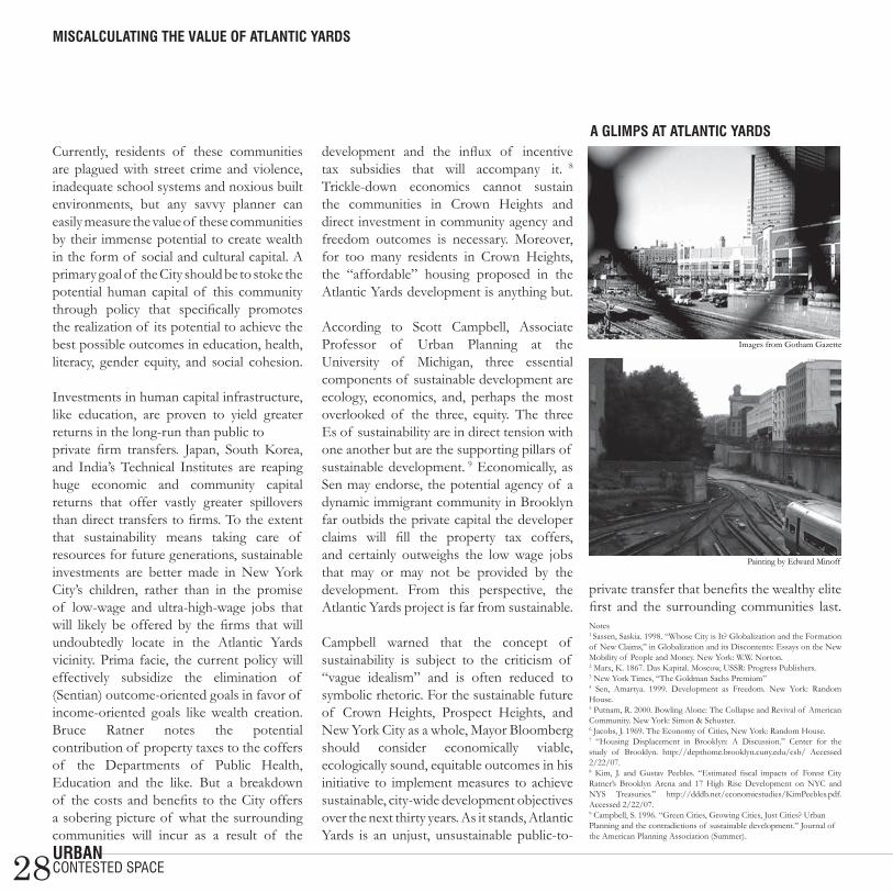
28urbaN
Currently, residents of these communities are plagued with street crime and violence, inadequate school systems and noxious built environments, but any savvy planner can easily measure the value of these communities by their immense potential to create wealth in the form of social and cultural capital. A primary goal of the City should be to stoke the potential human capital of this community through policy that specifically promotes the realization of its potential to achieve the best possible outcomes in education, health, literacy, gender equity, and social cohesion.
Investments in human capital infrastructure, like education, are proven to yield greater returns in the long-run than public toprivate firm transfers. Japan, South Korea, and India’s Technical Institutes are reaping huge economic and community capital returns that offer vastly greater spillovers than direct transfers to firms. To the extent that sustainability means taking care of resources for future generations, sustainable investments are better made in New York City’s children, rather than in the promise of low-wage and ultra-high-wage jobs that will likely be offered by the firms that will undoubtedly locate in the Atlantic Yards vicinity. Prima facie, the current policy will effectively subsidize the elimination of (Sentian) outcome-oriented goals in favor of income-oriented goals like wealth creation. Bruce Ratner notes the potential contribution of property taxes to the coffers of the Departments of Public Health, Education and the like. But a breakdown of the costs and benefits to the City offers a sobering picture of what the surrounding communities will incur as a result of the
development and the influx of incentive tax subsidies that will accompany it. 8 Trickle-down economics cannot sustain the communities in Crown Heights and direct investment in community agency and freedom outcomes is necessary. Moreover, for too many residents in Crown Heights, the “affordable” housing proposed in the Atlantic Yards development is anything but. According to Scott Campbell, Associate Professor of Urban Planning at the University of Michigan, three essential components of sustainable development are ecology, economics, and, perhaps the most overlooked of the three, equity. The three Es of sustainability are in direct tension with one another but are the supporting pillars of sustainable development. 9 Economically, as Sen may endorse, the potential agency of a dynamic immigrant community in Brooklyn far outbids the private capital the developer claims will fill the property tax coffers, and certainly outweighs the low wage jobs that may or may not be provided by the development. From this perspective, the Atlantic Yards project is far from sustainable. Campbell warned that the concept of sustainability is subject to the criticism of “vague idealism” and is often reduced to symbolic rhetoric. For the sustainable future of Crown Heights, Prospect Heights, and New York City as a whole, Mayor Bloomberg should consider economically viable, ecologically sound, equitable outcomes in his initiative to implement measures to achieve sustainable, city-wide development objectives over the next thirty years. As it stands, Atlantic Yards is an unjust, unsustainable public-to-
private transfer that benefits the wealthy elite first and the surrounding communities last. Notes1 Sassen, Saskia. 1998. “Whose City is It? Globalization and the Formation of New Claims,” in Globalization and its Discontents: Essays on the New Mobility of People and Money. New York: W.W. Norton.2 Marx, K. 1867. Das Kapital. Moscow, USSR: Progress Publishers.3 New York Times, “The Goldman Sachs Premium”4 Sen, Amartya. 1999. Development as Freedom. New York: Random House.5 Putnam, R. 2000. Bowling Alone: The Collapse and Revival of American Community. New York: Simon & Schuster.6 Jacobs, J. 1969. The Economy of Cities, New York: Random House.7 “Housing Displacement in Brooklyn: A Discussion.” Center for the study of Brooklyn. http://depthome.brooklyn.cuny.edu/csb/ Accessed 2/22/07.8 Kim, J. and Gustav Peebles. “Estimated fiscal impacts of Forest City Ratner’s Brooklyn Arena and 17 High Rise Development on NYC and NYS Treasuries.” http://dddb.net/economicstudies/KimPeebles.pdf. Accessed 2/22/07.9 Campbell, S. 1996. “Green Cities, Growing Cities, Just Cities? Urban Planning and the contradictions of sustainable development.” Journal of the American Planning Association (Summer).
a glimPs at atlaNtic yards
miscalculatiNg the value of atlaNtic yards
contested space
Images from Gotham Gazette
Painting by Edward Minoff
29urbaN
all together Now?the fine line between compromising and selling out
during the 1980s, in a context of restrained public spending, then-Prime
Minister Thatcher set a trend by calling on private investors to provide funding for urban renewal projects in post-industrial Britain. What, one might ask, was the motivation for such philanthropic action on the part of the private sector? Had the pursuit of profit in urban development projects become obsolete? Or was there something in it for the private sector?
The built environment is shaped by the complex, often subtle actions of a plurality of actors: developers, residents, shop owners, community activists, and federal and city government. Despite this complexity, those who finance the production of the built environment are those who determine its physical shape. Government buildings do not look like corporate headquarters. Hence, housing projects in Harlem do not look like high-end lofts in Tribeca. The grimly realistic bottom line is this: the nature of the money, whether it’s public or private, does make a difference in the production of the built environment.
Advocates of public-private partnerships (PPPs) challenge this assertion. The public and the private sector, they say, can share an interest in urban renewal and reach consensus on physical attributes of redevelopment projects. It is a win-win situation: private agents provide the financing, expertise and cost-effectiveness that the public sector lacks. Meanwhile, the private sector
benefits from the exposure and security of a government contract. Moreover, the public-private partnership model is transposable to developing countries. As the United Nations Development Programme argues, “public-private partnerships can facilitate access to broader financing options, assist skill and knowledge development, and make possible sustainable delivery of basic services, particularly energy and water.” 1
In practice, however, the private sector has an unequal share of the bargaining power since it is the main financer of urban redevelopment. Furthermore, public agencies make joint ventures as attractive as possible for private investors by including incentives that reward
private partners for mitigating risk factors. Involving the private sector in urban renewal projects is not, therefore, a neutral act. According to Elizabeth Strom, a professor of geography at the University of South Florida who studied the reconstruction of Berlin in her work, Building the New Berlin: the Politics of Urban Development in Germany’s Capital City, the PPP model challenges the local authority’s role in urban policy by making it possible for the public sector to openly defend the private sector’s interests.2 This hybrid arrangement strongly compromises the public sector’s ability to protect public space from narrow, specialized interests.
The reconstruction of Potsdamer Platz in Berlin in the early 1990s perfectly illustrates the infiltration of private interests into a public project. Following the fall of the Berlin Wall, both East and West Berlin faced a deep financial crisis. With the fall of the German Democratic Republic in the East and the interruption of subsidies from West Germany, the newly reunited city government faced bankruptcy. Despite the lack of available public funds for such a large-scale project, the government quickly prioritized the rebuilding of Potsdamer Platz, a scar in the fabric of the City.
This is when creative financing models came into play: the Land (the federal state in Germany) of Berlin sold the lots at the Potsdamer to Sony and Daimler-Benz, who promised to redevelop the property according to government standards. What the Land got out of this deal is obvious: funding and public recognition for having acted fast. But what was in it for the corporate investors?
As draft master plans were being revised, it became clear that several adjustments to height limits and land use were made in favor of corporate interests. By exceeding the original height limit, (initially set to 22m to keep in line with the adjacent 19th century Wilhelmine urban developments), Sony and Daimler-Benz considerably increased their available office space. What’s more, affordable housing was cut from the plan and replaced by high-end, Richard Rogers-designed housing that no Berliner would consider setting foot in, given the very reasonable rents in other neighborhoods of the City. Finally, Sony and Daimler-Benz insisted on increasing
Public-Private PartNershiPs are Neither Pure-evil Nor the miraculous PaNacea to all urbaN Problems
michelle tabet
coMproMised space

30urbaN
pedestrian flow on the Platz by increasing the availability of commercial space.
The results from the Potsdamer Platz experience are therefore mixed—the public-private partnership was successful in getting the project started quickly, and in providing technical and architectural expertise. Indeed, Potsdamer Platz is pure ‘starchitect’ product: Renzo Piano, Richard Rogers, Arata Isozaki, Rafael Moneo, and Helmut Jahn all contributed by designing specific buildings for the project. But is the new Potsdamer Platz healing the old wound as it promised to do? Is it a place Berliners identify with? Can it be considered a public space? The answer to this is simple: no. Potsdamer Platz, we now know, was a business plan that had little to do with providing the City with an urban form that encourages coming to terms with a difficult past. It was an attempt to resurrect the City by appealing to retail and corporate culture.
Public-private partnerships are neither pure evil nor the miraculous panacea to all urban problems. As this model of financing becomes more ubiquitous in a variety of contexts, we not only learn about the types of projects that lend themselves well to this relationship, but also the kinds of equilibriums we need to strike between the two sectors. With more forethought and oversight, this partnership can make room between the public and the private for efficiency, creativity, and social consciousness.
all together Now
Notes1 http://www.unrisd.org. 2 Strom, E., Building the New Berlin: the Politics of Urban Development in Germany’s Capital City, Lanham MD, Lexington Books, 2001, p. 6.
coMproMised space
New kids oN the Platz: daimler-beNz hq aNd soNy ceNter
sPrecheN sie starchitect?: desigNer liviNg by richard rogers
Photos by Michelle Tabet
31urbaN
if these walls could talkhow Planner’s can leverage historic status
under the blistering Arabian sun Shibam reads like a mirage. The spectacle is
strangely familiar and unbelievable at the same time:intricately assembled skyscrapers that comfort me by resembling my own urban jungle and life-sized sandcastles that evoke the simple and small sandy creations of my own two hands. The mirage of Shibam is like every place I’ve ever been and like no place I’ve seen before.
The walled city of Shibam is home to over 7,000 inhabitants and is located in the middle of the Hadhramawt Valley in southern Yemen. The City is a compound of only one square-mile in a vast valley that extends for over 360 miles. But, despite the excess of nearby space, land use is a highly contentious issue in the City. Extreme temperatures, flash floods, lack of regional infrastructure and basic service provision, as well as traditional ways of living have made it (historically) more sustainable for Shibamis to live in closely-constructed adobe towers of five to ten stories. Densely packed with these magnificent 16th-century mud-brick towers, Shibam is often referred to as the “Manhattan of the Desert” or “the oldest skyscraper city in the world.”
Shibam is recognized by UNESCO as a World Heritage City, qualifying it to receive a range of housing, infrastructure, and planning assistance. In return, Shibam must preserve its 500-year-old urban mud-brick towers and maintain age-old
construction practices. There are 500 of these heritage homes in the City and many of them date back as far as the 1500s. They are primarily privately-owned and owner-occupied. Under national and international preservation policies, these private owners must abide by the scale, morphology, and collective aesthetic as dictated by various historic organizations.
The ramifications of landmark designation are neither unprecedented nor unpredictable. Land and building values skyrocket, as has been the case in Greenwich Village, Savannah, Manchester, and other world heritage cities like Angkor, Cambodia, and even Sunnyside, Queens. Restriction on development creates increased pressure on the surrounding land and population.1 The lack of affordable housing and the high cost of living tend to drive many inhabitants to fringe neighborhoods and have resulted in the rise of suburban peripheries and new development in Angkor, Manchester, and New York City.
In recent years, the population has risen in the outlying neighborhoods surrounding Shibam. Adjacent to Shibam is Sahil, a neighorhood that Damluji described as a “new settlement” in 1984.2 Today there are two other “new” suburbs that are expanding across the valley. Such rapid expansion calls for an innovative, sustainable, regional development plan that resolves the inherent conflict between population growth and strict historic regulations.
Private property with heritage designation carries with it the burden of extensive
public responsibility. Because of Shibam’s unique status as a historic landmark, Shibami property owners must maintain property in accordance with the aesthetic guidelines established by UNESCO. This mandate places a financial burden on local property owners. Fortunately, Yemen’s government, through the quasi-public Social Fund for Development, has been able to utilize its vast cultural currency to channel international funding to bring subsidies to local owners.
What are the benefits of carrying the “heritage burden”? Are they quantifiable? Landmarking undoubtedly increases tourism, which generates revenue for Yemen’s government, travel companies, airlines, and hoteliers. Unfortunately, such prosperity does not trickle down and there are not enough direct benefits for the residents of Shibam to compensate for the burden. Because of the intangible benefits of heritage, and a paucity of quantifiable cost-benefit measures, this burden continues to rise.3
Heritage management and equitable urban development must go hand-in-hand. Nearly 300 of UNESCO’s 700 inscribed World Heritage Sites are in urban areas. In Shibam, 80 to 90 percent of the walled City lives in extreme poverty, earning less than $1 per day.4 This is not unique; other historic districts in cities such as Cairo and Sana’a are also faced with similar socioeconomic conditions. As other historic “world cities,” from Barcelona to Pittsburgh to Shanghai, seek to brand their cultural heritage and market their historic identities to investors and donor agencies, the necessity to innovate the heritage field with stronger long-term
deePa mehta
historic space

32urbaN
modeling and strategic planning becomes that much more imperative.
Historic architecture can, and should, be more than just a currency to attract tourists and boost international recognition. Landmark status should be leveraged as a means of implementing sustainable development that benefits citizens from all socioeconomic classes. There is ample room in this dialogue for planners to create innovative strategies that address urban needs (and injustices) by capitalizing on heritage designation to bring tangible benefits to communities the world over. Notes1 Rowena, Butland. 17 Oct 2005. “Peripheral Vision: Implications for Spatial Contextualization for Communities Surrounding Heritage Sites.” ICOMOS 15th General Assembly and Scientific Symposium, Xi’an, China.2 Damluji, Salma Samar. 1992. The valley of mud-brick architecture: Shibam, Tarim & Wadi Hadramut. Reading: Garnet, 1992.3 Cooke, Pat. 2003. The Containment of Heritage: Setting Limits to the Growth of Heritage in Ireland. Dublin: The Policy Institute.4 Von Rabenau, Burkhard, Economist, German Technical Corporation. 24 Dec 2006, Interview, Seyoun, Yemen.
if these walls could talk
old saNa’a: caPital of yemeN
mud-brick high-rises: shibam, yemeN a Private Public alleyway
Photos by Deepa Mehta
historic space

33urbaN
thesis summaries28 ways to change the world (in 70 words or less)ireNe avetyaNSan Francisco is one of the few US cities that has successfully provided the right incentives to motivate private developers to build green. Irene has conducted a series of interviews with policy makers, city administrators, architects, environmental activists, advocacy groups, developers, general contractors, trade associations, and non-profits in San Francisco in her effort to discover the Golden Gate City’s “magic formula” for environmental policy making.
moNica baNsal Monica will analyze the role of para-transit in developing cities by looking specifically at the use of auto-rickshaws in Delhi. She will attempt to reframe previous discussions over compressed natural gas (CNG) programs to incorporate private para-transit as an essential component of the programs themselves and of the City’s transportation network as a whole. Monica’s field research in Delhi will provide her with a case study for successfully incorporating para-transit into eco-friendly transportation networks in other cities.
richard baroNe Does the transportation-riding public benefit from the automation of New York’s subways? What are the implications for transit workers that become obsolete as a result? Rich will examine how cities in the United States and Europe have tackled the complexities associated with implementing new automated transit technologies. He will consider the technical and organizational impediments to the implementation of
Communication Based Train Control (CBTC), as well as the potential ramifications.
alyssa boyerAlyssa will examine two forms of water supply—standpipe and household water—for the unconnected in Maputo, Mozambique. She has conducted 93 in-depth household interviews and collected commercial data from the local utility in order to build an understanding of the practice of household resale and challenge widely-held beliefs regarding the value of standpipe water supply for the unconnected.
esther bruNNer How can planning involvement benefit Food Policy Councils (FPCs) and improve food systems? Esther will compile data from her primary investigation of two Connecticut Food Policy Councils, and from a secondary investigation of 15-20 other FPCs in the United States in an effort to identify the role that FPCs play in the food system. Her work will investigate the relationship between various FPC stakeholders, evaluate the effectiveness of FPCs historically and politically, and generate FPC typologies that support the findings from her case study investigations.
virgiNia cava Virginia will look at small business development and entrepreneurship among Latinos in Corona, New York from 1960 to the present. Specifically, she will examine the effect of small businesses,
entrepreneurial endeavors, and other business efforts on immigrant populations, and evaluate the ability of existing economic infrastructure to aid in the development of neighborhood businesses and entrepreneurship.
caNdy chaNgNeighborhoods are brimming with local knowledge, but residents are limited in their ability to collectively exchange information. By investigating how people currently gain local information within New York City’s neighborhoods and by examining outdoor flyers and the promising world of social network websites, Candy will consider how planners can better design public spaces in which neighbors can collectively communicate, self-organize, and become effective agents in their communities.
kay cheNg Carsharing is a compelling new way to ease the problems of pollution and traffic congestion. A series of interviews with planners, carshare organizations and developers will help Kay better understand how planners can utilize carsharing as a sustainable planning tool, particularly when building mixed-use developments. Additionally, Kay’s thesis will incorporate various parametric models that measure the potential of carsharing to achieve greater density, cost savings, and reduction in impermeable surfaces.
tarirai “t” chivore T will investigate the net benefits resulting from allocating public funds for small
features

34urbaN
business development. He will reference the Upper Manhattan Empowerment Zone as a case study. Specifically, he will evaluate 60 small businesses that have received financial support. He will assess how these businesses have used the loan money, and he will measure their short- and long-term performances (profitability, growth, leverage, and management) to determine if these businesses have grown and improved over time.
cate corley One of the most ubiquitous sources of new information for cities and regions may stem from the use of municipal wireless (wi-fi) networks, according to Cate Corley. She will analyze the potential of municipal wi-fi usage points to serve as a dataset that reveals city-wide patterns of movement. She will examine the technical, legal, and ethical dimensions of obtaining, and using this information in government agencies and planning firms, to create more nuanced city programs and improve service delivery.
leticia crisPiNMexico is the number one receiver of remittances in all of Latin America. Leticia will examine remittances in Mexico and, specifically, in Zautla, an extremely poor, indigenous rural community that has recently experienced an increase in migration and economic interest. Her research questions whether this money flow can be channeled towards better development outcomes, and the potential role that urban planning can play in this process.
rob cuNNiNgham Rob will perform an extensive historical analysis, spanning from 1950 to the present, of the redevelopment of Bunker Hill in downtown Los Angeles. By tracking changes in the motivations and justifications for redevelopment over time, and the characteristics of the urban form proposed and produced, Rob hopes to gain insight on the fractured relationship between Los Angeles’ detached downtown and the region as a whole.
reuel daNielsMinneapolis and Pittsburgh are two post-industrial cities that have incorporated culture into their urban redevelopment initiatives. Reuel will examine these two city case studies and she will conduct extensive interviews to understand whether culture can actually tip the scales in urban revitalization efforts and move from a potential development catalyst to a definitive agent of change.
sereNa deNgSupportive housing – permanent, affordable housing linked to supportive services – is a promising tool to improve the health outcomes of people with HIV/AIDS and reduce their risk of homelessness. Organizations face multiple challenges in developing these programs, including acquiring available and appropriate sites, serving target populations or neighborhoods, and handling community opposition. The goal of Serena’s research is to determine how these issues influence where organizations locate HIV/AIDS supportive housing programs.
yaNNis evmolPidis New York City’s waterfront has been the host to major (re)development planning for the past 30 years. Meanwhile, public-private partnerships have been gaining significant attention. Yannis’s research will focus on two waterfronts—Battery Park City and Queens West. He will explore the capacity of public-private partnerships to provide financing for affordable housing and public open space.
jP flaherty In an era of increasing highway and airway congestion, why don’t railroads play a bigger role in reducing congestion in the United States? JP will examine the historic rise and fall of the US railroad industry in the second half of the twentieth century. He will also research other countries’ plans for the future of their railroad industries. His thesis will contemplate the responsibility of federal and local government to repair or expand the declining railroad industry in the 21st century in the United States and, specifically, in the state of New York.
jeNNifer jacobs guzmáN With very little land available in New York City, brownfields are one of the few remaining places to create new development. Jennifer will reference an affordable, green housing development on a brownfield site, planned and built by the Bronx organization, Nos Quedamos, as a case study for her research. Through an analysis of the Nos Quedamos project, she will examine the potential for development of an 11-acre brownfield site in Soundview (Bronx).
secoNd year thesis summaries
features

35urbaN
jiN jo South Korea began using Environmental Management Systems (EMS) in its public sector environmental management in Gangwon province in 2002. Jin will explore how local governments can successfully implement a comprehensive EMS. More specifically, he will examine the organizational and structural changes required to successfully implement the Gangwon EMS.
aNNa klePPert Generating and using electricity on a small, localized scale through the use of microgrids could drastically reduce our energy vulnerability and greatly improve our overall fuel efficiency. Anna’s research supports the implementation of policy (at local, state, and federal levels) to encourage the development of small energy improvement districts that reduce
New York City’s reliance on a massive, centralized grid. Particularly, she will look into the potential effect that such policy would have on the manufacturing sector of the City. She hypothesizes that policy advocating local energy production has the potential to reduce greenhouse gases and increase blue-collar jobs.
lily laNglois Ahouansori, a peri-urban area of Cotonou, Benin, is characterized by inadequate infrastructure and poor service delivery. Eighty-six percent of the population is not served by the formal water utility and must rely on small-scale service providers (SSIPs) for drinking water. SSIPs in Ahouansori manifest in two forms—household resale and public water kiosks. The aim of Lily’s thesis is to determine if SSIPs are adequately fulfilling their role in serving the urban poor, and to evaluate the quality of service that they currently provide.
secoNd year thesis summaries
features
matt leavellMatt will look into pattern books and their use as tools for design and communication in the planning process. His thesis will question whether the use of pattern books can improve the communication abilities within and between the different professions involved in planning and designing communities.
clare NewmaN A little known section of NYC’s Charter enables community boards to create plans for their own neighborhoods – 197-a plans. While the rhetoric surrounding 197-a plans evokes an empowering grass roots spirit, the reality is far more bleak. The long and complex approval process often takes the teeth out of the plans or nixes those recommendations most important to the community (though least appealing to the City). Clare seeks to understand how the arduous approval process affects the capacity of 197-a plans to achieve the goals of the community. Ideally, her research will inform ways to make the approval process more community-friendly.
marNie Purciel Basic neighborhood resources are an important part of residents’ everyday activities and quality of life, but necessary goods and services may not be equally accessible to all residents of the City. Marnie will examine disparities in the spatial accessibility of “everyday” retail by accounting for the variables of race, ethnicity, and poverty in New York City. She will use GIS to measure distances to and from neighborhood amenities to evaluate the potential temporal, fiscal, and health
fayerwether: where secoNd year theses magic haPPeNs
Photo by Sharene Azimi

36urbaN
burdens that inadequacies of the built environment place on some of the most vulnerable members of society.
heather roiter Heather’s work emphasizes the need for emergency and disaster recovery planning by assessing the distribution of resources in regions vulnerable to hurricanes and populations particularly vulnerable to disaster. Heather has devised a quantitative analysis tool for weighing social vulnerability against flood risk in New York City. According to her analysis, the City’s most at risk area is Ravenswood in Queens. She will use this neighborhood as a working model for the recommendations she makes to emergency planners on disaster preparedness.
kate sargeNt Can regional rail be an effective tool for cooperative, regional economic development in Upstate New York? Kate will compare regional railways in Northern France, the Tyne and Wear region of England, and post-industrial Japan to evaluate regional rail as a post-industrial economic development tool. Kate hypothesizes that a regional rail system linking Upstate New York to New York City and other major metropolitan regions could be a vital part of a comprehensive and successful economic development plan for the region.
rachael gray shiPkiN Rachael is examining the redevelopment of the former Philadelphia Naval Shipyard. The 1200-acre semi-brownfield site
occupies eight miles of waterfront and is a valuable piece of real estate. It has been the source of contention and debate amongst municipal and federal governments, community groups, investors, and local entrepreneurs. By conducting interviews with stakeholders, analyzing the master plan, and synthesizing historic documents and newspaper clippings, she seeks to evaluate the political and financial actors involved in the formation of the various redevelopment plans proposed since the closure of the yards in 1991.
daNielle toumaNational instability has several dimensions. Depending on the country, precautionary formal and informal structures may be put into place in areas that are more vulnerable to instability. Danielle will look to Lebanon to evaluate sustainability from a political
avery library: where secoNd year theses live forever
secoNd year thesis summaries
Photo by Leigh A. Harvey
features
and economic perspective. She will examine the attributes of underlying institutional structures that may act as sources of instability.
alejaNdro triaNaCan affordable housing spur economic growth? Alejandro will examine developments that have used Low Income Housing Tax Credits (LIHTC) to build affordable housing—at the zip code level—in the United States between 2000 and 2003. He will use changes in employment opportunity and job types, unemployment rates, and population growth and decline to measure the effect of LIHTC on economic growth in locations where affordable housing developments have been built.
Photo by Pepper Watkins

37urbaN
evacuatiNg lebeNoN Photo by Michelle Tabet
dilaPidate sPace Photo by Pepper Watkins the domiNicaN rePublic: PeoPle of Public sPace Photo by Michelle Tabet
New york cemetery Photo by Irene Avetyan

38urbaN
h e a d s Pa c eEven on busy city streets we are isolated from each other, walking around to the beat of our own soundtrack. For each thin white headphone wire is a new interpretation of the urban experience, whether it’s a solemn Bach concerto or a Sophia Coppola film. But what are we missing out on when we get plugged in? Referring to a condition that he calls “iPod oblivion”, a state Senator from Brooklyn introduced legislation in February that would fine pedestrians $100 for using electronic gadgets while crossing the street. The proposed law was inspired by several accidents in the City involving pedestrians who were distracted from traffic warnings and other dangers. Maybe we all need saving from our own cocoons. One way to start is to get inside the headspace of your fellow pod people…er…classmates. It may not save a life, but you may find inspiration for your next city soundscape.
Photoi collage by Jezra Thompson
head space

39urbaN
caNdy chaNg“ten songs that Will turn any old subway ride into the Most poignant life-in-the-city scene from a heartbreaking Movie”these days | nico mike mills | air airplane | mellow space oddity | david bowie une année sans lumière | arcade fire je t’aime moi non plus | serge gainsbourg and jane birkin beachwood park | the zombies cherry | ratatat superstar | sonic youth she smiled sweetly | the rolling stones
the ballad of leigh“not the all-time-stranded-on-an-island-top-ten, but darn good”waltz #2 (xo) | elliot smithdrink to moving on | grand nationalmaybe you can owe me | architecture in helsinkiha ha | mates of state green grass of tunnel | múmmad world | gary jules scared straight | the long winterssing | the dresden dolls sinnerman | verve remix ii sunrise, sunset | bright eyes
miNNa NiNova“hey! What are all these people doing on my runway?: a playlist”standing in the way of control | the gossip natural’s not in it | gang of four this is pop? | xtcvenus | television boys in the band | the libertines i can’t sleep | the la’s the 15th | wire 2:1 | elastica a minha menina | os mutantes andy warhol | david bowie gates of the west | the clash open your heart | lavender diamond
gaviN browNiNg“songs for pompeii” irreplaceable | beyonce hot | missy elliot lava | b52s wheels on fire | siouxsie and the banshees stand back | stevie nicks calm inside the storm | cyndi lauper running up that hill | kate bush landslide | fleetwood mac call the doctor | sleater kinney miss you much | janet here comes the rain again | eurythmics everything’s gone green | new order
jezra thomPsoN“inside My head there is a space for the city’s sounds”electricity and drums | the apparitionscall it a day | the raconteursmodern girl |sleater kinneystaring at the sun | tv on the radioi’ll believe in anything | wolf parade yeah! new york | yeah yeah yeahsblack swan | thom yorkewhere is my mind | pixiestiny cities made of ashes | modest mouse28 | erin mckeown
rob viola“Bubblegum, glam and one-hit wonders”love grows (where my rosemary goes) | edison lighthouse indian giver | the 1910 fruitgum co. ballroom blitz | sweet sugar baby love | the rubettes sheer hear attack | queen saturday night | bay city rollers my coo ca choo | alvin stardust magic | pilot roxy roller | sweeney todd mirage | tommy james & the shondells
leslie alba“punky n train party”liberation front | thievery corporation illumination | thievery corporationnatural blues | moby punky reggae party | bob marleysexy back | justin timberlake
crazy | gnarls barkley all that we perceive | thievery corporation ask the lonely | journey is you is or is you ain’t my baby | beth mcntyre almost like being in love | frank sinatra PePPer watkiNs“nashville, don’t touch My country Music (and assorted whimsy)”steam powered aero plane | john hartford while you were sleeping | elvis perkinsbuckets of rain | bob dylan james river blues | old crow medicine show louis collins | mississippi john hurt cher catin | clifton chenier narcissist’s waltz | die romantik djangology | django reinhardt & stephane grapellibring it on down to my house honey | bob wills and his texas playboys poor boy, minor key | m. ward
reNe saliNas“a thinking (play)Boy’s playlist”the blower’s daughter | damien ricecreep | radiohead the beautiful people | suede the last of the famous international playboys | morriseyhungry like the wolf | duran duranwise up | aimee mannmalagueña salerosa | chingón run | snow patrolblack | pearl jamel gran varón | willie colón
reuel daNiels “procrastinator’s daydreams”speeding cars | imogen heap on the radio | regina spektor destroy everything you touch | ladytron hard to concentrate | red hot chili peppers poster of a girl | metric staring at the sun | tv on the radio paper tiger | spoon rebellion (lies) | arcade fire this modern love | bloc party 12:51 | the strokes
h e a d s Pa c e
head space

Contact UsURBAN Magazine413 Avery Hall, GSAPPUrban Planning Program1172 Amsterdam AvenueColumbia UniversityNew York, NY 10027
[email protected]/magazine
To learn more about the graduate program in Urban Planning at Columbia University, visit our website at www.urban.columbia.eduor call 212.854.4728.
Image from glowlab.com
Photo by Alejandro Triana
Image from John Humble