Tuul River Basin, Mongolia Ms.S.Baasansuren, Lecturer Mongolian University of Sciences and...
16
Tuul River Basin, Mongolia Ms.S.Baasansuren, Lecturer Mongolian University of Sciences and Technology Ms.J.Otgonbayar, Officer Water Authority, Mongolia
-
Upload
patricia-flowers -
Category
Documents
-
view
224 -
download
1
Transcript of Tuul River Basin, Mongolia Ms.S.Baasansuren, Lecturer Mongolian University of Sciences and...
Tuul River Basin, Mongolia
Ms.S.Baasansuren, Lecturer
Mongolian University of Sciences and Technology
Ms.J.Otgonbayar, Officer
Water Authority, Mongolia
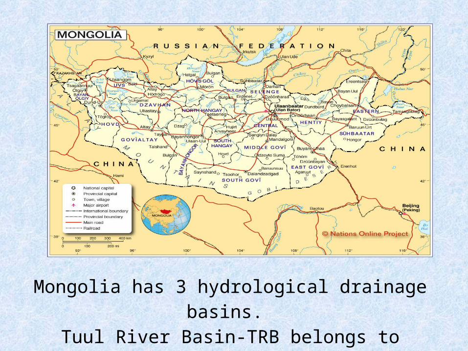
Mongolia has 3 hydrological drainage basins. Tuul River Basin-TRB belongs to Arctic Ocean Basin.
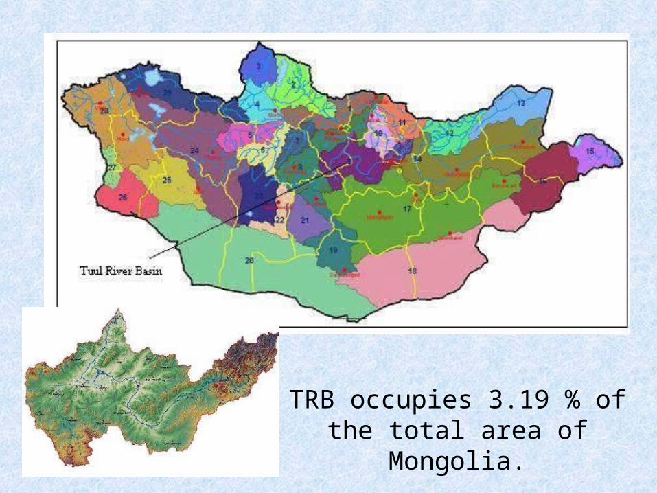
TRB occupies 3.19 % of the total area of Mongolia.

Tuul River Basin has 9 sub-basins.
Catchment area: 49,840 km2
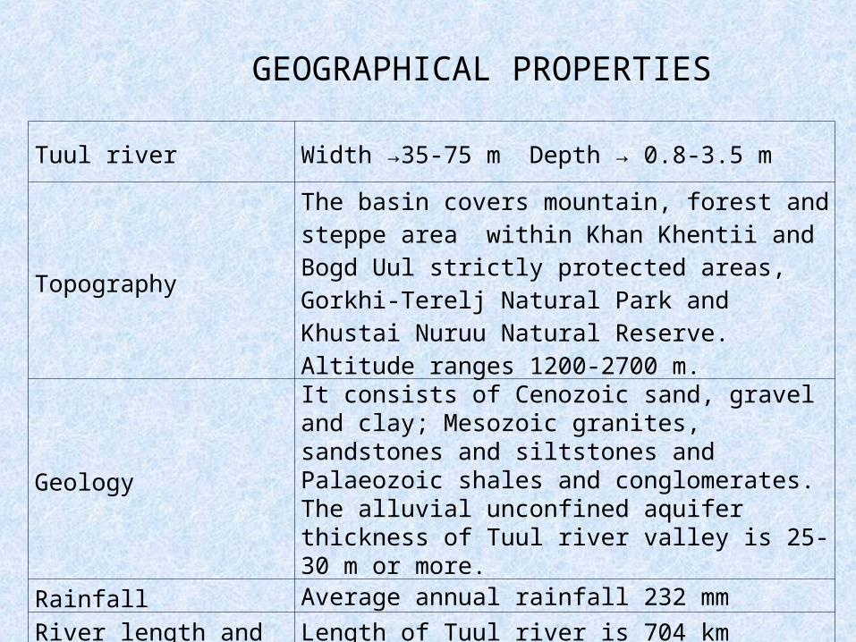
Tuul river Width →35-75 m Depth → 0.8-3.5 m
Topography
The basin covers mountain, forest and steppe area within Khan Khentii and Bogd Uul strictly protected areas, Gorkhi-Terelj Natural Park and Khustai Nuruu Natural Reserve. Altitude ranges 1200-2700 m.
Geology
It consists of Cenozoic sand, gravel and clay; Mesozoic granites, sandstones and siltstones and Palaeozoic shales and conglomerates. The alluvial unconfined aquifer thickness of Tuul river valley is 25-30 m or more.
Rainfall Average annual rainfall 232 mm
River length and annual flow
Length of Tuul river is 704 kmAnnual mean flow 26.6 m3/sec
GEOGRAPHICAL PROPERTIES
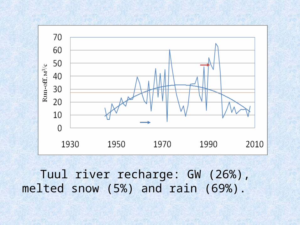
Tuul river recharge: GW (26%), melted snow (5%) and rain (69%).
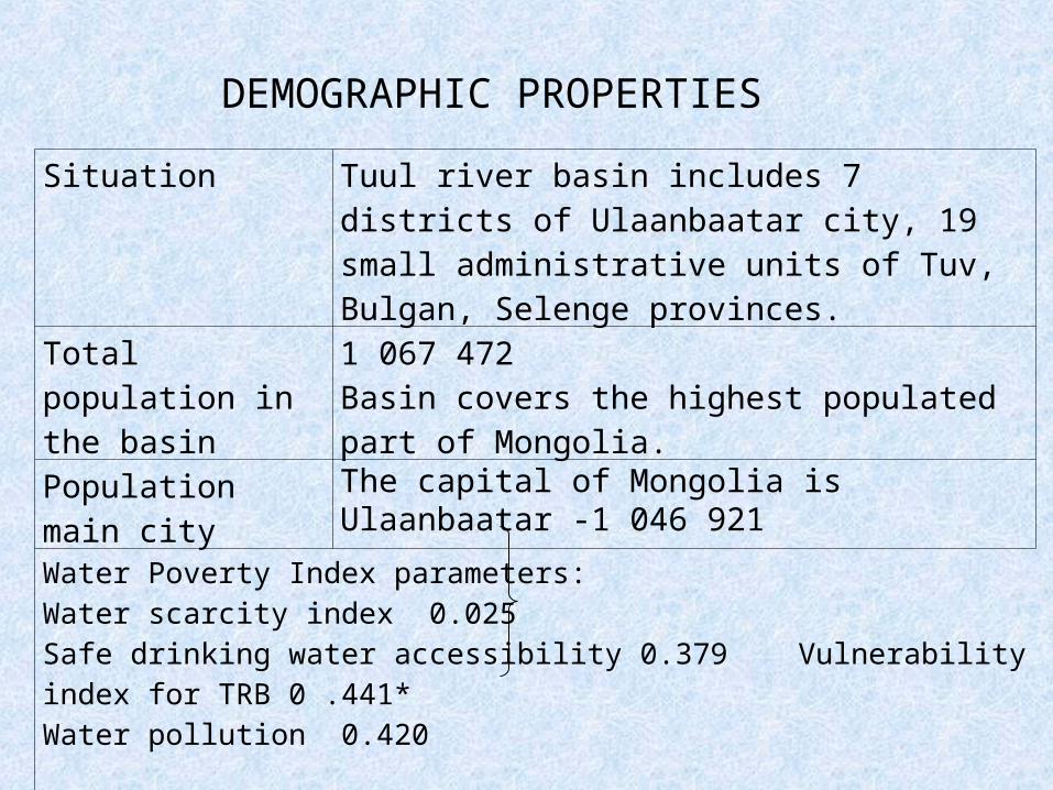
Situation Tuul river basin includes 7 districts of Ulaanbaatar city, 19 small administrative units of Tuv, Bulgan, Selenge provinces.
Total population in the basin
1 067 472Basin covers the highest populated part of Mongolia.
Population main city The capital of Mongolia is Ulaanbaatar -1 046 921
Water Poverty Index parameters: Water scarcity index 0.025 Safe drinking water accessibility 0.379 Vulnerability index for TRB 0 .441*Water pollution 0.420 Ecosystem deterioration 0.829
* UNEP report “Freshwater under threat Northeast Asia”
DEMOGRAPHIC PROPERTIES
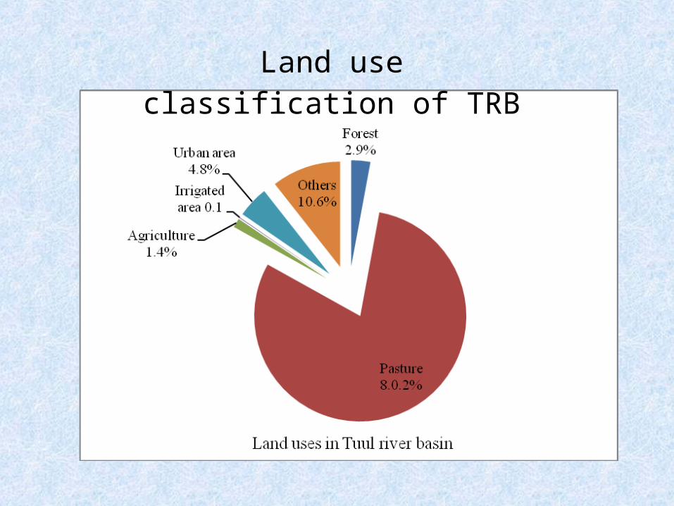
Land use classification of TRB
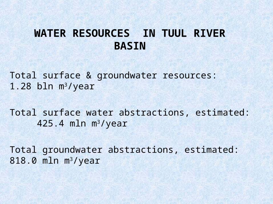
WATER RESOURCES IN TUUL RIVER BASIN
Total surface & groundwater resources: 1.28 bln m3/year
Total surface water abstractions, estimated: 425.4 mln m3/year
Total groundwater abstractions, estimated: 818.0 mln m3/year
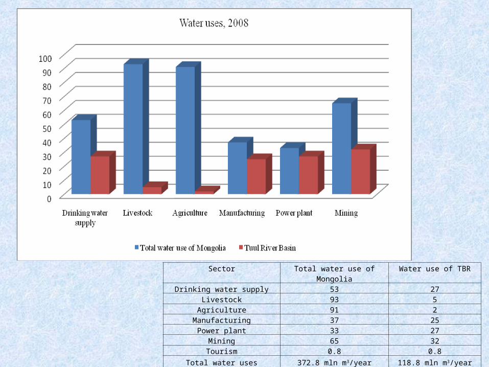
Sector Total water use of Mongolia Water use of TBR
Drinking water supply 53 27Livestock 93 5
Agriculture 91 2Manufacturing 37 25
Power plant 33 27Mining 65 32Tourism 0.8 0.8
Total water uses 372.8 mln m3/year 118.8 mln m3/year
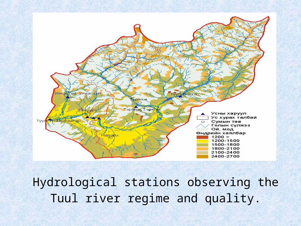
Hydrological stations observing the Tuul river regime and quality.
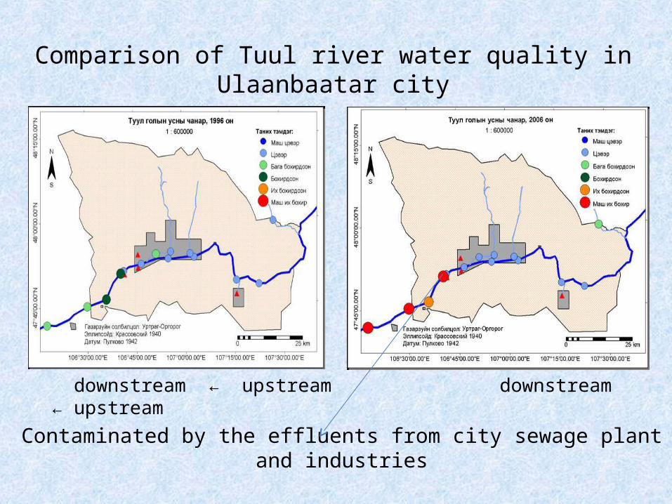
downstream ← upstream downstream ← upstream
Comparison of Tuul river water quality in Ulaanbaatar city
Contaminated by the effluents from city sewage plant and industries
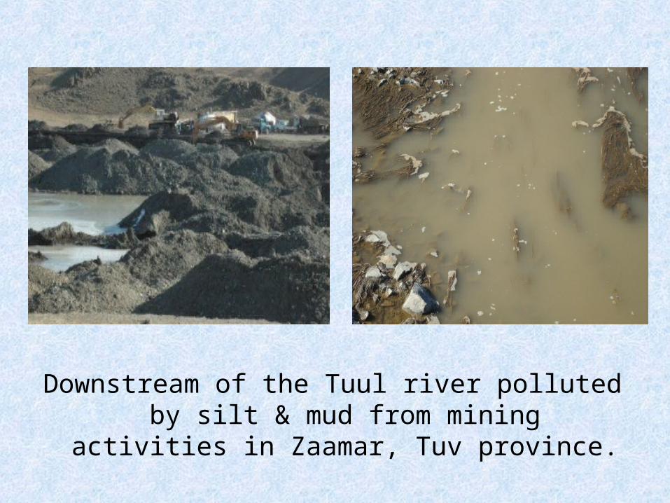
Downstream of the Tuul river polluted by silt & mud from mining activities in Zaamar, Tuv province.
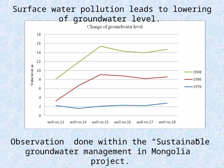
Surface water pollution leads to lowering of groundwater level.
Observation done within the “Sustainable groundwater management in Mongolia” project.
-Increasing urbanization, deforestation, overgrazing pasture, waste water mismanagement, mineral resources exploitation destructing the Tuul river ecosystem.
- Surface water pollution threatens safety of drinking water resources.
Setting up “Tuul River Basin Board” is underway.
Work out”Integrated Water Management Plan of Tuul Tiver Basin” is vital.
CONCLUSION: