TopoBathy Database Mozambique - FIG · PDF fileTopoBathy Database Mozambique Fredericton ......
15
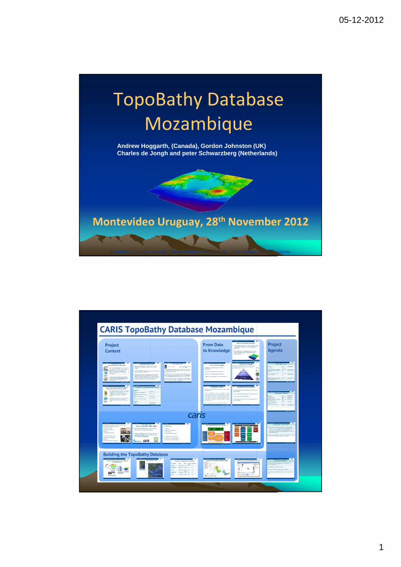
05-12-2012 1 TopoBathy Database Mozambique Fredericton – Canada • Heeswijk – The Netherlands • Washington DC – United States • Adelaide – Australia Montevideo Uruguay, 28 th November 2012 Andrew Hoggarth, (Canada), Gordon Johnston (UK) Charles de Jongh and peter Schwarzberg (Netherlands)
Transcript of TopoBathy Database Mozambique - FIG · PDF fileTopoBathy Database Mozambique Fredericton ......
05-12-2012
1
TopoBathy Database
Mozambique
Fredericton – Canada • Heeswijk – The Netherlands • Washington DC – United States • Adelaide – Australia
Montevideo Uruguay, 28th November 2012
Andrew Hoggarth, (Canada), Gordon Johnston (UK)Charles de Jongh and peter Schwarzberg (Netherlands )

05-12-2012
2
Project Context – Past: Coast-Map-IO Project (2007-2009)
‘The focus of COAST-MAP-IO is to increase
the capacity of countries to collect and use
bathymetric and topographical data to
support management of tsunami risk in
coastal areas.’
Participating countries: Mozambique (INAHINA),
Tanzania, Kenya, Madagascar, Mauritius, Seychelles,
Comoros, Maldives, Bangladesh, Myanmar,
Sri Lanka, Thailand.
Coast-Map-IO Project Goals
• Improve national expertise to locally produce accurate bathymetric and topographic maps on either side of the coastline.
• Strengthen modelling capacity for inputs to tsunami arrival, run-up and inundation in coastal areas.
• Facilitate the transfer of necessary skills to national disaster Management agencies to use bathymetric and terrestrial datasets in developing targeted maps and services, including inundation maps, determination of set back lines, coastal ecosystem mapping, and zonation for coastal users.
05-12-2012
3
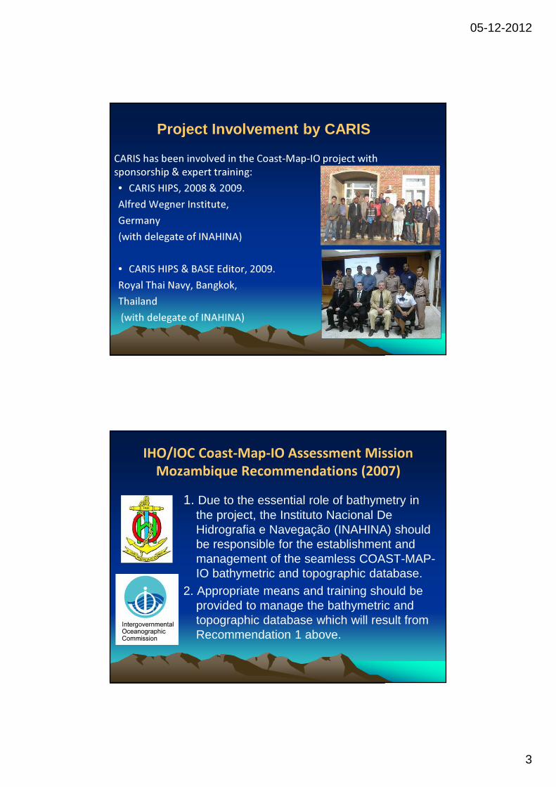
CARIS has been involved in the Coast-Map-IO project with
sponsorship & expert training:
• CARIS HIPS, 2008 & 2009.
Alfred Wegner Institute,
Germany
(with delegate of INAHINA)
• CARIS HIPS & BASE Editor, 2009.
Royal Thai Navy, Bangkok,
Thailand
(with delegate of INAHINA)
Project Involvement by CARIS
IHO/IOC Coast-Map-IO Assessment Mission
Mozambique Recommendations (2007)
1. Due to the essential role of bathymetry in the project, the Instituto Nacional De Hidrografia e Navegação (INAHINA) should be responsible for the establishment and management of the seamless COAST-MAP-IO bathymetric and topographic database.
2. Appropriate means and training should be provided to manage the bathymetric and topographic database which will result from Recommendation 1 above.
05-12-2012
4
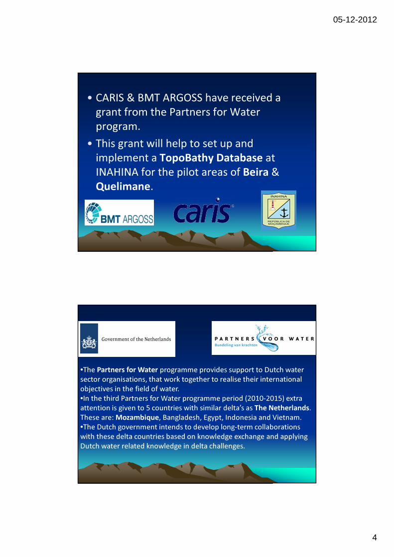
• CARIS & BMT ARGOSS have received a
grant from the Partners for Water
program.
• This grant will help to set up and
implement a TopoBathy Database at
INAHINA for the pilot areas of Beira &
Quelimane.
•The Partners for Water programme provides support to Dutch water
sector organisations, that work together to realise their international
objectives in the field of water.
•In the third Partners for Water programme period (2010-2015) extra
attention is given to 5 countries with similar delta’s as The Netherlands.
These are: Mozambique, Bangladesh, Egypt, Indonesia and Vietnam.
•The Dutch government intends to develop long-term collaborations
with these delta countries based on knowledge exchange and applying
Dutch water related knowledge in delta challenges.
05-12-2012
5
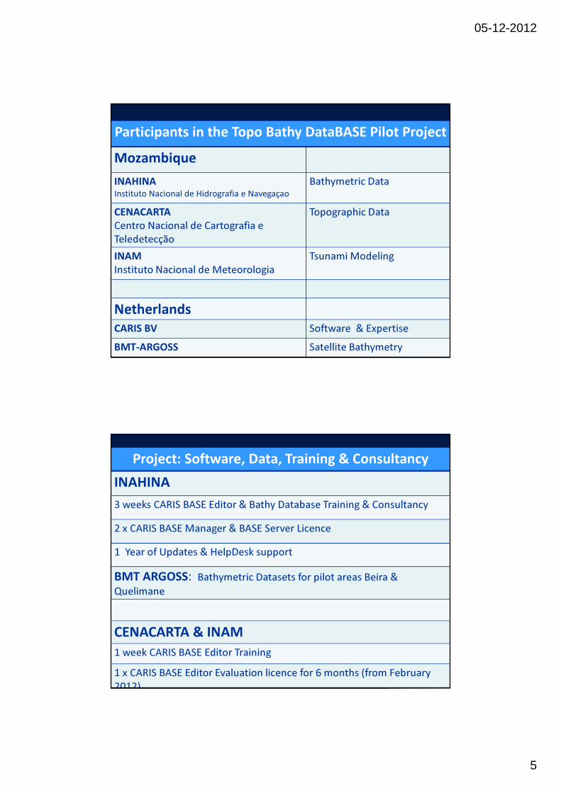
Participants in the Topo Bathy DataBASE Pilot Project
Mozambique
INAHINA Instituto Nacional de Hidrografia e Navegaçao
Bathymetric Data
CENACARTA
Centro Nacional de Cartografia e
Teledetecção
Topographic Data
INAM
Instituto Nacional de Meteorologia
Tsunami Modeling
Netherlands
CARIS BV Software & Expertise
BMT-ARGOSS Satellite Bathymetry
Project: Software, Data, Training & Consultancy
INAHINA
3 weeks CARIS BASE Editor & Bathy Database Training & Consultancy
2 x CARIS BASE Manager & BASE Server Licence
1 Year of Updates & HelpDesk support
BMT ARGOSS: Bathymetric Datasets for pilot areas Beira &
Quelimane
CENACARTA & INAM
1 week CARIS BASE Editor Training
1 x CARIS BASE Editor Evaluation licence for 6 months (from February
2012)
05-12-2012
6
What is a TopoBathy DataBASE
• A geospatial database that contains gridded
models of topographic elevations as well as
bathymetric depth data.
• The CARIS Bathy DataBASE suite is the tool to
import, manage, modify, visualize and export
geospatial data.
05-12-2012
7
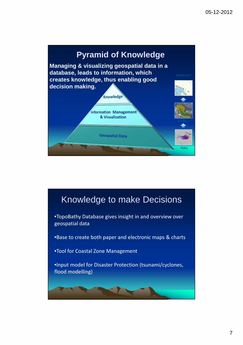
Pyramid of KnowledgeManaging & visualizing geospatial data in a database, leads to information, which creates knowledge, thus enabling good decision making.
FULL
DEM’s
PRODUCT
•TopoBathy Database gives insight in and overview over
geospatial data
•Base to create both paper and electronic maps & charts
•Tool for Coastal Zone Management
•Input model for Disaster Protection (tsunami/cyclones,
flood modelling)
Knowledge to make Decisions
05-12-2012
8
Knowledge to Protect
Knowledge of geospatial information helps to protect
against natural disasters:
‘Given its geographic location, Mozambique is highly vulnerable to
natural disasters, in particular those of a hydro-meteorological
nature (such as floods, drought and cyclones). The terrain of the
country is mostly coastal lowland, with a vast network of rivers and
tributaries emptying into the Indian Ocean. The coastline is highly
susceptible to cyclones and tropical storms.’
Source: Climate Change Assessment for Mozambique - UN
Habitat,2009.
•Building one geospatial elevation model of
Mozambique
•Central data management and visualization.
•Organisations sharing geospatial information.
•Building a National Spatial Data Infrastructure (SDI).
Why a Topo-Bathy Database

05-12-2012
9
CARIS TopoBathy DataBASE Workflow
ReferenceFiles
•GeoTIFF•JPEG2000•BSB
•DXF•S-57•Shape
INFORMATIONINFORMATIONCARIS Bathy DataBASE Suite
INPUT
• XYZ
• CSAR
• ESRI Grid
• HOB
• HTF
• HYD93
• LAS
• CARIS NTX
• PFM
• RDP
OUTPUT
•BASE Surface
•Sounding Set
•S-57 Bathymetry
•SHAPE
•GML
•BAG
•ASCII
•Google Earth
•ESRI GRID
•Geospatial PDF
BASE
Editor
BASE
ManagerBathy DataBASE
Server
DATADATA

05-12-2012
10
Project Agenda - Done
Planning Data Deliverable(s)
Assessment and conversion of
available analogue and digital data.
(INAHINA & CENACARTA)
10 Oct.-30
Dec. 2011
Digital datasets to
be imported in
BathyDB
Selection and processing of
satellite images.
(BMT ARGOSS)
10 Oct.-30
Dec. 2011
Digital datasets to
be imported in
BathyDB
Import digital datasets, convert to
same reference system and
combine as seamless elevation
model in BathyDB.
(CARIS)
2 Jan.- 3 Feb.
2012.
Seamless elevation
model of first Pilot
Area (Beira)
Create Training Manual for Beira 2 Jan.- 3 Feb. Training Manual
Project Agenda – Further Activities
Planning Data Deliverable(s)
Maputo: Training Workshop
Pilot for Area-1 : Beira
(INAHINA, CENACARTA, INAM,
CARIS)
6 Feb.-17 Feb.
2012.
-Training manual
-Combined Dataset
Beira
Execution of Pilot for Area-2:
Quelimane (INAHINA).
CARIS HelpDesk Support
February – June
2012.
-Combined Dataset
Quelimane
Documenting of the workflows,
experiences and results.
(INAHINA)
February– June
2012
-INAHINA Report
Maputo: Consultancy &
Presenting of the results.
(INAHINA, CENACARTA, INAM,
1 week
July/August
2012
-Final Datasets Beira
& Quelimane
-Final Report

05-12-2012
11
CARIS Bathy DataBASE:Data Storage, Processing
& Visualization
(CARIS & INAHINA)
Bathymetric & Topographic Data
(BMT ARGOSS, ASTER, GEBCO)
Seamless Digital Elevation Model
(INAM & INGC)
Satellite Data
Land & Bathymetric Survey Data
(INAHINA & CENACARTA)
Beira & Quelimane Pilot Project WorkflowTopo Bathy Database
Pilot Project Location
Quelimane
Beira
Mozambique
1 During Training
2 After Training
05-12-2012
12
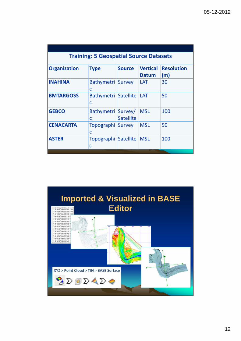
Training: 5 Geospatial Source Datasets
Organization Type Source Vertical
Datum
Resolution
(m)
INAHINA Bathymetri
c
Survey LAT 30
BMTARGOSS Bathymetri
c
Satellite LAT 50
GEBCO Bathymetri
c
Survey/
Satellite
MSL 100
CENACARTA Topographi
c
Survey MSL 50
ASTER Topographi
c
Satellite MSL 100
Imported & Visualized in BASE Editor

05-12-2012
13
Combined into One Elevation Model
for Beira
Training Activities
� Go through BASE Editor Training Manual to create
combined elevation model for Beira.
� Set up TopoBathy DataBASE at INAHINA & Load combined
elevation model.
� Start to create combined elevation model for Quelimane.
� Add other data to the model.
• Test Import elevation model into Tsunami Modelling
Software
05-12-2012
14
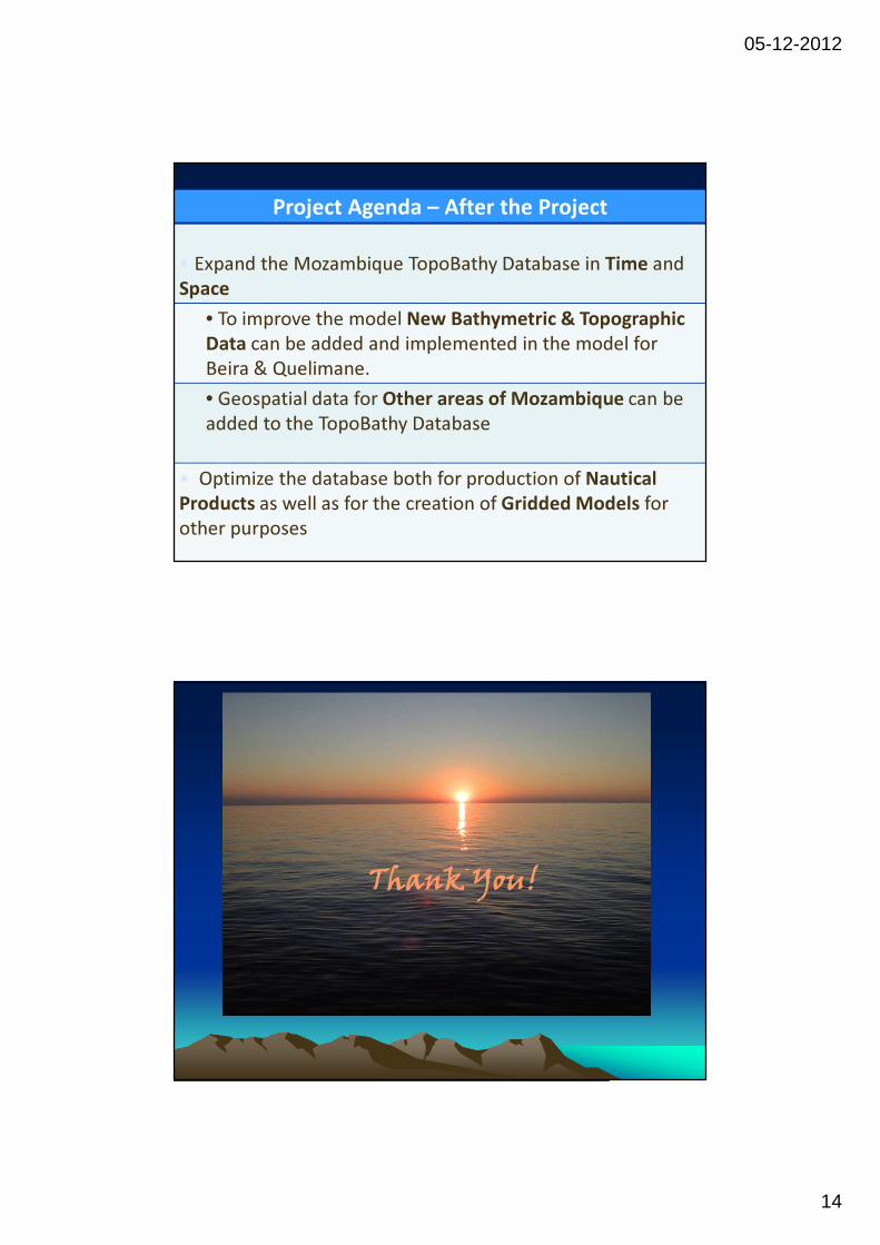
Project Agenda – After the Project
• Expand the Mozambique TopoBathy Database in Time and
Space
• To improve the model New Bathymetric & Topographic
Data can be added and implemented in the model for
Beira & Quelimane.
• Geospatial data for Other areas of Mozambique can be
added to the TopoBathy Database
• Optimize the database both for production of Nautical
Products as well as for the creation of Gridded Models for
other purposes
Questions?
Contact details:
IHO (IBSC): http://www.iho.int/srv1/FIG: www.fig.netGordon Johnston: [email protected]
Thank You!

05-12-2012
15
Any Questions
Thank You!