Top 10 for OpenRoads 2
3
Top Ten Reasons to Use OpenRoads Technology 1. Use data throughout project life-cycle Work with any type of field data—survey, ASCII, GPS, LiDAR, photogram- metric, contour maps, and many other forms of data. Users can modify and process the data as needed and when the design is complete, upload design data to data collectors for stakeout or automated machine guid- ance for site preparation. Result: Reduce project costs by eliminating expensiv e and sometimes redundant data conversions. 2. Ensure engineered project Know that the design project is reflective of engineering intent. Design intent builds associations and relationships between civil elements. Object information (how, where, and by what method it was created) is stored with the object to insure the original intent is retained and honored in the design. If an element is modified, any related elements will recreate them- selves based on these stored relationships. Result: Assures the project is engineered. Design quality is enhanced with element relationship s and links in the project. 3. Take advantage of dynamic civil cell functionality Create commonly used 2D and 3D geometric configurations as civil cells to accelerate design production by using repurposed design layouts. De- sign, constraint, and relational intelligence are maintained between ele- ments to ensure design standards. Result: Accelerate design production by using repurposed design layouts. 4. Use immersive modeling with parametric design Combine plan, profile, and cross-section workflows with innovative 3D modeling technology and the result is immersive modeling. Add paramet- ric design features that allow users to incorporate rules, relationships, and constraints into the modeling workflow and you have incomparable model- ing capabilities. Result: Improve quality with integrated designs based on parametrics, relationships, and constraints.
-
Upload
adhimalik22 -
Category
Documents
-
view
226 -
download
1
description
open roads
Transcript of Top 10 for OpenRoads 2

7/17/2019 Top 10 for OpenRoads 2
http://slidepdf.com/reader/full/top-10-for-openroads-2 1/2
Top Ten Reasons to Use OpenRoads Technology
1. Use data throughout project life-cycle
Work with any type of field data—survey, ASCII, GPS, LiDAR, photogram-
metric, contour maps, and many other forms of data. Users can modifyand process the data as needed and when the design is complete, upload
design data to data collectors for stakeout or automated machine guid-
ance for site preparation.
Result: Reduce project costs by eliminating expensive and sometimes redundant data
conversions.
2. Ensure engineered project
Know that the design project is reflective of engineering intent. Design
intent builds associations and relationships between civil elements. Object
information (how, where, and by what method it was created) is stored
with the object to insure the original intent is retained and honored in the
design. If an element is modified, any related elements will recreate them-
selves based on these stored relationships.
Result: Assures the project is engineered. Design quality is enhanced with element
relationships and links in the project.
3. Take advantage of dynamic civil cell functionality
Create commonly used 2D and 3D geometric configurations as civil cells
to accelerate design production by using repurposed design layouts. De-
sign, constraint, and relational intelligence are maintained between ele-
ments to ensure design standards.
Result: Accelerate design production by using repurposed design layouts.
4. Use immersive modeling with parametric design
Combine plan, profile, and cross-section workflows with innovative 3D
modeling technology and the result is immersive modeling. Add paramet-
ric design features that allow users to incorporate rules, relationships, and
constraints into the modeling workflow and you have incomparable model-
ing capabilities.
Result: Improve quality with integrated designs based on parametrics, relationships, and
constraints.
7/17/2019 Top 10 for OpenRoads 2
http://slidepdf.com/reader/full/top-10-for-openroads-2 2/2
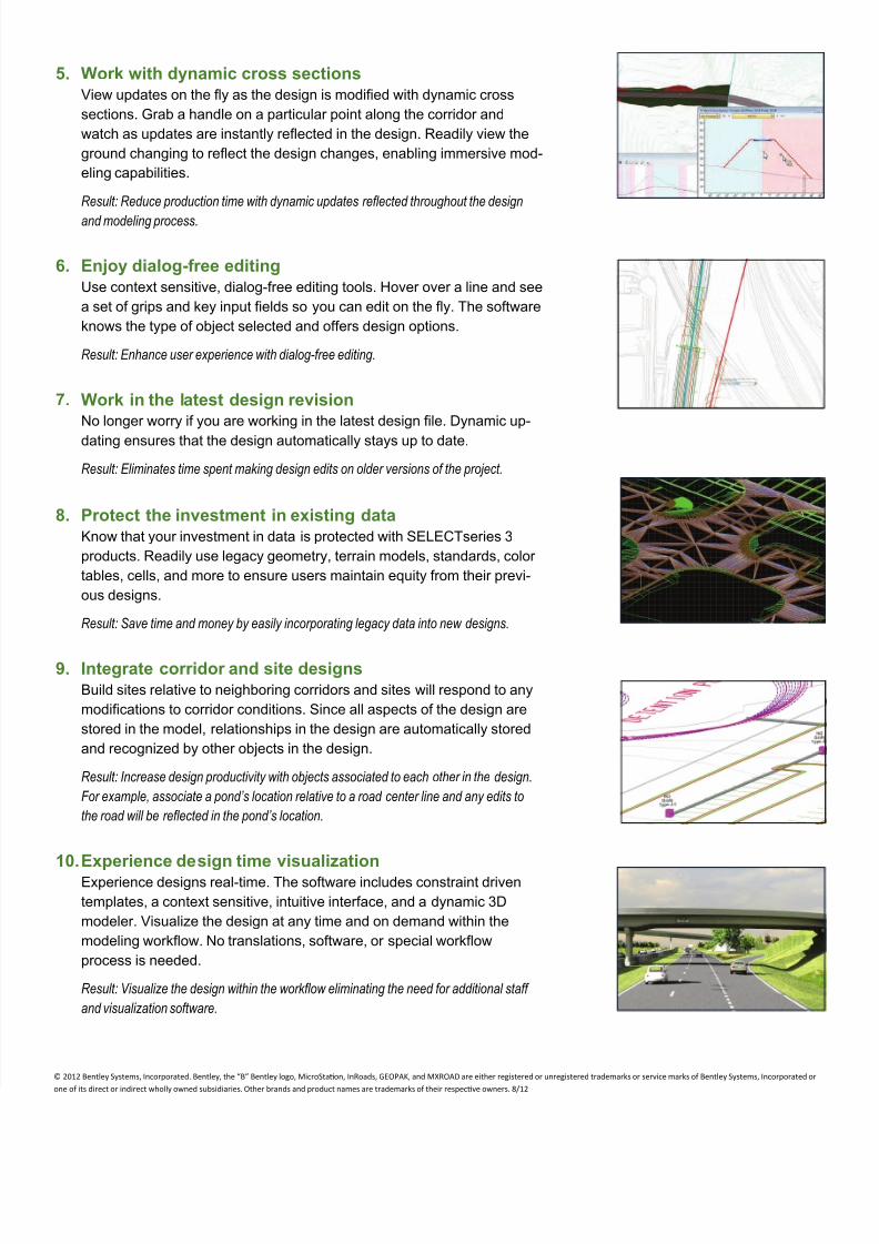
5. Work with dynamic cross sections
View updates on the fly as the design is modified with dynamic cross
sections. Grab a handle on a particular point along the corridor and
watch as updates are instantly reflected in the design. Readily view the
ground changing to reflect the design changes, enabling immersive mod-
eling capabilities.
Result: Reduce production time with dynamic updates reflected throughout the design
and modeling process.
6. Enjoy dialog-free editing
Use context sensitive, dialog-free editing tools. Hover over a line and see
a set of grips and key input fields so you can edit on the fly. The software
knows the type of object selected and offers design options.
Result: Enhance user experience with dialog-free editing.
7. Work in the latest design revision
No longer worry if you are working in the latest design file. Dynamic up-
dating ensures that the design automatically stays up to date.
Result: Eliminates time spent making design edits on older versions of the project.
8. Protect the investment in existing data
Know that your investment in data is protected with SELECTseries 3
products. Readily use legacy geometry, terrain models, standards, color
tables, cells, and more to ensure users maintain equity from their previ-
ous designs.
Result: Save time and money by easily incorporating legacy data into new designs.
9. Integrate corridor and site designs
Build sites relative to neighboring corridors and sites will respond to any
modifications to corridor conditions. Since all aspects of the design are
stored in the model, relationships in the design are automatically stored
and recognized by other objects in the design.
Result: Increase design productivity with objects associated to each other in the design.
For example, associate a pond’s location relative to a road center line and any edits to
the road will be reflected in the pond’s location.
10. Experience design time visualization
Experience designs real-time. The software includes constraint driven
templates, a context sensitive, intuitive interface, and a dynamic 3D
modeler. Visualize the design at any time and on demand within the
modeling workflow. No translations, software, or special workflow
process is needed.
Result: Visualize the design within the workflow eliminating the need for additional staff
and visualization software.
© 2012 Bentley Systems, Incorporated. Bentley, the “B” Bentley logo, MicroStaon, InRoads, GEOPAK, and MXROAD are either registered or unregistered trademarks or service marks of Bentley Systems, Incorporated or
one of its direct or indirect wholly owned subsidiaries. Other brands and product names are trademarks of their respecve owners. 8/12