THE HAICHENG, CHINA, EARTHQUAKE OF 4 …1)0032.pdf · THE FIRST SUCCESSFULLY PREDICTED MAJOR...
11
32 THE HAICHENG, CHINA, EARTHQUAKE OF 4 FEBRUARY, 1975; THE FIRST SUCCESSFULLY PREDICTED MAJOR EARTHQUAKE R. D. Adams* ABSTRACT The earthquake of magnitude 7.3 that occurred near the town of Haicheng in northeast China on 4 February, 1975 was the first major earthquake anywhere in the world known to have been predicted with enough certainty for people to have been warned, and measures taken for civil protection. These steps were successful in keeping the number of casualties small. This paper describes a visit to the affected area seven and a half months after the earthquake, and discussions with Chinese scientists about their successful prediction methods. The prediction resulted from the synthesis of many types of investigation, but the main methods used for long-, mid-, and short- term prediction appear to have been based on studies of seismicity, deformation, and foreshocks respectively. INTRODUCTION On 4 February, 197 5 a major earthquake occurred near the town of Haicheng in Liaoning Province of northeast China. The earthquake had a magnitude of 7.3 and caused extensive damage in Haicheng and neighbouring towns and villages. Despite the size of the earth- quake and the large population of the area affected by it, casualties were few. This was a direct consequence of the successful prediction of the earthquake by Chinese scientists, leading to a series of warnings of increasing urgency, culminating in an evacuation order issued some five and a half hours before the earthquake occurred. This is the first time anywhere in the world that a major earthquake is known to have been predicted with enough certainty to enable such civil action to have been undertaken, and the scientific and social implications of this successful prediction are of great significance. During the course of a two week visit to China in September, 1975, I was able to spend two full days in the region affected by the earthquake and discuss its prediction and effects with Chinese scientists at national institutes in Peking and Harbin, and at local centres in Liaoning Province. The following account is put together from many sources, and from my many discussions. A remarkably consistent picture of events leading up to the earthquake emerges. Any inconsistencies are likely to be a result of my misunderstanding, or of difficulties arising in translation. In this paper, however, I attempt to report only those aspects of the earthquake about which I learned directly, without going into details of previous seismicity of the area or seismological work done in China in other fields. Itinerary and Sources During my stay in China I was the guest * Seismological Observatory, Geophysics Division, Department of Scientific and Industrial Research, Wellington. of the Academia Sinica, as part of a programme of scientific exchanges between that body and the Royal Society of New Zealand. Institutions which I visited, where I had extensive discussions on the Haicheng earthquake and its effects, were the Geophysical Institute, Academy of Sciences, Peking (15, 16 September); Geological Institute, Academy of Sciences, Peking (16 September); and the Institute of Engineering Mechanics, Harbin (22, 23 September). I spent two days (24 , 25 September) in the area affected by the earthquake, based at Anshan. From here I visited the Yinkow Municipality Seismograph Station, the nearest to the epicentre, where I had extensive discussions with the staff and saw seismological instruments and records that had been used in the prediction. I also inspected geological effects such as the new fault break that accompanied the earthquake, and gravity slumping. I was able to inspect damaged towns and villages and to talk to local inhabitants, as well as professional and part-time seismological workers. During this time I was accompanied by Mr. Chu Feng-ming, Head of the Liaoning Provincial Seismological Brigade. Also in attendance were Mr. Wang, Head of the Foreign Affairs Bureau of the Municipality of Anshan, Dr. Lin Ting-hwang and Mr. Shie Yu-sho from the Geophysical Institute, Peking, and various local officials. Dr. Lin, who was my travelling companion for my entire stay in China, spent several months undertaking field work following the earthquake and was a source of much information concerning all aspects of its study. As far as I know, I was the first foreign seismologist to visit China since the Haicheng earthquake, and the first to visit the affected area. EARTHQUAKE PREDICTION IN CHINA Background and Organisation Following the major Hsingtai earthquake to the south of Peking in 1966, and the visit to the area by Premier Chou En-lai, BULLETIN OF THE NEVA/ ZEALAND NATIONAL SOCIETY FOR EARTHQUAKE ENGINEERING, VOL.9, N0.1. MARCH 1976
Transcript of THE HAICHENG, CHINA, EARTHQUAKE OF 4 …1)0032.pdf · THE FIRST SUCCESSFULLY PREDICTED MAJOR...

32
THE H A I C H E N G , C H I N A , EARTHQUAKE OF 4 FEBRUARY, 1975;
THE FIRST S U C C E S S F U L L Y PREDICTED M A J O R E A R T H Q U A K E
R. D. A d a m s *
ABSTRACT
The earthquake of magnitude 7.3 that occurred near the town of Haicheng in northeast China on 4 February, 1975 was the first major earthquake anywhere in the world known to have been predicted with enough certainty for people to have been warned, and measures taken for civil protection. These steps were successful in keeping the number of casualties small. This paper describes a visit to the affected area seven and a half months after the earthquake, and discussions with Chinese scientists about their successful prediction methods. The prediction resulted from the synthesis of many types of investigation, but the main methods used for long-, mid-, and short-term prediction appear to have been based on studies of seismicity, deformation, and foreshocks respectively.
INTRODUCTION
On 4 February, 197 5 a major earthquake occurred near the town of Haicheng in Liaoning Province of northeast China. The earthquake had a magnitude of 7.3 and caused extensive damage in Haicheng and neighbouring towns and villages. Despite the size of the earthquake and the large population of the area affected by it, casualties were few. This was a direct consequence of the successful prediction of the earthquake by Chinese scientists, leading to a series of warnings of increasing urgency, culminating in an evacuation order issued some five and a half hours before the earthquake occurred. This is the first time anywhere in the world that a major earthquake is known to have been predicted with enough certainty to enable such civil action to have been undertaken, and the scientific and social implications of this successful prediction are of great significance.
During the course of a two week visit to China in September, 1975, I was able to spend two full days in the region affected by the earthquake and discuss its prediction and effects with Chinese scientists at national institutes in Peking and Harbin, and at local centres in Liaoning Province. The following account is put together from many sources, and from my many discussions. A remarkably consistent picture of events leading up to the earthquake emerges. Any inconsistencies are likely to be a result of my misunderstanding, or of difficulties arising in translation. In this paper, however, I attempt to report only those aspects of the earthquake about which I learned directly, without going into details of previous seismicity of the area or seismological work done in China in other fields.
Itinerary and Sources During my stay in China I was the guest
* Seismological Observatory, Geophysics Division, Department of Scientific and Industrial Research, Wellington.
of the Academia Sinica, as part of a programme of scientific exchanges between that body and the Royal Society of New Zealand. Institutions which I visited, where I had extensive discussions on the Haicheng earthquake and its effects, were the Geophysical Institute, Academy of Sciences, Peking (15, 16 September); Geological Institute, Academy of Sciences, Peking (16 September); and the Institute of Engineering Mechanics, Harbin (22, 23 September).
I spent two days (24 , 25 September) in the area affected by the earthquake, based at Anshan. From here I visited the Yinkow Municipality Seismograph Station, the nearest to the epicentre, where I had extensive discussions with the staff and saw seismological instruments and records that had been used in the prediction. I also inspected geological effects such as the new fault break that accompanied the earthquake, and gravity slumping. I was able to inspect damaged towns and villages and to talk to local inhabitants, as well as professional and part-time seismological workers. During this time I was accompanied by Mr. Chu Feng-ming, Head of the Liaoning Provincial Seismological Brigade. Also in attendance were Mr. Wang, Head of the Foreign Affairs Bureau of the Municipality of Anshan, Dr. Lin Ting-hwang and Mr. Shie Yu-sho from the Geophysical Institute, Peking, and various local officials. Dr. Lin, who was my travelling companion for my entire stay in China, spent several months undertaking field work following the earthquake and was a source of much information concerning all aspects of its study. As far as I know, I was the first foreign seismologist to visit China since the Haicheng earthquake, and the first to visit the affected area.
EARTHQUAKE PREDICTION IN CHINA
Background and Organisation
Following the major Hsingtai earthquake to the south of Peking in 1966, and the visit to the area by Premier Chou En-lai,
BULLETIN OF THE NEVA/ Z E A L A N D N A T I O N A L SOCIETY FOR EARTHQUAKE ENGINEERING, VOL.9, N 0 . 1 . MARCH 1976

33
Chairman Mao declared that China must learn to predict earthquakes. The reason for this appears basically to have been to prevent loss of life, for much of China 1s population lives in simply constructed dwellings which can never be made earthquake resistant. To save people it is, therefore, more practicable to concentrate on prediction rather than on remedial engineering.
Chairman Mao's directive has been an essential part of the prediction programme, for this can now be fitted into the popular Chinese social philosophy of "striving to overcome nature". Earthquake prediction has been given great priority and publicity by the Chinese leaders, and this has ensured not only adequate financial and administrative support for the programme, but it has convinced the people that a working prediction programme is feasible and necessary. Mao also instructed that prediction programmes were to involve the "masses" as well as experts, and this has resulted not only in an almost limitless number of potential observers, but also an awareness among the people that this is their programme, and that any failures or false alarms are the responsibility of the people themselves, as well as of the scientific experts. Such an attitude is essential if people are going to accept the disruption to their lives that must follow any earthquake prediction. In western societies, orders for evacuation given by authorities would cause resentment, and if unfounded could cause great unrest, particularly because of economic losses due to the closing of businesses. In China, however, these disruptions can be accepted and failures are blamed by the people on themselves, not on nameless "experts" or authorities.
As an essential part of the prediction scheme, the State Seismological Bureau (SSB) was set up about 1970. This body, in Peking, is made up of representatives of the Geophysical and Geological Institutes and the Institute of Engineering Mechanics of the Academia Sinica, and of Provincial Seismological Brigades. As part of a policy of decentralisation, much of the work previously carried out by the Institutes in Peking is now handed over to the Provincial Brigades. Most of the large provinces, particularly those in more active seismological areas, now have such bodies, as do also the larger municipal areas. The Geophysical Institute in Peking controls only those seismograph stations necessary for the study of seismicity of China as a whole (and in addition a local network around Peking). The individual Provincial Brigades control their own seismograph networks, locate their own earthquakes, and collect and evaluate instrumental and other observations.
Prediction Techniques
The work on which prediction is based is carried out at several levels. I learned of no completely new techniques being used in China but, on the other hand, know of no technique known outside China that was not being used.
At the national level, overall analyses of seismicity and tectonic patterns are carried out at the central institutes of the
Academia Sinica and communicated to the SSB. Surface deformation studies are carried out both nationally and locally. These include geodetic and levelling surveys, measurements of tilt by pendulum and water-tube tiltmeters, changes in well levels, and measurements of earth strain. Seismological studies include looking for velocity anomalies and the identification of precursory seismicity gaps and foreshocks. Changes in earth currents, and in magnetic and gravity readings are sought, and in some areas measurements of radon content in ground water are made.
As well as full-time seismological workers, many thousands of part-time workers are involved in earthquake prediction studies. These "indigenous" workers watch recording ammeters for changes in earth electricity, report changes in well level and water turbidity, and any unusual occurrence that could be associated with earthquakes, including unusual behaviour of animals. This last aspect had been widely publicised, and was often mentioned to me in China, but I could learn of no controlled experiments, or quantification of results. Chinese seismologists could offer no physical explanation for any premonitory effect detected by animals, but said that workers in animal psychology were looking at the problem.
The main scientific use of these "indigenous" observations seems to be to identify those areas where anomalies are occurring, so other investigations, including deformation and seismological studies, can be concentrated there. Sociologically, of course, they have the important effect of involving the population in predicting studies.
The overall Chinese philosophy appears to be to attempt to predict earthquakes by any means possible, without at this stage being unduly concerned with the underlying scientific principles. All conceivably relevant information is collected, and sorted first at local, then at provincial level, and unusual occurrences noted. The reason for the success or failure of various techniques in different parts of the country will be investigated as more failures and successes in prediction occur. This approach contrasts with that in most western countries, where the usual practice is for a physical theory of earthquake occurrence to be set up, and to look for various consequences. Chinese prediction techniques are based initially on a very dense coverage of very simple observations, leading to a gradual refinement of areas and times of risk.
The use of these techniques will be illustrated in the account of the prediction of the Haicheng earthquake.
THE HAICHENG EARTHQUAKE
Setting and Local Organisation
The earthquake originated at llh 36m 07.5s U.'T. (7.36 p.m. local time) on 4 February, 1975 near 40°40'N, 122°50 SE, about 30 km to the SSE of the town of Haicheng, in southern Liaoning Province of north-east China. The earthquake occurred at shallow depth and had a magnitude of 7.3, making it

34
a major shock by world standards. All further references to time will be in Chinese local time, which is eight hours ahead of U.T.
The earthquake area is at the base of the Liaotung Peninsula, which has a central ridge of uplifted hills of Mesozoic to Cenozoic age, which rise to a maximum height of about 1000 m. A structural fault runs down the western side of the hills, beyond which the land slopes down in a coastal plain to the bay of Liaotung Wan, and further north to the flat alluvial plain of the Liao Ho river (Fig. 1 ) . The principal cities and towns lie on the plain and the instrumental epicentre is in the foothills of the main range. The area is pastoral in the hills, but is also heavily mined, and the city of Anshan, 40 km north of Haicheng, has one of China's largest steel works and much associated heavy industry.
Liaoning Province extends from Hopeh Province, in which lies the Municipality of Peking, to the North Korean border, and has about 33 million inhabitants. The province has some 250 full-time seismological workers, at 10 centres, organised by the Liaoning Provincial Seismological Brigade. The Brigade runs 10 full seismological observatories and there are about 10 others run by other organisations, bringing to about 20 the number of seismograph stations which supply records to the Brigade headquarters in the provincial capital of Shenyang. These stations are equipped with three-component , short-period seismographs of type DDI, which are made in Peking. About 10 further stations are planned for installation in the next few years. This work is supplemented by some 10,000 part-time workers, carrying out "indigenous" observations; about 1000 of these workers are in the Yinkow and Haicheng Counties that were most severely affected by the earthquake . There are about 700 simple ammeter installations for detecting changes in earth currents, and other observations are made of changes in well levels, turbidity in water, and unusual animal behaviour.
PREDICTION OF HAICHENG EARTHQUAKE
The prediction of the Haicheng earthquake was not a single statement issued at one particular time. It was rather a gradual specification of the risk, with increasingly accurate estimates being made of the time, place and magnitude of the earthquake. The following chronicale of events divides the prediction into three stages, in which the basic information used appears to have been derived successively from seismicity, deformation, and the occurrence of foreshocks.
Long-term Prediction
About 1970 or even earlier, the SSB identified Liaoning Province as an area of greater than normal seismic risk. This appears to have been done mainly on the basis of seismicity studies, and particularly on the migration of large earthquakes.
In 1944 there was a magnitude 6 \ shock to the south-east of Liaotung Peninsula in Korea Bay, and since then three other earthquakes of magnitude greater than 6 appeared to be setting a trend of migration towards
Liaoning from the west. These earthquakes were those near Hsingtai in 1966, Tientsin in 1967 and in Po Hai in 1969. The positions of these earthquakes are shown in Fig. 1, and the three most recent are seen to lie on the ENE-WSW lineation that characterises the regional compressive stress found from seismological studies around Peking and the north China plain in general. After 1966 Liaoning began experiencing earthquakes of magnitude greater than 4, whereas there had not been such medium-sized shocks in the area since about 1940 . Later analyses, however, revealed a seismic gap about 350 km long in the area of the Liaotung Peninsula.
Realising the industrial importance of this area, the SSB urged fuller investigations , including geologic and tectonic surveys, long base-line measurements of tilt, and gravity and magnetic surveys, as well as improved seismographic coverage.
Mid-Term Prediction
Deformation work showed that Liaotung Peninsula was tilting to the northwest and the Yinkow area was sinking by 3 to 5 mm/ year. This was established by levelling, tide-gauge measurements, and by repeating in 1970 and 1971 a geodetic survey made in 1958. In 1972 one station for observing tilt was established to the south-east of Yinkow with perpendicular base lines of 540 m and 380 m crossing the main fault that runs through the area in a NNE-SSW direction. From 1973 the rate of tilt to the north-west increased, and this trend continued until it reversed direction shortly before the earthquake.
In June 1974 the SSB met again, and on the basis of deformation studies fixed the likely location of the earthquake as southern Liaoning. From the size of the affected area, the impending earthquake was estimated to be about magnitude 6 and was expected in 1974 or 1975. At this stage, as well as increasing the number of seismograph stations, the Provincial Brigade placed more emphasis on "indigenous" observations. In particular, changes in well levels, and the occurrence of turbidity in well water were plotted. Similarly, plots were kept of areas from which there were anomalous readings of earth currents, and places where unusual behaviour of animals was reported. All these anomalies scattered widely over the province, but the Brigade interpreted the observations as falling on two main lines, one striking NNE-SSW down the main structural fault on the west side of the Liaotung mountains from Liaoyang to Dairen, and the other crossing it at right angles near the base of the Peninsula, from Chinchow to Antung. The earthquake was expected at the intersection of these two lines near Yinkow, but this was not well established at this stage, because later warnings up to January 1975 included Antung, 170 km to the east near the North Korean border. Geodetic measurements continued, and local cities and counties began to instill in the minds of the population the idea that a large earthquake was likely to occur before long.
In December 1974 an increase in anomalous readings, particularly changes in
35
well levels, was noted, again extending as far as Antung. On 20 December local government was told to expect an earthquake of up to magnitude 5. On 22 December a shock of magnitude 4.8 occurred near Liaoyang but tilt and other anomalies continued to increase, and after 17 months of tilt anomaly it was considered that this earthquake was not large enough to be the main shock that was impending.
Some time about this date a false alarm was given in the Yinkow area and pel people were evacuated from their houses for two days; a serious step to take in mid-winter.
Short-Term Prediction
On 13 January 1975 the SSB held another meeting and the Provincial Party Committee was told that a large earthquake could be expected shortly in south Liaoning. This news was passed to local authorities at county level on 28 January, and places as far afield as Dairen, Antung and Anshan were told that a large earthquake was imminent, but its exact location was not known. At commune and family brigade level, villagers prepared themselves for the possibility of an earthquake, by making provision for caring for the aged, and for sleeping away from their main houses if need be.
During this time observations of all types were being made with increasing vigilance. The almost exclusive use of pen-and-ink recorders enabled seismographs to be watched continuously. Some electrical anomalies were found, but the first convincing evidence for the approaching shock came on 1 February when a small shock of magnitude 0.4, with an S-P interval of 2.5s, corresponding to a distance of about 20 km, was recorded at the seismograph station operated by the Municipality of Yinkow, about 30 km to the east of the city in the foothills beyond the main south road. Apparently no such close shock had been recorded previously. On 3 February further similar shocks were recorded, all with the same S-P interval to within a few tenths of a second; the largest of these shocks reached magnitudes between 2 and 3. At 6.30 p.m. on 3 February there was a large increase in foreshock activity, and the Provincial Revolutionary Committee was warned. The largest foreshock, at 7.51 a.m. on 4 February, was of magnitude 4.7 and was felt. Shocks became somewhat less frequent during the morning, but at 2 p.m. on 4 February a general warning was issued, on the basis of the foreshocks, for Yinkow and Haicheng Counties to expect an earthquake within two days. The main earthquake, of magnitude 7.3, occurred five and a half hours later, at 7.36 p.m.
DAMAGE AND FELT EFFECTS
The maximum intensity that the Chinese allocated in this earthquake was IX+ on their equivalent of the 12-point Modified Mercalli scale. The zone of intensity IX, about 20 to 30 km across, included the immediate epicentral area and the seismograph station operated by the Yinkow Municipality. In this zone, virtually all
houses were destroyed. No specially designed structures were evident in the area, but some of the larger structures associated, with talc mining appeared to have survived. At the Teng Family Brigade, a sub-unit of the regional commune, all of about 130 houses had been rebuilt since the earthquake, mainly in brick with timber frames to support roofs.
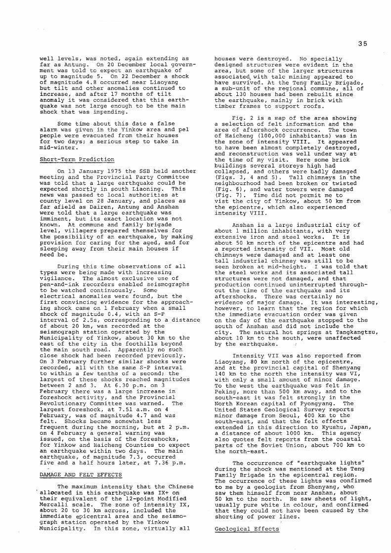
Fig. 2 is a map of the area showing a selection of felt information and the area of aftershock occurrence. The town of Haicheng (100,000 inhabitants) was in the zone of intensity VIII.. It appeared to have been almost completely destroyed, and reconstruction was well under way at the time of my visit. Here some brick buildings several storeys high had collapsed, and others were badly damaged (Figs. 3, 4 and 5 ) . Tall chimneys in the neighbourhood had been broken or twisted (Fig. 6), and water towers were damaged (Fig. 7 ) . Time did not permit me to vist the city of Yinkow, about 50 km from the epicentre, which also experienced intensity VIII.
Anshan is a large industrial city of about 1 million inhabitants, with very extensive iron and steel works. It is about 50 km north of the epicentre and had a reported intensity of VII. Most old chimneys were damaged and at least one tall industrial chimney was still to be seen broken at mid-height. I was told that the steel works and its associated tall structures were not damaged, and that production continued uninterrupted throughout the time of the earthquake and its aftershocks. There was certainly no evidence of major damage. It was interesting, however, to learn that the region for which the immediate evacuation order was given on the day of the earthquake stopped to the south of Anshan and did not include the city. The natural hot springs at Tangkangtzu, about 10 km to the south, were unaffected by the earthquake.
Intensity VII was also reported from Liaoyang, 80 km north of the epicentre, and at the provincial capital of Shenyang 140 km to the north the intensity was VI, with only a small amount of minor damage. To the west the earthquake was felt in Peking, more than 500 km away, and to the south-east it was felt strongly in the North Korean capital of Pyongyang. The United States Geological Survey reports minor damage from Seoul, 400 km to the south-east, and that the felt effects extended in this direction to Kyushu, Japan, a distance of about 1000 km. This agency also quotes felt reports from the coastal parts of the Soviet Union, about 700 km to the north-east.
The occurrence of "earthquake lights" during the shock was mentioned at the Teng Family Brigade in the epicentral region. The occurrence of these lights was confirmed to me by a geologist from Shenyang, who saw them himself from near Anshan, about 50 km to the north. He saw sheets of light, usually pure white in colour, and confirmed that they could not have been caused by the shorting of power lines.
Geological Effects

36
Geological effects near the central area of the earthquake included the appearance of a new fault break about 10 km northeast of the instrumental epicentre, near the village of Simucheng. The strike of the fault was in an E-W direction, roughly paralleling one of the lines of precursory anomalies, but perpendicular to the main fault running down the Liaotung Peninsula; the fault was traced for about 5 km, and was most clearly evident where it ran along a small valley. Here the fault appeared as a series of en echelon breaks, with a maximum displacement of 55 cm. The motion was almost purely strike-slip in a left-lateral sense. The basement rock in this area is mica schist covered with about 1 m of diluvium. At the time of the earthquake about 50 cm of snow covered the area. The fault break was still clearly visible after seven months, but some of the associated pressure ridges had been eroded. The fault orientation matched that given by first-motion studies and the elongation of the aftershock zone. The Chinese seismologists did not seem to attach overmuch significance to the occurrence of the fault break and pointed out that it occurred outside the zone of maximum intensity.
Another feature of this region is a band of talc about 60 m wide, traversing in an east-west direction an area of exposed marble. The upper boundary between the talc and the marble was marked by a crack a few tens of centimetres wide before the earthquake, but this had now widened to about 10 m as a result of gravity slumping at the time of the earthquake.
Soil Liquefaction and Sand Fountaining
Some of the earthquake 1s most interesting effects took place well to the northwest of the epicentre, on the low plain of the Liao Ho River, where the shaking caused extensive soil liquefaction and sand fountaining. I did not visit this area, but the various effects there were described to me by the staff of the Geological Institute, Peking, and the Institute of Engineering Mechanics, Harbin.
Sand and water fountaining on this plain started within two to three minutes of the main shock and reached heights from three to five metres (Figs. 8, 9 ) . Some fountaining continued for up to seven hours, accompanied by subterranean sounds. These effects caused flow and horizontal movement of surface layers, and the resultant cracking of the ground damaged some buildings (Fig. 10) and bridge foundations. The bridge shown in Fig. 11 was about 80 km from the epicentre, and two days after the main shock one of its spans fell completely off its pier.
The ejected material was grey sand and silt, with particle sizes up to 0.3 mm in diameter in the areas of greatest shaking. Later drilling established the thickness of the various soil layers. A strong clay layer 3 to 5 m thick covered a sandy layer, from which the expelled sand came from depths of 3 m to 15 m. The uppermost metre of the ground was frozen at the time of the earthquake. In areas of strong liquefaction, vibrational effects were less, but the effects of settling and horizontal movement
were worse. There was thus only light vibrational damage in areas of many sand blows, and small buildings in these areas fared best if they had only shallow foundations . Liquefaction effects were not observed in areas of compacted fill larger than about half a square kilometre.
No tsunami was generated, but the prevalence of water and sand fountaining may have resulted in reports that were interpreted by untrained commentators as tsunami effects.
Earthquake Engineering and Strong Motion Studies
Strong-motion recording was undertaken by staff from the Institute of Engineering Mechanics, Harbin, who set up a temporary network in the aftershock area. The network consisted of eight instruments of RDZ type, which are triggered accelerographs recording on ultra-violet sensitive paper. The instruments are sensitive to ground motion in the frequency range 0.5 to 35 Hz and have a maximum trace sensitivity of 0.5 gal/mm. These strong-motion instruments recorded two earthquakes of magnitude greater than 5, and several others with magnitudes above 4.
Recorded accelerations on soil were greater than those on rock at a similar distance, by a factor of about 2.3 for horizontal motion, and 2.4 for vertical. There was also a local topographic effect, which caused accelerations on the top of hills to be about double those recorded at the base. The period of recorded ground motion depended on the magnitude of the earthquake, and on soil conditions, with longer periods being recorded for larger earthquakes, and on thicker alluvium.
The intensity observed near the new fault break was not particularly high, and other faults had no effect on the intensity-pattern, apart from local variations due to soil properties of the fault zone. In studying the variations of effects with distance, the macroseismic centre was considered more significant than the instrumental epicentre. The former is associated with the area of maximum energy release, while the latter is the point of initiation of the earthquake rupture. The frequency of ground vibration fell off with increasing distance for sites in rock, but the variation with distance was less for sites on low density soils.
Engineers from Harbin inspected nearly 300 damaged industrial buildings and concluded that much more bracing was needed. More than 100 bridges were also investigated, and it was established that even in the epicentral area, most damage was caused by pile movement related to soil conditions.
FORESHOCKS, AFTERSHOCKS AND SOURCE MECHANISM
Detailed technical information on foreshocks and aftershocks was given to me at the Yinkow Municipality Seismograph Station, the closest to the instrumental epicentre. The first foreshock was recorded here on 1 February, with an S-P interval of 2.5s and a magnitude of 0.4. Further

shocks occurred on 2 February, and from 6 p.m. on 3 February there was a large increase in the number and magnitude of shocks. The largest foreshock had a magnitude of 4.7 and occurred at 7.51 a.m. on 4 February. The frequency of foreshock occurrence increased until about noon on 4 February and thereafter the activity decreased until the main shock occurred at 7.36 p.m. Of the 527 foreshocks recorded at this station, 388 (73%) occurred between midnight and noon on 4 February. The S-P interval varied by only a few tenths of a second from a mean value of about 2.5s, indicating that the foreshocks all originated from a small volume. All foreshocks gave dilatational first motions at this station, which was in the south-west quadrant from the epicentre. The magnitude-frequency parameter b for the foreshocks was low as has been found for some foreshock sequences elsewhere, and had a value of 0.56.
Up to 31 March more than 63,000 aftershocks with magnitude above zero were recorded. The shocks were located by the provincial network, supplemented with about eight portable instruments. The aftershocks occurred in an elliptical area about 70 km by 35 km, elongated roughly WNW-ESE, positioned so that the instrumental epicentre lay on the major axis, but somewhat to the ESE of the centre of the ellipse. The largest aftershock had a magnitude of 5.5, which is rather low for a main shock of magnitude 7.3. The magnitude-frequency parameter b was 0.9, a value in the usual range; no information was yet available concerning the variation of b during the sequence. The decay parameter £ had a value of 1.33, indicating a more than usually rapid decay of aftershock activity. Most aftershocks had focal depths in the range 10 to 15 km; the deepest was assigned a depth of 23 km.
The source mechanism of the main earthquake was determined from observations of first motion to be almost entirely strike-slip. Nodal planes had strikes of N68°W and N21 E, both dipping at 87 : The pressure axis was almost horizontal in a direction N66°E. This may be interpreted as left-lateral movement on the plane striking WNW-ESE, in agreement with the observed faulting and the direction of elongation of the area of aftershocks. Analysis of the frequency of radiation at different azimuths suggested a velocity of fault rupture about 1% km/s going from ESE to WNW.
Focal mechanisms were determined for two large foreshocks and 22 aftershocks of magnitude greater than 4. The foreshocks and most of the aftershocks gave mechanisms similar to that of the main shock, but one group of aftershocks at about 12h on 6 February (about 40h after the main shock) gave solutions that were opposite in sense.
The Chinese estimated that seismic moment of the main earthquake to be about 2 x 1 0 2 6 dyne-cm, based on aftershock distribution. Combining this figure with a magnitude of 7.3 would give a very compact source size (r = 10 km) and a very high stress drop (100 bars) according to relationships found for New Zealand earthquakes. The preliminary estimation of stress drop by the Chinese, however, was only about 5
37
bars, which seemed excessively low for an earthquake of this size.
All evidence points to the fault that ruptured being not the main structural fault running in a roughly north-south direction down Liaotung Peninsula, but rather a transverse fault cutting the main trend in an approximately E-W direction.
SOCIAL AND GENERAL IMPLICATIONS
The people of south Liaoning appear to have been slowly accustomed to the idea of an impending large earthquake from about mid-1974, with their increasing involvement in "indigenous" recording. From 28 January, when an imminent warning was given, individual communes and family brigades appear to have taken active steps to alleviate earthquake effects, including the preparation of tents and other temporary shelter for sleeping and the organisation of small "working groups" to discuss the best way of helping the young, old and disabled.
I am not sure to what extent the immediate evacuation order at 2 p.m. on the day of the earthquake reached outlying villages, but it was certainly enforced in the large towns of Yinkow and Haicheng where shops and businesses were closed, and patients were moved from hospitals to temporary shelters. I was told that outside cinema shows were arranged to encourage people to stay outdoors during the evening. In view of the winter season such encouragements were certainly needed. I was unable to discover the exact number of casualties beyond the fact that these were very few. In the Teng Family Brigade, for instance, the only casualties were two children, who were slightly injured by falling tiles. These low casualty figures can be directly attributed to the fact that people were outside. The Chinese agreed with me that they were fortunate that the earthquake came so quickly after the immediate evacuation order, and that had it not come until the early morning, it would be likely that many people would have returned to their homes, with a resultant increase in casualties. A new Chinese fable seems to have arisen about this earthquake; it was told to me by many people in many different places - "Most people moved outside when warned of the earthquake, but a few old, stubborn, men said 'What are earthquakes? We don 1t have earthquakes here!', and did not believe that the party and the state could predict earthquakes. They stayed inside, and were killed."
I learned little of immediate relief measures. Most villages seemed to have their own food supplies. The Army does appear to have helped extensively in the distribution of extra tents and bedding. Following the earthquake, the general behaviour in the country seems to have been to have continued agricultural working during the day, and to rebuild during the evening. Rebuilding was well advanced in Haicheng seven and a half months after the earthquake and efforts were apparently being made to ensure as much rebuilding as possible before the beginning of the next winter. I was assured that proper anti-seismic precautions were being taken in

3 8
rebuilding but was not professionally competent to judge from my brief passages through damaged towns whether this was true.
The achievements of the Chinese people relating to this earthquake are twofold. Technically, this is the first major earthquake anywhere in the world to have been adequately predicted by a systematic refining of the estimate of time, position and magnitude. This achievement alone is outstanding whether or not there may have been an element of luck, but an even greater achievement, and one to which only a society such as that in China can currently aspire, is the education of the people to take part in prediction programmes, and to accept the disruption to their lives that must accompany any action taken following an earthquake prediction. In this aspect perhaps lies the greatest value of involving the people in mass prediction programmes.
Understandably enough, my hosts were reticent about prediction of future earthquakes . My understanding is that at the June 1974 meeting of the SSB two other areas besides Liaoning were designated as regions of high probability for the occurrence of a major earthquake, but I could not learn what these were. The Chinese do not claim to be able to predict all earthquakes, and admit that there may have been some luck in the successful prediction on this occasion, but the fact remains that the Haicheng earthquake is, at the time of writing, the only major earthquake anywhere in the world to have been successfully predicted to the extent of civil protection action being taken beforehand.
ACKNOWLEDGEMENTS
My visit was made possible only through the efforts of many organisations and individuals. In particular I must thank Sir Malcolm Burns, President, Royal Society of New Zealand, and Mr. W. B. Harland, New Zealand Ambassador in Peking, for their personal interest and involvement in helping to arrange my visit, and my employers, the New Zealand Department of Scientific and Industrial Research, for their support. My greatest thanks, of course, go to my Chinese hosts, to the Academia Sinica whose guest I was, and to all those individuals who gave so fully of their time to make my stay as pleasant and profitable as it was. Particular thanks go to Dr Ku Kung-hsu, Acting Director of the Geophysical Institute, Peking; Prof. Hu Yu-shien of the Institute of Engineering Mechanics, Harbin; and Mr Chu Feng-ming, Head of the Liaoning Provincial Seismolocical Brigade whose company I enjoyed in the field studies of the earthquake. I also acknowledge the help and friendship of my two travelling companions, Dr Lin Ting-hwang and Mr Liu Shao-wen, who spared no effort to assist me in every way during my stay. I am grateful to the Institute of Engineering Mechanics, Harbin, for supplying the photographs of damage that I have reproduced.

3 9
114° E 117° E 120° E 123° E
42° Nh
40° Nh
38° NK
F I G U R E 1: M A P OF N O R T H - E A S T C H I N A , W I T H EPICENTRE OF H A I C H E N G E A R T H Q U A K E S H O W N BY LARGE S T A R . S M A L L E R S T A R S S H O W EPICENTRES OF P R E V I O U S LARGE E A R T H Q U A K E S , N U M B E R E D IN ORDER OF O C C U R R E N C E .
123° E
FIGURE 2 : E P I C E N T R A L A R E A W I T H P O S I T I O N OF H A I C H E N G E A R T H Q U A K E S H O W N BY S T A R . R O M A N N U M E R A L S S H O W FELT I N T E N S I T I E S A N D B R O K E N L INES REPRESENT I S O S E I S M A L L I N E S . S H A D E D A R E A IS A P P R O X I M A T E A R E A O F A F T E R S H O C K O C C U R R E N C E .

40
FIGURE 5: DAMAGE TO INDUSTRIAL BUILDING IN HAICHENG EARTHQUAKE FIGURE 6: BRICK CHIMNEY BROKEN AND TWISTED NEAR HAICHENG.

41
FIGURE 7: DAMAGED WATER TOWER NEAR HAICHENG. FIGURE 8 : SAND CRATERS RESULTING FROM SOIL
LIQUEFACTION, IN A STUBBLE FIELD
NORTH-WEST OF HAICHENG.
FIGURE 9 : CLEARING FIELDS FOLLOWING SAND FOUNTAINING ON THE PLAIN FIGURE 10: DAMAGE TO BRICK BUILDING FOLLOWING
NORTH-WEST OF HAICHENG {PHOTO: HSINHUA NEWS AGENCY). LIQUEFACTION AND HORIZONTAL MOVEMENT OF SOIL ON THE PLAIN NORTH-WEST OF HAICHENG.

FIGURE 11: DAMAGE TO BRIDGE FOUNDATION RESULTING FROM HORIZONTAL
MOVEMENT DURING SOIL LIQUEFACTION ON THE PLAIN NORTH
WEST OF HAICHENG.