TECHNICAL NOTES 4D Control - KOREC Group · TECCAL TES 4D Control SOFTWARE Web Access and...
2
TRANSFORMING THE WAY THE WORLD WORKS TECHNICAL NOTES Key Features ► Collect and manage data from optical, GNSS, seismic, metrological and geotechnical instruments ► Analyze and visualize monitoring projects over a fast, feature-rich Web interface ► Define sets of conditions for alarms and issue alerts via SMS and email to specified stakeholders ► Monitor and manage multiple projects in the Control Room Web Trimble ® 4D Control ™ brings the latest technology to installations for monitoring and analysis. Trimble 4D Control provides advanced, easy to use functionality that fits a wide range of monitoring needs. Complete Sensor Management Trimble 4D Control manages all of your sensors. In addition to optical and GNSS sensors, Trimble 4D Control supports a wide variety of seismic, metrological and geotechnical instruments. The software measures and stores the data according to schedules that you define. It manages measurement cycles, communications and the flow of incoming data. Automated Measuring 24/7 With Trimble 4D Control you can define groups of points to be measured and scheduled for observation. For optical measurements, you can simply ‘train’ the system by aiming the total station to each point when setting up your project. The system then automatically measures to the points according to schedules that you have defined. For GNSS monitoring, you can control measurement intervals, cutoff angles and other parameters used in processing the GNSS data. For maximum flexibility, Trimble 4D Control lets you choose among different GNSS processing techniques to ensure the best results for your monitoring project. 4D Control Software is the core of a monitoring project. It triggers alarms based on user defined thresholds as well as controls the measurements, manages data and compiles and analyzes the results. From campaign monitoring to real-time, multi-sensor operations, Trimble 4D Control can handle the challenge of complex monitoring applications. SOFTWARE Advanced Data Analysis Trimble 4D Control contains sophisticated tools to analyze your data. At the core are Trimble’s cutting-edge algorithms for network deformation analysis. Trimble 4D Control provides detailed evaluation of your data and highlights points that are moving. You can identify random or systematic measurement errors and spot movement in your points. Trimble 4D Control helps you see cyclic movement as well as sudden or unexpected changes in your project. With Trimble 4D Control you can define the direction of movement expected for each point. The point’s motion is computed along or across this axis as well as in the vertical plane. It’s a powerful tool in understanding the behavior of your monitoring project.
Transcript of TECHNICAL NOTES 4D Control - KOREC Group · TECCAL TES 4D Control SOFTWARE Web Access and...
TRANSFORMING THE WAY THE WORLD WORKS
TECHNICAL NOTES
Key Features ► Collect and manage data from optical,
GNSS, seismic, metrological and geotechnical instruments
► Analyze and visualize monitoring projects over a fast, feature-rich Web interface
► Define sets of conditions for alarms and issue alerts via SMS and email to specified stakeholders
► Monitor and manage multiple projects in the Control Room Web
Trimble® 4D Control™ brings the latest technology to installations for monitoring and analysis. Trimble 4D Control provides advanced, easy to use functionality that fits a wide range of monitoring needs.
Complete Sensor Management
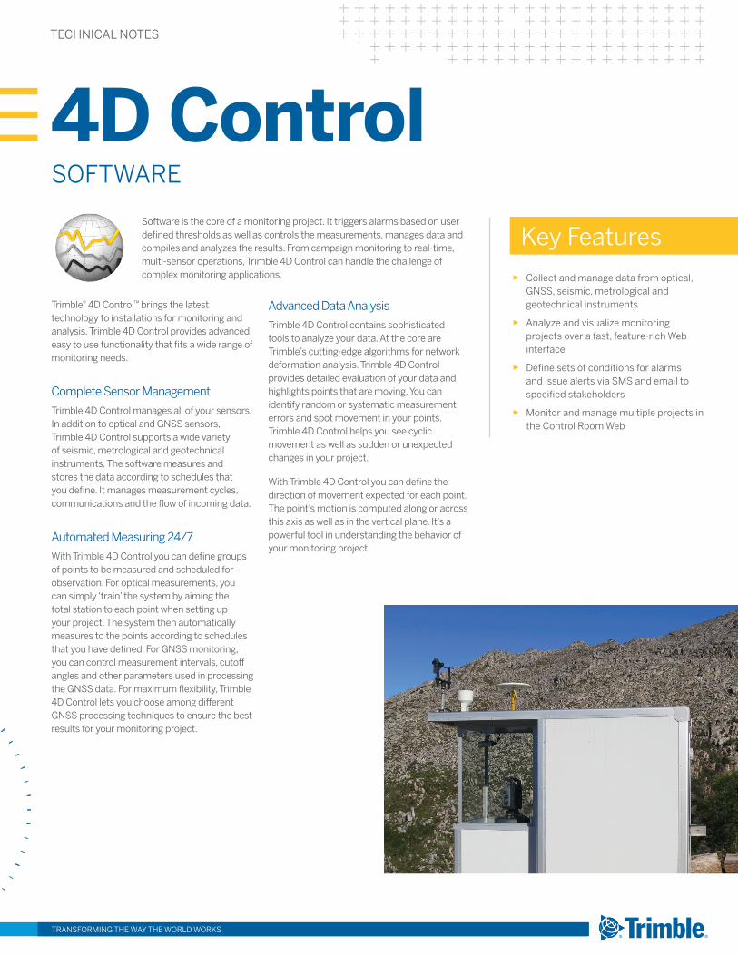
Trimble 4D Control manages all of your sensors. In addition to optical and GNSS sensors, Trimble 4D Control supports a wide variety of seismic, metrological and geotechnical instruments. The software measures and stores the data according to schedules that you define. It manages measurement cycles, communications and the flow of incoming data.
Automated Measuring 24/7
With Trimble 4D Control you can define groups of points to be measured and scheduled for observation. For optical measurements, you can simply ‘train’ the system by aiming the total station to each point when setting up your project. The system then automatically measures to the points according to schedules that you have defined. For GNSS monitoring, you can control measurement intervals, cutoff angles and other parameters used in processing the GNSS data. For maximum flexibility, Trimble 4D Control lets you choose among different GNSS processing techniques to ensure the best results for your monitoring project.
4D Control Software is the core of a monitoring project. It triggers alarms based on user defined thresholds as well as controls the measurements, manages data and compiles and analyzes the results. From campaign monitoring to real-time, multi-sensor operations, Trimble 4D Control can handle the challenge of complex monitoring applications.
SOFTWARE
Advanced Data Analysis
Trimble 4D Control contains sophisticated tools to analyze your data. At the core are Trimble’s cutting-edge algorithms for network deformation analysis. Trimble 4D Control provides detailed evaluation of your data and highlights points that are moving. You can identify random or systematic measurement errors and spot movement in your points. Trimble 4D Control helps you see cyclic movement as well as sudden or unexpected changes in your project.
With Trimble 4D Control you can define the direction of movement expected for each point. The point’s motion is computed along or across this axis as well as in the vertical plane. It’s a powerful tool in understanding the behavior of your monitoring project.

TECHNICAL NOTES
4D Control SOFTWARE
Web Access and Visualization of Your Monitoring Projects
Trimble 4D Web is used to analyze and visualize monitoring projects, and provides access to your monitoring system over a fast, feature-rich Web interface. Visualization tools in Trimble 4D Web provide a versatile overview of your monitoring network. Whenever you connect to the Internet, you can connect to Trimble 4D Control Web and view your project in real-time.
► Powerful map and custom views to identify sensors and measurement points. You can use aerial photos or other imagery to provide detail background information.
► Fast and easy charting lets you plot the results of individual points or sensors.
► Visualize information from monitoring sensors in chart or tabular forms.
► Link to project webcams in real time and make visual inspection from any location.
► Post and manage updates and reminder to the project log to meet stakeholders’ needs.
► Set conditions and recipients for issuing alerts and messages and manage in a secure environment.
► Controlled access to specified stakeholders by assigning different access levels to ensure information is available only to those who need it.
Trimble 4D Control Room Web
The Trimble 4D Control Room Web allows you to monitor Trimble 4D Control projects that belong to one or more Trimble 4D Control Web installations. This add-on to the Trimble 4D Control software shows information that is published by the individually linked Trimble 4D Web instances.
Trimble 4D Control Room Web has the following benefits:
► Seamless authentication and authorization of users registered both at Trimble 4D Control Room Web and a linked Trimble 4D Control Web installation.
► Monitoring information about the Sensor Data Flow, Existing Alarm Status, and Unacknowledged Events for each project of interest on one page.
► Map visualization of the location of different Trimble 4D Control Web installations including tooltips for further information.
► User management functionality.
Overview of Monitoring Apps
Trimble 4D Control supports various apps to enable a wide and growing range of capabilities for different monitoring requirements. Each app offers a number of modules and functionalities for specific monitoring operations such as instrument controls, data collection, data processing, data analysis and alarming. New apps can be added to existing installations at any time.
Radar Uses pre-processed data from a radar device to calculate displacements based on radar interferograms.
High Rise Uses GNSS and inclination sensors to monitor high-rise structures during construction and delivers precise and reliable coordinates on demand.
Seismo Geodetic Integrates strong motion and high frequency data for the combined processing of accelerometer and GNSS data using a Kalman filter to produce high rate GNSS displacement data.
Geotechnical Provides continuous high precision measurements and rapid updates to monitor over long distances.
Pivot RTX Performs absolute position estimation and coordinate integrity monitoring in real-time mode using the RTX technology.
Pivot RTX-PP Performs absolute position estimation and coordinate integrity monitoring in postprocessing mode using the RTX technology.
Integrity Manager Provides real- time and postprocessing engines to monitor GNSS reference stations.
TRANSFORMING THE WAY THE WORLD WORKS
NORTH AMERICATrimble Navigation Limited10368 Westmoor DriveWesminster, [email protected]
© 2014–2016, Trimble Navigation Limited. All rights reserved. Trimble and the Globe & Triangle logo are trademarks of Trimble Navigation Limited, registered in the United States and in other countries. 4D Control is a trademark of Trimble Navigation Limited. All other trademarks are the property of their respective owners. PN 022543-460G (06/16)
www.trimble.com/monitoring