Summer 2007: The Greenbelt - An open space of state-wide significance
12
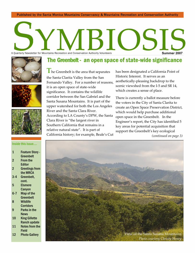
The Greenbelt - an open space of state-wide significance Summer 2007 Inside this issue…. 1 Feature Story - Greenbelt 2 From the Editor 2 Greetings from the MRCA 3-4 Greenbelt, cont. 5 Elsmere Canyon 6-7 Map of the Greenbelt 8 Wildlife Corridors 9 Parks in the News 10 King Gillette Ranch update 11 Notes from the Field 12 Photo Gallery The Greenbelt is the area that separates the Santa Clarita Valley from the San Fernando Valley. For a number of reasons, it is an open space of state-wide significance. It contains the wildlife corridor between the San Gabriel and the Santa Susana Mountains. It is part of the upper watershed for both the Los Angeles River and the Santa Clara River. According to LA County’s DPW, the Santa Clara River is “the largest river in Southern California that remains in a relative natural state”. It is part of California history; for example, Beale’s Cut has been designated a California Point of Historic Interest. It serves as an aesthetically-pleasing backdrop to the scenic viewshed from the I-5 and SR 14, which creates a sense of place. There is currently a ballot measure before the voters in the City of Santa Clarita to create an Open Space Preservation District, which would help purchase additional open space in the Greenbelt. In the Engineer’s report, the City has identified 5 key areas for potential acquisition that support the Greenbelt’s key ecological (continued on page 3) View of the Santa Susana Mountains Photo courtesy Christy Henry
-
Upload
mountains-recreation-and-conservation-authority -
Category
Documents
-
view
213 -
download
0
description
Â
Transcript of Summer 2007: The Greenbelt - An open space of state-wide significance
The Greenbelt - an open space of state-wide significance
Summer 2007
Inside this issue….
1 Feature Story -
Greenbelt
2 From the
Editor
2 Greetings from
the MRCA
3-4 Greenbelt,
cont. 5 Elsmere
Canyon
6-7 Map of the
Greenbelt
8 Wildlife
Corridors
9 Parks in the
News
10 King Gillette
Ranch update
11 Notes from the
Field
12 Photo Gallery
The Greenbelt is the area that separates
the Santa Clarita Valley from the San
Fernando Valley. For a number of reasons,
it is an open space of state-wide
significance. It contains the wildlife
corridor between the San Gabriel and the
Santa Susana Mountains. It is part of the
upper watershed for both the Los Angeles
River and the Santa Clara River.
According to LA County’s DPW, the Santa
Clara River is “the largest river in
Southern California that remains in a
relative natural state”. It is part of
California history; for example, Beale’s Cut
has been designated a California Point of
Historic Interest. It serves as an
aesthetically-pleasing backdrop to the
scenic viewshed from the I-5 and SR 14,
which creates a sense of place.
There is currently a ballot measure before
the voters in the City of Santa Clarita to
create an Open Space Preservation District,
which would help purchase additional
open space in the Greenbelt. In the
Engineer’s report, the City has identified 5
key areas for potential acquisition that
support the Greenbelt’s key ecological
(continued on page 3)
View of the Santa Susana Mountains
Photo courtesy Christy Henry

Page 2
From the Editor…..From the Editor…..
Last month, my husband and I were in Philadelphia,
listening to a commencement address by Dr. Michael
Dombeck, former head of the US Forest Service and now a
professor at the University of Wisconsin, Stevens Point. In
the audience there was a mixture of Generation Y graduates,
all decked out in their caps and gowns, and their grey-haired
Boomer parents. As he spoke, I recognized a characteristic
Midwestern “twang” and knew he spent time in Minnesota.
As it turns out, we both attended graduate school at the
University of
Minnesota at the
same time. I
immediately liked
the guy.
In his speech, Dr.
Dombeck
encouraged his
audience to
become better
stewards of the land. Then he said something that really
caught my attention. He quoted Aldo Leopold, reminding
us “that the highest task of civilization was to figure out how
‘to live on a piece of land without spoiling it.”
To live on a piece of land without spoiling it requires us to
view it from an historical perspective, a perspective beyond
our limited personal lifespan. We need to adopt the best
practices from the people who lived here before us as well as
consider the needs of the people who will come after us.
Right now, the people in my hometown of Santa Clarita
have a chance to vote on the formation of an open space
district, one that would enable our city government to
purchase open space before it is developed. We could add
to the greenbelt between the Santa Clarita and the San
Fernando Valleys. We could choose to become better
stewards of the land.
It’s an opportunity— for Boomer’s as well as Generation X
and Y’s - to work together, to live on the land as stewards
and leave a legacy for the future. I hope we choose wisely.
And to our daughter Ellie, congratulations.
Your Dad and I are very proud of you.
Wendy Langhans
310-858-7272 x115
Greetings from the MRCA…..Greetings from the MRCA…..
Dear Friends,
This story didn’t make the news: According to MRCA trail
volunteer Steve Ioerger, “In the first quarter of this year we
had 19 trail work days where our 23 volunteers donated 344
ours maintaining the trails in Towsley Canyon.”
Here’s another story didn’t make the news: On June 6, the
MRCA Board accepted a grant from Prop 40 to develop and
improve of land and water resources in Mentryville, Santa
Clarita. This includes plans to develop new trails.
As isolated stories, these don’t tell you much beyond the
facts. But if you look at them together, you begin to see a
pattern. You see good things being accomplished by a
cooperate effort among public agencies and private citizens.
And you also see that where the public is actively engaged
in something worthwhile, the government is supportive.
As this issue of Symbiosis goes to press, the citizens of Santa
Clarita are voting on an assessment to create an Open Space
Preservation District, to create a green belt of open space
around the city and the valley.
Now here’s something that did make the news: last week
the Santa Monica Mountains Conservancy passed a
resolution supporting this measure. As quoted in The Signal,
Executive Director Joe Edmiston stated that “park officials
rarely turn down requests for matching funds when voters
in a local area approve something like an assessment, which
generates revenue. ‘That is the single most persuasive
argument you can make when you go to Sacramento,’”
It gives a whole new meaning to “send
them a message”, doesn’t it?
Now go outside and play!
Michael D. “Mike” Berger, Chair
Mountains Recreation and
Conservation Authority
Haverford College
Page 3
Greenbelt (continued from page 1)….Greenbelt (continued from page 1)….
functions. That is one of the reasons why the Santa Monica
Mountains Conservancy supports the measure.
In this issue of Symbiosis we will focus on some of the
proposed developments and illustrate what is at stake
ecologically. We will also provide an insert with maps
identifying each proposed development site, as well as the
location of land that is now being preserved as open space.
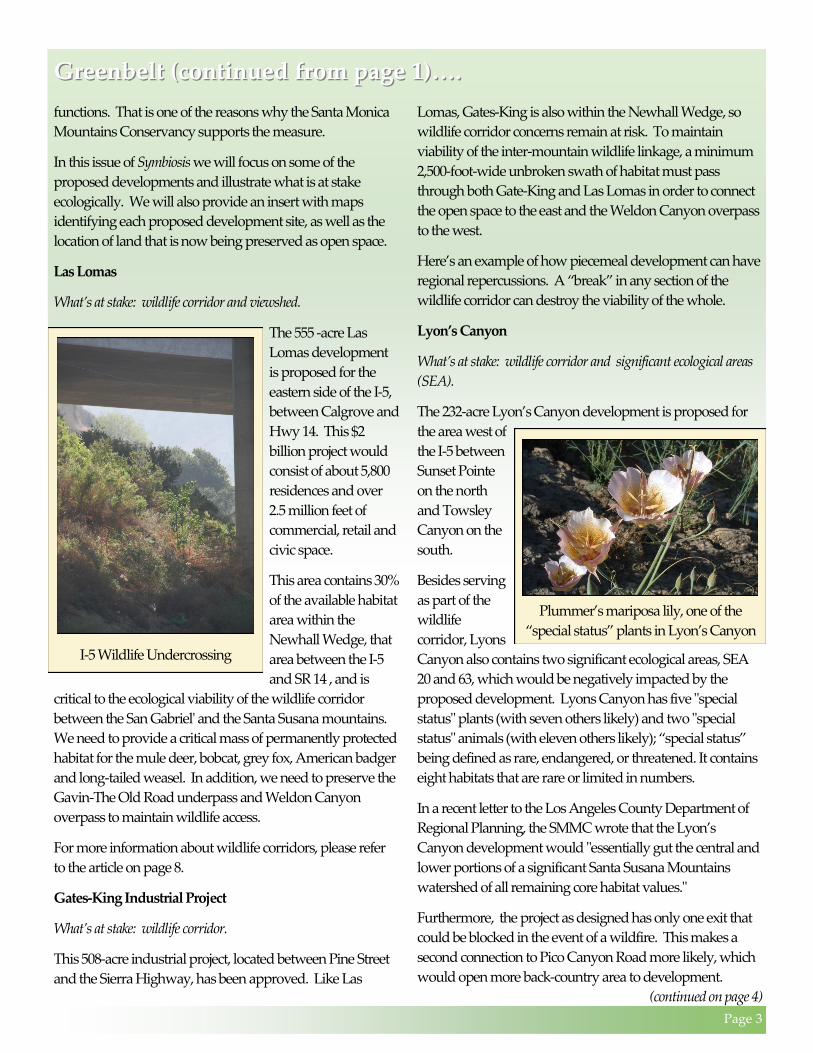
Las Lomas
What’s at stake: wildlife corridor and viewshed.
The 555 -acre Las
Lomas development
is proposed for the
eastern side of the I-5,
between Calgrove and
Hwy 14. This $2
billion project would
consist of about 5,800
residences and over
2.5 million feet of
commercial, retail and
civic space.
This area contains 30%
of the available habitat
area within the
Newhall Wedge, that
area between the I-5
and SR 14 , and is
critical to the ecological viability of the wildlife corridor
between the San Gabriel' and the Santa Susana mountains.
We need to provide a critical mass of permanently protected
habitat for the mule deer, bobcat, grey fox, American badger
and long-tailed weasel. In addition, we need to preserve the
Gavin-The Old Road underpass and Weldon Canyon
overpass to maintain wildlife access.
For more information about wildlife corridors, please refer
to the article on page 8.
Gates-King Industrial Project
What’s at stake: wildlife corridor.
This 508-acre industrial project, located between Pine Street
and the Sierra Highway, has been approved. Like Las
Lomas, Gates-King is also within the Newhall Wedge, so
wildlife corridor concerns remain at risk. To maintain
viability of the inter-mountain wildlife linkage, a minimum
2,500-foot-wide unbroken swath of habitat must pass
through both Gate-King and Las Lomas in order to connect
the open space to the east and the Weldon Canyon overpass
to the west.
Here’s an example of how piecemeal development can have
regional repercussions. A “break” in any section of the
wildlife corridor can destroy the viability of the whole.
Lyon’s Canyon
What’s at stake: wildlife corridor and significant ecological areas
(SEA).
The 232-acre Lyon’s Canyon development is proposed for
the area west of
the I-5 between
Sunset Pointe
on the north
and Towsley
Canyon on the
south.
Besides serving
as part of the
wildlife
corridor, Lyons
Canyon also contains two significant ecological areas, SEA
20 and 63, which would be negatively impacted by the
proposed development. Lyons Canyon has five "special
status" plants (with seven others likely) and two "special
status" animals (with eleven others likely); “special status”
being defined as rare, endangered, or threatened. It contains
eight habitats that are rare or limited in numbers.
In a recent letter to the Los Angeles County Department of
Regional Planning, the SMMC wrote that the Lyon’s
Canyon development would "essentially gut the central and
lower portions of a significant Santa Susana Mountains
watershed of all remaining core habitat values."
Furthermore, the project as designed has only one exit that
could be blocked in the event of a wildfire. This makes a
second connection to Pico Canyon Road more likely, which
would open more back-country area to development.
(continued on page 4)
I-5 Wildlife Undercrossing
Plummer’s mariposa lily, one of the
“special status” plants in Lyon’s Canyon
Page 4
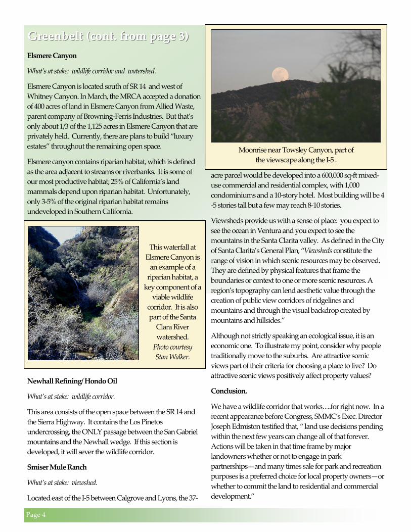
Greenbelt (cont. from page 3)Greenbelt (cont. from page 3)
Elsmere Canyon
What’s at stake: wildlife corridor and watershed.
Elsmere Canyon is located south of SR 14 and west of
Whitney Canyon. In March, the MRCA accepted a donation
of 400 acres of land in Elsmere Canyon from Allied Waste,
parent company of Browning-Ferris Industries. But that’s
only about 1/3 of the 1,125 acres in Elsmere Canyon that are
privately held. Currently, there are plans to build “luxury
estates” throughout the remaining open space.
Elsmere canyon contains riparian habitat, which is defined
as the area adjacent to streams or riverbanks. It is some of
our most productive habitat; 25% of California’s land
mammals depend upon riparian habitat. Unfortunately,
only 3-5% of the original riparian habitat remains
undeveloped in Southern California.
Newhall Refining/ Hondo Oil
What’s at stake: wildlife corridor.
This area consists of the open space between the SR 14 and
the Sierra Highway. It contains the Los Pinetos
undercrossing, the ONLY passage between the San Gabriel
mountains and the Newhall wedge. If this section is
developed, it will sever the wildlife corridor.
Smiser Mule Ranch
What’s at stake: viewshed.
Located east of the I-5 between Calgrove and Lyons, the 37-
acre parcel would be developed into a 600,000 sq-ft mixed-
use commercial and residential complex, with 1,000
condominiums and a 10-story hotel. Most building will be 4
-5 stories tall but a few may reach 8-10 stories.
Viewsheds provide us with a sense of place: you expect to
see the ocean in Ventura and you expect to see the
mountains in the Santa Clarita valley. As defined in the City
of Santa Clarita’s General Plan, “Viewsheds constitute the
range of vision in which scenic resources may be observed.
They are defined by physical features that frame the
boundaries or context to one or more scenic resources. A
region’s topography can lend aesthetic value through the
creation of public view corridors of ridgelines and
mountains and through the visual backdrop created by
mountains and hillsides.”
Although not strictly speaking an ecological issue, it is an
economic one. To illustrate my point, consider why people
traditionally move to the suburbs. Are attractive scenic
views part of their criteria for choosing a place to live? Do
attractive scenic views positively affect property values?
Conclusion.
We have a wildlife corridor that works….for right now. In a
recent appearance before Congress, SMMC’s Exec. Director
Joseph Edmiston testified that, “ land use decisions pending
within the next few years can change all of that forever.
Actions will be taken in that time frame by major
landowners whether or not to engage in park
partnerships—and many times sale for park and recreation
purposes is a preferred choice for local property owners—or
whether to commit the land to residential and commercial
development.”
Moonrise near Towsley Canyon, part of
the viewscape along the I-5 .
This waterfall at
Elsmere Canyon is
an example of a
riparian habitat, a
key component of a
viable wildlife
corridor. It is also
part of the Santa
Clara River
watershed.
Photo courtesy
Stan Walker.
Page 5
Elsmere Canyon was the Route Between the Valleys….Elsmere Canyon was the Route Between the Valleys….
Elsmere Canyon is a park with many faces. To the hiker it
is a rugged and challenging playground with beautiful
vistas and rewarding trails. To the naturalist it is home to a
thriving stream ecosystem teaming with fascinating plant
and animal life. To the photographer the contrasts created
by the stunning explosion of colors hidden just below the
dry and worn hillsides are magical. To the MRCA it is the
newest addition to the critical expanse of open space
between the San Fernando and Santa Clarita Valleys. Given
it’s rich history, it is only fitting that this canyon fill many
different needs for many different people.
Elsmere Canyon’s importance in human history was
determined by it’s natural history. Elsmere Canyon lay
between two large and agriculturally productive river
valleys. For centuries before the arrival of the Europeans, the
Gabrielino/Tongva, centered in the San Fernando Valley,
and the Tatavium, centered in the Santa Clarita Valley,
utilized Elsmere Canyon as a suitable avenue for their
extensive trade.
By the mid-1850’s the
demographics
changed but the need
remained for a
convenient route
between the two
valleys. General Beale
and the troops from
Fort Tejon cut a 90 foot
slash through Elsmere
Canyon. Later known
as Beale’s Cut, this
gash in the mountains
allowed for quicker
and easier passage.
By the early 1900’s, Los
Angeles undertook the
largest water project in
the world. In order to supply the growing metropolis with
fresh water, the Owens Valley in the Eastern Sierras was
drained and piped to the faucets and orchards of the valleys
of Los Angeles. A large section of pipe was laid underneath
Elsmere Canyon.
Today when you
look at the canyon,
you can see a
challenge through
the eyes of the hiker,
a thriving ecosystem
through the eyes of a
naturalist, a magical
contrast through the
eyes of a
photographer, or an
amazing history
through the eyes of
time. It seems fitting
that a park that has
so much to offer
yesterday and today
has become a crucial part of a larger effort by the MRCA and
others to create a vital and lasting expanse of open space
between the San Fernando Valley and Santa Clarita Valley.
Submitted by MRCA Interpreter Keith Jobson
Waterfall at Elsmere Canyon
Photo courtesy Stan Walker
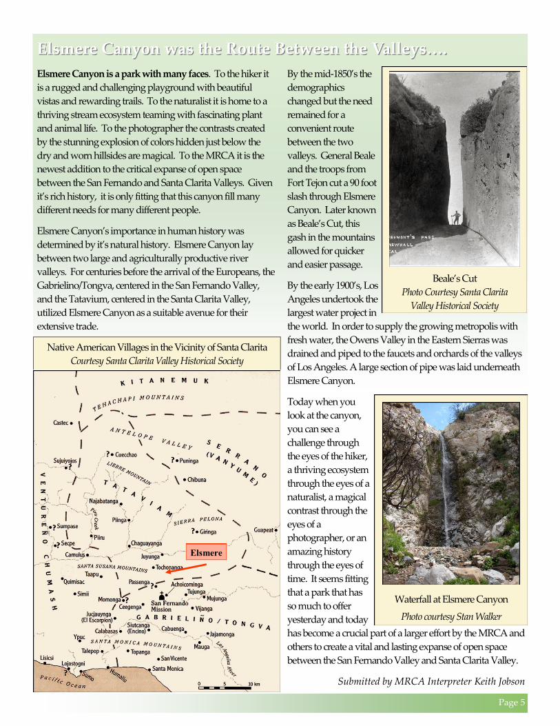
Elsmere
Native American Villages in the Vicinity of Santa Clarita
Courtesy Santa Clarita Valley Historical Society
Beale’s Cut
Photo Courtesy Santa Clarita
Valley Historical Society

The Newhall Wedge, the key
to the ecological health of the
Greenbelt.
The Newhall Wedge is an ecologically strategic
section of land between the I-5 and Highway 14. It is
part of the Greenbelt, the open space between the
Santa Clarita and San Fernando Valleys.
It serves as the wildlife corridor between the San
Gabriel Mountains and the Santa Susana
Mountains.
It is part of the watershed for both the
Santa Clara River and the Los Angeles
River
Its viability is threatened by a series of
proposed development projects, such as
555-acre Los Lomas, which threatens the
Gavin-Old Road underpass and Gavin
overpass.
508-acre Gates-King, key to a viable
wildlife corridor.
232-acre Lyon’s Canyon, encroaching
upon a significant ecological areas, SEA
63.
1,225 acres in Elsmere Canyon, potential
site of “luxury estates”. The “Los Pinetos
undercrossing” is the ONLY
undercrossing between the San Gabriel
Mountains and the Newhall Wedge.
Hondo Oil/Newhall Refining Company.
The loss of this open space will destroy the
wildlife corridor.
37-acre Smiser Mule Ranch. This is the
northwestern entrance to the Newhall
Wedge, across the I-5 from Lyon’s
Canyon.
Wildlife Corridor
SITE OF
POTENTIAL
LUXURY
ESTATES
Page 8
Wildlife Corridors keep wildlife healthy and one the go…. Wildlife Corridors keep wildlife healthy and one the go….
What happens when our comings and goings are
hampered by a road closure, a tree falling across our path or
a flooded street? It can be very frustrating. Now imagine
that your life depends on getting across that area – you have
to cross a freeway with cars traveling at sixty miles per hour
to get your dinner or to get to your mate. This is what occurs
when the needs of different keystone species are at odds, like
humans and mountain lions. A keystone species is defined
as a species with a disproportionate effect on its
environment relative to its abundance.
First, take a look at how this conflict begins. For a keystone
species like the mountain lion, Puma concolor, to survive, it
needs to be able to have access to a territory of upwards of
100 square mile, depending on the cat’s gender and the
density of prey. Residential development reduces the
amount of available wildlife habitat (threatening an
estimated 59 per cent of California’s wildlife).
Also, humans tend to cluster the answers to their basic needs
like shopping malls, hospitals and housing, then connect
those areas with roads and highways for accessibility. These
connectors fragment an animal’s territory and create
“islands” of habitat, which limits an animal’s ability to move
in response to changing conditions and threatens their
survival. Other methods of fragmentation include power
lines, fences, dams, aqueducts, off-road vehicles, and even
light and noise pollution.
These “islands” deprive the animals and plants
of genetic diversity that is crucial to a healthy
population and lead to smaller, more isolated
animal populations. To put this in human
terms, consider a tour I took recently in the
mountains of Southern Appalachia. As I stood
between two mountains in Cataloochie Valley,
the guide explained, “When a young man
came of age and lived on that mountain”, he
said, pointing to his left, “he’d put on his
traveling shoes and walk over to that
mountain”, he pointed to the area on his right,
“to find a woman. That way there was no
mixing of kin.” The same is true for species
such as the mountain lion. The males do not
recognize individuals as family and may mate
with their daughters, resulting in sterility in the
young (Mountain Lion Foundation).
One solution to meeting the needs of both humans and
wildlife is to create wildlife corridors, land managed for its
function as a route for wildlife movement and dispersal.
“Corridors mitigate the effects of this fragmentation by
(1) allowing animals to move between remaining habitats,
thereby permitting depleted populations to be replenished
and promoting genetic exchange; (2) providing escape
routes from fire, predators, and human disturbances, thus
reducing the risk of catastrophic events (such as fire or
disease) causing population or local species extinction; and
(3) serving as travel routes for individual animals as they
move within their home ranges in search of food, water,
mates, and other needs.”(1) That’s one reason why the Santa
Clarita Woodlands was purchased in the 1980’s. So the next time you experience a blockage in your travels
whether it be traffic, a detour, an accident, or a downed
power line, remember our wild friends and how they need
safe passages too. Agencies like the Santa Monica
Mountains Conservancy and its partners work diligently to
provide crucial passages for keystone specie like the Puma
Concolor to survive by buying up key properties that link
core habitats, thus providing what is necessary for a healthy
ecosystem.
Submitted by Angi Orton, MRCA Director of Volunteer Services ___________________
(1) Santa Clarita Valley General Plan, pg 54.
Dr. Ray Sauvajot and his team have spent years tracking mountain
lions in the mountains of Southern California. They have seen
first-hand how mountain lions use wildlife corridors.
July’s Chautauqua Program Presents:
Page 9
Parks in the News…..Parks in the News…..
The Franklin Canyon Store
is Now Open!
The Franklin Canyon
Store is now open inside
the Sooky Goldman
Nature Center.
It’s a great place to
purchase cold water
and snacks!!!
Open everyday from 10am to 4pm.
MRCA Facilities and Maintenance:
Preparing for the fire before we see the smoke
You don’t need a crystal ball to know this fire season could
get real ugly. We know it too and our brushing crews are
preparing for it. Brushing is mix of mechanical, hand labor,
resource modification and other techniques to remove
hazardous fuel loads.
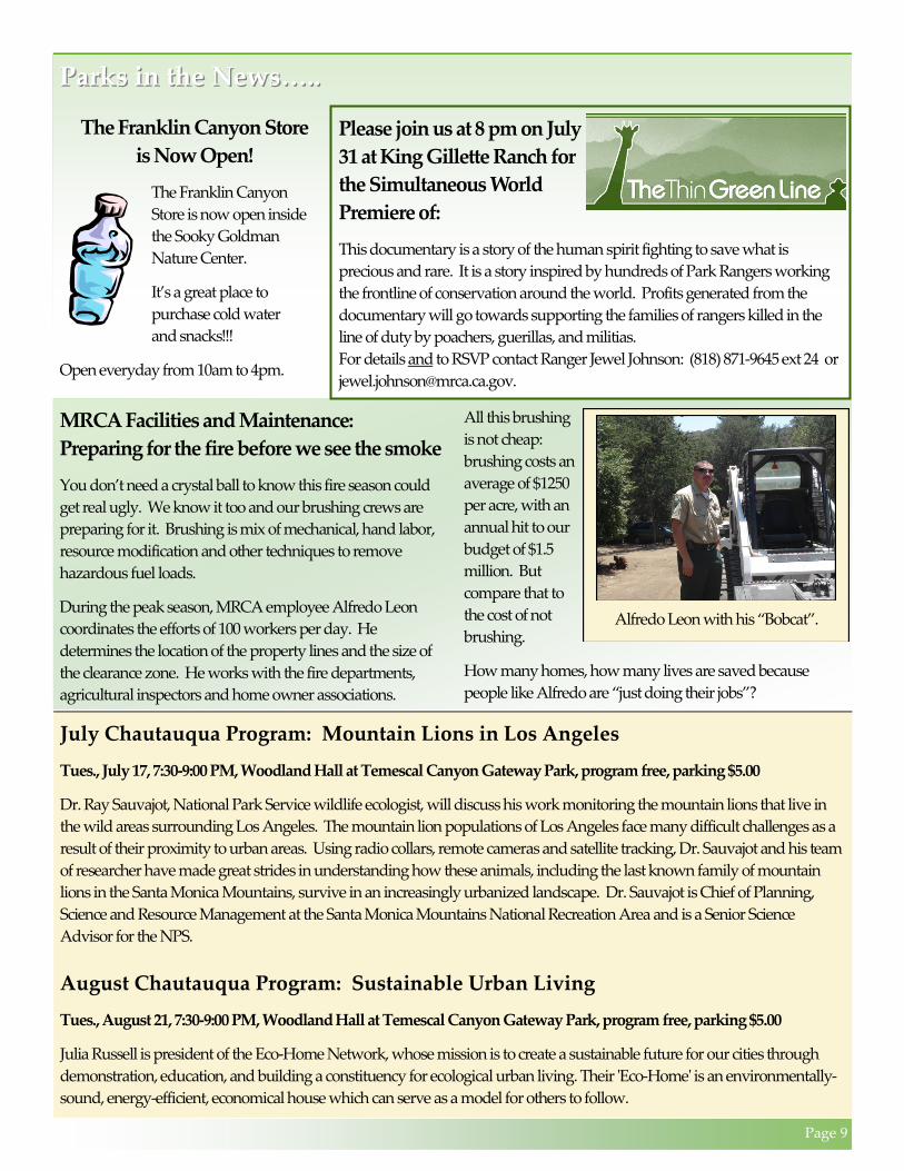
During the peak season, MRCA employee Alfredo Leon
coordinates the efforts of 100 workers per day. He
determines the location of the property lines and the size of
the clearance zone. He works with the fire departments,
agricultural inspectors and home owner associations.
All this brushing
is not cheap:
brushing costs an
average of $1250
per acre, with an
annual hit to our
budget of $1.5
million. But
compare that to
the cost of not
brushing.
How many homes, how many lives are saved because
people like Alfredo are “just doing their jobs”?
Alfredo Leon with his “Bobcat”.
July Chautauqua Program: Mountain Lions in Los Angeles
Tues., July 17, 7:30-9:00 PM, Woodland Hall at Temescal Canyon Gateway Park, program free, parking $5.00
Dr. Ray Sauvajot, National Park Service wildlife ecologist, will discuss his work monitoring the mountain lions that live in
the wild areas surrounding Los Angeles. The mountain lion populations of Los Angeles face many difficult challenges as a
result of their proximity to urban areas. Using radio collars, remote cameras and satellite tracking, Dr. Sauvajot and his team
of researcher have made great strides in understanding how these animals, including the last known family of mountain
lions in the Santa Monica Mountains, survive in an increasingly urbanized landscape. Dr. Sauvajot is Chief of Planning,
Science and Resource Management at the Santa Monica Mountains National Recreation Area and is a Senior Science
Advisor for the NPS.
August Chautauqua Program: Sustainable Urban Living
Tues., August 21, 7:30-9:00 PM, Woodland Hall at Temescal Canyon Gateway Park, program free, parking $5.00
Julia Russell is president of the Eco-Home Network, whose mission is to create a sustainable future for our cities through
demonstration, education, and building a constituency for ecological urban living. Their 'Eco-Home' is an environmentally-
sound, energy-efficient, economical house which can serve as a model for others to follow.
Please join us at 8 pm on July
31 at King Gillette Ranch for
the Simultaneous World
Premiere of:
This documentary is a story of the human spirit fighting to save what is
precious and rare. It is a story inspired by hundreds of Park Rangers working
the frontline of conservation around the world. Profits generated from the
documentary will go towards supporting the families of rangers killed in the
line of duty by poachers, guerillas, and militias.
For details and to RSVP contact Ranger Jewel Johnson: (818) 871-9645 ext 24 or
Page 10
King Gillette Ranch Opening to the Public June 30th….King Gillette Ranch Opening to the Public June 30th….
What do disposable razors, glamorous Hollywood parties,
campfires, and mountain lion survival all have in common?
The answer is King Gillette Ranch, the newest addition to
public open space. The MRCA is opening King Gillette
Ranch to the public on June 30th. KGR is located 3 miles
south of Hwy. 101
at the intersection
of Mulholland
Hwy. and Las
Virgenes Road.
The history behind
this property is vast
and varied –
starting out as
Talapop, a large
and socially
important
Chumash village,
moving on to
become part of the
Rancho era, and then purchased by razor baron King
Gillette, who wanted to take his disposable razor-generated
millions and create the rustic retirement. He commissioned
noted California architect Wallace Neff to build a Spanish
revival styled mansion. However, the stock market crash
reversed Gillette’s fortunes and he died several years later.
His widow sold the property to MGM director Clarence
Brown. The property became a Catholic seminary and later
home to the controversial cult of Elizabeth Clair Prophet
before Soka University bought it in 1986. Park agencies had
hoped to acquire the 588-acre property since the late 1970’s,
but that did not occur until 2005, when it was purchased
from Soka by the SMMC and MRCA (along with the
National Park Service, California State Parks, other state and
local agencies, and some private contributions).
The turnover wasn’t scheduled until early next year, but in a
surprising turn of events, the doors are opening 6 months
early. So while we work with our park partners to garner
public input and develop long-term programming, we felt
the need to offer something NOW.
Campfires are a traditional summer pastime (with stringent
and proper safeguards, of course). We will offer evening
campfires every Tuesday starting in July. On weekends
there will be moonlight hikes, and day hikes showcasing the
natural world as well as the site's history and architecture.
We see this as a chance to introduce KGR to the public with
a series of programs similar to those we offer at our other
sites. For information about our public programs, please
visit our website at www.LAMountains.com. If you wish to
be added to our e-mail list for hikes and activities, contact
Robin Smith at [email protected].
King Gillette Ranch may also serve as a location for a school-
based field science program. Currently, the MRCA brings
LAUSD sixth graders to Temescal Canyon Gateway Park
for a week of outdoor education, rope course challenges,
campfires, and hiking. With it’s open spaces, sweeping
views, and dormitory buildings already in place KGR
would enable us to reach even more students, helping to
create the next generation of naturalists.
Besides being an ideal location for public programs and
outdoor education, KGR serves an important ecological role
in the heart of the Santa Monica Mountains. KGR, along
with other areas such as Malibu Creek State Park, Upper Las
Virgenes Canyon, and Cheeseboro Canyon, occupies a
strategically position in the wildlife corridor connecting the
Santa Monica Mountains, through the Simi Hills, to the
Santa Susanna Mountains. It increases the size of the core
habitat area for wildlife. And it’s part of the watershed for
Malibu Creek.
So come on down and pay us a visit this summer.
Hollywood stars Clark Gable and Greta Garbo used to fly
here for weekend parties. We invite you and your family to
join us for an evening campfire or a morning hike.
Submitted by MRCA Interpreter Anna Fink
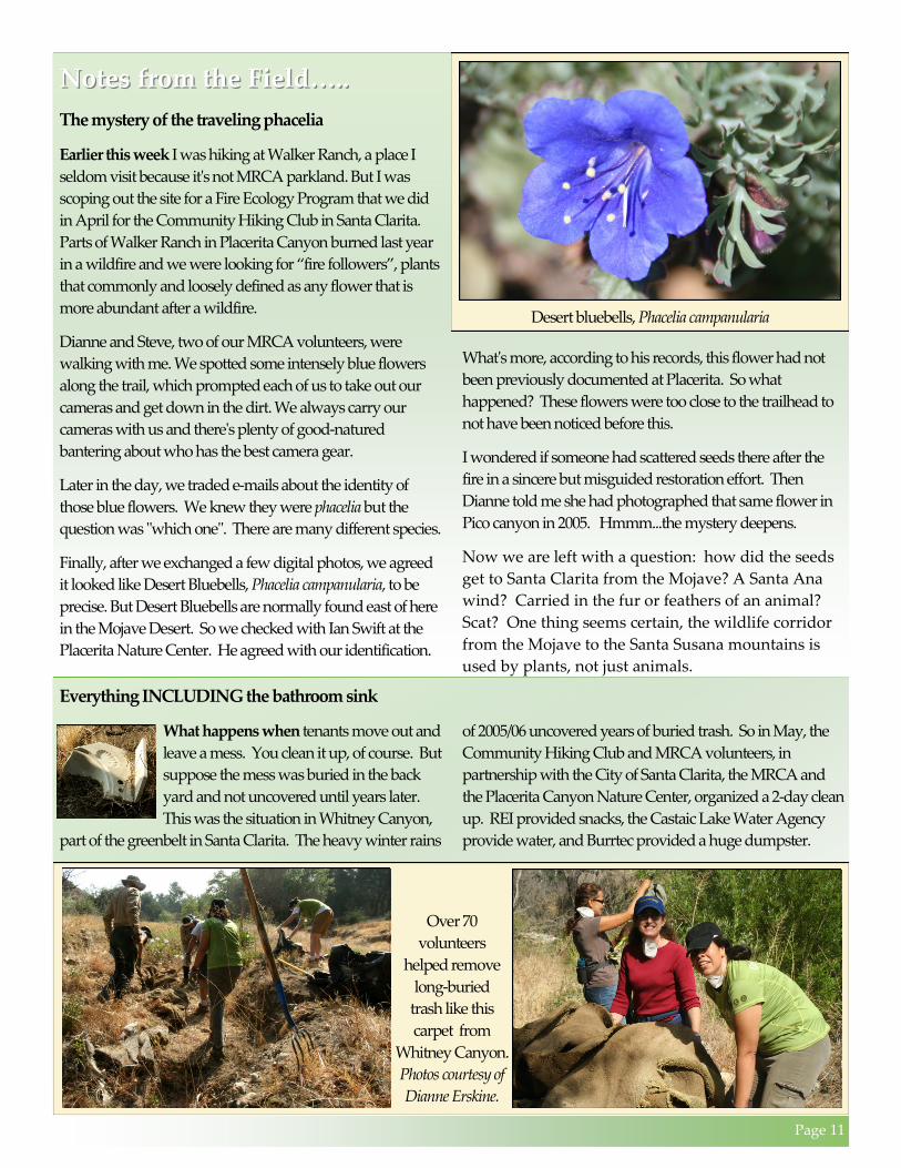
Mule deer can often be found browsing on the property.
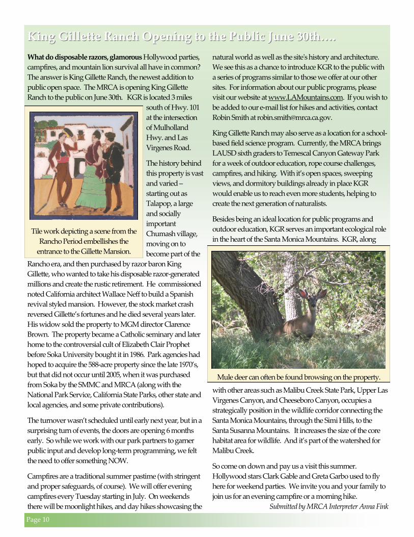
Tile work depicting a scene from the
Rancho Period embellishes the
entrance to the Gillette Mansion.
Page 11
Notes from the Field…..Notes from the Field…..
The mystery of the traveling phacelia
Earlier this week I was hiking at Walker Ranch, a place I
seldom visit because it's not MRCA parkland. But I was
scoping out the site for a Fire Ecology Program that we did
in April for the Community Hiking Club in Santa Clarita.
Parts of Walker Ranch in Placerita Canyon burned last year
in a wildfire and we were looking for “fire followers”, plants
that commonly and loosely defined as any flower that is
more abundant after a wildfire.
Dianne and Steve, two of our MRCA volunteers, were
walking with me. We spotted some intensely blue flowers
along the trail, which prompted each of us to take out our
cameras and get down in the dirt. We always carry our
cameras with us and there's plenty of good-natured
bantering about who has the best camera gear.
Later in the day, we traded e-mails about the identity of
those blue flowers. We knew they were phacelia but the
question was "which one". There are many different species.
Finally, after we exchanged a few digital photos, we agreed
it looked like Desert Bluebells, Phacelia campanularia, to be
precise. But Desert Bluebells are normally found east of here
in the Mojave Desert. So we checked with Ian Swift at the
Placerita Nature Center. He agreed with our identification.
What's more, according to his records, this flower had not
been previously documented at Placerita. So what
happened? These flowers were too close to the trailhead to
not have been noticed before this.
I wondered if someone had scattered seeds there after the
fire in a sincere but misguided restoration effort. Then
Dianne told me she had photographed that same flower in
Pico canyon in 2005. Hmmm...the mystery deepens.
Now we are left with a question: how did the seeds
get to Santa Clarita from the Mojave? A Santa Ana
wind? Carried in the fur or feathers of an animal?
Scat? One thing seems certain, the wildlife corridor
from the Mojave to the Santa Susana mountains is
used by plants, not just animals.
Desert bluebells, Phacelia campanularia
Everything INCLUDING the bathroom sink
What happens when tenants move out and
leave a mess. You clean it up, of course. But
suppose the mess was buried in the back
yard and not uncovered until years later.
This was the situation in Whitney Canyon,
part of the greenbelt in Santa Clarita. The heavy winter rains
of 2005/06 uncovered years of buried trash. So in May, the
Community Hiking Club and MRCA volunteers, in
partnership with the City of Santa Clarita, the MRCA and
the Placerita Canyon Nature Center, organized a 2-day clean
up. REI provided snacks, the Castaic Lake Water Agency
provide water, and Burrtec provided a huge dumpster.
Over 70
volunteers
helped remove
long-buried
trash like this
carpet from
Whitney Canyon.
Photos courtesy of
Dianne Erskine.

Santa Clarita Woodlands Park is adjacent to the
Newhall Pass along the I-5. According to
Caltrans, 50 million vehicles travel this corridor
each year. How many of these people, enveloped
inside their air-conditioned cars, ever stop to see
the natural treasures surrounding them?
There’s a whole ’nother world outside your car.
Take the Calgrove exit west off the I-5, turn south
1/4 mile along the Old Road and go for a walk.
The interior of this sacred datura
blossom glows in the natural
light of early morning.
Things you may not see while driving
along the I-5 through the Newhall Pass.
A Behr’s metalmark enjoys a nourishing
visit to a golden yarrow.
A Honeybee
feasts on a
Sunflower.
Big-coned
douglas fir
trees stand in
silhouette
against the
sky.
From a distance,
all you see is a
cluster of white
flowers. But a
closer look
reveals the details
of an elderberry
(top) and toyon
(bottom).