STATE OF NORTH CAROLINA DEPARTMENT OF … Quality/Surface... · that are not 404 jurisdictional...
16
STATE OF NORTH CAROLINA DEPARTMENT OF ENVIRONMENTAL QUALITY DIVISION OF WATER RESOURCES STATE GENERAL PERMIT FOR IMPACTS TO ISOLATED AND OTHER NON-404 JURISDICTIONAL WETLANDS AND WATERS PERMIT NUMBER: IWGP100000REV FOR PROJECTS IMPACTING LESS THAN OR EQUAL TO ONE (1) ACRE OF ISOLATED AND OTHER NON-404 JURISDICTIONALWETLANDS OR ISOLATED AND OTHER NON-404 JURISDICTIONALSURFACE WATERS AND/OR LESS THAN OR EQUAL TO THREE HUNDRED FEET (300) OF ISOLATED AND OTHER NON-404 JURISDICTIONALSTREAMS In accordance with the provision of Article 21 of Chapter 143, General Statutes of North Carolina as amended and other lawful standards and regulations, including 15A NCAC 02H .1300 and 15A NCAC 02B .0200, promulgated and adopted by the North Carolina Environmental Management Commission. Permission is hereby granted to all owners or operators of activities which impact isolated and other non-404 wetlands, isolated streams or other isolatedand waters in accordance with the conditions set forth in this General Permit. This General Permit shall become effective on March 2, 2016 xxxx. This General Permit shall expire at midnight on March 1, 2021 or unless otherwise rescinded or until deemed appropriate by the Director of the NC Division of Water Resources (DWR). ______________________________________ S. Jay Zimmerman, P.G., Director Division of Water Resources By the Authority of the NC Environmental Management Commission
Transcript of STATE OF NORTH CAROLINA DEPARTMENT OF … Quality/Surface... · that are not 404 jurisdictional...
STATE OF NORTH CAROLINA DEPARTMENT OF ENVIRONMENTAL QUALITY
DIVISION OF WATER RESOURCES
STATE GENERAL PERMIT FOR IMPACTS TO ISOLATED AND OTHER NON-404 JURISDICTIONAL WETLANDS AND WATERS
PERMIT NUMBER: IWGP100000REV
FOR PROJECTS IMPACTING LESS THAN OR EQUAL TO ONE (1) ACRE OF ISOLATED AND OTHER NON-404 JURISDICTIONALWETLANDS OR ISOLATED
AND OTHER NON-404 JURISDICTIONALSURFACE WATERS AND/OR LESS THAN OR EQUAL TO THREE HUNDRED FEET (300) OF ISOLATED AND OTHER NON-404
JURISDICTIONALSTREAMS In accordance with the provision of Article 21 of Chapter 143, General Statutes of North Carolina as amended and other lawful standards and regulations, including 15A NCAC 02H .1300 and 15A NCAC 02B .0200, promulgated and adopted by the North Carolina Environmental Management Commission. Permission is hereby granted to all owners or operators of activities which impact isolated and other non-404 wetlands, isolated streams or other isolatedand waters in accordance with the conditions set forth in this General Permit. This General Permit shall become effective on March 2, 2016 xxxx. This General Permit shall expire at midnight on March 1, 2021 or unless otherwise rescinded or until deemed appropriate by the Director of the NC Division of Water Resources (DWR).
______________________________________ S. Jay Zimmerman, P.G., Director
Division of Water Resources By the Authority of the
NC Environmental Management Commission

State General Permit No. IWGP100000REV
Isolated Wetlands General Permit (IWGP100000)REV 2
This General Permit is issued in conformity with the requirements of North Carolina Division of Water Resources (DWR) Regulations in 15A NCAC 02H .1300 as amended by Session Law 2015-286 for the discharge of fill material to isolated and other non-404 jurisdictional wetlands and isolated waters of the State of North Carolina. This Permit may be rescinded when deemed appropriate by the Director of DWR after appropriate public notice.
Pursuant to Session Law 2015-286, this permit shall apply only to Basin Wetlands and Bogs and no other wetland types as described in the North Carolina Wetland Assessment User Manual prepared by the North Carolina Wetland Functional Assessment Team, version 4.1 October 2010 that are not 404 jurisdictional wetlands under the federal Clean Water Act.
Pursuant to 15A NCAC 02H .1305 as amended by Session Law 2015-286 impacts less than one acre of isolated and other non 404-jurisdictional wetlands for the entire project in the coastal region, less than or equal to one-half (1/2) acre of isolated and other non 404-jurisdictional wetlands for the entire project in the piedmont region, or less than or equal to one-third (1/3) acre of isolated and other non 404-jurisdictional wetlands in the mountain region for the entire project are deemed to be permitted as long as they comply with 15A NCAC 2H.1305. The Coastal, Piedmont and Mountain Regions are depicted in Attachment A.
Public Notice requirement – A separate Public Notice and Individual Permit will be required for all projects which propose to impact greater than 300 linear feet of isolated and other non 404-jurisdictional streams or greater than one (1) acre of isolated and other non-404 jurisdictional wetlands or other isolatedopen waters in accordance with 15A NCAC 02H .1303. For impacts equal to or below these thresholds, this General Permit is applicable without additional Public Notice.
The State of North Carolina certifies that the specified category of activity will not violate applicable portions of Sections 301, 302, 303, 306 and 307 of the Public Laws 92-500 and 95-217 if conducted in accordance with the conditions hereinafter set forth.
Activities meeting any one (1) of the following thresholds or circumstances require written approval from the DWRDivision of Water Resources (DWR):
a) If any of the Conditions of Certification (listed below) cannot be met; or b) Any impacts to isolated streams involving from excavation or dredging; or c) Any isolated stream relocation or isolated stream restoration; or d) Total temporary and permanent isolated stream impacts to isolated streams within the
project boundaries equal to or greater than 150 linear feet of intermittent and/or perennial stream, including temporary and/or permanent impacts; or
e) Total temporary or permanent impacts to isolated and other non-404 wetlands or isolated open waters equal to or greater than one-half (1/2) acre of isolated and other non-404 wetlands or isolated open waters for the entire project in the Piedmont Region; or
f) Total temporary or permanent impacts to isolated and other non-404 wetlands or isolated open waters equal to or greater than one-third (1/3) acre of isolated and other non-404 wetlands or isolated open waters for the entire project in the Mountain Region; or
g) Total temporary or permanent impacts to isolated and other non-404 wetlands or isolated open waters equal to or greater than one (1) acre of isolated and other non-404 wetlands or isolated open waters for the entire project in the Coastal Region;

State General Permit No. IWGP100000REV
Isolated Wetlands General Permit (IWGP100000)REV 3
h) Any high density project, as defined in 15A NCAC 02H .1003(2)(a) and by the density thresholds specified in 15A NCAC 02H .1017, which does not have a stormwater management plan reviewed and approved under a state stormwater program1 or a state-approved local government stormwater program2. Projects that have vested rights, exemptions, or grandfathering from state or locally-implemented stormwater programs and projects that satisfy state or locally-implemented stormwater programs through use of community in-lieu programs require written approval
i) Any impact associated with a Notice of Violation or an enforcement action for violation(s) of DWR Wetland Rules (15A NCAC 02H .0500), Isolated Wetland Rules (15A NCAC 02H .1300), DWR Surface Water or Wetland Standards (15A NCAC 02B .0200), or State Regulated Riparian Buffer Rules (15A NCAC 02B .0200); or
j) Any impacts to isolated streams subject water bodies and/or state regulated riparian buffers along isolated subject water bodies in the Neuse, Tar-Pamlico, or Catawba River Basins or in the Randleman Lake, Jordan Lake or Goose Creek Watersheds (or any other basin or watershed with Riparian Area Protection Rules [Buffer Rules] in effect at the time of application) unless:
i. the activities are listed as “EXEMPT” from these rules or ii. a Buffer Authorization Certificate is issued through NC Division of Coastal
Management (DCM) delegation for “ALLOWABLE” activities; or iii. a Buffer Authorization Certificate or a Minor Variance is issued by a delegated
or designated local government implementing a state riparian buffer program pursuant to 143-215.23.
Activities included in this General Permit that do not meet one of the thresholds listed above do not require written approval from the DWR as long as they comply with the Conditions of Permit listed below. If any of these Conditions cannot be met, then written approval from the DWR is required.
In accordance with North Carolina General Statute 143-215.3D(e), any application for an Isolated Wetland General or Individual Permit must include the appropriate fee. An applicant for a CAMA permit under Article 7 of Chapter 113A of the General Statutes for which a water quality certification is required shall only make one payment to satisfy both agencies; payment shall be the higher of the two feesIf a project also requires a CAMA Permit, one payment to both agencies shall be submitted. This payment shall be the higher of the two fees.
Conditions of Permit:
I. ACTIVITY SPECIFIC CONDITIONS:
1. Totaling and Reporting of Impacts
Isolated Streams - Impacts to isolated streams as determined by the DWR shall be measured as the length of the centerline of the normal flow channel. Permanent and/or temporary stream impacts shall be enumerated on the entire project for all impacts regardless of which 404 Nationwide Permits are used (if any). Stream relocations and streambed and/or bank hardening are considered to be permanent stream impacts. Any activity that results in a loss of use of stream functions including but not limited to filling, relocating, flooding, excavation, dredging and complete shading shall be considered stream impacts.
1 e.g. Coastal Counties, HQW, ORW, or state-implemented Phase II NPDES 2 e.g. Delegated Phase II NPDES, Water Supply Watershed, Nutrient-Sensitive Waters, or Universal Stormwater Management Program
State General Permit No. IWGP100000REV
Isolated Wetlands General Permit (IWGP100000)REV 4
Impacts to streams shall include streams enclosed by bottomless culverts, bottomless arches or other spanning structures unless the entire structure (including construction impacts) spans the entire bed and both banks of the stream, is only used for a road, driveway or path crossing, and is not mitered to follow the stream pattern. Impacts for dam footprints and flooding will count toward the threshold for stream impacts, but flooding upstream of the dam will not count towards mitigation requirements as long as no filling, excavation, relocation or other modification of the existing stream dimension, pattern or profile occurs. Any filling, excavation, relocation or other modification of the existing stream (other than flooding) must re-establish the same dimensions, patterns and profiles of the existing channel (or those of a stable reference reach if the existing channel is unstable.)
Isolated Lakes and Ponds – Impacts to isolated waters other than streams and wetlands as determined by the DWR shall be measured as area. Permanent and/or temporary water impacts shall be enumerated on the entire project for all impacts proposed regardless of which 404 Nationwide Permits are used (if any). Any activity that results in a loss of use of aquatic functions including but not limited to filling, draining, and dredging shall be considered waters impacts.
Isolated and Other Non-404 Wetlands - Impacts to isolated and other non-404 wetlands as determined by the DWR shall be measured as area. Permanent and/or temporary wetland impacts shall be enumerated on the entire project for all impacts. Any activity that results in a loss of use of wetland functions including but not limited to filling, excavating, draining, and flooding shall be considered wetland impacts. Impacts to wetlands shall include activities that change the hydrology of a wetland.
2. In accordance with 15A NCAC 02H .1305 (c) & (d) as amended by Session Law 2015-286, compensatory mitigation may be required for losses of equal to or greater than 150 linear feet of isolated and non-404 jurisdictional streams and/or equal to or greater than one (1) acre of isolated and non-404 jurisdictional wetland impacts in the Coastal Region, one-half (1/2) acre of isolated and non-404 jurisdictional wetland impacts in the Piedmont Region, and one-third (1/3) acre of isolated and non-404 jurisdictional wetland impacts in the Mountain Region. Impacts to isolated and non-404 jurisdictional wetlands shall not be combined with the project impacts to 404 jurisdictional wetlands or streams for the purpose of determining when impact thresholds trigger a mitigation requirement. Pursuant to Session Law 2015-286, mitigation requirements for impacts to isolated and non-404 jurisdictional wetlands shall only apply to the amount of impact that exceeds the thresholds set out in this Condition. For linear, public -publically owned and maintained transportation projects that are not determined to be part of a larger common plan of development by the USACE, compensatory mitigation may be required for, impacts equal to or exceeding greater than 150 linear feet per stream. shall require mitigation.
Compensatory stream and/or wetland mitigation shall be proposed and completed in compliance with G.S. 143-214.11. For applicants proposing to conduct mitigation within a project site, a complete mitigation proposal developed in accordance with the most recent guidance issued by the US Army Corps of Engineers Wilmington District shall be submitted for review and approval with the application for impacts.
3. If this General Permit is used to access residential, commercial or industrial building sites, then all lots parcels owned by the applicant must be buildable without additional impacts to streams or wetlands. The applicant is required to provide evidence that the lots parcels are buildable without requiring additional impacts to wetlands, waters, or state regulated riparian buffers if required to do so in writing by DWR.
4. For road construction purposes, this Permit shall only be utilized from natural high ground to natural high ground

State General Permit No. IWGP100000REV
Isolated Wetlands General Permit (IWGP100000)REV 5
5. Deed notifications or similar mechanisms shall be placed on all retained jurisdictional wetlands, waters, and protective state regulated riparian buffers within the project boundaries in order to assure compliance for future wetland, water, and state regulated riparian buffer impact. These mechanisms shall be put in place at the time of recording of the property or of individual lotsparcels, whichever is appropriate. A sample deed notification can be downloaded from DWR’s web site at http://portal.ncdenr.org/web/wq/swp/ws/401/certsandpermits/apply/forms. The text of the sample deed notification may be modified as appropriate to suit to a specific project. Documentation of deed notifications shall be provided to the Division upon request.
II. GENERAL CONDITIONS:
1. Approved plans and specifications for this project are incorporated by reference and are enforceable parts of this permit. When written authorization is required the plans and specifications for the project are incorporated into the authorization by reference and are an enforceable part of the Certification. Any modifications to the project requires notification to DWR and may require an application submittal to DWR with the appropriate fee. [15A NCAC 02H .0501 and .0502]
2. No waste, spoil, solids, or fill of any kind shall occur in wetlands or waters, or riparian areas beyond the footprint of the impacts (including temporary and/or incidental impacts depicted in the Pre-Construction Notification, as authorized in the written approval from the Division DWR; or beyond the thresholds established for use of this Certification without written authorization, including incidental impacts. [15A NCAC 02H .0501 and .0502] All construction activities, including the design, installation, operation, and maintenance of sediment and erosion control Best Management Practices shall be performed so that no violations of state water quality standards, statutes, or rules occur. Approved plans and specifications for this project are incorporated by reference and are enforceable parts of this permit.
No removal of vegetation or other impacts of any kind shall occur to state regulated riparian buffers beyond the footprint of impacts approved in a Buffer Authorization or Variance or as listed as an exempt activity in the applicable riparian buffer rules. [15A NCAC 02B .0200]
3. All activities shall be in compliance with any applicable State Regulated Riparian Buffer Rules in Chapter 2 of Title 15A. Activities located in the protected riparian areas (whether jurisdictional wetlands or not), within the Neuse, Tar-Pamlico, or Catawba River Basins or in the Randleman, Jordan, or Goose Creek Watersheds (or any other basin or watershed with buffer rules) shall be limited to “uses” identified within and constructed in accordance with 15A NCAC 02B .0233, .0259, .0243, .0250, .0267 and .0605, and shall be located, designed, constructed, and maintained to have minimal disturbance to protect water quality to the maximum extent practicable through the use of best management practices. All buffer rule requirements, including diffuse flow requirements, must be met.
4. In accordance with 15A NCAC 02H .0506 (h), compensatory mitigation may be required for losses of equal to or greater than 150 linear feet of streams (intermittent and perennial) and/or equal to or greater than one (1) acre of wetlands. Impacts to isolated wetlands shall not be combined with 404 jurisdictional wetlands for the purpose of determining when impact thresholds trigger a mitigation requirement. For linear public publicly owned and maintained transportation projects that are not determined to be part of a larger common plan of development by the USACE, compensatory mitigation may be required for impacts equal to or exceeding greater than 150 linear feet per stream. shall require mitigation.
Buffer mitigation may be required for any project with Buffer Rules in effect at the time of application for activities classified as "Allowable with Mitigation" or “Prohibited” within the Table of Uses.

State General Permit No. IWGP100000REV
Isolated Wetlands General Permit (IWGP100000)REV 6
A determination of buffer, wetland, and stream mitigation requirements shall be made for any General Water Quality Certification for this Nationwide and/or Regional General Permit.
Compensatory stream and/or wetland mitigation shall be proposed and completed in compliance with G.S. 143-214.11. For applicants proposing to conduct mitigation within a project site, a complete mitigation proposal developed in accordance with the most recent guidance issued by the US Army Corps of Engineers Wilmington District shall be submitted for review and approval with the application for impacts.
Design and monitoring protocols shall follow the US Army Corps of Engineers Wilmington District Stream Mitigation Guidelines (April 2003) or its subsequent updates. Compensatory mitigation plans shall be submitted to the Division for written approval as required in those protocols. The mitigation plan must be implemented and/or constructed before any impacts occur on site. Alternatively, the Division will accept payment into an in-lieu fee program or a mitigation bank. In these cases, proof of payment shall be provided to the Division before any impacts occur on site.
5. All applications shall address stormwater management throughout the entire project area per the 401 Stormwater Requirements, referenced herein as “Attachment A” at the end of this Certification All projects that disturb one acre or more of land, including a project that disturbs less than one acre of land that is part of a larger common plan of development or sale, and are proposing new built-upon area shall comply with the following requirements: [15A NCAC 02H .0506 (b)(5) and (c)(5)]:
a. Stormwater management shall be provided throughout the entire project area in accordance with 15A NCAC 02H .1003. For the purposes of 15A NCAC 02H .1003(2)(a), density thresholds shall be determined in accordance with 15A NCAC 02H .1017;
b. Projects that have vested rights, exemptions, or grandfathering from state or locally-implemented stormwater programs do not satisfy this condition. Projects that satisfy state or locally-implemented stormwater programs through use of community in-lieu programs do not satisfy this condition.
c. Projects that require written authorization from DWR shall submit the following with their application for review and approval:
i. For projects that have a stormwater management plan (SMP) reviewed under a state stormwater program3 or a state-approved local government stormwater program4 shall submit plans that show the location and approximate size of all proposed stormwater measures;
ii. All other low density projects not covered above shall submit a completed low density supplement form with all required items;
iii. All other high density projects not covered above shall submit a completed SMP, including all appropriate stormwater control measure (SCM) supplemental forms and associated items, that complies with the high density development requirements of 15A NCAC 02H .1003.
d. Projects that do not require written approval from DWR shall obtain approval of the SMP before any impacts authorized by this certification occur.
3 e.g. Coastal Counties, HQW, ORW, or state-implemented Phase II NPDES 4 e.g. Delegated Phase II NPDES, Water Supply Watershed, Nutrient-Sensitive Waters, or Universal Stormwater Management Program
State General Permit No. IWGP100000REV
Isolated Wetlands General Permit (IWGP100000)REV 7
e. SMPs approved by DWR may be phased on a case-by-case basis. SMPs for each future phase must be approved before construction of that phase is commenced. Approved SMPs may not be modified without prior written authorization from DWR.
6. Bridge deck drains shall not discharge directly into the stream. Stormwater shall be directed across the bridge and pre-treated through site-appropriate means (e.g. grassed swales, pre-formed scour holes, vegetated buffers, etc.) before entering the stream. Please refer to the most current version of Stormwater Best Management Practices. Exceptions to this condition require application to and written approval from the Division DWR. [15A NCAC 02H .0506)(b)(5)]
7. When applicable, all construction activities shall be performed and maintained in full compliance with G.S. Chapter 113A Article 4 (Sediment and Pollution Control Act of 1973). Regardless of applicability of the Sediment and Pollution Control Act, all projects shall incorporate the appropriate Best Management Practices for the control of sediment and erosion so that no violations of state water quality standards, statutes, or rules occur. [15A NCAC 02H .0506 (b)(3) and (c)(3) and 15A NCAC 02B .0200]. Erosion and sediment control practices must be in full compliance with all specifications governing the proper design, installation and operation and maintenance of such Best Management Practices and if applicable, comply with the specific conditions and requirements of the NPDES Construction Stormwater Permit issued to the site:
a. Design, installation, operation, and maintenance of the sediment and erosion control measures must shall be such that they equal to or exceed the requirements specified in the most recent version of the North Carolina Sediment and Erosion Control Manual.
b. The All devices shall be maintained on all construction sites, borrow sites, and waste pile (spoil) projects sites, including contractor-owned or leased borrow pits associated with the project.
c. For borrow pit sites, the erosion and sediment control measures must shall be designed, installed, operated, and maintained in accordance with the most recent version of the North Carolina Surface Mining Manual.
d. Reclamation measures and implementation must shall comply with the reclamation in accordance with the requirements of the Sedimentation Pollution Control Act and the Mining Act of 1971.
e. Sufficient materials required for stabilization and/or repair of erosion control measures and stormwater routing and treatment shall be on site at all times.
f. If the project occurs in waters or watersheds classified as Primary Nursery Areas (PNAs), SA, WS-I, WS-II, High Quality (HQW), or Outstanding Resource (ORW) waters, then the sedimentation and erosion control designs must shall comply with the requirements set forth in 15A NCAC 04B .0124, Design Standards in Sensitive Watersheds.
8. Sediment and erosion control measures shall not be placed in wetlands or waters except within the footprint of temporary or permanent impacts authorized under this Certification. Exceptions to this condition require application submittal to and written approval by from DWR the Division. If placement of sediment and erosion control devices in wetlands and waters is unavoidable, then design and placement of temporary erosion control measures shall not be conducted in a manner that may result in dis-equilibrium of wetlands, stream beds, or banks, adjacent to or upstream and downstream of the above structures. All sediment and erosion control devices shall be removed and the natural grade restored within two (2) months of the date that the Division of Land Resources (DLR) or locally delegated program has released the specific area within the project. [15A NCAC 02H .0501 and .0502]

State General Permit No. IWGP100000REV
Isolated Wetlands General Permit (IWGP100000)REV 8
9. Erosion control matting that incorporates plastic mesh and/or plastic twine shall not be used along streambanks or within wetlands.
10. An NPDES Construction Stormwater Permit (NCG010000) is required for construction projects that disturb one (1) or more acres of land. This The NCG010000 Permit allows stormwater to be discharged during land disturbing construction activities as stipulated in the conditions of the permit. If your project is covered by this permit, full compliance with permit conditions including the erosion & sedimentation control plan, inspections and maintenance, self-monitoring, record keeping and reporting requirements is required. [15A NCAC 02H .0506(b)(5) and (c)(5)] A copy of the general permit (NCG010000), inspection log sheets, and other information may be found at .
The North Carolina Department of Transportation (NCDOT) shall be required to be in full compliance with the conditions related to construction activities within the most recent version of their individual NPDES (NCS000250) stormwater permit. [15A NCAC 02H .0506(b)(5) and (c)(5)]
11. All work in or adjacent to stream waters shall be conducted so that the flowing stream does not come in contact with the disturbed area. Approved best management practices from the most current version of the NC Sediment and Erosion Control Manual, or the NC DOT Construction and Maintenance Activities Manual, such as sandbags, rock berms, cofferdams, and other diversion structures shall be used to minimize excavation in flowing water. Exceptions to this condition require application submittal to and written approval by from the Division DWR. [15A NCAC 02H .0506(b)(3) and (c)(3)]
12. If activities must occur during periods of high biological activity (i.e. e.g. sea turtle nesting, fish spawning, or bird nesting), then biological monitoring may be required at the request of other state or federal agencies and coordinated with these activities. [15A NCAC 02H .0506 (b)(2) and 15A NCAC 04B .0125]
All moratoriums on construction activities established by the NC Wildlife Resources Commission (WRC), US Fish and Wildlife Service (USFWS), NC Division of Marine Fisheries (DMF), or National Marine Fisheries Service (NMFS) to lessen impacts on trout, anadromous fish, larval/post-larval fishes and crustaceans, or other aquatic species of concern shall be implemented. Exceptions to this condition require written approval by the resource agency responsible for the given moratorium. A copy of the approval from the resource agency shall be forwarded to DWR.
Work within the twenty-five (25) designated trout counties a designated trout watershed of North Carolina, or identified state or federal endangered or threatened species habitat, shall be coordinated with the appropriate WRC, USFWS, NMFS, and/or DMF personnel.
13. Culverts required for this project shall be designed and installed in such a manner that the original stream profiles are not altered and allow for aquatic life movement during low flows. The dimension, pattern, and profile of the stream above and below a pipe or culvert should not be modified by widening the stream channel or by reducing the depth of the stream in connection with the construction activity. The width, height, and gradient of a proposed culvert should be such as to pass the average historical low flow and spring flow without adversely altering flow velocity. [15A NCAC 02H .0506(b)(2) and (c)(2)
Placement of culverts and other structures in waters and streams must shall be below the elevation of the streambed by one foot for all culverts with a diameter greater than 48 inches, and 20% of the culvert diameter for culverts having a diameter less than or equal to 48 inches, to allow low flow passage of water and aquatic life.

State General Permit No. IWGP100000REV
Isolated Wetlands General Permit (IWGP100000)REV 9
If multiple pipes or barrels are required, they shall be designed to mimic existing stream cross section as closely as possible including pipes or barrels at flood plain elevation and/or sills where appropriate. Widening the stream channel shall be avoided.
When topographic constraints indicate culvert slopes of greater than 5%, culvert burial is not required, provided that all alternative options for flattening the slope have been investigated and aquatic life movement/ connectivity has been provided when possible (e.g. rock ladders, crossvanes, etc). Notification, to the Division including supporting documentation to include a location map of the culvert, culvert profile drawings, and slope calculations, shall be provided to the Division DWR 60 calendar days prior to the installation of the culvert.
When bedrock is present in culvert locations, culvert burial is not required provided that there is sufficient documentation of the presence of bedrock. Notification, to the Division including supporting documentation such as, but not limited to, a location map of the culvert, geotechnical reports, photographs, etc shall be provided to the Division DWR a minimum of 60 calendar days prior to the installation of the culvert. If bedrock is discovered during construction, then the Division DWR shall be notified by phone or email within 24 hours of discovery.
If other site-specific topographic constraints preclude the ability to bury the culverts as described above and/or it can be demonstrated that burying the culvert would result in destabilization of the channel, then exceptions to this condition require application submittal to and written approval by from, the Division DWR of Water Quality, regardless of the total impacts to streams or wetlands from the project.
Installation of culverts in wetlands shall be installed at grade, must shall ensure continuity of water movement, and be designed to adequately accommodate high water or flood conditions. Additionally, when roadways, causeways, or other fill projects are constructed across FEMA-designated floodways or wetlands, openings such as culverts or bridges must shall be provided to maintain the natural hydrology of the system as well as prevent constriction of the floodway that may result in destabilization of streams or wetlands.
The establishment of native, woody vegetation and other soft stream bank stabilization techniques must shall be used where practicable instead of riprap or other bank hardening methods.
14. Relocated stream designs should include the same dimensions, patterns, and profiles as the existing channel (or a stable reference reach if the existing channel is unstable), to the maximum extent practical. The new channel should be constructed in the dry and water shall not be turned into the new channel until the banks are stabilized. Vegetation used for bank stabilization shall be limited to native woody species, and should include establishment of a 30-foot wide wooded and an adjacent 20-foot wide vegetated buffer on both sides of the relocated channel to the maximum extent practical. A transitional phase incorporating appropriate erosion control matting materials and seedling establishment is allowable, however matting that incorporates plastic mesh and/or plastic twine shall not be used in wetlands, riparian areas or floodplains as recommended by the North Carolina Sediment and Erosion Control Manual. Rip-rap, A-Jacks, concrete, gabions or other hard structures may be allowed if it is necessary to maintain the physical integrity of the stream; however, the applicant must provide written justification and any calculations used to determine the extent of rip-rap coverage. [15A NCAC 02H .0506(b)(2) and (c)(2)]
15. A one-time application of fertilizer at agronomic rates to re-establish planted/seeded vegetation is allowed in disturbed areas including riparian buffers, areas, but is restricted to no closer than 10 feet from top of bank of streams. Any fertilizer application must shall comply with all other Federal, State and Local regulations. [15A NCAC 02B .0200 and 15A NCAC 02B .0231]

State General Permit No. IWGP100000REV
Isolated Wetlands General Permit (IWGP100000)REV 10
16. If concrete is used during the construction, then all necessary measures shall be taken to prevent direct contact between uncured or curing concrete and waters of the state. Water that inadvertently contacts uncured concrete shall not be discharged to waters of the state due to the potential for elevated pH and possible aquatic life/ fish kills. [15A NCAC 02B .0200]
17. All proposed and approved temporary fill and culverts shall be removed and the impacted area shall be returned to natural conditions within 60 calendar days of the determination that after the temporary impact is no longer necessary. The impacted areas shall be restored to original grade, including each stream’s original cross sectional dimensions, planform pattern, and longitudinal bed and bed profile. For projects that receive written approval, no temporary impacts are allowed beyond those included in the application and authorization. All temporarily impacted sites shall be restored and the various sites shall be and stabilized with natural native woody vegetation (except for the approved maintenance areas) and restored to prevent erosion. [15A NCAC 02H .0506(b)(2) and (c)(2)]
18. All proposed and approved temporary pipes/ culverts/ riprap pads etc, in streams shall be installed in all streams as outlined in the most recent edition of the North Carolina Sediment and Erosion Control Planning and Design Manual or the North Carolina Surface Mining Manual or the North Carolina Department of Transportation Best Management Practices for Construction and Maintenance Activities so as not to restrict stream flow or cause dis-equilibrium during use of this General Certification. [15A NCAC 02H .0506(b)(2) and (c)(2)]
19. Any riprap required for proper culvert placement, stream stabilization, or restoration of temporarily disturbed areas shall be restricted to the area directly impacted by the approved construction activity. All rip-rap shall be buried and/or “keyed in” placed such that the original stream elevation and streambank contours are restored and maintained. Placement of rip-rap or other approved materials shall not result in de-stabilization of the stream bed or banks upstream or downstream of the area or in a manner that precludes aquatic life passage. [15A NCAC 02H .0506(b)(2)]
20. Any rip-rap used for stream or shoreline stabilization shall be of a size and density so as not to be able to be carried off to prevent movement by wave, current action, or stream flows and consist of clean rock or masonry material free of debris or toxic pollutants. Rip-rap shall not be installed in the streambed except in specific areas required for velocity control and to ensure structural integrity of bank stabilization measures. [15A NCAC 02H .0506(b)(2)]
21. Applications for riprap groins proposed in accordance with 15A NCAC 07H .1401 (NC Division of Coastal Management General Permit for construction of Wooden and Riprap Groins in Estuarine and Public Trust Waters) must shall meet all the specific conditions for design and construction specified in 15A NCAC 07H .1405.
22. Equipment shall operate adjacent to any flowing stream and not within the flowing stream unless prior approval has been granted. All mechanized equipment operated near surface waters should be inspected and maintained regularly to prevent contamination of stream waters from fuels, lubricants, hydraulic fluids, or other toxic materials. Construction shall be staged in order to minimize the exposure of equipment to surface waters to the maximum extent practicable. Fueling, lubrication and general equipment maintenance should not take place within 50 feet of a waterbody or wetlands to prevent contamination by fuels and oils. [15A NCAC 02H .0506 (b)(3) and (c)(3) and 15A NCAC 02B .0200 (3)(f)]
23. Heavy equipment working in wetlands shall be placed on mats, or, other measures shall be taken to minimize soil disturbance. [15A NCAC 02H .0506 (b)(3) and (c)(3)]
State General Permit No. IWGP100000REV
Isolated Wetlands General Permit (IWGP100000)REV 11
24. In accordance with 143-215.85(b), the applicant shall report any petroleum spill of 25 gallons or more; any spill regardless of amount that causes a sheen on surface waters; any petroleum spill regardless of amount occurring within 100 feet of surface waters; and any petroleum spill less than 25 gallons that cannot be cleaned up within 24 hours.
25. If an environmental document is required under the National or State Environmental Policy Act (NEPA or SEPA), then this General Certification is not valid until a Finding of No Significant Impact (FONSI) or Record of Decision (ROD) is issued by the State Clearinghouse. If an environmental document is required under the National Environmental Policy Act (NEPA), then this General Certification is not valid until the Final Environmental Assessment or Environmental Impact Statement is published by the lead agency [15A NCAC 01C .0107(a)]
26. In the twenty (20) coastal counties, the appropriate DWQ Regional Office must be contacted to determine if Coastal Stormwater Regulations will be required.
27. This General Certification does not relieve the applicant of the responsibility to obtain all other required Federal, State, or Local approvals before proceeding with your project, including those required by (but not limited to) Sediment and Erosion Control, Non-Discharge, Water Supply Watershed, and Trout Buffer regulations
28. The applicant and their authorized agents shall conduct all activities in a manner consistent with State water quality standards (including any requirements resulting from compliance with §303(d) of the Clean Water Act), and any other appropriate requirements of State and Federal Law. If the Division DWR determines that such standards or laws are not being met, including failure to sustain a designated or achieved use, or that State or Federal law is being violated, or that further conditions are necessary to assure compliance, then the Division DWR may reevaluate and modify this General Water Quality Certification.revoke or modify a written authorization associated with this General Water Quality Certification. [15A NCAC 02H .0507(d)]
29. When written authorization is required for use of this certification, upon completion of all permitted impacts included within the approval and any subsequent modifications, the applicant shall be required to return the a certificate of completion (attached to the approval or available on the DWR website). One copy of the certificate shall be sent to the DWQ DWR Central Office in Raleigh 401 and Buffer Permitting Branch at 1650 1617 Mail Service Center, Raleigh, NC, 27699-1650 1617. [15A NCAC 02H .0502(f)]
30. Additional site-specific conditions, including monitoring and/or modeling requirements, may be added to the written approval letter for projects proposed under this Water Quality Certification in order to ensure compliance with all applicable water quality and effluent standards. [15A NCAC 02H .0507(c)]
31. If the property or project is sold or transferred, the new Permittee shall be given a copy of this Certification (and written authorization if applicable) and is responsible for complying with all conditions. [15A NCAC 02H .0501 and .0502]
32. This Certification neither grants nor affirms any property right, license, or privilege in any waters, or any right of use in any waters. This Certification does not authorize any person to interfere with the riparian rights, littoral rights, or water use rights of any other person and this Certification does not create any prescriptive right or any right of priority regarding any usage of water. This Certification shall not be interposed as a defense in any action respecting the determination of riparian or littoral rights or other rights to water use. No consumptive user is deemed by virtue of this Certification to possess any prescriptive or other right of priority with respect to any other consumptive user regardless of the quantity of the withdrawal or the date on which the withdrawal was initiated or expanded.
State General Permit No. IWGP100000REV
Isolated Wetlands General Permit (IWGP100000)REV 12
33. This certification grants permission to the Director, an authorized representative of the Director, or DENR DWR staff, upon the presentation of proper credentials, to enter the property during normal business hours. [15A NCAC 02H .0502(e)]
This General Permit shall expire five (5) years from the date of issuance of the written letter from DWR. The conditions in effect on the date of issuance for a specific project shall remain in effect for the life of the project, regardless of the expiration date of this Permit.
Non-compliance with or violation of the conditions herein set forth by a specific project may result in revocation of this General Permit for the project and may also result in criminal and/or civil penalties.
The Director of DWR may require submission of a formal application for Individual Permit for any project in this category of activity if it is determined that the project is likely to have a significant adverse effect upon water quality, including state or federally listed endangered or threatened aquatic species, or degrade the waters so that existing uses of the wetland waters or downstream waters are precluded.
Public hearings may be held for specific applications or group of applications prior to a Certification decision if deemed in the public's best interest by the Director of DWR. History Note: This Isolated Wetlands General Permit replaces the Isolated Wetlands General Permit (IWGP100000) issued on March 2, 2016, March 12, 2012, October 31, 2008 and October 3, 2003. This General Permit is rescinded five (5) years from the effective date or unless otherwise rescinded or until deemed appropriate by the Director of the Division of Water Resources.

State General Permit No. IWGP100000REV
Isolated Wetlands General Permit (IWGP100000)REV 13
Attachment A
The Coastal Region, Piedmont Region and Mountain Region shall be as follows:
• “Coastal Region” includes Beaufort, Bertie, Bladen, Brunswick, Camden, Carteret, Chowan, Columbus, Craven, Cumberland, Currituck, Dare, Duplin, Edgecombe, Gates, Greene, Halifax, Harnett, Hertford, Hoke, Hyde, Johnston, Jones, Lee, Lenoir, Martin, Moore, Nash, New Hanover, Northampton, Onslow, Pamlico, Pasquotank, Pender, Perquimans, Pitt, Richmond, Robeson, Sampson, Scotland, Tyrrell, Washington, Wayne, and Wilson Counties.
• “Piedmont Region” includes Alamance, Alexander, Anson, Burke, Cabarrus, Caldwell, Caswell, Catawba, Chatham, Cleveland, Davidson, Davie, Durham, Forsyth, Franklin, Gaston, Granville, Guilford, Iredell, Lincoln, Mecklenburg, Montgomery, Orange, Person, Polk, Randolph, Rockingham, Rowan, Rutherford, Stanly, Stokes, Surry, Union, Vance, Wake, Warren, Wilkes, and Yadkin Counties.
• “Mountain Region” includes Alleghany, Ashe, Avery, Buncombe, Cherokee, Clay, Graham, Haywood, Henderson, Jackson, Macon, Madison, McDowell, Mitchell, Swain, Transylvania, Watauga and Yancey Counties.
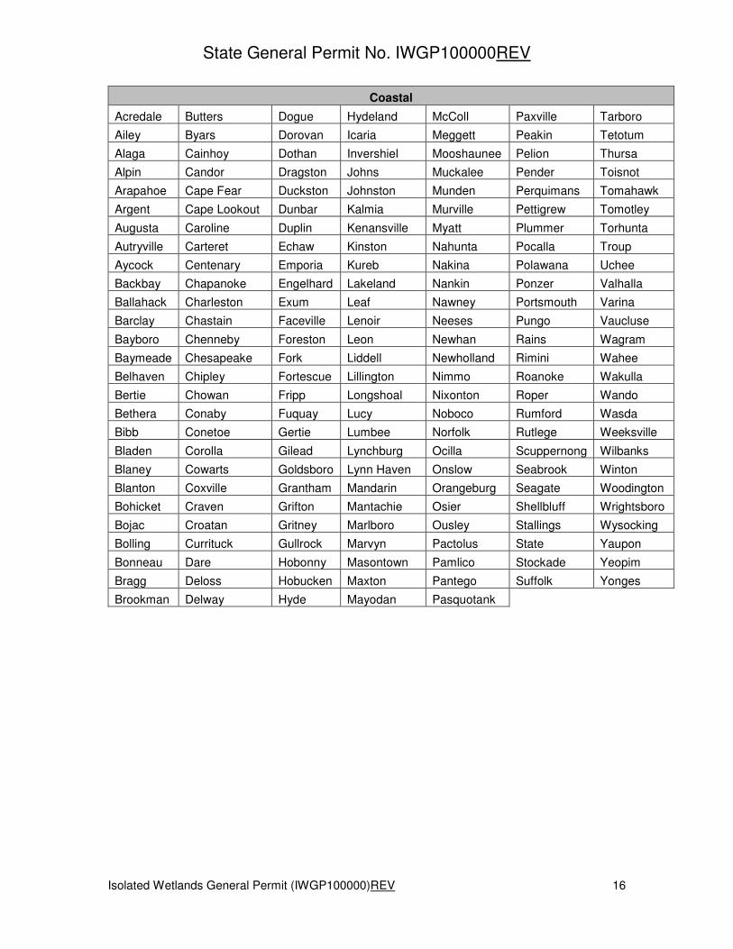
When a landowner believes their property is not in the correct region for purposes of regulating impacts to isolated wetlands under Title 15A NCAC 02H .1305(d)(2), they may have a soil scientist conduct a site-specific evaluation to determine the soil series. The soil scientist shall be an individual who is currently licensed or authorized to practice soil science under G.S. 89F by the North Carolina Board for Licensing of Soil Scientists. The landowner shall submit the soil report to the Division of Water Resources. Soil series that occur in North Carolina have been categorized by the Natural Resources Conservation Service of the U. S. Department of Agriculture as follows:

State General Permit No. IWGP100000REV
Isolated Wetlands General Permit (IWGP100000)REV 14
Mountains
Alarka Chandler Cullowhee Hayesville Maymead Saluda Thurmont
Anakeesta Cheoah Dellwood Heintooga Micaville Santeetlah Toccoa
Arkaqua Chester Dillard Hemphill Nantahala Saunook Toecane
Ashe Chestnut Dillsboro Hiwassee Nikwasi Sauratown Toxaway
Balsam Chestoa Ditney Horsetrough Northcove Shinbone Transylvania
Bandana Chiltoskie Edneytown Huntdale Nowhere Skyuka Trimont
Biltmore Cleveland Edneyville Iotla Oconaluftee Smokemont Tsali
Braddock Cliffield Ela Jeffrey Ostin Snowbird Tuckasegee
Bradson Clifford Ellijay Junaluska Oteen Soco Tusquitee
Brasstown Clifton Elsinboro Kanuga Peaks Spivey Unaka
Breakneck Clingman Evard Keener Pigeonroost Statler Unicoi
Brevard Codorus Fannin Kinkora Pineola Stecoah Unison
Brownwood Colvard Farner Lauada Pinnacle Suches Walnut
Buladean Comus Fontaflora Leatherwood Plott Swannanoa Watauga
Burton Cowee French Longhope Porters Sylco Wayah
Cades Craggey Greenlee Lonon Pullback Sylva Wesser
Calvin Crossnore Guyot Lostcove Rabun Tanasee Whiteoak
Cashiers Cruso Harmiller Luftee Reddies Tate Whiteside
Cataloochee Cullasaja Hatboro Mars Hill Rosman Thunder Zillicoa
Cataska

State General Permit No. IWGP100000REV
Isolated Wetlands General Permit (IWGP100000)REV 15
Piedmont
Alamance Cecil Exway Leaksville Nathalie Riverview Turbeville
Altavista Chewacla Fairview Lignum Oak Level Ronda Tussahaw
Appling Cid Georgeville Lloyd Oakboro Rowan Uwharrie
Appomattox Claycreek Goldston Louisa Orange Saw Vance
Armenia Cliffside Granville Louisburg Ostin Secrest Wadesboro
Ashlar Clover Green Level Madison Pacolet Sedgefield Wake
Augusta Colfax Grover Mandale Pactolus Siloam Warne
Ayersville Congaree Gwinnett Masada Peakin Skyuka Wate
Badin Coronaca Halifax Mattaponi Peawick Spartanburg Wateree
Banister Creedmoor Hallison Mayodan Penhook Spray Wedowee
Bannertown Cullen Haw River McQueen Pfafftown Spriggs Wehadkee
Belews Lake Dan River Helena Meadowfield Picture Starr Westfield
Bentley Danripple Herndon Mecklenburg Pilot Mountain Stoneville White Store
Bethera Davidson Hibriten Merry Oaks Pinkston Stott Knob Wickham
Bethlehem Davie Hiwassee Misenheimer Pinoka Tarrus Wilkes
Biscoe Delila Hornsboro Mocksville Pittsboro Tatum Winnsboro
Brickhaven Devotion Hulett Monacan Poindexter Tillery Woolwine
Buncombe Dorian Iredell Moncure Polkton Toast Worsham
Callison Durham Jackland Montonia Poplar Forest Toccoa Wynott
Carbonton Elbert Kinkora Mooshaunee Rasalo Tomlin Yadkin
Cartecay Enon Kirksey Nanford Rhodhiss Totier Zion
Casville Enott Lackstown Nason Rion
State General Permit No. IWGP100000REV
Isolated Wetlands General Permit (IWGP100000)REV 16
Coastal
Acredale Butters Dogue Hydeland McColl Paxville Tarboro
Ailey Byars Dorovan Icaria Meggett Peakin Tetotum
Alaga Cainhoy Dothan Invershiel Mooshaunee Pelion Thursa
Alpin Candor Dragston Johns Muckalee Pender Toisnot
Arapahoe Cape Fear Duckston Johnston Munden Perquimans Tomahawk
Argent Cape Lookout Dunbar Kalmia Murville Pettigrew Tomotley
Augusta Caroline Duplin Kenansville Myatt Plummer Torhunta
Autryville Carteret Echaw Kinston Nahunta Pocalla Troup
Aycock Centenary Emporia Kureb Nakina Polawana Uchee
Backbay Chapanoke Engelhard Lakeland Nankin Ponzer Valhalla
Ballahack Charleston Exum Leaf Nawney Portsmouth Varina
Barclay Chastain Faceville Lenoir Neeses Pungo Vaucluse
Bayboro Chenneby Foreston Leon Newhan Rains Wagram
Baymeade Chesapeake Fork Liddell Newholland Rimini Wahee
Belhaven Chipley Fortescue Lillington Nimmo Roanoke Wakulla
Bertie Chowan Fripp Longshoal Nixonton Roper Wando
Bethera Conaby Fuquay Lucy Noboco Rumford Wasda
Bibb Conetoe Gertie Lumbee Norfolk Rutlege Weeksville
Bladen Corolla Gilead Lynchburg Ocilla Scuppernong Wilbanks
Blaney Cowarts Goldsboro Lynn Haven Onslow Seabrook Winton
Blanton Coxville Grantham Mandarin Orangeburg Seagate Woodington
Bohicket Craven Grifton Mantachie Osier Shellbluff Wrightsboro
Bojac Croatan Gritney Marlboro Ousley Stallings Wysocking
Bolling Currituck Gullrock Marvyn Pactolus State Yaupon
Bonneau Dare Hobonny Masontown Pamlico Stockade Yeopim
Bragg Deloss Hobucken Maxton Pantego Suffolk Yonges
Brookman Delway Hyde Mayodan Pasquotank