Stage 2 of the EA Study for the GTA West Transportation ... Community... · The GTA West Project...
16
1 GTA West Transportation Corridor EA Study – Stage 2 Introductory Community Workshop
Transcript of Stage 2 of the EA Study for the GTA West Transportation ... Community... · The GTA West Project...

1
GTA West Transportation Corridor EA Study – Stage 2
Introductory Community Workshop

2
Today’s Agenda
• The GTA West Project Team
• Study overview
• Interactive exercises and one-on-one discussions with the Project Team
– Application for Community Advisory Group & Greenbelt Transportation Advisory Group
– Things to Consider for Route and Interchange Alternatives
– What Features are Important to You?
– Where Should the Route Go?
3
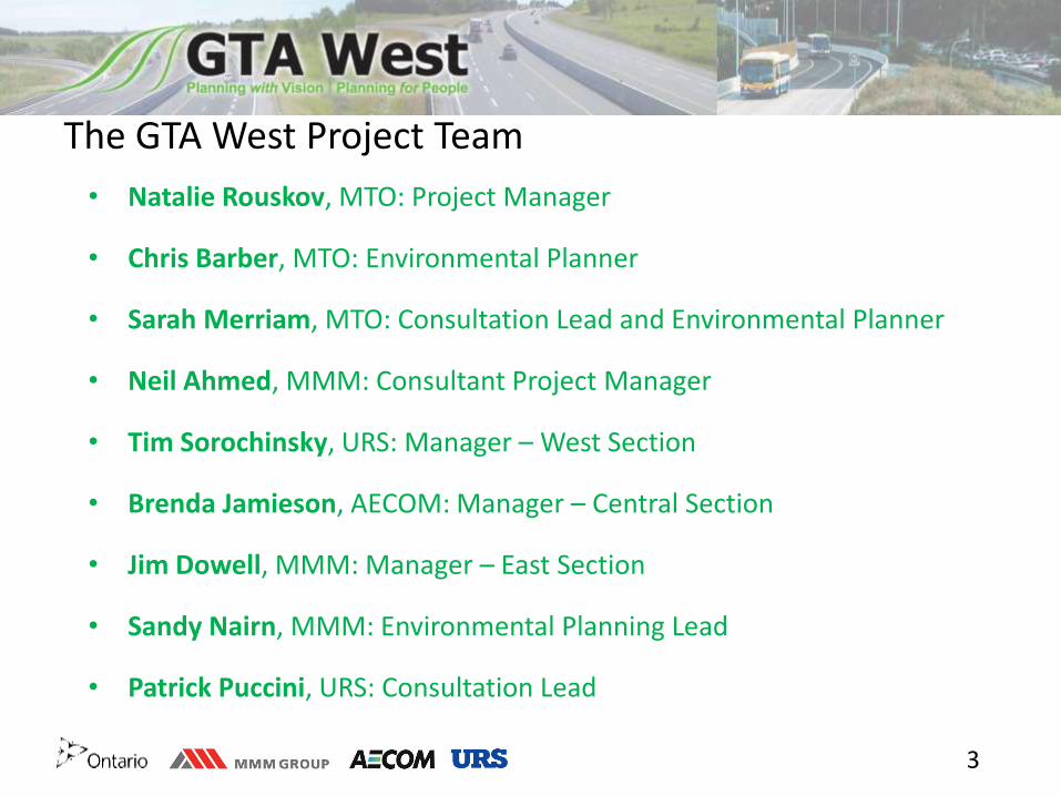
The GTA West Project Team
• Natalie Rouskov, MTO: Project Manager
• Chris Barber, MTO: Environmental Planner
• Sarah Merriam, MTO: Consultation Lead and Environmental Planner
• Neil Ahmed, MMM: Consultant Project Manager
• Tim Sorochinsky, URS: Manager – West Section
• Brenda Jamieson, AECOM: Manager – Central Section
• Jim Dowell, MMM: Manager – East Section
• Sandy Nairn, MMM: Environmental Planning Lead
• Patrick Puccini, URS: Consultation Lead

4
Planning with Vision, Planning for People Our philosophy is….
• To follow an open and transparent process that provides equal opportunities for all stakeholders to help shape the outcome of the project
• To arrive at a recommended solution for the Transportation Corridor through the Route Planning Study Area that provides the best balance of benefits and impacts to the local communities and the users of the transportation system
To accomplish this, we are committed to providing members of the local community and users of the transportation system with innovative and
engaging consultation opportunities that enable active participation and the ability to help shape the outcome of this study in a meaningful way

5
Stage 1 of the Study
Stage 1 of the GTA West Transportation Corridor Planning and EA Study was completed in November 2012. It recommended a multimodal strategy including:
• Optimize the existing transportation network
• Improvements to non-roadway transportation modes such as transit and rail
• Widening of existing highways
• A new transportation corridor
This study (Stage 2) focuses on the recommendation for a new transportation corridor:
• Extending from Highway 400 in the east to the Highway 401/407 ETR interchange area in the west
• That includes a 400-series highway, a transitway, and potential goods movement priority features
Stage 2 of the Study

6
7
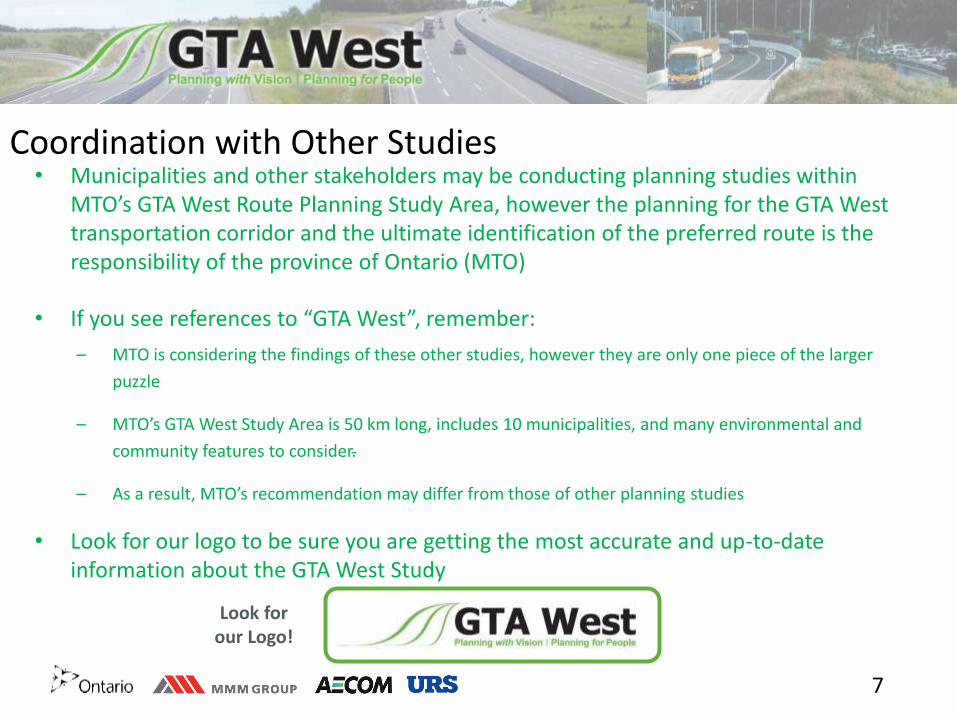
Coordination with Other Studies
• Municipalities and other stakeholders may be conducting planning studies within MTO’s GTA West Route Planning Study Area, however the planning for the GTA West transportation corridor and the ultimate identification of the preferred route is the responsibility of the province of Ontario (MTO)
• If you see references to “GTA West”, remember:
– MTO is considering the findings of these other studies, however they are only one piece of the larger
puzzle
– MTO’s GTA West Study Area is 50 km long, includes 10 municipalities, and many environmental and
community features to consider.
– As a result, MTO’s recommendation may differ from those of other planning studies
• Look for our logo to be sure you are getting the most accurate and up-to-date information about the GTA West Study
Look for our Logo!
8
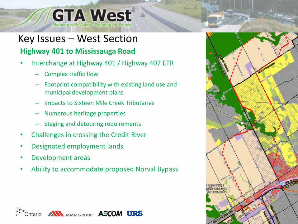
Key Issues – West Section Highway 401 to Mississauga Road
• Interchange at Highway 401 / Highway 407 ETR
– Complex traffic flow
– Footprint compatibility with existing land use and municipal development plans
– Impacts to Sixteen Mile Creek Tributaries
– Numerous heritage properties
– Staging and detouring requirements
• Challenges in crossing the Credit River
• Designated employment lands
• Development areas
• Ability to accommodate proposed Norval Bypass

9
Key Issues – Central Section
• Existing agricultural operations
• Future development areas
• Numerous watercourses
• Residential communities
• Highway 410 connection options:
– Complex traffic flow
– Footprint compatibility with existing land use and municipal development plans
– Partial interchange at Countryside Drive
Mississauga Road to Highway 50

10
Key Issues – Eastern Section Highway 50 to Highway 400
• Connection to Highway 400
• Connection to Highway 427
– Narrow section south of Bolton due to Humber River Tributaries, CP Rail, Hydro Substation, and local developments
• Highway 400 Employment Lands
• Challenges in crossing the Humber River
• Greenbelt / Protected Countryside
• Crossing of Hydro One 500 kV corridor

11
Helping to Reduce Uncertainty • The Project Team is committed to moving forward as quickly as possible with this
study
• A full set of route planning alternatives is under development and will be available for review later this year
• MTO objections to development applications can be lifted progressively, with additional consultation and associated documentation (following PIC1)
• Further removal of objections to development applications when:
– Preferred route has been identified and confirmed (following PIC 2)
– Preliminary design of preferred route has been completed (following PIC 3)
• All lands outside of the preferred route location, as denoted in the EA documentation, will be released once EA approval is obtained.

12
The New Corridor
• The new corridor will feature a 4- to 6-lane highway and a separate adjacent transitway
₋ Transitway stations will be located at interchanges and key connection points
• Truck priority features are also being actively explored

13
Greenbelt Design Guidelines • The Draft Guideline for Planning and Design of the GTA West Corridor
through the Greenbelt was developed in Stage 1 for application in Stage 2
• Included input from representatives of various environmental agencies, ministries, and interest groups
• Key elements include:
• Impact avoidance, where possible
• Consideration of road ecology and wildlife
• Consideration of impacts to agriculture
• Stormwater management
• Bridge design over rivers and valleys
• Consideration of a reduced cross-section width through the Greenbelt
• Community Sensitive Design

14
Consultation Program
2014 2018
Route Alternatives Evaluation of
Alternatives Preliminary Design
Draft Environmental
Assessment Report
Submission of Final
Environmental
Assessment Report
Consultation
Round 1 Minimum 90-
Day Review
• Introductory Community
Workshop
• Introductory MAG / RAAG
meeting
• Agency meetings with:
MAG, RAAG, MEAG, CAG,
GTAG, Councils
• PIC #1
• Second Community
Workshop
• Meetings with First
Nations and Métis
Communities
• Meetings with other
stakeholder groups
Consultation
Round 2
• Agency meetings with:
MAG, RAAG, MEAG, CAG,
GTAG, Councils
• PIC #2
• Third Community
Workshop
• Meetings with First
Nations and Métis
Communities
• Meetings with other
stakeholder groups
• Community Value Plans
Consultation
Round 3
• Agency meetings with:
MAG, RAAG, MEAG, CAG,
GTAG, Councils
• PIC #3
• Fourth Community
Workshop
• Meetings with First
Nations and Métis
Communities
• Meetings with other
stakeholder groups
• One-on-One Meetings
with impacted property
owners
• Introductory Community
Workshop
• Introductory MAG / RAAG
meeting
• Agency meetings with:
MAG, RAAG, MEAG, CAG,
GTAG, Councils
• PIC #1
• Second Community
Workshop
• Meetings with First
Nations and Métis
Communities
• Meetings with other
stakeholder groups
• Introductory Community
Workshop
• Introductory MAG / RAAG
meeting
• Agency meetings with:
MAG, RAAG, MEAG, CAG,
GTAG, Councils
• PIC #1
• Second Community
Workshop
• Meetings with First
Nations and Métis
Communities
• Meetings with other
stakeholder groups
• Agency meetings with:
MAG, RAAG, MEAG, CAG,
GTAG, Councils
• PIC #2
• Third Community
Workshop
• Meetings with First
Nations and Métis
Communities
• Meetings with other
stakeholder groups
• Community Value Plans
• Agency meetings with:
MAG, RAAG, MEAG, CAG,
GTAG, Councils
• PIC #3
• Fourth Community
Workshop
• Meetings with First
Nations and Métis
Communities
• Meetings with other
stakeholder groups
• One-on-One Meetings
with impacted property
owners

15
Consultation & Engagement Program The consultation program features multiple outreach tools and points of contact:
• Public Information Centres (3 rounds)
• Community workshops (4 rounds)
• First Nation and Métis Council / Community Meetings (3 rounds)
• Stakeholder advisory groups, working groups, and Council presentations
• Project website: www.gta-west.com
• Project Team e-mail address: [email protected]
• Follow us on Twitter: @GTAWestStudy
• Toll-free telephone line: 1-877-522-6916

16
Next Steps
• Finalize existing conditions mapping (with your input tonight!)
• Develop route alternatives (with your input tonight!)
• Identify potential interchange locations (with your input tonight!)
• Meetings with municipal working groups
• Present findings to study stakeholders in Fall/Winter 2014:
– Stakeholder Advisory Group meetings (MAG, RAAG, CAG, GTAG, etc.)
– Council presentations
– Members of the public (Public Information Centre #1)