SMP Handbook Chapter 9 Chapter 9 Shoreline Public Access
31
SMP Handbook Chapter 9 1 Publication Number 11-06-010 1/11; rev. 6/17 Chapter 9 Shoreline Public Access Introduction The tide is out, so it’s a good time to walk on the beach. The wind is up, perfect for launching the sailboat from the local dock. On a hot, sunny day, the kids are excited about swimming at the lake. At sunset, the views of the water and the distant shore from the overlook are beautiful. These are all examples of public access to the shoreline. Public access offers the general public the opportunity "to reach, touch, and enjoy the water’s edge, to travel on the waters of the state, and to view the water and the shoreline from adjacent locations” [WAC 173-26-221(4)]. Phase 2, Task 2.2 and Phase 3, Task 3.2 Shoreline Master Program Planning Process Figure 9-1: A sign directs walkers to this public access trail on Camano Island in western Washington. (Photo by Deborah Purce.)
Transcript of SMP Handbook Chapter 9 Chapter 9 Shoreline Public Access

SMP Handbook Chapter 9
1 Publication Number 11-06-010 1/11; rev. 6/17
Chapter 9 Shoreline Public Access
Introduction The tide is out, so it’s a good time to walk on the beach. The wind is up, perfect for launching the sailboat from the local dock. On a hot, sunny day, the kids are excited about swimming at the lake. At sunset, the views of the water and the distant shore from the overlook are beautiful.
These are all examples of public access to the shoreline. Public access offers the general public the opportunity "to reach, touch, and enjoy the water’s edge, to travel on the waters of the state, and to view the water and the shoreline from adjacent locations” [WAC 173-26-221(4)].
Phase 2, Task 2.2 and Phase 3, Task 3.2 Shoreline Master Program Planning Process
Figure 9-1: A sign directs walkers to this public access trail on Camano Island in western Washington. (Photo by Deborah Purce.)
SMP Handbook Chapter 9
2 Publication Number 11-06-010 1/11; rev. 6/17
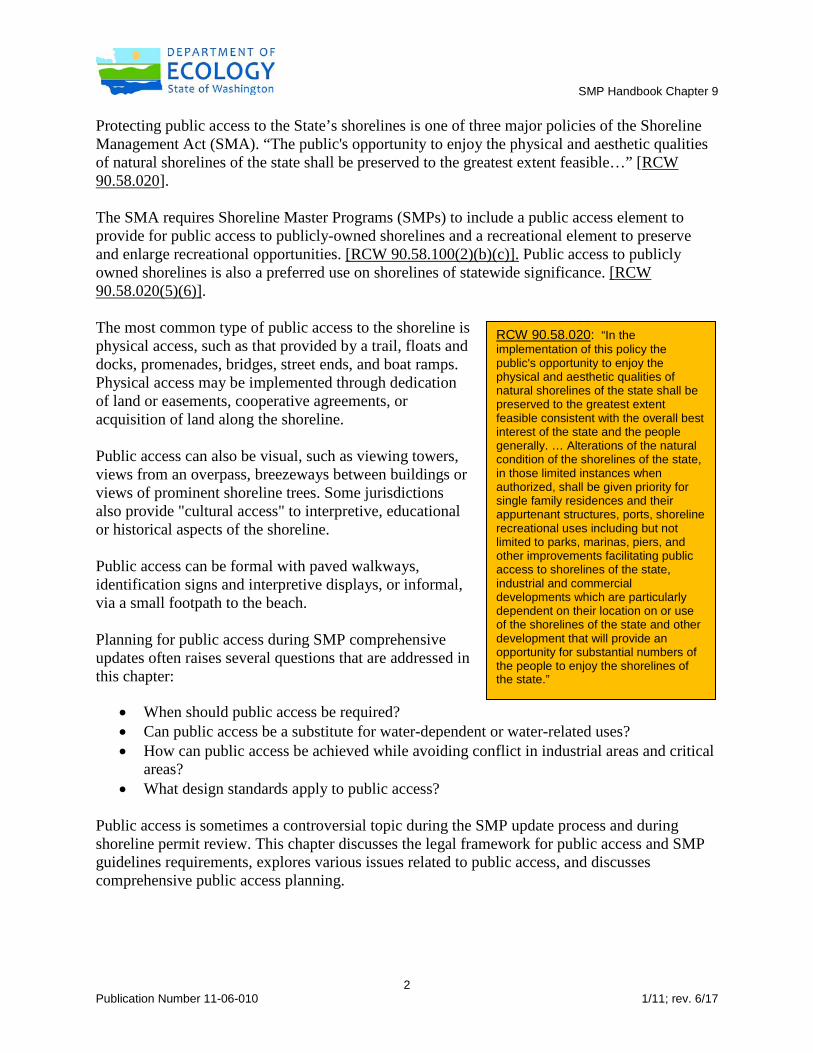
Protecting public access to the State’s shorelines is one of three major policies of the Shoreline Management Act (SMA). “The public's opportunity to enjoy the physical and aesthetic qualities of natural shorelines of the state shall be preserved to the greatest extent feasible…” [RCW 90.58.020]. The SMA requires Shoreline Master Programs (SMPs) to include a public access element to provide for public access to publicly-owned shorelines and a recreational element to preserve and enlarge recreational opportunities. [RCW 90.58.100(2)(b)(c)]. Public access to publicly owned shorelines is also a preferred use on shorelines of statewide significance. [RCW 90.58.020(5)(6)]. The most common type of public access to the shoreline is physical access, such as that provided by a trail, floats and docks, promenades, bridges, street ends, and boat ramps. Physical access may be implemented through dedication of land or easements, cooperative agreements, or acquisition of land along the shoreline. Public access can also be visual, such as viewing towers, views from an overpass, breezeways between buildings or views of prominent shoreline trees. Some jurisdictions also provide "cultural access" to interpretive, educational or historical aspects of the shoreline. Public access can be formal with paved walkways, identification signs and interpretive displays, or informal, via a small footpath to the beach. Planning for public access during SMP comprehensive updates often raises several questions that are addressed in this chapter:
• When should public access be required? • Can public access be a substitute for water-dependent or water-related uses? • How can public access be achieved while avoiding conflict in industrial areas and critical
areas? • What design standards apply to public access?
Public access is sometimes a controversial topic during the SMP update process and during shoreline permit review. This chapter discusses the legal framework for public access and SMP guidelines requirements, explores various issues related to public access, and discusses comprehensive public access planning.
RCW 90.58.020: “In the implementation of this policy the public's opportunity to enjoy the physical and aesthetic qualities of natural shorelines of the state shall be preserved to the greatest extent feasible consistent with the overall best interest of the state and the people generally. … Alterations of the natural condition of the shorelines of the state, in those limited instances when authorized, shall be given priority for single family residences and their appurtenant structures, ports, shoreline recreational uses including but not limited to parks, marinas, piers, and other improvements facilitating public access to shorelines of the state, industrial and commercial developments which are particularly dependent on their location on or use of the shorelines of the state and other development that will provide an opportunity for substantial numbers of the people to enjoy the shorelines of the state.”

SMP Handbook Chapter 9
3 Publication Number 11-06-010 1/11; rev. 6/17
Public Trust Doctrine
The Public Trust Doctrine is a legal principle derived from English Common Law and is part of the legal framework supporting public access, along with the SMA and the Coastal Zone Management Act. In essence, the doctrine says that:
• The waters of the state are a public resource owned by and available to all citizens equally for the purposes of navigation, conducting commerce, fishing, recreation and similar uses.
• Private ownership of the underlying land that the doctrine applies to does not invalidate this trust.
The Public Trust Doctrine gives individual states the responsibility to hold certain natural resources in trust for the people and is the foundation for a body of court cases defining public access obligations. These cases have affirmed that the State has the right to sell lands beneath the waters, and the new property owners must abide by the dictates of the public trust and allow access to the waters of the state. The doctrine limits private use of tidelands to protect the public's right to use the waters of the state. (Search online for the Washington State Supreme Court cases Caminiti v. Boyle, 107 Wn. 2d 662, 732 P.2d 989; and Wilbour v. Gallagher, 77 Wn.2d 306, 462 P.2d 232 (1969).
Figure 9-2: The Island County Parks Department sign indicates beach public access at Lagoon Point North on Whidbey Island. (Photo by Deborah Purce.)

SMP Handbook Chapter 9
4 Publication Number 11-06-010 1/11; rev. 6/17
The Public Trust Doctrine does not allow the public to trespass over privately owned uplands to access the tidelands or water areas. It does, however, protect public use of navigable water bodies below the ordinary high water mark. This applies to not only navigable waters, but also to certain wetlands subject to the ebb and flow of the tides and certain fresh waters.
Protection of the trust is a duty of the State. The SMA is one of the primary means of carrying out that duty in Washington State. The doctrine requires a careful evaluation of whether any proposed action serves the public interest. This requirement can be fulfilled in major part by the planning and permitting requirements of the SMA. (Search online for Portage Bay v. Shorelines Hearings Bd., 92 Wn.2d 1, 593 P.2d 151.)
Local governments should consider public trust doctrine concepts when developing shoreline master programs, comprehensive plans, and development regulations. Because the Public Trust Doctrine is common law, not statutory law, there are few "bright lines.” The extent of its applicability can only be determined by state court decisions. The documents below provide a good introduction to the case law in Washington State.
• The Public Trust Doctrine and Coastal Zone Management in Washington State, Johnson, Ralph W., Craighton Goepple, David Jansen and Rachel Pascal, 1991.
• Putting the Public Trust Doctrine to Work, Second Edition, The Application of the Public Trust Doctrine To the Management of Lands, Waters and Living Resources Of the Coastal States, June 1997. Available from online retailers.
Coastal Zone Management Act The Coastal Zone Management Act (CZMA), a federal law approved in 1972, also promotes public access to the shoreline. The national policy approved by Congress encourages and assists the states in developing coastal management programs. These programs are to provide for many values such as protection of natural resources, management of coastal development to restore water quality, and “public access to the coasts for recreation purposes,” among others. The SMA and local SMPs are components of Washington’s Coastal Zone Management Program. Only the 15 coastal counties are part of the program. Using CZMA funds, Ecology has provided grants to local jurisdictions for SMP work and for developing public access improvements, in keeping with the objectives of the CZMA.

SMP Handbook Chapter 9
5 Publication Number 11-06-010 1/11; rev. 6/17
SMP Guidelines The SMP Guidelines address SMP public access requirements. These include a requirement to identify public access opportunities and comply with specific principles and standards. Public access opportunities
For the shoreline inventory and characterization report, local governments should identify both existing physical and visual access to a jurisdiction's shorelines, including public rights of way and utility corridors, and potential opportunities for enhancing public access [WAC 173-26-201(3)(c)(vi)]. Public access sites should be shown on inventory maps, preferably for each shoreline reach. Existing plans that address public access should be summarized in the report. For example, a parks plan may call for a new trail to the water or kayak launching beach or marina.
As part of public participation activities for SMP updates, citizens can help to identify existing public access sites and potential opportunities and speak to the need for additional access. Members of the public can also help to develop goals for public access. How can potential sites be identified during the SMP update process?
Figure 9-3: Chelan PUD opens the gorge of the Chelan River to whitewater boaters on four weekends each year. The PUD negotiated this access as part of the relicensing for the Lake Chelan hydroelectric project. (Photo by Chelan PUD.)

SMP Handbook Chapter 9
6 Publication Number 11-06-010 1/11; rev. 6/17
• Potential public access sites may be identified by shoreline users during public participation activities.
• Publicly owned properties on the shoreline that do not currently provide access could provide public access in the future. These may already be shown in existing recreation or parks plans. Areas that have the potential for providing more than one form of public access, such as an historical site, might be ranked as high priorities for acquisition or protection.
• Informal trails or footpaths may indicate a demand for access to a particular shoreline area.
• Some public access sites are accessible only from the water. Public access sites on the marine shore that are accessible only by personal watercraft are identified on Ecology’s Washington Coastal Atlas. Also, check with the boaters in your community and the Washington Water Trails Association.
• Undeveloped or partially developed parcels should be identified as potential public access sites with development.
• Work with regional, state and federal agencies that have developed or undeveloped property within your city, town or county. State Parks, the Department of Fish and Wildlife, Department of Natural Resources, public utility districts, and National Park Service all provide public access to shorelines.
• Private property owners may be willing to provide easements or sell property to a public entity. Private resorts may open some facilities such as boat launches or beaches to the general public for a fee.
Figure 9-4: Identifying public access sites in the field might involve some help from unexpected sources (above, at Twanoh State Park.) Left, Northwest Case Inlet tidelands, Mason County. (Photos by Deborah Purce.)

SMP Handbook Chapter 9
7 Publication Number 11-06-010 1/11; rev. 6/17
Public road ends provide opportunities to reach or see the water. Under state law, public access is a preferred use for a road that abuts a body of water.
No county shall vacate a county road or part thereof which abuts on a body of salt or fresh water unless the purpose of the vacation is to enable any public authority to acquire the vacated property for port purposes, boat moorage or launching sites, or for park, viewpoint, recreational, educational or other public purposes, or unless the property is zoned for industrial uses [RCW 36.87.130].
RCW 35.79.035 regulates street vacations in a similar manner for cities and towns. The City of Bainbridge Island’s Shoreline Access Guidebook provides information about public access in parks, road ends, view roads, and other areas such as conservation easements. The Guidebook includes maps that show public access locations at road ends. The City has developed rules regarding road ends that address hours, pets, fires, parking and camping.
The Guidebook describes road ends as “typically narrow rights-of-way that are owned and managed by the City of Bainbridge Island while in some cases road-ends are easements across private property that provide public access. These narrow rights-of-way and easements extend across the tidelands down to the water - users should be aware and respect that most tidelands on either side of these sites are privately owned. Since road-ends are small, narrow sites surrounded by private residential properties, users should conduct their activities respectful of the constraints inherent to that setting.”
Public access needs SMPs should also “identify public access needs and opportunities within the jurisdiction and explore actions to enhance shoreline recreation facilities…” [WAC 173-26-201(3)(d)(v)]. Public access needs will depend on the type and amount of public access currently available, population growth, and desires expressed by shoreline users from the local area and from visitors. As part of its public access planning, Chelan County and its cities held two shoreline public access workshops each in April and June of 2010. At the April workshops, staff provided information about current public access facilities and identified gaps. Small group discussions
Figure 9-5: Map of Dock Street road-end from Bainbridge Island’s Shoreline Access Guidebook.

SMP Handbook Chapter 9
8 Publication Number 11-06-010 1/11; rev. 6/17
focused on whether there was enough shoreline access, the types of facilities needed, areas well served with public access, public access level of service standards, gap areas and opportunities to fill gaps, and priority locations for public access. Questionnaires were distributed to participants as well as to those on a stakeholder database. Public access gaps and opportunities were presented to participants at the June workshops. Participants discussed potential shoreline level of service standards, public access proposals for several areas, policies and implementation. The County and cities analyzed existing and planned public access facilities for the existing and projected 2030 population. The analysis looked at trails, boat launches, shoreline parks and protected lands per 1,000 population. It also considered tourists, estimating the number of tourists within 15 miles of boating facilities, fishing, trails, parks and other open space. These data informed the staff whether existing and planned facilities were adequate to meet the chosen level of service. In determining adequate level of service, the County and cities looked at their own parks plans, studies for small communities, the National Recreation and Park Association standards, and the Washington State Recreation and Conservation Office recommendations for level of service planning in its Manual 2 Planning Policies and Guidelines. Principles and standards for public access Public access principles and standards that shall be addressed in SMPs are included in WAC 173-26-221(4)(b). Basic principles address:
• Promoting the right to access waters held in public trust while protecting property rights and public safety.
• Protecting the rights of navigation and space needed for water-dependent uses. • Protecting the public’s opportunity to enjoy physical and aesthetic qualities of shorelines. • Regulating design, construction and operation of permitted uses to minimize interference
with and enhance the public’s use of the water.
SMPs must be consistent with the standards established in the Guidelines and address public access on public lands. Standards for requiring public access are listed below. (These standards may not apply for new development or re-development if an adopted public access states that public access is not required for the subject shoreline area plan [WAC 173-26-221(4)(c)].) View corridors and dimensional standards such as height limits and setbacks also should be addressed in the SMP.
When to require public access The SMA emphasizes “the public's opportunity to enjoy the physical and aesthetic qualities of natural shorelines of the state” and directs that SMPs include public access elements. Public

SMP Handbook Chapter 9
9 Publication Number 11-06-010 1/11; rev. 6/17
access is not required on every inch of shoreline, so where is it required? The SMA and the SMP Guidelines do not require local governments to provide access to the shoreline for the general public on all private property. Public access is not required of individual single family residences, but may be required of larger residential subdivisions or commercial and industrial development. In such cases, requirements for public access may be satisfied by conveyance to a local government or through dedicated public access easements, recorded with approval of a new subdivision of land. Local government should require public access for the following scenarios:
• The proposed development or use will create demand for or increase demand for public access.
• The proposed development is for water-enjoyment, water-related and/or nonwater-dependent uses or for the subdivision of land into more than four parcels.
• The development or use is proposed by a public entity, unless public access would be incompatible for safety, security or ecological impact reasons.
• The development or use is proposed on public lands. • The proposed development or use will interfere with existing access by blocking access
or discouraging use of existing access. • The proposed development or use will interfere with public use of waters subject to the
Public Trust Doctrine.
Figure 9-6: The community trail on Lake Osoyoos north of Oroville was built as part of the Veranda Beach resort development. (Photo by Department of Ecology.)

SMP Handbook Chapter 9
10 Publication Number 11-06-010 1/11; rev. 6/17
Public access may not be required under the circumstances listed below. SMPs should include regulations that require applicants to demonstrate that one or more of the following circumstances exist.
• Health or safety hazards exist that cannot be prevented by practical measures. • Security requirements necessary to the project cannot be satisfied if public access of any
type is provided. • Significant ecological impacts that cannot be mitigated would occur if public access is
provided. Public access improvements should not result in a net loss of shoreline ecological functions.
• The cost of providing public access is unreasonably disproportionate to the long-term cost of the proposed development.
• Significant unavoidable conflict between public access and the proposed use or adjacent uses cannot be mitigated.
• Constitutional or legal limitations make public access infeasible.
When considering whether the circumstances listed above apply to a particular site, local governments should consider alternate methods of providing public access. These might include view platforms, off-site public access improvements, restricted hours of public access and separation of uses through site planning and design.
Some local governments are setting up fee-in-lieu programs for development sites where public access cannot be provided due to health, safety or security programs. The proponent of the proposed development would pay a fee that would be used to provide public access elsewhere. The city of Tacoma is proposing such a fee-in-lieu program as part of its comprehensive SMP update. The city of Everett allows projects that meet specific criteria to construct off-site public access improvements, or, if approved by the planning director, contribute to a city public access fund for construction of off-site public access improvements.
SMP Handbook Chapter 9
11 Publication Number 11-06-010 1/11; rev. 6/17
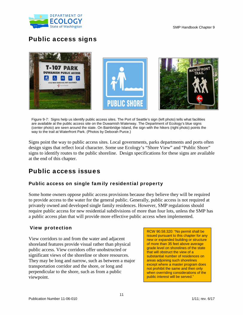
Public access signs
Signs point the way to public access sites. Local governments, parks departments and ports often design signs that reflect local character. Some use Ecology’s “Shore View” and “Public Shore” signs to identify routes to the public shoreline. Design specifications for these signs are available at the end of this chapter.
Public access issues Public access on single family residential property Some home owners oppose public access provisions because they believe they will be required to provide access to the water for the general public. Generally, public access is not required at privately owned and developed single family residences. However, SMP regulations should require public access for new residential subdivisions of more than four lots, unless the SMP has a public access plan that will provide more effective public access when implemented. View protection View corridors to and from the water and adjacent shoreland features provide visual rather than physical public access. View corridors offer unobstructed or significant views of the shoreline or shore resources. They may be long and narrow, such as between a major transportation corridor and the shore, or long and perpendicular to the shore, such as from a public viewpoint.
RCW 90.58.320: “No permit shall be issued pursuant to this chapter for any new or expanded building or structure of more than 35 feet above average grade level on shorelines of the state that will obstruct the view of a substantial number of residences on areas adjoining such shorelines except where a master program does not prohibit the same and then only when overriding considerations of the public interest will be served.”
Figure 9-7: Signs help us identify public access sites. The Port of Seattle’s sign (left photo) tells what facilities are available at the public access site on the Duwamish Waterway. The Department of Ecology’s blue signs (center photo) are seen around the state. On Bainbridge Island, the sign with the hikers (right photo) points the way to the trail at Waterfront Park. (Photos by Deborah Purce.)

SMP Handbook Chapter 9
12 Publication Number 11-06-010 1/11; rev. 6/17
View protection can include preventing view blockage through height limitations or requiring aesthetic enhancement with landscaping. However, view protection does not allow for excessive vegetation removal to create views or enhance existing views. Local governments sometimes require project applicants to provide a visual analysis for projects that appear to obstruct residential views. Views to the water from nearby residences are addressed in the SMA. The Shorelines Hearings Board has held that local governments must address how approval of a project over 35 feet high that block views of a substantial number of residences is justified by overriding considerations of public interest (SHB NO. 02-001, Grill and Tamm v. Baraka LLC and City of Anacortes). The Board also said that the five residences that would have views blocked constituted a “substantial number of residences” and cited Ecology v. Pacesetter Construction (89 Wn.2d 203, 297-08, 571 P.2d 196 (1977). Public access for water-enjoyment and nonwater-oriented uses
Public access should be a component of all "water-enjoyment" uses. The definition of water-enjoyment use focuses on public access [WAC 173-26-020(37)]. Water-enjoyment uses are generally of two types. For example, a park is a recreational use that offers public water-enjoyment. A private development such as a restaurant with public access is another use that facilitates access to the shoreline. The master program should set definite access design standards that should cover: • Connection to public right-of-way. • Hours and restrictions to access. • Legal mechanism for insuring that access will be established permanently (easement
dedicated specifically for public access, etc.) and maintained. • Signage. • Connection to pedestrian or bike trail. • Requirements for site enhancements such as seating, landscaping, viewing platforms,
opportunity to reach the water's edge, lighting, interpretive displays, etc. If local governments will permit non water-oriented uses on the shoreline, the SMP should include regulations that require public access. However, provision of public access alone should not be considered a substitute for a water-oriented use. For example, a proposed office building would not become a shoreline preferred water-oriented use because it has a trail to the beach or a view platform open to the public.
WAC 173-26-020(37): “Water-enjoyment use means a recreational use or other use that facilitates public access to the shoreline as a primary characteristic of the use; or a use that provides for recreational use or aesthetic enjoyment of the shoreline for a substantial number of people as a general characteristic of the use…”

SMP Handbook Chapter 9
13 Publication Number 11-06-010 1/11; rev. 6/17
Public access at commercial and industrial sites
Industrial waterfronts, especially those with a variety of human activities and historical or cultural associations, have value as important public amenities as well as critical economic resources. But industrial activities and recreational visitors can conflict for several reasons. Many ports and maritime industries fear that public access improvements such as pathways, piers, viewpoints, boat moorage or parks will interfere with work activities, compromise security or threaten individual safety. Often, industrial activities produce noise, glare, fumes, or other conditions that make them incompatible with waterfront attractions such as parks, restaurants and retail shops. Commercial and industrial developers are sometimes concerned that public access will be required at any development, even if public safety or security is at risk. This is not the case. The SMP Guidelines specifically note that public access is not required “where it is demonstrated to be infeasible due to reasons of incompatible uses, safety, security or impact to the shoreline environment or due to constitutional or other legal limitations that may be applicable” [WAC 173-26-221(4)(d)(iii)(B)]. Local governments that determine that public access should not be provided in a specific location should consider alternate methods of access such as off-site improvements, view platforms,
Figure 9-8: Fishermen’s Terminal in Seattle harbors the Seattle fishing fleet and offers restaurants and other amenities for visitors. (Washington Coastal Atlas photo.)

SMP Handbook Chapter 9
14 Publication Number 11-06-010 1/11; rev. 6/17
restricted public access hours or separation of uses. Some local governments are considering fee-in-lieu programs so that public access can be provided at locations away from the industrial site. The apparent conflicts between public access and working waterfronts challenge the planning and design of public access elements and mixed-use projects and pose the following design questions:
• What are some ways visitors' safety can be assured in active industrial areas? • How can public access be added to industrial sites without interfering with work or
compromising security? • How can the working waterfront's visual character be maintained while providing
attractive amenities for visitors? Several projects in Washington State incorporate observation points such as view towers, periscopes and elevated platforms that provide views of both industrial activities and the shoreline. Such view features have proven successful at Percival Landing in Olympia and the Port Angeles waterfront. Interpretive displays are also an attractive feature. Observation points are viable alternatives to trails or paths into dangerous industrial sites. Observation points may be used more heavily when close to other public attractions or located on pedestrian and bicycle trails. Designing public access improvements at commercial and industrial sites Careful site design is the key to promoting public access on commercial and industrial sites. The Port of Seattle's Fishermen's Terminal complex is a good example, as it includes a range of industrial activities and serves as a popular visitors' destination. Successful design aspects include:
• Separating visitor vehicle circulation and parking from industrial traffic. • Concentrating visitor attractions in one part of the site. • Providing a strong attraction that focuses visitors' attention. The restaurants and central
plaza with the Fishermen’s Memorial serve this purpose. • Reinforcing safety signage with design cues such as paving, crosswalks, lighting and site
amenities to indicate where visitors are welcome. • Designing architectural and site elements to reinforce the activity's utilitarian character.
For example, the building design at Seattle’s Fishermen's Terminal incorporates metal siding and simple forms in response to the architecture of the warehouses and net sheds. The terminal was successful in meeting both its industrial and public access goals.
Fishermen’s Terminal illustrates that industrial waterfronts can have exciting recreational opportunities and important civic attractions. If properly planned, such projects can combine recreational and commercial uses along a harbor to enhance economic viability of all uses and maximize the use of shoreline resources. Visitor safety, impacts on industrial work and compatibility of shoreline uses must be addressed when developing such public access sites.

SMP Handbook Chapter 9
15 Publication Number 11-06-010 1/11; rev. 6/17
Fishermen's Terminal also illustrates several elements in the design process that are key to successfully integrating public access with industrial activities. They include:
• Working directly with industrial businesses to lower apprehensions regarding increased public access and seeking solutions that benefit both visitors and workers.
• Considering public access and use compatibility issues throughout the master planning and design process. Continuity within the design team through these work phases is recommended.
• Separating incompatible uses and providing adequate circulation. Separate vehicle access and parking for visitors reduces impact to work activities.
• Including elements in the project that benefit workers and industrial activities as well as the visiting public including better circulation and parking, convenient commercial services, improved lighting and new site amenities.
• Using signing and visual cues to orient and direct visitors such as pavement markings, lighting and site furniture.
• Respecting the work-a-day qualities of the industrial setting. The low-key design helps preserve the working waterfront's character and indicates that visitors should respect the workers' needs.
Most industrial developments require on-site environmental improvements such as the creation or enhancement of wetlands, beaches, lagoons, dune environments or other biological resources. In some cases, environmental enhancement measures can incorporate public access improvements such as nature trails, canoe launches, observation decks or fishing piers. The combination of environmental and public access improvements can, if done well, save money and utilize shorelines more efficiently. Public access in critical areas Where public access conflicts with environmental protection of wetlands and critical wildlife habitats, protection of the resource has priority. Although project proponents may cite damage to critical areas as a reason for not providing public access, careful design can often accomplish both objectives. For example, a wetland protection buffer may incorporate public access through passive measures with limited impact such as observation decks, boardwalks and viewing platforms. Impacts to the environment must be mitigated. Public access is not absolutely required where environmental harm will occur. However, all reasonable alternatives to
Figure 9-9: Viewing towers can provide visual public access at critical areas, industrial areas, and locations like this one on the Twisp River. (Photo by Department of Ecology.)

SMP Handbook Chapter 9
16 Publication Number 11-06-010 1/11; rev. 6/17
avoid and mitigate the impacts should be explored. Local governments should not consider an apparent conflict between public access and environmental protection a necessarily irreconcilable conflict. Off-site public access As a matter of policy, on-site public access mitigation is preferred over off-site public access improvements. Unless it is carefully planned, off-site mitigation does not truly compensate for the loss of the public's right to access the shoreline. However, there are cases where safety, security, compatibility or site planning reasons preclude on-site public access. Most exceptions to on-site public access requirements apply to water-dependent industries.
A public access plan that indicates key public access locations, pedestrian/bike routes and special features is necessary to insure successful off-site access.
• A plan addresses the broad spectrum of shoreline access resources and allows evaluation of each site’s relative importance.
• A plan identifies potential public access features to consider as part of off-site compensation.
Figure 9-10: The Diagonal Ave South public access site owned by the Port of Seattle includes an area for launching small boats. (Photo by Deborah Purce.)

SMP Handbook Chapter 9
17 Publication Number 11-06-010 1/11; rev. 6/17
The Port of Seattle's 1985 Comprehensive Public Access Plan for the Duwamish Waterway linked Port development with a comprehensive series of projects to improve access throughout the waterway. Public access sites were developed based on this plan. Existing and potential public shoreline access for the Duwamish River, Elliott Bay, Shilshole Bay and Fishermen’s Terminal are mapped in the Port’s Seaport Shoreline Plan, published in 2007. Public access improvements continue to be based on this plan. Public access design standards The SMA addresses both visual and physical access. SMP design standards can be used to preserve views, provide sunlight and air, control height and building density, regulate signage and enhance urban design character. To address view protection, master programs should regulate height and side yard (or view corridor) dimensions. Besides maintaining views of the water, height and bulk provisions (bulk means the size of building as determined by side yard setbacks) regulate the scale of shoreline developments and prevent undesirable shade and shadow patterns. Basic standards for public access signs should be included in the SMP. SMP standards for signs, other than signs for public access elements, do not need to address color, materials or graphic designs. These types of controls, if desired, should be included in the local jurisdiction’s signage, zoning or design review ordinance. Likewise, design standards for building materials and architectural design elements standards do not need to be included in master programs except for public access improvements. Some SMPs include design standards to preserve historic character or preservation of cultural sites. Design standards must be specific enough to facilitate project review with predictable results. At the same time, design standard flexibility is desirable to take into account unique site conditions or to allow deviations or variables that would result in development more favorable to the public. Parallel shoreline environments (e.g. aquatic, shoreline lots and upland lots) can be used to develop more effective design standards. For example, in a given shoreline area, the height limits might be 15 feet for aquatic areas, 35 feet for shoreline lots and 55 feet for lots further landward. This type of refinement can help prevent view obstruction and maintain smaller-scale development at the shoreline. Greater heights can be allowed in areas designated for water-dependent uses. Local governments should include specific limits and conditions when using additional height as an incentive for encouraging water-dependent uses.

SMP Handbook Chapter 9
18 Publication Number 11-06-010 1/11; rev. 6/17
Legal issues related to public access Nexus and proportionality Requiring public access should take into account the legal standards of “nexus and proportionality.” Is a proposed public access requirement related to the impacts of and demand for public access created by the proposed project, and is it related to the size or impacts of the project? A major U.S. Supreme Court ruling (Nollan v. Coastal Commission, 1987) deals directly with placing conditions on permits and illustrates the need for comprehensive planning. The Nollan case points out that permit administrators should make decisions on a consistent and sound legal basis. When a public agency requires public access as a permit condition, there must be a rational connection between the project's impact on public access and the public access required. Local governments should periodically review their public access provisions to ensure they comply with current legal standards. While this chapter suggests public access provisions for SMPs, responsibility for legal review rests with the local government and its legal counsel. Liability concerns Liability of property owners is limited by state law. RCW 4.24.210 states that public and private land owners that allow members of the public to use the land for outdoor recreation and do not charge fees are not liable for unintentional injuries to users.

SMP Handbook Chapter 9
19 Publication Number 11-06-010 1/11; rev. 6/17
Suggested SMP policies and regulations The suggested language for general public access provisions presented below is a good starting point for a city or county SMP. You can add provisions to provide greater specificity in terms of required public access improvements for different shoreline areas or additional design standards for public access areas, including view corridors and open space.
Policies
1. Physical or visual access to shorelines should be incorporated in all new developments when the development would either generate a demand for one or more forms of access or would impair existing legal access opportunities or rights.
2. Public access facilities should be designed to address public health and safety. 3. Public access improvements should be mitigated in order to avoid a net loss of shoreline
ecological processes and functions. 4. Public access requirements should be consistent with all relevant constitutional and other
legal limitations on regulation of private property. 5. Public access facilities should be designed with provisions for persons with disabilities,
where appropriate. 6. Public access should be designed to minimize potential impacts to private property and
individual privacy. Physical separation or other means should clearly delineate public and private space in order to avoid user conflict.
7. Views from public shoreline upland areas should be enhanced and preserved.
8. Development, uses and activities on or near the shoreline should not unreasonably impair or
detract from the public’s legal access to the water.
9. Non-water-oriented uses located on the shoreline should provide public access as a public benefit.
10. Public access area and facility requirements should be commensurate with the scale and
character of the development.
11. Shoreline development by public entities such as local governments, port districts, state agencies and public utility districts should provide public access unless such access is shown to be incompatible due to reasons of safety, security or impact to the shoreline.

SMP Handbook Chapter 9
20 Publication Number 11-06-010 1/11; rev. 6/17
12. Public access to the shoreline afforded by existing shoreline street ends and rights-of-way should be identified and mapped in the shoreline inventory process and maintained as public access.
13. Designated view corridors should be preserved, maintained and enhanced. In ________
(City/County), designated view corridors include _________________, _____________ and __________________.
14. Enhancement of views does not justify excessive removal of vegetation. Clearing,
thinning and/or limbing should be allowed only where it does not adversely impact ecological and aesthetic values or slope stability.
15. Public use and access to the water should be a priority in recreational development. 16. Private views of the shoreline, although considered during the shoreline permit review
process, are not expressly protected. Property owners concerned with the protection of views from private property are encouraged to obtain view easements, purchase intervening property or seek other means of minimizing view obstruction.
17. Public access should connect to public areas, undeveloped right-of-way, and other pedestrian or public thoroughfares.
18. Hiking paths, bicycle paths, easements and scenic drives should link shoreline parks, recreation areas and public access points.
19. Incentives such as density or bulk and dimensional bonuses should be considered if development proposals include additional public access beyond that required by this SMP.
Regulations
1. Public access improvements shall be constructed and maintained in a manner that does not result in a net loss of shoreline ecological functions.
2. Except as provided in Regulations 5 and 6, below, shoreline substantial developments or
conditional uses shall provide public access where any of the following conditions are present:
a. A development or use will create increased demand for public access to the
shoreline. A development or use will interfere with an existing public access way. Such interference may be caused by blocking access or by discouraging use of existing on-site or nearby accesses.
b. New non-water-oriented uses are proposed. c. A use or activity will interfere with public use of lands or waters subject to the
public trust doctrine.

SMP Handbook Chapter 9
21 Publication Number 11-06-010 1/11; rev. 6/17
3. Shoreline development by public entities, port districts, state agencies, and public utility districts shall include public access measures as part of each shoreline development project, unless such access is shown to be incompatible due to reasons of safety, security, or impact to the shoreline environment.
4. Public access shall not be required for single-family residential development of four (4) or fewer lots. (Note: Local governments that conduct a comprehensive public planning process for public access may determine that public access should be required for small subdivisions.)
5. Public access shall not be required where one or more of the following conditions apply.
a. Unavoidable health or safety hazards to the public exist which cannot be
prevented by any practical means. b. Constitutional or other legal limitations may apply. c. Inherent security requirements of the use cannot be satisfied through the
application of alternative design features or other solutions. d. The cost of providing the access, easement or an alternative amenity is
unreasonably disproportionate to the total long-term cost of the proposed development.
e. Adverse impacts to shoreline ecological processes and functions that cannot be mitigated will result from the public access.
f. Significant unavoidable conflict between any access provisions and the proposed use and adjacent uses would occur and cannot be mitigated.
6. To meet any of the conditions in Regulation 5 above, the applicant must first demonstrate
and the City/County determine in its findings that all reasonable alternatives to provide public access have been exhausted, including but not limited to:
a. Regulating access by such means as maintaining a gate and/or limiting hours of
use. b. Separating uses and activities (e.g. fences, terracing, use of one-way glazings,
hedges, landscaping, etc.). c. Developing access at a site geographically separated from the proposal such as a
street end, vista or trail system. d. Sharing the cost of providing and maintaining public access between public and
private entities.
7. Projects that meet the criteria of Regulation No. 5 shall either build off-site public access facilities or, if approved by the shoreline administrator, contribute to the local public access fund.

SMP Handbook Chapter 9
22 Publication Number 11-06-010 1/11; rev. 6/17
8. When provisions for public access are required as a condition of project approval, the Administrator shall prepare written findings demonstrating consistency with constitutional and legal practices regarding private property and the principles of nexus and proportionality.
9. Public access provided by existing shoreline street ends and public rights-of-way shall be
preserved, maintained and enhanced consistent with RCW 35.79.035 and RCW 36.87.130. 10. Required public access sites shall be fully developed and available for public use at the
time of occupancy of the shoreline development. 11. Public access shall consist of a dedication of land or a physical improvement in the form
of a walkway, trail, bikeway, corridor, viewpoint, park, deck, observation tower, pier, boat launching ramp, dock or pier area or other area serving as a means of view and/or physical approach to public waters. It may include interpretive centers and displays.
12. Public access provisions shall run with the land and be recorded via a legal instrument
such as an easement, or as a dedication on the face of a plat or short plat. Such legal instruments shall be recorded with the County Auditor's Office prior to the time of building permit approval, occupancy or plat approval, whichever comes first (RCW 58.17.110). Future actions by the applicant’s successors in interest or other parties shall not diminish the usefulness or value of required public access areas and associated improvements.
13. Maintenance of the public access facility over the life of the use or development shall be
the responsibility of the owner unless otherwise accepted by a public or non-profit agency through a formal agreement recorded with the County Auditor's Office.
14. Minimum width of public access easements shall be at least 12 feet, unless the
administrator determines that undue hardship to the proponent would result. In such cases, easement width may be reduced only to the minimum extent necessary to relieve the hardship.
15. Public access sites shall be made barrier-free for the physically disabled where feasible, and in accordance with the Americans with Disabilities Act (ADA).
16. The standard state approved logo or other locally approved signs that indicate the public's right of access and hours of access shall be constructed, installed and maintained by the applicant or owner in conspicuous locations at public access sites.
17. Public access shall incorporate the following location and design criteria:
a. A public pedestrian access walkway is required where open space is provided along the shoreline, and public access can be provided in a manner that will not adversely impact shoreline ecological processes and functions. The walkway shall
SMP Handbook Chapter 9
23 Publication Number 11-06-010 1/11; rev. 6/17
be buffered from sensitive ecological features and provide limited and controlled access to the water’s edge where appropriate. Fencing may be used to control damage to plants and other sensitive ecological features. Trails shall be constructed of permeable materials and limited to 5 feet in width to reduce impacts to ecologically sensitive resources.
b. Public access shall be located adjacent to other public areas, access points and connecting trails and connected to the nearest public street.
c. Where views of the water or shoreline are available and physical access to the water's edge is not present or appropriate, a public viewing area shall be provided.
d. Intrusions on privacy shall be minimized by avoiding locations adjacent to windows and outdoor private open spaces or by screening or other separation techniques.
18. Public access design shall provide for the safety of users to the extent feasible. Appropriate amenities such as benches, picnic tables and public parking sufficient to serve the users shall be provided.
19. Public restrooms, facilities for disposal of animal waste and other appropriate public facilities shall be required at developments that attract a substantial number of persons.
20. Development over the water shall be constructed as far landward as possible to reduce
interference with views to the shoreline from surrounding properties. 21. New development shall be located and designed to avoid or minimize adverse impacts to
views from public property.

SMP Handbook Chapter 9
24 Publication Number 11-06-010 1/11; rev. 6/17
Comprehensive Public Access Planning
As an alternative to a site-by-site approach to providing public access, local governments can strategically integrate public access improvements and master program requirements through a comprehensive public access plan. The goal of public access planning is to develop a coordinated plan to help residents and visitors connect with local public access sites. Local governments with an up-to-date comprehensive public access plan that effectively addresses shoreline management objectives for public access may not need to require specific prescriptive public access standards in the SMP. The Guidelines allow local governments to prepare a comprehensive public access plan as an alternative to requiring public access on a project by project basis.
Such a plan organizes public planning and capital improvement efforts and provides a rationale for private development access requirements on a community-wide scale. For example, a comprehensive shoreline access plan that identifies where access will be most useful can demonstrate how private efforts will tie into public projects. A comprehensive strategy provides a strong legal basis for enhancing public use of the shoreline.
Public access plans have been useful in revitalizing urban waterfronts, garnering public support and furthering urban design goals. This is because they are visual in presentation and positive in direction rather than solely regulatory. They also complement the regulatory aspects of master programs and can provide a better basis for applying master program standards where they are needed.
Elements of a Comprehensive Public Access Plan
In general, a comprehensive public access plan should include the following elements:
Public Participation • Identify community priorities and goals through workshops, visioning sessions,
questionnaires, solicitation of written comments.
WAC 173-26-221 (4)(c): “Planning process to address public access: Local governments should plan for an integrated shoreline area public access system that identifies specific public needs and opportunities to provide public access. Such a system can often be more effective and economical than applying uniform public access requirements to all development. This planning should be integrated with other relevant comprehensive plan elements, especially transportation and recreation. The planning process shall also comply with all relevant constitutional and other legal limitations that protect private property rights…Public participation requirements in WAC 173-26-201 (3)(b)(i) apply to public access planning. At a minimum, the public access planning should result in public access requirements for shoreline permits, recommended projects, port master plans, and/or actions to be taken to develop public shoreline access to shorelines on public property. The planning should identify a variety of shoreline access opportunities and circulation for pedestrians (including disabled persons), bicycles, and vehicles between shoreline access points, consistent with other comprehensive plan elements.”

SMP Handbook Chapter 9
25 Publication Number 11-06-010 1/11; rev. 6/17
Integration with other community plans • Parks and Recreation. • Port District. • Transportation. • Comprehensive land use plan.
Inventory and Gap Analysis • Inventory and map current visual and physical public access (baseline); analyze the type, size
and location of access sites. • Assess current visual and physical access relative to population density, demographics and
community values (tourism, recreation, aesthetics, etc.). • Identify and map existing view corridors for protection and potential view point
development. • Identify gaps in amounts and types (physical and visual) of public access. • Identify and map potential public access (physical and visual) on public lands. • Identify private lands for potential easements, acquisitions and development.
Identification of Priority Areas and Special Opportunities • Use gap analysis to identify priority areas for public access. • Prepare to identify special opportunities as they arise (development, unique shoreline features
or aesthetics, natural, historic or cultural heritage sites, availability of property). • Identify potential public/public or public/private partnerships to leverage acquisitions
through local, state, and federal funding, and land trusts.
Implementation Strategy • Timelines and funding. • Project database and tracking matrices. • Responsibilities of involved parties.
Standards • Goals and policies. • Minimum requirements for public access. • Design and sign standards. • Fee-in-lieu or offsite mitigation. • Identified areas where access is required. • Setback, landscaping, dedication and other standards.
A comprehensive public access plan can be a part of the SMP or a separate document referred to in the SMP. A separate document (not considered part of the SMP) can be more easily modified. If a separate public access plan document is developed, the SMP also must include public access policies, regulations, and minimum design standards and indicate where and when access is
SMP Handbook Chapter 9
26 Publication Number 11-06-010 1/11; rev. 6/17
required. Some jurisdictions have included abbreviated portions of the public access plan as an appendix to the SMP. The plan should include both a map and language that establishes the criteria and standards.
Highlights from public access plans
Several jurisdictions have developed comprehensive public access plans for a portion or all of their shorelines. Several jurisdictions have also initiated successful public access and recreation projects resulting from or in addition to such planning efforts. The following examples include highlights from some of these public access plans.
King County Public Access Plan • Includes draft priorities for providing new public access to major shorelines. • Identifies gaps where public access is limited. • Identifies ten priority shoreline areas for new public access.
King County identified a subset of the gap areas as priority areas for providing new public access or improved public access where informal access already exists. Remaining gap areas are considered areas where additional future opportunities for public access may be pursued. The results of the gaps and priorities analysis resulted in the identification of ten priority shoreline areas where the County can focus efforts to provide new formal public access on existing County ownerships or pursue new voluntary acquisitions for public recreation.
Details are available in the following documents, which are part of the King County Shorelines Technical Appendix:
• King County Shoreline Public Access Plan. • Existing Shoreline Public Access Map. • Shoreline Public Access Gaps & Opportunities Map.
City of Enumclaw Public Access Plan • Structured with Introduction, Methods and Results sections. • “Methods” section is clear and provides potential guidance for other jurisdictions.
Some excerpts from the Public Access Plan follow:
Introduction (excerpts) This document describes opportunities for improvements to existing publicly-owned land (within the City or its Urban Growth Area) that will increase public access to Boise and Newaukum creeks, and the White River, while also providing increased connectivity across the City…Existing and potential future shoreline public access areas have been

SMP Handbook Chapter 9
27 Publication Number 11-06-010 1/11; rev. 6/17
selected that meet the following criteria: establish connectivity among existing public access areas; allow for shoreline public access points, including view points to shoreline areas; minimize impacts to ecologically critical areas; and provide access to historical resources.
Methods In order to identify potential for public access improvements, we reviewed existing park and trail information both within the City and in nearby rural King County areas. The City is providing information to citizens through its website and open houses, in order to collect information for future public access and land use policies for shoreline areas. As part of the process for creating the City’s Parks, Recreation, and Cultural Services Master Plan, the City held public meetings to solicit input from citizens on their vision of park improvements needed in the City (City of Enumclaw 2006), some of which are relevant to shoreline areas. Property owners of land within the shoreline jurisdiction will also be contacted on an individual basis by the City to solicit comments. All of this information will be analyzed to identify projects for public access improvement. For descriptive purposes, the shoreline jurisdiction has been divided into four shoreline management zones (SMZs) as shown on Figure C-1.
City of Everett Shoreline Public Access Plan • Outlines plan implementation strategy including timing, funding, plan elements and inter-
agency coordination. • Focuses on strategy to establish a system of trails, parks and attractions with connections to
city neighborhoods and regional trails.
Excerpts from the plan state:
During that [SMP update] process, it was clear the citizen participants placed a high emphasis on improving public access to Everett’s shoreline. In response…the City initiated a follow-up plan for significantly upgrading the city’s shoreline access in 2002. The Mayor and City Council appoint a volunteer committee to guide the project…the committee first held a public workshop to obtain citizens’ ideas on the type and location of desired public access features. From this input and inventory information, committee members identified public access needs and opportunities.
Cities of Lacey, Olympia, Tumwater Regional Public Access Plan • Highlights opportunities for future public access along SMA shorelines. • Builds upon existing parks and recreation plans and the inventory of existing public access
sites.

SMP Handbook Chapter 9
28 Publication Number 11-06-010 1/11; rev. 6/17
This plan incorporates shoreline public access inventories, plans and opportunities from the Olympia Parks, Arts, and Recreation Plan; Lacey Comprehensive Plan for Outdoor Recreation; and Tumwater Parks, Recreation and Open Space Plan. Chelan County Shoreline Public Access Plan (draft) • Incorporates shoreline recreation goal for the county, cities, public utilities district and land
trusts. • Incorporates public outreach process from individual sectors planning processes and
additional public review process. • Conducted a study of the proximity of shoreline recreation facilities to residents and tourists
using census data. Duwamish Waterway Public Access Plan The Port of Seattle developed the Comprehensive Public Access Plan for the Duwamish Waterway in 1985 for the location, schematic design and phasing of public access development along the Duwamish Industrial Waterway in Seattle. • Plan was prepared with extensive consultation between Port and City staff and active citizen
involvement. • Development timing for the eight identified public access sites was determined by associated
marine terminal development projects. In each case, when the Port obtained all of the required development permits for the associated marine terminal projects, construction began on both the marine terminal and the public access site.
• Includes specific design schematics for each of the eight proposed access sites.
Examples of public access partnerships City of Olympia – West Bay Park This 17-acre park on the west side of West Bay in Olympia opened in July 2010. Funding from Washington Wildlife and Recreation Program Water Access and Aquatic Lands Enhancement grants helped cover the cost of acquisition, development and shoreline enhancement. The City has partnered with local Rotary Clubs to develop an overlook, launch for hand held boats and other improvements. Phase I work covers four acres and includes trails and interpretive signs.
http://www.ci.olympia.wa.us/city-services/parks/parks-and-trails/west-bay-park.aspx
Whatcom County – Lily Point The Lily Point Marine Reserve, a 130 acre property at Point Roberts at the tip of Northwest Washington, once included a salmon cannery. Development pressures in 2008 prompted local residents, the Whatcom Land Trust, Washington Departments of Fish & Wildlife and Ecology,

SMP Handbook Chapter 9
29 Publication Number 11-06-010 1/11; rev. 6/17
and Whatcom County to secure funding to purchase the property. (The Nature Conservancy also acquired 146 adjacent acres in 2009 for transfer to Whatcom County.) Trails lead to the beach and bluffs and provide views of Boundary Bay, the Strait of Juan de Fuca and the San Juan Islands. Pierce County – Devil’s Head Devil’s Head is a 94-acre property with about a mile of Puget Sound shoreline, at the south end of Key Peninsula. Pierce County acquired the property in July 2010 after years of cooperation among public and private partners, including county officials, Washington State Recreation and Conservation Office, Nisqually Tribe, Greater Peninsula Conservancy, Key Peninsula Parks District, the Nature Conservancy, and Washington Water Trails Association. A majority of funding came from the Washington Wildlife and Recreation Program and Salmon Recovery Funding Board, with funding also from the Pierce County Conservation Futures Program. Direct shoreline access, parking or facilities currently do not exist. A regional park with passive recreational use is planned and would include trails, hiking, beach walking, access for non-motorized boats, and protection of wildlife and habitat.

SMP Handbook Chapter 9
30 Publication Number 11-06-010 1/11; rev. 6/17
Public Access Links
• Washington State Coastal Atlas -- detailed information about public beaches on marine shorelines, including location, amenities and activities.
• Department of Ecology Shoreline Public Access Handbook (James Scott, 1990)
• Public Access Signage Guidelines (San Francisco Bay Example)
Figure 9-11: Kayakers on the Duwamish River in the South Park area launched their
boats from one of the public access sites. (Photo by Hugh Shipman.)

SMP Handbook Chapter 9
31 Publication Number 11-06-010 1/11; rev. 6/17