Small Bass Strait Island Reserves · Black Pyramid Rock Nature Reserve is the only breeding site...
54
Small Bass Strait Island Reserves Draft Management Plan October 2000 Low Islets Nature Reserve Moriarty Rocks Nature Reserve Foster Islands Nature Reserve Tenth Island Nature Reserve Judgement Rocks Nature Reserve West Moncoeur Island Nature Reserve Rodondo Island Nature Reserve Reid Rocks Nature Reserve Black Pyramid Rock Nature Reserve Albatross Island Nature Reserve Penguin Islet Nature Reserve Cat Island Conservation Area Department of Primary Industries, Water and Environment
Transcript of Small Bass Strait Island Reserves · Black Pyramid Rock Nature Reserve is the only breeding site...

Small Bass Strait Island Reserves
Draft Management Plan
October 2000
Low Islets Nature Reserve Moriarty Rocks Nature Reserve Foster Islands Nature Reserve Tenth Island Nature Reserve
Judgement Rocks Nature Reserve West Moncoeur Island Nature Reserve
Rodondo Island Nature Reserve Reid Rocks Nature Reserve
Black Pyramid Rock Nature Reserve Albatross Island Nature Reserve
Penguin Islet Nature Reserve Cat Island Conservation Area
Department of Primary Industries, Water and Environment

Small Bass Strait Island Reserves
Draft Management Plan
October 2000
Low Islets Nature Reserve Moriarty Rocks Nature Reserve Foster Islands Nature Reserve Tenth Island Nature Reserve
Judgement Rocks Nature Reserve West Moncoeur Island Nature Reserve
Rodondo Island Nature Reserve Reid Rocks Nature Reserve
Black Pyramid Rock Nature Reserve Albatross Island Nature Reserve
Penguin Islet Nature Reserve Cat Island Conservation Area

SMALL BASS STRAIT ISLAND RESERVES DRAFT MANAGEMENT PLAN 2000
This draft Management Plan for the following Bass Strait Island reserves has been prepared in accordance with the requirements of Part IV of the National Parks and Wildlife Act 1970:
Low Islets Nature Reserve Moriarty Rocks Nature Reserve Foster Islands Nature Reserve Tenth Island Nature Reserve Judgement Rocks Nature Reserve West Moncoeur Island Nature Reserve Rodondo Island Nature Reserve Reid Rocks Nature Reserve Black Pyramid Rock Nature Reserve Albatross Island Nature Reserve Penguin Islet Nature Reserve and Cat Island Conservation Area
Unless otherwise specified, this plan adopts the interpretation of terms given in Section 3 of the National Parks and Wildlife Act 1970. The term “Minister” when used in the plan means the Minister administering the Act. The term “reserves” refers to all the reserves listed above. The term PWS refers to the Tasmanian Parks and Wildlife Service.
In accordance with Section 23 of the National Parks and Wildlife Act 1970, the managing authority for the nature reserves, in this case the Director of National Parks and Wildlife, shall carry out his or her duties in relation to the reserves for the purpose of giving effect to, and in accordance with the provisions of this management plan.
The plan may only be varied in accordance with procedures set out in Sections 19 and 20 of the National Parks and Wildlife Act 1970 and, in any case, will be reviewed ten years after approval of the plan by the Governor.
ACKNOWLEDGEMENTS
Coastcare funded the development of the management plan with assistance from the Marine and Coastal Community Network. The project was overseen by a steering committee of Anni McCuaig, Leslie Frost, Christian Bell, David Pemberton, Kim Willing, Donnalee Young, Nigel Brothers, and Chris Arthur.
Many people have assisted in the preparation of this plan by providing comments on earlier drafts. Their time and efforts are gratefully acknowledged.
ISBN
© Parks and Wildlife Service, Department of Primary Industries, Water and Environment, 2000
Published by Parks and Wildlife Service, Department of Primary Industries, Water and Environment, GPO Box 44A Hobart, Tasmania 7001
i

Making a Representation - What do you think?
What do you think of the proposals in this draft management plan? This is your chance to have your say on how it is proposed to manage the Bass Strait Island reserves for the next 10 years.
Copies of the draft plan are available for inspection or purchase at a cost of $3 at Service Tasmania offices in Hobart, Launceston, Burnie and Devonport, and at the Hobart and Launceston offices of the Parks and Wildlife Service, Department of Primary Industries, Water and Environment.
Making a Representation
Please make your representation concise and clear. It will help if you refer to the section numbers in the plan. Say whether you agree or disagree with the actions proposed in the areas which interest you. Wherever possible, give reasons and provide sources of information. Suggest alternatives if you disagree. Giving reasons, offering information and alternative suggestions will help improve the plan. Your representation should be addressed to:
The Minister for Primary Industries, Water and Environment First Floor Franklin Square Offices Hobart, Tasmania 7000
How is Your Representation Assessed?
The Minister will consider all representations made with respect to the draft plan and may make alterations to the draft plan having regard to the representations. As a general guide, and depending on all the circumstances, the draft plan may be amended if a representation: • provides new information relevant to planning and management; • indicates proposed policies and actions are misunderstood and need clarification; • clarifies or proposes policies and actions that would better achieve the management objectives; • identifies a lack of policies or actions for particular issues; or • corrects errors, omissions or lack of clarity. Similarly, the draft plan may not be amended if a representation: • contradicts planning proposals for which there is widespread support; • conflicts with government policy; • is contrary to the intention of relevant legislation or national or international conventions and
agreements; • is among widely divergent viewpoints better handled or balanced by the proposed approach to
policies or actions; • addresses issues beyond the scope of the plan; or • ignores or contradicts relevant established facts.
How Much Time Do You Have?
This draft management plan was released for public comment on 4 November 2000. Your comments should be submitted to the Minister by 15 December 2000.
Confidentiality
Your representation may be accessible under the Freedom of Information Act 1991.
ii

Bass Strait Island Nature Reserves - Draft Management Plan, October 2000
Summary The twelve small Bass Strait island reserves covered by this management plan are significant breeding places for seabirds or seals and are highly vulnerable to disturbance by people.
Low Islets, Foster Islands and Penguin Island Nature Reserves are significant as Tasmania’s only Australian pelican breeding colonies and apart from one New Zealand breeding site, are the most southerly in the world. Pelicans are shy, non-synchronised breeders who favour remote, undisturbed sites. Although information about the population trends of the Australian pelican is sketchy, it indicates relatively high natural mortality, chiefly caused by the squashing of eggs by courting birds, as well as relatively high mortality caused by human disturbance (Marchant and Higgins, 1990).
Moriarty Rocks, Tenth Island, Judgement Rocks, West Moncoeur and Reid Rocks Nature Reserves are significant as Tasmania’s only Australian fur seal breeding colonies, which provide approximately half the global habitat for the species. Population trend data are variable indicating a small overall increase over the past decade, but numbers fluctuate considerably from site to site due to the influence of storms on breeding success.
Black Pyramid Rock Nature Reserve is the only breeding site for the Australasian gannet in Bass Strait and one of three Tasmanian, and eight national breeding sites for this species. The major breeding sites globally are off the north island of New Zealand. Black Pyramid Rock is the largest breeding colony nationally with approximately 12,500 birds. Cat Island Conservation Area is significant as once being the world’s largest gannet colony with an estimated 20,000 birds in 1908 before the population was systematically destroyed by fishers and then fire. It is also important as a site for the potential recolonisation of the Australasian gannet.
Albatross Island Nature Reserve is significant as one of only three global breeding sites for the shy albatross, the other two being Pedra Branca and Mewstone off Tasmania’s south coast. With approximately 5000 pairs, it is the second largest colony after Mewstone, (~7,000 pairs) but still only about a quarter of the size of the original colony in the early 19th century. The
shy albatross is listed as vulnerable under IUCN criteria D2 because of its restricted habitat.
Rodondo Island Nature Reserve is significant, because due to the absence of fire, it supports climax Eucalyptus globulus and Melaleuca armillaris communities, which are considered to be extremely rare.
The major prescriptions of this plan will ensure that the reserves will be managed to protect their significant wildlife values and, in the case of Rodondo Island, its botanical values. In summary, they include:
• the restriction of access to all the reserves unless authority has been granted;
• the preparation and implementation of codes of practice for visitors to the reserves;
• the preparation and implementation of educational programs about the values of the reserves and the need for restricted access; and
• liaison with Marine Resources, recreational fishers and the commercial fishing industry to ensure, through Marine Resources legislation, that:
§ human disturbance is minimised within 500 metres of nature reserves with pelican colonies due to their high sensitivity to disturbance; and
§ gill nets set within a 500 metre perimeter of other nature reserves must be constantly attended to reduce the potential for seal and seabird entanglement.
iii

Bass Strait Island Nature Reserves - Draft Management Plan, October 2000
Contents
1. Introduction 1.1 Overview ................................................................................................................................1
1.1.1 Location, Reservation and Regional Context...............................................1 1.1.2 Importance of the Reserves.................................................................................1 1.1.3 Threats to the Values of the Reserves ..............................................................2
2. Description of the Reserves 2.1 Low Islets Nature Reserve................................................................................................4 2.2 Moriarty Rocks Nature Reserve......................................................................................4 2.3 Foster Islands Nature Reserve ........................................................................................5 2.4 Tenth Island Nature Reserve ..........................................................................................6 2.5 Judgement Rocks Nature Reserve .................................................................................6 2.6 West Moncoeur Island Nature Reserve .......................................................................7 2.7 Rodondo Island Nature Reserve ....................................................................................7 2.8 Reid Rocks Nature Reserve..............................................................................................8 2.9 Black Pyramid Rock Nature Reserve............................................................................9 2.10 Albatross Island Nature Reserve ...................................................................................9 2.11 Penguin Islet Nature Reserve........................................................................................10 2.12 Cat Island Conservation Area........................................................................................11
3. Vision and Objectives 3.1 The Vision............................................................................................................................13 3.2 Purposes and Objectives of Nature Reserves..........................................................13 3.3 Purposes and Objectives of Conservation Areas....................................................13 3.4 Management Zoning........................................................................................................14
4. Conservation 4.1 Strategies ..............................................................................................................................15
4.1.1 Declaration of Restricted Areas ......................................................................15 4.1.2 Education ..............................................................................................................15 4.1.3 Management Policies .........................................................................................15 4.1.4 Community and Industry Partnerships.......................................................16 4.1.5 Reserve Status ......................................................................................................16
5. Other Issues 5.1 Administration....................................................................................................................17 5.2 Research................................................................................................................................17 5.3 Plan Evaluation and Revision........................................................................................17
References.................................................................................................................18
Glossary.....................................................................................................................20
Appendices Appendix 1 Guidelines for Obtaining Authority to Visit to Restricted Areas..........................21 Appendix 2 Guidelines for visiting a seabird colony and seal watching guidelines ............22
Australian Fur Seal: Conservation Information ........................................................23Appendix 3 Appendix 4 Shy Albatross: Conservation Information ...................................................................24 Appendix 5 Australasian Gannet: Conservation Information .....................................................25
iv

Bass Strait Island Nature Reserves - Draft Management Plan, October 2000
Contents Appendix 6 Australian Pelican: Conservation Information..........................................................26 Appendix 7 Conservation Strategies Implementation Summary Table .....................................27
Performance Indicators .....................................................................................................32Appendix 8 Appendix 9 List of Consultees................................................................................................................33
Maps Map 1 Location of Bass Strait Islands (North West)..............................................................34 Map 2 Location of Bass Strait Islands (North East)...............................................................35
Low Islets Nature Reserve................................................................................................36Map 3 Map 4 Moriarty Rocks Nature Reserve......................................................................................37
Foster Island Nature Reserve ..........................................................................................38Map 5 Tenth Island Nature Reserve...........................................................................................39Map 6
Map 7 Judgement Rocks Nature Reserve..................................................................................40 West Moncoeur Island Nature Reserve........................................................................41Map 8 Rodondo Island Nature Reserve....................................................................................42Map 9 Reid Rocks Nature Reserve..............................................................................................43Map 10
Map 11 Black Pyramid Rock Nature Reserve ............................................................................44 Albatross Island Nature Reserve ...................................................................................45Map 12
Map 13 Penguin Islet Nature Reserve..........................................................................................46 Map 14 Cat Island Conservation Area.........................................................................................47
v

Bass Strait Island Nature Reserves - Draft Management Plan, October 2000
Introduction
1.1 Overview
1.1.1 Reservation, Location, and Regional Context (Maps 1 and 2)
Ten of the small groups of Bass Strait islands and rocks covered by this management plan are nature reserves, which were proclaimed in the late 1970s and early 1980s on the basis of their value as significant seal or seabird breeding colonies. Rodondo Island was proclaimed a nature reserve because it is a particularly good example of an undisturbed ecosystem. Cat Island, proclaimed a wildlife sanctuary in 1953, and now a conservation area, is the exception and has been included because of its significance as once being the largest Australasian gannet colony in Australia and for its potential for recolonisation.
All of the reserves are reserved to low water mark.
Nature Reserve status confers full protection of the islands and all their resident wildlife under the National Parks and Wildlife Act 1970.
Regionally, the islands are diverse. Penguin Islet, Albatross Island, Reid Rocks and Black Pyramid Rock are located in western Bass Strait between King Island and the north west coast of Tasmania. Penguin Islet, Albatross Island and Black Pyramid Rock are part of the Circular Head municipality and Reid Rocks is part of King Island municipality. Because of the current relative economic downturn in these municipalities, there is a push for increased tourism, which could impinge on the nature reserves.
Tenth Island, also known as Barrenjoey, is 6 kilometres from mainland Tasmania and is accessible from the northern coastal towns of Low Head, George Town, Lulworth and Weymouth. It forms part of the George Town municipality, which is also seeking to create wealth through increased tourism.
Foster Islands Nature Reserve is three kilometres from Cape Portland in north
east Tasmania and forms part of the Dorset municipality. It is the most easily accessed of the nature reserves covered by this plan.
Low Islets, Moriarty Rocks and Cat Island are off shore islands of the Furneaux group in eastern Bass Strait and form part of the Flinders Municipality.
Judgement Rocks Nature Reserve is most closely associated with the Kent group of islands in north eastern Bass Strait, and is part of the Flinders municipality.
Rodondo and West Moncoeur Nature Reserves are less than 10 kilometres south of Wilsons Promontory, the southernmost point of the Victorian mainland, and are less than a kilometre south of the Victorian-Tasmanian official border. They are more accessible from mainland Australia than they are from Tasmania.
Many of the island nature reserves have been impacted on by fishers, sealers and whalers in the past, some irrevocably. There is no evidence, however, of Aboriginal use or occupation of any of the islands.
Apart from Rodondo Island, which has significant forest communities and the wave-washed islets of Judgement, Moriarty and Reid Rocks, which are almost devoid of vegetation, the vegetation of the reserves is dominated by succulent herbfield communities. These are characterised by species such as Disphyma crassifolium, Tetragonia implexicoma and Rhagodia candolleana and grasses such as Poa and Stipa.
1.1.2 Importance of the Reserves
Moriarty Rocks, Tenth Island, Judgement Rocks, West Moncoeur Island and Reid Rocks Nature Reserves are important as they provide approximately 50% of the global Australian fur seal (Arctocephalus pusillus) breeding habitat, the other 50% being provided by Victorian-administered colonies in Bass Strait and Port Philip Bay (Shaughnessy, 1999). It is difficult to assess the population trends of the Australian fur seal as their breeding success or failure tends to correlate with the frequency of storms
1

Bass Strait Island Nature Reserves - Draft Management Plan, October 2000
in Bass Strait during their breeding season. Regular long-term monitoring of the population is essential in order to fully understand the trends.
Foster Islands, Low Islets and Penguin Islet Nature Reserves are important as they are the only known breeding sites of the Australian pelican (Pelecanus conspicillatus) in Tasmanian waters and globally, they are the most southerly of the pelicans’ breeding sites, apart from one possible site in New Zealand. Breeding may also occur on Little Swan Island, but if so, it is irregular. Because pelicans do not have a specific breeding season and will only breed successfully if they are completely undisturbed, they favour remote areas (Marchant and Higgins, 1990)
Black Pyramid Rock Nature Reserve is the sole currently successful breeding site for the Australasian gannet (Sula serrator) in Bass Strait and is the largest of approximately 35 known global sites. Cat Island Conservation Area is significant as the largest gannet colony in Australian waters before it was depleted by fishermen using the gannet meat as bait and then destroyed by fire in 1984. It is still considered important for its potential to be recolonised. (Brothers et.al., In prep.). It also serves as a reminder and educational example of what can happen to a “protected” species, if protection strategies are not adequately implemented.
Albatross Island Nature Reserve is important as one of only three shy albatross (Thalassarche cauta) breeding sites, worldwide. The shy albatross is listed as vulnerable globally under IUCN category D2 because its population is restricted in area of occupancy to less than 5 sites. Albatross Island is also significant because it is the most northerly shy albatross breeding colony and as such, differs in various ways from the other colonies on Pedra Branca and Mewstone off southern Tasmania (Gales, 1993).
Rodondo Island Nature Reserve is important because it supports ecological climax communities of Eucalyptus globulus, and Melaleuca armillaris, which have evolved without the interference of fire (Kirkpatrick et. al., 1971).
1.1.3 Threats to the Values of the Reserves
(Specific island threats are discussed in Section 2.)
The reserves included in this management plan and other small island refuges like them are often the only suitable, predator-free breeding sites available for species like seabirds and seals that favour remoteness to breed. Their significant natural values, enhanced by their remoteness and relative inaccessibility could be severely threatened if not appropriately managed.
Human disturbance, the major threat to these breeding seal and seabird colonies, can have severe adverse impacts on the reserves and the protected wildlife covered in this plan. The major manifestations of human disturbance are:
• physical disruption of the land and/or wildlife through inappropriate visitor or research activities;
• noise from visitors, nearby fishing or recreational activities, boats or aircraft;
• disruption of the seals’ and seabirds’ foraging habits through fishing or recreational activities in the sea immediately surrounding the islands; and
• the introduction of weeds, feral pests, disease and fire.
While direct disturbance is the major threat to the reserves, the survival of the breeding seabirds and seals is also dependent on access to a sustainable food supply. The development of ecologically sustainable fisheries and marine ecosystem management guidelines are steps towards the wholistic management of the fish resource, which acknowledges and factors in wildlife requirements.
Of the species breeding on these reserves, the shy albatross is listed as vulnerable and the white-fronted tern is classified as rare under the Tasmanian Threatened Species Protection Act 1995. Although the wildlife in the reserves is protected under the National Parks and Wildlife Act 1970, disturbance to breeding and foraging habitats continues to threaten its existence.
2

Bass Strait Island Nature Reserves - Draft Management Plan, October 2000
The general public’s lack of knowledge and education about seals and, more particularly, seabirds limits the opportunities to change inappropriate attitudes and behaviours, a necessity to ensuring their full protection.
Oil spills from petroleum bulk carriers, cargo carrying vessels and fishing boats which frequent Bass Strait can also potentially endanger the reserves’ seal and seabird populations and as importantly, their feeding habitat. Although the national Oil Spill Response Atlas will facilitate a more efficient response to future catastrophes, marine life is still at risk.
3

Bass Strait Island Nature Reserves - Draft Management Plan, October 2000
2 Description of the Reserves
2.1 Low Islets Nature Reserve (Map 3)
Area and Boundaries
The Low Islets Nature Reserve is comprised of two small islets situated to the east of Clarke Island in Bass Strait. The Nature Reserve includes all adjacent rocks extending to low water mark. The west island at 40034'S, 147043'E comprises 4 hectares and is about 200m in length, 100 metres in width and about 10m in height. The east island at 40034'S, 148014'E is a similar size.
Reservation History
Low Islets became a Nature Reserve on 7 November 1979. In eastern Bass Strait Australian pelicans breed only on Little Swan Island, Foster Islands and Low Islets. From anecdotal evidence, their colonies have moved between the three islands, depending on the level of disturbance, particularly by humans. Continual disturbance on Little Swan Island caused the pelicans to relocate to the more remote and inaccessible Low Islets from the early 1970s (Brothers et. al. In prep).
Geology
Low Islets are composed primarily of Devonian granite. (Dixon, 1996)
Significant values
The islets are reserved as the site of a significant Australian pelican (Pelecanus conspicillatus) colony with approximately 29 pairs breeding there. They are one of only four breeding areas in Tasmania. Pelicans from this reserve are a feature of popular east coast town estuaries and much admired by residents and tourists. The islets also harbour a diversity of other breeding seabirds. A 1986 study by the Tasmanian Parks and Wildlife Service identified little penguins, sooty oystercatchers, black-faced cormorants, silver gulls, Pacific gulls, Caspian terns, crested terns and white-fronted terns breeding on the islets, an exceptially high species diversity for the islets’ size (Brothers et. al., In prep.). For more
information on the Australian pelican see Appendix 6.
Access
Low Islets Nature Reserve can be accessed by boat from Clarke Island or Cape Barren Island.
Threats
• Low Islets harbour a wide variety of important seabirds, of which the white-fronted tern is listed as rare in Tasmania under the Tasmanian Threatened Species Protection Act, 1995. Continued disturbance by humans will put this species at further risk.
• Australian pelicans are nervous breeders who breed throughout the year. Disturbance causes them to abandon their nests and chicks, which may then become prey to adverse weather conditions and attacks from other birds (Marchant and Higgins, 1990). It is believed that because of their remoteness and relative inaccessibility, Low Islets have been sought as a refuge by pelicans that have been disturbed on Little Swan Island or Foster Islands (Brothers et. al., In prep.).
2.2 Moriarty Rocks Nature Reserve (See Map 4)
Area and Boundaries
Moriarty Rocks Nature Reserve is situated approximately 7 kilometres east of Clarke Island. It comprises two major rocks and several smaller ones in a reef formation. The more northerly rock is about 1.32ha in area and its southerly neighbour about 1.22ha.
Reservation History
Moriarty Rocks became a Nature Reserve on 6 April 1978 due to their significance as an Australian fur seal breeding colony.
Geology
4

Bass Strait Island Nature Reserves - Draft Management Plan, October 2000
Moriarty Rocks Nature Reserve is composed of Devonian granite which has intruded lower Palaeozoic Mathinna Group sedimentary rocks (Dixon, 1996).
Significant Values
Moriarty Rocks Nature Reserve is the only Australian fur seal (Artocephalus pusillus) breeding colony in the Furneaux Group. The two rocks which make up the reserve are constantly wave-washed which accounts for the large variation in the numbers of seal pups counted annually. A 1997 ground count estimated that there were 397 seal pups on the rocks, a decrease of 788 since 1994. Over the past ten years in which the monitoring program has been conducted, there have been fluctuations in seal pup numbers, ranging from 397 to 1190 (Humes and Gales, 1999). For more information on the Australian fur seal see Appendix 3.
Access
It is difficult to land on Moriarty Rocks due to rough seas caused by the interaction of currents, tides and winds. It can be accessed from Clarke Island.
Threats
Being the only Australian fur seal breeding colony in south eastern Bass Strait and vulnerable to wave-washing, any added disturbance to the seals such as nearby human activity or visits ashore during the breeding season (October to January) could threaten the viability of the breeding colony.
2.3 Foster Islands Nature Reserve (Map 5)
Area and Boundaries
Foster Islands Nature Reserve comprises two islets referred to as Northern Fosters Islet and West Fosters Islet and a small offshore rock, all of which are connected at low tide. The land mass totals 48 hectares. They are situated at 40044’S, 147058’E, approximately 3 kilometres off Cape Portland in north east Tasmania and 10 kilometres west of Swan Island in Banks Strait. The length of the total land mass is approximately 370 metres, its width
approximately 250 metres and its height approximately 10m.
Reservation History
Foster Islands became a Nature Reserve on 22 July, 1975. They are reserved as an important breeding colony for Australian pelicans in Tasmania.
Foster Islands have a chequered history. On May 24, 1910 they were proclaimed a sanctuary for seabirds by the then Governor, Sir Harry Barron, under the Crown Lands Act 1903. This was revoked on 30 April 1968 so that it could be proclaimed a sanctuary under the Animal and Birds Protection Act 1928. There is no evidence that the new proclamation actually happened. A grazing lease was operated from 8 June 1953 until it was cancelled on 7 January 1959 for non-payment of rent.
Geology
The islands are composed predominantly of Jurassic dolerite with Tertiary basalt also possibly present (Dixon, 1996).
Significant Values
Foster Islands Nature Reserve is one of only four Australian pelican breeding colonies in Tasmania. They also harbour other important breeding seabirds including the little penguin, the short-tailed shearwater, the white-faced storm petrel, the Pacific gull and the sooty oystercatcher (Brothers et. al., In prep.). For more information on the Australian pelican see Appendix 6.
Access
The primary access to Foster Islands is by boat from Petal Point, Cape Portland or Little Musselroe Bay in the north east of Tasmania. Because of its closeness to mainland Tasmania it is easily accessed.
5

Bass Strait Island Nature Reserves - Draft Management Plan, October 2000
Threats Geology
• Foster Islands’ proximity to Cape Portland and to the boat ramps at Little Musselroe Bay and Petal Point means that they are becoming increasingly popular as a destination for recreational boat users. Continued unrestricted visitor access, fishing and boating activity and potential wildlife tourism activities will further reduce the breeding success of the Australian pelican in Tasmania. The pelican is known to be a particularly shy breeder who will abandon its nest, if disturbed by human activity, allowing its eggs to be preyed on by gulls or ravens or to be destroyed by weather extremes. If disturbed continually, they will seek alternative breeding sites (Marchant and Higgins, 1990).
• Illegal short-tailed shearwater harvesting on Foster Islands could reduce the breeding success of the pelicans.
• Introduced plants such as African boxthorn Lycium ferocissimum ) on Foster Islands are in danger of changing the islands’ ecology. A 1985 report identified hundreds of European starlings breeding in the boxthorn (Brothers et.al., In prep.). Uncontrolled visitor access could lead to greater weed and feral pest invasions.
2.4 Tenth Island Nature Reserve (Map 6)
Area and Boundaries
Tenth Island Nature Reserve, also known as Barrenjoey, is situated in Bass Strait at 40057’S, 146059’E approximately 6 kilometres off Stony Head to the east of Low Head. It is 1.26 hectares in area and approximately 150 metres long, 75 metres wide and 10 metres high.
Reservation History
Tenth Island became a Nature Reserve on 5 April 1978. In 1996 a Marine Park was mooted for the island. There is currently at least one nature-based tourist operator who regularly takes seal watching trips to Tenth Island.
Tenth Island is composed predominantly of lower Palaeozoic Mathinna Group siltstone and sandstone (Dixon, 1996).
Significant Values
Tenth Island is reserved as an important Australian fur seal breeding colony with 408 pups being counted in the 1998 census. The mean annual pup production over the last decade is 371, with a range of between 194 and 541 (Humes and Gales, 1999). It is also the breeding ground for approximately 20 pairs of black-faced cormorants (Brothers et. al., In prep.). For more information on the Australian fur seal see Appendix 3.
Access
Tenth Island is easily accessed from Low Head, Georgetown, Weymouth and Lulworth.
Threats
Its accessibility from George Town and Low Head and the nearby holiday villages of Lulworth and Weymouth makes Tenth Island a target for one day trippers and sightseers, who want to see a seal colony. Without a broad education campaign to teach day trippers and potential ecotourist operators the necessary protocol to protect seals and with no controls over access, the seal colony could be endangered by over-visitation. See Appendix 2 for seal watching guidelines.
2.5 Judgement Rocks Nature Reserve (Map 7)
Area and Boundaries
Judgement Rocks Nature Reserve is situated approximately 20 kilometres west of Deal Island in the Kent Group in northern Bass Strait.
Reservation History
It became a Nature Reserve on 25 April 1978 due to its significance as an Australian fur seal breeding colony.
6

Bass Strait Island Nature Reserves - Draft Management Plan, October 2000
Geology
Judgement Rocks Nature Reserve is composed of Devonian granitic rock (Dixon, 1996).
Significant Values
It is reserved as an important Australian fur seal breeding colony with 2932 pups being counted in the 1998 census. The mean annual seal pup production is 2150 with a range of between 1315 and 2932 (Hume and Gales, 1999). For more information on the Australian fur seal see Appendix 3.
Access
Access is difficult due to the fact that the rocks are constantly wave-washed and are relatively isolated. Boats, however, are able to access Judgement Rocks either from Flinders Island via the Kent Group or from Wilsons Promontory, Victoria.
Threats
Inappropriate fishing or tourist activity near or on Judgement Rocks may threaten the sustainability of the seals’ breeding and feeding habitats (Shaughnessy et.al., 1999).
2.6 West Moncoeur Island Nature Reserve (Map 8)
Area and Boundaries
West Moncoeur Island Nature Reserve is a 10 hectare land mass situated approximately 10 kilometres south of Wilsons Promontory in northern Bass Strait.
Reservation History It became a Nature Reserve on 6 December 1978 due to its importance as an Australian fur seal breeding colony.
Geology
It is composed largely of felsic unfractionated Devonian granite(Dixon, 1996).
Significant Values
It is reserved as an important Australian fur seal breeding colony with approximately 178 seal pups. The mean annual seal pup production over the past ten years is 275 with a range of between 178 and 377 (Hume and Gales, 1999). The reserve also harbours approximately 100 short-tailed shearwater burrows (Brothers et. al., In prep.). For more information on the Australian fur seal see Appendix 3.
Access
West Moncoeur Island Nature Reserve can be accessed by boat from either Wilsons Promontory or from the Kent, Hogan or Curtis groups of islands in northern Bass Strait.
Threats
• West Moncoeur Island is the most northerly of the seal breeding colonies in Bass Strait. Its closeness to the official Victorian/Tasmanian border makes management by a single State agency a difficult task.
• Uncontrolled fishing and tourism activities near or on the island could threaten the seals’ breeding and feeding habitat (Shaugnessy et.al., 1999).
2.7 Rodondo Island Nature Reserve (Map 9)
Area and Boundaries
Rodondo Island Nature Reserve is a land mass of 80 hectares situated approximately 10 kilometres south of Wilsons Promontory. Its height is 350 metres and it has steep coastal cliffs varying from 70m to 200m.
Reservation History
It became a Nature Reserve on 6 October 1976. Due to its steep sided coasts and relative
7

Bass Strait Island Nature Reserves - Draft Management Plan, October 2000
inaccessibility, it has not suffered from human interference and was reserved on the basis that it serves as an outstanding example of a natural ecosystem.
Geology
The major rock type on Rodondo Island is felsic fractionated Devonian granite(Dixon, 1996).
Significant Values
There is no evidence of fire on the island and the Eucalyptus globulus forest is probably an ecological climax community. There are also significant communities of Melaleuca armillaris (low closed forest), Poa poiformis (tussock grassland) and Disphyma crassifolium (herbfield) (Kirkpatrick et.al., 1971). It also harbours an estimated 77,000 short-tailed shearwater burrows (Brothers et. al., In prep.).
Access
Rodondo Island can be accessed from Wilsons Promontory, but landing is difficult due to its steep cliffs.
Threats
• Rodondo Island, being an ecological curiosity, is susceptible to being visited by well-meaning naturalists and researchers who could unwittingly destroy the values they seek to study through the transportation of weeds or fungal diseases or the introduction of fire.
• Its closeness to Victoria also makes single state management relatively ineffective.
2.8 Reid Rocks Nature Reserve (Map 10)
Area and Boundaries
Reid Rocks are situated approximately 21.5 kilometres east-south-east of Stokes Point at the southern extremity of King Island in western Bass Strait. The main islet is approximately 500 metres long and rises to 13 metres above sea level.
Reservation History
Reid Rocks became a Nature Reserve on 5 April 1978 due to their importance as an Australian fur seal breeding colony.
Geology
Reid Rocks are composed of Tertiary basalt with well developed columnar jointing (Dixon, 1996).
Significant Values
Reid Rocks Nature Reserve is the only breeding site for Australian fur seals in western Bass Strait. For more information on the Australian fur seal see Appendix 3.
Access
Reid Rocks can be accessed by boat from King Island.
Threats
• Over the past four years there has been a marked decline in the number of seal pups recorded on Reid Rocks from 2891 in 1995 to only 244 in 1998. This is possibly attributable to the intense storms in western Bass Strait during the breeding season, causing the pups to be washed from the rocks. The annual mean seal pup production over the past ten years is 1501 with a range of 207 to 2891 (Hume and Gales, 1999). The lack of success in breeding has serious implications given that Reid Rocks is the only Australian fur seal breeding colony in western Bass Strait.
• Reid Rocks Nature Reserve was identified by consultants as being a potential site for ecotourist operations from King Island. The current lack of control over ecotourism is a cause of concern in ensuring the protection of the colony from disturbance. See Appendix 2 for seal watching guidelines.
• Fishing activities which take place close to the shore at Reid Rocks could adversely impact on the seals’ breeding success (Shaughnessy et. al., 1999).
8

Bass Strait Island Nature Reserves - Draft Management Plan, October 2000
2.9 Black Pyramid Rock Nature Reserve (Map 11)
Area and Boundaries
Black Pyramid Rock Nature Reserve, situated at 40028’ S, 144021’E west of Hunter Island, has a land mass of approximately 40 hectares.
Reservation History
Black Pyramid Rock was proclaimed a Wildlife Sanctuary on 30 June 1964 due to it being the largest known breeding ground for Australasian gannets in Australia. A 1963 survey of the rock had revealed that there were approximately 400 gannet nests occupied by breeding pairs. On 23 December 1981, it officially became a Nature Reserve.
Geology
Black Pyramid Rock consists of Tertiary basaltic volcanics including both lava and pyroclastic deposits. Small areas of limestone also occur (Dixon, 1996).
Significant Values
It is reserved as the largest breeding ground for Australasian gannets (Sula serrator) in Australia, with a population of approximately 12,500 birds (Brothers et. al., In prep.). It is nationally important as one of only 8 breeding sites for the Australasian gannet in Australia. For more information on the Australasian gannet see Appendix 5.
Access
Black Pyramid Rock is relatively isolated, but can be accessed by boat from either King Island, Hunter Island or the north west coast of Tasmania.
Threats
• Although the population of gannets on Black Pyramid Rock has increased over the past decade, the susceptibility of gannet colonies to human disturbance can be
illustrated by the Cat Island fire of January 8, 1984 which destroyed the already depleted gannet colony of that island.
• In the past Black Pyramid Rock has been the subject of geological studies. Future exploratory work by geologists could disturb the gannets during their breeding season.
• An increase in the jack mackerel and redbait fisheries, the major food source of the Australasian gannet, could threaten the sustainability of these seabirds (Reid and Brothers, Unpub., 2000)
• Gannets are particularly susceptible to oil spills; oiled birds transfer oil to their eggs, preventing them from hatching. One study showed that oiled birds, having waited in vain for longer than normal for their eggs to hatch, did not return again to that colony. (Marchant and Higgins, 1990).
2.10 Albatross Island Nature Reserve (Map 12)
Area and Boundaries
Albatross Island Nature Reserve is a land mass of approximately 18 hectares situated in western Bass Strait 12 kilometres west of Hunter Island at 40023'S, 144039'E. Like all of these reserves, it is reserved to low water mark.
Reservation History
The first recorded landing on Albatross Island was by George Bass and Matthew Flinders in 1798, who recorded that “the island seemed to be almost covered with birds, for there were white patches which we took to be of them some acres in extent”. There were an estimated 20,000 birds then inhabiting the island. In the ensuing 50 years, sealers were responsible for exterminating the island’s large population of Australian fur seals and severely depleting the albatross colony. Records from George Robinson’s visit in October 1832 indicate that at that stage very few seals remained and the “destruction of albatrosses has been very great.” Between 1832 and 1973 there were 4 recorded visits to the island by naturalists who recorded the numbers of albatross nests they sighted. In 1894 some 400 nests were recorded,
9
Bass Strait Island Nature Reserves - Draft Management Plan, October 2000
in 1909 between 250 and 300 nests, in 1960, between 680 and 700 and in 1973, 1460 nestlings were counted (Johnstone et. al., 1975). It became a Nature Reserve on 24 June, 1981 due to the fact that it is one of only three known shy albatross colonies globally.
Geology
Albatross Island is composed of relatively unmetamorphosed siliceous, haematitic conglomerate of probable Upper Precambrian age. Clasts are cobble to boulder-sized and consist of mainly Neoproterozoic quartzite (Dixon, 1996).
Significant Values
The global breeding range of the shy albatross(Thalassarche cauta) is restricted to only three Tasmanian islands. Albatross Island is reserved as the second largest shy albatross breeding colony, and the only one in Bass Strait, with an estimated 5,000 pairs. Mewstone off the south coast of Tasmania has an estimated 7000 pairs and Pedra Branca also off southern Tasmania has an estimated 3,200 pairs. The shy albatross is listed as vulnerable under the Tasmanian Threatened Species Protection Act 1995 and its restricted occupancy also makes it vulnerable under IUCN criteria D2. Albatross Island is also a breeding site for short-tailed shearwaters, (~2000 pairs), little penguins, (~350 pairs), fairy prions, (~20,000 pairs), silver gulls, Pacific gulls and white-breasted sea-eagles (Brothers et. al., In prep.). For more information on the shy albatross, see Appendix 4.
Access Albatross Island can be accessed by boat from either King Island or mainland Tasmania.
Threats
• The potential of Albatross Island for wildlife tourism ventures, its popularity as a destination for fishers, recreational boat users and sea kayakers and its attraction for researchers makes it particularly vulnerable. Human visitation not only increases the risk of disturbance to the shy albatross and other resident seabirds, it also greatly enhances the risk of fire, weeds and feral pests, which could destroy the values of the reserve. An escaped camping fire, for example, burnt 20ha in the north of
the island in February 1982, killing hundreds of seabirds. Because there is currently no monitoring in place, it is difficult to gauge the number of visitors to this and other islands. A permit system is a mechanism to provide this information, which in time, may contribute to the determination of sustainable visitor levels.
• An avian pox virus transmitted by fleas (Parapsyllus australiacus) is a major cause of chick mortality and decline (N. Brothers pers comm). Tick infestation of albatross chicks also causes weakness and possible death.
• Noise from fishing activity close to Albatross Island has the potential to disrupt the breeding patterns of the shy albatross and other breeding seabirds such as little penguins and fairy prions (Giese, 1997).
• Air traffic noise could affect the breeding patterns of the shy albatross.
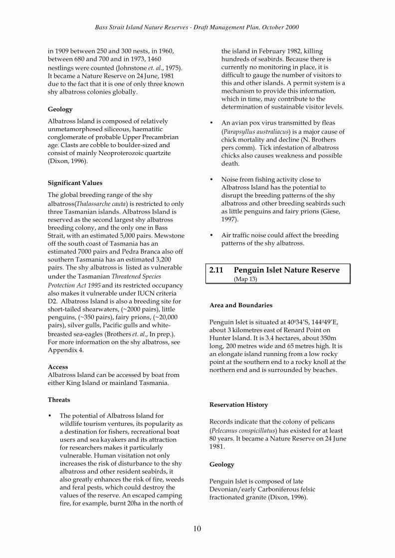
2.11 Penguin Islet Nature Reserve (Map 13)
Area and Boundaries
Penguin Islet is situated at 40034’S, 144049’E, about 3 kilometres east of Renard Point on Hunter Island. It is 3.4 hectares, about 350m long, 200 metres wide and 65 metres high. It is an elongate island running from a low rocky point at the southern end to a rocky knoll at the northern end and is surrounded by beaches.
Reservation History
Records indicate that the colony of pelicans (Pelecanus conspicillatus) has existed for at least 80 years. It became a Nature Reserve on 24 June 1981.
Geology
Penguin Islet is composed of late Devonian/early Carboniferous felsic fractionated granite (Dixon, 1996).
10

Bass Strait Island Nature Reserves - Draft Management Plan, October 2000
Significant Values
It has reservation status as one of only four Australian pelican breeding grounds in Tasmania and is the only one situated in western Bass Strait. A 1998 census counted 8 pairs breeding there. It is also significant for the diversity of other seabirds breeding on it. These include little penguins, fairy prions, short-tailed shearwaters, white-faced storm petrels, common diving petrels, black-faced cormorants, silver gulls, Pacific gulls, Caspian terns and sooty oystercatchers (Brothers et. al., In prep.). For more information on the Australian pelican, see Appendix 6.
Access
Penguin Islet can be accessed by boat from King Island, the Hunter group or mainland Tasmania.
Threats
• Because Australian pelicans breed throughout the year and are particularly nervous when nesting, human disturbance at any time of the year can cause panic-induced behaviour such as the abandonment of nests, the crushing of eggs or the drowning of chicks (Marchant and Higgins, 1990). Recreational boating and fishing activities, particularly near the southern end of the island, could cause breeding failure. Unlike some of the breeding sites in eastern Bass Strait, the pelicans always use Penguin Islet, which makes it extremely vulnerable to disturbance. Having the largest diversity of breeding seabirds of any Tasmanian offshore island also adds to its susceptibility. (Brothers et. al., In prep.).
• Illegal short-tailed shearwater harvesting may cause disturbance to all seabirds breeding on the island.
• Lack of information on the breeding and foraging patterns of pelicans may be contributing to insufficient protection of their breeding grounds and food sources.
• The woody weed Coprosma repens (shining coprosma) was reported by a Parks and Wildlife officer to be “overrunning the island” in 1989.
2.12 Cat Island Conservation Area (Map 14)
Area and Boundaries
Located at 39057’S, 148021’E, Cat Island Conservation Area comprises 49 hectares with a length of 1km, width of 0.8km and height of about 32 metres.
Reservation History
Cat Island became a Wildlife Sanctuary on 18 November 1953. All Wildlife Sanctuaries became Conservation Areas under the Regional Forest (Land Classification) Act 1998.
Geology
Cat Island consists of Devonian felsic fractionated granite (Dixon, 1996).
Significant Values
Cat Island was possibly the most important national Australasian gannet breeding ground with an estimated 10,000 birds, when first described in 1908. Over the past 70 years, the gannet colony has been damaged by fishers taking the birds as crayfish bait, by fire, particularly a large escaped burn-off in 1984, and by continual disturbance. It is now the site of a gannet reintroduction trial using decoys. There are currently no resident pairs breeding on the island, but it is still likely that gannets may recolonise it (Brothers et.al. In prep.).
Apart from its significance as a potential renewed breeding site for Australasian gannets, Cat Island is also the breeding ground for the little penguin, the short-tailed shearwater, the Pacific gull, the silver gull, the crested tern, the pied oystercatcher, the sooty oytstercatcher and the black-faced cormorant.
Cat Island is important as it was the largest colony of Australasian gannets globally and one of four colonies in Tasmanian waters and only nine in Australian waters. For more information on the Australasian gannet, see Appendix 5.
11

Bass Strait Island Nature Reserves - Draft Management Plan, October 2000
Access
Cat Island can be accessed by boat from Flinders Island.
Threats
• The relative accessibility of Cat Island from Flinders Island creates the problem of unrestricted and inappropriate visitation causing disturbance to the thousands of short-tailed shearwaters that inhabit the island and possibly deterring the return of the Australasian gannets to the island.
• Illegal harvesting of short-tailed shearwaters also causes disturbance to the gannet colony and may contribute to the reluctance of gannets to recolonise the island.
• Any gill netting undertaken around Cat Island would be hazardous to the breeding short-tailed shearwaters foraging close to the island.
• Visits via helicopter by the Australian Maritime Safety Authority to the island to maintain their navigation light may create a disturbance and increase the threat of introducing more weeds.
• Because Cat Island is regularly used as a safe anchorage for commercial and recreational vessels en route between Tasmania and the mainland, it can be subjected to regular shore visits, which increases the likelihood of habitat and seabird breeding disturbance.
• African boxthorn (Lycium ferocissimum) is a major concern, with seeds coming from Babel Island (Chris Arthur pers. comm.).
12

Bass Strait Island Nature Reserves - Draft Management Plan, October 2000
3. Vision and Objectives
3.1 The Vision
For generations into the future, the reserves will be places of global significance which support and facilitate: • healthy and flourishing populations of
breeding seabirds and seals; • unfettered ecological processes; • undisturbed breeding grounds for all
species; • unpolluted atmosphere, sea and land; • greater understanding of and empathy
with their significant values.
3.2 Purposes and Objectives of Nature Reserves
Nature reserves are a class of reserved land under the National Parks and Wildlife Act 1970. Nature reserves are areas of land that contain natural values that contribute to the natural biological diversity or geological diversity of the area of land, or both; and are unique, important or have representative value.
Purposes
The purposes of reservation of nature reserves are the conservation of the natural biological diversity or geological diversity of the area of land, or both, and the conservation of the natural values of that area of land that are unique, important or have representative value.
These islands are reserved for these purposes in that they conserve the breeding places of seabirds or seals and, in the case of Rodondo Island, protect native vegetation untouched by fire.
Objectives
The management objectives of nature reserves are set out in the National Parks and Wildlife Act 1970 as follows:
a) to conserve natural biological diversity;
b) to conserve geological diversity;
c) to preserve the quality of water and protect catchments;
d) to conserve sites or areas of cultural significance;
e) to encourage education based on the purposes of reservation and the natural or cultural values of the nature reserve or both;
f) to encourage research, particularly that which furthers the purposes of reservation;
g) to protect the nature reserve against, and rehabilitate the nature reserve following adverse impacts such as those of fire, introduced species, diseases and soil erosion on the nature reserve’s natural and cultural values and on assets within and adjacent to the nature reserve;
h) to encourage cooperative management programs with Aboriginal people in areas of significance to them in a manner consistent with the purposes of reservation and the other management.
Objectives a), b), c), e), f) and g) have been included because the reserves are significant seal and seabird breeding grounds and one of the few places certain species may be found.
Objectives d) and h) have not been specified in the management plan as objectives for which the reserves are to be managed, because, as far as is known, the reserves do not contain sites or areas of cultural significance and are not considered by Aboriginal people to be of significance to them.
Because of the significance of the reserves for seal and seabird breeding, greatest emphasis will be given to conserving the natural biological diversity and protecting and rehabilitating the reserves against adverse impacts.
3.3 Purposes and Objectives of Conservation Areas
Conservation areas are a class of reserved land under the National Parks and Wildlife Act 1970. Conservation areas are areas of land predominantly in a natural state.
Purposes
13

Small Bass Strait Island Reserves - Draft Management Plan, October 2000
The purposes of reservation of conservation areas, as set out in the National Parks and Wildlife Act 1970, are the protection and maintenance of the natural and cultural values of the area of land and the sustainable use of the natural resources of that area of land. Cat Island was reserved specifically to protect breeding seabirds.
Objectives
The objectives of conservation areas are set out in the National Parks and Wildlife Act 1970 as follows:
a) to conserve natural biological diversity;
b) to conserve geological diversity;
c) to preserve the quality of water and protect catchments;
d) to conserve sites or areas of cultural significance;
e) to provide for the controlled use of natural resources;
f) to provide for exploration activities and utilisation of mineral resources subject to appropriate controls;
g) to provide for the taking, on an ecologically sustainable basis, of designated game species for commercial or private purposes, or both;
h) to provide, for the controlled use of natural resources including as an adjunct to utilisation of marine resources;
i) to encourage education based on the purposes of reservation and the natural or cultural values of the conservation area, or;
j) to encourage research, particularly that which furthers the purposes of reservation;
k) to protect the conservation area against, and rehabilitate the conservation area following, adverse impacts such as those of fire, introduced species, diseases and soil erosion on the conservation area’s natural and cultural values and on assets within and adjacent to the conservation area;
l) to encourage appropriate tourism, recreational use and enjoyment consistent with
the conservation of the conservation area’s natural and cultural values;
m) to encourage cooperative management programs with Aboriginal people in areas of significance to them in a manner consistent with the purposes of the reservation and other management objectives.
Objectives a), b), c), i), j), k) and l) apply because of the island’s significance and potential as a seabird breeding ground. Objectives d), e), f), g), h) and m) have not been specified in the management plan as objectives for which the reserves are to managed. As far as is known, Cat Island Conservation Area does not contain sites or areas of cultural significance and is not considered by the Aboriginal people to be of significance to them. The previous and potential future significance of Cat Island Conservation Area as a breeding site for the Australasian gannet is considered incompatible with objectives e), f), g) and h).
Greatest emphasis will be given to rehabilitating the reserve following the adverse impacts of fire and human disturbance of the gannet colonies.
3.4 Management Zoning
In larger reserves such as national parks, different conditions prevail in different parts of the reserves. In national parks for example, management zones are designated to provide for visitor use and protection of reserve values. These reserves are small islands or rocks that are restricted from public access for all or part of the year (see Section 4.1.1). Therefore, all of the islands are zoned as Natural Zones, in order to conserve their integrity; protect, maintain and monitor their biodiversity; and, where possible, maintain their character of naturalness, tranquility and isolation.
14

Small Bass Strait Island Reserve Draft Management Plan, October 2000
4. Conservation
4.1 Strategies
See Appendix 7 for Summary Table.
4.1.1 Declaration of Restricted Areas
Pursuant to Section 25 of the National Parks and Wildlife Act 1970, the following reserved lands, to low water mark, are declared restricted areas to which the public has not a general right of access:
• Foster Islands, Low Islets and Penguin Islet Nature Reserves to protect the Australian pelicans which can breed at any time of the year and are particularly vulnerable to disturbance.
• Rodondo Island Nature Reserve, as any human interference could damage the unique environmental values for which the island was reserved.
• Albatross Island Nature Reserve to protect the breeding environment of the shy albatross.
• Moriarty Rocks, Tenth Island, Judgement Rocks, West Moncoeur Island and Reid Rocks Nature Reserves to ensure an undisturbed breeding environment for the Australian fur seals. Seal watching in close offshore waters may occur outside of October 1 to January 31, the breeding season. The seal watching guidelines set out in Appendix 2 should be followed.
• Black Pyramid Rocks Nature Reserve and Cat Island Conservation Area, except between September 1 to April 30, (during which time entry to the reserves is permitted) to protect current and potential rare breeding environments of the Australasian gannets.
Except for management purposes approved by the Director, pursuant to Regulation 11 of the National Parks and Reserved Land Regulations 1999, a person must not enter or remain in a restricted area, declared pursuant to Section 25 of the Act, unless he/she is granted written authority by the Director of the Parks and
Wildlife Service or is accompanied by a Ranger or other person authorised by the Director.
A person wishing to enter or remain in a restricted area should see Appendix 1, which sets out the guidelines for obtaining an authority to visit the reserves.
4.1.2 Education
• Ensure that personnel required to implement the strategies contained within this plan such as PWS officers and marine police are fully briefed.
• Ensure that interest groups such as fishers, sea kayakers and tourist operators are aware of the management requirements contained within this plan, particularly the guidelines in Appendices 1 and 2.
• Erect signs, where practical, at the most frequented departure points to inform the public that the reserves are restricted areas, giving the reasons for restricted access and the relevant dates of access.
• Provide training for seal and seabird tourism operators, thus both enhancing the wildlife watching tourist experience and maintaining the credibility of the ecotourism industry.
• Continue the seal monitoring and education program.
• Further develop community education programs as well as fisher-targeted education programs about the vulnerable breeding and feeding habits of seals and seabirds.
4.1.3 Management policies
• Recommend the factoring in of food requirements of the reserved species, where known, to fisheries management plans for Bass Strait.
• Establish joint management strategies with Parks Victoria for the Rodondo and West Moncoeur Island Nature Reserves.
15

Small Bass Strait Island Reserves - Draft Management Plan, October 2000
• District rangers to increase patrols during the short-tailed shearwater season to counteract illegal harvesting operations.
• Instigate weed control measures for the eradication and future control of weeds in the reserves, particularly the boxthorn on Foster Islands Nature Reserve and Cat Island Conservation Area and the Coprosma repens on Penguin Islet.
4.1.4 Community and Industry Partnerships
• Encourage community groups such as Coastcare, Fishcare, Bushcare, Wildcare and Birds Tasmania to become involved with reserve education and protection programs.
• Encourage recreational boat user and sea kayak clubs to develop their own codes of practice based on the guidelines in Appendix 2.
• Liaise with Marine Resources, Fishcare, recreational fishers and the commercial fishing industry to ensure, through implementation of Marine Resources legislation, that:
§ human disturbance is minimised within 500 metres of nature reserves with pelican colonies due to their high sensitivity to disturbance; and
§ gill nets set within a perimeter of 500 metres of the other reserves are constantly attended. Implementation of these measures would greatly increase the safety of seals and seabirds near their breeding sites.
• In conjunction with Tourism Tasmania, develop a process of ecotourism licensing and accreditation based on compliance with the guidelines set out in Appendix 2 for tourist operators wishing to operate near nature reserves. Controlled seal watching tours around Tenth Island, Reid Rocks and Judgement Rocks may be possible.
• Liaise with the Antarctic Division and Air Services Australia regarding the possible implementation of guidelines and “fly
neighbourly” agreements for aircraft flying over significant seal or seabird colonies.
• Encourage the Australian Maritime Safety Authority Victoria to service the navigation light on Cat Island during non-breeding times only (1 May - 31 August). The Director must authorise access to the island to undertake any repairs that may be necessary between 1 September and 30 April.
• Liaise with the Department of Primary Industries, Water and Environment Animal Ethics Committee regarding the incorporation of the guidelines for visiting a reserve into their criteria.
4.1.5 Reserve Status
• Seek to upgrade the status of Cat Island Conservation Area to a Nature Reserve in recognition of its potential significance as a breeding site for the Australian gannet.
16

Small Bass Strait Island Reserve Draft Management Plan, October 2000
5. Other Issues
5.1 Administration
The nature reserves and conservation area encompassed by this management plan fall into three Parks and Wildlife Service administrative districts: the north, north west and north east. The district officers will be responsible for the implementation of the plan by ensuring that fishers and recreational boat users, who are most likely to visit the reserves, have obtained authority to visit under the National Parks and Reserved Land Regulations 1999.
The granting of authorities to visit will be managed by the Hobart office of the Parks and Wildlife Service.
The management plan may only be varied in accordance with the procedures set out in Sections 19 and 20 of the National Parks and Wildlife Act 1970.
5.2 Research
To enhance the conservation of the reserves included in this management plan, research is recommended for the following priority issues:
a) the determination of food requirements and foraging areas of the reserved species, particularly the Australian pelican, about which the least is known;
b) the monitoring of the breeding patterns of the reserved species (shy albatrosses and Australian fur seals are currently being monitored on a regular basis);
c) the cause, effect and possible mitigation of the avian pox virus affecting shy albatrosses on Albatross Island.
5.3 Plan Evaluation and Revision
The management plan will be reviewed ten years after gazettal of its approval by the Governor, or sooner if research, monitoring or other circumstances demonstrate a need.
In the review of the plan the implementation of the conservation strategies and their effectiveness in achieving the management objectives of the plan will be evaluated.
The performance indicators set out in Appendix 8 will be used to evaluate the success of the plan in achieving its objectives.
17

Bass Strait Island Nature Reserves - Draft Management Plan, October 2000
References
ALEXANDER, K., ROBERTSON, G. & GALES, R. 1997; The Incidental Mortality of Albatrosses in Longline Fisheries; Australian Antarctic Division, Tasmania.
BAXTER, A.S. 1992; The Management of Whale and Dolphin Watching Kaikoura New Zealand; Department of Conservation, New Zealand.
BIODIVERSITY GROUP - ENVIRONMENT AUSTRALIA 1998; Threat Abatement Plan for the Incidental Catch of Seabirds During Oceanic Longline Fishing Tasmanian Islands; Earth Science Section, Parks and Wildlife Service, Tasmania.
BROTHERS, N., PEMBERTON, D., PRYOR, H., & HALLEY V., (In prep.) Tasmania’s Offshore Islands: seabirds and other natural features.
BROTHERS, N., GALES, R. & PEMBERTON, D. 1993; Prey harvest of the Australasian Gannet (Sula serrator) in Tasmania; in Wildlife Reserarch Vol. 20, CSIRO, Melbourne.
BROTHERS, N. & HARRIS, S. 1999 133(1) 15-22; The effects of fire on burrow-nesting seabirds particularly short-tailed shearwaters (Puffinus tenuirostris) and their habitat in Tasmania; published papers and proceedings of the Royal Society of Tasmania.
DIXON, G. 1996; A reconnaissance inventory of sites of geoconservation significance on Tasmanian islands; unpublished report, Parks and Wildlife Service, Tasmania.
GALES, R. 1993; Co-operative Mechanisms for the Conservation of Albatross; ANCA and Australian Antarctic Foundation, Hobart.
GALES, R., PEMBERTON, D., LU, C.C & CLARKE, M.R. 1993; Cephalopod diet of the Australian fur seal: variation due to location, season and sample type in Australian Journal of Marine and Freshwater Research, Victoria.
GIESE, M., 1997; Guidelines for people approaching breeding groups of Adelie penguins (Pygoscelis adeliae), Antarctic Division, Hobart, Australia.
HEDD, A. 1999; Foraging Ecology of Shy Albatrosses Thalassarche cauta Breeding in Australia: Implications for Interactions with Longline Fisheries, University of Tasmania, Hobart.
HEDD, A., GALES, R., BROTHERS, N. & ROBERTSON, G. 1997; Diving behaviour of the Shy Albatross Diomedea cauta in Tasmania: initial findings and dive recorder assessment in Ibis 139 :452-460, Australia.
HUME, F. & GALES R. 1999; Princess Melikoff Trust Marine Mammal Program Report 1998-1999; Marine Conservation Branch, Tasmanian Parks and Wildlife Service, Hobart.
JOHNSTONE, G.W., MILLEDGE, D. & DORWARD, D.F. 1975; The White-capped Albatross of Albatross Island: numbers and breeding behaviour from The Emu Vol. 75 Part 1, Melbourne.
KIRKPATRICK, J.B., MASSEY J.S. & PARSONS R.F. 1971; Natural history of Curtis Island, Bass Strait 2, soils and vegetation with notes on Rodondo Island in Papers and Proceedings of the Royal Society of Tasmania, Volume 107, Hobart.
18

Bass Strait Island Nature Reserves - Draft Management Plan, October 2000
MARCHANT, S. & HIGGINS, P.J. 1990; Handbook of Australian, New Zealand and Antarctic Birds Vol 1 & 2; Oxford University Press, Melbourne.
Marine Mammals Protection Regulations 1992, New Zealand.
MARMION P., 1997; Seal Ecotourism Potential in Tasmania, unpublished report, Parks and Wildlife Service, Tasmania. NELSON, B. 1980; Seabirds: Their Biology and Ecology; Hamlyn Publishing Group Ltd., London.
PEMBERTON, D., GALES, R. & HUME F. 1998; Princess Melikoff Trust Marine Mammal Program Report 1997-1998; Tasmanian Parks and Wildlife Service, Hobart.
PEMBERTON, D. & KIRKWOOD, R.J. 1994; Pup Production and Distribution of the Australian Fur Seal Arctocephalus pusillus doriferus in Tasmania , in Wildlife Res., Vol. 21, CSIRO, Melbourne.
REID, T. & BROTHERS, N., 2000; AFMA Discussion Paper on Possible Management Arrangements for the Commonwealth Jack Mackerel Fishery – Response from Tasmanian Parks and Wildlife Marine Conservation Section, unpublished report.
SERVENTY, D.L., SERVENTY, V. & WARHAM, J. 1971; The Handbook of Australian Sea-birds; A.H. and A.W. Reed Ltd., Sydney.
SHAUGHNESSY, P.D. 1999; NICHOLLS, A.O. & BRIGGS, S.V. 1999; Interactions between Tourists and Wildlife at Montague Island: Fur Seals, Little Penguins and Crested Terns: Report to New South Wales National Parks and Wildlife Service, CSIRO, Canberra.
SHAUGHNESSY, P.D. 1999; The Action Plan for Australian Seals; Environment Australia, Canberra.
WBM OCEANICS AUSTRALIA AND CLARIDGE, G. 1997; Guidelines for Managing Visitation to Seabird Breeding Islands; Great Barrier Reef Marine Park Authority, Townsville.
19

Bass Strait Island Nature Reserves - Draft Management Plan, October 2000
Glossary
Biodiversity (biological diversity) means the variety of life forms: the different plants, animals and micro-organisms, the genes they contain and the ecosystems they form (genetic diversity, ecosystem diversity and community diversity).
Conservation means all the processes and actions of looking after a place so as to retain its significance, always including protection, maintenance and monitoring.
Indigenous species means a species that occurs at a place within its historically known natural range and that forms part of the natural biodiversity of a place.
Introduced species means a translocated or alien species occurring at a place outside its historically known natural range as a result of intentional or accidental dispersal by human activities.
Protection means taking care of a place by maintenance and by managing impacts to ensure that significance is retained.
Threatened species means a species listed in the Schedules of the Tasmanian Threatened Species Protection Act 1995. The following conservation category definitions apply under the Tasmanian Act:
• Endangered - species which are either: − in danger of extinction because long term survival is unlikely while the factors causing the
species to be endangered continue operating or − presumed extinct on the grounds that no occurrence of the species in the wild can be
confirmed during the past 50 years.
• Vulnerable – a species which is likely to become endangered while the factors causing it to be vulnerable continue operating.
• Rare – a species which has a small population in Tasmania that is not endangered or vulnerable but is at risk.
20

Bass Strait Island Nature Reserves - Draft Management Plan, October 2000
Appendix 1
Guidelines for Obtaining Authority to Visit to Restricted Areas
Pursuant to Section 25 of the National Parks and Wildlife Act the following reserved land is declared a restricted area:
• Foster Islands, Low Islets and Penguin Islet Nature Reserves to protect the Australian pelicans which can breed at any time and are particularly vulnerable to disturbance.
• Rodondo Island Nature Reserve , as any human interference could damage the unique environmental values for which the island was reserved.
• Albatross Island Nature Reserve to protect the breeding environment of the shy albatross.
• Moriarty Rocks, Tenth Island, Judgement Rocks, West Moncoeur Island and Reid Rocks Nature Reserves to ensure an undisturbed breeding environment for the Australian fur seals. Seal watching in close offshore waters may occur outside of the breeding season of October 1 to January 31.
• Black Pyramid Rocks Nature Reserve and Cat Island Conservation Area except between 1 September and 30 Apri (during which time entry to the reserves is permitted) to protect current and potential rare breeding environments of the Australasian gannets.
Pursuant to Regulation 11 of the National Parks and Reserved Land Regulation 1999, a person may only enter or remain in a restricted area declared pursuant to Section 25 of the Act, unless he/she is granted written authority by the Director of the Parks and Wildlife Service or is accompanied by a Ranger or other person authorised by the Director.
Permission for visitor access to one or more of the reserves detailed above may be granted on the basis that the applicant:
• is an acknowledged researcher, who has the approval of the Department of Primary Industry, Water and Environment Animal Ethics Committee for proposed wildlife research or is an acknowledged researcher in other relevant fields such as botany and geology;
• is an acknowledged tourist operator with an educational focus and is licensed to operate in a reserve by Parks and Wildlife Service.;
• is a responsible non-commercial recreational organisation, with an educational focus and preferably with its own code of practice for visiting reserves;
• can adequately justify the need to visit the reserve;
• has read the management plan and is prepared to comply with the conservation strategies within it;
• is prepared to comply with the guidelines for visiting seabird or seal colonies (Appendix 2 of the plan);
• is prepared to comply with the visitor group size and time constraints which may apply;
• is briefed about appropriate visitor behaviour either in writing or verbally by a relevant employee of the Marine Conservation Branch of the Parks and Wildlife Service, Tasmania or is accompanied by a Parks and Wildlife Service guide.
21

Bass Strait Island Nature Reserves - Draft Management Plan, October 2000
Appendix 2
Guidelines for visiting a seabird colony
When visiting a seabird colony the following actions will minimise your impact on the resident birds and their habitat:
• Always report your visit to the Parks and Wildlife Service and obtain permission if required. • If possible, plan for a day trip with no overnight camping. • If an overnight stay is unavoidable, preferably stay on your boat or set up camp as far away from
the bird colonies as possible. • Ensure that there are no feral pests such as rats and mice aboard your boat. They could devastate a
seabird colony either by eating or destroying the eggs and carrying ticks, fleas or other harmful parasites.
• Prior to arrival, thoroughly wash your shoes, tent pegs and other soil-contacted equipment in salty water to avoid transporting Phytophthora cinnamomi and other potentially damaging weed seeds or fungal spores.
• Where possible, walk on the rocky shoreline to ensure that you do not trample on burrows and nests.
• Look out for signs of birds being disturbed such as them flying in circles or squawking. Ensure that you keep well away, if they are displaying any agitated behaviour.
• Look out for small nesting birds, particularly between August and March. Some, like terns, are often difficult to see, so stay alert.
• Do not light fires. Smoke can distress some birds and there is always a risk of escape, no matter how careful you may be. Always carry a fuel stove.
• Avoid setting, or constantly attend set gill nets, within 500 metres of the bird colony. Many diving birds are killed in nets, especially during their breeding season when they forage nearer their colony.
• Record, in as much detail as possible, information about dead wildlife and unusual occurrences you may witness during your visit. Report them to PWS officers on your return.
Seal watching guidelines
(adapted from Parks and Wildlife Service “See them in the wild!” brochure)
• Approach a seal colony quietly. Seals are sensitive - fast boats, noisy engines, clattering sails and rattling anchor chains frighten them, making them flee into the water.
• During the breeding season, disturbance may cause stampedes, where pups are crushed or forced off the colony. Lower your sail or reduce speed to under 10 knots within 200 metres and 5 knots within 100 metres of the colony.
• Approach downwind slowly and quietly - seals have an acute sense of smell and will be wary of your intrusion into their territory.
• In November and December when pups are born, boats should not moor or pass closer than 100 metres to a seal colony.
• At all other times of year it is best to go no closer than 50 metres to a seal colony. • Do not swim with seals, as sharks often share the same habitat. • Never land at a seal colony. Disturbed seals will stampede, endangering their pups. In cases of
severe disturbance, they may abandon them. • Never discard plastic material overboard. Seals can be killed by swallowing it or, more likely, from
becoming entangled in it. • Avoid setting or constantly attend gill nets within 500 metres of the bird colony. Many diving birds
are killed in nets, especially during their breeding season when they forage nearer their colony. • Record, in as much detail as possible, information about dead wildlife and unusual occurrences
you may witness during your visit. Report them to PWS officers on your return.
22

Bass Strait Island Nature Reserves - Draft Management Plan, October 2000
Appendix 3
Australian Fur Seal: Conservation Information (adapted from P. Shaughnessy, Action Plan for Australian Seals)
Scientific name: Arctocephalus pusillus Common name: Australian fur seal, Tasmanian fur seal, giant fur seal IUCN status: Lower risk, conservation dependent Tasmanian status: None Breeding sites: Restricted to Bass Strait islands (5 Victorian and 5 Tasmanian) Foraging range: South Australia, southern Tasmania, NSW and Jervis Bay
Territory Habitat: Rocky parts of islands, with flat, open terrain Key sites: Lady Julia Percy Island, Victoria
Seal Rocks, Victoria Judgement Rocks, Tasmania Reid Rocks, Tasmania
Biology: Birth weight 5-12kg. Birth length 60-80cm. Weaning age 10 - 12 months Average weight (f) 78kg. Average weight (m) 279kg. Average length (f) 157cm. Average length (m) 216cm Maximum age (f) 21 years Maximum age (m) 19 years Age at sexual maturity (f) 3-6 years Age at sexual maturity (m) 5-13 years Gestation 8-9 mths. Pupping interval 1 year Pupping season late October - late December
Source: Warneke (1995a), Pemberton and Kirkwood, (1994)
Diet: Principally fish (in winter) and cephalopods (in summer), also seabirds. Most important prey are Gould’s squid, redbait, leatherjacket and jack mackerel. (Gales et.al., 1993)
Behaviour Colonies are occupied year round, but activity is greatest during the summer breeding season. Adult females give birth soon after coming ashore, mate about six days after giving birth and then leave the colony to feed. For several months, they alternate periods at sea with shore attendance to suckle their young. In June or July, pups begin to forage to supplement their milk diet. (Pemberton et.al., 1994)
Mortality rate: 15% by about 6 weeks of age
Population: Estimated at between 60,000 and 77,000 for Australian waters
Threats: Illegal culling by fishers Drowning in fish farm nets and traps Death and weakness due to entanglement Oil spills Disease
Responsibility: 3-200 nautical miles offshore – Commonwealth Environment Australia (EA). Low water mark to 3 nautical miles – State (DPIWE)
23

Bass Strait Island Nature Reserves - Draft Management Plan, October 2000
Appendix 4
Shy Albatross: Conservation Information
Scientific name: Thalassarche cauta (formerly Diomedea cauta) Common name: Shy albatross IUCN status: Vulnerable Tasmanian status: Vulnerable Breeding sites: Restricted to three Tasmanian Islands - Albatross (5000 pairs, Mewstone
7000 pairs and Pedra Branca (250 pairs) Foraging range: Approx 320km post breeding, but considerably less when chick
brooding (~100km) and rearing (58km) (Hedd 1998) Habitat: Ocean, steep cliffs
Biology: Birth weight 190g Birth length 60-80cm Incubation time 70 days Fledging age ~4 months Weight at 9 mths 5kg Average weight 5-7kg Average wingspan 230-260cm Maximum age (known) ~ 30 years Avg. age at sexual maturity 7 years Egg laying interval 1 year Breeding season early September to end of April
Diet: Principally fish (present in 92% of regurgitate samples), cephalopods (present in 33% of samples), crustaceans (present in 14% of samples) and tunicates (present in 40% of samples) Jack mackerel is the main species of fish eaten and Gould’s squid is the most common cephalopod (Hedd, 1999). Albatrosses may dive up to 7 metres for fish. However, their primary method of food collection is surface seizing ((Hedd et al, 1997).
Behaviour Colonies are occupied year round, but activity is greatest during the summer breeding season. They breed annually, laying one egg only. Egg laying commences in September, eggs are incubated for about 10 weeks and chicks hatch in December. Chicks are brooded by both parents for approximately 3 weeks and fledge during April. When they fledge they don’t return to the colony until they are ready to mate (usually in 7-8 years’ time) (Gales, 1993).
Population: 12,200 breeding pairs, ~ 55,000-60,000 individuals worldwide
Threats: Long lining (the shy albatross, including the New Zealand subspecies, constitutes over 10% of the seabird bycatch on Japanese tuna longlines) Trawling Other fishing methods Direct competition for food
Disease, particularly avian pox virus (Gales, 1993).
Responsibility: 3-200 nautical miles offshore – Commonwealth Environment Australia(EA). Low water mark to 3 nautical miles – State (DPIWE)
24

Bass Strait Island Nature Reserves - Draft Management Plan, October 2000
Appendix 5
Australasian Gannet: Conservation Information
Scientific name: Sula serrator Common name: Australasian gannet IUCN status: None Tasmanian status: None Breeding sites: Lawrence Rocks, Victoria.
Port Philip Bay, Victoria. , Pedra Branca, Black Pyramid Island, Eddystone Rock, Tasmania. and approximately 30 islands off New Zealand
Foraging range: Up to 450km, but most feed within a range of 61 km. Habitat: Oceans, bays, steep cliffs, rock stacks. 99.7% of birds breed
between 340-400S and colony sites are usually steep rocky islands largely or wholly surrounded by water.
Biology: Birth weight 75g Birth length 60-80cm Incubation time 43-47 days (6-7 weeks) Fledging age 13-15 weeks Average weight 2-3kg Average wingspan 463mm Age at sexual maturity 4-5 years Egg laying interval 1 per year Breeding season October to end of April Life expectancy about 20 years Annual adult mortality 4.5%
Diet: Pelagic fish, up to the size of barracouta. In Tasmanian waters, mainly redbait and jack mackerel. Also cephalopods. They dive from heights of up to 20m and attack a shoal of fish from beneath, usually remaining under the water for less than 10 seconds. They often fish in large flocks (Brothers et. al., 1993)
Behaviour Colonies are occupied year round, but activity is greatest during the summer breeding season. They breed annually and lay one egg Egg laying commences in October in nests less than 1 metre apart. Eggs are incubated for about 6 weeks by both the male and female birds and the chicks have usually hatched by the end of December. Chicks are brooded by both parents taking 12 hour shifts for approximately 6 weeks. Most chicks have fledged by late April. They reappear at the home rookery at the age of about 3 years and commence breeding by about 4-5 years (Marchant and Higgins, 1990).
Population: In 1981 there were 52,664 pairs worldwide, of which Australia had 6,660 pairs and New Zealand 46,004 pairs. There has been a mean annual increase of 2.3% in the size of the population, but the number of colonies has remained steady (Marchant and Higgins, 1990).
Threats: Netting Long lining Storms Fishermen using them for bait.
Responsibility: 3-200 nautical miles offshore – Commonwealth Environment Australia (EA). Low water mark to 3 nautical miles – State (DPIWE)
25

Bass Strait Island Nature Reserves - Draft Management Plan, October 2000
Appendix 6
Australian Pelican: Conservation Information
Scientific name: Pelecanus conspicillatus Common name: Australian pelican IUCN status: None Tasmanian status: None Breeding sites: From Bass Strait to the Gulf of Carpentaria, and Papua New Guinea but
possibly fewer than 15 sites with a mixture of inland lagoons, coast and offshore islands. Low Islets, Foster Islands, Penguin Islet and possibly Little Swan Island are the only known breeding sites in Tasmanian waters.
Foraging range: Extensive, but not specifically known. Habitat: Islands, coastal lagoons, estuaries
Biology: Birth weight 150-170g Incubation time 32-35days Fledging age 3-4 months Average weight 4-6kg Average wingspan 2-3 metres Egg laying interval 1-4 per year Breeding season all year, often dependent on water
levels
Diet: Predominantly fish, both fresh and saltwater, and crustaceans
Behaviour: Both sexes alternately incubate the eggs usually males in the morning, females in the afternoon. Pelicans are not close sitters and after being disturbed from nests, it is some time before they return, allowing ravens, gulls and other predators to enter the rookery and destroy the eggs and/or chicks. Sometimes they will desert the colony altogether. Chicks leave their nests and join a creche at about 25 days old.
Population: Not known.
Threats: Human disturbance Pollution Flying into obstructions (Marchant and Higgins, 1990)
Responsibility: 3-200 nautical miles offshore – Commonwealth Environment Australia(EA). Low water mark to 3 nautical miles – State (DPIWE)
26

Bass Strait Island Nature Reserves - Draft Management Plan, October 2000
Appendix 7 Conservation Strategies Implementation Summary Table
Nature Reserve Significant Values Major Aims Actions Responsibilities
Low Islets Australian pelican To protect the Australian pelicans and their breeding and in–shore feeding habitat.
PWS under Section 25 of its Act• Restrict visitor access at all times of the PWS district officersyear (see Section 4.1.1)
Nature Conservation Branch and• Liaise with Marine Resources and Marine Resources, DPIWEindustry to minimise the risk of
disturbance within 500m of the NR.
PWS, Coastcare, Wildcare, Birds• Develop education programs Tasmania & Fishcare groups
Moriarty Rocks Australian fur seal colony To protect the Australian fur seals and their breeding and in-shore feeding habitat.
PWS under Section 25 of its Act.• Restrict visitor land access and control PWS district officerswater access within 100 metres during
the breeding season (Oct 1- Jan 31)
PWS, Coastcare, Wildcare, Birds• Develop education programs. Tasmania & Fishcare groups
Nature Conservation Branch under• Continue the research and monitoring Princess Melikoff Trust funds.program.
Marine Conservation Section and• Liaise with Marine Resources and Marine Resources, DPIWEindustry to develop a policy of
Foster Islands Australian pelican colony To protect the Australian pelicans and their breeding and in-shore feeding habitat.
constantly attended nets within 500m of the NR.
PWS under Section 25 of its Act.• Restrict visitor access at all times of the PWS district officersyear (see Section 4.1.1).
PWS, Coastcare & Fishcare groups• Develop education programs and signage at key departure points.
PWS district officers• Instigate weed control measures
• Liaise with Marine Resources and Nature Conservation Branch and
27

Bass Strait Island Nature Reserves - Draft Management Plan, October 2000
Nature Reserve Significant Values Major Aims Actions Responsibilities
industry to minimise the risk of Marine Resources, DPIWE disturbance within 500m of the NR.
Foster Islands (cont) • Increase patrolling for illegal short-tailed shearwater harvesting
Tenth Island Australian fur seal To protect the Australian fur seals and • Restrict visitor land access and control their breeding habitat water access within 100 metres during
the breeding season Oct 1 – Jan 31
• Develop education programs
• Continue the monitoring program
• Liaise with Marine Resources and industry to ensure constantly attended nets within 500m of the NR
• Encourage responsible licensed seal watching tours
Judgement Rocks Australian fur seal colony To protect the Australian fur seals and • Restrict land access and control water their breeding habitat access within 100 m of the NR during
the breeding season (1 Oct – 31 Jan).
• Develop education programs.
• Continue the research and monitoring programs
• Liaise with Marine Resources and industry to ensure constantly attended nets within 500m of the NR.
• Investigate the feasibility of
PWS district officers
PWS under Section 25 of its Act. PWS district officers
PWS, Coastcare & Fishcare groups
Nature Conservation Branch, DPIWE under Princess Melikoff Trust funds
Marine Conservation Section and Marine Resources, DPIWE
Tourism Tasmania and PWS
PWS under Section 25 of its Act with assistance from Parks Victoria
PWS, Coastcare, Wildcare & Fishcare groups
Nature Conservation Branch, DPIWE under Princess Melikoff Trust funds
Marine Conservation Section and Marine Resources, DPIWE
Tourism Tasmania and PWS
28

Bass Strait Island Nature Reserves - Draft Management Plan, October 2000
Nature Reserve Significant Values Major Aims Actions Responsibilities
responsible licensed seal watching tours
West Moncoeur Island
Australian fur seal colony To protect the Australian fur seals and their breeding habitat.
• Restrict visitor land access and control water access within 100 m during the breeding season from Oct 1 – Jan 31.
• Develop education programs.
• Continue the monitoring program
• Liaise with Marine Resources and industry to ensure constantly attended nets within 500m of the NR.
Rodondo Island Unique ecological community
To protect the significant ecological community.
• Restrict visitor access at all times of the year (see Section 4.1.1).
Reid Rocks Australian fur seal colony To protect the Australian fur seals and their breeding habitat
• Restrict visitor land access and control water access within 100 m of the NR during breeding season Oct 1- Jan 31.
• Develop education programs.
• Continue the research and monitoring program
• Liaise with Marine Resources and industry to esure constantly attended nets within 500m of the NR.
• Investigate the feasibility of responsible licensed seal watching tours.
PWS under Section 25 of its Act with assistance from Parks Victoria.
PWS, Coastcare, Wildcare & Fishcare groups
PWS under Princess Melikoff Trust funds
Marine Conservation Section and Marine Resources, DPIWE
PWS under Section 25 of its Act with assistance from Parks Victoria.
PWS under Section 25 of it Act with assistance from Parks Victoria.
PWS, Coastcare, Wildcare & Fishcare groups Nature Conservation Branch, DPIWE under Princess Melikoff Trust funds
Marine Conservation Section and Marine Resources, DPIWE
Tourism Tasmania and PWS
29

Bass Strait Island Nature Reserves - Draft Management Plan, October 2000
Nature Reserve Significant Values Major Aims Actions Responsibilities
Black Pyramid Rock Australasian gannet colony To protect the Australasian gannets and their breeding habitat.
• Limit visitor access, especially during the breeding season from Sept 1 to April 30
PWS under Section 25 of its Act. PWS district officers
• Develop education programs. PWS, Coastcare, Wildcare & Fishcare groups
Albatross Island Shy albatross colony To protect the shy albatross and its breeding habitat.
Penguin Islet Australian pelican colony To protect the Australian pelicans and their breeding habitat.
• Liaise with Marine Resources and industry to minimise the risk of disturbance within 500m of the NR
Marine Conservation Section and Marine Resources, DPIWE
• Restrict visitor access at all times of the year
PWS under Section 25 of its Act. PWS district officers
• Liaise with Marine Resources and industry to minimise the risk of disturbance within 500m of the NR
Nature Conservation Branch and Marine Resources, DPIWE
• Continue research and education campaigns
Marine Conservation Section of PWS, Coastcare & Fishcare groups.
• Restrict visitor access at all times of the PWS under Section 25 of its Act.
year
•
•
Develop education programs
Liaise with Marine Resources and industry minimise the risk of disturbance within 500m of the NR.
PWS, Coastcare, Wildcare & Fishcare groups Nature Conservation Branch and Marine Resources, DPIWE
• Increase patrolling for illegal short-tailed shearwater harvesting
PWS district officers
• Instigate weed control measures PWS district officers
30

Bass Strait Island Nature Reserves - Draft Management Plan, October 2000
Nature Reserve Significant Values Major Aims Actions Responsibilities
Reserve Significant Values Major Aims Actions Responsibilities
Cat Island Conservation Area
Australasian gannets, short-tailed shearwaters
To protect the breeding habitat of the Australasian gannets and to encourage recolonisation. To protect the short-tailed shearwater breeding habitat.
•
•
•
Limit visitor access, especially during the breeding season from Sept 1 to April 30.
Develop education programs
Continue gannet recolonisation trials
PWS under Section 25 of its Act
PWS, Coastcare, Wildcare & Fishcare groups PWS
• Liaise with Marine Resources and industry to ensure constantly attended nets within 500m of the reserve
Nature Conservation Branch and Marine Resources, DPIWE
• Instigate weed control measures PWS district officers
• Increase patrolling for illegal short-tailed shearwater harvesting
PWS district officers
31

Bass Strait Island Nature Reserves - Draft Management Plan, October 2000
Appendix 8
Performance Indicators
Performance indicators provide a guide for evaluating the success of the implementation of the management plan and the achievement of its objectives. The following performance indicators will be applied when assessing this plan:
• The seal and seabird populations resident on the island reserves encompassed by this plan, have increased, with significant breeding success being achieved on the reserves.
• The ecosystems which support the values of the reserves are untarnished by fire, weed or pathogen invasion.
• Visitor levels are being monitored and controlled through controlled access.
• Coastcare, Fishcare, Wildcare, Bushcare and Birds Tasmania groups have become involved in ensuring the protection of the reserves.
• Education programs have been put in place to inform the public about the values of the reserves.
• Recreational boating and sea canoe clubs have developed codes of practice incorporating the guidelines to visiting seabird and seal colonies in Appendix 2.
• Appropriate education-focussed ecotourism ventures have been licensed to operate seal watching tours to Tenth Island, Reid Rocks and possibly Judgement Rocks.
• Parks Victoria and Victorian Coastcare groups have assumed some responsibility for the implementation of the management plan for Rodondo Island and West Moncoeur Island Nature Reserves.
• The development of Marine Resource legislation which ensures that human disturbance is minimised within 500 metres of the pelican breeding colonies and that gill nets are constantly attended within 500 metres of certain`` other reserves in Bass Strait and that the legislation has been implemented as part of the Scalefish Policy Review process.
• Where known, the food requirements of the protected wildlife of the reserves have been acknowledged and factored into fisheries management decisions for Bass Strait according to ecologically sustainable fisheries guidelines.
32

Bass Strait Island Nature Reserves - Draft Management Plan, October 2000
Appendix 9
Apart from regular liaison with staff of the Parks and Wildlife Service of the Department of Primary Industries, Water and Environment, there has also been consultation with the following individuals and groups throughout the development of the draft management plan.
David Pemberton Tasmanian Museum and Art Gallery Christian Bell Marine and Coastal Community Network (Tas) Tim Allen Marine and Coastal Community Network (Vic) Peter McGlone Threatened Species Network Priscilla Park Birds Tasmania Simon Plowright Birds Tasmania Jenny Smith Tasmanian Aboriginal Land Council Bob Lister Tasmanian Fishing Industry Council Stuart Richey Tasmanian Fishing Industry Council Tim Barnard Marine Police Melissa Giese Antarctic Division Anna Wind Coastcare (NW) Donnalee Young Coastcare (E) Kim Willing Coastcare (S) Jeremy Lyle TAFI Laurie Ford Maatsuyker Sea Canoe Club Craig Saunders Tasmanian Sea Canoe Club Jenny Scott Tasmanian Sea Canoe Club Grant Dixon Tasmanian Sea Canoe Club Stuart Lennox Tourism Tasmania Dave Simmons Seal tours John Everard Mineral Resources Tasmania John Pemberton Mineral Resources Tasmania Doug Nicol DPIWE (Wild Fisheries) John Smith DPIWE (Recreational Fishing) Fiona Hume Biologist (seals) Neil Smith Charter boat operator Nigel Burgess Councillor, King Island Rob Alliston Lessee, Three Hummock Island Students TAFE
Flyers seeking comment were distributed to 13 key shops and organisations on the north west coast and articles appeared in “Hands On”, the Tasmanian Coastcare newsletter , “Waves”, the newsletter of the Marine and Coastal Community Network, Sea Canoeing, the newsletter of the Tasmanian Sea Canoe Club and the “Tasmanian Conservationist”, the newsletter of the Tasmanian Conservation Trust.
33

King Island
Map 1 - Location of Bass Strait Islands (North West)
Reid Rocks Bass Strait Nature Reserve
Albatross Island Three Hummock Island Nature Reserve
Black Pyramid Nature Reserve
Cape Grim Robbins Island
Hunter Island Penguin Islet Nature Reserve
Smithton
Stanley
Marrawah
0
Kilometres
10 20
Scale: 1:500,000
�
Bass Strait
Tasmania
Hobart
Launceston Devonport
Burnie
Produced by Parks & Wildlife Service

Rodondo Island Nature Reserve West Moncoeur
Island Nature Reserve Map 2 - Location of Bass Strait Islands (North East)
Deal Island Judgement Rocks Nature Reserve
Cape Barren Island
Flinders Island
Clarke Island
Cat Island Conservation Area
Bass Strait
Foster Islands Nature Reserve
Moriarty Rocks Nature Reserve
Low Islets Nature Reserve
Bass Strait
Tasmania
Hobart
Launceston Devonport
Burnie
�
Produced by Parks & Wildlife Service
0
Kilometres
20 40
Scale: 1:1,000,000

Map 3 - Low Islets Nature Reserve 5509200
5509000
� 0 100
5508800
Projection/Datum - UTM/AGD66 605000 605200 605400 605600
Produced by Parks & Wildlife Service
����������
����������
Land Low Water Mark / Rock / Sand
Metres
Scale: 1:3,000
200

5506600
5506400
5506200
5506000
Produced by Parks & Wildlife Service Projection/Datum - UTM/AGD66
608000 608200607800607600
Map 4 - Moriarty Rocks Nature Reserve
�
Land Tidal Zone / Low Water Mark
0 100 200
Metres
Scale: 1:4,000
608400

5491600
Map 5 - Foster Islands Nature Reserve
5491200
5490800
10
�
10 Metre Contour Interval
Tidal Zone / Low Water Mark Land
0 200 400
Metres
5490400 Scale: 1:7,000
Produced by Parks & Wildlife Service Projection/Datum - UTM/AGD66 582000 582400 582800 583200

500700 500800 500900
5467400
500500 500600
5467500
5467600
Map 6 - Tenth Island Nature Reserve
�
Produced by Parks & Wildlife ServiceProjection/Datum - UTM/AGD66
Tidal Zone / Low Water MarkLand
0
Metres
50 100
Scale: 1:2,000

511000 511200 510600 510800
5627200
5626800
5626600
5627000 20
1030
10 Judgement Rocks
Big Rock
Map 7 - Judgement Rocks Nature Reserve
�
Produced by Parks & Wildlife ServiceProjection/Datum - UTM/AGD66
10 Metre Contour Interval
Tidal Zone / Low Water MarkLand
0
Metres
100 200
Scale: 1:4,000

457200 457600 456800
5656800
5657200
5657600
3010
10
20
20
40
50
50
10
10
20
40
50
70
90
30
80
20
40
60
10
Map 8 - West Moncoeur Island Nature Reserve
�
Produced by Parks & Wildlife ServiceProjection/Datum - UTM/AGD66
10 Metre Contour Interval
LandTidal Zone / Low Water Mark
0
Metres
200 400
Scale: 1:6,000

448000 447000 447500 446500
5657000
5657500
5658000
10
50
90110
60
40
60
120
20
170
100
50
110
210
80
6040
40
3020
290
150
210
220
240
260
130200 50
190
23090
210
70
100
190
270
270
290
310
320330
30
200250
190
180
130
130
140
140
160
160
170
260
250
300
210
150
90
70
6040
20
20
50
150
90
120
8070
60
40
30
100
90 110
120
190
30100
50
110
Map 9 - Rodondo Island Nature Reserve
�
Produced by Parks & Wildlife ServiceProjection/Datum - UTM/AGD66
10 Metre Contour Interval
Land
0
Metres
250 500
Scale: 1:10,000

261000 262000 257000 258000 259000 260000
5537000
5538000
256000
5539000
5540000
5542000
5541000 10
Map 10 - Reid Rocks Nature Reserve
�
Produced by Parks & Wildlife ServiceProjection/Datum - UTM/AGD66
10 Metre Contour Interval
Land
0
Kilometres
1 2
Scale: 1:30,000

276000 275500 275000 274500 274000
5515500
5516000
5516500
5517000
50
60
20
30
3040
10
70
Map 11 - Black Pyramid Nature Reserve
�
Produced by Parks & Wildlife ServiceProjection/Datum - UTM/AGD66
10 Metre Contour Interval
Land
0
Metres
250 500
Scale: 1:10,000

301000 301500 300500
5527000
5527500
5528000
10
10
10
3020
10
10
30
10
10
10
20
20
20
10
20
10
10
1030
10
10
20
30
20
30
30
30
30
20
20
20
3030
10
10
30
30
30
20
20
20
20
30
20
30
30
3030
10
Map 12 - Albatross Island Nature Reserve
�
Produced by Parks & Wildlife ServiceProjection/Datum - UTM/AGD66
10 Metre Contour Interval
LandTidal Zone / Low Water Mark / Reef
Vehicular Tracks
0
Metres
250 500
Scale: 1:7,000
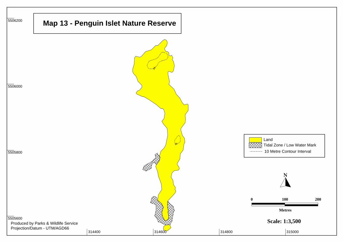
315000 314600 314800 314400
5505600
5505800
5506000
5506200
10
10
Map 13 - Penguin Islet Nature Reserve
�
Produced by Parks & Wildlife ServiceProjection/Datum - UTM/AGD66
10 Metre Contour Interval
LandTidal Zone / Low Water Mark
0
Metres
100 200
Scale: 1:3,500
616500 616000 616250 615750
5576750
5576500
5577000
615500
5577250
South Point
NorthBay
Cat Bay
North Point
The Peninsula
20
1010
10
10
Map 14 - Cat Island Conservation Area
�
Produced by Parks & Wildlife ServiceProjection/Datum - UTM/AGD66
10 Metre Contour Interval
LandSandTidal Zone / Low Water Mark
0
Metres
125 250
Scale: 1:5,000